
New Zealand
Auckland
Volcano views, islands, beaches and a Polynesian market
Days Start with the basic programme and choose extensions for the time you have.
How the guide reaches this number
If you have a third, spend it on an island or the west coast. Buses, trains and ferries are enough for the city and the islands, but the region covers about 5,600 km², and Piha, 40 km away, has no regular bus; so rent a car just for the west coast day. With only one day, I'd spend the morning at the Auckland War Memorial Museum and, after lunch, take the 12-minute ferry to Devonport. Late in the afternoon, climb Maungawhau on foot, when the light hits Rangitoto head-on and both harbors appear for free from up there. If that day falls on a Saturday, swap the museum for the Ōtara market, which runs from 6am to noon. Don't expect much from downtown: Queen Street is a shopping street like any other, and the view you pay for at the Sky Tower is free from the top of the public cones.
2–3
When November to April; March and April strike the best balance of heat, rain and price
How the guide reaches this number
Auckland has a warm oceanic climate with no dry season, and locals say the city gets “four seasons in one day”, which usually turns out to be true. Summer runs from December to February, with highs of 23 to 25°C, high humidity and the sea between 19 and 21°C. It's high season: lodging prices go up, and the coast and ferries are packed from Christmas to New Year. March and April are the best window, with 20 to 23°C, less rain than in winter, cheaper lodging and Pasifika and Polyfest on the March calendar. Winter, from June to August, sits between 8 and 15°C, with frequent rain and strong southwesterly wind. It isn't heavy-coat cold, but it's the period I'd avoid for hiking and beaches, and August is usually the wettest month. Spring, from September to November, is changeable and windy, but has low-season prices. The UV index tops 12 in December and January because of the thin ozone layer over the South Pacific, so pack sunscreen year-round, even under cloudy skies.
Per person/day NZ$180–280 per person in the mid-range, including lodging; about NZ$90–120 on a budget
How the guide reaches this number
Per person per day: accommodation, meals, urban transport, visits and a small allowance for extras. Flights excluded; larger purchases vary. Editorial estimate, not a quote.
 What Nilo thinks
Stay two days: one for downtown, Karangahape Road and the harbor, another for the volcanoes and the museum. If you have a third, spend it on an island or the west coast. Buses, trains and ferries are enough for the city and the islands, but the region covers about 5,600 km², and Piha, 40 km away, has no regular bus; so rent a car just for the west coast day. With only one day, I'd spend the morning at the Auckland War Memorial Museum and, after lunch, take the 12-minute ferry to Devonport. Late in the afternoon, climb Maungawhau on foot, when the light hits Rangitoto head-on and both harbors appear for free from up there. If that day falls on a Saturday, swap the museum for the Ōtara market, which runs from 6am to noon. Don't expect much from downtown: Queen Street is a shopping street like any other, and the view you pay for at the Sky Tower is free from the top of the public cones.From the top of Maungawhau, at 196 m, you can see all of Auckland: a narrow isthmus with a harbor on each side and volcanic cones between the houses. The city sits on about 53 volcanoes, and many have become public parks, with sheep grazing on the terraces of old Māori pā and a free view of both harbors. Getting around by water is part of it too, with ferries running from downtown to Devonport, to the Rangitoto cone and to the Waiheke wineries. Since Auckland is the largest Polynesian city in the world, it's no surprise that the Auckland War Memorial Museum holds the largest collection of Māori and Pacific art there is. The same mix shows up at the market in Ōtara, a neighborhood that Samoan and Tongan families filled from the 1950s on, where Saturdays bring panipopo, buns baked in sweetened coconut milk. On the west coast, 40 km away, Piha has black sand and Lion Rock, but no regular bus, and you only get there by car. Come in March or April, with 20 to 23 °C and cheaper lodging, and set aside two days.
Quick facts
- Population
- about 1.82 million in the Auckland region and about 1.55 million in the urban area (2025 est.); about a third of New Zealand
- Founded
- 18 September 1840 as the colonial capital; continuous Māori occupation of the isthmus since around 1350
- Country and region
- New Zealand, North Island; Auckland region, Māori name Tāmaki Makaurau
- Language
- English, te reo Māori and New Zealand Sign Language are official; Samoan, Mandarin and Hindi come next in the number of speakers in the city
- Currency
- New Zealand dollar (NZD, $); the 15% GST is already included in the price on the tag
- Time zone
- NZST UTC+12; daylight saving UTC+13 from late September to early April
- Best time to visit
- November to April; March and April strike the best balance of heat, rain and price
- Average daily cost
- NZ$180–280 per person in the mid-range, including lodging; about NZ$90–120 on a budget
When to go
November to April; March and April strike the best balance of heat, rain and price
How the year changes
Auckland has a warm oceanic climate with no dry season, and locals say the city gets “four seasons in one day”, which usually turns out to be true. Summer runs from December to February, with highs of 23 to 25°C, high humidity and the sea between 19 and 21°C. It's high season: lodging prices go up, and the coast and ferries are packed from Christmas to New Year. March and April are the best window, with 20 to 23°C, less rain than in winter, cheaper lodging and Pasifika and Polyfest on the March calendar. Winter, from June to August, sits between 8 and 15°C, with frequent rain and strong southwesterly wind. It isn't heavy-coat cold, but it's the period I'd avoid for hiking and beaches, and August is usually the wettest month. Spring, from September to November, is changeable and windy, but has low-season prices. The UV index tops 12 in December and January because of the thin ozone layer over the South Pacific, so pack sunscreen year-round, even under cloudy skies.
Nilo's tips
Ōtara at 7am, not at 11
The hot panipopo and green banana sell out well before noon, so get there early. Ōtara Market runs only on Saturday morning, from 6am to noon. Ōtara is in the south of the city, with no train station at its door: work out a bus route with your AT HOP card or take a ride-hailing app. Stall prices run at half of what you pay downtown. Bring cash, because contactless cards don't cover everything here the way they do in the rest of Auckland.
Don't buy a pass: the daily fare cap already limits spending
In Auckland, a contactless debit or credit card pays the same fare as AT HOP, and the system caps your spending automatically. After NZ$20 in a day or NZ$50 in a week, Monday to Sunday, the rest of your trips are free, so a tourist pass saves you nothing. Only the Waiheke and Rangitoto ferries fall outside that cap, with their own fares.
Rangitoto on the first ferry, with water in your bag
The ferry to Rangitoto takes 25 minutes, and the climb to the 259 m crater about an hour. There's no water, food or shade along the way, and the island has no lodging or services. Leave early and check the time of the last boat, which departs in the late afternoon, before you board. Bring a flashlight if you want to go into the lava tubes.
Climb Maungawhau on foot, in 20 to 30 minutes
Cars have been banned from the summit of Mount Eden since 2016, and the walk up to 196 m takes 20 to 30 minutes. From the top you see both harbors at once, without paying for the Sky Tower. The 50 m crater is a sacred site, and you don't go down into it. Go in the late afternoon, when the light falls full on Rangitoto.
Eat dinner at 7pm, not 9pm.
Most kitchens in Auckland stop taking orders at 9:30pm, and if you show up at 9pm the kitchen is already closing. For cheaper, later food, go to Karangahape Road, the city's strip for cheap eats and nightlife. For a walkable strip packed with restaurants and bars, head to Ponsonby Road. The Viaduct has harbor views, but charges more for them.
Avoid December 24 to the first weekend of January
Between December 24 and the first weekend of January, offices, shops and many restaurants close for two weeks. The coast, the Coromandel and the ferries get crowded and pricier over the same period. Go in the New Zealand fall instead, which is drier and cheaper than summer. Whatever month you go, bring sunscreen: the sun here burns faster than you'd expect.
Explore the map

© OpenStreetMap · OpenFreeMap · © OpenMapTiles
Explore the map, read about the other places and plan your travel days in the app.
Open the appWhat to see
In Auckland, downtown is small, and what's worth seeing is spread across the region: volcanic cones, islands, beaches and Ōtara Market.
Auckland occupies a volcanic isthmus between two harbors: the Waitematā, to the north, sheltered by the Hauraki Gulf, and the Manukau, to the south, facing the Tasman Sea. Downtown sits on the Waitematā shore, where Queen Street climbs from the harbor through a valley of shops, universities and towers, and at its foot Britomart, a block of restored Edwardian warehouses, gathers restaurants and the central train and bus station.
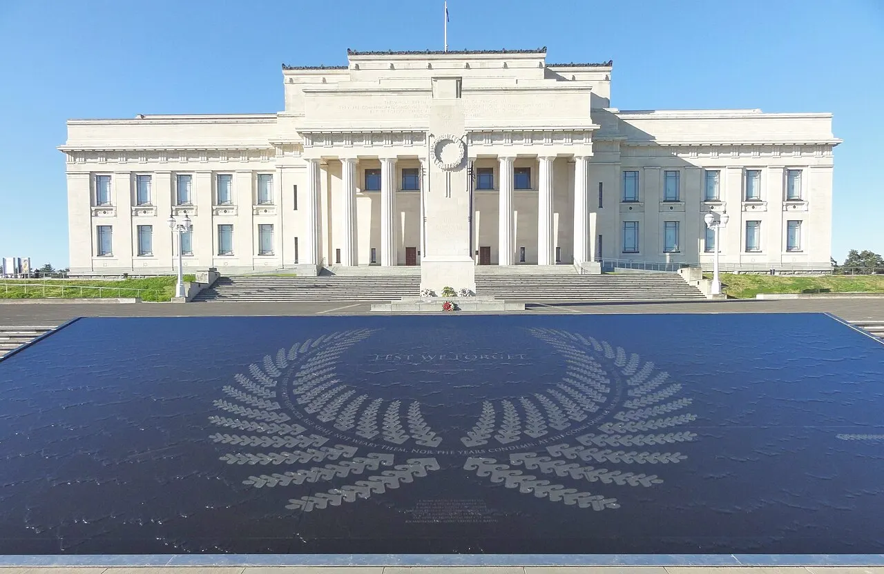
Auckland War Memorial Museum
Tāmaki Paenga Hira, atop the Domain, in a neoclassical 1929 building erected as a First World War memorial. It holds the world's largest collection of Māori and Pacific art, including the 1878 meeting house Hotunui and the 1836 war canoe Te Toki a Tapiri, carved from a single 25 m trunk.
At the top of the Domain, the largest collection of Māori and Pacific art includes the Hotunui meeting house and the single-log waka carved from one piece of wood.
Check access
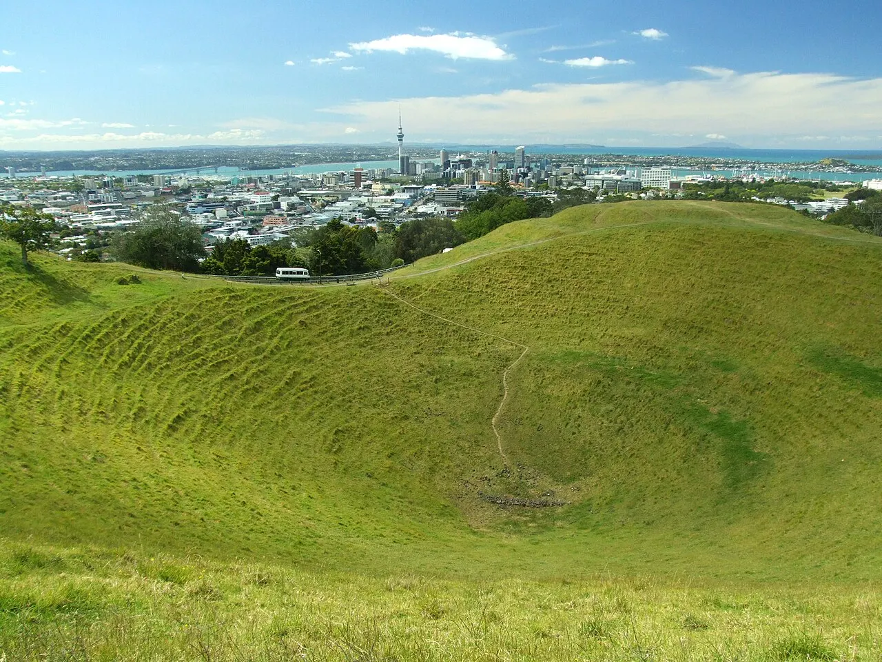
Maungawhau / Mount Eden
The highest natural point on the isthmus, 196 m, with a crater 50 m deep and pā terraces still visible. Cars have been banned from the summit since 2016, and the walk up takes 20–30 minutes. Don't go down into the crater: entry is forbidden because it's a sacred site.
The walk up takes 20 to 30 minutes to the 196 m summit, with cars banned since 2016, and the 50 m deep crater is off-limits as a sacred site.
Check access

Ōtara Market
A Saturday morning market (roughly 6am to noon) in the parking lot of Ōtara's shopping mall, the city's main Polynesian market since the 1970s. Taro, green bananas, panipopo, ‘ie lavalava, haircuts and barbecue at prices well below downtown.
Anyone who gets to Ōtara early finds the city's main Polynesian market, a standing it has held since the 1970s.
Check access
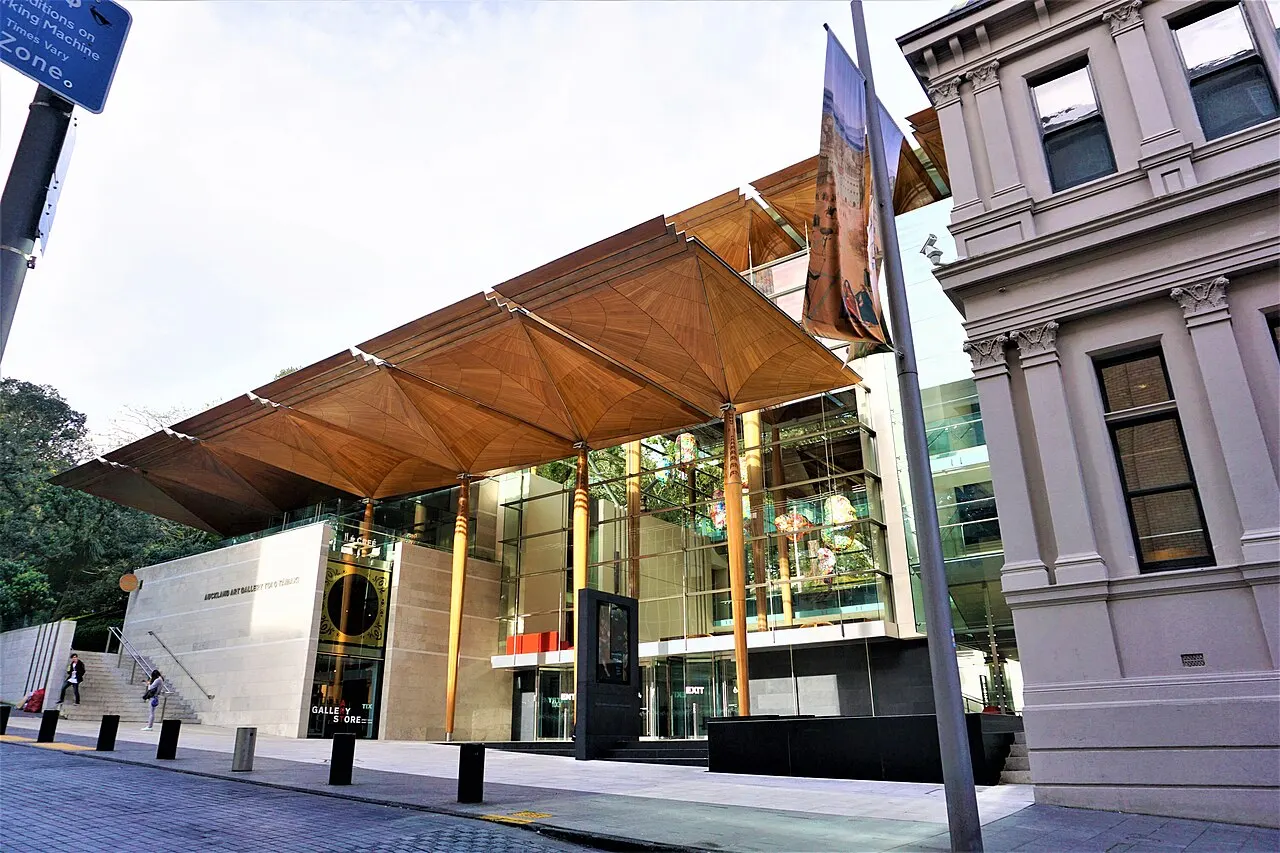
Auckland Art Gallery Toi o Tāmaki
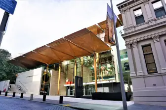
New Zealand's largest art collection, opened in 1888 in the city's first purpose-built museum building. The 2011 extension, with columns and a kauri ceiling that mimic tree canopies, won World Building of the Year in 2013; the Gottfried Lindauer and Charles Goldie portrait gallery is the historical core.
The extension won the World Building of the Year award.
Check access

Rangitoto Island
A symmetrical 259 m shield volcano that emerged around 1400, 25 minutes by ferry from downtown. It has the largest pōhutukawa forest in the world, lava tubes you explore with a flashlight, and an about hour-long climb to the crater; there's no water, food or shade along the way.
The 259 m shield volcano, which erupted around 1400, is reached by a 25-minute ferry and climbed on a shadeless path through the world's largest pōhutukawa forest.
Check access
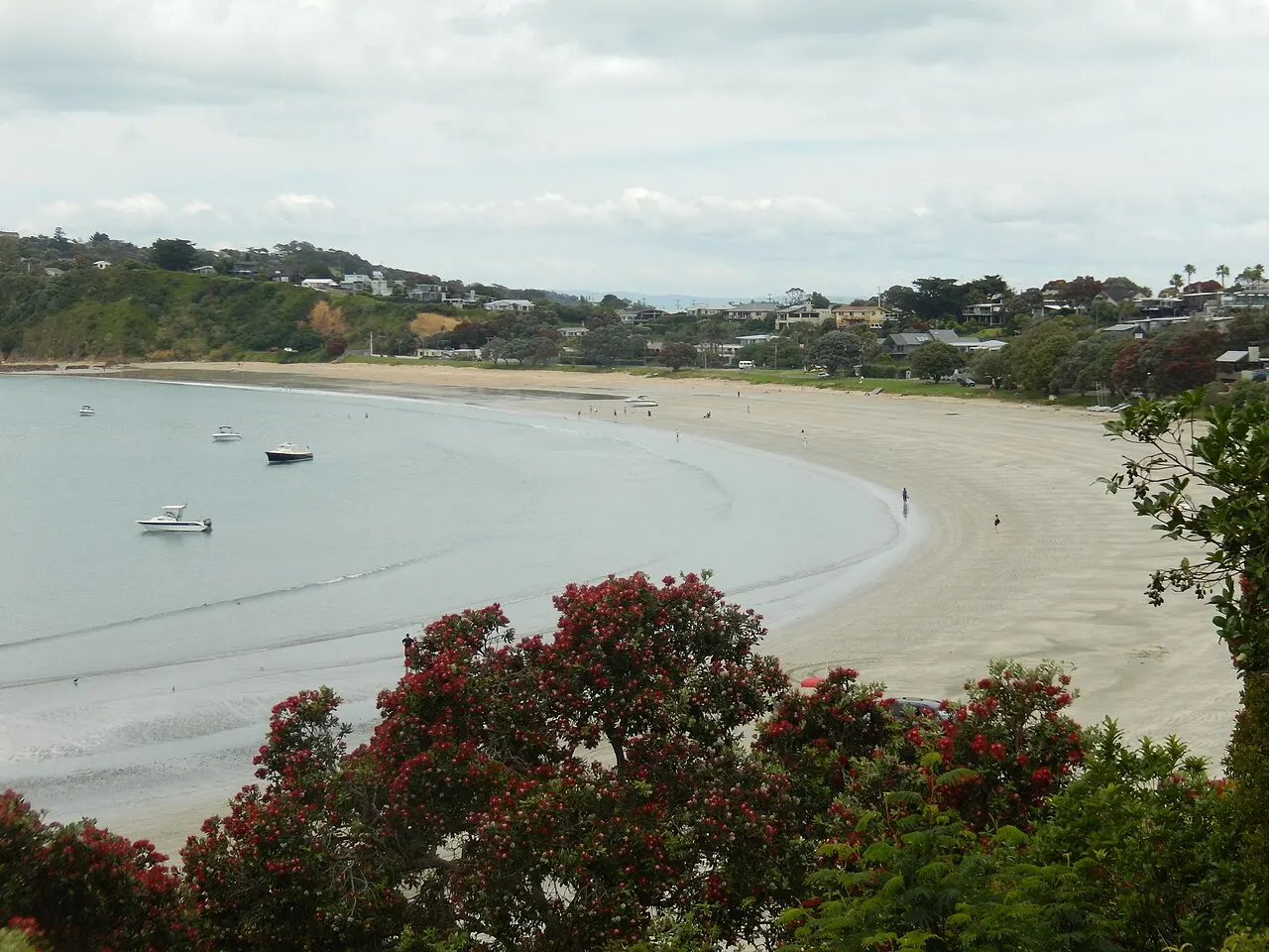
Waiheke Island
40 minutes by ferry, 92 km² of beaches and about 30 wineries specializing in Bordeaux blends and syrah. Oneroa and Onetangi are the main beaches, and the coastal trail between them takes about two hours; the island buses accept the HOP card.
The coastal trail takes about two hours.
Check access

Devonport and Maungauika / North Head
A late-19th-century wooden village served by a 12-minute ferry. The North Head headland is a fortification dug in the 1880s, during the scare over a Russian invasion, with tunnels open to the public and “disappearing” guns that recoiled into the rock after firing.
The north side of the bay, a few minutes away by boat, hides a fort built out of fear of foreign attack, with tunnels you can visit and guns that disappeared back into the rock after firing.
Check access

Piha and the Waitākere Ranges
40 km to the west, a black ironsand beach dominated by the 101 m Lion Rock, inside a 16,000-hectare regional park of kauri forest. The rip currents are strong and swimming is only allowed between the flags; several trails have stayed closed since 2018 because of kauri dieback, and the boot-cleaning stations at the entrance are mandatory.
Swimming is only safe between the flags, because the rip current is strong, and several trails remain closed, with a mandatory station to clean your soles.
Check access
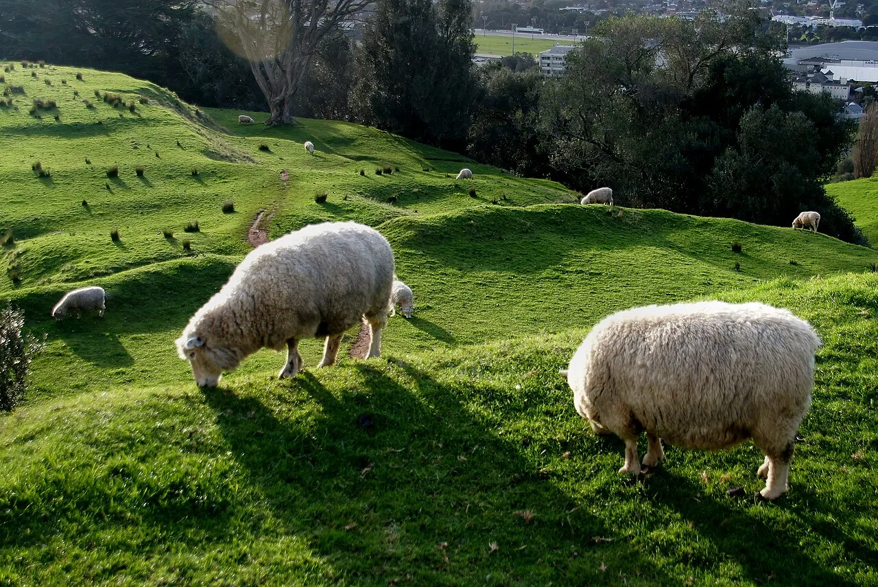
Maungakiekie / One Tree Hill and Cornwall Park
A 182 m cone inside an urban farm donated to the city in 1901 by John Logan Campbell, with sheep and cattle grazing among the terraces of the isthmus's largest pā. The 1948 obelisk marks Campbell's grave; the lone tree that gave the hill its name was felled in 2000 after two chainsaw attacks in Māori protest, and new saplings were planted in 2016.
It's the second cone on the same route: 182 m against Maungawhau's 196 m, with the same pā terraces. The lone tree that gave the hill its name was cut down in 2000, and the saplings planted in 2016 are still small.
Check access
Nilo’s itinerary
Start with the basic programme and choose extensions for the time you have.
Plan my days in the app ↗Day 1 · Downtown, Karangahape Road and the harbor
Start at Waitematā station (Britomart) and walk through the block of restored Edwardian warehouses, between Customs Street and Tyler Street.
Walk up Queen Street to Aotea Square and go into the Auckland Art Gallery Toi o Tāmaki: Māori portraits by Lindauer and Goldie in the old core, kauri ceiling in the 2011 wing.
Grab a cheap lunch on Karangahape Road and walk the ridge on foot to Ponsonby Road, about 25 minutes.
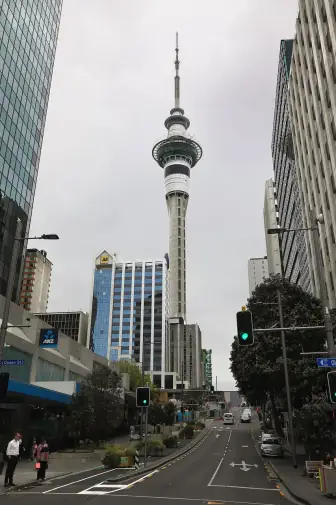
In the late afternoon, climb Maungawhau/Mount Eden, at 196 m, instead of the Sky Tower: from the summit you see both harbors, the cones and the outline of Rangitoto for free, with the 328 m tower itself in the shot.
Dine at Wynyard Quarter or Viaduct Harbour, home base for the America's Cup campaigns of 2000, 2003 and 2021.
Day 2 · Volcanoes, a museum and a food street
Take the 12-minute ferry to Devonport and climb Maungauika/North Head, with tunnels and disappearing guns from the 1880s.
Ferry back, then take a bus or walk to the Auckland Domain, which is the crater of the Pukekawa volcano.
Set aside two hours for the Auckland War Memorial Museum: the Hotunui meeting house (1878), the waka Te Toki a Tapiri (1836) and the midday Māori performance.
End the afternoon at Maungakiekie/One Tree Hill and Cornwall Park, with sheep grazing among the terraces of the old pā at 182 m.
Dinner on Dominion Road or Sandringham Road.


If you stay longer
Day 3 · Island or west coast
Take the morning ferry to Waiheke (40 min), with about 30 wineries, or to Rangitoto (25 min), with a one-hour climb to the 259 m crater.
On Waiheke, use your HOP card on the island buses and walk the coastal track from Oneroa to Onetangi, about two hours.
Swap the ferry for a car if you'd rather stay on the mainland than go to Waiheke or Rangitoto: head to the Arataki Visitor Centre in the Waitākere Ranges and then on to Piha, 40 km from the center, with black sand and the 101 m Lion Rock.
Check the last ferry or the last daylight before setting out, and clean your boots at the cleaning stations entering and leaving the forest.
End the day with paper-wrapped fish and chips on the grass at Mission Bay, on Tāmaki Drive.

Food
 AI illustration
Flat white
A double espresso with finely microfoamed steamed milk, served in a small cup: New Zealand and Australia both claim the invention in the 1980s. Auckland has its own roasters and coffee is a morning ritual, not a nighttime one.
 AI illustration
Hāngī
Meat (lamb, pork, chicken) and root vegetables cooked for hours in a pit oven of heated stones and leaves. It appears at marae events, at Matariki, and at a few market stalls; the smoky smell is the giveaway.
 AI illustration
Panipopo and sapasui
Samoan cooking from the south of the city: panipopo are baked buns swimming in sweetened coconut milk, and sapasui is Samoan chop suey made with glass noodles, ground meat and soy sauce. You'll find them at church fundraisers, at the Ōtara market and in Māngere takeaways.
 AI illustration
Fish and chips
Local white fish (snapper, tarakihi, hoki, gurnard), battered and fried, served wrapped in paper with chips. Buy it at the corner shop in the late afternoon and eat it sitting on the grass at Mission Bay or on the sand at Takapuna.
 AI illustration
Greenshell mussels and oysters
Greenshell mussels are farmed in the Coromandel and reach fishmongers alive; the oysters come from Mahurangi and Te Matuku Bay on Waiheke. Served steamed with white wine or raw with lemon, best between May and September.
 AI illustration
Meat pie
The mince and cheese pie in puff pastry is the bakery-counter meal, eaten standing up, napkin in hand. There's been a national championship since 1997, and winning bakeries put the certificate up in the window.
 AI illustration
Hokey pokey ice cream and L&P
Hokey pokey is vanilla ice cream with bits of aerated toffee, invented in New Zealand; L&P is the lemon soda made with Paeroa mineral water. Both are bought at the “dairy,” the corner store, and are the local definition of summer.
 AI illustration
Waiheke and Kumeū wine
Waiheke makes Bordeaux blends and syrah in vineyards overlooking the gulf; Kumeū, to the northwest, has been a chardonnay benchmark since the 1980s. Both regions are under an hour from downtown and welcome visitors for tastings.
Day trips

Waiheke Island
40 minutes by ferry from the Downtown Ferry Terminal, round trip for NZ$45–60. It's 92 km² of beaches, olive groves and about 30 wineries; you can do it all by island bus with a HOP card or by bike, and the day unfolds without rushing.

Piha, Karekare and the Waitākere Ranges
40 km to the west, about 50 minutes by car along a winding road, with no regular public transport. Black volcanic sand, the 101 m Lion Rock, Kitekite Falls and the 16,000-hectare regional park; check ahead which trails are still closed for kauri dieback.
Matamata (Hobbiton) and Waitomo
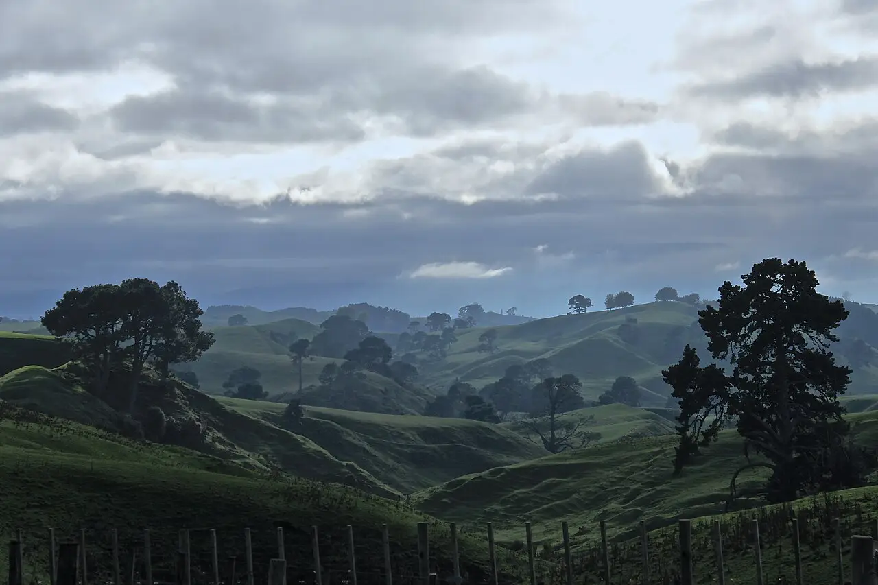
Matamata is about 175 km and 2 hours by car via SH1 and SH27; the Hobbiton set can only be visited on a guided tour booked in advance. The Waitomo caves, with bioluminescent glowworms, are about 200 km and 2 hours 30 minutes from downtown, and the two only fit into the same day if you leave before 7am.
Where to begin
Downtown, Karangahape Road and the harbor

Start at Waitematā station (Britomart) and walk through the block of restored Edwardian warehouses, between Customs Street and Tyler Street.
Volcanoes, a museum and a food street
Take the 12-minute ferry to Devonport and climb Maungauika/North Head, with tunnels and disappearing guns from the 1880s.
Island or west coast
Take the morning ferry to Waiheke (40 min), with about 30 wineries, or to Rangitoto (25 min), with a one-hour climb to the 259 m crater.
Money
The currency is the New Zealand dollar (NZD, $), worth roughly R$3.2 or US$0.60 in September 2026 (approximate rate, check on the day). The 15% GST is already included in every advertised price, so the price on the tag is what you pay at the register. Typical ranges: flat white NZ$5.50–7; counter or food-court lunch NZ$15–25; dinner at a midrange restaurant NZ$35–55 per person without drinks; draft beer NZ$12–15; glass of wine NZ$14–18. For beds and getting around: dorm bed NZ$45–70; midrange hotel NZ$180–320 a night; short Uber ride NZ$15–25; economy car NZ$60–100 a day, plus fuel at about NZ$2.60 a liter. Tipping isn't customary, because wages are built into prices; rounding up or leaving 10% after a long dinner is an optional gesture. Contactless cards work almost everywhere, including buses. Many cafés add 2% to 2.5% for credit cards and a 15% surcharge on public holidays, always posted at the door. Cash has become rare and is only useful in two places, the Ōtara and Avondale markets, where many stalls don't take cards.
From the airport to the center
Guide estimate
Scroll to compare all columns
| Route | Time | Price |
|---|---|---|
| AKL → Puhinui → Waitematā/Britomart · AirportLink bus and Southern Line train | about 50 min | NZ$6–9 with a HOP card |
| AKL → center · SkyDrive express bus | 40–60 min, up to double at peak | about NZ$20 |
| AKL → center · taxi or Uber | 40–60 min, up to double at peak | NZ$60–95 |
Getting there and around
The airport is 21 km away; at rush hour, the trip doubles
Auckland Airport (AKL) is in Māngere, about 21 km from the center, a 40- to 60-minute ride that can double in the 4pm to 6pm peak. The cheapest option has two legs: the AirportLink bus to Puhinui station (about 10 minutes, departures every 10) and then the Southern Line train to Waitematā/Britomart station, about NZ$6–9 in total with a HOP card and about 50 minutes. The SkyDrive express bus goes straight to the center for around NZ$20, and a taxi or Uber runs between NZ$60 and NZ$95. Before you fly, every foreigner who isn't Australian needs to check whether an NZeTA is required: Brazilians enter as tourists with the electronic authorization, which costs about NZ$17 through the app and NZ$23 on the website, plus the NZ$100 International Visitor Conservation and Tourism Levy (IVL), paid at the same time and valid for up to two years.
The HOP card and four train lines
In the city, public transport is run by AT (Auckland Transport): buses, four train lines (Southern, Eastern, Western and Onehunga) and ferries from the Downtown Ferry Terminal. The AT HOP card costs about NZ$5 and is reloadable, but you don't need it: contactless debit and credit cards pay the same fare, and you just tap yours on the reader. There are nine fare zones, with adults paying about NZ$2.30 for one zone and NZ$3.80 for two (February 2026 fares), a daily cap of NZ$20 and a weekly cap of NZ$50, Monday to Sunday, after which the rest of your trips are free. A single trip never charges more than four zones. The Waiheke and Rangitoto ferries are run by private operators with their own fares, outside the cap: budget NZ$45–60 round-trip to Waiheke. Since September 13, 2026, the City Rail Link has connected Waitematā to the Maungawhau branch through 3.45 km of tunnel, with three new stations: Te Waihorotiu and Karanga-a-Hape, under downtown, and Maungawhau, rebuilt in place of Mount Eden; since the line has only just opened, check timetables and which stations are running on the day. The center is walkable, but expect steep hills, and for cycling there are paths like the Northwestern and Te Ara I Whiti (the pink “Lightpath,” from 2015). To reach the west coast, Waitākere or Kumeū, you practically need a rental car, and here you drive on the left.
Safety
Auckland is a safe city by international standards, with a national homicide rate of about 1 per 100,000 people a year, and the real risk to visitors is almost entirely to property or from nature. The most common problem is car break-ins at trailhead and beach parking lots, such as those at Piha, Karekare, Maungawhau and Mission Bay. Leave nothing visible inside the vehicle, not even luggage in the trunk. Downtown, Queen Street and K’ Road get rowdy in the early hours of Friday and Saturday, when the bars close, and what you'll see is drunken fights rather than robberies; calling an Uber instead of walking alone at 3am solves it. Organized scams against tourists are rare, and the one that exists is inflated fares from unlicensed taxis at the airport, which you avoid by using the official desks or the app. The risks that actually kill are natural: rip currents on west coast beaches, tides, unstable cliffs and forest trails where the weather turns within an hour. Before a hike, tell someone your plan and bring a rain jacket. Earthquakes are rare in Auckland, but the volcanic field is considered active and there's a civil evacuation plan. Emergency: 111 for police, fire and ambulance.
Etiquette tips
Take off your shoes when you enter a home
Taking your shoes off at the door is automatic in New Zealand, even in a rental apartment. Out on the street it's the opposite: seeing barefoot people at the supermarket, on the bus or on the way to school is normal, a beach-country habit rather than carelessness or poverty.
At a marae, follow the pōwhiri
Wait to be called in before entering, don't sit on tables or counters, don't bring food into the wharenui and return the hongi: foreheads and noses touching, one shared breath. Taking off your shoes at the meeting house door is mandatory.
Don't tip out of reflex
Insisting on a tip is more awkward than welcome, and in a taxi or café it can be uncomfortable. If service at a dinner was exceptional, 10% is more than enough.
Clean your boots at the cleaning stations
Kauri dieback, a soil disease that kills the giant trees, has closed entire trails in the Waitākere since 2018. Brushing and disinfecting your soles at the entrance and exit isn't a suggestion, and a rāhui (a restriction declared by the local iwi) is respected even where there's no fence.
Pronounce the Māori names
The five vowels sound almost like in Portuguese; “wh” is an f sound and “ng” is the sound in “singer.” Whangārei is “fangarei,” Maungawhau is “maunga-fau,” Ōtāhuhu has a long o. Someone who tries to pronounce Māori names and gets it wrong is well received; what bothers people is anglicizing those names on purpose.
Don't treat New Zealand as an appendage of Australia
Calling a New Zealander Australian, or crediting the haka, the pavlova or the flat white to Australia, ends the conversation faster than any other slip. The two countries are neighbors and rivals, two different places.
Mistakes to avoid
Walking to the beaches
A lot of people think you can walk to the beaches, but the region covers about 5,600 km² at low density: even Mission Bay is 8 km along Tāmaki Drive, and Piha is 40 km from downtown. There's no regular bus to the west coast, and you get there by rental car or guided tour.
An island trip without checking the last ferry
Going to Waiheke or Rangitoto without checking the time of the last ferry back. Neither island has lodging for anyone who misses the boat. In summer, the Waiheke ferry fills up and it's worth booking ahead, especially on weekends.
The patrolled strip is narrow on the west coast
Swimming outside the flags on the west coast. Piha, Muriwai, Bethells and Karekare have rip currents that sweep even experienced swimmers out to sea, and the area patrolled by lifeguards is a narrow strip between two red-and-yellow flags. Outside patrol hours, stay out of the water.
UV over 12, sunburn in 15 minutes
Underestimating the sun. The summer UV index goes over 12 and sunburn shows up in about 15 minutes, even on a cloudy day or inside a car. Sunscreen, a hat and a shirt in the water are the local norm, not overkill: adults here cover up as much as the kids do.
The last week of December
Planning a trip for the last week of December and expecting a busy city. Auckland shuts down for the holidays: offices, many restaurants and shops close between December 24 and early January, while the coast and the Coromandel get overcrowded and pricey.
Useful phrases
Kia ora
Hello, thanks, cheers: it covers almost everything (approximate pronunciation: “kee-a or-a”)
Ka kite anō
See you later, catch you around (“ka kee-teh a-noh”)
Chur
Cheers, thanks; also a greeting between acquaintances
Sweet as
Great, all good: the “as” is left dangling on purpose and never completes the comparison
Yeah, nah
No, said politely; in reverse order, “nah, yeah” means yes
The dairy
The corner store, where you buy milk, the paper and an ice cream cone
Districts
Downtown (Waitematā) and Britomart
Queen Street climbs from the harbor through a valley of shops, universities and towers; Britomart, a block of Edwardian warehouses restored from 2003 on, is packed with restaurants and holds the central train and bus station. This is where you'll find the Sky Tower, Aotea Square and most of the hotels.
Viaduct Harbour and Wynyard Quarter
A former fishing dock and fuel depot converted for the America’s Cup campaigns of 2000, 2003 and 2021. Waterfront bars, Silo Park with open-air cinema in summer, and the Te Wero pedestrian bridge, which opens to let boats through.
Ponsonby and Grey Lynn
Ridges of wooden Victorian villas that were a working-class and Polynesian neighborhood until the 1980s and today hold the city's largest concentration of restaurants and bars along Ponsonby Road. A good base for walking around at night.
Karangahape Road (K' Road)
Auckland's nightlife, secondhand shops, record stores, cheap eats and queer history axis, on the ridge between downtown and Ponsonby. It gained the Karanga-a-Hape station with the City Rail Link, which changed the street's flow.
Parnell and Newmarket
Parnell is the oldest suburb (1841), with restored wooden houses, Holy Trinity Cathedral and the municipal rose garden; Newmarket, across the Domain, is the shopping district, with Broadway and the big department stores.
Mount Eden, Kingsland and Sandringham
A belt of villas around the Maungawhau volcano, Eden Park stadium and two food streets: Dominion Road, with hand-pulled noodles and dumplings, and Sandringham Road, with dosas, biryanis and South Indian sweets.
Devonport and the North Shore
Across the bridge, 12 minutes by ferry: a Victorian village with bookshops and cafés at the foot of the Maungauika/North Head and Takarunga/Mount Victoria cones. Further north, Takapuna and Milford have urban beaches with views of Rangitoto.
Ōtara, Māngere and Manukau (south)
The Polynesian heart of the city and metro area: Ōtara Market on Saturday mornings, Samoan and Tongan churches, umu restaurants and the Māngere volcano. Home to the airport, and where food prices drop by half.
History
c. 1350 · Māori arrival on the isthmus
Hapū descended from the migration canoes settle Tāmaki Makaurau and fortify the volcanic cones. The ash soil becomes kūmara gardens, and the 1.3 km isthmus at Ōtāhuhu becomes the route where waka were dragged from one sea to the other.
c. 1400 · Rangitoto rises off the harbor
The volcanic field's most recent eruption creates the symmetrical 259 m island that closes off the Waitematā's horizon. Human footprints preserved in the ash of neighboring Motutapu prove there were witnesses.
c. 1740 · Ngāti Whātua takes Tāmaki
After more than a century of Waiohua confederation rule, with as many as three thousand people terracing Maungakiekie, Te Taoū of Ngāti Whātua conquers the isthmus and founds the settlement of Ōkahu Bay.
1820–1830 · Musket Wars
Ngāpuhi raids armed with muskets empty out the isthmus. For nearly two decades Tāmaki sits practically uninhabited, which later makes it easier to negotiate with the settlers.
1840 · Treaty and colonial founding
On February 6 the Treaty of Waitangi is signed; on September 18, William Hobson founds Auckland on land ceded by chief Apihai Te Kawau of Ngāti Whātua, and names the city after George Eden, Earl of Auckland.
1863–1865 · The Waikato War and the lost capital
Imperial troops march down the Great South Road to invade the Waikato, and the land confiscations that follow fund the city's expansion. In 1865 the capital moves to Wellington, more central, and Auckland responds by growing as a port.
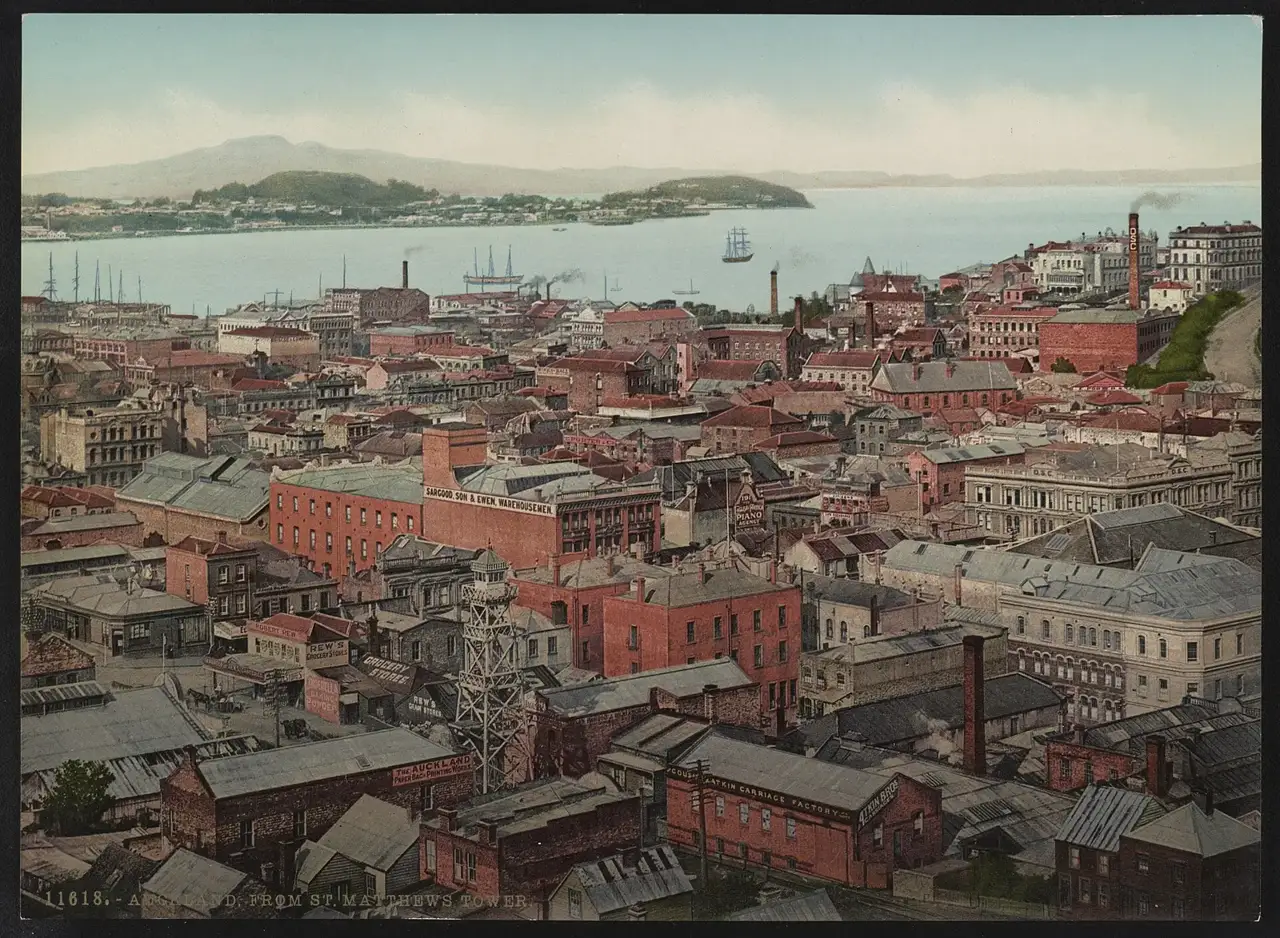
1959 · The Harbour Bridge
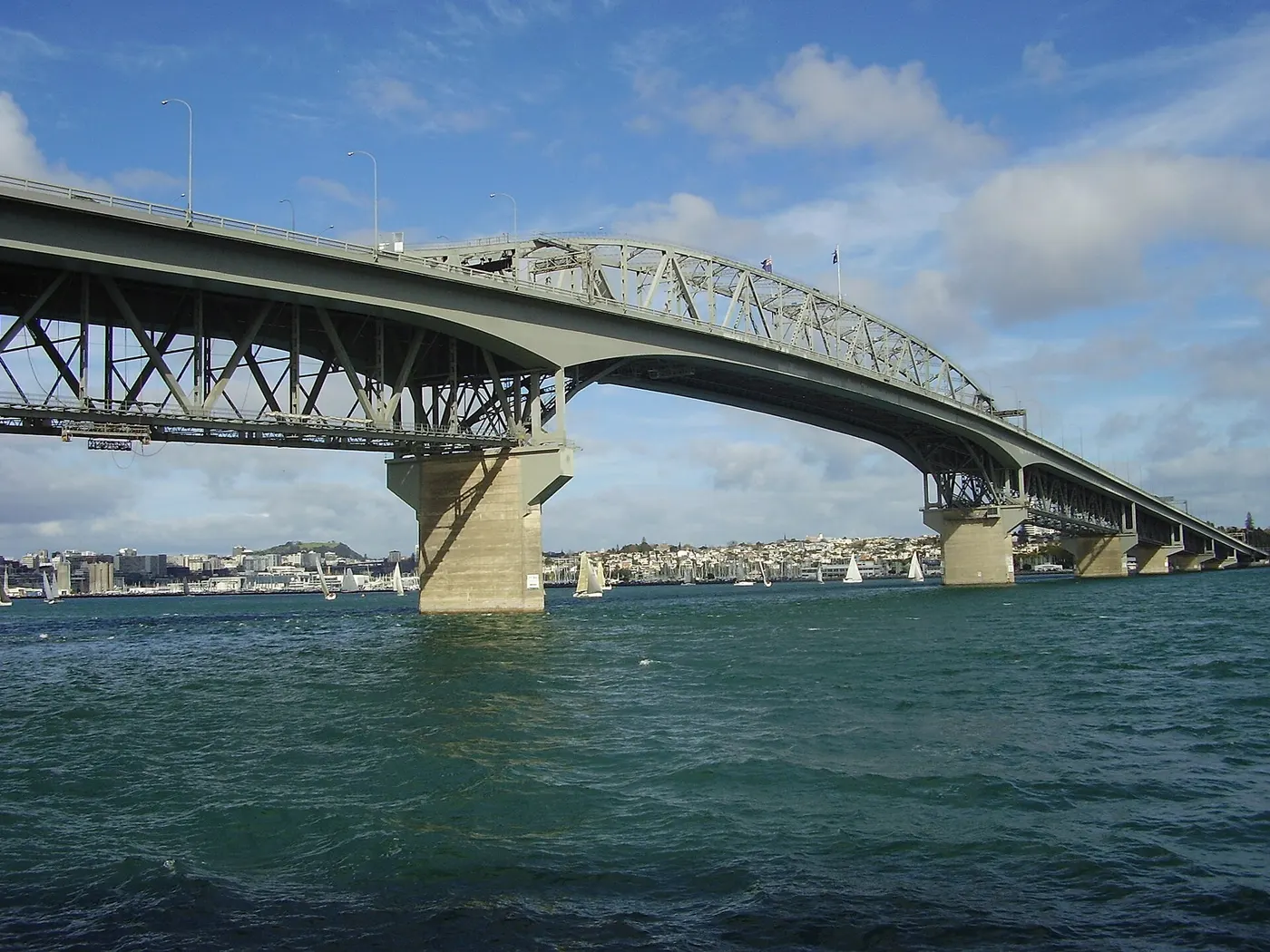
On May 30 the Auckland Harbour Bridge opens, 1,020 m over the Waitematā. The North Shore, until then reachable only by ferry, becomes a suburb within a decade, and in 1969 the bridge gains the Japanese-built side lanes nicknamed the “clip-ons.”
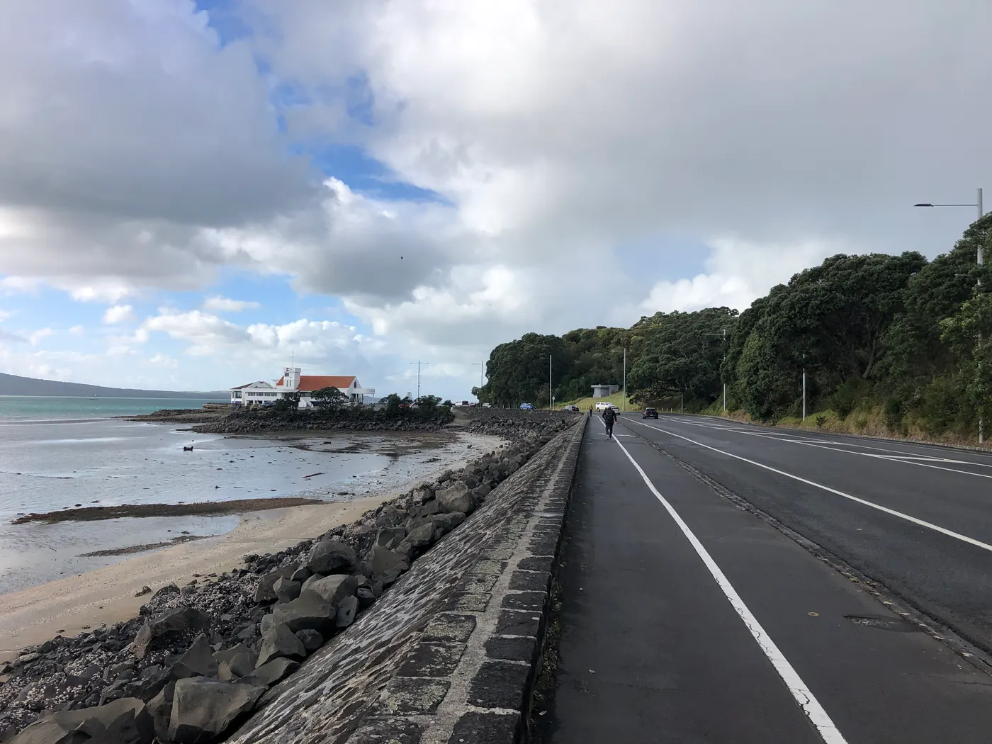
1950–1976 · Māori and Pacific migration
Factories in the south of the city draw Māori workers from the countryside and families from Samoa, Tonga, Niue and the Cook Islands, and Auckland becomes the largest Polynesian city in the world. Between 1974 and 1976 the pre-dawn raids on Pacific immigrants, the Dawn Raids, leave a wound that only gets an official apology on August 1, 2021.
1977–1978 · Bastion Point occupation
Ngāti Whātua occupies the land at Takaparawhau for 506 days after the government tries to subdivide it. The removal on May 25, 1978, with 222 arrests, becomes a landmark of the Māori protest movement; the land is returned in 1988.
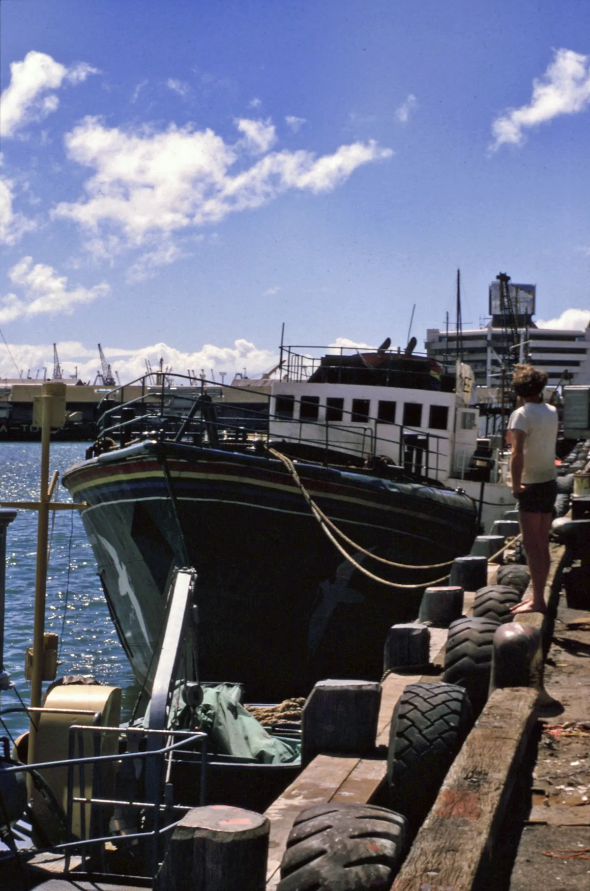
1985 · The Rainbow Warrior is sunk
On the night of July 10, French agents bomb the Greenpeace ship docked in the Waitematā, killing photographer Fernando Pereira. The case shakes relations with France, ends in a UN arbitration in 1986 with a French apology and compensation, and seals New Zealand's anti-nuclear policy.
2010–2026 · Super City and the tunnel
On November 1, 2010, eight local councils become a single Auckland Council. In 2026 the City Rail Link opens, 3.45 km of tunnel with three new stations: Te Waihorotiu and Karanga-a-Hape, under downtown, and Maungawhau, rebuilt in place of Mount Eden. The tunnel turns the rail line into a real network.
 AI illustration
Complete history
Geography explains the settlement
Geography explains the settlement. The Tāmaki Makaurau isthmus is about 1.3 km wide at its narrowest point, at Ōtāhuhu, and links two seas: whoever controlled that portage, where canoes were dragged overland from one sea to the other, controlled navigation between the east and west coasts of the North Island. Add the volcanic soil, the best in the region for growing kūmara, and it's clear why the cones (Maungakiekie, Maungawhau, Maungarei, Māngere) were terraced into fortified pā from the 14th century. The Māori name means, in one common reading, “Tāmaki desired by many,” and the contest was literal: the isthmus changed hands several times before any European arrived.
The Musket Wars emptied the isthmus before 1840
The Musket Wars of the 1820s emptied the area and changed everything. When William Hobson looked for a site for the new colony's capital in 1840, he found a nearly empty isthmus and a Ngāti Whātua chief, Apihai Te Kawau, keen to attract settlers as protection against Ngāpuhi. The city was born on September 18, 1840, on roughly 1,200 hectares transferred on that basis. Twenty-five years later, with settlement already concentrated in the south, the capital moved to Wellington. Auckland didn't shrink: in 1863 it became the logistics base for the invasion of the Waikato, and the land confiscated after the war, together with the Thames gold rush from 1867, kauri gum and timber, gave the city an economy of its own.
Two expansions in the 20th century
The 20th century was shaped by two expansions. The first, physical: the 1959 Harbour Bridge opened the North Shore, the SH1, SH16 and SH20 motorways spread the city across the isthmus into neighborhoods of detached houses with yards, and Auckland became one of the great low-density metropolises of the world. The second, human: between 1950 and 1975 Māori urbanization and the recruitment of Pacific labor filled Ōtara, Māngere and Ponsonby with Samoan, Tongan, Niuean and Cook Islands families. When the economy turned in 1974, the government sent police to these families' homes at dawn, the Dawn Raids, and the cultural response came in groups like the Polynesian Panthers, in Polyfest from 1976 on, and in a generation of Pacific musicians and writers.
The 1987 immigration law opened the third layer
The 1987 immigration law reform opened the third layer. Auckland took in Chinese from Hong Kong and Taiwan, Koreans, Indians from Fiji and Punjab, South Africans and Filipinos, and in a generation went from a provincial British city to one of the most diverse in the world: today about 40% of residents were born outside the country. The urban fabric records this in whole streets: Dominion Road in Chinese, Sandringham in Indian, Northcote in Korean, Ōtara in Samoan. In the same period the city lived through the 1987 crash, five weeks without power downtown in 1998, and the America's Cup sailing series of 2000, 2003 and 2021, which rebuilt the Viaduct and Wynyard Quarter waterfront.
The 2010 merger and the plan against sprawl
Today's Auckland is a city trying to correct its own sprawl. The 2010 amalgamation merged eight councils into a single Auckland Council; the 2016 Unitary Plan allowed three- to six-story buildings across much of the suburbs, and the result was one of the few documented cases of a relative drop in rents through densification. The City Rail Link, the first major rail investment since the 1930s, opened in September 2026 and added three stops to the train map, two of them underground downtown. At the same time, the floods of January 27, 2023 (about 280 mm in one day, four deaths) and Cyclone Gabrielle two weeks later exposed the cost of having piped the volcanic streams under the suburbs.
Geography and shape of the city
Two harbors and a volcanic field
Auckland occupies a volcanic isthmus with two harbors: the Waitematā, to the north, sheltered by the Hauraki Gulf and the islands of the Tīkapa Moana marine park, and the Manukau, to the south, shallow, with a dangerous bar and facing the Tasman Sea. Between them lie about 53 monogenetic volcanoes (cones, craters and lava fields) from a field roughly 190,000 years old and still active; the newest is Rangitoto, from around 1400, and the tallest on the isthmus is Maungawhau/Mount Eden, at 196 m with a crater 50 m deep.
Streets that follow the ridges and volcanic cones
The isolated hills and short streams of the volcanic field shaped the street layout: roads follow ridges and valleys instead of a grid, and every cone became a public park with a view, which is why the city has so many free lookouts. To the west, the Waitākere Ranges and the black iron-sand beaches (Piha, Karekare, Muriwai, Bethells) close off the isthmus with cliffs; to the east, Tāmaki Drive runs right along the water to Mission Bay and St Heliers.
Oceanic climate and settlement spread across the region
The climate is warm oceanic, with no dry season, about 1,200 mm of well-distributed rain and prevailing southwesterly winds. Settlement is exceptionally spread out: the region covers about 5,600 km² and average density stays under 1,300 people/km², with radial motorways (SH1 north–south, SH16 to the northwest, SH20 to the southwest) converging on the downtown interchange nicknamed Spaghetti Junction.
From the top of a volcanic cone you see the whole isthmus, with a harbor on each side.
Rangitoto, the youngest volcano in the field, appeared around 1400, when the older cones on the isthmus were already being terraced into pā.
Culture
Māori and Pacific production
Auckland is the hub of the country's Māori and Pacific culture. Te reo Māori has been an official language since 1987 and is back on the streets: station names, radio greetings, and kapa haka as a school subject. Polyfest, created in 1976 and today the world's largest Polynesian performing arts festival for high schools, has launched generations of musicians; New Zealand hip-hop and R&B came out of the city's south, from Che Fu and Scribe to the more recent scene in Ōtara and Māngere. Urban Māori literature has two landmarks in Alan Duff (“Once Were Warriors,” 1990) and Witi Ihimaera, and Pacific theater is built around companies like Pacific Underground and the Māngere Arts Centre.
The country's commercial base for film and music
The city is also the commercial engine of the country's film and music. International productions shot in New Zealand go through studios and services in Auckland, and the west coast (Karekare, Bethells, Muriwai) is a recurring location: Jane Campion's “The Piano” was filmed at Karekare in 1993. In rock, Flying Nun was born in Christchurch but found its audience in Auckland, and acts such as Split Enz, Crowded House, OMC and Lorde came out of the city's suburbs. To hear that music live, nights are split between K’ Road, Ponsonby Road and the Viaduct, and they end early by Brazilian standards, with most kitchens closing at 9:30pm.
Rugby at Eden Park: the All Blacks and the Blues
In Auckland, sport is a matter of public conversation, and rugby union comes first: the All Blacks play at Eden Park, a stadium of about 50,000 seats in Kingsland that hosted the Rugby World Cup finals of 1987 and 2011, and the Blues play Super Rugby there. Sailing is close behind: Auckland calls itself the “City of Sails”, defended the America’s Cup in 2000 and 2003 and won it again in 2021, and the Anniversary Regatta, at the end of January, brings together more than a thousand boats on the Waitematā. Netball, summer cricket and the Warriors' rugby league round out the calendar.
The war canoe Te Toki a Tapiri, from 1836, in the War Memorial Museum, was carved from a single 25 m trunk.
Festivals and events

Auckland Anniversary Day and the Regatta
The last Monday in January (with the long weekend attached). The Anniversary Regatta has been held since 1840 and is one of the largest one-day sailing races in the world, with more than a thousand boats on the Waitematā; the whole city takes the day off.

Pasifika Festival
In March, at Western Springs Park. Created in 1993, it divides the park into “villages” by nation (Samoa, Tonga, Niue, the Cook Islands, Fiji, Tuvalu, Tokelau, Kiribati, Tahiti, Aotearoa) each with its own music, dance and food. It's the largest Pacific festival on the planet, drawing crowds in the hundreds of thousands.
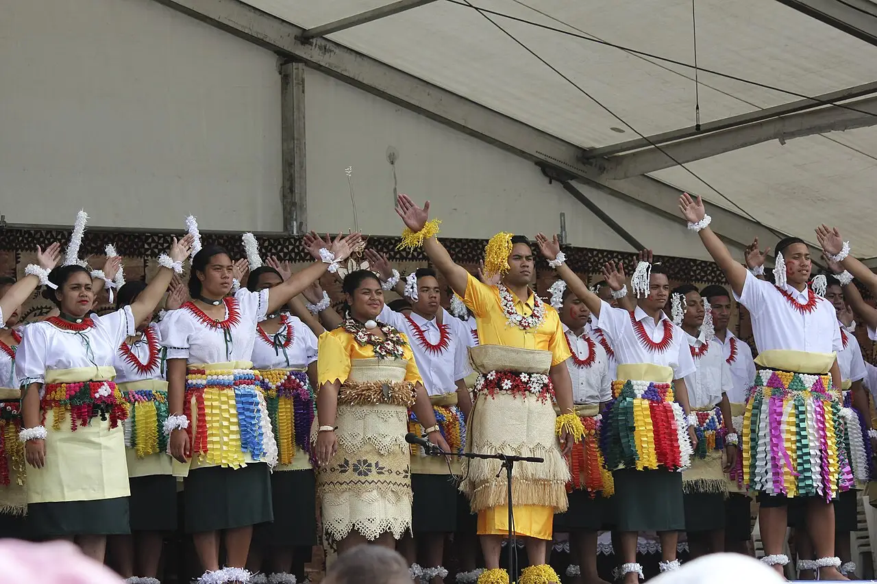
ASB Polyfest
In March, at the Manukau Sports Bowl. Since 1976, around 70 secondary schools and more than 10,000 students compete on Māori, Samoan, Tongan, Cook Islands, Niuean and “diversity” stages. It's the largest school Polynesian arts festival in the world, and the crowd is mostly local.

Matariki
Between late June and mid-July, with a moving date set by the Māori lunar calendar. The Māori New Year has been a national holiday since 2022; Auckland holds dawn hautapu ceremonies, projections, community hāngī and museum programs.

Lantern Festival and Diwali
The Lantern Festival marks Chinese New Year between February and March, with hundreds of lanterns in a public park; the Diwali Festival takes over Aotea Square and Queen's Wharf in October or November. Both are free, city-run, and show off post-1987 Asian Auckland.
Books and films
“Once Were Warriors,” directed by Lee Tamahori (1994)
Adapted from Alan Duff's novel, shot in the suburbs of south Auckland. It's the harshest and most debated portrait of Māori urbanization, the loss of connection with iwi and the consequences of the 1950s and 1960s migrations.
“The Piano” (Jane Campion, 1993)
Filmed on Karekare beach, on Auckland's west coast, with the black ironsand and the wet bush as characters. It visually explains the North Island's colonial frontier in the 19th century, and the landscape is 45 minutes from downtown.
“How Bizarre,” OMC (1996)
An album by Pauly Fuemana, a Niuean-Māori artist raised in Ōtara, produced by Alan Jansson: the sound of Pacific Auckland reaching the top of charts worldwide. Listening to the title track is a way of understanding the Polynesian-pop blend the city has exported ever since.
Frequently asked questions
Auckland: What's the cheapest way to get from the airport to downtown?
The cheapest option has two legs: the AirportLink bus to Puhinui station (about 10 minutes, departures every 10) and then the Southern Line train to Waitematā/Britomart station, about NZ$6 to 9 in total with a HOP card and about 50 minutes.
Auckland: What's the currency, and what's the exchange rate for the Brazilian real?
The currency is the New Zealand dollar (NZD, $), worth roughly R$3.2 or US$0.60 in September 2026 (approximate rate, check on the day).
Auckland: What's the best time to go?
March and April are the best window, with 20 to 23 °C, less rain than in winter, cheaper lodging and Pasifika and Polyfest on the March calendar. Summer, from December to February, is high season.
Auckland: Do you need to take off your shoes when entering a house?
Yes: taking off your shoes at the door is automatic in New Zealand, even in a rented apartment. On the street the opposite holds, and seeing people barefoot at the supermarket or on the bus is normal.
Auckland: What's the real risk for visitors?
The most common problem is car break-ins at trail and beach parking lots, like those at Piha, Karekare, Maungawhau and Mission Bay: don't leave anything visible in the vehicle. The risks that actually kill are natural, like the rip currents on the west coast.
Other cities in the country
New Zealand ↗- Days
- 3–4
- When
- Mar–Apr
- Per person/day
- Average 250–380 NZ$Mid-range · per person/day
Cost scope
Per person per day: accommodation, meals, urban transport, visits and a small allowance for extras. Flights excluded; larger purchases vary. Editorial estimate, not a quote.


Itineraries through here
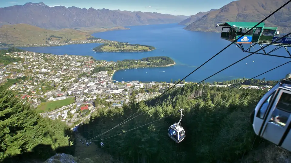
 Australia and New Zealand in 20 daysFrom the red desert to the fiordsSydney · Melbourne · Uluru · Cairns · Auckland · Queenstown16–21 days6 cities
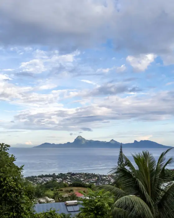 New Zealand and Tahiti in 7 daysAuckland’s volcanoes and Tahiti’s lagoonsAuckland · Papeete (Tahiti)5–7 days2 cities
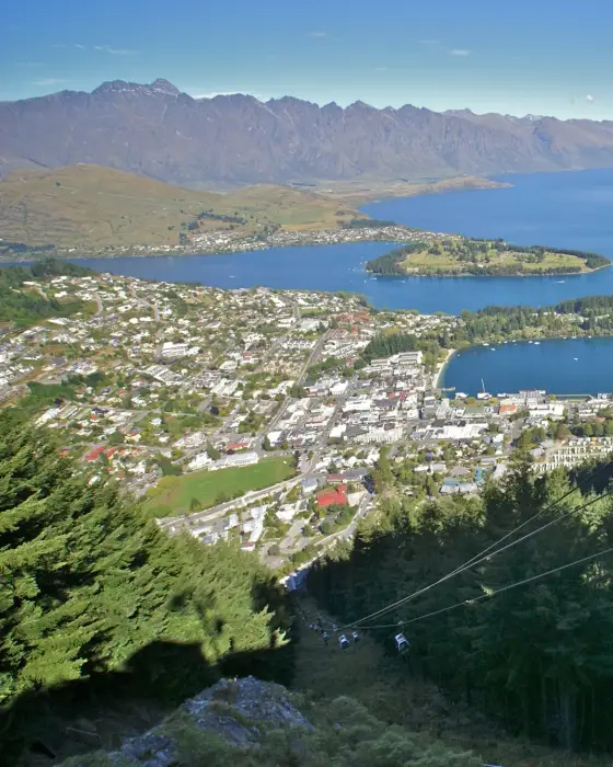 New Zealand in 7 daysVolcanoes and fiordsAuckland · Queenstown5–7 days2 cities