Australia
Cairns
Gateway to the Great Barrier Reef and the rainforest
Days Start with the basic programme and choose extensions for the time you have.
How the guide reaches this number
Keep a fourth day free, because the wind sometimes cancels the boat. If you're after a city beach or nightlife, you'll be disappointed. In front of the city the bay turns to mud at low tide, and the center empties after 10pm outside Lake Street. With just one day, choose the reef and board at the Reef Fleet Terminal between 7:30am and 8:30am, returning late in the afternoon. Leave the range for another trip, because you can see it from the plane window, and the reef you can't. Back in town, have dinner on Lake Street or on the waterfront and plan nothing afterward. For the swim the bay doesn't offer, use the Lagoon, the public pool on the Esplanade.
3–4
When May to September, the dry season; October as a middle ground
How the guide reaches this number
Cairns has two seasons, the dry and the wet. The dry runs from May to September, with highs of 26 to 29 °C, lows of 17 to 20 °C, low humidity and almost always clear skies, and it's the busiest period and the best window for reef and rainforest. Between June and August, though, the southeast wind reaches 15 to 25 knots and can cancel reef trips or leave the sea choppy; in those months, choose large catamarans and fixed pontoons, which rock less. The wet runs from December to March, with highs of 31 to 32 °C, lows around 24 °C and humidity above 80%, and it brings much of the year's roughly 2,000 mm of rain, in downpours lasting one to three hours. Cyclone season runs from November 1 to April 30, and jellyfish season from November to May. Avoid February and March if you can choose, because they're the rainiest months and the ones most likely to see roads cut. Prices peak in July, because of school holidays, and at the end of September, which makes October the best balance of price, heat and visibility, before the jellyfish arrive in November.
Per person/day A$150–260 per person (about R$530–920), not counting a reef trip
How the guide reaches this number
Per person per day: accommodation, meals, urban transport, visits and a small allowance for extras. Flights excluded; larger purchases vary. Editorial estimate, not a quote.
 What Nilo thinks
Spend three days in Cairns: the city and the tide on the first, the outer reef on the second and the Kuranda range on the third. Keep a fourth day free, because the wind sometimes cancels the boat. If you're after a city beach or nightlife, you'll be disappointed. In front of the city the bay turns to mud at low tide, and the center empties after 10pm outside Lake Street. With just one day, choose the reef and board at the Reef Fleet Terminal between 7:30am and 8:30am, returning late in the afternoon. Leave the range for another trip, because you can see it from the plane window, and the reef you can't. Back in town, have dinner on Lake Street or on the waterfront and plan nothing afterward. For the swim the bay doesn't offer, use the Lagoon, the public pool on the Esplanade.In Cairns, the rainforest runs down the mountains almost to the sea, and the Great Barrier Reef is closer here than in almost any other city, with Green Island, a coral island with a reef reachable from the beach, 27 km away, and the outer reef 40–70 km off the coast. Downtown has no sand beach, and anyone wanting to cool off heads to the Lagoon, the open-air pool beside the Esplanade boardwalk. Catamarans leave the port for snorkeling on the outer reef, 1 hour 30 minutes to 2 hours 30 minutes away by boat, and from the foot of the mountains the Skyrail runs over the canopy to Kuranda, from where the hand-dug 1891 railway winds down through the Barron River gorge. On the table, prawns come straight off the deck of the trawlers at Marlin Marina, and lychees and mangosteens from the Tablelands arrive at Rusty's Markets. The reef and the mountains each take a full day, and with the city that adds up to three days, plus a spare day for rough seas. Come in the dry season, from May to September.
Quick facts
- Population
- about 168,000 in the Cairns Regional Council municipality, about 155,000 in the contiguous urban area (2025/26 estimates)
- Founded
- Landing at Trinity Bay on November 1, 1876; territory of the Gimuy Walubara Yidinji and Yirrganydji peoples
- Country and region
- Australia · Queensland · Far North Queensland
- Language
- Australian English; Yidinji and Yirrganydji languages under revitalization
- Currency
- Australian dollar (AUD, A$): about R$3.50 per dollar in 2026
- Time zone
- AEST, UTC+10, no daylight saving (Queensland doesn't observe it)
- Best time to visit
- May to September, the dry season; October as a middle ground
- Average daily cost
- A$150–260 per person (about R$530–920), not counting a reef trip
When to go
May to September, the dry season; October as a middle ground
January
24° to 32°C
389 mm of rain
February
24° to 32°C
475 mm of rain
March
23° to 31°C
367 mm of rain
April
22° to 30°C
179 mm of rain
October
21° to 30°C
63 mm of rain
November
23° to 31°C
85 mm of rain
December
24° to 32°C
185 mm of rain
How the year changes
Cairns has two seasons, the dry and the wet. The dry runs from May to September, with highs of 26 to 29 °C, lows of 17 to 20 °C, low humidity and almost always clear skies, and it's the busiest period and the best window for reef and rainforest. Between June and August, though, the southeast wind reaches 15 to 25 knots and can cancel reef trips or leave the sea choppy; in those months, choose large catamarans and fixed pontoons, which rock less. The wet runs from December to March, with highs of 31 to 32 °C, lows around 24 °C and humidity above 80%, and it brings much of the year's roughly 2,000 mm of rain, in downpours lasting one to three hours. Cyclone season runs from November 1 to April 30, and jellyfish season from November to May. Avoid February and March if you can choose, because they're the rainiest months and the ones most likely to see roads cut. Prices peak in July, because of school holidays, and at the end of September, which makes October the best balance of price, heat and visibility, before the jellyfish arrive in November.
The same numbers as a table
| Month | Temperature °C | Rain mm |
|---|---|---|
| January | 24 to 32 | 389 |
| February | 24 to 32 | 475 |
| March | 23 to 31 | 367 |
| April | 22 to 30 | 179 |
| May · | 20 to 28 | 81 |
| June · | 19 to 27 | 42 |
| July · | 17 to 26 | 36 |
| August · | 17 to 27 | 27 |
| September · | 19 to 29 | 28 |
| October | 21 to 30 | 63 |
| November | 23 to 31 | 85 |
| December | 24 to 32 | 185 |
Nilo's tips
Have prawns from the trawler before the day's catch runs out
When the day's prawns run out, the trawler closes and doesn't reopen, so go early. Buy straight off a trawler at Marlin Marina and eat right there, on the boat. For comparison, an 800 g to 1 kg mud crab at a restaurant costs A$90–140, money that pays for several lunches on deck.
By bus to Palm Cove for A$0.50
With a go card or paper ticket, the bus has cost A$0.50 across all of Queensland since August 2024. From the Lake Street station you'll reach Palm Cove, 25 km north, in about an hour. That makes a car unnecessary for the northern beaches. The ride back is the weak point, because frequency drops at night and on Sundays: check the last departure before you sit down to dinner.
On the reef tour, ask about the A$25 to 40 fees
The environmental and port fees add up to A$25 to A$40 per person and don't show up in the listed price. Before booking the tour, ask at the counter whether the price already includes them. Ask about the boat too, because in winter large-hulled catamarans and fixed pontoons rock less in rough seas.
Go up to Kuranda by Skyrail and come down by train
With the cable car in the morning and the train in the afternoon, the whole day works out without a car. On the Skyrail, get off at the intermediate stops; the Kuranda Scenic Railway leaves Kuranda at 2pm and 3:30pm. The railway has a scheduled maintenance closure from November 4 to 6, 2026, and times change by season. Check the train departures before booking the cable car.
Avoid the Cairns Show in July, and Ironman in June
In July, the Friday of the Cairns Show is a local public holiday, and shops and public services close. Don't save that day for errands. On Ironman Sunday, in June, the northern road closes for much of the day, so anyone staying at the northern beaches needs to leave before the race starts.
Climb the Red Arrow before 7am, when the locals do
Once the heat climbs, the loop's stairs stop being pleasant. If your trip falls on a weekend, head straight from the trail to Rusty's Markets, the Grafton Street market that opens Friday to Sunday. On Saturday, get there before 10am, while the good lychees, mangosteens and rambutans are still on the stalls.
Explore the map
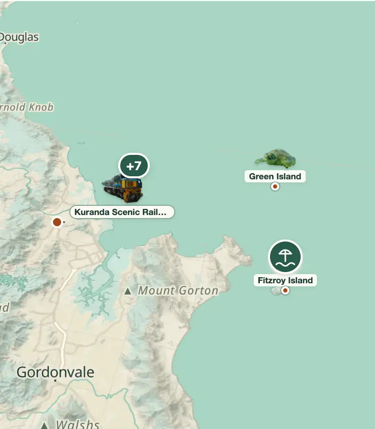
© OpenStreetMap · OpenFreeMap · © OpenMapTiles
Explore the map, read about the other places and plan your travel days in the app.
Open the appWhat to see
Cairns: The plain between the range and the sea
Cairns fits onto a flat strip 2 to 5 km wide between the Coral Sea and the wall of the Great Dividing Range. With no room to the west, the city grew along the coast, with the port at Trinity Inlet, to the south, and the airport by the mouth of the Barron River, to the north.

Reef Fleet Terminal and Marlin Marina
The departure point for almost the entire reef fleet, with boats leaving between 7:30am and 8:30am and returning in the late afternoon. The most visited outer reefs from here (Hastings, Norman, Saxon, Michaelmas Cay) are 1.5 to 2.5 hours away by catamaran, and the marine park environmental charge is levied per passenger, per day.
In winter, the southeast wind changes the sea: choose a large boat, with a pontoon. Departure at 8am, return in late afternoon: it's a full day, not half.
Check access

Skyrail Rainforest Cableway
A 7.5 km cableway opened in 1995 between Smithfield and Kuranda, passing over the canopy of the Wet Tropics rainforest. It has two midway stations: Red Peak, with a ground-level boardwalk and guide, and Barron Falls, with three lookouts over the gorge.
Ride the Skyrail up from Smithfield around 9am, with stops at Red Peak and Barron Falls, and come down by train: that way the day works out without a car.
Check access

Esplanade Lagoon and the boardwalk
A public saltwater pool of about 4,800 m² opened in 2003, free and lifeguarded, built because the city's waterfront is tidal mud. The 2.5 km boardwalk beside it has public barbecues, exercise equipment, and signs identifying the migratory birds that come down to the mud at low tide.
The city's waterfront is tidal mudflat and nobody swims in it: the 4,800 m² lagoon, from 2003, is free and has lifeguards. Come early, along the 2.5 km Esplanade boardwalk, before the heat.
Check access

Green Island
A coral cay 27 km offshore, 45 minutes by fast catamaran, with rainforest grown over coral sand and reef accessible right from the beach. It's been a national park since 1937 and the only cay on the Great Barrier Reef with mature rainforest and a hotel.
A coral cay 27 km off the coast, 45 minutes by fast catamaran, with forest grown over coral sand and a reef reachable from the beach.
Check access
Kuranda Scenic Railway
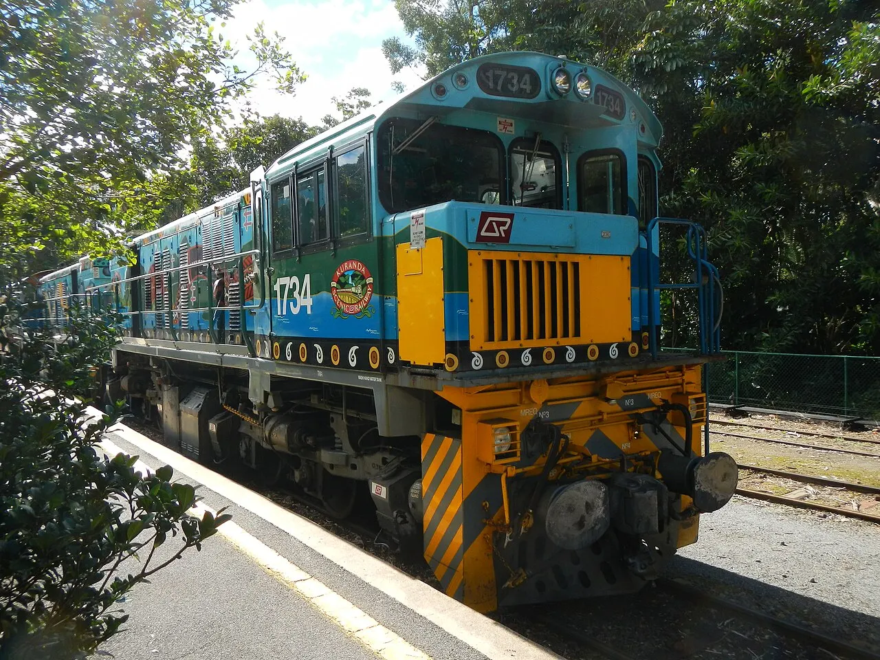
A 37 km railway from 1891, with 15 tunnels and 93 curves dug by hand between 1886 and 1891, including the Stoney Creek bridge. The trip takes about 1 hour 45 minutes, schedules change by season and the line has a scheduled maintenance closure from November 4 to 6, 2026, so check departures on the railway's website before planning your day.
The Kuranda Scenic Railway schedule changes by season, with maintenance closures planned in advance. The ride takes about 1 hour 45 minutes and is worth it as an experience, not just as transport.
Check access
Cairns Botanic Gardens and Tanks Arts Centre
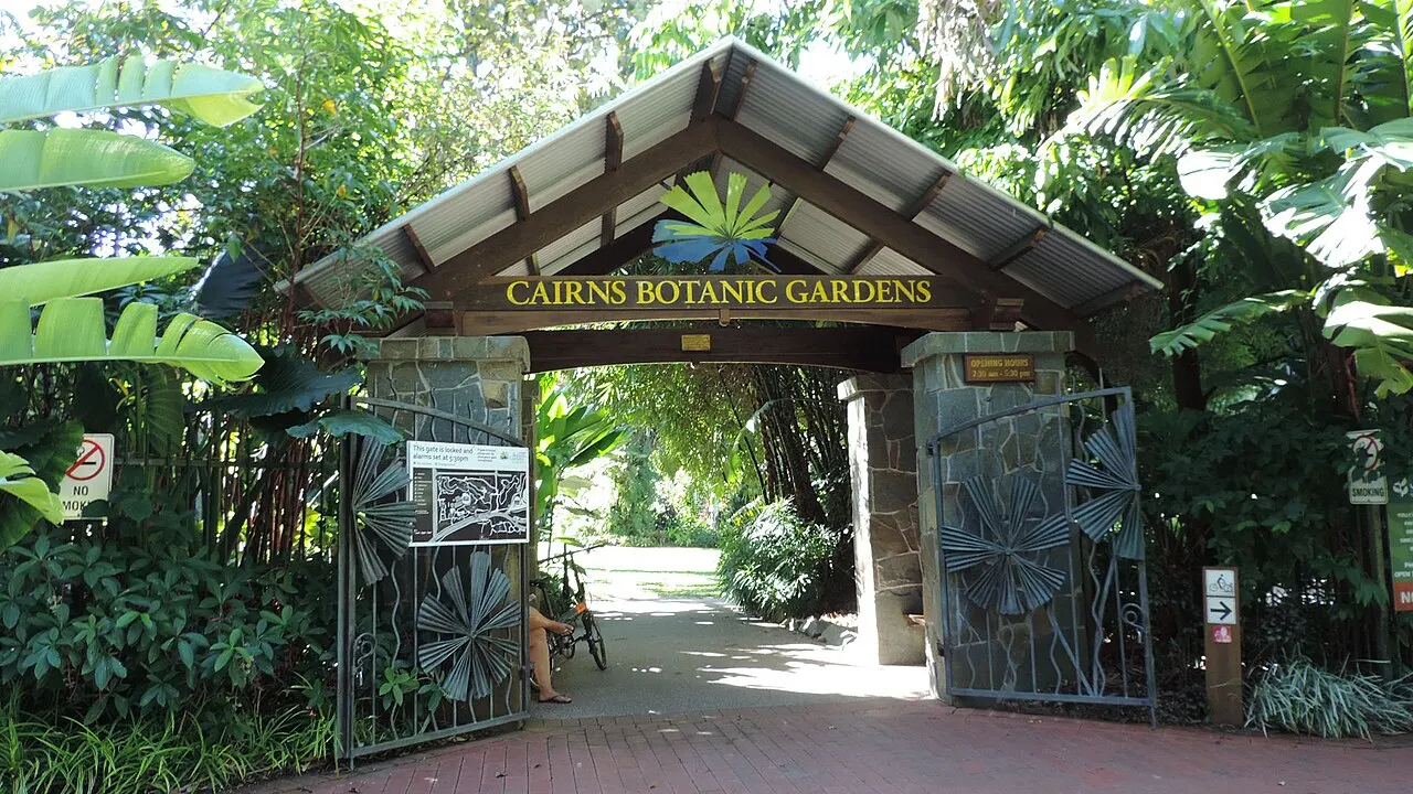
A tropical botanic garden in Edge Hill with a palm collection, an orchid house, and trails to the Centenary Lakes, 10 minutes from the center. Next door, three navy fuel tanks built in 1943 have been converted into performance spaces and a gallery, with a monthly market from May to November.
Tropical botanic garden 10 minutes from downtown, with palms, an orchid house and trails to the Centenary Lakes, in Edge Hill. Next door, the Navy's 1943 fuel tanks became performance venues, and the visit pays off more combined with an evening show or the monthly market, from May to November.
Check access

Mount Whitfield and Crystal Cascades
The Red Arrow is a 1.3 km loop with stairs up the range just behind the botanic gardens, walked by locals before 7am; the Blue Arrow runs 5.4 km, climbs 350 m and calls for water and stamina. The Crystal Cascades, 20 km away in Redlynch, are a chain of freshwater pools along a 1.2 km boardwalk: no crocodiles, but a strong current after rain.
An hour round trip, and it only makes sense before 7am, when the Red Arrow loop belongs to the locals and the heat hasn't arrived yet.
Check access

Fitzroy Island
A continental island 29 km out, 45 minutes by boat, with Nudey Beach, a coral-shingle beach, and trails up to the lighthouse and the peak. It's home to the Cairns Turtle Rehabilitation Centre, which runs guided visits at set times.
Check access

Barron Falls / Din Din
A waterfall on the Barron River inside Barron Gorge National Park, with lookouts rebuilt in 2020 and access by both Skyrail and road from Kuranda. The flow ranges from a trickle in the dry season to a full wall of water after heavy rain; the Barron Gorge hydroelectric plant, from 1963, diverts part of the flow.
In the dry season from May to September (which is high season), the falls become a trickle. The viewpoints are already part of the Skyrail stop, and they're not worth the drive on their own.
Check access
Nilo’s itinerary
Start with the basic programme and choose extensions for the time you have.
Plan my days in the app ↗Day 1 · The flat city and the tide
Start on the Esplanade boardwalk at 7am, before the heat; at low tide the whole mudflat is exposed, and with it the migratory birds named on the signs.
Visit the Cairns Museum, in the 1907 School of Arts building, which covers gold, cane, the railway and the war in about an hour.
Have lunch at Rusty's Markets, open Friday to Sunday on Grafton Street, or buy prawns straight off a trawler at Marlin Marina.
Swim in the public lagoon, free and with lifeguards, and spend the middle of the afternoon in the shade, the hottest time of day.
Stroll through the Esplanade night markets from 4:30pm and have dinner on Lake Street or on the waterfront.
Day 2 · The outer reef
Book this day with at least one spare day after it; wind and rain cancel departures and you'll want the second chance.
Board at the Reef Fleet Terminal between 7:30am and 8:30am.
Take seasickness medication 30 minutes before boarding and put on the stinger suit even outside jellyfish season. It also cuts the sun.
Make two or three snorkeling stops, have lunch on board and head back between 4:30pm and 6pm; check whether the marine park fee is already included in the price you paid.
Keep the evening free, because after a full day of sun, salt and boat, tiredness comes early.
Day 3 · The range
Ride the Skyrail up from Smithfield around 9am, with stops at Red Peak and Barron Falls.
Explore Kuranda: the craft markets, the short trail through the gorge and the lookouts over Din Din, the Barron River falls.
Return on the Kuranda Scenic Railway, which leaves Kuranda at 2pm and 3:30pm; maintenance closes the line from November 4 to 6, 2026.
If you have a car, continue from Kuranda to Mareeba and Atherton, with Lake Eacham and the Curtain Fig Tree, and return over the Gillies Range late in the afternoon.
End the day at the Botanic Gardens or at a show at the Tanks Arts Centre, 10 minutes from the center.


If you stay longer
Day 4 · Free day
Free day: use it to rest, go back to the place you liked most or cover a setback.
Food
 AI illustration
Barramundi
An estuary fish from northern Australia, served grilled with salad or battered as fish and chips. The farmed kind comes from Innisfail and Hinchinbrook and is the menu standard; the wild kind is out of season from November to February and costs much more.
 AI illustration
Mud crab
Mangrove crab (Scylla serrata) caught in Trinity Inlet and the region's estuaries, almost always sold by weight and served whole with chili and garlic or black bean sauce. A piece of 800 g to 1 kg runs A$90–140 at a restaurant; it's long-table, dirty-hands eating.
 AI illustration
Coral trout
A reef grouper straight from the reef itself, the priciest fish on the counter and the one most often ordered grilled whole. Fishing is regulated by quota and closed seasons, so the price swings and its absence from the menu is usually seasonal, not carelessness.
 AI illustration
Prawns and Moreton Bay bug at the marina
Prawns from the Gulf of Carpentaria and the coast, cooked on board, and the bug, a flat crustacean that looks like a small lobster. At Marlin Marina, trawlers have sold straight off the deck since 2016, with tables on the boat, a line and short hours; it's the cheapest seafood lunch in town.
 AI illustration
Native ingredients
Finger lime, Davidson's plum, lemon myrtle, wattleseed, and green ant show up in restaurants downtown; Ochre, opened in 1994, was the one that set the format in the city. Order the tasting plate if you want to try four or five at once.
 AI illustration
Tropical fruit at Rusty's
The Grafton Street market, open Friday to Sunday since 1975, is where the Tablelands' produce comes to town: mango from November to January, and lychee, mangosteen, jackfruit, rambutan, passion fruit and bananas year-round. Go before 10am on Saturday.
 AI illustration
Laksa and Asian food
Chinese migration from the 19th-century goldfields and recent waves of Thai, Japanese and Korean arrivals left the city with good laksa, curry and counter sushi. Rusty's food court and the Esplanade night markets, open from 4:30pm to 11pm, are the cheapest places to eat.
 AI illustration
Mareeba coffee and craft beer
Mareeba, on the tableland 60 km away, has grown arabica coffee since the 1980s and supplies roasters in the city. For beer, Hemingway's, set in the wharf's old passenger terminal, brews on site and faces out onto the marina.
Day trips
Kuranda and Barron Gorge
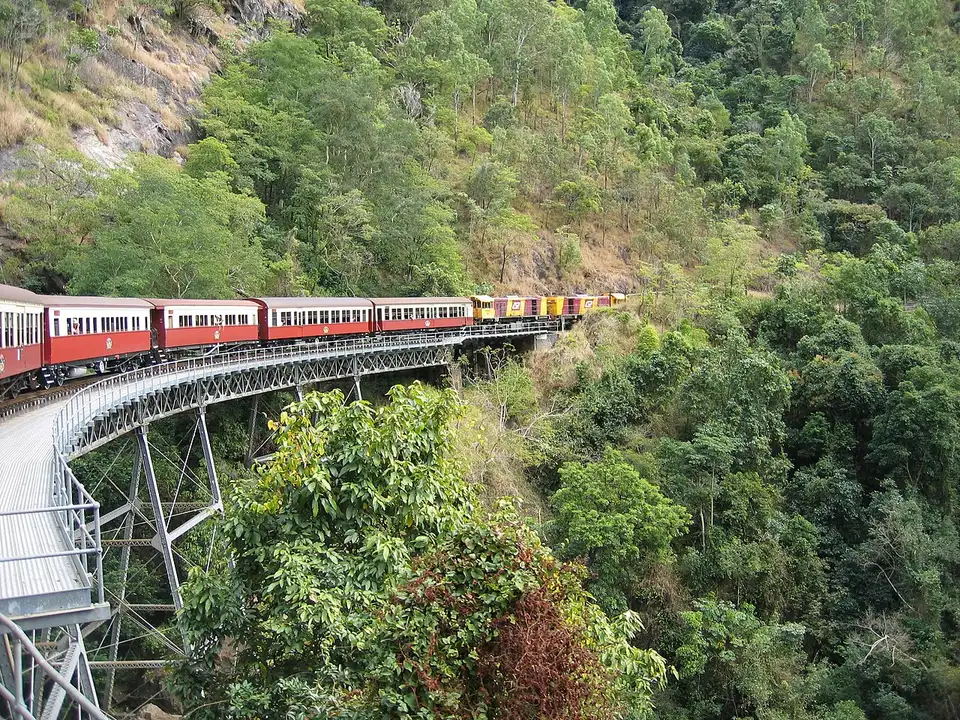
25 km and 35 minutes by car along the Kennedy Highway; 1 hour 45 minutes by heritage train or 1 hour 30 minutes by cableway with stops. The standard combination pairs the two in the same day, one each way.
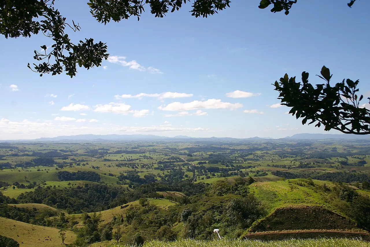
Atherton Tablelands
70 to 110 km, 1 hour 15 minutes to 2 hours climbing via the Kuranda Range or the Gillies Range, the latter with 263 curves over 19 km. It gets you Yungaburra, Lake Eacham (a volcanic crater with freshwater swimming allowed), the Curtain Fig Tree, the Millaa Millaa waterfall circuit, and Mareeba coffee.

Port Douglas, Mossman Gorge, and the Daintree
68 km and about 1 hour to Port Douglas on the Captain Cook Highway, right along the coast, then another 20 km to Mossman Gorge, with a visitor center and guided walks led by the Kuku Yalanji. Cape Tribulation is 140 km and 2 hours 30 minutes away, crossing the Daintree River by ferry. The ferry runs from early morning until around midnight, and the road beyond it is narrow, with no cell signal.
Where to begin
The flat city and the tide
Start on the Esplanade boardwalk at 7am, before the heat; at low tide the whole mudflat is exposed, and with it the migratory birds named on the signs.
The outer reef
Book this day with at least one spare day after it; wind and rain cancel departures and you'll want the second chance.
The range
Ride the Skyrail up from Smithfield around 9am, with stops at Red Peak and Barron Falls.
Money
The currency is the Australian dollar (A$), worth around R$3.50 in 2026 and fluctuating. The 10% GST is already built into every displayed price, and nothing is added at the end of the bill. Approximate ranges for September 2026: flat white A$5–6.50; bakery pie or savory A$6–9; counter lunch at a pub A$20–30. Dinner at a mid-range restaurant A$40–65 per person, without drinks; a 425 ml glass of draft beer (schooner) A$9–13. Dorm bed A$35–55; three- to four-star hotel A$180–300 in the dry season, less in the wet; rental car A$60–110 per day. The city bus costs A$0.50 per trip, a single statewide fare. The reef is the one price that breaks the pattern: a full day on the outer reef runs between A$230 and A$340. The advertised price almost never includes the Environmental Management Charge, the reef conservation fee, of A$8.50 per person for a full day and A$4.25 for a half day (with an increase to A$9.00 and A$4.50 planned from April 1, 2027), or the administrative and port fee. Add A$25 to A$40 to the price in the window. Tipping isn't expected anywhere, and rounding up is enough: try to leave more and you'll get the change back. Cards work almost everywhere, even at market stalls, with a 1% to 2% surcharge being common. Cash is rare, and some cafés no longer take it. Sundays and public holidays usually carry a 10% to 15% surcharge on the menu, flagged on the first page.
Getting there and around
Cairns Airport (CNS): 7 km, two terminals side by side
Cairns Airport (CNS) is 7 km north of the center, with the international (T1) and domestic (T2) terminals side by side, five minutes' walk apart. It's one of the easiest international airports to get through. A taxi to the center costs A$25–35 and takes 10 to 15 minutes; Uber and DiDi operate and are usually a bit cheaper; shared vans charge around A$20 per person and stop at hotels; every rental company has a desk at the terminal. There's a Translink public bus connection, but it runs infrequently and isn't practical with luggage (check the day's timetable). There's no train to the airport. To Port Douglas there's a regular transfer, about 1 hour and A$45–60. Long-distance coaches and the Spirit of Queensland train, which links Cairns to Brisbane in about 24 hours over 1,681 km, leave from the station inside the Cairns Central mall.
Buses at A$0.50 for any trip
Within the city the network is buses only, run by Kinetic under the Translink banner (the Sunbus brand was retired in 2022), with the hub at the Lake Street station. Since August 2024 the fare has been a flat A$0.50 per trip across the whole state of Queensland, for any distance or number of zones, paid with a go card or paper ticket. It's the cheapest public transportation in Australia, and the same fare applies all the way to Palm Cove, about an hour's ride, although away from the main routes the gaps between buses grow at night. The center is flat and you can cross it on foot in 20 minutes, with a bike path along the Esplanade and an almost continuous path to Machans Beach, and only the heat gets in the way of walking. For the Tablelands, the Daintree or the waterfalls, 30 to 140 km away, a rental car is practically a must, because public transportation doesn't cover that area. Traffic drives on the left, so look right before crossing, an easy mistake to make in the first few days.
Safety
Cairns is safe by international standards, and nearly all the real risks are environmental: they depend on the time of day and the tide, not the neighborhood. The biggest risk is the sun. The UV index tops 11 for most of the year and sunburn happens in 15 minutes at midday, so a hat, long sleeves, and shade work better than sunscreen alone. Saltwater crocodiles live in Trinity Inlet, the Barron River, the Daintree, and practically any estuary in the region: don't get into fresh or brackish water outside a pool, don't clean fish on the bank, don't camp at the water's edge, and take the “Crocwise” signs literally. From November to May, box jellyfish (Chironex fleckeri) and Irukandji make the open sea dangerous: swim inside the stinger nets at the northern beaches, in a lycra stinger suit, or use the Esplanade lagoon. If stung, pour vinegar on it and call 000 immediately, without rubbing. At lifeguarded beaches, swim between the red and yellow flags. In the city, the most common problem is bag theft and alcohol-related incidents on Lake Street and the Esplanade after midnight on Friday and Saturday. It's the same precaution as any urban center, and on other nights the place simply goes to sleep. Driving, the risks are fatigue on long stretches, animals on the road at dawn and dusk, and flooded roads in the rain: never drive through a flooded stretch. Emergency number is 000. Ambulance is billed to anyone who isn't a Queensland resident, so travel insurance isn't optional; the public hospital is Cairns Hospital, on the Esplanade.
Etiquette tips
Acknowledging the traditional owners
Events, openings, and even meetings often start with an Acknowledgement of Country or a Welcome to Country from the Gimuy Walubara Yidinji or the Yirrganydji. Stand and stay quiet; it's not decorative formality and you don't applaud midway through.
Ordering at the counter
At pubs, cafés, and most casual restaurants you order and pay at the counter, note the table number, and carry your own drink over. Sitting down and waiting for a server where no one is waiting on tables is the fastest tell of a newcomer.
No tipping as a rule
A high minimum wage and weekend penalty rates make tipping optional in Australia; no one expects it, no one asks for it, and the card machine doesn't suggest a percentage. Leaving change for exceptional service is fine, insisting on it is awkward.
Reading the signs as practical law
Crocodile signs, stinger nets, and red-and-yellow flags aren't generic warnings: they mark where the water is usable that day. It's frowned on to swim outside the net at the northern beaches during jellyfish season.
Sitting up front in a taxi
A solo passenger usually sits in the front seat, an Australian habit of treating the driver as an equal. Sitting in the back isn't rude, but chatting is the regional norm.
Taking nothing from the reef
Removing coral, shells, sand, or any material from the Great Barrier Reef Marine Park is illegal and carries a fine. Also, don't touch coral, don't feed fish, and don't chase turtles or rays; operators lose their license over it.
Mistakes to avoid
The reef isn't at the city beach
Arriving thinking the reef is off the city beach. Cairns' waterfront is tidal mudflat, nobody swims there, and the outer reefs are 1 hour 30 minutes to 2 hours 30 minutes away by boat. Set aside a full day, and pick the operator by the type of boat, not just the price.
A Brazilian passport needs the subclass 600
Counting on an electronic travel authority. Brazilian passports aren't eligible for Australia's ETA or eVisitor, so you need to apply for the Visitor visa (subclass 600) through ImmiAccount before boarding, weeks in advance, with a fee of around A$200.
Passing through without declaring food
Passing through customs without declaring food. Australian biosecurity checks luggage in Cairns with dogs and X-ray, and any food, seed, wood, animal product, or boots with soil on them must be declared on the entry card. Declaring costs nothing; not declaring gets you an on-the-spot fine.
The reef on the last day
Leaving the reef trip for the last day. Strong winds from June to August and heavy rain in February and March often cancel departures. Without at least one spare day after the trip, you risk going home without seeing the reef.
Treating a river or lagoon as a swimming spot
Treating a river, lagoon, or channel as a swimming spot. In the range's natural pools, like Crystal Cascades and Babinda Boulders, the risk is current and slippery rock, with deaths recorded every year. In the estuaries and lowland rivers, the risk is crocodiles. Only swim where a sign allows it, or in a pool.
Useful phrases
How ya going?
“How are you?”: it's a greeting, not a real question. You answer “good, thanks” and hand the same line back.
No worries
“No problem” or “you're welcome.” It answers thanks, apologies, and favors, in that order of frequency.
This arvo
“This afternoon.” Same family as “servo” (gas station), “bottle-o” (liquor store), and “brekkie” (breakfast).
Ta
“Thanks,” the short, casual version, said when handed change or a plate. It doesn't replace a proper thank-you, but it covers the counter.
Stinger suit
A lycra suit against jellyfish. Ask for yours on board between November and May; most boats include it or rent it for about A$10.
Gimuy
The Yidinji name for the place Cairns was built on. It appears in the traditional owners' name, Gimuy Walubara Yidinji, and in the city's institutions and events.
Districts
City center (CBD) and Esplanade
A 1.5 km rectangle between Sheridan Street and the sea, with the public lagoon, the Reef Fleet Terminal, the night markets and most of the hotels. It's where you sleep, eat and board the boats to the reef; away from Lake Street, it empties out after 10pm.
Cairns North and Edge Hill
Residential neighborhoods just above the center, with Queenslander houses on stilts, the Botanic Gardens, the Tanks Arts Centre, and the start of the Mount Whitfield trails. Good for breakfast and lunch, almost no nightlife.
Parramatta Park and Bungalow
A belt between the center and the airport, with the Cairns Showgrounds, Barlow Park stadium, and workshops. Cheaper rent, useful for a long stay, but not much fun to walk around after dark.
Portsmith
Industrial and maritime zone on the bank of the Trinity Inlet: shipyards, the HMAS Cairns naval base, fish processing plants and fishing boats. It's a working neighborhood, with no attractions for visitors.
Northern Beaches
A 25 km ribbon with Machans, Holloways, Yorkeys Knob, Trinity Beach, Kewarra, Clifton, and Palm Cove, each with a beachfront street and a stinger net in season. Palm Cove is the priciest and leafiest, with paperbark trees along Williams Esplanade.
Smithfield and Redlynch
The foot of the range 15 km from the center: James Cook University's Cairns campus (since 1987), a regional mall, and the Skyrail departure station. Redlynch is a residential valley pressed against the forest, with trails and the Crystal Cascades at the end of the road.
Edmonton and Gordonvale
A southern corridor 15 to 25 km out, fast-growing with cheaper property. Gordonvale keeps the Mulgrave Mill, from 1896, crushing cane between June and November, and serves as the base for climbing Walsh's Pyramid.
Yarrabah
An Aboriginal community of about 4,000 people across Trinity Inlet, 50 km away by road despite being visible from the Esplanade. It has an art center and a beach; visit with a local operator or by invitation, not as someone wandering through any old neighborhood.
History
before 1770 · Gimuy, the earlier name
The Trinity Bay plain is Yirrganydji territory along the coast and Gimuy Walubara Yidinji territory at the foot of the range. Gimuy, the Yidinji name for the place, comes from the blue mangrove fig; the economy ran on reef, estuary, and forest.
1770 · Cook names the bay
James Cook names Trinity Bay on June 10, 1770, Trinity Sunday, and sails on without landing. The area stays off the colonial map for another century: mangrove, tide, and mosquito, with no natural harbor.
1876 · Gold on the Hodgkinson
The discovery of gold on the Hodgkinson River, 100 km away, creates the need for a port. The first landing at Trinity Bay is on November 1, 1876, and the settlement takes the name of the Queensland governor, William Wellington Cairns.
1880–1901 · Sugar and forced labor
The first mills use laborers recruited by force from the islands of Melanesia. The Pacific Island Labourers Act of 1901 deports most of them and ushers in the White Australia policy; the work passes to Italian and Maltese migrants.
1886–1893 · The railway settles the rivalry
Cairns competes with Port Douglas for the tableland trade and wins because the government picks its rail route. The first passenger trip to Kuranda runs on June 25, 1891; the line reaches Mareeba in 1893.

1923 · Cairns becomes a city
The port settlement is proclaimed a city, with about 10,000 people living off cane, timber, tin, and fishing. The grid layout parallel to the wharf dates from this period.
1942–1945 · Allied base in the war
Cairns becomes a rear base for the Battle of the Coral Sea in May 1942, with a seaplane base at Trinity Inlet and thousands of Australian and American troops. Three fuel tanks dug into the Edge Hill hillside survived and are now the Tanks Arts Centre.
1981–1988 · World Heritage: the reef in 1981 and the forest in 1988
The Great Barrier Reef is inscribed as a World Heritage site in 1981, and the Wet Tropics rainforest in 1988. The rainforest listing ends logging in the range and turns the forest into a visitor economy.
1984–2003 · Tourism infrastructure
The airport starts receiving international flights in 1984, opening the Japanese phase of tourism, followed by backpackers on working holiday visas. The Skyrail cableway opens in 1995 and the public Esplanade lagoon in 2003.

2020–2022 · Closed borders
The closure of Australia's borders wipes out international tourism for nearly two years and forces the industry to live off domestic visitors. Some reef operators only return to full scale from 2023.

2023–2026 · Cyclone Jasper flooded the airport in 2023
In December 2023 Cyclone Jasper causes the biggest recorded flood of the Barron River, floods the airport terminal, and cuts off the northern beaches. Meanwhile, the mass bleaching events of 2016, 2017, 2020, 2022, and 2024 have shifted local talk toward recovery and monitoring.
 AI illustration
Complete history
The Yirrganydji and Yidinji at Gimuy, before 1876
Before anything colonial, the Trinity Bay plain was a system of mangrove, estuary, and foothill occupied by the Yirrganydji along the coast and the Gimuy Walubara Yidinji at the base of the mountains. Gimuy is the Yidinji name for the place and comes from the blue fig that grows in the mangrove. James Cook passed the coast on June 10, 1770, named the bay Trinity, and didn't land. For another hundred years the area stayed irrelevant to the colony: there was no natural harbor, no road, and no economic reason.
Hodgkinson River gold and the 1891 railway
The discovery of gold on the Hodgkinson River in 1876, 100 km from the coast, set off a race between three coastal landings to become the goldfield's port. The landing at Trinity Bay took place on November 1, 1876, and the settlement was named after Governor William Wellington Cairns. Port Douglas, 68 km to the north along the coast road, had a better track to the tableland and stayed ahead for a decade. Cairns won by government decision: the railway to Herberton began in 1886, reached Kuranda on June 25, 1891 and Mareeba in 1893, pouring tin, timber and cattle from the tableland onto the Cairns wharf. Port Douglas shrank to a fishing village and only came back onto the map in the 1980s.
A century paid for by sugar
Between 1880 and 1980, sugar paid the bills. The first mills ran on laborers brought by force from the islands of Melanesia under a coercive recruitment system, ended by the Pacific Island Labourers Act of 1901, which deported most of them and opened the White Australia policy. The work then went to migrants from southern Europe, mostly Italians and Maltese, who settled in Babinda, Innisfail and Gordonvale, where the Mulgrave Mill, from 1896, still crushes cane between June and November. Cairns was proclaimed a city in 1923. In World War II it became a rear Allied base for the Battle of the Coral Sea, in May 1942, with seaplanes in Trinity Inlet and fuel tanks dug into the slope of Edge Hill, three of which became the Tanks Arts Centre.
The Great Barrier Reef in 1981, the international airport in 1984
Two events defined the current economy: the Reef's recognition and the arrival of international flights. In 1981 the Great Barrier Reef was listed as World Heritage; in 1984 the airport began receiving international flights, and Japanese demand created the first wave of hotels, dive shops, and bilingual signage. In 1988 the Wet Tropics rainforest also became World Heritage, which ended logging on the range and turned the same mountain from a resource into an attraction. Skyrail opened in 1995, the Esplanade lagoon in 2003, the aquarium in 2017. Today tourism accounts for roughly a quarter of the regional economy, with sugar, the university, a naval base, fishing, and health services for the whole Far North filling out the rest.
Cyclones Larry and Yasi, then closed borders in 2020
The last two decades brought a series of cyclones, border closures, and coral bleaching. Cyclones Larry (2006) and Yasi (2011) hit the coast to the south and wrecked crops; the border closures from 2020 to 2022 zeroed out international tourism; in December 2023 Cyclone Jasper produced the biggest recorded flood of the Barron River, flooded the airport terminal, and cut off the northern beaches for days. Out at sea, the mass bleaching events of 2016, 2017, 2020, 2022, and 2024 changed the conversation: operators now talk as much about coral nurseries, monitoring, and recovering sites as about colorful fish. The city keeps growing anyway, squeezed by the range, stretching 25 km north to Palm Cove and 20 km south to Gordonvale.
Ask about colorful fish and you'll hear about coral nurseries and reef monitoring.
Geography and shape of the city
The plain between the range and the sea
Cairns sits on a narrow coastal plain, 2 to 5 km wide, pressed between the Coral Sea and the wall of the Great Dividing Range, which rises almost vertically to 800–900 m at the Lamb Range right behind the city. To the south, Trinity Inlet and the Mulgrave River form a mangrove and navigable channel system that became the port; to the north, the Barron River comes down from the gorge and empties near the airport, built on filled-in tidal flats.
The city grows in two ribbons: Palm Cove and Gordonvale
The center is a flat rectangle of about 1.5 km by 1 km, with streets running parallel to the waterfront (Esplanade, Abbott, Lake, Grafton, Sheridan); Sheridan Street is the Bruce Highway itself crossing the city. Because the range blocks expansion to the west, Cairns grew in two ribbons: 25 km north along the Captain Cook Highway to Palm Cove, and 20 km south to Gordonvale, at the foot of Walsh's Pyramid (922 m).
The 2003 lagoon was born from the Trinity Bay tide
The tide in Trinity Bay reaches about 3 m and exposes a mudflat in front of the Esplanade, which is why the city built an artificial saltwater lagoon in 2003 instead of having a city beach. The continental shelf is narrow here: Green Island, a coral island on the inner shelf, is 27 km away, and the outer reef starts 40–70 km offshore, which makes Cairns one of the closest cities to the Great Barrier Reef.
Culture
Above-average Indigenous presence
Cairns is one of Australia's mid-sized cities with the highest Indigenous presence: about 10% of the region's residents identify as Aboriginal or Torres Strait Islander, against roughly 3.8% nationally. The traditional owners here are the Gimuy Walubara Yidinji and the Yirrganydji, and the region also holds a concentration of families from Cape York, the Torres Strait, and Papua New Guinea, which shows up in the music, the rugby teams, and the galleries. Since 2009 the Cairns Indigenous Art Fair, in July, has been the main marketplace for Indigenous art in North Queensland; Bulmba-ja, on Abbott Street, keeps the exhibition circuit running year-round.
Small-scale tropical science
The city produces tropical science and small-scale arts. James Cook University's Cairns campus, in Smithfield, and the Australian Tropical Herbarium concentrate research in reef ecology, botany, and tropical health; JUTE Theatre Company, active since 1992, stages new writing from the north; the Tanks Arts Centre occupies former World War II fuel depots and now hosts shows and exhibitions; Munro Martin Parklands, reopened in 2016, hosts open-air concerts in the dry season. In sport, the Cairns Taipans have played in the national basketball league since 1999 at the Cairns Convention Centre, the Northern Pride represent the region in the Queensland Cup rugby league, and the June Ironman shuts down the Captain Cook Highway for much of race-day Sunday.
The night is short and concentrated
Nightlife is short and concentrated on Lake Street and the Esplanade, with backpacker bars that fill up early and empty around 2am, plus the breweries on the waterfront. The city's real rhythm is early: public life starts and ends early. Behind the counters, the mix of accents comes from a large contingent of young foreigners on working holiday visas, who keep the hotels going and pick the region's bananas and cane, and who turn over every season.
The Tanks Arts Centre occupies naval fuel tanks from 1943.
Festivals and events
 AI illustration
Cairns Indigenous Art Fair (CIAF): July
A fair and program of Aboriginal and Torres Strait Islander arts running since 2009, with exhibitions, a fashion show, dance, and direct sales from art centers at the Cairns Convention Centre and the cruise terminal. Entry to the fair is usually free.
 AI illustration
Cairns Festival: late August to early September
About two weeks of programming organized by the city council, with a parade down Abbott Street, outdoor cinema, park concerts, and fireworks over the Esplanade to close it out. This is when the city gets busiest outside school holidays.
 AI illustration
Ironman Cairns: June
A long-distance triathlon held since 2011, with swimming at Palm Cove and cycling along the Captain Cook Highway. The road to the northern beaches is closed for much of Sunday: if you're staying north, plan your transport around it.
 AI illustration
Cairns Show: July
An annual agricultural show at the Showgrounds, with cattle judging, a Tablelands produce competition and a carnival. The Friday of the show is a local public holiday, and many shops and public services close.
 AI illustration
Tanks Market: first Sunday of the month, May to November
A market of growers, craftspeople and food stalls at the Tanks Arts Centre, next to the Botanic Gardens, from 9am to 2pm. It's the easiest way to buy Tablelands produce without driving up the range.
Books and films
“The Reef: A Passionate History,” by Iain McCalman (2013)
A history of the Great Barrier Reef told through the people who tried to explain it, from Cook to 20th-century biologists. It explains why the reef became heritage site, laboratory, and Cairns's economy all at once.
“Chasing Coral” (2017), by Jeff Orlowski
A documentary about the photographic record of mass bleaching, much of it filmed on the Great Barrier Reef. It's the most direct context for understanding local operators' talk about recovery and monitoring.
“Cairns: City of the South Pacific,” by Timothy Bottoms
A local history written by a historian from the region itself, from the 1876 landing to the end of the 20th century, without softening the colonial frontier or the forced labor in the cane fields. It's the book that explains the street grid and the names on it.
Frequently asked questions
Cairns: Can you see the reef from the city beach?
No: Cairns' waterfront is tidal mudflat, nobody swims there, and the outer reefs are 1 hour 30 minutes to 2 hours 30 minutes away by boat. Set aside a full day, and pick the operator by the type of boat, not just the price.
Cairns: How do you get to Kuranda and Barron Gorge?
By car it's 25 km and 35 minutes along the Kennedy Highway; the heritage train takes 1 hour 45 minutes, and the cableway with stops, 1 hour 30 minutes. The standard combination pairs the two in the same day, one each way.
Cairns: What's the currency, and what's the exchange rate for the Brazilian real?
The currency is the Australian dollar (A$), worth around R$3.50 in 2026 and fluctuating.
Cairns: How should you behave during the acknowledgment of the traditional owners?
Stand up and stay quiet: events, openings and even meetings start with an Acknowledgement of Country or a Welcome to Country from the Gimuy Walubara Yidinji or the Yirrganydji, and you don't applaud partway through.
Cairns: What's the real risk for visitors?
The real risks are almost all environmental and vary with the time of day and the tide: the sun, with a UV index above 11, crocodiles in practically any estuary, and, from November to May, jellyfish in the open sea.
Other cities in the country
Australia ↗- Days
- 3–4
- When
- Mar–Apr · Oct–Nov
- Per person/day
- Average 280–450 A$Mid-range · per person/day
Cost scope
Per person per day: accommodation, meals, urban transport, visits and a small allowance for extras. Flights excluded; larger purchases vary. Editorial estimate, not a quote.
- Days
- 3
- When
- Mar–May
- Per person/day
- Average 180–260 A$Mid-range · per person/day
Cost scope
Per person per day: accommodation, meals, urban transport, visits and a small allowance for extras. Flights excluded; larger purchases vary. Editorial estimate, not a quote.
- Days
- 2–3
- When
- May–Sep
- Per person/day
- Average 220–380 A$Mid-range · per person/day
Cost scope
Per person per day: accommodation, meals, urban transport, visits and a small allowance for extras. Flights excluded; larger purchases vary. Editorial estimate, not a quote.