Australia
Uluru
The Uluru base walk, Kata Tjuta and the desert sky
Days Start with the basic programme and choose extensions for the time you have.
How the guide reaches this number
On the first, settle into Yulara, visit the Cultural Centre and watch the sunset from the viewing area west of the rock. On the second, do the 10.6 km base walk, which rewards you with shelters, paintings and clefts that differ on each face, and in the hot months finish before 11am. At night, go to Field of Light, with transfer from Yulara. If you have a third day, spend the morning at Kata Tjuta, 50 km from Yulara, on the same pass. Lodging weighs on the budget: Yulara is a resort village with no competition, with rooms from A$250 to A$700. With just one day, do the whole loop in the morning, have lunch in Yulara, stop at the Cultural Centre and finish at the sunset viewing area; Kata Tjuta is left out. Between 12pm and 4pm, the sun limits your options to the pool and the air conditioning.
2–3
When May through September: days of 20–25 °C, nights of 0–7 °C, almost no rain
How the guide reaches this number
May to September is the dry, cool season: highs of 20 to 25 °C, lows of 0 to 7 °C, occasional frost in July and clear skies almost every day. This is when long hikes are possible, but also when the resort fills up, with higher prices and bookings taken months ahead. From October to April, highs exceed 35 °C and often reach 40 °C. In hot weather, finish walks before 11am. Closures vary by trail and temperature, so summer requires a flexible itinerary. The gate opens at 5am in summer, allowing an early start; check park notices before each walk. Rainfall totals about 300 mm a year, concentrated in summer storms that can turn the rock into a waterfall for a few hours. Within the dry season, May and August to September offer the best balance of temperatures and visitor numbers. Bush flies appear from September to April and are persistent: an A$10 head net is the most useful thing to pack then, and nobody finds it strange if you eat lunch with it resting on your forehead. January is the month most people would avoid.
Per person/day A$220–380 per person with a hotel in Yulara; A$110–160 camping (2026)
How the guide reaches this number
Per person per day: accommodation, meals, urban transport, visits and a small allowance for extras. Flights excluded; larger purchases vary. Editorial estimate, not a quote.
 What Nilo thinks
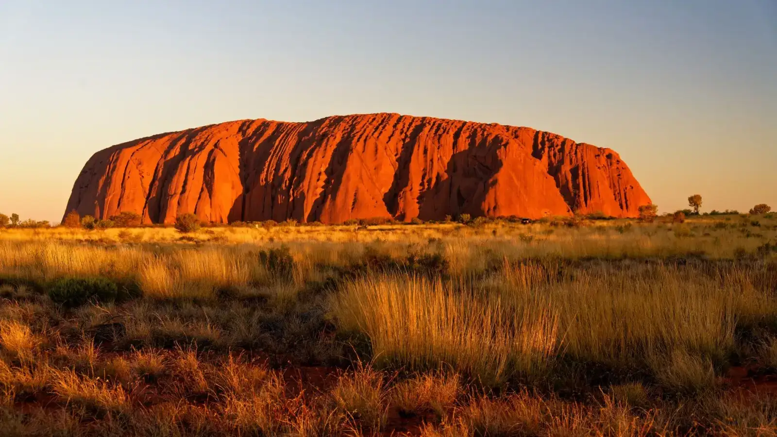
Plan two days for Uluru. On the first, settle into Yulara, visit the Cultural Centre and watch the sunset from the viewing area west of the rock. On the second, do the 10.6 km base walk, which rewards you with shelters, paintings and clefts that differ on each face, and in the hot months finish before 11am. At night, go to Field of Light, with transfer from Yulara. If you have a third day, spend the morning at Kata Tjuta, 50 km from Yulara, on the same pass. Lodging weighs on the budget: Yulara is a resort village with no competition, with rooms from A$250 to A$700. With just one day, do the whole loop in the morning, have lunch in Yulara, stop at the Cultural Centre and finish at the sunset viewing area; Kata Tjuta is left out. Between 12pm and 4pm, the sun limits your options to the pool and the air conditioning.Uluru is a single sandstone rock, 348 m tall, in the middle of the plain at the center of Australia, and since 2019 no one climbs it: the thing to do is walk around it on the flat 10.6 km trail, with shelters, clefts and paintings that differ on each face. At the Mutitjulu waterhole, the wall paintings tell the story of the fight between Kuniya and Liru, an episode of the Tjukurpa, the law and creation stories of the Anangu, the land's owners. They're the ones who explain that law at the Cultural Centre, where artists work in view of the public. Late in the afternoon, from the viewing area to the west, the rock changes color with the sunset. Further west, 50 km from Yulara by road, are the 36 conglomerate domes of Kata Tjuta, with trails that run between them. Come between May and September, with days of 20 to 25 °C, and set aside two days.
Quick facts
- Population
- about 1,100 residents in Yulara and about 300 in Mutitjulu, the Anangu community at the base of the rock
- Founded
- Continuous Anangu presence for more than 30,000 years; the village of Yulara opened in 1984
- Country and region
- Australia · Northern Territory, central desert (Red Centre)
- Language
- English; Pitjantjatjara and Yankunytjatjara among the Anangu
- Currency
- Australian dollar (AUD, A$)
- Time zone
- ACST, UTC+9:30, the Northern Territory doesn't observe daylight saving
- Best time to visit
- May through September: days of 20–25 °C, nights of 0–7 °C, almost no rain
- Average daily cost
- A$220–380 per person with a hotel in Yulara; A$110–160 camping (2026)
When to go
May through September: days of 20–25 °C, nights of 0–7 °C, almost no rain
How the year changes
May to September is the dry, cool season: highs of 20 to 25 °C, lows of 0 to 7 °C, occasional frost in July and clear skies almost every day. This is when long hikes are possible, but also when the resort fills up, with higher prices and bookings taken months ahead. From October to April, highs exceed 35 °C and often reach 40 °C. In hot weather, finish walks before 11am. Closures vary by trail and temperature, so summer requires a flexible itinerary. The gate opens at 5am in summer, allowing an early start; check park notices before each walk. Rainfall totals about 300 mm a year, concentrated in summer storms that can turn the rock into a waterfall for a few hours. Within the dry season, May and August to September offer the best balance of temperatures and visitor numbers. Bush flies appear from September to April and are persistent: an A$10 head net is the most useful thing to pack then, and nobody finds it strange if you eat lunch with it resting on your forehead. January is the month most people would avoid.
Nilo's tips
Stay at the lookout 20 minutes after sunset
The color shifts most strongly in the 20 minutes after the sun disappears, right when the buses leave and the viewing area, packed until 15 minutes before, empties out almost completely. At the sunset viewing area, west of the rock, buses and cars stop in separate areas: park on the car side and arrive an hour early.
Arrive at Talinguru Nyakunytjaku 45 minutes before sunrise
Anyone who arrives right at sunrise ends up in the second row of people, and it's the first row that decides the framing.
Buy the 3-day pass online before you travel
Cell signal ends once you leave Yulara, so don't count on sorting out the purchase at the park gate. The pass is valid for 3 consecutive days, and anyone under 18 gets in free.
Leave at dawn and finish the walk before 11am
The flat 10.6 km loop takes 3 to 4 hours, and the northeast face closes at 11am when the forecast or observed temperature reaches 40 °C. If you set off from the Mala parking lot at first light, you'll have time to spare; from May to September, you can watch the sunrise at Talinguru Nyakunytjaku beforehand. Carry water for the whole walk and bring a head net in fly season.
At 36 °C, Valley of the Winds closes beyond Karu at 11am
The trail is 50 km by road from Yulara, and anyone leaving late arrives to find the stretch already closed, because a heat forecast is enough, without waiting for the thermometer. If the heat rules out the full loop, check with the rangers about Walpa Gorge, 2.6 km round trip. The gorge has shade and wind, but that doesn't make it safe to walk under extreme heat.
Shop at the IGA, lunch at the apprentices' counter
Groceries at the IGA on the town square cost half as much as eating out, even though they run 20% to 30% more than in a capital city. For a quick lunch, the Kulata Academy Café, on the square, is the cheapest in the village. At night, head straight from sunset to dinner, because almost everything in Yulara stops serving around 9pm.
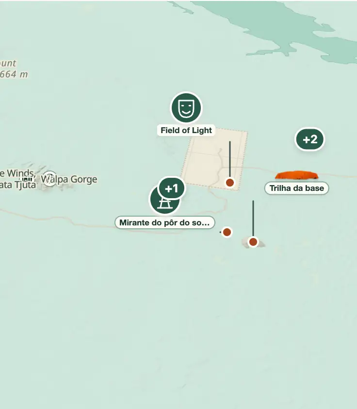
Explore the map
© OpenStreetMap · OpenFreeMap · © OpenMapTiles
Explore the map, read about the other places and plan your travel days in the app.
Open the appWhat to see
Uluru: The plain and what you see from it
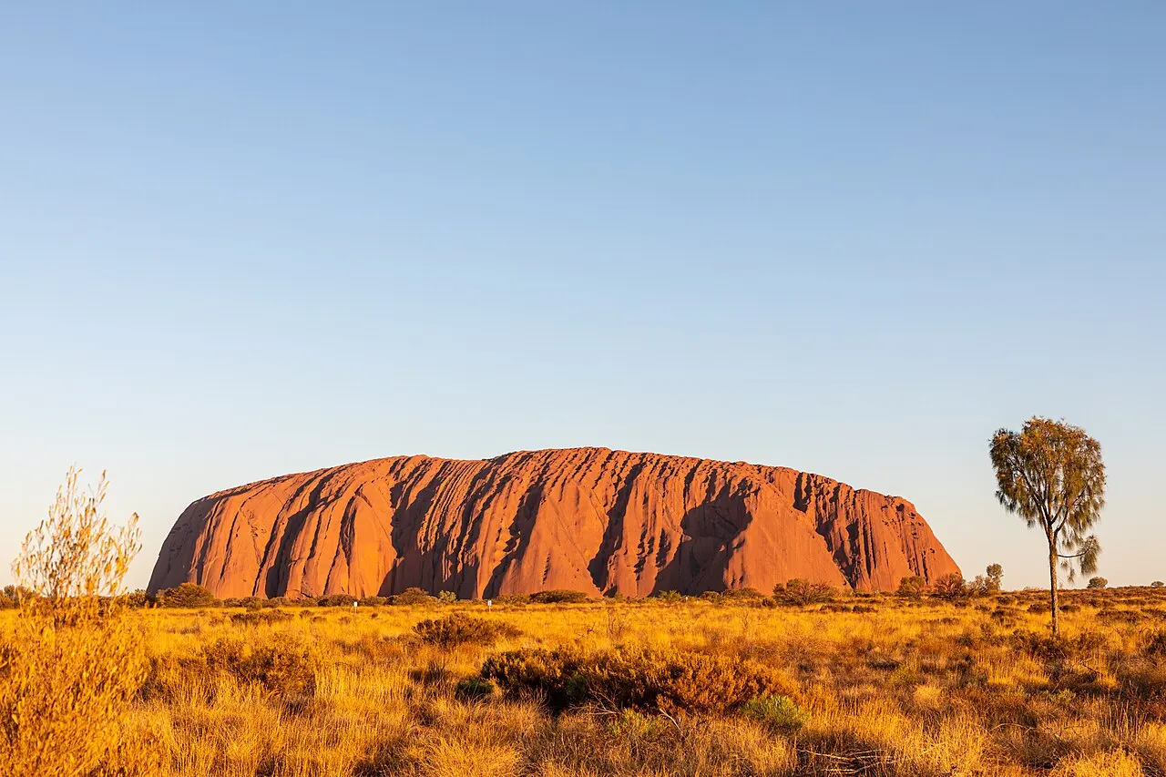
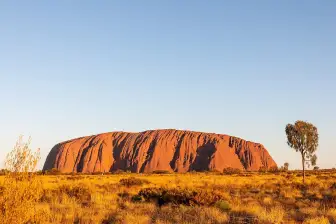
Around the monolith, the Amadeus Basin opens up flat in every direction, with fixed dunes covered in spinifex and mulga acacias, and the horizon has almost no relief: to the west the domes of Kata Tjuta appear, and to the east the mesa of Mount Conner, which many people mistake for Uluru when arriving by road.

Uluru Base Walk
A flat 10.6 km circuit around the monolith, taking 3 to 4 hours. Leave the Mala parking lot at dawn and finish before 11am in hot weather. The northeast face closes at that time when the forecast or observed temperature reaches 40 °C; follow local notices.
The flat 10.6 km route around the rock takes 3 to 4 hours, and one side closes when the thermometer breaks the limit; it shuts at 11am at 40 °C; start from the Mala car park.
Check access
Talinguru Nyakunytjaku
Sunrise lookout opened in 2009, with boardwalks over dunes and place names in Pitjantjatjara on the signs. Arrive 45 minutes before official sunrise.
The sunrise viewing area, opened in 2009, has signs with names in Pitjantjatjara, and it's worth arriving 45 minutes before the official sunrise time.
Check access

Uluru sunset lookout
Parking west of the rock, with a separate area for buses and another for cars, from where you watch Uluru change color at sunset.
It's the classic spot to watch the rock change color at sunset, and the cars-only section avoids competing for space with the groups arriving by bus.
Check access
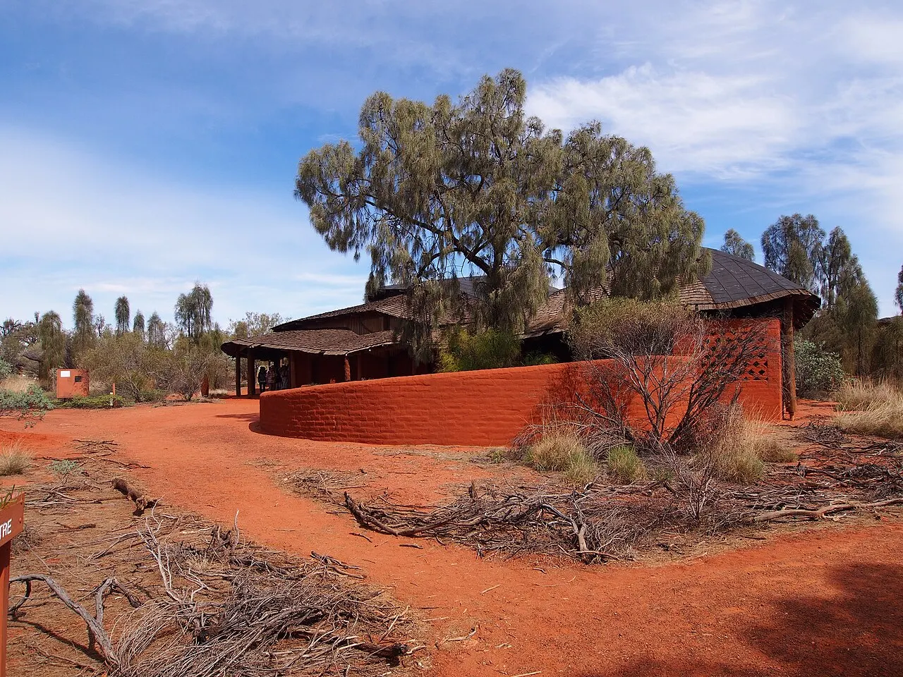
Uluru-Kata Tjuta Cultural Centre
Opened in 1995, designed by Gregory Burgess in forms that reference Kuniya and Liru. The Anangu explain the Tjukurpa here in their own words, in two galleries where the artists work in view of the public.
The center opened in 1995 and offers the explanation of the Tjukurpa that the Anangu themselves give, while the galleries of the building designed by Gregory Burgess let artists work in view of visitors. Its shapes evoke Kuniya and Liru.
Check access

Kuniya Walk and Mutitjulu waterhole
A one-kilometer round trip to the rock's only permanent water, home of Wanampi, the water serpent of the Tjukurpa. The paintings on the wall and the crack above the waterhole are read as a record of the battle between Kuniya and Liru.
One kilometer round trip reaches the only permanent water, where the Wanampi lives, and the paintings and the cleft are read as a record of the fight between Kuniya and Liru.
Check access
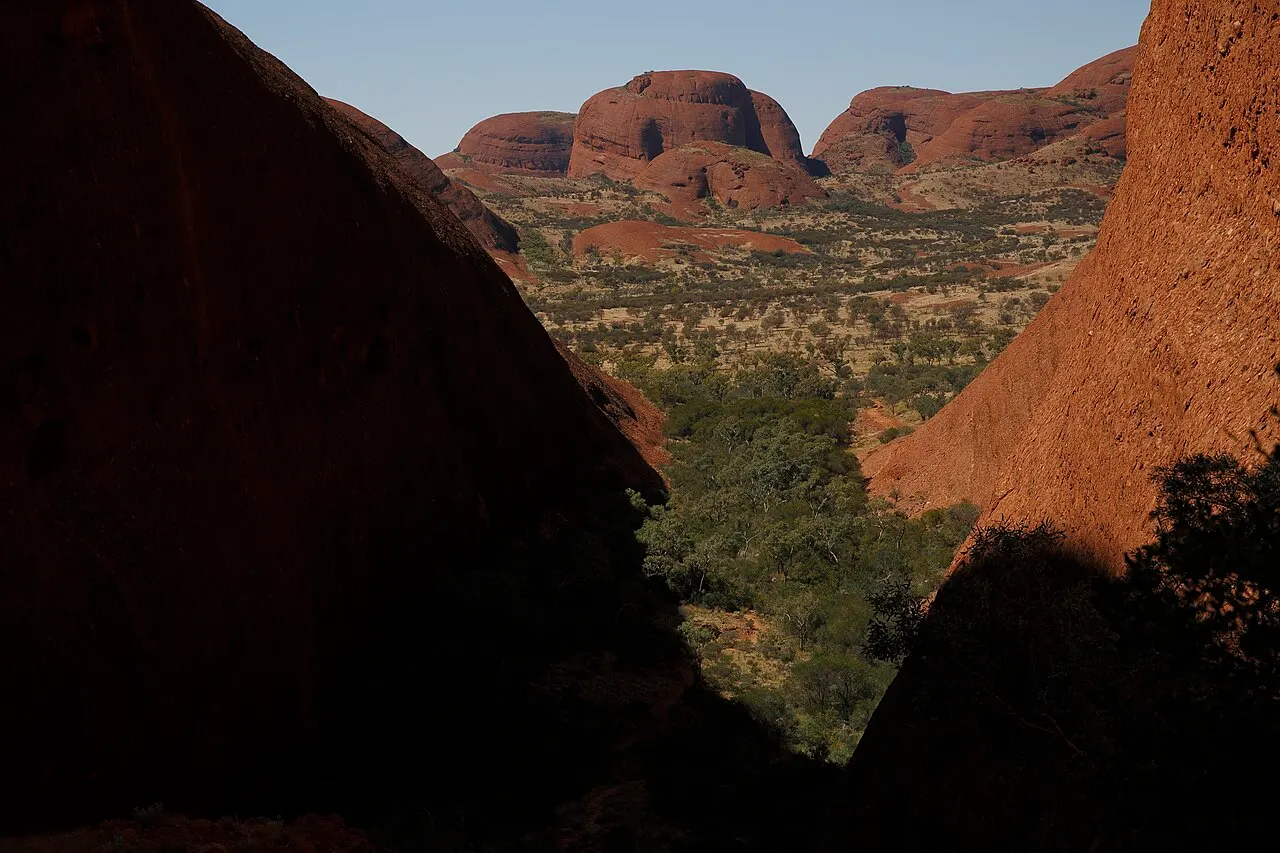
Valley of the Winds, at Kata Tjuta
A 7.4 km circuit among the domes, taking 3 to 4 hours, with Karu and Karingana lookouts and sections of loose rock. When the forecast or observed temperature is 36 °C or higher, access beyond Karu closes at 11am. Start early and respect the closure.
The route between the stone domes takes several hours, with unstable stretches, and the continuation closes in the heat past a fixed time; beyond Karu, at 36 °C, it shuts at 11am; it's 7.4 km.
Check access
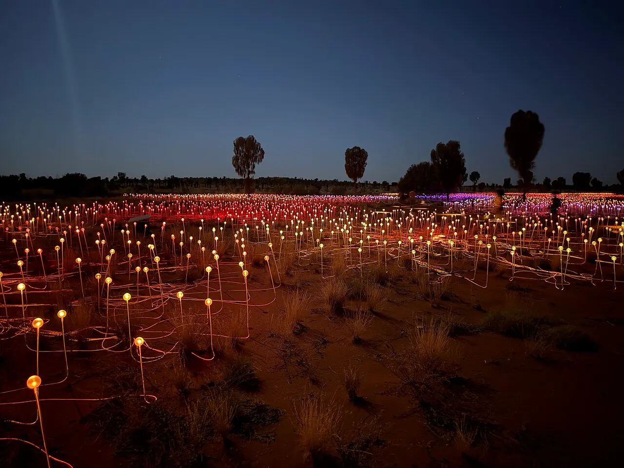
Field of Light
Installation by Bruce Munro set up in 2016 with more than 50,000 fiber-optic stems over about seven soccer fields; in 2026 it marks ten years at the site. Timed entry, with transfer from Yulara.
With more than 50,000 fiber stems across about seven soccer fields, the 2016 installation marks ten years on site in 2026, and entry requires a set time with transfer from Yulara.
Check access
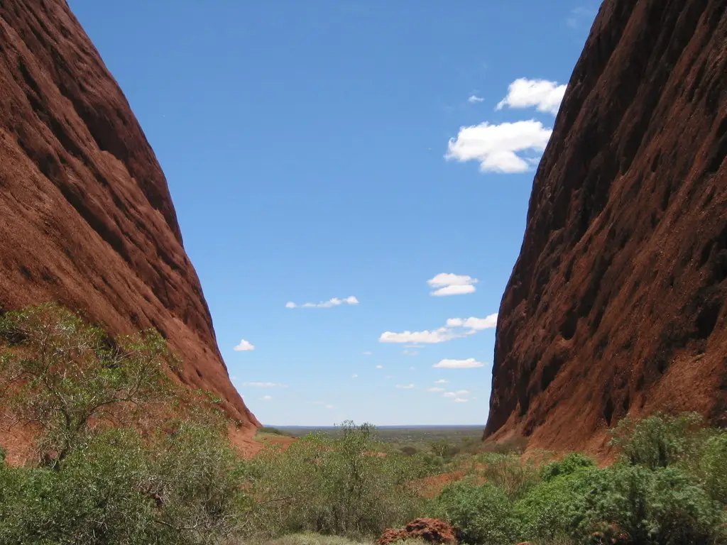
Walpa Gorge
A 2.6 km return walk through a corridor between two domes, with channeled wind and vegetation in the gap's shade. If Valley of the Winds closes, consult the rangers before choosing this alternative: shade doesn't guarantee safety in extreme heat.
Walpa Gorge offers a shorter walk between the domes. In extreme heat, the choice depends on the park's warnings and the rangers' guidance.
Check access
Nilo’s itinerary
Start with the basic programme and choose extensions for the time you have.
Plan my days in the app ↗Day 1 · Arrival, context and the first light
Buy the 3-day pass online before you leave home and pick up your car, or confirm the transfer, at Connellan Airport.
Check in at Yulara and stock up at the IGA on the plaza: water, breakfast and lunch for the coming days.
Go to the Cultural Centre at 2:30pm, see the exhibition on the Tjukurpa, and stop by the Maruku Arts and Walkatjara Art galleries.
Get to the sunset viewing area an hour early, park in the car section, and don't leave until the rock's color has darkened.
Have dinner early: almost everything in Yulara stops serving around 9pm.
Day 2 · The full loop around the base
From May to September, get to Talinguru Nyakunytjaku 45 minutes before sunrise, counting the drive from Yulara, and watch from there, with Uluru and Kata Tjuta in the same field of view.
Right after, start the 10.6 km base walk from the Mala parking lot, with side trips to Kantju Gorge and Mutitjulu, and set aside 3 to 4 hours. In the hot months, skip the viewing area and leave Mala at dawn, to finish before 11am.
If it's a guided-walk morning, join the free Mala Walk led by a ranger from the Mala parking lot.
Have lunch in Yulara and keep the middle of the afternoon for the pool or your room: between 12pm and 4pm the sun rules out any plan.
Close the night with Field of Light, with transfer from Yulara, or, in season, with Wintjiri Wiru. Both run on a set schedule.

If you stay longer
Day 3 · Kata Tjuta and departure
Leave Yulara at 6am for the 50 km drive to Kata Tjuta and tackle the Valley of the Winds, 7.4 km, before the heat closes it at 11am.
If the long trail is closed, ask the rangers about Walpa Gorge, a 2.6 km return walk. Don't assume the gorge is safe for walking during hours of extreme heat.
Stop at the Kata Tjuta dune lookout on the way back, to see the 36 domes from a distance and get a sense of the scale.
In the afternoon, join a Maruku Arts dot-painting workshop at the Cultural Centre, led by an Anangu artist with an interpreter.
Return the car with a full tank: the Yulara station is the only one within 85 km.

Food
 AI illustration
Grilled kangaroo
Lean, dark meat with a strong iron taste, served rare on nearly every menu in Yulara. Overcooking it past medium dries it out: the most common mistake at the Pioneer BBQ grill.
 AI illustration
Damper
Unleavened bread baked in the coals, a legacy of the outback drovers. It shows up at outdoor dinners sprinkled with wattleseed, which tastes like coffee with hazelnut.
 AI illustration
Kutjera, the desert tomato
Small, dried fruit of a native nightshade, tasting somewhere between tamarind and roasted tomato. It becomes a relish or sauce for game meat and is sold as a powder in the Yulara supermarket.
 AI illustration
Quandong
Desert peach with tart flesh and a large pit, used in preserves, pies and ice creams. It grows on semi-parasitic shrubs common in the region.
 AI illustration
Maku (witchetty grub)
A grub that lives in the roots of the witchetty bush, a traditional food of the Anangu, gathered by the women. It shows up roasted on cultural tours and in tasting menus; raw, it has a creamy texture.
 AI illustration
Barramundi
Fish from tropical northern Australia, transported frozen or chilled to the desert. It's the standard alternative to red meat at the resort's restaurants.
 AI illustration
Sounds of Silence dinner
Open-air buffet service on top of a dune, with a sparkling wine welcome at sunset and a presentation of the southern-hemisphere sky after dessert. Book weeks ahead in high season.
 AI illustration
Coffee at Kulata Academy Café
Coffee counter, savory pies and sandwiches on the Yulara plaza, run by Indigenous apprentices in the resort's training program. It's the cheapest option for lunch without cooking.
Where to eat
- Tali Wiru · Atop a dune, reached by van from Yulara · $$$
An outdoor three-course dinner under the stars, with native ingredients, wine and Indigenous storytelling; it runs only from April to October.
Source · 2026-09-28
- Ilkari Restaurant · Inside Sails in the Desert · $$
A breakfast buffet and a dinner of local fish and meat; booking ahead is essential given the demand.
Source · 2026-09-28
- The Bough House · Inside Outback Pioneer Hotel · $$
Native Australian ingredients, such as Kakadu plum and bush tomato; a main course already includes the entrée and dessert buffets.
Source · 2026-09-28
- Outback BBQ & Bar · Outback Pioneer Hotel · $
Cook-it-yourself barbecue: pick a cut, from kangaroo to barramundi, and grill it at the communal barbecue with an all-you-can-eat salad bar.
Source · 2026-09-28
$: up to A$20, a snack or a pie · $$: A$20-45 per dish · $$$: above A$45, or a set-menu dinner · 2026-09-28
Day trips
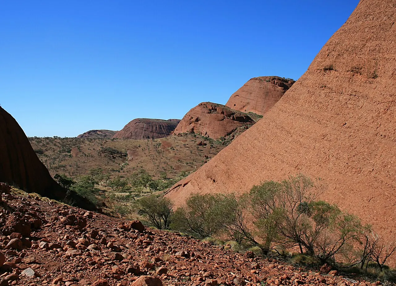
Kata Tjuta
50 km from Yulara, 45 minutes by car on the park's internal road. Half a day of walking among conglomerate domes; the Valley of the Winds is the region's most demanding trail.
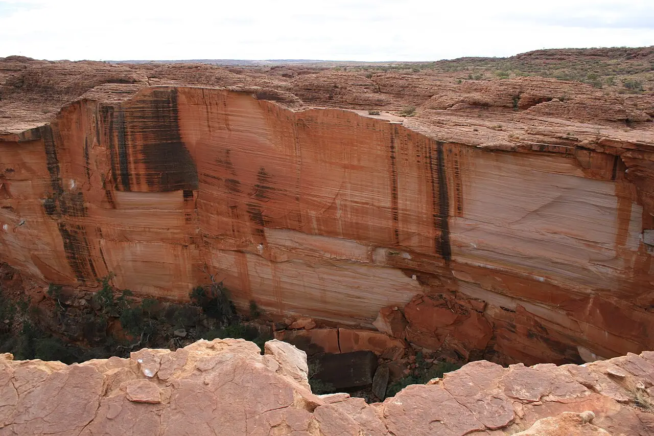
Kings Canyon (Watarrka)
306 km northeast, about 3 hours 30 minutes via the Lasseter Highway and Luritja Road. The Rim Walk is 6 km, starts with a steep climb, and is open only until 9am on days above 36 °C. It usually means an overnight at Kings Creek or the canyon resort.

Curtin Springs and Mount Conner
85 km east on the Lasseter Highway, about an hour. Cattle station with fuel, free camping and tours to the tabletop of Mount Conner (Attila) and the salt lake Amadeus behind it.
Where to begin
Arrival, context and the first light
Buy the 3-day pass online before you leave home and pick up your car, or confirm the transfer, at Connellan Airport.
The full loop around the base
From May to September, get to Talinguru Nyakunytjaku 45 minutes before sunrise, counting the drive from Yulara, and watch from there, with Uluru and Kata Tjuta in the same field of view.
Kata Tjuta and departure
Leave Yulara at 6am for the 50 km drive to Kata Tjuta and tackle the Valley of the Winds, 7.4 km, before the heat closes it at 11am.
Money
The currency is the Australian dollar. Yulara has no competition, and prices are high: a coffee costs A$5 to A$7, a sandwich or savory pie A$12 to A$20, a pub meal A$28 to A$42, a restaurant dinner A$55 to A$90 per person without drinks, and a large glass of beer runs between A$12 and A$16. The IGA supermarket on the central square is the most effective saving of the trip: about 20% to 30% above big-city prices, but half the cost of eating out, and a room with a kitchen or the campground makes this workable. Accommodation in 2026 runs roughly between A$45 and A$70 for a tent site at Ayers Rock Campground, A$250 to A$400 at the Outback Hotel, A$350 to A$520 at Desert Gardens and A$450 to A$700 at Sails in the Desert. Cards are accepted everywhere, often with a 1% to 2% surcharge. There are ATMs at the IGA and in the hotels, and it's worth carrying some cash for roadhouse stops. Tipping isn't required or expected in Australia; rounding up the bill is enough.
Getting there and around
Ayers Rock Airport: 6 km north of Yulara
By air: Ayers Rock/Connellan Airport (AYQ) is 6 km north of Yulara and gets direct flights from Sydney (about 3 hours 20 minutes), Melbourne (about 3 hours), Brisbane, Cairns, Adelaide and Alice Springs, mostly operated by Jetstar, Qantas and Virgin. Every hotel at the resort offers a free airport transfer, timed to arrivals. There's no need to arrange anything ahead of time. By car, Alice Springs is 450 km away: 4 hours 30 minutes to 5 hours on the Stuart Highway to Erldunda and then 245 km on the Lasseter Highway. Fuel up at Erldunda or Curtin Springs, because there's no station between the two, and avoid driving from dusk to dawn, when camels, wild horses and kangaroos cross the road. There are also regular long-distance buses and operator transfers between Alice Springs and Yulara, taking about 5 hours 30 minutes.
No public transit to the park
There's no public transport to the park. The options are a rental car (picked up at the airport or in the Yulara town square), scheduled shuttles such as Uluru Hop On Hop Off between Yulara, Uluru and Kata Tjuta, at around A$60 to A$95 per person depending on the package, or guided tours that already include park entry. There's no Uber and taxis are rare. Within Yulara, a free shuttle bus runs every 20 minutes between the hotels, campground, town square and visitor center, from 10:30am until after dinner. Distances from Yulara: entry station 12 km, Uluru base 20 km, Kata Tjuta 50 km. The village is walkable and has a short scenic trail over the dune behind the square, but you can't walk between the village and the park. Park entry costs about A$38 per adult, is valid for 3 consecutive days and is free for under-18s (approximate 2026 prices: check the Parks Australia website). Buy online before you travel, because cell signal disappears once you leave Yulara. The gate opens before sunrise and closes after sunset, with hours that change every month: in winter, around 6:30am to 7:30pm; in summer, 5am to 9pm.
Safety
Heat is the main risk for visitors to Uluru; violent crime is rare. Walk at dawn and allow 3 to 4 hours for the circuit, plus a margin to finish before 11am on hot days. Some stretches have little shade, and help may take time to arrive. In extreme heat, Parks Australia advises carrying and drinking at least 1 liter of water per person per hour, alternating with foods or drinks that replenish electrolytes. Wear a brimmed hat and obey the signs: the northeast face closes at 11am when forecast or observed temperatures reach 40 °C or higher, and Lungkata closes at 2pm at the same threshold. Keep your distance from snakes and dingoes and don't feed them. Mobile coverage is concentrated in Yulara and around the park perimeter. Avoid driving between dusk and dawn, when camels, kangaroos and cattle may cross the region's long roads. The Northern Territory restricts alcohol sales, and neighboring Aboriginal communities are legally dry areas.
Etiquette tips
Don't climb, and don't leave the trail
The climb has been closed since October 26, 2019, and trying anyway can earn you a fine. Stepping off the marked path, even by a few meters, can mean entering a restricted site and damaging ground that takes decades to recover.
Respect the no-photography signs
Photography is forbidden at sacred points around the base. Ask first if you're not sure.
Don't take rock, sand or a chip
Removing material from the park is illegal. Parks Australia receives return packages every year (the so-called “sorry rocks”) from people who had second thoughts; returning them takes curatorial work, and it isn't always possible to put them back.
Ask before photographing Anangu people
Photographing without permission is a direct offense, and there are cultural restrictions around images of the deceased. A “palya” and a question settle it.
Don't enter the water at Mutitjulu
It's the rock's only permanent water and sustains local wildlife. No swimming, no drinking from it, and nothing thrown in.
Use the right names
Uluru and Kata Tjuta have been the official names since the 1993 renaming, with the order reversed in 2002 to Uluru/Ayers Rock. Say “Anangu” for the people and “Tjukurpa” for the law; no one corrects you out loud, but the difference is noticed.
Mistakes to avoid
In a single day, the base loop leaves no room for the rest
Booking just one day. The 10.6 km loop, the Cultural Centre and sunset already fill two days without rushing; in a single day, the base loop and the heat from 12pm to 4pm squeeze out everything else.
Alice Springs is 450 km away; nearly five hours of driving
Thinking Uluru is close to Alice Springs. It's 450 km and almost 5 hours by car, and without a rental vehicle the only overland link is the long-distance bus or an operator transfer, with a trip of about 5 hours 30 minutes; with little time, it's worth flying straight into Connellan Airport.
Starting late and carrying too little water for the walk's duration
The base loop takes 3 to 4 hours not counting breaks and detours, and in the hot months anyone leaving at 7:30am is still on the trail past 11am, in the worst of the sun. Leave early and carry water for the whole route, not for a short walk. If you arrive late, cover just one stretch instead of forcing the full loop.
Kata Tjuta needs an extra day, on the same pass
Trying to fit Kata Tjuta into the same day as the loop around Uluru. The domes are 50 km from Yulara by road, have the park's most interesting gorges, and the Valley of the Winds closes at 11am on hot days. That's why they deserve the morning of a third day, already covered by the three-day pass.
Leaving Yulara without filling up
Leaving Yulara with the tank half full. Heading east, the next gas station is 85 km away, in Curtin Springs, and after that there's no other one until Erldunda.
Useful phrases
Palya
Good, all right, hello, thank you: the most versatile word in Pitjantjatjara (PAL-ya)
Wai!
Hey! Used to get someone's attention (why)
Uwa / Wiya
Yes / no (OO-wa / WEE-ya)
Nyuntu palya?
Are you well? (NYUN-too PAL-ya)
Pukulpa pitjama Ananguku ngurakutu
Welcome to Anangu land: the phrase on the park's entrance sign
Tjukurpa
The law, the creation, and the body of stories that organize the landscape (choo-KOOR-pa)
Where to stay
- Ayers Rock Campground · A backpack, a car with a trailer, a family · $: It is the cheapest option in the Yulara resort, with a communal kitchen and a pool; in exchange, the bathroom is shared and bush flies show up from September to April.
- Outback Pioneer Hotel & Lodge · A middle ground, in a dorm or a simple room · $$: It sits next to the Bough House and the BBQ counter for cooking your own meat, within walking distance of everything else in Yulara.
- Sails in the Desert and Desert Gardens · Comfort inside the resort, no car needed · $$$: These are Yulara's two top-tier hotels, both a few minutes' walk from the town square and the free shuttle bus.
- Longitude 131° · Isolated luxury, the rock in view from bed · $$$: It sits 10 km from Yulara, outside the resort, with only 15 tents facing Uluru and a three-night minimum stay; everything is included, from the guided tours to the sparkling wine.
$: campsite tent, A$45-70 · $$: mid-range resort hotel, A$250-400 · $$$: above A$400 a night · 2026-09-28
Districts
Yulara
The resort village where everyone sleeps, 20 km from the rock and outside the park. It holds hotels, camping, an IGA supermarket, a gas station, ATMs and the only post office; the central plaza is the late-afternoon meeting point.
Mutitjulu
Anangu community of about 300 people set against Uluru's southeast flank, inside the park. It isn't a tourist site: entry is only by invitation or on a tour led by residents.
Base of Uluru
The ring of trails around the monolith, with the Mala (northwest) and Kuniya (southeast) parking lots. Several stretches carry signs asking visitors not to take photos, because they are sites of restricted knowledge.
Talinguru Nyakunytjaku
Sunrise viewing platform over dunes east of the rock, opened in 2009. It's the park's only lookout from which you can see Uluru and Kata Tjuta in the same frame.
Kata Tjuta
Group of 36 domes 50 km from Yulara by road, with two official trails and a dune lookout. All the interior of the domes off the trails is closed for cultural reasons.
Park Cultural Centre
Group of mudbrick and timber pavilions opened in 1995, about 1 km from the base. Home to Maruku Arts, Walkatjara Art, an exhibition on the Tjukurpa and the rangers' information desk.
Connellan Airport (AYQ)
Six kilometers north of Yulara, with car rental desks, free transfers to the hotels and direct flights from Sydney, Melbourne, Brisbane, Cairns, Adelaide and Alice Springs.
The Lasseter Highway corridor
The 245 km stretch between Yulara and Erldunda, with Curtin Springs (85 km, fuel and cheap camping) and the Mount Conner lookout. It's the only refueling point between the park and the Stuart Highway.
History
about 550 million years ago · The sand that became rock
Alluvial fans dump coarse granite and feldspar sand into the Amadeus Basin. It's the arkosic sandstone that forms Uluru; Kata Tjuta forms from a conglomerate of larger pebbles.

about 550–300 million years ago · The layers turn on their side
The Petermann and Alice Springs orogenies fold and tilt the strata to nearly vertical: at Uluru they dip about 85°. Erosion strips away everything around and leaves the hard core exposed.
30,000+ years ago · Anangu occupation
Rock shelters at the base hold traces of continuous human occupation. The Tjukurpa (the law, the creation stories and the rules of conduct) organizes the landscape into routes, sites and obligations.
1872–1873 · The names from outside
Ernest Giles sights Kata Tjuta in 1872 and names it Mount Olga; in July 1873 William Gosse reaches the monolith and calls it Ayers Rock, after Henry Ayers, chief secretary of South Australia.

1920 · Aboriginal reserve
The area enters the reserve of the southwest Northern Territory, created for the desert peoples. The protection lasts less than four decades.
1948–1958 · The road and the park
In 1948 the first vehicle track to the base opens; the first commercial tours begin. In 1958 the area is removed from the reserve and becomes the Ayers Rock–Mount Olga National Park, with motels built right against the rock.
1980–1982 · The Chamberlain case
In August 1980 baby Azaria Chamberlain disappears from the campground at the foot of the rock. The case against her mother, overturned in 1988, makes the place known worldwide for the wrong reason.
1984 · Yulara and the move outside
The motels and the airport at the foot of Uluru are shut down and lodging moves to Yulara, a village designed by Philip Cox 20 km away, outside the park boundary.
10/26/1985 · The return of the title
The Australian government hands the deed to the Uluru-Kata Tjuta Aboriginal Land Trust, which leases it back for 99 years. The management board comes to have a majority of members appointed by the traditional owners.
1987 and 1994 · Double World Heritage listing
UNESCO inscribes the park under natural criteria in 1987 and adds cultural criteria in 1994, as a living cultural landscape: a rare combination on the list.

10/26/2019 · End of the climb
The park's board of management, with an Anangu majority, decided unanimously in November 2017 to end the climb, which had already been losing visitors: in 1990 about 74% of visitors climbed, compared with about 16% in the final years. After the closure in 2019, the chain and posts were removed.
Complete history
Oxide on the surface gives Uluru its color
The geology explains the shape and color of the rocks. About 550 million years ago, torrential rivers flowed down from a mountain range that no longer exists and deposited coarse granite sand at the bottom of the Amadeus Basin. That sand became arkosic sandstone. Between 550 and 300 million years ago, two major folding phases (the Petermann and Alice Springs orogenies) tilted the strata to nearly vertical, and what you walk around today is the tip of a layer that continues several kilometers below the ground. Uluru and Kata Tjuta are parts of the same formation with different grain sizes: a sandstone of uniform grain holds together as a single block; a conglomerate of pebbles breaks into 36 domes. The color isn't in the rock: the sandstone is gray, and it's the rust of the oxidized surface that changes tone with the angle of the sun.
The Anangu have been here for more than 30,000 years
The Anangu have been here for more than 30,000 years. In the Tjukurpa, every crack, waterhole and stain on the rock records an episode of the ancestral beings (Kuniya, the woman python; Liru, the venomous snake; Mala, the rufous hare-wallabies), and from these episodes come the rules of kinship, of caring for water and of access to knowledge. Part of that knowledge is restricted by gender and by initiation, which is why the signs around the base ask you not to photograph certain sections.
Giles and Gosse arrive in 1872 and 1873
Ernest Giles sighted Kata Tjuta in 1872 and William Gosse reached the monolith in July 1873, leaving behind the names Mount Olga and Ayers Rock. In 1920 the area became part of an Aboriginal reserve, but in 1958 it was taken out of it to become a national park run by the Northern Territory, and tourism arrived fast: motels, an airstrip and a campground set up at the foot of the rock. By the 1970s this occupation was already degrading the most sensitive areas, and the Northern Territory's Aboriginal Land Rights Act of 1976 opened the legal path for the land claim. The infrastructure was removed and moved to Yulara, which opened in 1984, 20 km away.
The handback, on October 26, 1985
On October 26, 1985, in a ceremony at the foot of the rock, the Governor-General handed the deed to the Uluru-Kata Tjuta Aboriginal Land Trust. The agreement provided for a 99-year lease to the federal parks agency, a management board with a majority of members appointed by the traditional owners and (a clause imposed at the time by the Territory government) that climbing remain open. The Anangu had always asked that no one climb, because the route coincides with a Tjukurpa path and because they felt responsible for every accident there. On November 1, 2017 the board voted unanimously to close the climb, with the date set for the 34th anniversary of the handback: October 26, 2019. The chain installed in 1964 was torn out and the holes filled in.
Three hundred thousand visitors a year
Today the park receives something close to 300,000 visitors a year, nearly all of them sleeping in Yulara. The Ayers Rock Resort has belonged since 2011 to the Indigenous Land and Sea Corporation, is one of the country's largest Indigenous employers, and trains apprentices at the National Indigenous Training Academy. The local economy organizes itself around two hours of the day, sunrise and sunset, and around cultural products designed with the Anangu: the Cultural Centre opened in 1995, Bruce Munro's Field of Light installation since 2016, and, since May 2023, the Wintjiri Wiru drone show, which narrates part of the Mala story with the authorization of the Mutitjulu community. It was also here, at the national convention of May 2017, that the Uluru Statement from the Heart was drafted; its proposal for an Indigenous constitutional voice was rejected in the Australian referendum of October 2023.
Uluru's sandstone is gray inside, and the red that changes tone with the sun comes from the iron oxide on its surface.
The Uluru climb had a support chain from 1964; when climbing ended in 2019, it was taken off the rock and the holes were filled in.
Geography and shape of the city
The plain and what you see from it
Uluru sits in the far south of the Northern Territory, at 25° south latitude, in the middle of the Amadeus Basin: a sandy plain of fixed dunes, spinifex and mulga acacias, at about 500 m altitude. From the top of the monolith, at 863 m, only two other landforms are visible: Kata Tjuta, 36 conglomerate domes about 30 km to the west in a straight line (50 km from Yulara by road), whose Mount Olga rises 546 m above the plain, and Mount Conner (Attila), a flat-topped mesa 85 km to the east, mistaken for Uluru by people arriving by car.
The rare rain and the waterfalls
Average rainfall is close to 300 mm a year, concentrated in summer storms and highly irregular; after a heavy rain, temporary waterfalls run down the walls for a few hours.
Yulara and the single road
There's no street grid: there's a village designed all at once, Yulara, ring-shaped around a central plaza, hotels of different categories set right against each other, a supermarket, a gas station and a groundwater system; and there's a single road, the Lasseter Highway, linking all of it to the Stuart Highway, 245 km to the east, at the Erldunda junction.
Culture
Sacred knowledge: restricted photos and closed areas
Sacred knowledge here isn't for just anyone: that's why there are signs asking not to photograph certain stretches, and parts of Kata Tjuta remain closed to the public.
Two cooperatives inside the park
Artistic production is concentrated in two cooperatives inside the park. Maruku Arts, formed by artists from several communities of the western desert, is known for punu (wood carvings decorated with designs burned in with a hot wire) and holds daily dot-painting workshops at the Cultural Centre, led by Anangu artists with an interpreter. Walkatjara Art, tied to Mutitjulu, works mainly with canvas and ceramics. The dot-painting style sold here has its roots close by, in Papunya, in the early 1970s, when desert painters began transposing ceremonial designs into acrylic paint.
Beer, barbecue and stargazing at the resort
Social life on the resort side is that of any Australian village: a cold beer in the late afternoon, self-service barbecues, astronomy talks that make the most of one of the darkest skies on the planet and early-morning runs. The local sports calendar is small and specific (a marathon in late July, camel races in May), and most staff stay in the village for only a few months, by the season.
In May, the camel farm near Yulara hosts the Uluru Camel Cup, with races that recall the Afghan cameleers who supplied the Australian interior between 1860 and 1930.
Festivals and events
 AI illustration
Uluru Camel Cup
Late May, at the camel farm 10 km from Yulara: camel races, food stalls and a full day of programming. A legacy of the Afghan cameleers who supplied the Australian outback between 1860 and 1930.
 AI illustration
Australian Outback Marathon
Late July, starting on the dunes near Yulara with 6 km, 11 km, half and full marathon courses, always with Uluru and Kata Tjuta on the horizon. Limited spots, register months ahead.
 AI illustration
NAIDOC Week
First full week of July, nationwide: a celebration of the history and cultures of Aboriginal and Torres Strait Islander peoples. In the park, the Cultural Centre expands its program with Anangu artists and rangers.
 AI illustration
Anniversary of the handback
October 26. The date the title was handed to the traditional owners in 1985 and, since 2019, also the date the climb closed; usually marked with a ceremony in Mutitjulu and events at the Cultural Centre.
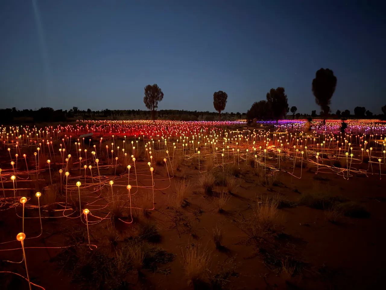
Light seasons
Field of Light and Wintjiri Wiru have their own dates and times, to be confirmed before you buy your flight. Field of Light runs year-round, with hours that vary, and Wintjiri Wiru runs by seasons: in 2026, the After Dark version runs from August 1 to September 30.
Books and films
Tracks, by Robyn Davidson (1980); the 2013 film of the same name
Account of a 2,700 km crossing of the Australian desert with camels in 1977, passing through Uluru. It explains the scale, the solitude and the relationships between white travelers and desert communities better than any guidebook.
Evil Angels (1988)
Fred Schepisi film with Meryl Streep about the disappearance of Azaria Chamberlain from the campground at the foot of the rock in 1980, and the trial that followed. It documents the era when people slept at the base of Uluru.
Uluru: An Aboriginal History of Ayers Rock, by Robert Layton
Anthropological study commissioned by the traditional owners and used in the land claim process. It's the most direct source on the Tjukurpa and on how the 1985 handback came about.
Frequently asked questions
Uluru: How do you get from the airport to the hotels in Yulara?
All the resort hotels offer a free transfer, coordinated with arrivals, with nothing to arrange beforehand. Ayers Rock/Connellan Airport (AYQ) is 6 km north of Yulara.
Uluru: How much does it cost to eat in Yulara?
Prices are high, because Yulara has no competition: a coffee costs A$5 to A$7, a pub meal A$28 to A$42 and a restaurant dinner A$55 to A$90 per person without drinks. Groceries at the IGA on the square cost half as much as eating out.
Uluru: What's the best time to go?
May to September is the dry, cool season: highs of 20 to 25 °C, lows of 0 to 7 °C, occasional frost in July and clear skies almost every day. This is when long hikes are possible, but also when the resort fills up, with higher prices and bookings taken months ahead.
Uluru: How is kangaroo meat properly cooked?
Rare: kangaroo is a lean, dark meat with a strong iron taste, served on almost every menu in Yulara, and cooking it past medium dries it out.
Uluru: Where do you buy the park pass?
Buy the 3-day pass online before you travel: cell signal ends once you leave Yulara, so don't count on sorting it out at the park gate. The pass is valid for 3 consecutive days, and anyone under 18 gets in free.
Other cities in the country
Australia ↗- Days
- 3–4
- When
- Mar–Apr · Oct–Nov
- Per person/day
- Average 280–450 A$Mid-range · per person/day
Cost scope
Per person per day: accommodation, meals, urban transport, visits and a small allowance for extras. Flights excluded; larger purchases vary. Editorial estimate, not a quote.
- Days
- 3
- When
- Mar–May
- Per person/day
- Average 180–260 A$Mid-range · per person/day
Cost scope
Per person per day: accommodation, meals, urban transport, visits and a small allowance for extras. Flights excluded; larger purchases vary. Editorial estimate, not a quote.
- Days
- 3–4
- When
- May–Sep
- Per person/day
- Average 150–260 A$Mid-range · per person/day
Cost scope
Per person per day: accommodation, meals, urban transport, visits and a small allowance for extras. Flights excluded; larger purchases vary. Editorial estimate, not a quote.