Australia
Gold Coast
Surf beaches, the skyscrapers of Surfers Paradise and the rainforest of the hinterland
Days I'd stay three days on the Gold Coast.
How the guide reaches this number
The first to the north, from The Spit to Surfers Paradise, with sunset at the top of the Q1; the second on the south coast, from the Burleigh headland to Point Danger, ending with the Currumbin lorikeets at 16:00; the third by car in Springbrook, with the plateau waterfalls by day and the Natural Bridge glow-worms at dusk. Anyone with more time can add a theme park, just one, chosen by the kind of thrill, and a full day of forest at Lamington, via O'Reilly's or Binna Burra. The beach doesn't ask for more itinerary time; those who want to surf or stay on the sand can stretch the trip without needing a plan.
3
Start with the basic programme and choose extensions for the time you have.
When July to October; these are the driest months, with 41 to 85 mm of rain a month and highs of 21 to 25 °C, and they coincide with the humpback whale migration.
How the guide reaches this number
The sea is coldest in July and August, and from December to March the heat is humid and it rains more
July to October; these are the driest months, with 41 to 85 mm of rain a month and highs of 21 to 25 °C, and they coincide with the humpback whale migration. The sea is coldest in July and August, and from December to March the heat is humid and it rains more
Per person/day Budget around AUD78; mid-range around AUD181; comfortable around AUD364 per person per day, based on spending reported by travelers to Budget Your Trip (checked October 2026).
How the guide reaches this number
Indicative figures, excluding travel to the destination.
Budget around AUD78; mid-range around AUD181; comfortable around AUD364 per person per day, based on spending reported by travelers to Budget Your Trip (checked October 2026). Indicative figures, excluding travel to the destination.
Per person per day: accommodation, meals, urban transport, visits and a small allowance for extras. Flights excluded; larger purchases vary. Editorial estimate, not a quote.
Salta · among the cheapestZermatt · among the priciest
Right in the middle of them. The tick marks the median. Compared by the middle of each city’s daily range, converted at the 24 Sept 2026 exchange rate.
 What Nilo thinks
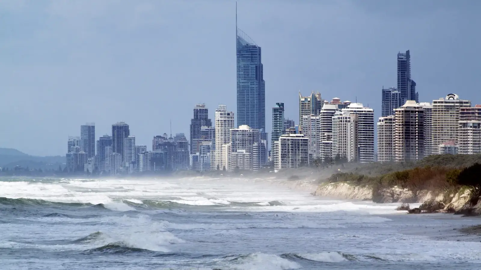
I'd recommend the Gold Coast to anyone who likes surfing off the postcard, canal neighborhoods and bush history. The city, which goes by the nickname Goldy, treats its own names without ceremony: the Isle of Capri is not an island but a canal estate on the bank of the Nerang, and Budds Beach is one of the river beaches of the center, a few blocks from the sea. In Lamington, they tell the story of Bernard O'Reilly, who in 1937 found the survivors of the crashed Stinson airplane in the bush, carrying only bread and onion. Anyone who already knows the Superbank should cross the border to Duranbah, in New South Wales, counted among the best-known surf beaches in the world. On the coast's menu, I'd choose the Bangalow pork rack that Rick Shores serves as lechon, with atchara pickles and banana ketchup.The first image of the Gold Coast is the wall of skyscrapers at Surfers Paradise, seen from the sand or from the top of the Q1. Up close, the city is more varied than the photo promises. To the south, the buildings thin out and the beach divides into suburbs with a character of their own: Burleigh's James Street, at the foot of a forested headland; the estuaries of Currumbin; and Coolangatta, where sand pumped from the Tweed River formed the Superbank, one of the longest and most contested waves in the country, right against the border with New South Wales. To the west, the road climbs from the heat of the beach to the damp cold of Springbrook and Lamington, remnants of a 23-million-year-old volcano covered in ancient rainforest, with waterfalls and a grotto where glow-worms light up at dusk. It is this pairing, the urban beach of lifeguards and flags and the Gondwana forest right behind it, that sets the city apart from any other seaside resort.
Quick facts
- Population
- 691,230 inhabitants in the City of Gold Coast, the whole municipality (preliminary estimate by the Australian Bureau of Statistics for June 30, 2025)
- Founded
- Territory of the Yugambeh people; Nerang, the first European settlement, dates from 1865; the Town of South Coast, created on June 17, 1949, was renamed Gold Coast on October 23, 1958 and proclaimed a city on May 16, 1959
- Country and region
- Australia, state of Queensland; southeast coast, about 66 km from the center of Brisbane, on the border with New South Wales
- Language
- English; the region is the traditional territory of the Yugambeh people, whose language has an organization dedicated to preserving it
- Currency
- Australian dollar (A$, AUD)
- Time zone
- UTC+10 year-round (Australian Eastern Standard Time); Queensland does not observe daylight saving time. From the first Sunday in October to the first Sunday in April, New South Wales, just to the south (Tweed Heads, Byron Bay), is one hour ahead
- Best time to visit
- July to October; these are the driest months, with 41 to 85 mm of rain a month and highs of 21 to 25 °C, and they coincide with the humpback whale migration. The sea is coldest in July and August, and from December to March the heat is humid and it rains more
- Average daily cost
- Budget around AUD78; mid-range around AUD181; comfortable around AUD364 per person per day, based on spending reported by travelers to Budget Your Trip (checked October 2026). Indicative figures, excluding travel to the destination.
What’s new
Recent changes that affect the plan, with date and source.
- Aug 2026
The G:link light rail now runs from Broadbeach to Burleigh Heads, with eight new stations over 6.7 km (Mermaid Beach, Mermaid Beach South, Nobby Beach, Miami North, Miami, Christine Avenue, Second Avenue and Burleigh Heads). The coast, from Helensvale to Burleigh, can now be covered entirely by rail. source
When to go
July to October; these are the driest months, with 41 to 85 mm of rain a month and highs of 21 to 25 °C, and they coincide with the humpback whale migration. The sea is coldest in July and August, and from December to March the heat is humid and it rains more
January
22° to 29°C
137 mm of rain
13 h 43 min of daylight
National holidays
Jan 1 – 3, 2027 · long weekend · New Year's Day
Jan 23 – 26, 2027 · long weekend · Australia Day
Jan 1 – 3, 2028 · long weekend · New Year's Day
Jan 26, 2028 · Australia Day
Source: Nager.Date. Holiday dates shift; check close to your trip.
February
22° to 29°C
183 mm of rain
13 h 02 min of daylight
March
21° to 28°C
134 mm of rain
12 h 16 min of daylight
National holidays
Mar 26 – 29, 2027 · long weekend · Good Friday, Easter Monday
Source: Nager.Date. Holiday dates shift; check close to your trip.
April
18° to 26°C
119 mm of rain
11 h 25 min of daylight
National holidays
Apr 14 – 17, 2028 · long weekend · Good Friday, Easter Monday
Source: Nager.Date. Holiday dates shift; check close to your trip.
May
15° to 24°C
98 mm of rain
10 h 44 min of daylight
June
13° to 21°C
114 mm of rain
10 h 22 min of daylight
November
19° to 27°C
102 mm of rain
13 h 31 min of daylight
December
21° to 28°C
135 mm of rain
13 h 54 min of daylight
National holidays
Dec 25 – 28, 2026 · long weekend · Christmas Day, Boxing Day
Dec 25 – 28, 2027 · long weekend · Christmas Day, Boxing Day
Source: Nager.Date. Holiday dates shift; check close to your trip.
High, shoulder and low season
High · December and January
These are Queensland's summer school holidays, which run from mid-December to the end of January and are the longest of the state's school year; this is when families from within the state fill the coast. The weather is hot and humid, with highs of 28 to 29 °C, about 140 mm of rain a month and summer storms.
Shoulder · February to June
School term in Queensland, with a break of about two weeks in April, around Easter. February is the rainiest month (183 mm), with the sea at its warmest, 27.1 °C, and March still gets 134 mm; from April to June the rain stays between 98 and 119 mm a month and highs fall from 26 to 21.4 °C.
Shoulder · July to November
Also school term, with two short school breaks, one in early July and another between late September and early October. It is the dry half of the year, with 41 to 102 mm of rain a month, and the humpback whale season; the events calendar includes the marathon in early July, the Swell in September and, usually, the Gold Coast 500 in October.
How the year changes
July, August and September are the driest months: at the Gold Coast Seaway station, in the normals for 1991 to 2020, it rains 50, 55 and 41 mm, less than a third of February's 183 mm, and highs are between 21 and 24 °C. October is still good, with 85 mm and a high of 25.4 °C, and June, though already mild, still gets 114 mm. This period coincides with the passage of the humpback whales, from late May to early November, peaking in July and August, and with the Swell Sculpture Festival in September. The price is the sea: the water is 21.5 °C in July and August, against 27.1 °C in February, and anyone who wants to spend the day in the water will feel the difference. From December to March it is hot and humid, with highs near 29 °C, summer storms and the heaviest rains in the hinterland, where trails get slippery or close. In every season the sun is strong, and on jellyfish days the lifeguards warn swimmers.
The same numbers as a table
| Month | Temperature °C | Rain mm |
|---|---|---|
| January | 22 to 29 | 137 |
| February | 22 to 29 | 183 |
| March | 21 to 28 | 134 |
| April | 18 to 26 | 119 |
| May | 15 to 24 | 98 |
| June | 13 to 21 | 114 |
| July · | 12 to 21 | 50 |
| August · | 12 to 22 | 55 |
| September · | 15 to 24 | 41 |
| October · | 17 to 25 | 85 |
| November | 19 to 27 | 102 |
| December | 21 to 28 | 135 |
Nilo's tips
The light rail now goes to Burleigh
Since August 2026, the G:link links Helensvale to Burleigh Heads over 27 km, at 50 cents a trip. Choosing lodging near a station takes care of almost the whole coast without a car.
From the Gold Coast airport, the 777
The 777 express bus runs from the terminal to Burleigh Heads, where you change to the light rail. It is the simplest way to Burleigh, Broadbeach and Surfers Paradise.
Free lorikeets
The rainbow lorikeet feeding at Currumbin Wildlife Sanctuary, at 8:00 and 16:00, is open to anyone who turns up, without a ticket. Anyone not going into the sanctuary can come just at that time.
Natural Bridge at dusk
Leave Natural Bridge for the end of the day in Springbrook: the circuit is done in the last light, and the glow-worms appear in the grotto only after dark.
The flags move
Lifeguards move the red and yellow flags to avoid the rips. Check where they are each time you go back in the water, even on the same beach.
Explore the map
Explore the map, read about the other places and plan your travel days in the app.
Open the appWhat to see
Leave for last, if time allows: Cavill Avenue · Sea World
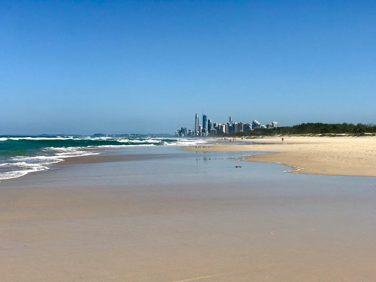
Surfers Paradise Beach
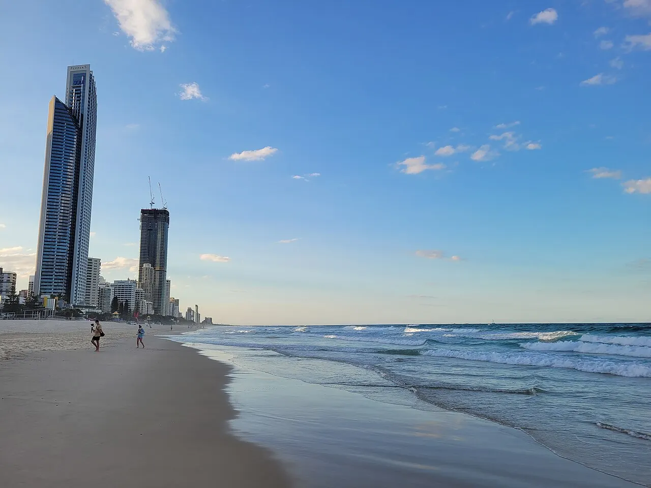
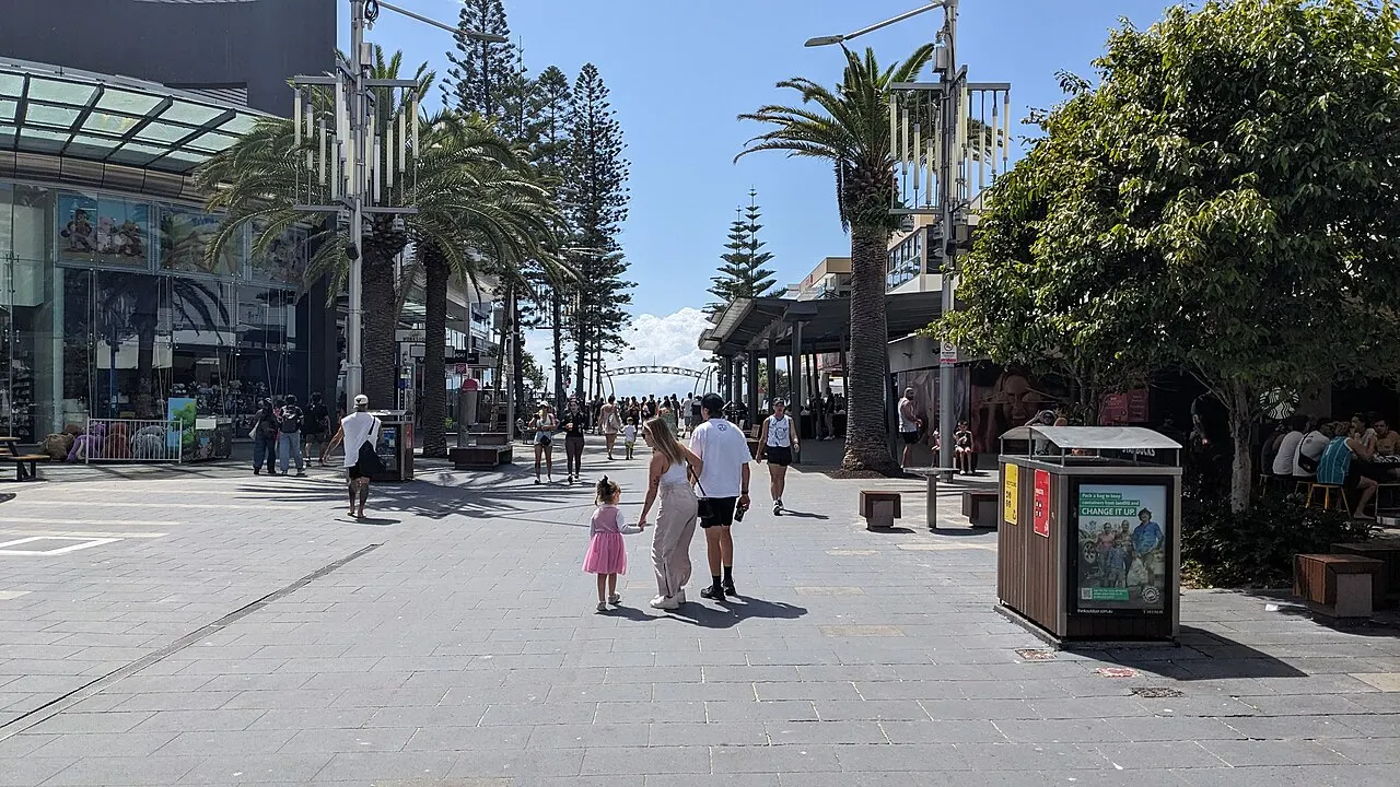
The beach that gave the suburb its name runs unbroken in front of the line of skyscrapers, with a wide strip of sand, open surf and lifeguard stations. It is the city's best-known beach and one of the easiest to reach: the light rail passes a few blocks from the sand, and Cavill Avenue ends right at it.
Check access
Burleigh Head National Park
The 80 m headland, covered in rainforest, separates Burleigh beach from the Tallebudgera estuary and is a place of cultural importance to the Aboriginal peoples of the region. Two trails cross the park: the Rainforest Circuit, which climbs to the top of the hill, and the Oceanview, which skirts the slope near the sea and closes from time to time after rockfalls. On the sea side, whales can be spotted in season. At the foot of the hill, the Jellurgal cultural center runs guided walks on the Yugambeh history of the place; days and booking are on the center's website.
Check access
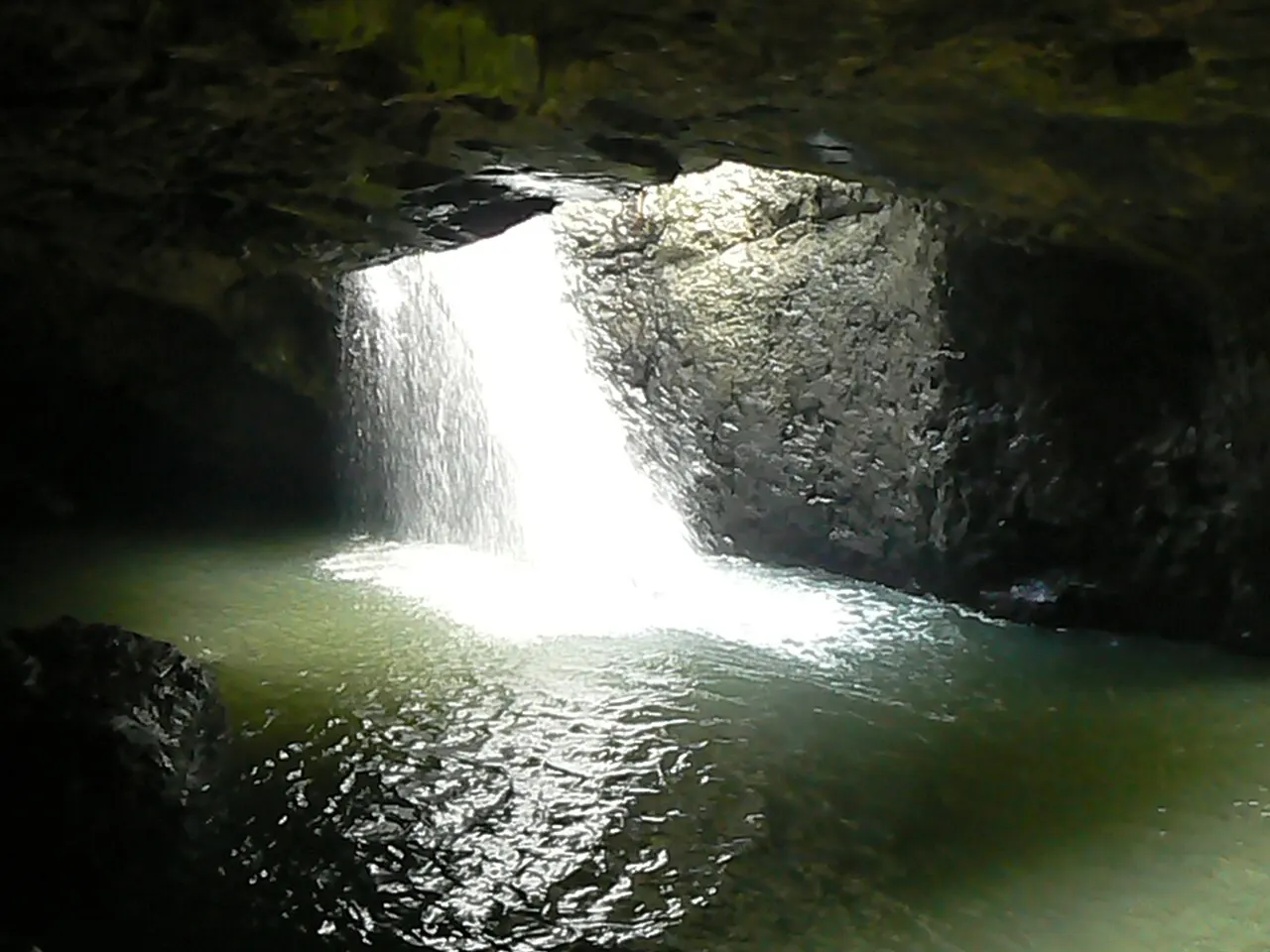
Natural Bridge
In the Numinbah Valley, inside Springbrook National Park, Cave Creek falls through a hole in the ceiling of a cave and leaves through a stone arch. A short circuit through the forest leads to the arch and the grotto, where a colony of glow-worms (the luminous larvae of an insect, Arachnocampa flava) can be seen after dark. Swimming and entering the creek and its bank are prohibited, to protect the glow-worms and the bats. Access is by the Nerang-Murwillumbah road, by car.
Check access
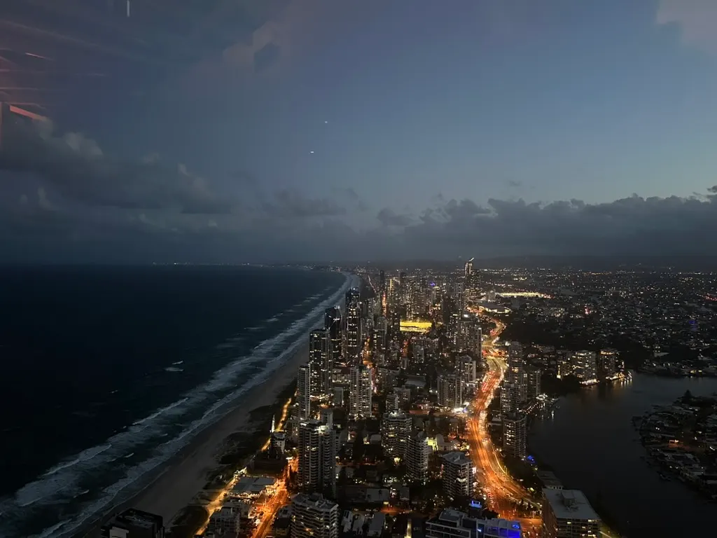
SkyPoint Observation Deck
The observation deck is on the 77th floor of the Q1 tower, 230 m above Surfers Paradise, and the elevator climbs in 38 seconds. From up there you can see the whole coast, from the buildings of Southport to the headlands in the south, and the hinterland behind. There is also the external climb, roped, along the top of the tower, sold for daytime, sunrise, dusk and night sessions. The dated-entry ticket started at A$33 in October 2026.
Check access
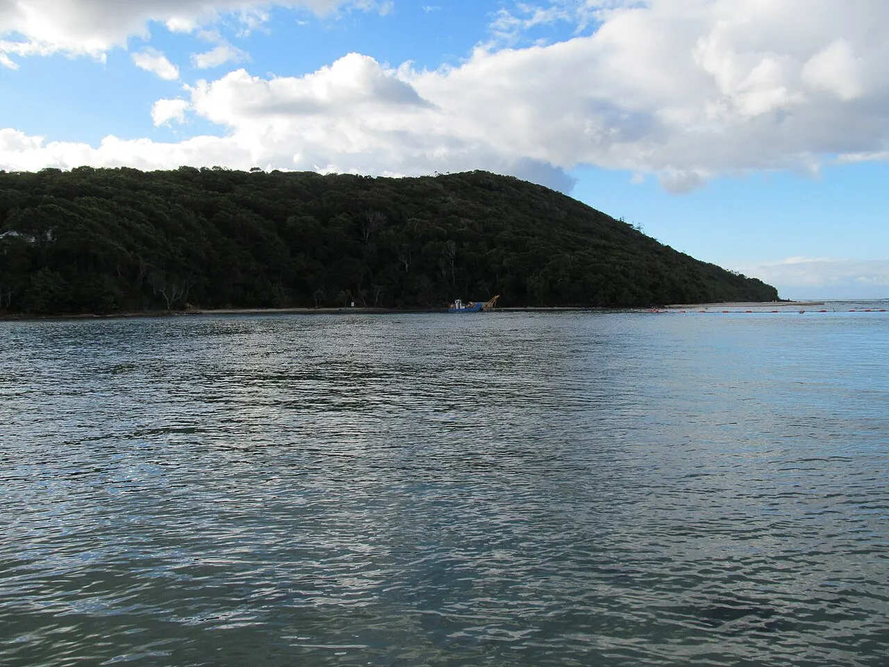
The Spit
The tongue of sand north of Main Beach ends at the Gold Coast Seaway, the channel with breakwaters that connects the Broadwater to the sea. It is the stretch of coast without skyscrapers closest to the center, with ocean beach on one side, calm water on the other and, opposite, South Stradbroke Island. The fishermen's co-op, on the Broadwater side, sells fish and seafood straight from the boats from 7:00.
Check access
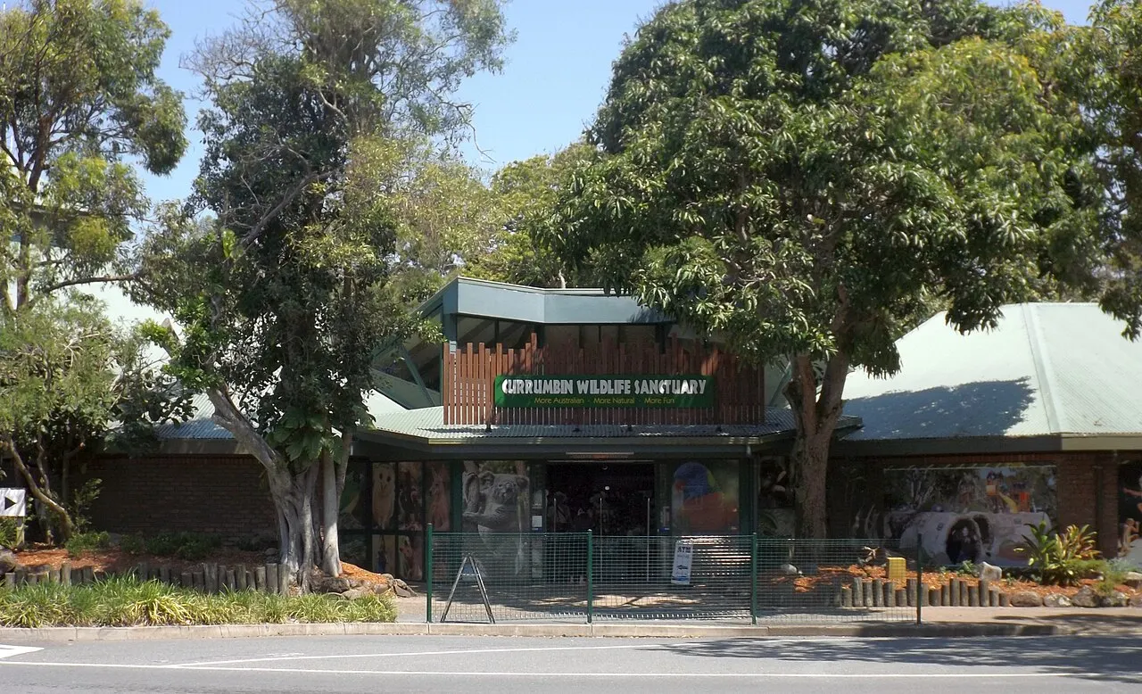
Currumbin Wildlife Sanctuary
It began in 1947, when the beekeeper Alex Griffiths started feeding rainbow lorikeets to pull them away from his flowers, and today it is one of the largest collections of native Australian wildlife in the country, with a wildlife hospital and a little train running since 1964. It is open from 9:00 to 16:00, with last entry at 15:30, and closes on April 25 and December 25. The lorikeet feeding takes place at 8:00 and 16:00, open to anyone who turns up, without a ticket.
Check access
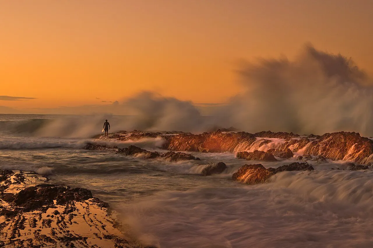
Snapper Rocks
The rocky point beneath Point Danger is the start of the Superbank, the sandbank created by pumping sand from the Tweed River, which forms a wave of about 2 km all the way to Kirra. On a good day, more than 500 surfers share this stretch. For those who don't surf, it is worth watching the action from the sand at Rainbow Bay or from the top of the headland.
Check access
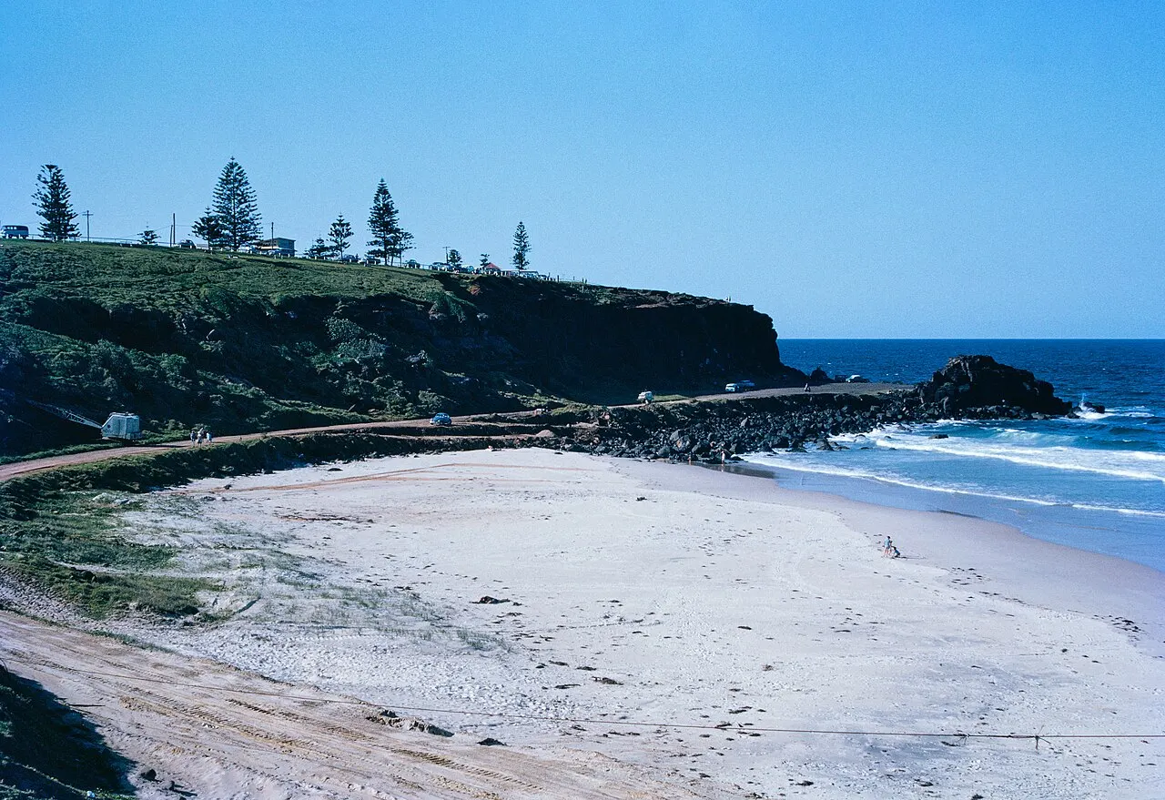
Point Danger
The headland that marks the border between Queensland and New South Wales, with the Point Danger lighthouse on the line and the mouth of the Tweed River just to the south. From the top you can follow the Superbank below, and from May to November it is worth looking out to sea for the spouts of humpback whales.
Check access
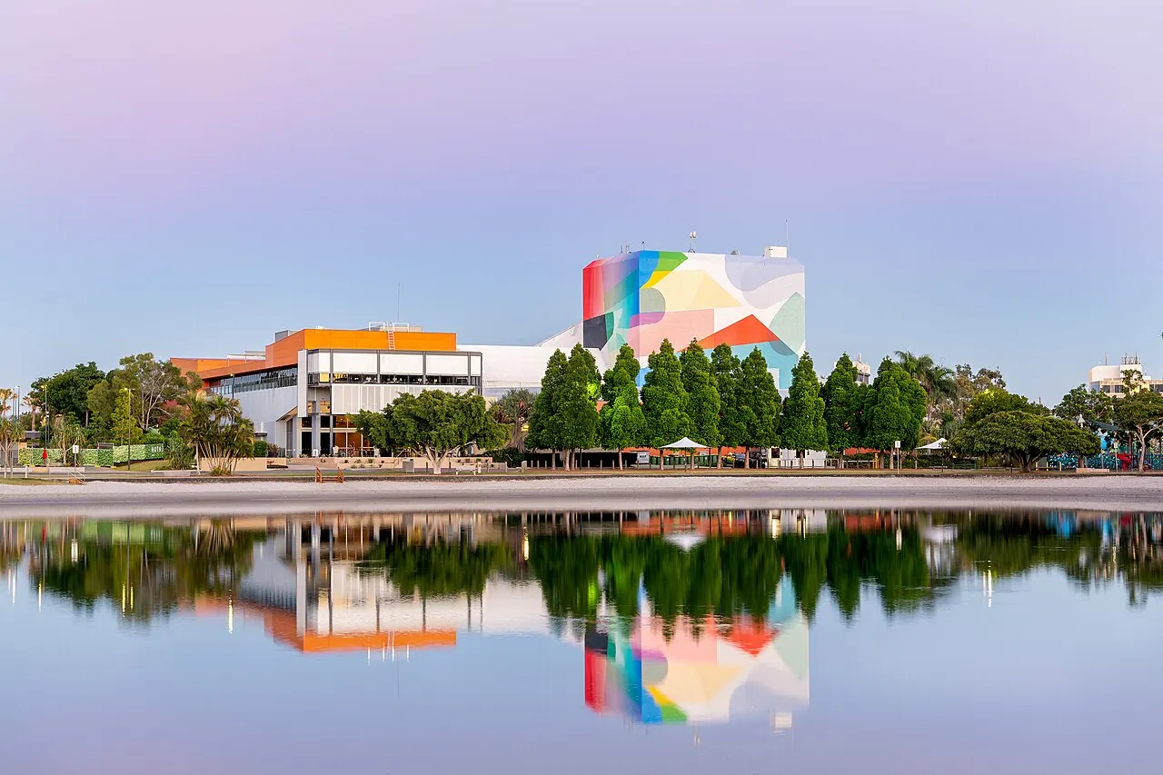
HOTA, Home of the Arts
The city's cultural center, in the park beside the Nerang River, has the HOTA Gallery, with five exhibition rooms, a theater, two cinemas and an underground performance venue. It is also home to the BLEACH* arts festival. For those spending several days at the beach, it is the place to see the city that produces art and not just tourism.
Check access
More places in the guide
Warner Bros. Movie World
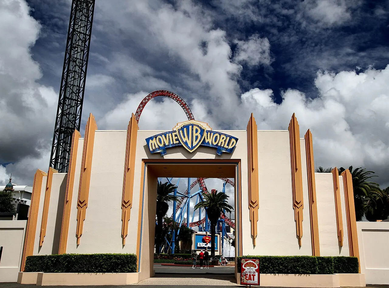
The theme park opened in 1991 in Oxenford is devoted to film and to the Warner and DC characters, next to the Village Roadshow studios; the city has hosted shoots for productions such as Thor: Ragnarok and Aquaman. It belongs to the same group as Sea World and the Wet'n'Wild water park, which is next door. Tickets and hours change with the season; buy online.
Dreamworld
The largest theme park in Australia, in Coomera, has more than 40 attractions, from extreme roller coasters to children's rides, and an area of Australian wildlife with koalas and tigers. The WhiteWater World water park is next door. Tickets and hours change with the season; buy online.
Purling Brook Falls
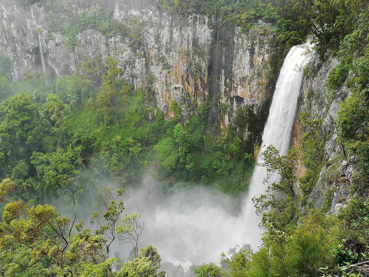
On the Springbrook plateau, the waterfall plunges from an escarpment in the middle of the forest, with access from the Gwongorella picnic area. On the same plateau there are other lookouts and the Twin Falls circuit, which passes several falls. Before going, check the park alerts, because plateau trails close for works or after heavy rain.
Cavill Avenue
The street that links the beach to the center of Surfers Paradise, with the Cavill Mall, the pedestrian stretch by the sand, was named in honor of Jim Cavill, whose 1925 hotel gave the suburb its name. By day it is a street of shops and snack bars; at night it holds the city's loudest nightlife. It is worth passing through on the way to the beach, but it doesn't need time of its own.
Sea World
A marine and theme park on The Spit, open there since 1971, with dolphins, aquariums, rides and a rescue program for injured marine animals. It makes more sense for families with small children; anyone with only one park day usually finds more variety at Movie World or Dreamworld.
Nilo’s itinerary
Start with the basic programme and choose extensions for the time you have.
Plan my days in the app ↗Day 1 · The Spit, Surfers Paradise and the Q1 observation deck
Start early at the Gold Coast Fishermen's Co-op, on The Spit, which opens at 7:00 and sells until it runs out, to see the boats and buy prawns or crab if you have somewhere to prepare them; from Burleigh or Broadbeach, at that hour the simplest way is a taxi or ride-hailing app.
Walk along The Spit to the breakwaters of the Gold Coast Seaway, with South Stradbroke Island on the other side of the channel.
Go back to Main Beach by taxi or ride-hailing app and take the G:link south to Surfers Paradise.
Spend late morning and early afternoon at Surfers Paradise Beach, swimming only between the flags, and have lunch near Cavill Avenue.
In mid-afternoon, cross the Nerang River to HOTA, Home of the Arts, for the HOTA Gallery; check the day's hours beforehand.
Go up to the SkyPoint Observation Deck, on the 77th floor of the Q1, for sunset over the hinterland, with a dated-entry ticket bought beforehand.
Have dinner in Broadbeach, a few light rail stops south, if you prefer a calmer evening than Cavill Avenue's.
Day 2 · The south coast: Burleigh, Coolangatta and the Currumbin lorikeets
Take the G:link to Burleigh Heads, the end of the line, and in the morning climb the Burleigh Head National Park Rainforest Circuit to the top of the headland; if the Oceanview is open, come down by it, beside the sea.
Have coffee or an early lunch on James Street.
Continue south to Coolangatta, by Translink bus (plan the connection in the Translink app) or by car, and walk from Kirra along the shore to Rainbow Bay, watching the line of surfers at Snapper Rocks.
Climb Point Danger, above the border; from May to November, look out to sea for the whale spouts.
In the early afternoon, head back north to Currumbin and enter the Currumbin Wildlife Sanctuary before last entry, at 15:30.
Stay until 16:00 for the rainbow lorikeet feeding, which takes place at closing time and is open to anyone who turns up, even without a ticket.
Take the bus back to Burleigh Heads and catch the light rail from there.
Day 3 · Springbrook: plateau waterfalls and the glow-worms of Natural Bridge
Check the Springbrook National Park alerts and set out by car in the morning, climbing to the plateau by the Mudgeeraba road.
Walk the Purling Brook Falls trail from the Gwongorella area and, if you have the energy, the Twin Falls circuit, which starts at the Tallanbana picnic area; if one of them is closed, switch to the plateau lookouts, such as Best of All Lookout.
Bring a jacket: the plateau, between 600 and 1,000 m, is much colder than the coast.
In mid-afternoon, drive down through the Numinbah Valley to the Natural Bridge section, by the Nerang-Murwillumbah road.
Walk the circuit to the stone arch in the last light of the day and wait for dark in the grotto to see the glow-worms, without entering the creek or going down to the bank.
Return to the coast by the same valley road, taking care on the bends in the dark.
Food
Moreton Bay bug
A flat-shelled crustacean, related to lobsters, called simply a bug in Australia. The meat is sweet; it appears, for example, breaded inside a brioche bun with sriracha mayonnaise, as in the bug roll at Rick Shores, in Burleigh Heads.
King prawns and spanner crab
The trawlers of the fishermen's co-op on The Spit bring in prawns, and one of them catches spanner crab, a crab with delicate meat; both are sold raw, straight from the boats. On menus, the prawns are often labeled by region of origin, such as those from Mooloolaba and Ballina.
Street food at Miami Marketta
The Miami night market gathers stalls of cuisines from around the world, a bar and live music, from Wednesday to Saturday starting at 17:00, with free entry.
Pan-Asian cooking on the coast
A strong strand of the coast's table mixes Asian flavors with Australian produce. At Rick Shores, in Burleigh Heads, that becomes raw kingfish with pineapple, duck curry with lychee and a salad of herbs from the Currumbin Valley; in Broadbeach, Mamasan Kitchen & Bar appears among the restaurants recommended by Tourism Australia.
Wines and spirits of Tamborine Mountain
On the Tamborine plateau there are wineries, distilleries and a coffee plantation open to visitors, which make the trip up the mountain a tasting tour as well. Whoever drives should agree beforehand who isn't drinking.
Where to eat
- Rick Shores · Burleigh Heads · $$$
Pan-Asian cooking with Australian produce, in a dining room facing Burleigh beach. The bug roll, Moreton Bay bug breaded in brioche with sriracha mayonnaise, cost A$26, and there are tasting menus at A$95 and A$150 per person (menu of September 30, 2026). Open Tuesday to Sunday; book ahead.
Source · 2026-10-19
- Justin Lane · Burleigh Heads · $
Sourdough pizzas baked in a wood-fired oven, and house-made pastas, on the Gold Coast Highway. Pizzas from A$29 to A$36, pastas from A$31 to A$38 and an all-you-can-eat pizza and pasta menu at A$59 per person, for two people or more (menu of October 2026).
Source · 2026-10-19
- Gold Coast Fishermen's Co-op · The Spit, Main Beach
A family-run fishermen's co-op, dating from 1970, whose trawlers, tuna longliners and crab boats sell their catch directly on the floating piers. It is a fish shop, not a restaurant: it suits those who have a kitchen or a barbecue. Opens at 7:00 and sells until it runs out.
Source · 2026-10-19
- Miami Marketta · Miami
A night street food market with several cuisines, with a bar and music, in a former industrial area. Open Wednesday to Saturday from 17:00, with free entry and no booking; good for groups in which everyone wants to eat something different.
Source · 2026-10-19
- Tamborine Mountain
Wineries, distilleries and tea houses on the plateau, which combine tasting with lunch on the drive up the mountain.
$: Up to about A$40 per person, without drinks: a pizza or pasta main course, from A$29 to A$38, at Justin Lane, in Burleigh Heads (menu of October 2026) · $$: A$59 per person, without drinks: Justin Lane's all-you-can-eat pizza and pasta menu, for two people or more (menu of October 2026) · $$$: A$95 to A$150 per person, without drinks: the tasting menus at Rick Shores, in Burleigh Heads (menu of September 30, 2026) · 2026-10-20
Day trips
Lamington National Park (O'Reilly's and Binna Burra)
The rainforest and Antarctic beech plateau, the core of the Gondwana Rainforests, is about 85 km from Southport. The O'Reilly's area, about 90 minutes by car from the Gold Coast, via Canungra, has the historic guesthouse from 1926, birds such as the regent bowerbird and trails through the forest; Binna Burra is about 30 minutes of climbing from Nerang. You go by car.
Tamborine Mountain
An 8 by 4 km plateau inland, with three villages (North Tamborine, Eagle Heights and Mount Tamborine), wineries, distilleries and short trails such as the one to Curtis Falls, in Tamborine National Park, whose first section, Witches Falls, from 1908, was the first national park in Queensland. You go by car or on an organized tour; several roads climb to the plateau.
Brisbane
The capital of Queensland is about 66 km to the north. The Gold Coast line train links Varsity Lakes, Robina, Nerang and Helensvale to central Brisbane at Translink's 50-cent fare; from Surfers Paradise, take the G:link to Helensvale and change to the train.
Byron Bay
Across the border, in New South Wales, south of Tweed Heads, the beach town has Cape Byron, the easternmost point of the Australian mainland. You go by car on the Pacific Highway. Remember that, from October to April, Byron Bay is one hour ahead of the Gold Coast.
South Stradbroke Island
The 21 km long island lies across the Seaway, a few meters from The Spit, with dunes, coastal scrub and hundreds of wallabies used to people. You can only get there by boat, by ferry crossing or tour leaving from the Broadwater area.
Where to begin
The Spit, Surfers Paradise and the Q1 observation deck
Start early at the Gold Coast Fishermen's Co-op, on The Spit, which opens at 7:00 and sells until it runs out, to see the boats and buy prawns or crab if you have somewhere to prepare them; from Burleigh or Broadbeach, at that hour the simplest way is a taxi or ride-hailing app.
The south coast: Burleigh, Coolangatta and the Currumbin lorikeets
Take the G:link to Burleigh Heads, the end of the line, and in the morning climb the Burleigh Head National Park Rainforest Circuit to the top of the headland; if the Oceanview is open, come down by it, beside the sea.
Springbrook: plateau waterfalls and the glow-worms of Natural Bridge
Check the Springbrook National Park alerts and set out by car in the morning, climbing to the plateau by the Mudgeeraba road.
Money
The currency is the Australian dollar (A$). All Translink buses, trains and light rail charge 50 cents per trip, which makes the coast cheap to get around; the Airtrain section to Brisbane airport charges its own fare. Some prices checked in October 2026: at the SkyPoint Observation Deck, dated-entry admission started at A$33 per adult, the family pack at A$102 and the daytime external climb at A$89, while residents with postcodes 4207 to 4272 paid A$15 with proof. In restaurants, a sourdough pizza cost from A$29 to A$36 and a pasta from A$31 to A$38 at Justin Lane, in Burleigh Heads, and the tasting menu at Rick Shores, in the same suburb, A$95 or A$150 per person. The theme parks change prices by date and sell online; compare the packages beforehand, especially if you will visit more than one. The lorikeet feeding at Currumbin Wildlife Sanctuary, at 8:00 and 16:00, is free, as is Miami Marketta, where you pay only for what you eat.
Getting there and around
From the Gold Coast airport
Gold Coast Airport (OOL) is in Coolangatta, at the far south of the city, with domestic and international flights. From the terminal, Translink's 777 express bus, with few stops, goes to Burleigh Heads, where you catch the G:link light rail to Miami, Broadbeach, Surfers Paradise and Southport. The 760 goes south, to Coolangatta, Kirra and Tweed Heads, and inland, to Robina.
From Brisbane airport
From Brisbane airport, the Airtrain runs along the Gold Coast line to the Helensvale, Nerang, Robina and Varsity Lakes stations. At Helensvale, the G:link light rail continues to Southport, Surfers Paradise and Burleigh Heads. The Airtrain section charges its own fare, which does not follow Translink's flat fare.
The light rail and the 50-cent fare
The G:link runs 27 km, from Helensvale train station to Burleigh Heads, with 27 stations, all accessible, passing through Southport, Main Beach, Surfers Paradise, Broadbeach, Mermaid Beach, Nobby Beach and Miami. All Translink services, train, bus and light rail, charge a flat fare of 50 cents per trip, regardless of distance; you pay with the go card or with the other methods accepted at the validators. On weeknights from Monday to Friday, between midnight and 5:00, the 700 bus replaces the light rail along most of the route.
Train to Brisbane
Queensland Rail's Gold Coast line leaves from Varsity Lakes, passes through Robina, Nerang, Helensvale and Coomera and continues to central Brisbane, with the same 50-cent fare. The theme parks and the hinterland are not next to the stations.
Car for the hinterland
Springbrook, Natural Bridge, Lamington and Tamborine Mountain are done by car or on an organized tour, such as the Hinterland Explorer hop-on hop-off bus. The mountain roads are narrow and winding; the steering wheel is on the right and you drive on the left. On the coast, with light rail, buses and the beachfront path, a car is unnecessary.
Accessibility
All G:link stations and trains are wheelchair accessible. The city council lends beach wheelchairs and installs access mats onto the sand at some beaches, and publishes maps to locate the accessible facilities.
Safety
The risk that most calls for attention on the Gold Coast is in the sea. Rip currents pull swimmers away from the sand and are marked with Dangerous Current signs. Swim only at beaches with lifeguards and between the red and yellow flags. If you are pulled out, don't swim against the current: float to save energy and raise an arm to call for help. For a jellyfish sting, wash with warm water in the nearest shower, without touching your face, and tell the lifeguard. The Australian sun is strong all year; the official guidance is SPF 50 sunscreen, a rash vest and a hat, even under cloud. The main beaches have nets and baited lines from Queensland's shark control program; attacks are rare, and lifeguards take swimmers out of the water when there is risk. In the hinterland, check park alerts before setting out, because trails close after heavy rain and rockfalls, like the Oceanview in Burleigh, and mountain roads demand attention.
Before you go
- Plug
- type I
- Voltage
- 230 V
- Driving side
- on the left
- Emergency
- General 000
- Country code
- +61
- Official language
- English
- Currency
- Australian dollar (AUD)
Source: Wikidata (CC0), checked September 2026.
Etiquette tips
Swim between the flags
On beaches with lifeguards, the safe area is the one between the red and yellow flags. Swimming outside it means ignoring the only guidance the beach gives, and the lifeguard may order everyone out of the water; when that happens, you get out without arguing.
One wave, one surfer
At the Superbank and at crowded peaks, whoever is closest to the spot where the wave breaks has priority, and taking the same wave (a drop-in) is the most frowned-upon offense in the water. Beginners are happier on sandy beaches with a surf school than at Snapper Rocks.
The bank at Natural Bridge is off limits
The stretch of Cave Creek around the arch is a restricted-access area: you don't swim or go down to the bank, to protect the glow-worms and the bats in the grotto.
A border without ceremony
Coolangatta and Tweed Heads behave like a single town, and people cross the border on foot several times a day. Just remember that, in summer, the clock changes from one side to the other.
Mistakes to avoid
Forgetting the border time zone
From October to April, New South Wales is one hour ahead of Queensland. A restaurant booking in Tweed Heads, a tour to Byron Bay or a flight that leaves from the other side may be on NSW time, while the phone of someone who slept in Coolangatta shows Queensland time.
Counting on public transport for the hinterland
Translink trains, light rail and buses cover the coast and the connection to Brisbane; Springbrook, Natural Bridge and Lamington have no regular transport. Without a car, the way is an organized tour.
Assuming the Airtrain costs 50 cents
The flat fare applies on Translink services. The Airtrain section, from Brisbane airport, charges its own fare even when paid with the go card.
Arriving at the fishermen's co-op in the afternoon
The co-op on The Spit opens at 7:00 and sells until it runs out. Anyone who wants to choose between prawns, crab and the catch of the day goes in the morning.
Planning a dip at Natural Bridge
People used to swim under the arch; today entering the creek and its bank along the circuit is prohibited. The visit is for walking and looking.
Going up SkyPoint on an overcast day
The view from the 77th floor is of the coast and the hinterland. With low cloud or rain, it disappears; leave the ascent for a clear day, preferably late in the afternoon.
Useful phrases
G'day
Hello, good day (informal greeting)
Swim between the flags
Swim between the flags (the lifeguards' guidance)
Thongs
Flip-flops
Esky
Beach cooler
Bug roll
Moreton Bay bug sandwich on a brioche bun
Is this Queensland time or New South Wales time?
Is this Queensland time or New South Wales time?
Where to stay
- Surfers Paradise · First trip, without a car, for those who want beach, shopping and nightlife on foot: It concentrates many of the hotels and vacation apartments, on the beachfront and with the light rail in the middle of the suburb, to the north (Southport, Helensvale and the train) and to the south (Broadbeach and Burleigh). The downside is the activity on Cavill Avenue, the center of nightlife. It is far from the hinterland and the theme parks without a car.
- Broadbeach · Couples and families who want the center without the nightlife of Surfers Paradise: The light rail runs through the middle and takes you to both Surfers Paradise and Burleigh Heads, and the suburb has many restaurants and a nightlife quieter than that of Surfers Paradise. The downside is the distance from whatever lies off the line: Gold Coast airport takes light rail plus the 777 bus, and the hinterland and the theme parks take a car.
- Burleigh Heads · Those who prefer cafés, restaurants and a neighborhood beach to the line of skyscrapers: Since August 2026 it has been the end of the light rail line, and the 777 express bus links the suburb to Gold Coast airport. It has the headland national park, James Street and easy access to Currumbin and Coolangatta. It is far from the theme parks in the north.
- Coolangatta and Kirra · Surfers and those arriving or leaving through Gold Coast airport: It is next to the airport and the Superbank, with the beaches of Rainbow Bay, Greenmount and Kirra and a small center. The light rail does not reach it: to get to the city center, take a bus to Burleigh and the light rail from there. In summer, watch the time zone: Tweed Heads, a few steps away, is on a different time.
- Main Beach · Families going to Sea World and those who want a calm base near Surfers Paradise: A residential suburb with Tedder Avenue, The Spit and the Seaway next door, and a light rail station. It is quieter than Surfers Paradise and a few stations from it. It lies at the opposite end of the coast from Gold Coast airport and Coolangatta, and far from the hinterland without a car.
- Hinterland (Lamington and Springbrook) · Those traveling by car who want to spend the night in the forest: Sleeping at O'Reilly's, Binna Burra or on the Springbrook plateau lets you do the trails early and see the forest at night, without the drive back on the mountain road in the dark. It requires a car, gets cold at night and is more than an hour from the beaches.
· 2026-10-20
Districts
Surfers Paradise
The tourist center of the city and the skyline of skyscrapers that appears in every photo, with the Q1 tower in the middle. Cavill Avenue and the Cavill Mall concentrate shops, bars and nightlife; the beach has lifeguards and direct access by light rail. It suits anyone who wants everything on foot and doesn't mind the activity at night.
Main Beach and The Spit
North of Surfers Paradise, Main Beach is more residential and calm, with restaurants on Tedder Avenue. The Spit, the tongue of sand that runs to the Seaway, has Sea World, marinas, the fishermen's co-op and stretches of beach with no buildings.
Southport
The city's administrative and commercial center, on the edge of the Broadwater lagoon, with Chinatown and the large waterfront park. It has little ocean beach, but it is the hub of the light rail and buses in the north.
Broadbeach
South of Surfers Paradise, with the convention center, shopping malls and restaurants, and a quieter nightlife than that of Surfers Paradise. The light rail runs through the middle and continues both north and toward Burleigh.
Mermaid Beach, Nobby Beach and Miami
Residential neighborhoods of houses and low-rise buildings between Broadbeach and Burleigh, served by the light rail since August 2026. Miami has the Miami Marketta night market, with street food, from Wednesday to Saturday.
Burleigh Heads
The forest-covered headland, the surf beach beside it and James Street, a street of cafés, delicatessens and restaurants. It is the end of the light rail line and is close to the airport by the 777 express bus.
Palm Beach and Currumbin
Beaches south of Burleigh, separated by the Tallebudgera and Currumbin estuaries, where you can also swim at inner beaches, such as Currumbin Alley and the Tallebudgera estuary. Currumbin has the wildlife sanctuary and is the starting point of the Swell sculpture festival, in September.
Coolangatta and Kirra
The far south of the city, right next to Tweed Heads, in New South Wales. Rainbow Bay, Greenmount, Coolangatta and Kirra follow one another along the Superbank, the wave formed by sand pumped from the Tweed River, beneath the Point Danger headland. The airport is next door.
Hinterland
The mountains to the west: the Springbrook plateau, with waterfalls and the Natural Bridge; Lamington, with the O'Reilly's and Binna Burra areas; and Tamborine Mountain, with villages, wineries and short trails. It gets cold at night, and you get there by car or on an organized tour.
North: Oxenford and Coomera
The theme park zone, along the M1 motorway: Warner Bros. Movie World and Wet'n'Wild in Oxenford, Dreamworld in Coomera. Farther north are the marinas of Hope Island and Sanctuary Cove.
History
before 1823 · Yugambeh land
The coast between the Logan and Tweed rivers is the territory of the Yugambeh people, organized into clans such as the Kombumerri, the Mununjali and the Wangerriburra. There are signs of occupation in the Lamington mountains going back at least 6,000 years.
1823 · Oxley on the Tweed River
The explorer John Oxley travels the Tweed River. In the following decades, red cedar cutters move up the valleys in search of timber.
1846 · The shipwreck that named Coolangatta
On August 18, the schooner Coolangatta, carrying cedar, runs aground in a storm on Kirra beach. In 1883, the surveyor who laid out the village used the ship's name.
1865 · Nerang
Nerang, inland, is surveyed as a base for the timber industry and becomes the first settlement of the future city. Southport is surveyed in 1875 and becomes a summer retreat for wealthy Brisbane families.
1903 · The train reaches the coast
On August 10, the South Coast railway to Tweed Heads opens, passing through Burleigh and Coolangatta and bringing the first holidaymakers.
1915 · Lamington National Park
After campaigns against land clearing, the plateau is protected. The O'Reilly family opens its guesthouse in the forest in 1926.
1925 · The hotel that named Surfers Paradise
Jim Cavill opens the Surfers Paradise Hotel in the village of Elston, past the Jubilee Bridge. On December 1, 1933, Elston is renamed after the hotel.
1947 · The Currumbin lorikeets
The beekeeper Alex Griffiths starts feeding rainbow lorikeets to keep them away from his flowers, and the scene becomes the Currumbin Wildlife Sanctuary.
1949–1959 · From South Coast to Gold Coast
Coolangatta, Southport and the Nerang coast join as the Town of South Coast in 1949. The nickname Gold Coast, which began as a complaint about inflated prices, becomes the official name in 1958, and the city is proclaimed in 1959.
1965 · The meter maids
To protest against parking meters, Surfers Paradise merchants hire young women in gold bikinis who put coins in expired meters. The custom continues, now as a private initiative.
1967 · The eleven cyclones
A series of eleven cyclones carries off almost all the sand from the beaches. The 1971 report by engineers from Delft University leads to the Seaway and to the pumping of sand from the Tweed River.
1981–1991 · The theme parks
Dreamworld opens on December 15, 1981 in Coomera, and Warner Bros. Movie World on June 3, 1991 in Oxenford, next to film studios.
2005 · Q1
Inaugurated in November, the Q1 tower reaches 322.5 m with its antenna and puts an observation deck on the 77th floor, at a height of 230 m.
2018 · Commonwealth Games
From April 4 to 15, the city hosts the Commonwealth Games; the G:link light rail, opened in 2014, had been extended to Helensvale train station for the event.
2026 · The light rail reaches Burleigh
On August 9, the G:link begins running from Broadbeach to Burleigh Heads, with eight new stations over 6.7 km.
Complete history
Before the resort
Long before the towers, the coast between the Logan and Tweed rivers was the territory of the Yugambeh people, divided into clans with their own areas and responsibilities. The Kombumerri lived on the coast and in the estuaries, where, according to some traditions, fishing was helped by dolphins; the Wangerriburra occupied the Tamborine plateau. Europeans arrived by the Tweed River in 1823 and, from the 1840s, red cedar cutters moved into the valleys. The displacement of the Yugambeh and the conflicts of the 1850s and 1860s came with them. Nerang was born in 1865 as a timber base, and Southport, surveyed in 1875, became the first summer retreat for wealthy Brisbane families.
The beach becomes a destination
The train to Tweed Heads, opened in 1903, and the Jubilee Bridge, from 1925, put the beach within reach of Brisbane. Between the First World War and the 1940s, the coast filled with improvised holiday cottages made of secondhand timber, fibro-cement and even retired trams. In 1925, Jim Cavill opened the Surfers Paradise Hotel in the village of Elston, and the hotel's name ended up being given to the place. After the Second World War, high prices earned the region the nickname Gold Coast, at first a criticism from the residents themselves; in 1958 it became the official name.
Towers, canals and parks
From the 1950s, the marshes behind the beach were dredged into canals with houses and piers, and the first tall buildings rose in Surfers Paradise. The 1980s brought the skyscraper boom, the developers known as the white-shoe brigade and the theme parks of the north. Erosion shaped the city too: after eleven cyclones took the sand in 1967, the coast gained the Seaway and the system that pumps sand from the Tweed River, and it was that sand that formed the Superbank, the wave that now crowds Snapper Rocks.
The city today
In 1994 the municipality absorbed Albert Shire and came to run from the sea to the mountains. The Gold Coast became the sixth-largest city in Australia in 2007 and hosted the Commonwealth Games in 2018. Today it accounts for most of Queensland's film shoots, which earned it the nickname Goldywood, and it was chosen as one of the three zones of the Brisbane Olympic and Paralympic Games. The G:link light rail, opened in 2014, reached Burleigh Heads in August 2026 and changed the way you get along the coast without a car.
Geography and shape of the city
A sandbar between the sea and the canals
The best-known part of the city sits on a narrow strip of sand between the Pacific and a network of artificial canals more than 260 km long, dug in place of the marshes drained by the Nerang River. From Coolangatta to Main Beach run about 40 km of surf beaches and resorts, punctuated by the headlands of Point Danger, Kirra, Currumbin and Burleigh Heads. To the north, The Spit ends at the Gold Coast Seaway, the channel that connects the Broadwater lagoon to the sea; on the other side lies South Stradbroke Island.
The volcano behind it
To the west, the city abuts the McPherson Range. The escarpments of Springbrook and Lamington, between 600 and more than 1,000 m in elevation, are the northern rim of the ancient Tweed volcano, about 23 million years old and centered on Mount Warning. The Burleigh headland was also born of that volcano's lava. The forest in these mountains is part of the Gondwana Rainforests of Australia, a World Heritage site, and the Springbrook plateau receives more than 3,000 mm of rain a year, most of it from December to March.
Climate
The climate is humid subtropical. At the Gold Coast Seaway station, in the normals for 1991 to 2020, average highs range from 21.3 °C in July to 28.9 °C in January, and lows from 12 °C to 21.9 °C. It rains about 1,250 mm a year, peaking in February (183 mm), with the driest months from July to September (41 to 55 mm). The sea at Surfers Paradise ranges from 21.5 °C in July and August to 27.1 °C in February. High in the hinterland it is much colder than on the coast.
Culture
The lifesaving clubs
The Gold Coast beach is organized by its lifeguards. The city has the largest professional beach lifesaving service in Australia, and alongside it operate the surf life saving clubs, volunteer associations linked to Surf Life Saving Australia, which patrol beaches and train lifesavers. The red and yellow flags mark where to swim, and the lifeguard takes everyone out of the water when the sea turns dangerous. Nets and baited lines from the Queensland government's shark control program protect the main beaches.
Surfing
The Gold Coast has some of the best-known waves in the country, from Main Beach to Burleigh and Kirra. The most famous is the Superbank, from Snapper Rocks to Kirra, formed by the sand that a pumping system has brought from the Tweed River since 1995: a long, tubing wave that gets crowded on good days. Kirra, considered one of the best waves in the world before the Superbank, changed character with the excess sand.
Goldywood
Since the 1990s, the city has accounted for about three-quarters of Queensland's film shoots. The Village Roadshow studios, in Oxenford, next to Movie World, have nine sound stages and have hosted productions such as Thor: Ragnarok, Aquaman, Godzilla vs. Kong and Pirates of the Caribbean: Dead Men Tell No Tales. The city also hosts the Gold Coast Film Festival.
HOTA and the BLEACH* festival
HOTA, Home of the Arts, brings together a gallery, theater and cinemas on the Nerang River, and is the home of BLEACH*, an arts festival with music, dance, theater and installations spread across the park. Live music has festivals of its own, such as Blues on Broadbeach, and a regular stage at Miami Marketta.
The Yugambeh today
The Yugambeh remain present in the city. They founded what is now one of the most successful Aboriginal language preservation organizations in the country, linked to the Kombumerri, and maintain the Jellurgal cultural center, at the foot of the Burleigh headland. Many names in the city come from the Yugambeh language, such as Tamborine, which comes from Jambireen, and Girung Island, in the Nerang River, which takes its name from the flying foxes that sleep there.
Sport
Australian rules football and rugby league are the most popular sports; the Gold Coast Suns, of Australian rules football, reached the league's finals for the first time in 2025. The Gold Coast Marathon, in early July, is the biggest community sporting event of the year, and the Gold Coast 500 Supercars race closes streets in Surfers Paradise and Main Beach, usually in October. After the 2018 Commonwealth Games, the city was chosen as one of the three zones of the Brisbane Olympic and Paralympic Games.
Festivals and events
Whale season
From late May to early November, humpback whales pass along the coast, peaking in July and August; at the end of the season, mothers with calves go by. You can see the spouts from the beach and the headlands. Whale-watching boats leave from the marinas on Sea World Drive and The Spit, in Main Beach, from Sanctuary Cove and from Runaway Bay; to the south, one operator leaves from Chinderah, already in New South Wales.
Cooly Rocks On
In June, Coolangatta spends two weeks as a festival of nostalgia for the 1950s and 1960s, with vintage cars and hot rods, bands of the era and free programming.
Gold Coast Marathon
On the first weekend of July, eight races, from the marathon to children's and wheelchair races, run along the beaches and the Broadwater; the 2026 edition had 43,000 entrants.
Next edition: 3 – 4 July 2027 (checked Oct 2026) source
Swell Sculpture Festival
In September, for ten days, more than 80 large-scale contemporary sculptures are installed along the shore between Currumbin beach and Flat Rock, in Tugun.
BLEACH* Festival
HOTA's arts festival, with music, dance, theater and installations, free and ticketed, spread across the park; the month changes from one edition to the next, so check the program.
Gold Coast 500
A Supercars race on a street circuit in Surfers Paradise and Main Beach, usually in October. It closes streets in the center on the weekend of the race.
Books and films
Muriel's Wedding (1994)
The comedy used Tweed Heads, the twin town of Coolangatta across the border, as the fictional Porpoise Spit, the beach town the protagonist wants to escape, and also filmed on the Gold Coast. It is a sharp portrait of the Australian beach suburb of the 1990s, seen by someone who doesn't fit in.
Life on Earth (1979)
In David Attenborough's series, the Lamington forest appears with its Antarctic beeches and bowerbirds, a good way to understand why the hinterland is World Heritage.
Frequently asked questions
Gold Coast: how do you get from Gold Coast Airport into the city?
Gold Coast Airport (OOL) is in Coolangatta, at the far south of the city, with domestic and international flights. From the terminal, Translink's 777 express bus, with few stops, goes to Burleigh Heads, where you catch the G:link light rail to Miami, Broadbeach, Surfers Paradise and Southport. The 760 goes south, to Coolangatta, Kirra and Tweed Heads, and inland, to Robina.
Gold Coast: how do you get there from Brisbane airport?
From Brisbane airport, the Airtrain runs along the Gold Coast line to the Helensvale, Nerang, Robina and Varsity Lakes stations. At Helensvale, the G:link light rail continues to Southport, Surfers Paradise and Burleigh Heads. The Airtrain section charges its own fare, which does not follow Translink's flat fare.
Gold Coast: how many days should you stay?
I'd stay three days on the Gold Coast. The first to the north, from The Spit to Surfers Paradise, with sunset at the top of the Q1; the second on the south coast, from the Burleigh headland to Point Danger, ending with the Currumbin lorikeets at 16:00; the third by car in Springbrook, with the plateau waterfalls by day and the Natural Bridge glow-worms at dusk. Anyone with more time can add a theme park, just one, chosen by the kind of thrill, and a full day of forest at Lamington, via O'Reilly's or Binna Burra. The beach doesn't ask for more itinerary time; those who want to surf or stay on the sand can stretch the trip without needing a plan.
Gold Coast: do you need a car, or are the light rail and buses enough?
The G:link runs 27 km, from Helensvale train station to Burleigh Heads, with 27 stations, all accessible, passing through Southport, Main Beach, Surfers Paradise, Broadbeach, Mermaid Beach, Nobby Beach and Miami. All Translink services, train, bus and light rail, charge a flat fare of 50 cents per trip, regardless of distance; you pay with the go card or with the other methods accepted at the validators. On weeknights from Monday to Friday, between midnight and 5:00, the 700 bus replaces the light rail along most of the route. Springbrook, Natural Bridge, Lamington and Tamborine Mountain are done by car or on an organized tour, such as the Hinterland Explorer hop-on hop-off bus. The mountain roads are narrow and winding; the steering wheel is on the right and you drive on the left. On the coast, with light rail, buses and the beachfront path, a car is unnecessary.
Gold Coast: how do you see the Natural Bridge glow-worms?
Natural Bridge is in the Numinbah Valley, inside Springbrook National Park, where Cave Creek falls through a hole in the ceiling of a cave and leaves through a stone arch. A short circuit through the forest leads to the arch and the grotto, where a colony of glow-worms (the luminous larvae of an insect, Arachnocampa flava) lives. Swimming and entering the creek and its bank are prohibited, to protect the glow-worms and the bats. Access is by the Nerang-Murwillumbah road, by car. Leave Natural Bridge for the end of the day in Springbrook: the circuit is done in the last light, and the glow-worms appear in the grotto only after dark.
Gold Coast: when is the best time to go?
July, August and September are the driest months: at the Gold Coast Seaway station, in the normals for 1991 to 2020, it rains 50, 55 and 41 mm, less than a third of February's 183 mm, and highs are between 21 and 24 °C. October is still good, with 85 mm and a high of 25.4 °C, and June, though already mild, still gets 114 mm. This period coincides with the passage of the humpback whales, from late May to early November, peaking in July and August, and with the Swell Sculpture Festival in September. The price is the sea: the water is 21.5 °C in July and August, against 27.1 °C in February, and anyone who wants to spend the day in the water will feel the difference. From December to March it is hot and humid, with highs near 29 °C, summer storms and the heaviest rains in the hinterland, where trails get slippery or close. In every season the sun is strong, and on jellyfish days the lifeguards warn swimmers.
Gold Coast: is it safe to swim in the sea?
The risk that most calls for attention on the Gold Coast is in the sea. Rip currents pull swimmers away from the sand and are marked with Dangerous Current signs. Swim only at beaches with lifeguards and between the red and yellow flags. If you are pulled out, don't swim against the current: float to save energy and raise an arm to call for help. For a jellyfish sting, wash with warm water in the nearest shower, without touching your face, and tell the lifeguard. The Australian sun is strong all year; the official guidance is SPF 50 sunscreen, a rash vest and a hat, even under cloud. The main beaches have nets and baited lines from Queensland's shark control program; attacks are rare, and lifeguards take swimmers out of the water when there is risk. In the hinterland, check park alerts before setting out, because trails close after heavy rain and rockfalls, like the Oceanview in Burleigh, and mountain roads demand attention.
Other cities in the country
Australia ↗- Days
- 3–4
- When
- Mar–Apr · Oct–Nov
- Per person/day
- Average 280–450 A$Mid-range · per person/day
Cost scope
Per person per day: accommodation, meals, urban transport, visits and a small allowance for extras. Flights excluded; larger purchases vary. Editorial estimate, not a quote.
- Days
- 3
- When
- Mar–May
- Per person/day
- Average 180–260 A$Mid-range · per person/day
Cost scope
Per person per day: accommodation, meals, urban transport, visits and a small allowance for extras. Flights excluded; larger purchases vary. Editorial estimate, not a quote.
- Days
- 2–3
- When
- May–Sep
- Per person/day
- Average 220–380 A$Mid-range · per person/day
Cost scope
Per person per day: accommodation, meals, urban transport, visits and a small allowance for extras. Flights excluded; larger purchases vary. Editorial estimate, not a quote.
- Days
- 3–4
- When
- May–Sep
- Per person/day
- Average 150–260 A$Mid-range · per person/day
Cost scope
Per person per day: accommodation, meals, urban transport, visits and a small allowance for extras. Flights excluded; larger purchases vary. Editorial estimate, not a quote.
- Days
- 3–5
- When
- Jan–Mar · Dec
- Per person/day
- Average 238 AUDMid-range · per person/day
Cost scope
Per person per day: accommodation, meals, urban transport, visits and a small allowance for extras. Flights excluded; larger purchases vary. Editorial estimate, not a quote.