Costa Rica
La Fortuna
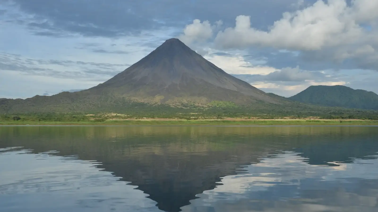
La Fortuna, Arenal's lava flows and rivers of thermal water
Days Start with the basic programme and choose extensions for the time you have.
How the guide reaches this number
Two full days are enough if you give up Río Celeste and focus the visit only on the base of Arenal; anything less turns a road trip of several hours from San José into a rushed outing at the risk of finding the volcano covered in cloud.
2–3
When February to April; according to the IMN, the Northern Zone follows the Caribbean rainfall regime, with rain all year, a single rainy season from May to December or January, and cold fronts that can bring days of steady rain between November and February.
How the guide reaches this number
La Fortuna lies in the Northern Zone, which the Instituto Meteorológico Nacional (IMN) classifies under the Caribbean rainfall regime: it rains all year, and the region is the third rainiest in the country, with more than 3,200 mm a year on average; at the Arenal station, the IMN map (1961 to 1990 normals) indicates about 4,500 mm. Relative relief comes from February to April, the best time for drier trails and a better chance of seeing the cone. From May to December or January runs the rainy season; mornings are usually the best window for trails and bridges, and showers tend to cluster in the second half of the day. Between November and February, cold fronts from the Caribbean (empujes fríos) can bring days of steady rain; in years when they fail, December and January are drier than normal. In any month, bring a rain jacket and shoes that can get wet.
Per person/day Budget around CRC26,800; mid-range around CRC62,700; comfortable around CRC133,000 per person per day, based on spending reported by travelers to Budget Your Trip (checked October 2026).
How the guide reaches this number
Indicative figures, excluding travel to the destination.
Budget around CRC26,800; mid-range around CRC62,700; comfortable around CRC133,000 per person per day, based on spending reported by travelers to Budget Your Trip (checked October 2026). Indicative figures, excluding travel to the destination.
Per person per day: accommodation, meals, urban transport, visits and a small allowance for extras. Flights excluded; larger purchases vary. Editorial estimate, not a quote.
 What Nilo thinks
I'd stay three full days in La Fortuna: the first for the two sectors of Volcán Arenal National Park in the morning and the hot springs in the late afternoon, the second for the Místico hanging bridges very early and the descent to the Río Fortuna Waterfall, and the third for the day trip to Río Celeste in Volcán Tenorio National Park. Two full days are enough if you give up Río Celeste and focus the visit only on the base of Arenal; anything less turns a road trip of several hours from San José into a rushed outing at the risk of finding the volcano covered in cloud.I'd choose La Fortuna because few places combine, within so few kilometers, a recent volcano and the daily rhythm of the tropical forest: early in the morning you walk across the lava flows that came down from Arenal in 1992 or cross hanging bridges at treetop height; in the late afternoon you step into a river heated by the mountain's underground warmth, and the rain that usually falls at that hour doesn't bother anyone who is already in the water.
Read more
Even without the explosions that ended in 2010, the Arenal cone still dominates the San Carlos valley and the mirror of Lake Arenal. I'd organize the days by the clock of the clouds: trails, bridges and the roughly 530 steps of the Río Fortuna Waterfall in the first half of the morning, and the hot springs after four in the afternoon.
Quick facts
- Population
- 15,383 inhabitants in the 2011 INEC census, in the district of La Fortuna (the seventh district of the canton of San Carlos, Alajuela province). The INEC estimate for the same district in 2022 is 19,469 inhabitants.
- Founded
- Agricultural settlement in the mid-1930s, in the village then called El Burío; created as the district of La Fortuna on February 5, 1952, by Executive Decree 15.
- Country and region
- Costa Rica, Alajuela province, canton of San Carlos (Huetar Norte Region).
- Language
- Spanish. English is widely understood in parks, private reserves, hotels and ecotourism agencies.
- Currency
- Costa Rican colón (CRC / ₡). The US dollar (USD) is used as the reference for prices on tours, at parks and in hotels.
- Time zone
- America/Costa_Rica: UTC-6 all year, with no daylight saving time.
- Best time to go
- February to April; according to the IMN, the Northern Zone follows the Caribbean rainfall regime, with rain all year, a single rainy season from May to December or January, and cold fronts that can bring days of steady rain between November and February.
- Average cost per day
- Budget around CRC26,800; mid-range around CRC62,700; comfortable around CRC133,000 per person per day, based on spending reported by travelers to Budget Your Trip (checked October 2026). Indicative figures, excluding travel to the destination.
When to go
February to April; according to the IMN, the Northern Zone follows the Caribbean rainfall regime, with rain all year, a single rainy season from May to December or January, and cold fronts that can bring days of steady rain between November and February.
How the year changes
La Fortuna lies in the Northern Zone, which the Instituto Meteorológico Nacional (IMN) classifies under the Caribbean rainfall regime: it rains all year, and the region is the third rainiest in the country, with more than 3,200 mm a year on average; at the Arenal station, the IMN map (1961 to 1990 normals) indicates about 4,500 mm. Relative relief comes from February to April, the best time for drier trails and a better chance of seeing the cone. From May to December or January runs the rainy season; mornings are usually the best window for trails and bridges, and showers tend to cluster in the second half of the day. Between November and February, cold fronts from the Caribbean (empujes fríos) can bring days of steady rain; in years when they fail, December and January are drier than normal. In any month, bring a rain jacket and shoes that can get wet.
Nilo's tips
Start the bridges and the park between 6 and 8 a.m.
I'd reserve the first slot of the morning for the Místico Hanging Bridges or for Volcán Arenal National Park. Early there is much more toucan and monkey activity, fewer groups on the bridges and a better chance of seeing the volcano's cone before the clouds close over the summit.
Do both sectors of the national park in the same morning
Sector Volcán (the Heliconias, Las Coladas and El Ceibo trails) and Sector Península, on the shore of Lake Arenal, belong to the same park. I'd do both before lunch and, when paying the 16.95 USD admission, ask at the ranger station whether the day's ticket is also valid at Península: SINAC does not publish that rule, and the sector is still under construction.
Buy your Río Celeste ticket on the SINAC site before leaving
If you want to make the day trip to Volcán Tenorio National Park, I'd buy the entry at serviciosenlinea.sinac.go.cr in advance. The Río Celeste gate does not sell tickets on the spot.
A guide is worth it at Bogarín and on the bridges, but not on the lava flows
To walk Sendero Las Coladas or go down to the Río Fortuna Waterfall, I'd go on my own: the path is obvious and the attraction is the landscape. At Sendero Bogarín or on the hanging bridges, though, I'd hire a naturalist guide with a spotting scope, because without one you walk right under the sloths and frogs and see almost nothing.
Explore the map
Explore the map, read about the other places and plan your travel days in the app.
Open the appWhat to see
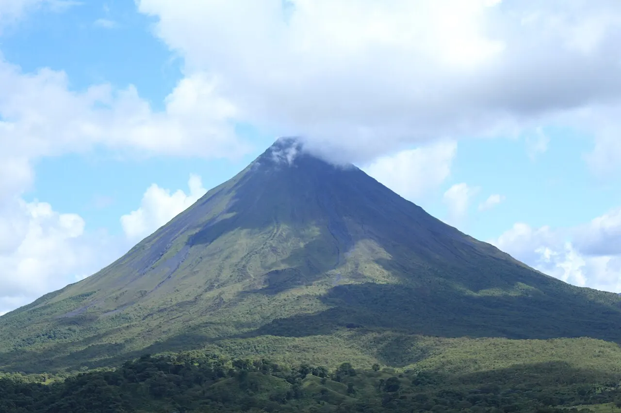
Volcán Arenal National Park
Managed by SINAC (Sistema Nacional de Áreas de Conservación), the park was created in 1991 to protect the volcano, the watershed that feeds Lake Arenal and the surrounding rainforest. The main entrance (Sector Volcán) is about 15 to 17 km west of La Fortuna, on the road to El Castillo, which leaves Route 142 about 13 km from town. There are three flat trails: Sendero Heliconias (610 meters, narrow and overgrown, with a view of the crater), Sendero Las Coladas (1.7 km, across the lava flows that came down in 1992, with views of the cone, Lake Arenal and the Cordillera de Tilarán) and Sendero El Ceibo (2.3 km, to a ceiba, Ceiba pentandra, more than 400 years old). The cone viewpoint is 1.5 km from the ranger station. Climbing the cone and its immediate surroundings is prohibited. As checked in October 2026, it is open daily from 8 a.m. to 4 p.m.; with VAT included, admission is 16.95 USD for nonresident adults, 5.65 USD for nonresident children, 1,130 CRC for national and resident adults and 565 CRC for national and resident children.
Check access
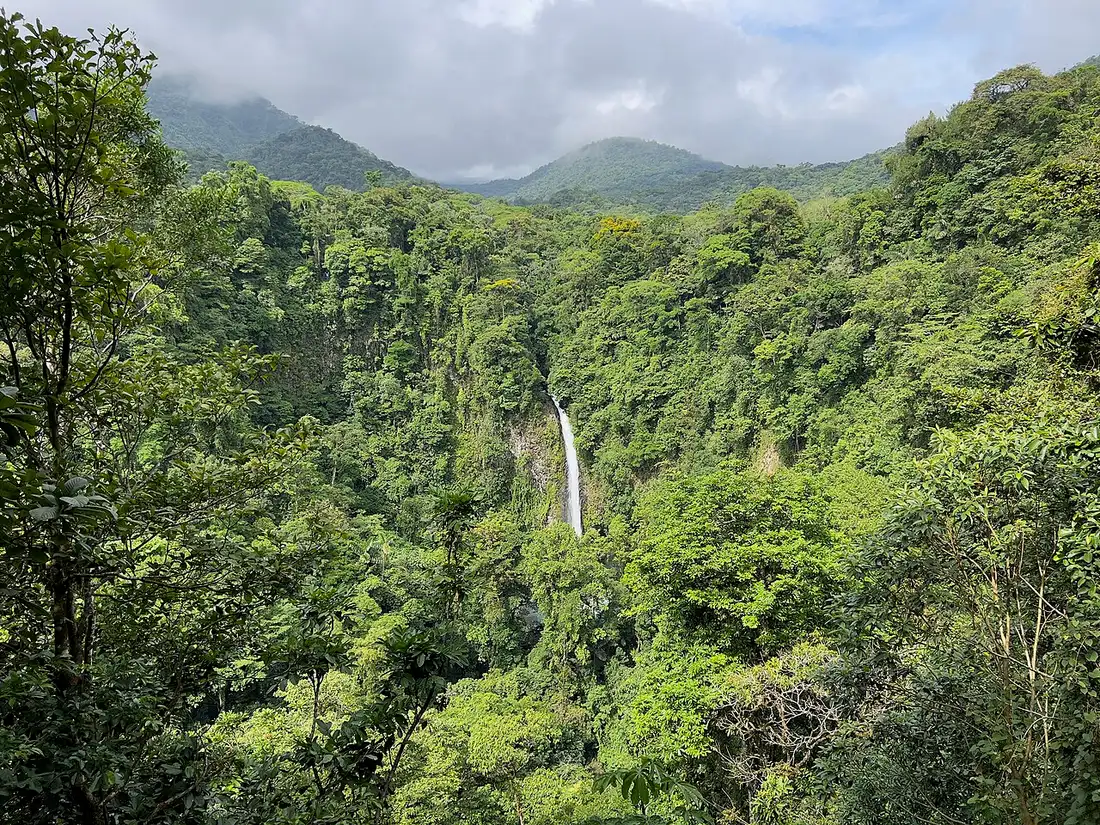
Río Fortuna Waterfall
Located 5.5 km from La Fortuna, at the start of the road that climbs to Cerro Chato, the Fortuna River falls from a height of 70 meters, with pools where you can cool off. Access is managed by the Asociación de Desarrollo Integral de La Fortuna (ADIFORT), founded on August 31, 1969, which puts admission revenue into community works and projects. From the top down to the falls, the trail has about 530 steps, with rest and hydration areas along the way through the forest. The official website does not publish hours or fees: check cataratalafortuna.com or the reception desk before you go, and follow the swimming signs at the pool.
Check access
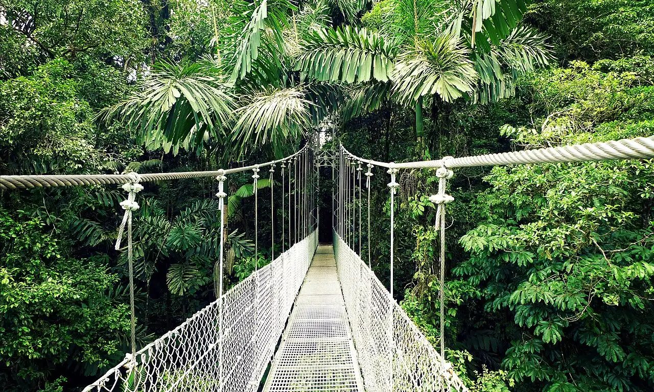
Místico Arenal Hanging Bridges Park
A private tropical forest reserve beside the Lake Arenal reservoir, entered from a road that leaves Route 142. The main loop trail is 3.2 km long and crosses 16 bridges, six of them large suspension bridges stretched over canyons at canopy height, where you can spot monkeys, birds and the silhouette of Arenal; the walk usually takes 2 to 3 hours. For visitors with disabilities, the park offers electric carts. As checked in October 2026, it receives visitors daily from 6 a.m. to 3:50 p.m. (last entry); the self-guided ticket costs 32 USD plus taxes for adults, and the visit with a naturalist guide 44 USD. Closed-toe shoes are required, and the park recommends reserving a time slot in advance, especially in the busiest season.
Check access

Tabacón Thermal Springs
The Tabacón complex occupies the bed of the Tabacón River, naturally heated by volcanic activity, which flows down the slope of Arenal through tropical gardens, forming cascades and pools with temperatures from 22 °C to 38 °C, according to the official website. Besides resort guests, it welcomes visitors with day or night passes; since shifts, prices and reservation rules change with the season, check the official website before you go.
Check access
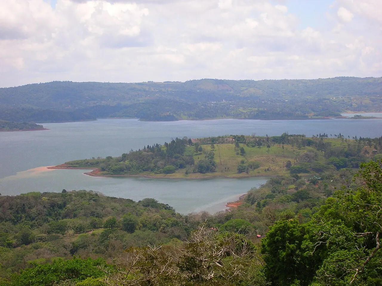
Lake Arenal
A few kilometers from downtown La Fortuna, Lake Arenal is the largest artificial lake in Costa Rica, at 87.8 km² and 546 meters above sea level, according to the ICT. Besides shaping the landscape west of the volcano, it hosts boat tours, kayaking, sport fishing, water skiing, windsurfing and stand-up paddleboarding, and it is crossed by boat on the combined transfer between La Fortuna and Monteverde.
Check access
Sector Península (Volcán Arenal National Park)
Within the same Volcán Arenal National Park, Sector Península lies on the shore of Lake Arenal. According to Lonely Planet, it opened in 2017 with about 1.2 km of trails, an observation tower and a lake viewpoint. SINAC reports that a shop, a small café, a trail for people with reduced mobility and a viewing platform at the end of Sendero La Península, facing the sunset over the lake, are planned and under construction. Because SINAC does not publish hours or admission rules specific to the sector, ask at the ranger station in Sector Volcán when you pay your entrance fee how to get there and whether that day's ticket is also valid there.
Check access
El Choyín (Río Tabacón)
A family-run spa on the bank of the Tabacón River, in La Fortuna, with one pool fed by the river's own thermal water, lockers, towels for rent and food service, according to a December 2024 report by Teletica, which describes it as an affordable option. The report gives neither price nor hours; confirm both before you go.
Check access
Sendero Bogarín
A private forest reserve on the outskirts of downtown La Fortuna, with a trail of about 2.5 km where sloths, toucans, blue jeans frogs (poison dart frogs) and other birds are commonly seen. As checked in October 2026, it is open daily from 6 a.m. to 8 p.m.; self-guided entry costs from 20 USD per adult, the guided visit of about 2 hours from 45 USD and the guided night walk, also about 2 hours, from 60 USD. A guide makes a difference in spotting the camouflaged sloths high in the cecropia trees (guarumos).
Check access
Arenal 1968 Private Reserve
A private reserve in La Fortuna with trails offering views of Volcán Arenal, a café (Lava 68) and a restaurant, plus guided walks by day and at night, horseback rides and a pass that combines the trails with the Kuru natural pools, according to the official website. Trail length, hours and prices do not appear on the main page: check arenal1968.com before you go.
Check access
Nilo’s itinerary
Start with the basic programme and choose extensions for the time you have.
Plan my days in the app ↗Day 1 · 1992 lava flows, Sector Península and an evening in the hot springs
Arrive at 8 a.m., when Sector Volcán of Volcán Arenal National Park opens, and walk Sendero Las Coladas (1.7 km, across the 1992 lava flows) and Sendero El Ceibo (2.3 km) while the morning has the best chance of clear sky over the cone.
Before leaving, ask at the ranger station how to reach Sector Península and whether the day's ticket is valid there; on the shore of Lake Arenal, short trails lead to the observation tower and the lake viewpoint.
Have a casado for lunch in El Castillo or on the way back along Route 142, and rest through the hot, rainy hours of early afternoon.
From 4 or 5 p.m., spend the late afternoon and evening in the hot springs: choose between the river cascades at Tabacón, the pools at Eco Termales or the simpler pool at El Choyín, always confirming the shift and price on the website or by phone before you go.
Day 2 · Canopy hanging bridges and the 530 steps to the waterfall
Arrive at Místico Arenal Hanging Bridges Park when it opens at 6 a.m. (the park recommends reserving a time slot and requires closed-toe shoes) to walk the 3.2 km circuit and cross the six hanging bridges at the hour of peak bird and monkey activity.
On the way back to town, in midmorning, continue to the Río Fortuna Waterfall (run by ADIFORT; check hours and fee on the official website), go down the roughly 530 steps to the base of the 70-meter fall and cool off in the pool, following the swimming signs.
Return to the area around Parque Central de La Fortuna for lunch at a local soda and rest through the hottest or rainiest hours of mid-afternoon.
If the afternoon clears, take the relaxed rowboat trip down the Río Peñas Blancas.
At nightfall, take the guided night walk at Sendero Bogarín, on the outskirts of town (about 2 hours, from 60 USD per adult as checked in October 2026), to look for the wildlife that moves after dark.
If you stay longer
Day 3 · Volcán Tenorio National Park and Río Celeste
Day trip
North of La Fortuna, by the road through San Rafael de Guatuso, Katira and Río Celeste to the park's administration office and entrance, near El Pilón (ICT); the park is 28 km from Guatuso (SINAC). Check the drive in a maps app before leaving, because the entrance closes early. Sendero Misterios del Tenorio is 3 km in a line, 6 km round trip in about 3 hours, and passes the waterfall of about 20 meters, the viewpoint, the Laguna Azul, the borbollones and the Teñidero, where the water takes on a sky-blue color. As checked in October 2026, entry is from 8 a.m. to 2 p.m., with a stay until 4 p.m., daily; the ticket with VAT costs 13.56 USD for nonresident adults and 5.65 USD for nonresident children, and is sold only on the official SINAC website (serviciosenlinea.sinac.go.cr). Entering the river is prohibited; parking is private and paid.
Food
Casado
The traditional Costa Rican lunch, served at sodas (small, inexpensive restaurants): rice and beans side by side, not mixed, one meat (beef, fish, pork chop or chicken) and salad, sometimes with fried plantain (ripe or as patacones), a slice of white cheese or corn tortillas.
Gallo pinto
The national dish, served at breakfast: rice and beans, red or black, sautéed together in a skillet with cilantro, bell pepper, onion, celery and Salsa Lizano (a sweet and tangy vegetable sauce created in 1920 by a Costa Rican company), accompanied by scrambled or fried eggs and sour cream or cheese.
Olla de carne
A stew of Spanish heritage with beef, cassava, potato, corn, green plantain, squash or chayote and other vegetables.
Chifrijo and patacones
Chifrijo, popular since the 1990s, combines chicharrón (fried pork) and frijoles (beans) with rice and pico de gallo, and usually comes with tortilla chips. Patacones are slices of green plantain fried, smashed and fried again, served with bean paste or guacamole as a boca (bar snack).
Agua de pipa, frescos and coffee
Agua de pipa is a green coconut that the vendor chops open with a machete and serves with a straw, common in tourist areas. Frescos are fruit juices blended with water or milk, made from guanábana (soursop), blackberry, tamarind or cas, a tart fruit native to Central America. Coffee is traditionally brewed in the chorreador, a wooden stand with a cloth filter.
Where to eat
- Downtown La Fortuna (around Parque Central)
The sodas, small restaurants with home cooking at low prices, serve gallo pinto at breakfast and casado at lunch, with fruit frescos. It is the cheapest and most local meal in town.
- Route 142 corridor and hot spring complexes
Several hot spring complexes and reserves along Route 142 have their own kitchens: Eco Termales has a restaurant, and Arenal 1968 a café and a restaurant. Menu, hours and whether the meal is included in the pass vary by operator; check each one's website before combining a soak with dinner.
· 2026-10-17
Day trips
Volcán Tenorio National Park and Río Celeste
North of La Fortuna, by the road through San Rafael de Guatuso, Katira and Río Celeste to the park's administration office and entrance, near El Pilón (ICT); the park is 28 km from Guatuso (SINAC). Check the drive in a maps app before leaving, because the entrance closes early. Sendero Misterios del Tenorio is 3 km in a line, 6 km round trip in about 3 hours, and passes the waterfall of about 20 meters, the viewpoint, the Laguna Azul, the borbollones and the Teñidero, where the water takes on a sky-blue color. As checked in October 2026, entry is from 8 a.m. to 2 p.m., with a stay until 4 p.m., daily; the ticket with VAT costs 13.56 USD for nonresident adults and 5.65 USD for nonresident children, and is sold only on the official SINAC website (serviciosenlinea.sinac.go.cr). Entering the river is prohibited; parking is private and paid.
Caño Negro National Wildlife Refuge
In the lower basin of the Frío River, near the Nicaraguan border, the refuge was declared a Ramsar Site on December 27, 1991, one of the first two in Costa Rica. In the dry season, the main lagoon shrinks and splits into smaller lagoons. SINAC records 307 bird species, 206 resident and 101 migratory, as well as the gaspar fish, considered a living fossil. According to the ICT, La Fortuna is the starting point for Caño Negro, and boats can be rented in Los Chiles to travel the river. Check the drive in a maps app and confirm the duration, schedule and price of the tour with the operator before you go.
Venado Caves
A cave system discovered in 1962, 3 km from the village of Venado, about 2,000 meters long, according to the ICT, which names La Fortuna as the starting point and says several operators organize the visit. Duration, equipment, price and restrictions (such as claustrophobia or a minimum age) vary by operator: confirm before booking and check the drive in a maps app.
Where to begin
1992 lava flows, Sector Península and an evening in the hot springs
Arrive at 8 a.m., when Sector Volcán of Volcán Arenal National Park opens, and walk Sendero Las Coladas (1.7 km, across the 1992 lava flows) and Sendero El Ceibo (2.3 km) while the morning has the best chance of clear sky over the cone.
Canopy hanging bridges and the 530 steps to the waterfall
Arrive at Místico Arenal Hanging Bridges Park when it opens at 6 a.m. (the park recommends reserving a time slot and requires closed-toe shoes) to walk the 3.2 km circuit and cross the six hanging bridges at the hour of peak bird and monkey activity.
Money
The official currency is the Costa Rican colón (CRC), but La Fortuna runs on an almost two-currency system: hotels, private parks and tours usually set their rates in US dollars (USD), as Místico and Sendero Bogarín do, while supermarkets, bakeries, public buses and neighborhood sodas work in colones. At the ticket offices of the state-run SINAC national parks (Arenal and Volcán Tenorio), payment is made only by credit or debit card (or in advance online through the SINAC portal), with no cash accepted. Value-added tax (IVA) of 13% applies to admission prices, restaurants and lodging; at restaurants a 10% service charge is also added by law (a total of 23% over the menu price when not included). If you pay in cash with dollars at local shops, bring small bills of 1, 5, 10 and 20 USD in perfect condition (no tears or stamps) and expect to get your change in colones.
Getting there and around
The nearest international airport is Juan Santamaría (SJO), in Alajuela, in the San José metropolitan area. By car, the ICT suggests the route along the Interamericana to San Ramón and from there north through Los Ángeles, La Tigra and Chachagua to La Fortuna. Daniel Oduber Quirós International Airport (LIR), in Liberia (Guanacaste), is the alternative from the west. Distance and driving time vary with the route and traffic: check the trip in a maps app before choosing an airport. There is also the La Fortuna airstrip (FON), with domestic SANSA flights of about 30 minutes from San José; check schedules and fares at flysansa.com.
By public bus from San José, note a change: the old Terminal 7-10 closed on April 30, 2025, and buses to La Fortuna now leave from the Terminal Atlántico Norte in downtown San José. There is a direct morning departure (about 3.5 to 4 hours); at other times, the trip is made by taking buses to Ciudad Quesada (San Carlos) and changing at the Ciudad Quesada terminal for La Fortuna. Check the schedule and fare with the operator before you go. Other widely used options are door-to-door shared shuttles and, for continuing to Monteverde, the combined Jeep-Boat-Jeep transfer, which crosses Lake Arenal by boat; price and duration vary by operator, so compare offers before booking.
Within La Fortuna, there is no public bus line that regularly serves the parks and hot springs along Route 142. The attractions are spread out beyond the center (the waterfall 5.5 km away and the national park entrance about 15 to 17 km away): if you don't have a rental car (a basic 4x2 sedan or SUV is enough for Route 142, the waterfall and the national park, which have paved access; a high-clearance SUV or 4x4 is only needed for certain hotels on steep dirt roads in El Castillo or on very rainy days heading toward Monteverde), you will need to use the official red taxis, Uber (which works well downtown but can be unreliable near the remote park entrances) or buy tickets that already include transport from local operators.
Safety
La Fortuna is a quiet town, but it calls for practical care related to nature and the rental car. The most common crime against travelers is opportunistic theft from vehicles parked on unattended road shoulders; never leave a passport, cameras or luggage in the car during intermediate stops. On the roads, avoid driving long distances after 6 p.m.: the fog in the mountains between San Ramón, Zarcero or Tilarán and La Fortuna is dense, the curves wind, and there is almost no street lighting on the highways. In rivers and waterfalls, be alert to the risk of flash floods (cabezas de agua): heavy rain on the upper slopes of Cerro Chato or the volcano can raise river levels quickly, and at the Río Fortuna Waterfall swimming is allowed only in the marked areas. On the trails, never put your hands on trunks or rocks without looking first, because the forest is home to venomous snakes such as the bocaracá (eyelash viper) and the terciopelo (Bothrops asper), a large pit viper. Dengue circulates in Costa Rica: use repellent and long sleeves at dusk. Tap water in downtown La Fortuna is treated and drinkable, and the national emergency number is 911.
Etiquette tips
Feeding, touching or luring wild animals is prohibited
In Costa Rica it is an environmental offense to feed monkeys, coatis (pizotes), sloths or birds, as well as to play loud recordings indiscriminately or to leave the marked trail for selfies near snakes and frogs. Keep your distance and use your camera zoom or the guide's spotting scope.
Closed-toe shoes on the hanging bridges and trails
Místico Park requires closed shoes suitable for walking and discourages sandals and other open footwear on the forest trails, which are often wet.
Respect the volcanic limits
Never try to hire unlicensed guides to climb the cone of Volcán Arenal: SINAC expressly prohibits climbing the cone and its immediate surroundings, and the authorized trails cover only the base and the lava flows.
Mistakes to avoid
Leaving the Volcán Arenal National Park trails or the Místico hanging bridges for early afternoon. After noon, clouds often cover the volcano's summit, the heat rises, wildlife retreats and showers are more likely; start forest outings at 6 or 8 a.m. and save the hot springs for late afternoon and evening.
Driving to Volcán Tenorio National Park (Río Celeste) without buying a ticket online first. The park gate does not sell tickets on site or accept cash; the ticket must be bought in advance through SINAC's official online system.
Leaving bags, passports or backpacks visible inside the rental car at roadside parking areas, including near the Río Celeste entrance. Carry only what you need in a waterproof bag and leave documents in the hotel safe.
Assuming the old Terminal 7-10 in San José still runs buses to La Fortuna. The terminal closed on April 30, 2025, and departures for La Fortuna moved to the Terminal Atlántico Norte.
Swimming outside the marked areas at the base of the Río Fortuna Waterfall, or entering the Río Celeste inside Volcán Tenorio National Park (where bathing is strictly prohibited to preserve the chemical composition of the water).
Useful phrases
Pura vida
A national Costa Rican expression used as a greeting ('hello', 'how are you'), as thanks, or to confirm that everything is great.
Soda
A traditional small family restaurant where you eat casados, gallo pinto and natural fruit drinks at local prices.
Una pipa fría
A cold green coconut, to drink the water with a straw.
Presa
A traffic jam, common leaving San José/Alajuela or when a truck climbs slowly up the mountain road.
Tico / Tica
What Costa Ricans affectionately call themselves.
Where to stay
- Downtown La Fortuna · Travelers without a rental car who want budget lodging and to walk to sodas, shops and tour agencies.: It concentrates sodas, shops and the arrival point for buses from San José and Ciudad Quesada, and some operators, such as Místico, offer transport from downtown hotels. On the other hand, the trails, bridges and hot springs lie outside town: the waterfall 5.5 km away and the national park about 15 to 17 km away.
- Volcano Corridor and Tabacón (Route 142) · Travelers with a car, or those who prioritize hotels with their own hot springs and views of the Arenal cone.: It lies on the way to the national park and the hot spring complexes of Route 142, several of which also have rooms. Because the hotels are spread along the highway, going out to dinner usually requires a car or taxi; confirm the distance to town before booking.
- El Castillo and the south shore of Lake Arenal · Travelers looking for quiet, views of the lake and the volcano, and proximity to Sector Península.: It lies on the road that passes Sector Península and climbs to the Butterfly Conservatory, away from the bustle of downtown. Before booking, confirm the drive time to La Fortuna, where most restaurants are, and the condition of the final access road to the lodging.
· 2026-10-17
Districts
Downtown La Fortuna
A flat grid of blocks around Parque Central and the church, 7 km from Volcán Arenal, according to the ICT. It has supermarkets, banks, sodas (family restaurants serving traditional food), pharmacies, budget lodging and the bus arrivals, plus the Bogarín trail on the outskirts.
Volcano Corridor and Tabacón (Route 142)
The roughly 15 km of Route 142 between the west edge of town and the entrance to Volcán Arenal National Park, about 15 to 17 km from La Fortuna. This is where the hotels with views of the cone and several hot spring complexes are, Tabacón among them. To get between them, count on a car, a taxi or the transport that comes with tours.
Cerro Chato and Río Fortuna
A green hillside south of the town center, along the road that climbs toward the base of Cerro Chato. It holds the Río Fortuna Waterfall, 5.5 km from town according to the ICT, and the Arenal Mundo Aventura reserve, as well as inns surrounded by forest.
El Castillo and Lake Arenal (Península Sector)
A rural community on the south side of Lake Arenal, on the road that leaves Route 142 toward the national park and continues to El Castillo. It gives access to the park's Sector Península, the lakeshore and the Butterfly Conservatory, in a quieter setting facing the water and the south face of the volcano. Check the drive time to downtown La Fortuna in a maps app.
Chachagua and the Southern Plain
A rural, forested area southeast of La Fortuna, on the way for those arriving from San Ramón via La Tigra and Chachagua, according to the ICT. It has private rainforest reserves and rural properties; check the distance to your lodging on a map before booking.
History
Pre-Columbian period · Territory of the Maleku (Guatuso) people
The northern plains and the basins of the Frío and Celeste rivers were home to the Indigenous Maleku people, whose communities today live in the Guatuso palenques, north of Arenal.
1930s to 1952 · From El Burío to the district of La Fortuna
Farming families from Ciudad Quesada, Grecia, Alajuela and other parts of the region opened farms in what was then called El Burío, starting in the mid-1930s. The village came to be called La Fortuna for the fertility of its land, before the 1968 eruptive cycle, and became a district on February 5, 1952.
July 29, 1968 · The eruption of Volcán Arenal
After centuries of dormancy, the volcano awoke with pyroclastic flows down its western flank that destroyed the villages of Tabacón, Pueblo Nuevo and San Luis and left 87 dead, while La Fortuna, east of the mountain, was spared.
1979 · Expansion of Lake Arenal
The Instituto Costarricense de Electricidad (ICE) completed the Sangregado dam, which enlarged the old lagoon and created the reservoir used to generate hydroelectric power and to transfer water to Guanacaste province.
1991 · Creation of Volcán Arenal National Park
Created on September 30, 1991, by Executive Decree 20791-MIRENEM and enlarged by decrees in 1992 and 1994, the park is part of the Arenal Huetar Norte Conservation Area (ACAHN) of SINAC.
2010 · Start of the eruptive rest phase
After 42 years of constant incandescent rock ejections and fumaroles, Arenal entered a rest phase, with only residual fumarolic activity in the crater and the geothermal heating of the underground rivers.
Complete history
The modern history of La Fortuna divides into exactly two halves, split by the morning of July 29, 1968. Before that date, the farming settlers who had arrived from other parts of Alajuela in the 1930s grew beans, cassava, papaya and pasture at the foot of a symmetrical mountain, covered in forest to its summit, that many residents called simply Cerro Arenal. On that Monday in July, after hours of seismic tremors, the western flank of the mountain broke open in three lateral craters. The glowing clouds and blocks hurled to the west buried the rural villages of Tabacón and Pueblo Nuevo and killed 87 people. La Fortuna, on the east side of the cone, escaped the pyroclastic flows thanks to the direction of the blast and the topography of the mountain.
In the following decade, another project transformed the west of the district: in 1979, the Instituto Costarricense de Electricidad (ICE) completed the Lake Arenal dam over the old natural lagoon, flooding the valley where the old villages of Arenal and Tronadora stood, which were resettled as Nuevo Arenal and Nueva Tronadora. The 87.8 km² reservoir became part of Costa Rica's electricity grid and put a stretch of water between La Fortuna and the Monteverde highlands, which today is crossed by boat on the combined transfer between the two destinations.
For forty-two years, from 1968 to 2010, Arenal was one of the most active volcanoes in the world, throwing out red rocks visible at night from the town's balconies. This drew volcanologists from the OVSICORI-UNA observatory and travelers who came to watch the mountain and bathe in the hot rivers around Tabacón. The local community organized through the Asociación de Desarrollo Integral de La Fortuna (ADIFORT), created in 1969, which took over management of the Río Fortuna Waterfall and reinvests ticket revenue in schools, roads and social projects in the district.
When the visible lava explosions stopped at the end of 2010, La Fortuna had to reinvent its appeal. Rather than emptying out, the destination turned its attention to the ecological regeneration on the volcanic rock of 1968 and 1992, to the private reserves with hanging bridges, and to the wildlife that has reoccupied the forest corridors. Today the cone is silent, but heat from magma deep below still feeds the hot springs that run down the north slope.
Walking Sendero El Ceibo, it's worth remembering that the ceiba the trail is named for is more than 400 years old, according to SINAC: it was already there long before 1968, when Arenal was still a dormant mountain covered in forest.
Geography and shape of the city
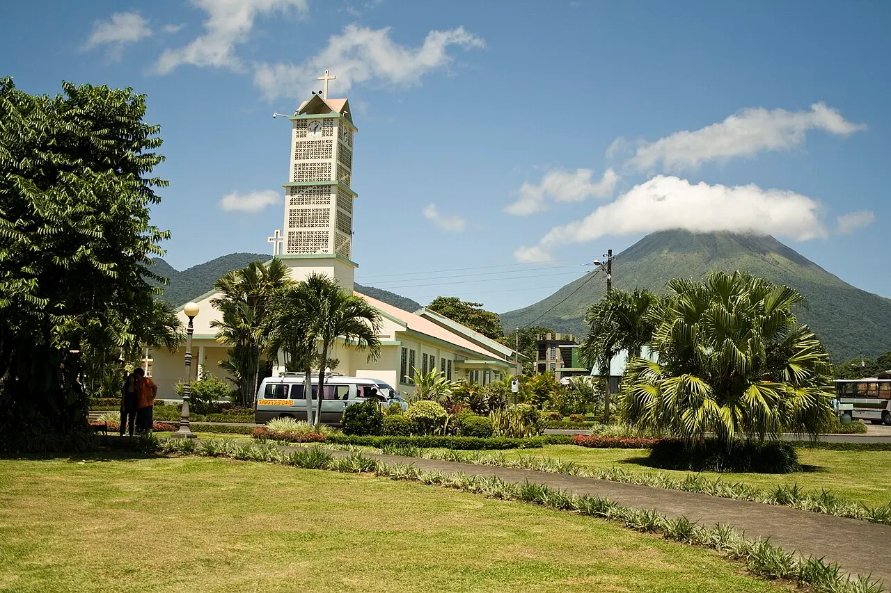
La Fortuna sits in a flat valley at about 250 m above sea level, where the Cordillera de Tilarán meets the alluvial plains of the north (Llanuras de San Carlos). West of the town center rises the stratovolcano cone of Volcán Arenal (1,670 m) and, attached to it on the southeast, the dormant volcano Cerro Chato (1,140 m), from which the cold waters of the Río Fortuna Waterfall descend. All practical life and the excursions are strung along a single main road: National Route 142, which leaves Parque Central in La Fortuna heading west, skirts the north face of the volcano past the hot spring complexes (Tabacón, Eco Termales, Baldi), reaches the Lake Arenal dam and the national park entrance (about 15 to 17 km from the center) and continues along the lake to Nuevo Arenal and Tilarán. A secondary road branches off that same route toward the south of the lake, to the village of El Castillo and the Península sector. The climate is humid tropical, shaped by Caribbean winds, with well-distributed rainfall and heavy cloud on the mountaintop.
I wouldn't pick a hotel on Route 142 thinking you can walk into town for dinner. The hot spring complexes and hotels with views of the cone are spread along fifteen kilometers of highway with no sidewalk; if you're without a car, work out the cost of a taxi or Uber carefully.
Culture
Everyday identity in La Fortuna blends the rural tradition of San Carlos, from the settlers of the San Carlos canton tied to dairy farming and crops such as cassava and papaya, with the ecotourism economy that has grown up around Arenal. On the trails, naturalist guides usually carry spotting scopes to show birds, amphibians and mammals without touching or feeding the wildlife.
North of the volcano, in the Guatuso palenques (Margarita, Tonjibe and El Sol), live the Indigenous Maleku people, who preserve the Maleku jaika language, rainforest plant medicine, and the sculpture and painting of traditional masks in lightweight balsa wood and decorated gourds (jícaras) with motifs of toucans, jaguars, turtles and frogs. When buying Maleku crafts in La Fortuna, prefer pieces sold directly by artisans from the Guatuso communities or on organized visits to the palenques.
Festivals and events
Día de la Independencia (September 15)
A national holiday commemorating the declaration of Central American independence on September 15, 1821. The program of parades and civic events in the district changes every year: check with the Municipalidad de San Carlos before planning a trip around the date.
Books and films
Costa Rican Natural History, edited by Daniel H. Janzen (University of Chicago Press, 1983)
A reference work with entries by specialists on the plants, insects, amphibians, reptiles, birds and mammals of Costa Rica. It helps identify what guides point out through their spotting scopes on the Arenal trails, from sloths to frogs.
The Ticos, by Mavis Hiltunen Biesanz, Richard Biesanz and Karen Zubris Biesanz (Lynne Rienner Publishers, 1998)
A study of culture and social change in Costa Rica, useful for understanding everyday life in the country away from the trails and resorts.
Frequently asked questions
La Fortuna: how do I get there from San José?
The nearest international airport is Juan Santamaría (SJO), in Alajuela, in the San José metropolitan area. By car, the ICT suggests the route along the Interamericana to San Ramón and from there north through Los Ángeles, La Tigra and Chachagua to La Fortuna; check the trip in a maps app, because distance and driving time vary with the route and traffic. Daniel Oduber Quirós International Airport (LIR), in Liberia, is the alternative from the west, and the La Fortuna airstrip (FON) receives domestic SANSA flights of about 30 minutes from San José. By public bus, the old Terminal 7-10 closed on April 30, 2025, and buses to La Fortuna now leave from the Terminal Atlántico Norte in downtown San José. There is a direct morning departure (about 3.5 to 4 hours); at other times, the trip is made by taking buses to Ciudad Quesada (San Carlos) and changing at the Ciudad Quesada terminal for La Fortuna. Check the schedule and fare with the operator before you go. There are also door-to-door shared shuttles.
La Fortuna: can I explore the area without a car?
Within La Fortuna, there is no public bus line that regularly serves the parks and hot springs along Route 142. The attractions are spread out beyond the center (the waterfall 5.5 km away and the national park entrance about 15 to 17 km away): without a rental car, you will need to use the official red taxis, Uber (which works well downtown but can be unreliable near the remote park entrances) or buy tickets that already include transport from local operators. For those who rent, a basic 4x2 sedan or SUV is enough for Route 142, the waterfall and the national park, which have paved access; a high-clearance SUV or 4x4 is only needed for certain hotels on steep dirt roads in El Castillo or on very rainy days heading toward Monteverde.
La Fortuna: how many days should I stay?
I'd stay three full days in La Fortuna: the first for the two sectors of Volcán Arenal National Park in the morning and the hot springs in the late afternoon, the second for the Místico hanging bridges very early and the descent to the Río Fortuna Waterfall, and the third for the day trip to Río Celeste in Volcán Tenorio National Park. Two full days are enough if you give up Río Celeste and focus the visit only on the base of Arenal; anything less turns a road trip of several hours from San José into a rushed outing at the risk of finding the volcano covered in cloud.
La Fortuna: how do I visit Volcán Arenal National Park?
The main entrance (Sector Volcán) is about 15 to 17 km west of La Fortuna, on the road to El Castillo, which leaves Route 142 about 13 km from town. There are three flat trails: Sendero Heliconias (610 meters), Sendero Las Coladas (1.7 km, across the lava flows that came down in 1992) and Sendero El Ceibo (2.3 km); the cone viewpoint is 1.5 km from the ranger station. Climbing the cone and its immediate surroundings is prohibited. As checked in October 2026, it is open daily from 8 a.m. to 4 p.m.; with VAT included, admission is 16.95 USD for nonresident adults, 5.65 USD for nonresident children, 1,130 CRC for national and resident adults and 565 CRC for national and resident children, paid by card only or in advance through the SINAC portal. Because SINAC does not publish hours or admission rules specific to Sector Península, on the shore of Lake Arenal, ask at the ranger station in Sector Volcán when you pay your entrance fee how to get there and whether that day's ticket is also valid there.
La Fortuna: how do I do the day trip to Río Celeste?
Volcán Tenorio National Park is north of La Fortuna, by the road through San Rafael de Guatuso, Katira and Río Celeste to the park entrance, near El Pilón; check the drive in a maps app before leaving, because the entrance closes early. As checked in October 2026, entry is from 8 a.m. to 2 p.m., with a stay until 4 p.m., daily; the ticket with VAT costs 13.56 USD for nonresident adults and 5.65 USD for nonresident children, and is sold only on the official SINAC website (serviciosenlinea.sinac.go.cr): the park gate does not sell tickets on site or accept cash. Sendero Misterios del Tenorio is 6 km round trip, in about 3 hours, to the waterfall, the Laguna Azul and the Teñidero. Entering the river is prohibited; parking is private and paid.
La Fortuna: where can I bathe in hot springs?
The Tabacón complex occupies the bed of the Tabacón River, heated by volcanic activity, with cascades and pools from 22 °C to 38 °C, according to the official website; besides resort guests, it welcomes visitors with day or night passes, and since shifts, prices and reservation rules change with the season, check the official website before you go. Eco Termales Fortuna, family-run, has several natural pools and its own restaurant; shifts, prices and rules do not appear on the main page, so check ecotermalesfortuna.cr and book through the site itself. El Choyín, a family-run spa on the bank of the Tabacón River, has one pool fed by the river's thermal water and is described as an affordable option in a December 2024 report by Teletica, with no published price or hours: confirm both before you go.
La Fortuna: how do I visit the Místico hanging bridges?
Místico Arenal Hanging Bridges Park is a private reserve beside the Lake Arenal reservoir, entered from a road that leaves Route 142. The main loop trail is 3.2 km long and crosses 16 bridges, six of them large suspension bridges at canopy height; the walk usually takes 2 to 3 hours, and there are electric carts for visitors with disabilities. As checked in October 2026, it receives visitors daily from 6 a.m. to 3:50 p.m. (last entry); the self-guided ticket costs 32 USD plus taxes for adults, and the visit with a naturalist guide 44 USD. Closed-toe shoes are required, and the park recommends reserving a time slot in advance, especially in the busiest season.
La Fortuna: when is the best time to go?
According to the Instituto Meteorológico Nacional (IMN), the Northern Zone follows the Caribbean rainfall regime: it rains all year. Relative relief comes from February to April, the best time for drier trails and a better chance of seeing the cone. From May to December or January runs the rainy season; mornings are usually the best window for trails and bridges, and showers tend to cluster in the second half of the day. Between November and February, cold fronts from the Caribbean can bring days of steady rain; in years when they fail, December and January are drier than normal. In any month, bring a rain jacket and shoes that can get wet.
La Fortuna: do I pay in colones or dollars?
The official currency is the Costa Rican colón (CRC), but hotels, private parks and tours usually set their rates in US dollars (USD), while supermarkets, bakeries, public buses and neighborhood sodas work in colones. At the ticket offices of the SINAC national parks (Arenal and Volcán Tenorio), payment is made only by credit or debit card, or in advance online through the SINAC portal, with no cash accepted. IVA of 13% applies to admission prices, restaurants and lodging; at restaurants a 10% service charge is also added by law (a total of 23% over the menu price when not included). If you pay in cash with dollars at local shops, bring small bills of 1, 5, 10 and 20 USD in perfect condition and expect to get your change in colones.
La Fortuna: what safety precautions should I take?
The most common crime against travelers is opportunistic theft from vehicles parked on unattended road shoulders; never leave a passport, cameras or luggage in the car during intermediate stops. On the roads, avoid driving long distances after 6 p.m.: the fog in the mountains between San Ramón, Zarcero or Tilarán and La Fortuna is dense, the curves wind, and there is almost no street lighting on the highways. In rivers and waterfalls, be alert to the risk of flash floods (cabezas de agua): heavy rain on the upper slopes of Cerro Chato or the volcano can raise river levels quickly, and at the Río Fortuna Waterfall swimming is allowed only in the marked areas. On the trails, never put your hands on trunks or rocks without looking first, because the forest is home to venomous snakes.
La Fortuna: where should I stay?
Downtown La Fortuna suits travelers without a rental car who want budget lodging: it concentrates sodas, shops and the arrival point for buses from San José and Ciudad Quesada, and some operators, such as Místico, offer transport from downtown hotels; on the other hand, the waterfall is 5.5 km away and the national park about 15 to 17 km away. The Route 142 corridor, between town and the national park, suits travelers with a car or those who want a hotel with its own hot springs and views of the cone, but the hotels are spread along fifteen kilometers of highway with no sidewalk, and going out to dinner usually requires a car or taxi. El Castillo, on the south shore of Lake Arenal, offers quiet and views of the lake and the volcano; before booking, confirm the drive time to La Fortuna and the condition of the final access road to the lodging.