Mexico
Oaxaca
Monte Albán, valley markets, mole and mezcal
Days Start with the basic programme and choose extensions for the time you have.
How the guide reaches this number
The first is for the cantera-stone center, between Santo Domingo, the markets and the Zócalo; the second, for Monte Albán in the morning and the Jalatlaco and Xochimilco neighborhoods in the afternoon. The third goes to the Central de Abastos, the chocolate mills and a mezcal palenque in the valley. With five, you can reach the Sierra Norte and sleep in the Pueblos Mancomunados. Don't come for beaches, because the coast is on the other side of the Sierra Madre del Sur, about 3 hours away by car. In July, in late October and at Christmas, only those who booked months ahead find a room. With just one day, get to Monte Albán at 8am and be back by noon for lunch in the pasillo de humo of Mercado 20 de Noviembre. In the afternoon, walk from Santo Domingo to the Zócalo using the Alcalá pedestrian street just as a route, and finish with a mezcal derecho. The letdown is that very street: its blocks have turned into shops for tourists, and downtown rents have doubled since 2010. Walk two streets away from it, to La Merced, Jalatlaco or Xochimilco, where people still live.
3
When October and November, and February through April; September is the month I'd avoid
How the guide reaches this number
At 1,555 m altitude and tropical latitude, the city has a mild climate year-round, with a big swing between day and night: it's possible to leave in short sleeves and need a jacket the same day. The dry season runs November to April: days of 24 °C to 28 °C, clear skies, and dawns of 6 °C to 10 °C in December and January, when a jacket is essential after sunset. April and May are the hottest, dustiest months, with highs of 30 °C to 33 °C and a parched valley. Rains start in May and run through October, almost always in a late-afternoon downpour lasting an hour or two. The rest of the day tends to stay clear, and the valley turns green. September is the rainiest month and carries the highest chance of leftover Pacific cyclones; it's the month I'd avoid. The best windows are October and November, with the green still intact, stable temperatures, and the Día de Muertos calendar, and February through April, dry and clear, with strong heat already setting in during the second half of April. High season has defined peaks: Semana Santa, the two weeks of Guelaguetza in July, late October, and the stretch between December 20 and January 2. Outside of those, even in the height of rainy season, the city is quiet and cheap.
Per person/day 900–1,800 MXN per person (about US$50–100), with simple lodging
How the guide reaches this number
Per person per day: accommodation, meals, urban transport, visits and a small allowance for extras. Flights excluded; larger purchases vary. Editorial estimate, not a quote.
 What Nilo thinks
Oaxaca calls for three days. The first is for the cantera-stone center, between Santo Domingo, the markets and the Zócalo; the second, for Monte Albán in the morning and the Jalatlaco and Xochimilco neighborhoods in the afternoon. The third goes to the Central de Abastos, the chocolate mills and a mezcal palenque in the valley. With five, you can reach the Sierra Norte and sleep in the Pueblos Mancomunados. Don't come for beaches, because the coast is on the other side of the Sierra Madre del Sur, about 3 hours away by car. In July, in late October and at Christmas, only those who booked months ahead find a room. With just one day, get to Monte Albán at 8am and be back by noon for lunch in the pasillo de humo of Mercado 20 de Noviembre. In the afternoon, walk from Santo Domingo to the Zócalo using the Alcalá pedestrian street just as a route, and finish with a mezcal derecho. The letdown is that very street: its blocks have turned into shops for tourists, and downtown rents have doubled since 2010. Walk two streets away from it, to La Merced, Jalatlaco or Xochimilco, where people still live.In Oaxaca, the church, the fountain and the curb are all made from the same green cantera stone quarried nearby, and the low-rise center changes shade with the daylight. The city is the capital of a Zapotec valley, with that history close at hand: 10 km away, on a mountain ridge, stand the pyramids and Gran Plaza of Monte Albán. The gold and jade Alfonso Caso found in Monte Albán's Tomb 7 in 1932 are in the Museo de las Culturas, inside the Santo Domingo convent. Oaxaca has Mexico's most elaborate regional cuisine, from the seven moles to the tlayuda, and in the pasillo de humo at Mercado 20 de Noviembre you buy meat by weight for immediate grilling. Outside the capital, each valley town has a market on a different day of the week: Sunday in Tlacolula, Thursday in Zaachila and Friday in Ocotlán. Plan your outings around that calendar. Come in October and November, with a green valley and Día de Muertos in the streets, or from February to April, in the dry season, and allow three days.
Quick facts
- Population
- about 271,000 in the municipality (2020 census); about 757,000 in the metropolitan area (2025 estimate)
- Founded
- Aztec garrison of Huaxyácac in 1486; Spanish town of Antequera in 1529, city in 1532
- Country and region
- Mexico: capital of Oaxaca state
- Language
- Spanish; the state recognizes 16 indigenous peoples, and Zapotec and Mixtec can be heard in the markets and valley vans
- Currency
- Mexican peso (MXN, $): about 18.5 per dollar and about 21 per euro in 2026
- Time zone
- Central Mexico Time (UTC−6), no daylight saving since October 2022
- Best time to visit
- October and November, and February through April; September is the month I'd avoid
- Average daily cost
- 900–1,800 MXN per person (about US$50–100), with simple lodging
When to go
October and November, and February through April; September is the month I'd avoid
How the year changes
At 1,555 m altitude and tropical latitude, the city has a mild climate year-round, with a big swing between day and night: it's possible to leave in short sleeves and need a jacket the same day. The dry season runs November to April: days of 24 °C to 28 °C, clear skies, and dawns of 6 °C to 10 °C in December and January, when a jacket is essential after sunset. April and May are the hottest, dustiest months, with highs of 30 °C to 33 °C and a parched valley. Rains start in May and run through October, almost always in a late-afternoon downpour lasting an hour or two. The rest of the day tends to stay clear, and the valley turns green. September is the rainiest month and carries the highest chance of leftover Pacific cyclones; it's the month I'd avoid. The best windows are October and November, with the green still intact, stable temperatures, and the Día de Muertos calendar, and February through April, dry and clear, with strong heat already setting in during the second half of April. High season has defined peaks: Semana Santa, the two weeks of Guelaguetza in July, late October, and the stretch between December 20 and January 2. Outside of those, even in the height of rainy season, the city is quiet and cheap.
Nilo's tips
Climb Monte Albán at 8am: at noon there's no shade on top
On the flattened summit there's not a single patch of shade, and only in the first hour of the morning does the sun not yet weigh on the stone. The van or taxi covers the 10 km from downtown in about 25 minutes. Up there, climb first to the North Platform, from which you can see all three arms of the valley; then cross the Gran Plaza and leave the Danzantes for last, already on the way to the exit.
At the pasillo de humo, buy the meat and hand it to the grill cook
The stall sells raw tasajo and cecina by weight, and the charcoal grill cook does the grilling. The meal at the Mercado 20 de Noviembre comes to 120 to 220 MXN per person, the cheapest downtown. Sit at the communal table and eat right there.
Reserve the garden time first, and avoid going on a Monday
You can only go into the Jardín Etnobotánico on a guided tour, at a fixed time booked the same day or the day before, and the rest of the day is built around it. The garden covers 2.3 hectares of the old orchard of the Santo Domingo convent. The Museo de las Culturas, in the same convent, is closed on Mondays, and it's where you'll find the more than 400 gold, jade and turquoise pieces from Tomb 7.
Go to Central de Abastos early Saturday, bills up to 200 MXN
Saturday is the big day at the Central de Abastos, the city's largest market, and the vans to the valley villages leave from right around it. Since they only leave when full, on Saturday the wait is short for early arrivals: shop at the market in the first hour and board right after. Carry 50, 100 and 200 notes, because nobody in the valley will break a 500.
At the airport, buy transport only at the terminal counter
At the official counter in the arrivals hall, the price comes printed on the ticket, and with anyone who approaches you on the sidewalk, the price isn't written down anywhere. The taxi costs 200 to 300 MXN, and a seat in the van, 100 or 160 MXN per person, depending on the zone. With light luggage, BinniBus route RC-11, for 8 MXN, runs along the access road from 6am to 10pm.
On the walkway, mezcal costs 60 to 150 MXN: drink it slowly
At 1,555 m altitude, the effect comes on faster than you'd expect, so drink it neat and in small sips. The mezcalerías are on the Alcalá pedestrian street, and almost everything there is made from espadín, the most widely planted agave in the valley, so order a wild one alongside it to compare. To see mezcal being made, visit a palenque in the Tlacolula valley.
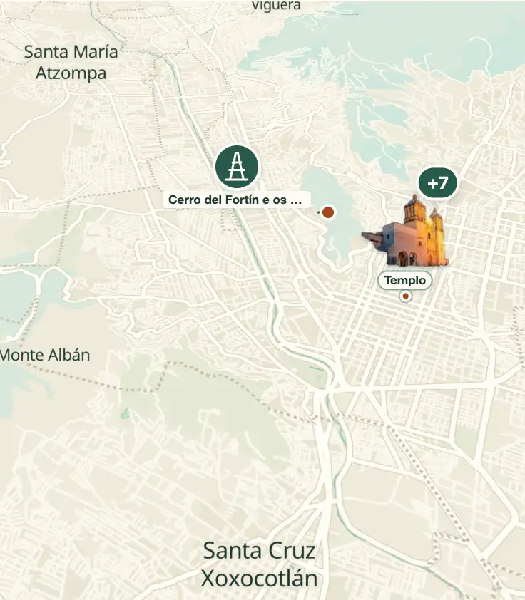
Explore the map
© OpenStreetMap · OpenFreeMap · © OpenMapTiles
- Church and Former Convent of Santo Domingo de Guzmán
- Museo de las Culturas de Oaxaca
- Mercado Benito Juárez and Mercado 20 de Noviembre
- Monte Albán
- Jardín Etnobotánico de Oaxaca
- Zócalo, Alameda de León, and Cathedral
- Basílica de Nuestra Señora de la Soledad
- Francisco Toledo's institutions
- Andador Macedonio Alcalá and Teatro Macedonio Alcalá
Explore the map, read about the other places and plan your travel days in the app.
Open the appWhat to see
Oaxaca sits where three valleys meet, between two mountain ranges
Oaxaca sits at 1,555 m, at the point where the three arms of the Valles Centrales meet: Etla, to the northwest, Tlacolula, to the east, and Zimatlán-Ocotlán, to the south. The center, laid out in 1529, is a flat grid crossed on foot in twenty minutes, and to its east the Calzada de la República, wide and straight over the old channeled Jalatlaco creek, separates the regular blocks from the Jalatlaco neighborhood, with its crooked stone streets.

Church and Former Convent of Santo Domingo de Guzmán
Dominican complex built between 1575 and 1608, with a green cantera façade between two low towers. The interior is entirely covered in gilded plaster, and above the choir loft is the Guzmán family tree, with relief figures rising from a trunk that grows out of a reclining man's chest. The convent became an army barracks in 1866, after the Reform Laws, and was restored through the 1990s.
Between 1575 and 1608 the Dominicans built the complex with green cantera stone outside, its interior covered in gilded stucco, and the trunk of the Guzmán family tree grows out of the chest of a reclining man, while the convent, which became a barracks in 1866, was restored in the 1990s.
Check access
Museo de las Culturas de Oaxaca
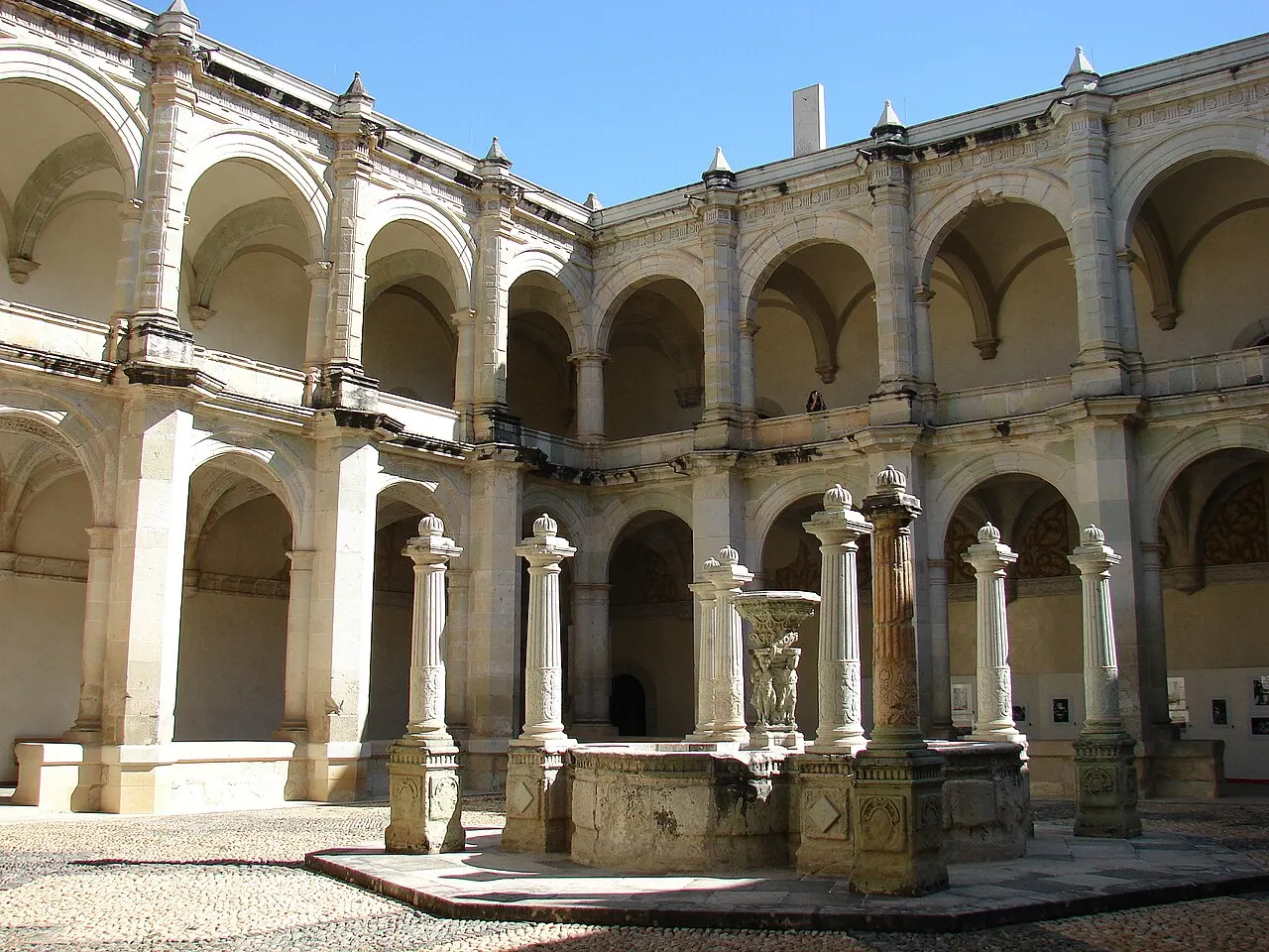
It has occupied the convent's cloister since 1998, in fourteen rooms that trace the valley from the pre-ceramic period through the 20th century. The centerpiece is the collection from Monte Albán's Tomb 7: more than 400 objects of lost-wax gold, jade, turquoise, rock crystal, and carved bone, deposited by Mixtecs and excavated by Alfonso Caso in January 1932. Closed Mondays.
In fourteen rooms the cloister traces the valley from the pre-ceramic period to the 20th century, and the centerpiece is the gold, jade and carved bone left by the Mixtecs.
Check access
Mercado Benito Juárez and Mercado 20 de Noviembre
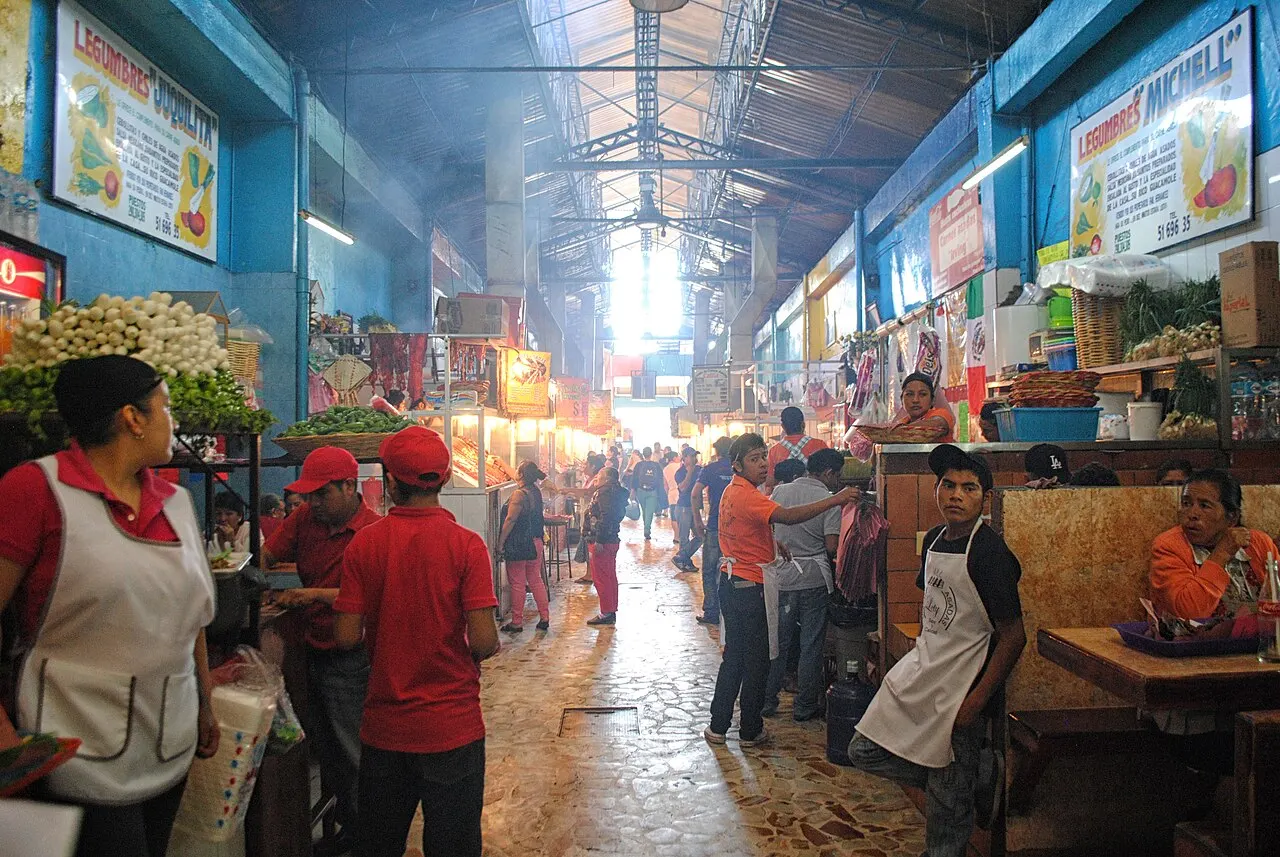
Two covered blocks one block from the Zócalo. At Benito Juárez you buy quesillo, chapulines, ground chocolate, herbs, knives, and mezcal by weight. At 20 de Noviembre is the pasillo de humo, a corridor of charcoal grills where you pick raw meat at a stall, hand it to the grill, and sit at a shared table. It's the cheapest and most Oaxacan meal downtown.
At the Benito Juárez, one block from the square, there's quesillo, chapulines and mezcal by the liter, and next door the raw meat goes to the grill cook in the smoke aisle before the communal table.
Check access

Monte Albán
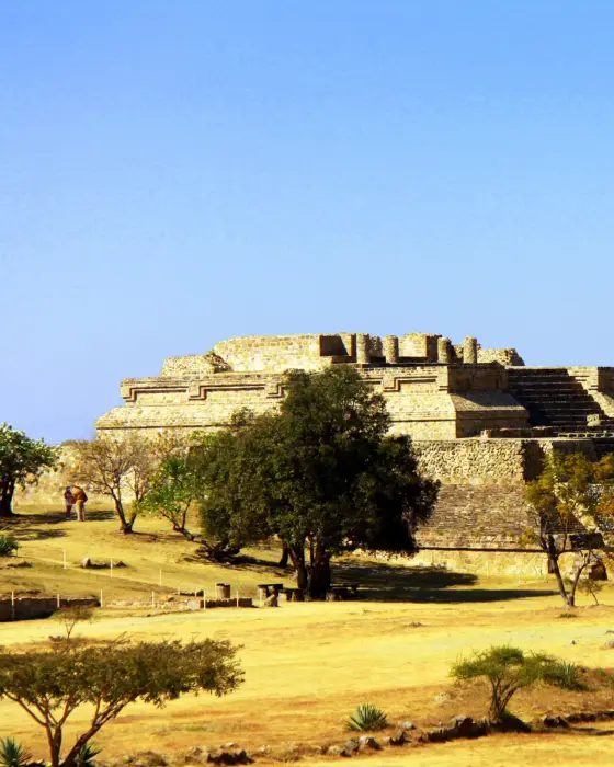
Zapotec capital founded around 500 BC atop a ridge leveled by hand, 400 m above the valley, 10 km west of the city. The Gran Plaza measures about 300 by 200 m; the Building of the Danzantes holds more than 300 slabs carved with human figures from the earliest period, and Building J, arrow-shaped, is rotated relative to everything else for astronomical alignment. In 2026 admission costs 210 MXN for foreigners and 105 MXN for Mexicans, 8am to 5pm, last entry at 4pm.
The Zapotec capital on the flattened mountaintop has a huge plaza, slabs with human figures from the early period, and an arrowhead-shaped block turned to face the sky.
Check access
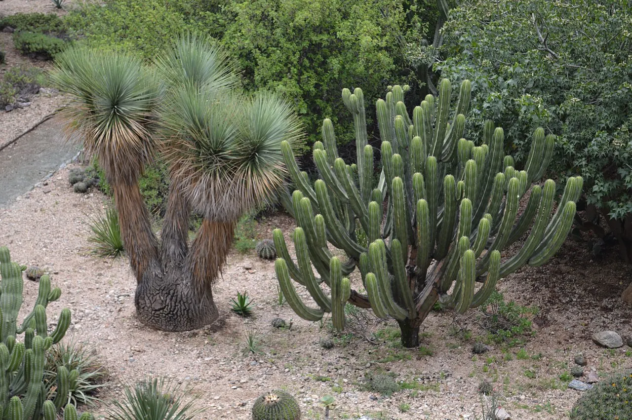
Jardín Etnobotánico de Oaxaca
2.3 hectares in the convent's old orchard, opened in 1998 on the initiative of Francisco Toledo and biologist Alejandro de Ávila, after the land narrowly escaped becoming a hotel and parking lot. Entry is only by guided tour with a scheduled time; the plants are all native to the state, arranged by region and by use: dye, food, fiber, construction, ritual.
The old orchard became a garden with only species from the state, arranged by region and by use, from dye to ritual, and entry requires a booked time.
Check access
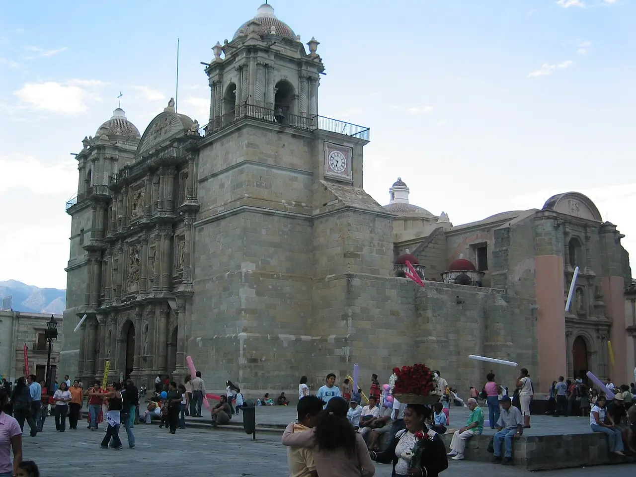
Zócalo, Alameda de León, and Cathedral
The central square is closed to cars, shaded by Indian laurels, and occupied all day by bands, balloon vendors, and café tables. The cathedral of Nuestra Señora de la Asunción was begun in 1535 and rebuilt several times because of earthquakes; the current structure dates from 1702, with a baroque green cantera façade and deliberately low towers.
The square, closed to traffic, sits all day under the laurel trees, with a band, a balloon seller and café tables, and the main church was rebuilt because of earthquakes, with towers kept deliberately low.
Check access

Basílica de Nuestra Señora de la Soledad
Built between 1682 and 1690 over the hermitage where, according to tradition, a mule appeared carrying the image of the state's patron saint. The screen-shaped façade, packed with niches, is one of the most elaborate in colonial Mexico.
The basilica of the state's patron saint has a screen-shaped façade packed with niches, and according to tradition a mule appeared carrying the image.
Check access
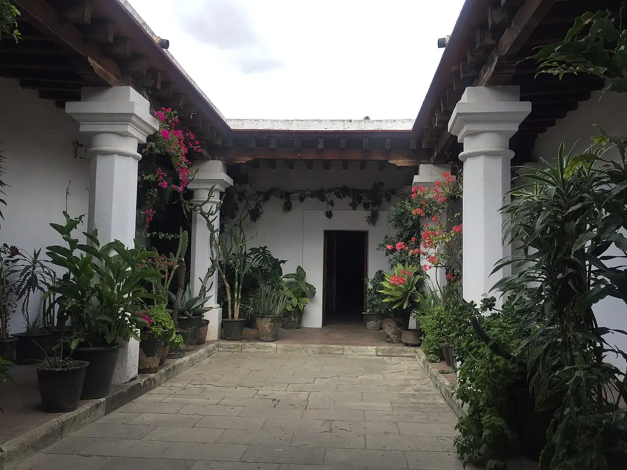
Francisco Toledo's institutions
Francisco Toledo, a painter born in Juchitán (1940–2019), set up and funded a network that is still running: IAGO, a graphic arts institute with a free-access library, opened in 1988 on Alcalá itself; the Centro Fotográfico Manuel Álvarez Bravo, from 1996; and the Museo Textil de Oaxaca, from 2008, devoted to the state's textiles and dyes. Nearby, MACO has occupied the colonial house known as the Casa de Cortés since 1992, and the Museo Rufino Tamayo holds the pre-Hispanic collection the painter donated to the city in 1974.
Toledo set up and funded a network that's still running.
Check access
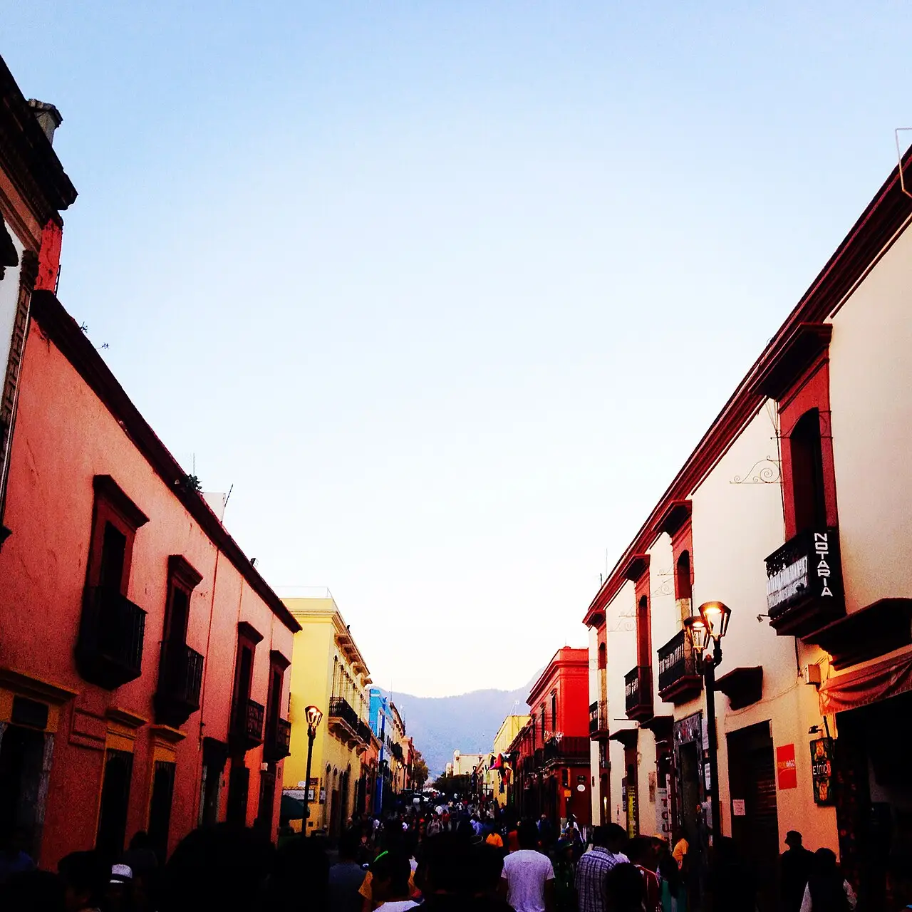
Andador Macedonio Alcalá and Teatro Macedonio Alcalá
A pedestrian street about 800 m long linking the Zócalo to Santo Domingo, with 18th-century mansions converted into galleries and shops. It's named after the composer of the waltz “Dios nunca muere” (1868), the state's unofficial anthem. The theater, opened in 1909, has a marble staircase, a Louis XV-style hall, and a painted dome, and keeps a regular schedule of performances.
It's about 800 m of 18th-century mansions converted into shops and galleries, and twenty minutes are enough to walk its length. Use the pedestrian street as a route between Santo Domingo and the Zócalo, and at night come back just for the mezcalerías.
Check access
Nilo’s itinerary
Start with the basic programme and choose extensions for the time you have.
Plan my days in the app ↗Day 1 · The green cantera center
Start at Santo Domingo at 10am, when the Museo de las Culturas opens: it's closed Mondays. Set aside two hours: the gilded church, the Guzmán family tree above the choir loft, and the fourteen rooms with the Tomb 7 collection.
Enter the Jardín Etnobotánico next door on the guided tour. It's the only way in, and the time slot is booked the same day or the day before.
Have lunch at the pasillo de humo of Mercado 20 de Noviembre: buy tasajo and cecina by weight at a stall, hand it to the grill, and sit at the shared table.
In the afternoon, go down the Alcalá walkway, stopping at the IAGO and the Museo Textil, and step into the 1909 Teatro Macedonio Alcalá if there's an open visit.
Finish at the Zócalo in the late afternoon, with a band playing, then at a mezcalería downtown to taste an espadín next to a wild agave.
Day 2 · Monte Albán and the neighborhoods
Take a van or taxi to Monte Albán right at opening, 8am: 10 km, about 25 minutes, admission 210 MXN for foreigners in 2026.
Walk the Gran Plaza end to end, the Building of the Danzantes, the rotated Building J, and the ballcourt, then climb to the Plataforma Norte to see all three arms of the valley at once.
Come back at midday and have lunch in Jalatlaco, across the Calzada de la República; walk the cobbled streets and step into the San Matías church.
Walk on to Xochimilco to see the arches of the San Felipe aqueduct and the houses fitted into the arches of Callejón del Agua.
Climb Cerro del Fortín by the staircase in the late afternoon, for the whole valley against the sunset, and come down before dark.
Day 3 · Market, chocolate, and mezcal
Start early at the Central de Abastos, preferably on a Saturday, the big day: sections for dye, herbs, clay, basketry, flowers, and broth kitchens.
Have tejate at a market stall (eat the foam first, with your hand) then a chocolate de agua with pan de yema.
Stop by a mill on Mina street to watch cacao being ground with sugar, almond, and cinnamon in the ratio you choose.
In the afternoon, visit a mezcal palenque in the Tlacolula valley or a printmaking workshop downtown; in both, the process is the visit.
Finish with nieves at the Jardín Sócrates, next to the Basílica de la Soledad, and a tlayuda after 8pm from a street stall.

Food
 AI illustration
Tlayuda
A 30–40 cm corn tortilla dried slowly on the comal until it stiffens, spread with asiento, the pork fat drippings from the bottom of the pot, mashed black beans, shredded quesillo, cabbage, tomato, and a meat, usually tasajo, cecina, or chorizo. Eaten folded in half, and at night: the stalls open after 8pm and run until the small hours. 80–150 MXN.
 AI illustration
Mole negro and the seven moles
Oaxaca presents itself as the land of seven moles: negro, coloradito, rojo, amarillo, verde, chichilo, and manchamanteles. Negro carries more than twenty ingredients, among them chilhuacle negro, mulato, and pasilla peppers charred to near-carbon, chocolate, plantain, almond, and pumpkin seed, and is served with turkey or chicken at parties and on Sundays. Verde is fresh, with pork, white beans, and herbs; amarillo goes inside empanadas.
 AI illustration
Tasajo and cecina in the pasillo de humo
Tasajo is a thin cut of top round, salted and air-dried; cecina enchilada is loin coated in guajillo chile paste. In the grill corridor of Mercado 20 de Noviembre you buy the meat by weight at a stall, hand it to the grill, and sit down; scallions, nopal, and chiles de agua go on the coals too, and tortillas, salsa, and lime come to the table. 120–220 MXN per person.
 AI illustration
Memelas, tetelas, and amarillo empanadas
The market breakfast. A memela is a thick tortilla with a pinched rim, topped with asiento, beans, and quesillo. A tetela is triangular, with the beans folded into the dough. An amarillo empanada is a large tortilla folded over amarillo mole with chicken and toasted on the comal until it cracks. 25–60 MXN each.
 AI illustration
Quesillo and chapulines
Quesillo and chapulines are sold by weight at the stalls of Mercado Benito Juárez. Quesillo is a stretched-curd cheese wound into a ball, originally from Reyes Etla, that pulls apart into strings and goes into tlayudas and quesadillas, or is eaten plain alongside mezcal. Chapulines are grasshoppers toasted with garlic, lime and chile, sold in three sizes, and the smallest are the most expensive and the crunchiest.
 AI illustration
Tejate
A cold pre-Hispanic drink of corn cooked with ash, cacao, toasted mamey seed (pixtle), and the rosita de cacao flower. The mixture is beaten by hand in a clay bowl until a white foam rises to the surface, eaten first, with your hand. Served in a jícara, half a painted gourd with no base, which won't stand on a table. 25–50 MXN; the benchmark version is the one from San Andrés Huayápam.
 AI illustration
Mezcal
Agave distillate roasted in a stone pit underground, which is where the smoky taste comes from. Espadín, cultivated, is behind most mezcals; tobalá, tepeztate, and madrecuishe are wild agaves, taking 10 to 25 years to mature and costing considerably more. A shot runs 60 to 150 MXN at a bar downtown; a bottle bought straight from a palenque in the Tlacolula valley costs much less.
 AI illustration
Chocolate de agua, pan de yema, and nieves
Oaxacan chocolate is drunk with water, not milk, whipped with a molinillo until it foams, and comes with pan de yema for dipping. It's bought freshly ground at the mills on Mina street, where you choose the ratio of cacao, sugar, almond, and cinnamon and take the paste home still warm. For the heat, the nieves of the Jardín Sócrates: leche quemada, tuna, elote, beso oaxaqueño.
Day trips
The Tlacolula route
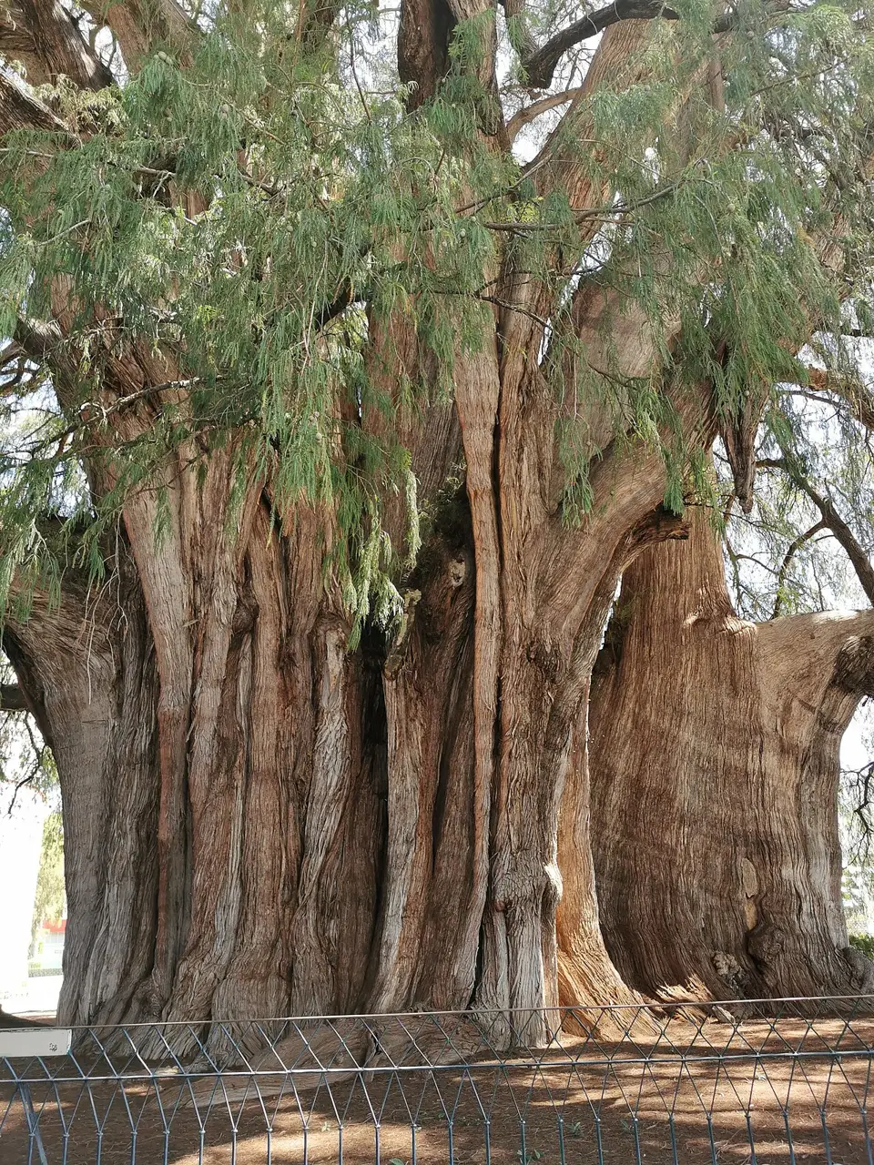
From 10 to 70 km east, a full day by car or on a tour. It brings together the Árbol del Tule, an ahuehuete about 42 m in circumference and over two thousand years old; Teotitlán del Valle, the village of hand-woven wool rugs; the Mitla archaeological site, with panels of stone fretwork fitted without mortar and a 1590 church built on top; and Hierve el Agua, petrified carbonate waterfalls 70 km out: access has been closed before over a dispute between communities, so check on the day. Sunday is Tlacolula's market day.
The southern route: black clay and alebrijes
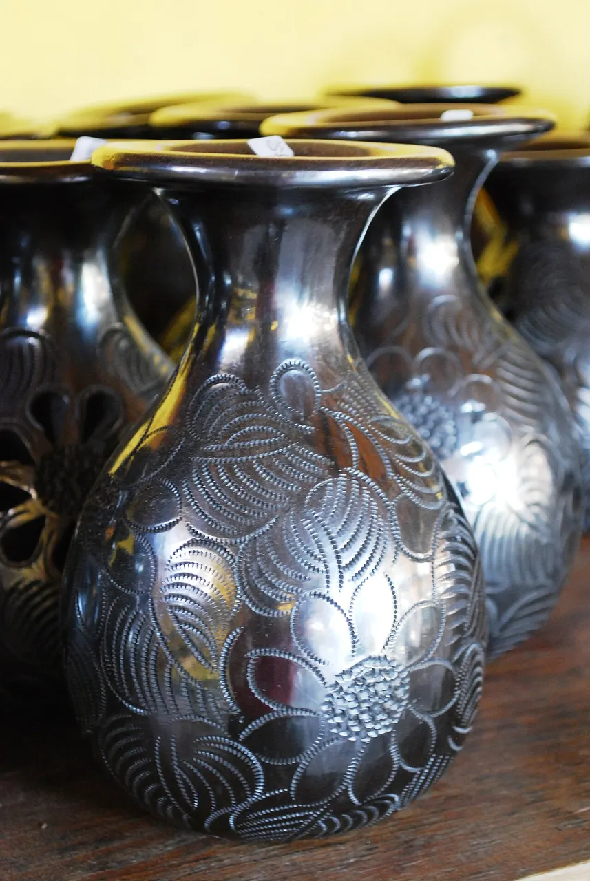
From 12 to 30 km south, half a day. San Bartolo Coyotepec makes black clay burnished with quartz, a technique developed by Doña Rosa in the 1950s; San Martín Tilcajete carves and paints copal-wood alebrijes; Santo Tomás Jalieza weaves on a backstrap loom; and Ocotlán has its Friday market and the convent restored with money from Rodolfo Morales's painting. Vans leave from the Central de Abastos for 20–40 MXN a leg.
Sierra Norte and the Pueblos Mancomunados
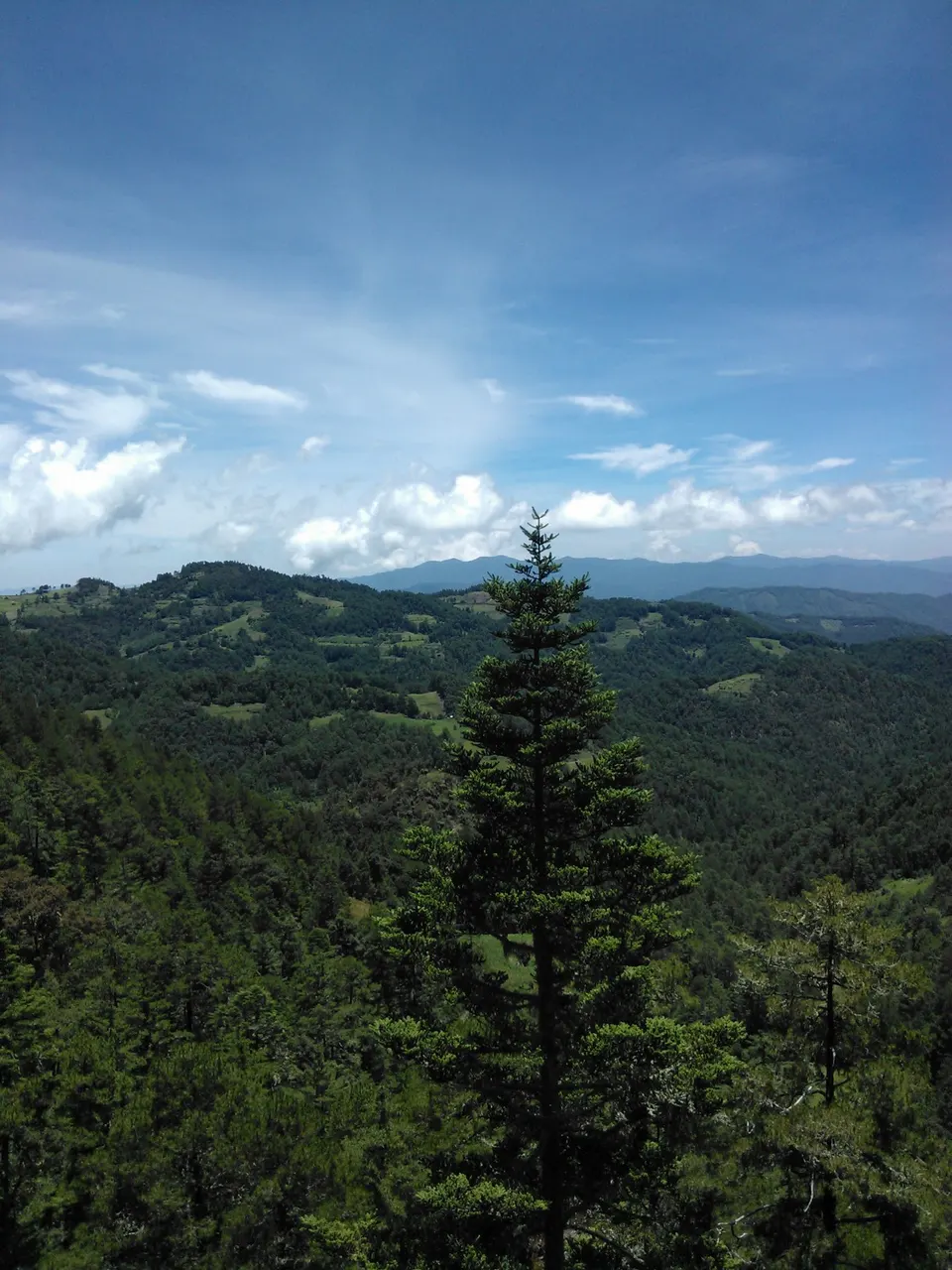
About 60 km north, 2 to 3 hours on a mountain road, climbing from 1,555 m to over 3,000 m. Eight Zapotec villages jointly run a network of trails, cabins, and guides (Cuajimoloyas, Benito Juárez, Latuvi, Amatlán) with pine forest and fog, temperatures near 5 °C at night, and bookings made directly with the communities. Worth an overnight, and bring warm clothes.
Where to begin
The green cantera center
Start at Santo Domingo at 10am, when the Museo de las Culturas opens: it's closed Mondays. Set aside two hours: the gilded church, the Guzmán family tree above the choir loft, and the fourteen rooms with the Tomb 7 collection.
Monte Albán and the neighborhoods
Take a van or taxi to Monte Albán right at opening, 8am: 10 km, about 25 minutes, admission 210 MXN for foreigners in 2026.
Market, chocolate, and mezcal
Start early at the Central de Abastos, preferably on a Saturday, the big day: sections for dye, herbs, clay, basketry, flowers, and broth kitchens.
Money
The currency is the Mexican peso (MXN, $). Contactless cards are accepted in restaurants, hotels and shops downtown, but markets, tlayuda stands, shared vans, taxis and valley artisans run on cash. Always carry 50, 100 and 200 notes, because at the stalls and in the vans hardly anyone has change for a 500, and the line waits while the vendor looks for it. Withdraw from bank ATMs (BBVA, Banorte, Santander, HSBC), not from the independent machines on the tourist streets, and decline the conversion into your own currency offered on screen: being charged in pesos is always cheaper. 2026 price ranges: espresso 45–70 MXN; set lunch (comida corrida) at a neighborhood kitchen 90–150 MXN; tlayuda 80–150 MXN; a plate of mole at a mid-range restaurant 180–320 MXN; dinner for two with mezcal 700–1,400 MXN; a shot of mezcal 60–150 MXN; hostel bed 300–500 MXN; basic hotel 1,200–2,200 MXN a night, rising 50% to 100% in July, over Día de Muertos and at year's end. Tip 10% to 15% at restaurants with table service, in cash; check whether the bill already includes a “propina sugerida” so you don't pay twice. There is no municipal tourist tax, but the state charges a 3% lodging tax built into the room rate, and the federal non-resident fee is included in your plane ticket. Before buying your flight, sort out the visa: Brazilians have needed one to enter Mexico since 2022, when the free electronic authorization ended. Since February 5, 2026, those arriving by air for tourism can get the electronic visa online, on the Mexican foreign ministry's website (visaelectronica.sre.gob.mx), without going to a consulate, for US$10 and for a single entry; anyone entering by land or sea still needs a consular visa. Holders of a valid visa from the US, Canada, Japan, the United Kingdom or the Schengen area are exempt. On arrival, the digital stamp that replaced the paper FMM form at most airports shows the number of days granted, which is often fewer than 180: check it on the spot.
Getting there and around
From the airport and bus stations to the center
The Aeropuerto Internacional de Oaxaca Xoxocotlán (OAX) is 8 km south of the Zócalo, 20 to 30 minutes by car. Options, with 2026 prices: authorized taxi bought at the terminal counter, 200–300 MXN; shared van sold at the same counter, about 100 MXN for zone 1 and 160 MXN for zone 2 per person; and BinniBus route RC-11, which passes the airport access from 6am to 10pm for 8 MXN. Uber and DiDi work in the city, but pickups inside the airport clash with the taxi union: many people arrange pickup on the road out front instead. By land, the first-class terminal (ADO) is on Calzada Niños Héroes de Chapultepec, north of downtown, with Mexico City about 6 hours 30 minutes away and Puebla 4 hours 30 minutes. The second-class terminal, next to the Central de Abastos, serves the valley villages. Puerto Escondido is now about 3 hours by car on the Barranca Larga–Ventanilla highway, opened in February 2024.
Walking downtown, buses, taxis and vans to the valley
Within the city, almost everything is done on foot: from the Zócalo to Santo Domingo it's 800 m on the flat along the Alcalá pedestrian street, and the whole historic center fits in a rectangle of 1.5 by 1 km. Public transportation means city buses, with a fare of 10 MXN on conventional lines and 8 MXN on BinniBus, the new corridor system (4 MXN at the reduced fare). You pay in cash or with the system's card, and the lines mainly serve neighborhoods outside the center, not the tourist core. Taxis have no meters: the authorized fare in 2026 runs from 40 to 100 MXN per ride within the city, and you agree on the price through the window before getting in, so there's no argument on arrival. For the valley, vans and shared taxis with fixed destinations leave from around the Central de Abastos and El Baratillo (Tlacolula, Mitla, Teotitlán, Zaachila), charging 20 to 60 MXN per leg, with no set schedule: they leave when they fill up. Cycling works in the flat center, but the stone paving, the speed bumps and the lack of a continuous bike lane are discouraging. Narrow sidewalks and high curbs make the city hard going for wheelchairs and strollers.
Safety
Oaxaca de Juárez is among the calmest state capitals in Mexico for walking, and the historic center is safe on foot until late. The state's violence is concentrated in other regions, mainly the Isthmus, the Coast and corridors of the Mixteca, not in this valley. Here the risks are small and predictable: pickpockets in the crush of the markets, especially at the Central de Abastos and Benito Juárez on busy days and during calendas and parades; the taxi that charges triple to anyone who didn't ask the price first; and mezcal, which at 1,555 m knocks down more visitors than any crime. At night, avoid the area around the Central de Abastos, the second-class bus terminal and the ring road, and after 11pm take a taxi or rideshare back if you're outside the central grid. Marches and blockades by teachers and community organizations can close the Zócalo or the airport road without warning, so check local social media on the day of your flight and leave with time to spare. Don't drink tap water; the ice and water at restaurants downtown come from large jugs and cause no trouble. The city lies in an active seismic zone: find the evacuation route posted in your hotel before you unpack and save the emergency number, 911.
Etiquette tips
Say “provecho”
When passing a table of people eating, or getting up from a shared market table, say “provecho”. The reply is “gracias”. Leaving the pasillo de humo without a word is the equivalent of closing the door in someone's face.
Mezcal is drunk slowly
It comes in a small clay cup and is drunk in small sips, smelled first, with orange and worm salt on the side. Never all at once, never with ice, never with lime and salt on your hand. Ordering “a shot” or mixing it with soda marks the whole table. The local toast is “stigibeu”, answered by raising your glass.
Don't haggle over crafts
A rug from Teotitlán dyed with cochineal takes weeks on the loom, and the price is already the price. Instead of trying to bring it down, ask about the dye, the design, and who wove it; that's the conversation that opens a discount, when it opens one. Bargaining is for street trinkets, not workshop pieces.
Ask before you photograph
Vendors, weavers and above all families in the panteones on Día de Muertos are people, not scenery. Ask, accept a no and don't photograph religious ceremonies in villages: several valley villages ban cameras at their patron saint festivals, and the notice is posted at the entrance.
Guelaguetza: the reciprocal exchange system behind the July festival
The word guelaguetza names a custom of giving and giving back: whoever receives turkeys, beer or hours of work at a wedding writes down what they received and returns it on the next occasion. So treating the festival as “folklore” or asking how much it costs to take part misses the point, because what it celebrates is that mutual obligation between families and villages.
Marches and encampments are routine on the Zócalo
Sección 22 and community organizations keep frequent marches and encampments on the Zócalo. Don't force your way through, don't film the front line, and reroute: from the outside, this is managed routine, not confrontation.
Mistakes to avoid
Monte Albán in the middle of the afternoon
Leaving Monte Albán until after lunch. On the flattened summit there's no shade at all, and an early-afternoon visit happens under the day's strongest sun; go in the morning and be back in town for lunch.
High season without a reservation
Arriving in July, late October, or between Christmas and New Year's without a booking. In those three windows lodging doubles in price and sells out months ahead, and the line for Guelaguetza's free gallery starts before dawn.
Taking mezcal as a shot
Treating mezcal like a tequila shot. It's stronger than it seems, is drunk neat and slowly, and the 1,555 m altitude speeds up its effect. A tasting of five varieties at a mezcalería on the pedestrian street takes one to two hours, so save it for the end of the day, after the sightseeing.
Ask through the window before opening the door
Getting into a taxi without agreeing on the price. There's no meter in the city; ask the fare through the window before opening the door, and have change ready. At the airport, buy at the terminal counter, not from someone who approaches you outside.
Smooth shoes on uneven cobblestone
Walking in smooth-soled shoes with no water. The center has uneven cobblestone with high steps, the sun at 1,555 m burns even at 25 °C, and tap water isn't drinkable. Carry a reusable bottle and use the refill jugs at hotels and cafés.
Useful phrases
Padiuxi
Hello, in Valley Zapotec (pa-DIU-chi): comes from the Spanish “por Dios” and works both as a greeting and a farewell
Provecho
Enjoy your meal: said when passing someone eating, or when leaving a shared table; the reply is “gracias”
Un mezcal derecho, por favor
A straight mezcal, please: “derecho” is how you order it with no ice, no juice, and no salt rim
¿De qué es el mole?
What kind of mole is it? A required question, since there are seven and the price and intensity change with each
¿Me lo da para llevar?
Can I get that to go? The formula for markets and budget kitchens
Mande
Sorry? Used instead of “¿qué?” when you didn't hear someone; saying just “¿qué?” sounds curt
Districts
Centro Histórico
The 1529 grid around the Zócalo, with the Palacio de Gobierno, the cathedral, the two covered markets, and most of the hotels. It's flat, crossed on foot in twenty minutes, and holds the city's highest prices.
Santo Domingo and the Alcalá walkway
The center's north strip, linked to the Zócalo by 800 m of pedestrian street. It brings together the convent, the museum, the ethnobotanical garden, galleries, filigree jewelers, and mezcal tasting bars; it's the area most transformed by tourism in the last decade.
Jalatlaco
A former dyers' neighborhood to the east, across the Calzada de la República, with cobbled streets, colorful houses, murals, and the 18th-century San Matías church. It has become the neighborhood of cafés and small lodging, without losing its tenement courtyards and corner bakery.
Xochimilco
The city's oldest neighborhood, to the north, home to the 18th-century arches of the San Felipe aqueduct, with houses built into the arches along Callejón del Agua. A neighborhood of weavers and workshops; it climbs uphill, and from there begins the path up to Cerro del Fortín.
Colonia Reforma
A residential neighborhood opened to the north starting in the 1940s, with wide streets and houses with gardens. It's where the city's middle class lives and where much of the neighborhood restaurants, clinics, and supermarkets are; it's a 20-minute walk from downtown.
La Merced
Blocks northeast of the Zócalo around the market of the same name, with a Carmelite church and street commerce. It serves as a benchmark for what a resident pays: budget kitchens, stationery shops, butchers, and no souvenir window.
Trinidad de las Huertas and the Central de Abastos
A strip to the southwest, around the largest market in southern Mexico and the second-class bus terminal. It's busy, functional, and the spot where you hear the most Zapotec and Mixtec in the city.
San Felipe del Agua
At the foot of the Sierra Norte, about 6 km north of the Zócalo and roughly 150 m higher up. A cooler residential area, with springs, the Benito Juárez national park, and trails climbing into the mountains; it depends on a car or bus.
History
c. 500 BC · Monte Albán is founded
The Zapotecs level the top of a ridge by hand, 400 m above the valley floor, at a neutral point among the three arms of the Valles Centrales. The so-called Danzantes slabs, more than 300 of them, date from this early period.
300–800 AD · Peak and abandonment
The city reaches 17–25 thousand residents around AD 500 and dominates the valley with its own writing and a 260-day calendar. Around 800 it stops being a capital, with no visible destruction, and the population scatters across dozens of smaller villages.
14th–15th c. · Mixtecs and valley lordships
Mixtec groups descend from the Mixteca Alta and reuse the Zapotec tombs of Monte Albán as burial vaults for their nobles. Political power fragments among Zaachila, Mitla, Cuilapan, and Tlacolula.
1486 · The Aztec garrison
Ahuítzotl installs Huaxyácac at the foot of what is now Cerro del Fortín to control the route to Soconusco. The name comes from huaje, the valley's pod tree, and becomes Oaxaca in the Spaniards' pronunciation.
1521–1532 · Spanish Antequera
Francisco de Orozco arrives in 1521; Alonso García Bravo lays out the grid in 1529, the same year Carlos V grants the town charter. In 1532 the settlement receives the title of city, under the name Antequera.
1575–1608 · Santo Domingo
The Dominicans, present since 1529, build the church-and-convent complex that organizes the city's north side. The interior is covered in gilded plaster and the façade uses the green cantera stone from nearby quarries.
18th c. · The cochineal cycle
The red dye extracted from cochineal raised on nopal cactus pads becomes New Spain's second export product, behind only silver, and Europe dyes uniforms and tapestries with it. Dye money paid for many of the mansions downtown; the cycle collapses with synthetic aniline dyes after 1850.
1806 and 1830 · Juárez and Díaz
Benito Juárez is born in San Pablo Guelatao, in the Sierra Norte, in 1806, and arrives in Oaxaca at age 12 not speaking Spanish; Porfirio Díaz is born in the city itself in 1830. Both presidents came out of the same seminary and the same Instituto de Ciencias y Artes, and the city is renamed Oaxaca de Juárez in 1872.

1931 · The January 14 earthquake
A quake of magnitude close to 7.8 brings down or ruins most of the houses and badly damages churches and the Palacio de Gobierno. The rebuilding cements the center's low, one- or two-story profile, which the city keeps to this day.
1932 · Tomb 7
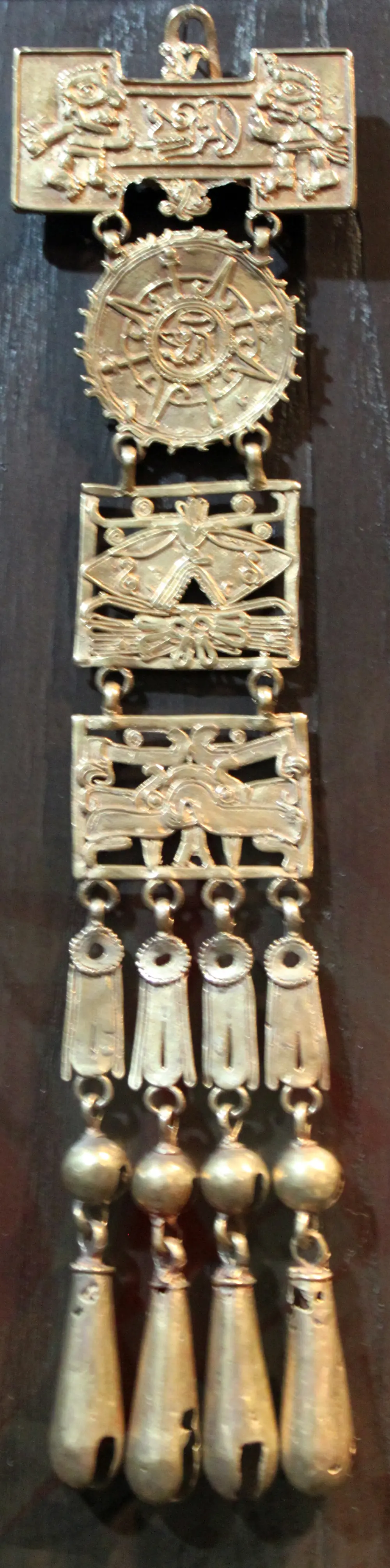
Alfonso Caso opens a chamber reused by Mixtecs at Monte Albán in January and finds more than 400 pieces of gold, jade, turquoise, rock crystal, and carved bone. The find comes to be displayed in Oaxaca and anchors the museum installed in the Santo Domingo convent.
1987 and 2006 · Heritage and uprising
UNESCO inscribes the historic center and Monte Albán as a single site in 1987, which freezes building heights and façades. In 2006, a teachers' strike turns into a five-month occupation of the city by the APPO, with barricades, seized radio stations, and deaths, until the Federal Police move in in November.
 AI illustration
Complete history
Monte Albán and the Zapotecs, 500 BC to AD 800
Everything in Oaxaca starts with geography: three fertile valleys meet at a single point and, around 500 BC, the Zapotecs chose as their capital the flattened top of a ridge equidistant from the three arms, not the valley floor. Monte Albán worked for more than a thousand years as a political, religious and writing center (Zapotec glyphs are among the oldest in the Americas) and reached 17–25 thousand residents around AD 500. Its abandonment, around 800, shows no signs of war: the population dispersed into dozens of smaller lordships, and it was that fragmentation the Mixtecs found when they came down from the Mixteca Alta from the 14th century on, reusing the old tombs to bury their own nobility. When Ahuítzotl set up the Aztec garrison of Huaxyácac in 1486, the valley already had two thousand years of cities.
The Spanish arrive in 1521
The Spanish arrive in 1521, and in 1529 Alonso García Bravo, the same man who laid out Mexico City and Veracruz, traces the grid of the Villa de Antequera around a central square. In 1532 comes the title of city and in 1535 the diocese. The Dominicans, who take charge of evangelizing the valley, build the Santo Domingo complex between 1575 and 1608, along with a chain of fortress-convents in the Mixteca (Yanhuitlán, Coixtlahuaca, Teposcolula) whose scale has nothing to do with the population they served and everything to do with the competition for souls and labor. The stone used in nearly everything is the green cantera from nearby quarries, and it's what gives the center its color that shifts with the hour.
18th century: the red dye from the nopal
In the 18th century, Oaxaca's wealth came from a red dye. Grana cochinilla, an insect raised on the nopal pads of the valley, produced the most intense dye known in Europe and became New Spain's second-largest export, behind only silver. Two-courtyard mansions, gilded altarpieces and the Palacio de Gobierno came out of that money. When synthetic aniline dyes reached the market after 1850, the boom collapsed within a few decades and the region went back to subsistence farming and migration, an impoverishment that still explains the state's social indicators. Cochineal survived as a craft dye, and it's what gives the rugs of Teotitlán del Valle their red.
Juárez and Díaz: two presidents born nearby
The 19th century produced Mexico's two most consequential presidents within a sixty-kilometer radius: Benito Juárez, a Zapotec born in Guelatao in 1806, who reached the city at age 12 not speaking Spanish, and Porfirio Díaz, born in Oaxaca itself in 1830. The Reform Laws, championed by Juárez, stripped the convents from the Church: Santo Domingo became an army barracks in 1866 and stayed that way for over a century. The 20th century was marked by the earthquake of January 14, 1931, which brought down much of the housing stock and fixed the center's low profile; by Alfonso Caso's opening of Tomb 7 in 1932, which gave the city its museum; and by the arrival of the paved road and tourism starting in the 1950s.
UNESCO listing (1987) and Toledo's institute change Oaxaca
Today's Oaxaca took shape in three recent movements. The UNESCO listing in 1987 froze the height, color and facades of the center. From 1988, the painter Francisco Toledo created a network of institutions (a graphic arts institute, a photography center, a textile museum and an ethnobotanical garden in the convent's old orchard) that gave the city a cultural life independent of tourism and a tradition of resistance that kept a McDonald's out of the Zócalo in 2002. The 2006 conflict, when a teachers' strike turned into the APPO's five-month occupation of the city, left visible marks: Sección 22 marches are still on the calendar, and the screen-printed political poster became a local language. Since 2010, mezcal and regional cooking have driven a tourism boom that doubled rents downtown and emptied entire blocks of residents, now the city's main urban policy issue, and the new highway to Puerto Escondido, opened in February 2024, cut the trip to the coast from six hours to about three and sped everything up.
The red of the rugs of Teotitlán del Valle comes from cochineal, the nopal insect that in the 18th century was New Spain's second-largest export, behind only silver.
Geography and shape of the city
Oaxaca sits where three valleys meet, between two mountain ranges
The city sits at an altitude of 1,555 m, at the meeting point of the three arms of the Valles Centrales: Etla, to the northwest; Tlacolula, to the east; and Zimatlán-Ocotlán, to the south. The Atoyac river runs along the west side and takes in the Salado and the old Jalatlaco creek, channeled beneath the Calzada de la República, which is why that avenue is wide and straight in the middle of a neighborhood of crooked streets. Around it rise the Sierra Norte, which climbs past 3,200 m less than 50 km from the center, and the Sierra Madre del Sur, which separates the valley from the Pacific and explains why the coast has always been far.
High-altitude climate and the cantera grid
The climate is temperate dry, at altitude: rain concentrated between May and October, almost always in the late afternoon, and dry from November to April, with cold nights year-round because of the altitude. The grid was laid out by Alonso García Bravo in 1529, in regular blocks of about 100 varas around a central square, and the material is green cantera stone from the Ixtlahuaca and Etla quarries, a greenish rhyolite that darkens with rain.
Earthquakes keep buildings low; the city grows across the valley
Buildings are low by seismic necessity: the city sits over the subduction zone of the Cocos plate, one of the most active in the Americas, and the January 14, 1931 earthquake brought down whatever stood tall. Modern growth spread out from the colonial grid into the valley floor: Colonia Reforma to the north from the 1940s on, the Central de Abastos and the ring road to the south and west, and Cerro del Fortín, to the west, remained the only high ground inside the city.
Culture
Visual arts out of proportion to its size
Oaxaca produces visual art on a scale disproportionate to its size. Rufino Tamayo was born here in 1899 and donated to the city in 1974 the pre-Hispanic collection that bears his name; Rodolfo Morales, from Ocotlán, funded with his own painting the restoration of his hometown's convent; and Francisco Toledo (1940–2019), from Juchitán, turned his art earnings into institutions: the IAGO in 1988, the Centro Fotográfico Manuel Álvarez Bravo in 1996, the Jardín Etnobotánico in 1998, the Museo Textil in 2008, and the San Agustín Etla arts center in 2006. Toledo also used his prestige politically: he blocked a McDonald's set to open on the Zócalo in 2002 and campaigned against genetically modified corn. Printmaking is the city's lingua franca: dozens of screen-print, lithography, and linocut workshops operate downtown, many descended from the ASARO collective, born on the barricades of 2006, and the political poster pasted on a wall is a local genre.
Village brass bands from the Sierra set the musical tone
In music, the backbone is the brass band of the Sierra communities: every village keeps its own, and it plays at parties, funerals, and the calenda that runs through the street behind giant wicker figures. The waltz “Dios nunca muere”, written by Macedonio Alcalá in 1868, works as the state anthem. Lila Downs, who sings in Spanish, Mixtec, and Zapotec, lives and records here, and the chilena from the coast and the sandunga from the Isthmus enter the repertoire of any dance. Add to that the July Guelaguetza, which brings together at the Cerro del Fortín auditorium delegations from the state's eight regions with costumes, dances, and their own products, and which, despite the stage and ticket booth, remains the only showcase where all eight regions appear together.
Usos y costumbres: how 417 of the state's 570 municipalities self-govern
Of the 570 municipalities in the state of Oaxaca, 417 govern themselves under an Indigenous normative system, known as usos y costumbres, in which public posts are unpaid service to the community and tequio is the compulsory collective labor for shared works. The same logic underpins the guelaguetza, the custom that lent its name to the show on Cerro del Fortín. Politics is also always on view downtown, because Sección 22 of the teachers' union keeps up regular marches and encampments in the Zócalo, and the memory of the 2006 conflict is still alive. After 2010, the mezcal and regional food boom brought tourism and money, and with them a tough debate over short-term rentals, the emptying of the center and the use of the valley's water.
Every village supports its own brass band, which plays at festivals, at funerals and at the calendas, the processions with wicker giants that anyone can follow down the street.
The guelaguetza is also a system of exchange: whoever brings turkeys to a wedding keeps credit for next time.
Festivals and events

Guelaguetza
On the two Mondays following July 16, the Lunes del Cerro: in 2027, July 19 and 26. Two daily performances at the Auditorio Guelaguetza, with delegations from the state's eight regions; numbered galleries sell out months in advance and the free ones require lining up before dawn. Around it come the delegation parade, the invitations, the mezcal showcase, and the mole fair.

Día de Muertos
From October 31 to November 2, with masked comparsas in San Agustín Etla and Villa de Etla, vigils in the Xoxocotlán and Atzompa cemeteries, and altars open to the public around the city. November 1 belongs to the angelitos, the children; November 2, to the adults. It's the busiest week of the year after July: book lodging three to six months ahead.

Noche de Rábanos
December 23, on the Zócalo, since 1897. Artisans carve whole scenes (nativities, markets, dragons) out of radishes grown oversized on purpose, plus categories in everlasting flower and dried corn husk. The display lasts only a few hours because the piece wilts; the line starts in the late afternoon.
 AI illustration
Semana Santa and Viernes de la Samaritana
On the Friday before Palm Sunday, houses, churches, and offices hand out free on the sidewalk cold drinks of chilacayota, horchata, and jamaica in clay cups, to anyone passing by. Semana Santa itself brings the night processions and the visit of the seven houses.

Virgen de la Soledad and the December calendas
December 18, feast day of the state's patron saint, with a procession, bands, and a fair on the Plaza de la Danza. Throughout the month, calendas cross the center: processions with wicker giants, cloth marmotas, fireworks, and a band, that anyone can join.
Books and films
Oaxaca Journal, by Oliver Sacks (2002)
An account of a botanists' expedition after ferns in the valleys and the Sierra in 2000. It's useful because in a few pages it ties together the three things that organize the region: plant diversity, corn, and the Zapotec heritage.
Un poquito de tanta verdad, by Jill Freidberg (2007)
Documentary about the five months of 2006 when a teachers' strike turned into the occupation of the city, told through the community radio stations seized by teachers and housewives. It explains the barricades, the murals, and the city's mistrust of the police.
La Sandunga, by Lila Downs (1999)
An album in Spanish, Zapotec, and Mixtec that brings the repertoire of the Isthmus and the valley into album form. Listening beforehand is genuinely useful: it's what will play at the calenda passing under your window.
Frequently asked questions
Oaxaca: How do you get from the airport to downtown?
There are three options, with 2026 prices: authorized taxi bought at the hall counter, 200 to 300 MXN; shared van sold at the same counter, about 100 MXN for zone 1 and 160 MXN for zone 2 per person; and BinniBus route RC-11, from 6am to 10pm, for 8 MXN.
Oaxaca: Where does a card work, and where is it cash only?
Contactless cards are accepted at restaurants, hotels and shops downtown, but markets, tlayuda stalls, shared vans, taxis and valley artisans run on cash.
Oaxaca: What's the climate like throughout the year?
The climate is mild year-round, at 1,555 m, with a big swing between day and night. The dry season runs from November to April, with days of 24 to 28 °C and dawns of 6 to 10 °C in December and January; April and May are the hottest, with highs of 30 to 33 °C. From May to October it rains almost every day in a late-afternoon downpour, and September is the rainiest month.
Oaxaca: What do you say when passing a table of people eating?
When passing a table of people eating, or getting up from a shared market table, say “provecho”.
Oaxaca: Is it safe to walk around the city?
Yes: Oaxaca de Juárez is among the calmest state capitals in Mexico for walking, and the historic center is safe on foot until late.
Other cities in the country
Mexico ↗- Days
- 4–5
- When
- Oct–Nov
- Per person/day
- Average 1,100–2,000 pesosMid-range · per person/day
Cost scope
Per person per day: accommodation, meals, urban transport, visits and a small allowance for extras. Flights excluded; larger purchases vary. Editorial estimate, not a quote.
- Days
- 2–3
- When
- Jan–Apr · Dec
- Per person/day
- Average 2,400 MXNMid-range · per person/day
Cost scope
Per person per day: accommodation, meals, urban transport, visits and a small allowance for extras. Flights excluded; larger purchases vary. Editorial estimate, not a quote.
- Days
- 3–4
- When
- Jan–Apr · Dec
- Per person/day
- Average 2,820 MXNMid-range · per person/day
Cost scope
Per person per day: accommodation, meals, urban transport, visits and a small allowance for extras. Flights excluded; larger purchases vary. Editorial estimate, not a quote.
- Days
- 3–4
- When
- Jan–Apr · Dec
- Per person/day
- Explore costsGuide estimate
Cost scope
Per person per day: accommodation, meals, urban transport, visits and a small allowance for extras. Flights excluded; larger purchases vary. Editorial estimate, not a quote.