Mexico
Los Cabos
Los Cabos: the granite Arch, swimming coves and the Cabo Pulmo reef at the tip of Baja California
Days Start with the basic programme and choose extensions for the time you have.
How the guide reaches this number
Those who want nightlife and everything on foot can sleep in Cabo San Lucas, accepting 132 km and about 2 hours 10 minutes of road to Cabo Pulmo. With a fourth day, I'd go to Todos Santos and Playa Los Cerritos, on the Pacific side. From December to April, the trip gains the whales and the dry weather; from August to October, the heat and the risk of cyclones call for a flexible plan.
3–4
When December to April; it is the dry, mild season, and it coincides with whale-watching season, which the federal notice opens each year from mid-December to the end of April.
How the guide reaches this number
August and September concentrate the little rain the year brings, and hurricane season runs from May 15 to November 30.
December to April; it is the dry, mild season, and it coincides with whale-watching season, which the federal notice opens each year from mid-December to the end of April. August and September concentrate the little rain the year brings, and hurricane season runs from May 15 to November 30.
Per person/day Add up lodging per night, meals per person, the Embrace It state fee and the boat trips you choose; the resorts of the Corridor and the December to April season change the total considerably.
How the guide reaches this number
Per person per day: accommodation, meals, urban transport, visits and a small allowance for extras. Flights excluded; larger purchases vary. Editorial estimate, not a quote.
 What Nilo thinks
I'd spend three days in Los Cabos, sleeping in San José del Cabo, near the airport and halfway to what matters: the first in Cabo San Lucas, with the boat to the Arch and Playa del Amor in the morning and the afternoon between El Médano and the marina; the second on the Corridor, with snorkeling at Santa María and swimming at Chileno, and the evening downtown in San José, preferably on an Art Walk Thursday; the third entirely at Cabo Pulmo, with snorkeling or diving booked with an accredited operator. Those who want nightlife and everything on foot can sleep in Cabo San Lucas, accepting 132 km and about 2 hours 10 minutes of road to Cabo Pulmo. With a fourth day, I'd go to Todos Santos and Playa Los Cerritos, on the Pacific side. From December to April, the trip gains the whales and the dry weather; from August to October, the heat and the risk of cyclones call for a flexible plan.I'd go to Los Cabos for the way the peninsula ends: a desert of cacti that runs down to two seas, separated by a granite ridge with an arch at its tip. On the strip of sand at the foot of the Arch, Playa del Amor has the calm water of the bay, and Playa del Divorcio, on the other side of the same sand, takes the Pacific waves. A few minutes by boat bring the sea lions on the rocks and, in winter, the whales offshore.
Read more
The two towns tell different stories. Cabo San Lucas grew up around a tuna cannery and became a town of marina, marlin fishing and nights around the dock. San José del Cabo is older and calmer: the square, the church that marks the site of the mission and a gallery district that opens at night on Thursdays in the dry season.
On the east side is the reason to stay one more day. At Cabo Pulmo, the community organized against predatory fishing, the park was created in 1995, and the reef has groupers, turtles and sharks again.
Quick facts
- Population
- 469,163 inhabitants in the municipality of Los Cabos according to INEGI's 2025 Intercensal Survey, released in 2026. In the 2020 Census the municipality had 351,111, of whom 202,694 in Cabo San Lucas and 136,285 in San José del Cabo.
- Founded
- The Jesuit mission of San José del Cabo Añuití was founded in 1730; the municipality of Los Cabos, split off from La Paz, installed its first ayuntamiento on April 7, 1981.
- Country and region
- Mexico, state of Baja California Sur, at the far southern end of the Baja California peninsula, between the Gulf of California (Sea of Cortez) and the Pacific.
- Language
- Spanish.
- Currency
- Mexican peso (MXN).
- Time zone
- Mexico's Pacific zone, UTC-7 year-round, with no daylight saving time since 2022.
- Best time to visit
- December to April; it is the dry, mild season, and it coincides with whale-watching season, which the federal notice opens each year from mid-December to the end of April. August and September concentrate the little rain the year brings, and hurricane season runs from May 15 to November 30.
- Average daily cost
- Add up lodging per night, meals per person, the Embrace It state fee and the boat trips you choose; the resorts of the Corridor and the December to April season change the total considerably.
When to go
December to April; it is the dry, mild season, and it coincides with whale-watching season, which the federal notice opens each year from mid-December to the end of April. August and September concentrate the little rain the year brings, and hurricane season runs from May 15 to November 30.
How the year changes
From December to April, the weather is dry and mild: in Cabo San Lucas, the average high in January is 26.6 °C and the low 12.8 °C, and the sea stays around 21 °C to 22 °C in winter. It is also whale-watching season, which the federal notice opens each year from mid-December to the end of April, and the season of the Art Walk, which runs from November to June. May to July stay dry, but hotter, with highs above 32 °C. August and September are the only months with significant rain (85 mm in August and 110 mm in September) and are among the hottest, with an average high of 34.7 °C in August, within the eastern Pacific hurricane season, which runs from May 15 to November 30; in September 2014, Hurricane Odile made landfall at Cabo San Lucas. In these months, the sea reaches 28 °C to 29 °C, and cyclone warnings need to be followed. November is dry again and cooler (average high of 30.4 °C), with the Art Walk back.
Nilo's tips
Choose the beach from the swimming list
I wouldn't trust the hotel photo: fewer than half of the beaches in Los Cabos are suitable for swimming, according to the tourism board. I'd book in one of the sheltered bays, such as El Médano, Santa María, Chileno or Palmilla, or in a hotel with access to one of them.
Pay Embrace It before you fly
I'd pay the state contribution online before the trip (488 MXN in 2026, according to the press) and keep the QR receipt on my phone.
Sort out the airport exit before you land
I'd have a transfer or car booked: according to local press, ride-hailing cars cannot pick up passengers in the federal area of SJD airport, and on arrival the alternative is an authorized taxi.
Whales and the Arch on the same outing
Between mid-December and the end of April, I'd choose a whale tour with an authorized operator that passes the Arch: the whales are watched far from it, outside the 2 km zone where watching is restricted. That tour does not drop passengers at Playa del Amor; for the beach, I'd take the water taxi at another time.
Snorkel in the morning
I'd go to Santa María early, when the water is usually clearer, and leave the afternoon for San José.
Explore the map
Explore the map, read about the other places and plan your travel days in the app.
Open the appWhat to see
El Arco de Cabo San Lucas
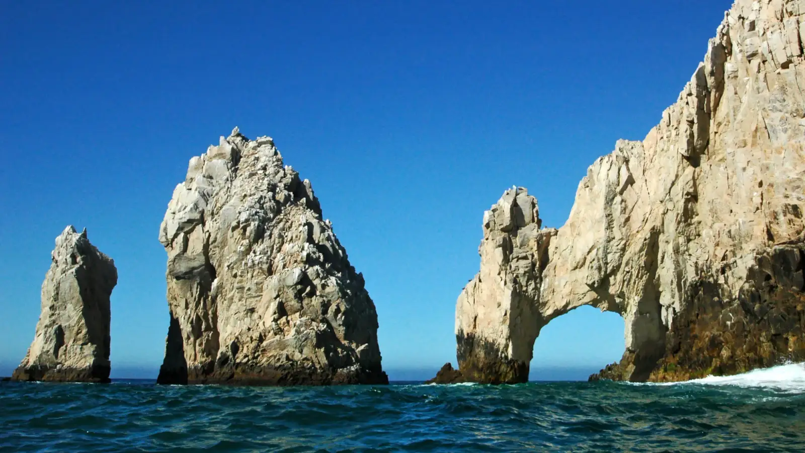
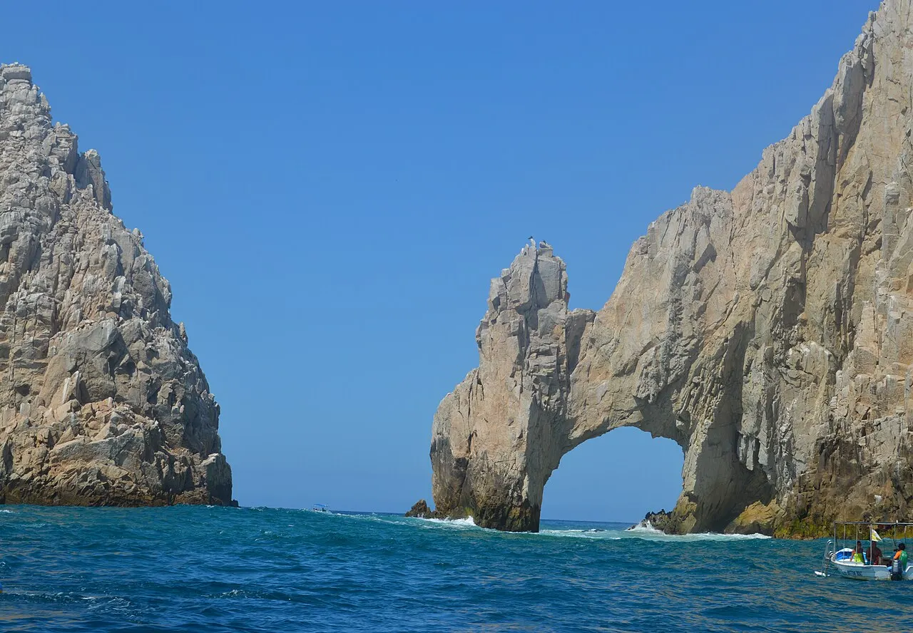
The granite arch at the tip of Land's End is the image that identifies Los Cabos: the rock, as tall as a three-story building, stands where the peninsula ends and the Sea of Cortez (Gulf of California) meets the Pacific. The formation is Cretaceous intrusive granite, carved by sea erosion. The Los Cabos tourism board notes that access is by water only, from Playa El Médano or the marina: water taxi, glass-bottom boat, sailboat or guided kayak. The sea lion colony on the rocks is usually part of the route. The tours enter the Área de Protección de Flora y Fauna Cabo San Lucas, where CONANP charges a fee per passenger, proven by a wristband; ask the operator for the current amount and whether it is included in the price. During whale season, the federal notice restricts whale watching within a 2 km radius around the Arch, because of excess boat traffic: the Arch is seen up close, the whales farther out.
Check access
Playa del Amor
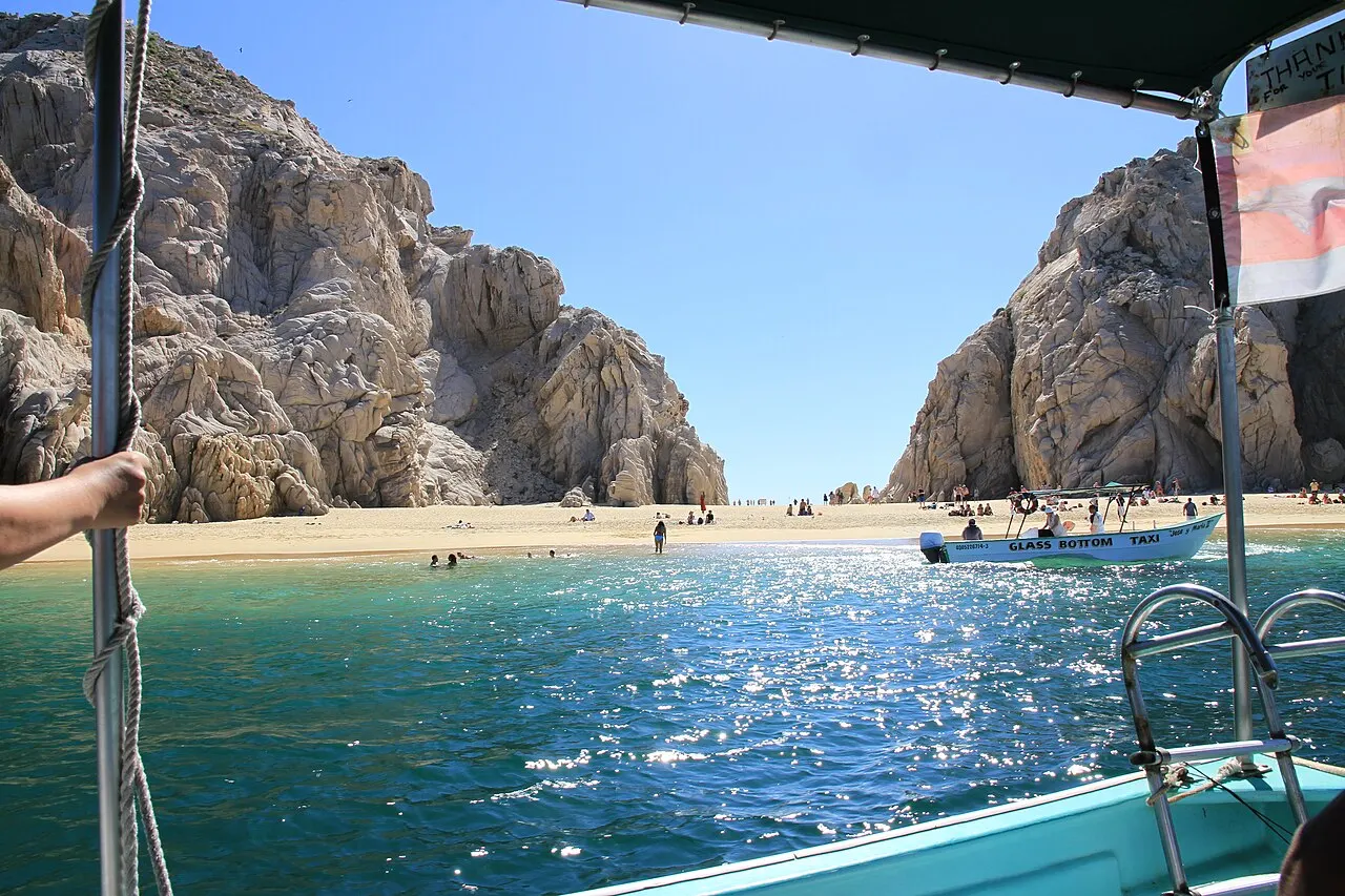
The small strip of sand at the foot of the Arch crosses the tip of the peninsula from one sea to the other. The Sea of Cortez side, Playa del Amor, has calm water that the tourism board recommends for swimming and snorkeling; the Pacific side, Playa del Divorcio, gets strong waves between rock walls, and the safest thing there is just to look. You get there by water taxi from Playa El Médano, by kayak or paddleboard across the bay, or on the boats that leave from the marina. There are no services on the sand: bring water and footwear, because the sand gets very hot in the afternoon, and agree with the boatman on the exact time of the return.
Check access

Playa Santa María
A cove on the Tourist Corridor, between Cabo San Lucas and San José del Cabo, protected by two large granite points that block most of the waves and wind. The shallow water is sheltered and full of tropical fish; the tourism board recommends going in the morning, when visibility is better, and the beach appears on the state government's Blue Flag list. You get there by car, about 13 km from Cabo San Lucas, or on boat tours that leave from the marina. Bring shade, water and snorkeling gear.
Check access
Distrito del Arte de San José del Cabo
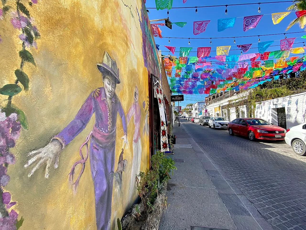
In the blocks behind the church, old houses hold painting, sculpture and craft galleries, plus shops and restaurants. From November to June, the Thursday Art Walk, from 5 p.m. to 9 p.m., opens the galleries at night, with free admission. On Tuesday evenings, Sabores San José brings together food, traditional music and folk dance across downtown, according to the tourism board. On other days, the galleries keep regular business hours.
Check access
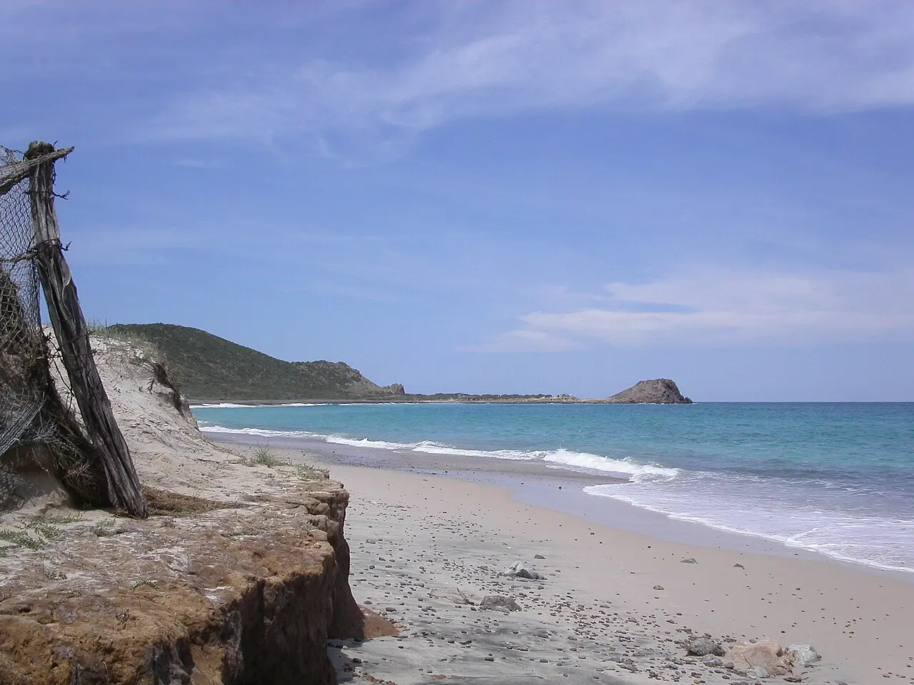
Cabo Pulmo National Park
On the east coast of the peninsula, 98 km and about 1 hour 50 minutes by car from San José del Cabo (132 km and 2 hours 10 minutes from Cabo San Lucas), the park protects the only hard coral reef in the Gulf of California, according to the tourism board. The community organized against overfishing, the park was created on June 6, 1995, UNESCO recognized it in 2005 as part of the Islands and Protected Areas of the Gulf of California, and in 2008 it became a Ramsar site. Today people snorkel and dive among groupers, turtles and sharks. The park's official guide sets the rules: snorkeling only with an accredited guide, life jacket required, at most eight people per guide and 30 minutes per group at each spot, from 6 a.m. to 6:59 p.m.; diving with certification and at most six per guide; 2.5 m distance from the corals; kayaks and paddleboards only with an accredited guide; swimming within 20 m of shore in the sandy areas of Miramar Norte, Cabo Pulmo, El Arbolito and Los Frailes beaches; biodegradable sunscreen, which the park's official guide declares mandatory, and preferably no sunscreen at all: the same guide notes that even the biodegradable kind damages the ecosystem and recommends a long-sleeved shirt for the water. The park wristband is paid per visitor. The last roughly 10 km are dirt road and become dangerous in the September rains; the village has no ATM (the nearest is 27 km away), pharmacy or health service, the nearest gas station is in La Ribera, 27 km away, and cell signal fails.
Check access
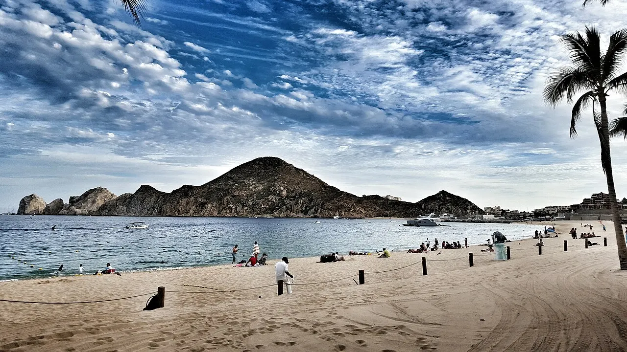
Playa El Médano
The urban beach of Cabo San Lucas stretches for a few kilometers inside the bay, sheltered from the Pacific swells. The tourism board describes it as the town's main swimming beach, with water suitable for swimmers of any age, and many water taxis to the Arch leave from here. The sand is occupied by beach clubs, cantinas and hotels; several hotel-front stretches appear on the state government's list of Blue Flag certified beaches. It is the most practical beach for anyone sleeping in Cabo San Lucas without a car.
Check access
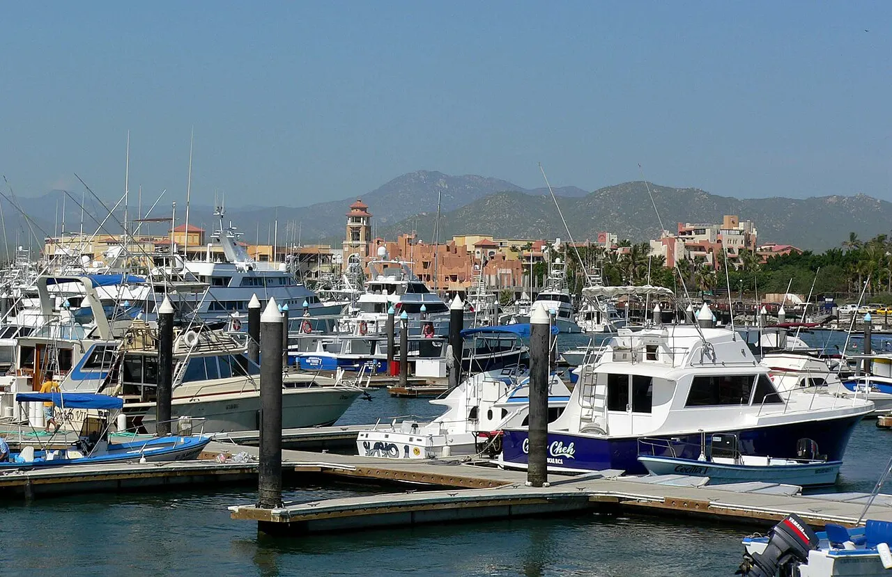
Cabo San Lucas Marina
The port of Cabo San Lucas brings together fishermen's pangas, yachts, sport fishing boats and the tour boats to the Arch and for whale watching. The promenade around it concentrates restaurants, bars and the operators' ticket offices. Marlin fishing gave the town international fame: in October, Cabo San Lucas hosts the Bisbee's Black & Blue tournament (October 19 to 24 in 2026). In the late afternoon, when the boats come back, it is the best place to understand the town that grew up around the dock.
Check access
Playa El Chileno
Another sheltered bay on the Corridor, about 15 km from Cabo San Lucas and a little over 1.5 km from Santa María. The tourism board lists it among the best beaches in the region for swimming and snorkeling, with showers, portable toilets, trash bins, parking and a lifeguard station, and it appears on the state government's Blue Flag list. You can combine the two in the same morning.
Check access
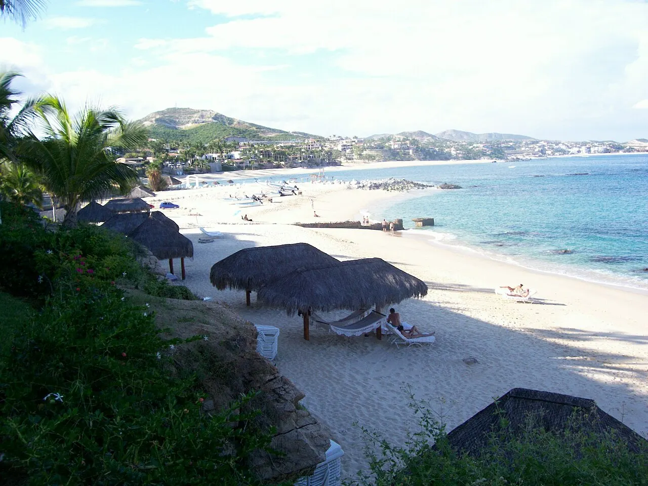
Playa Palmilla
A sheltered bay near San José del Cabo, less than 10 km from the center, which the tourism board defines as a safe swimming beach, protected by a cove. It is on the state government's Blue Flag list. It is the calm-water swimming beach closest to San José; neighboring Acapulquito, a little closer, mainly interests surfers.
Check access
Nilo’s itinerary
Start with the basic programme and choose extensions for the time you have.
Plan my days in the app ↗Day 1 · Cabo San Lucas, the Arch and the bay
From San José del Cabo, go by car or on the Ruta del Desierto bus to Cabo San Lucas, about 33 km and half an hour by highway.
In the morning, take a water taxi or tour boat from Playa El Médano or the marina to the Arch; ask to be dropped at Playa del Amor and agree on the exact time of the return. In whale season (mid-December to the end of April), you can also take a whale-watching tour with an authorized operator that passes the Arch; it watches the whales far from the Arch, outside the 2 km restricted zone, and does not drop passengers at Playa del Amor, so leave that tour for the afternoon or another day.
Come back for lunch of fish tacos downtown and make a short stop at Plaza Amelia Wilkes and the Museo de Historia Natural during the hottest hours.
In the afternoon, swim on the stretch of Playa El Médano facing the bay and finish by walking along the marina promenade when the fishing boats return.
Have dinner in Cabo San Lucas and return to San José by car or taxi; if you take the Ruta del Desierto bus, confirm the last bus at the stop.
Day 2 · Snorkeling on the Corridor and the evening in San José
Leave early for Playa Santa María, about 24 km and half an hour from San José along the Corridor, and snorkel in the morning, when the water is usually clearer.
Before noon, continue a few kilometers to Playa El Chileno, if you want a second sheltered bay with more facilities.
Have lunch back near San José or, if you have booked, at one of the organic farms in the foothills of the Sierra de la Laguna.
In the late afternoon, visit the mission church and Plaza Mijares in downtown San José del Cabo; if there is light left, walk the Estero de San José trail, just east of the center.
On Thursdays from November to June, do the Art Walk from 5 p.m. to 9 p.m.; on Tuesdays, look for Sabores San José. On other days, have dinner downtown and stroll past the open galleries.
Day 3 · The Cabo Pulmo reef
Book snorkeling or diving ahead with an accredited operator from the village; snorkeling can only be done with a guide, from 6 a.m. to 6:59 p.m.
Leave San José del Cabo early: it is 98 km and about 1 hour 50 minutes by car to Cabo Pulmo, with the last roughly 10 km on a dirt road. Fill up beforehand (the nearest gas station is in La Ribera, 27 km from the village) and bring cash in pesos, water and a long-sleeved shirt for the water; if you use sunscreen, it must be biodegradable.
Take the boat outing with a life jacket, respect the 30 minutes per group at each spot and keep 2.5 m away from the corals; afterward, have lunch at one of the village's businesses.
In the afternoon, swim within 20 m of shore in the sandy areas of Playa Cabo Pulmo or Los Frailes, or take a kayak outing with an accredited guide at Playa El Arbolito, which has limited places. Return to San José in daylight.
If you stay longer
Day 4 · Todos Santos and Playa Los Cerritos
Day trip
About 77 km north of Cabo San Lucas on Federal Highway 19 (a little over an hour by car; from San José, about 105 km and an hour and a half), Todos Santos is a Pueblo Mágico on the Pacific side, in the municipality of La Paz. The mission was founded in 1723, and in the late 19th century the village had eight sugarcane mills; today it has independent galleries, the Parroquia de Nuestra Señora del Pilar and the Hotel California, a historic building that houses a restaurant, bar and shop. On the way, Playa Los Cerritos has a long sandy bottom and steady waves sought out by surfers of all levels. Pacific beaches in general serve surfing more than swimming, and several are at the end of dirt roads: download maps before leaving.
Food
Fish taco
Fried or grilled fish in a corn or flour tortilla, with vegetables, pico de gallo (chopped tomato, onion and chile) and a creamy sauce; the dish is said to originate in Baja California and appears in the taquerias and cantinas of both centers.
Almeja chocolata
A brown-shelled clam from the Pacific and the Gulf of California, called chocolate clam for its color; it is eaten marinated on the half shell, as ceviche, roasted, steamed or in broths.
Damiana margarita
Damiana is a shrub native to Mexico, the base of a Mexican liqueur that sometimes replaces triple sec in the margarita; the damiana version is popular in Los Cabos.
Farm cooking
In the foothills of the Sierra de la Laguna, organic farms such as Flora Farms, Acre and Los Tamarindos serve meals and offer cooking classes with what they grow, a counterpoint to the hotel restaurants of the Corridor.
Where to eat
- Downtown Cabo San Lucas and marina
Fish tacos and seafood in taquerias and cantinas, and restaurants facing the marina. It is the area for eating on foot, near the boats.
- Downtown San José del Cabo and Plaza Mijares
Open-air cafés, Mexican street food and restaurants serving regional and international cuisine around the square. On Tuesday evenings, Sabores San José brings together food, traditional music and dance across downtown; on Art Walk nights, the restaurants fill up early.
- Flora Farms and Acre · Outskirts of San José del Cabo, in the foothills of the Sierra de la Laguna
Farm cooking with what is grown on site: Flora Farms grows more than a hundred varieties of vegetables and herbs and offers cooking classes followed by a meal; just beyond, Acre serves dishes of varied inspiration with produce from its own garden. It is outside the center of San José and requires a reservation and a car.
Source · 2026-10-17
- Cabo Pulmo village
The park guide asks visitors to spend at the village's businesses, which helps sustain conservation. The shops are small and have limited goods, the village has no ATM and several businesses do not accept cards: bring water, what you need for the day and cash in pesos.
· 2026-10-17
Day trips
Todos Santos and Playa Los Cerritos
About 77 km north of Cabo San Lucas on Federal Highway 19 (a little over an hour by car; from San José, about 105 km and an hour and a half), Todos Santos is a Pueblo Mágico on the Pacific side, in the municipality of La Paz. The mission was founded in 1723, and in the late 19th century the village had eight sugarcane mills; today it has independent galleries, the Parroquia de Nuestra Señora del Pilar and the Hotel California, a historic building that houses a restaurant, bar and shop. On the way, Playa Los Cerritos has a long sandy bottom and steady waves sought out by surfers of all levels. Pacific beaches in general serve surfing more than swimming, and several are at the end of dirt roads: download maps before leaving.
La Paz and Playa Balandra
The state capital is about 160 km from Cabo San Lucas (more than two hours by car) and faces the gulf. Playa Balandra, about 25 km from downtown La Paz, is inside a protected area managed by CONANP, which charges an entrance fee to those arriving on foot (54 MXN in 2022, according to local press); confirm current hours and fee before going. Tours to swim with whale sharks also leave from La Paz. Given the distance, the trip is better with a night in La Paz.
El Triunfo
A former silver-mining village about 130 km from San José del Cabo (a little over two hours by car), on the way to La Paz. It has the Museo de la Música, with the pianos and instruments that arrived in the mining era, the Museo de la Ruta de Plata, the La Ramona chimney and a cactus sanctuary on the outskirts. It combines well with the return from La Paz.
Santiago and Sol de Mayo
Santiago, a village at the foot of the Sierra de la Laguna, is about 55 km from San José del Cabo (an hour by car). On its outskirts, the Sol de Mayo ranch, run by Echologic, has a waterfall with freshwater pools and trails. Ask the ranch about access, fees and road conditions before setting out.
Where to begin
Cabo San Lucas, the Arch and the bay
From San José del Cabo, go by car or on the Ruta del Desierto bus to Cabo San Lucas, about 33 km and half an hour by highway.
Snorkeling on the Corridor and the evening in San José
Leave early for Playa Santa María, about 24 km and half an hour from San José along the Corridor, and snorkel in the morning, when the water is usually clearer.
The Cabo Pulmo reef
Book snorkeling or diving ahead with an accredited operator from the village; snorkeling can only be done with a guide, from 6 a.m. to 6:59 p.m.
Money
The currency is the Mexican peso (MXN). SJD airport has ATMs and currency exchange offices. Baja California Sur charges foreign visitors over 12 years old the Embrace It contribution, paid online, which generates a receipt with a QR code; Mexicans and residents of Mexico do not pay. In 2026, the amount is 488 MXN per person, according to press in January 2026 (it was 470 MXN in December 2025). On boat tours from the Cabo San Lucas marina, CONANP charges a fee per passenger, and in Cabo Pulmo each visitor pays for the park wristband; ask the operator for the current amount and whether it is included in the price before booking. Cabo Pulmo has no ATM (the nearest is 27 km away) and several businesses do not accept cards: bring cash in pesos.
Getting there and around
Almost everyone arrives through Los Cabos International Airport (SJD), operated by Grupo Aeroportuario del Pacífico, north of San José del Cabo: about 13 km from the center of San José and 37 km from Cabo San Lucas by highway. There is a smaller airfield, Cabo San Lucas (CSL), 8 km from town. On arrival, use an authorized taxi, a prebooked transfer or a rental car: according to local press in January 2026, ride-hailing cars cannot pick up passengers in the airport area, which is federal, but can drop them off at departures.
The Ruta del Desierto bus runs the highway between the airport, San José del Cabo and Cabo San Lucas with several stops along the Corridor. At the airport, the stop is at Terminal 1; those arriving at Terminal 2 go up to the departures level and follow the sidewalk to Terminal 1. There is no current published schedule of fares and times: confirm the fare, accepted currency and last bus at the stop or with the driver before relying on it at night.
The two towns are about 33 km apart, or half an hour by car without traffic. A rental car gives freedom to reach the Corridor's coves and is nearly essential for Cabo Pulmo, Todos Santos and El Triunfo. The centers of Cabo San Lucas and San José can be covered on foot; the Arch and Playa del Amor can only be reached by water, by water taxi, tour boat or kayak from El Médano and the marina.
For a street taxi, prefer one from a stand (sitio) or one called by the hotel, as the British government recommends for all of Mexico.
Safety
Los Cabos is not among the areas of Mexico the British government advises against traveling to; the assessment, updated on October 16, 2026, says Baja California Sur is not affected by the warnings for the neighboring state. The general advice for Mexico still applies: crimes against foreigners are recorded in tourist areas, and express kidnapping, in which the victim is taken to withdraw cash, can happen in urban areas. Use a stand taxi or one called by the hotel and withdraw cash in the daytime, from ATMs inside stores or shopping centers. The most common risk is the sea: many beaches have strong waves, currents and no lifeguard, and the official guidance is to swim only where the flag and the authorities indicate. Dengue circulates in the state: the Secretaría de Salud confirmed 677 cases in Baja California Sur in 2025, and the Cabo Pulmo guide warns of many mosquitoes in the rainy season; use repellent. From May 15 to November 30, follow cyclone warnings and obey evacuation orders.
Etiquette tips
Beach flags
Respect the flag: green means the water is fit for swimming; red or black, dangerous sea. Many beaches in Los Cabos have strong waves and rip currents.
Cabo Pulmo reef
Do not touch the corals or the wildlife, keep 2.5 m away from the formations and do not chase or feed animals. The park's official guide requires biodegradable sunscreen and recommends, preferably, using no sunscreen at all, because even the biodegradable kind damages the ecosystem; wear a long-sleeved shirt in the water.
Whales with an authorized operator
Whale watching follows the federal standard NOM-131 and the season notice, which restricts boat traffic near the Arch; hire an operator with a permit and do not ask the boat to get closer than allowed.
Church in use
The church of San José del Cabo is an active place of worship: enter outside Mass hours and avoid beachwear.
Mistakes to avoid
Assuming every beach in front of a hotel is good for swimming. The Los Cabos tourism board considers fewer than half of the beaches suitable; before booking, confirm that the hotel's beach is among the swimming ones, such as El Médano, Santa María, Chileno or Palmilla.
Going into the water at Playa del Divorcio, the Pacific side of the sand strip at the Arch, where the waves are strong. To swim, stay on the Playa del Amor side.
Counting on a ride-hailing app to leave the airport. According to local press, pickup in the federal airport area is not allowed; have an authorized taxi, transfer or car sorted out before landing.
Treating Cabo Pulmo as a half day. It is 98 km and about 1 hour 50 minutes from San José, with a dirt stretch at the end; snorkeling and diving only go out with an accredited guide and need a reservation, and the village has no ATM or pharmacy.
Planning the San José Art Walk for any night. It happens on Thursdays, from 5 p.m. to 9 p.m., and only from November to June.
Forgetting Embrace It. Foreign visitors over 12 years old pay the state contribution online (488 MXN in 2026, according to the press), and the receipt with the QR code may be requested at the entrance.
Useful phrases
¿Se puede nadar aquí?
Can we swim here?
Lancha (panga) al Arco, ida y vuelta
Boat to the Arch, round trip
¿A qué hora pasa a recogernos?
What time will you come pick us up?
¿Está incluido el brazalete del parque?
Is the park wristband included?
La cuenta, por favor
The check, please
Where to stay
- Cabo San Lucas: center, marina and Playa El Médano · Those who want to do everything on foot, head out by boat to the Arch and the whales, and have restaurants and bars nearby.: The marina and El Médano are a walk away, and El Médano is a swimming beach. In exchange, it is the busiest and noisiest area at night, about 37 km from the airport and 132 km (about 2 hours 10 minutes) from Cabo Pulmo.
- Tourist Corridor · Those looking for a resort with a calm beach, a pool and little travel.: The coves of Santa María, Chileno and Palmilla are here. The airport is north of San José, outside the Corridor: the hotels on the eastern stretch are much closer to it than Cabo San Lucas, at 37 km. Outside the hotels there are few services, and going out to dinner or for a stroll depends on a car or taxi. Confirm that the hotel is on a swimming beach: the tourism board's list helps.
- Historic center of San José del Cabo · Those who prefer a quiet town, the galleries and life around the square, and want the airport close.: It is about 13 km from the airport and the shortest base for Cabo Pulmo and the Sierra de la Laguna. The center is not on the waterfront: the nearest swimming beach is Palmilla, less than 10 km away, and Cabo San Lucas is half an hour away.
- San José del Cabo Hotel Zone · Those who want a beachfront hotel without the bustle of Cabo San Lucas and a few minutes from downtown San José.: It is a few minutes by car from Plaza Mijares. Before booking, check that the hotel's beach is a swimming beach.
· 2026-10-17
Districts
Cabo San Lucas (center and marina)
The largest town in the municipality, organized around the marina and Playa El Médano. It concentrates the boats to the Arch, sport fishing, nightlife, the restaurants along the waterfront promenade and Plaza Amelia Wilkes, the old core. All of this can be done on foot; it is the busiest and noisiest area.
Tourist Corridor
The 33 km of highway between the two towns, with resorts, golf courses and the swimming coves of Santa María, Chileno and Palmilla. It suits those who want a calm beach and a pool; outside the hotels there are few services, and almost everything depends on a car or on the bus that runs along the highway.

San José del Cabo (historic center)
The municipal seat, around Plaza Mijares and the mission church. Streets of low houses, the gallery district, restaurants and the Thursday Art Walk. It is about 13 km from the international airport; the center is not on the waterfront.
San José del Cabo Hotel Zone
The strip of hotels between downtown San José and the sea, a few minutes from the square. It is quieter than Cabo San Lucas; before booking, confirm that the beach in front of the hotel is a swimming beach.
Cabo Pulmo and East Cape
The east coast of the municipality, with small villages and long roads, and the Cabo Pulmo marine park. The village has limited electricity and few services, and many guesthouses run on solar power.
History
Before the 16th century · The Pericú at the tip of the peninsula
Pericú groups lived off gathering, fishing, shellfish and hunting in the south of the peninsula when the Europeans arrived; the name Yenecamú, for the Cabo San Lucas area, comes from their language.
1541–1542 · The cape gets a Spanish name
Francisco de Bolaños named the cape in 1541, and Juan Rodríguez Cabrillo called the bay Puerto de San Lucas in July 1542.
1587 · Cavendish captures the Santa Ana
On November 4, 1587, the English privateer Thomas Cavendish captured the Manila galleon Santa Ana off Cabo San Lucas after hours of fighting.
1602 · Vizcaíno looks for ports for the galleons
Sebastián Vizcaíno was sent to find sheltered ports along the galleon route between Manila and Acapulco; the freshwater spring at San José, the Aguada Segura, became a stopover for those ships.
1730 · The mission of San José del Cabo
The Jesuits Nicolás Tamaral and José de Echeverría founded the mission of San José del Cabo Añuití by the estuary; it moved more than once and settled inland in 1753.
1734–1737 · Pericú rebellion and presidio
The Pericú rebellion against the mission system began in 1734 and killed Father Tamaral; in the following years the crown built a presidio at San José (sources give dates from 1735 to 1737).
1927 · The tuna cannery
The Bernstein brothers founded the Compañía de Productos Marinos on the bay of Cabo San Lucas; the cannery operated until 1979 and employed the settlement that formed around it.
1973 · The Transpeninsular
The completion of Federal Highway 1 connected Cabo San Lucas by land to the rest of the peninsula; from 1974, the federal government began investing to turn the region into a tourist center.
1981 · The municipality is born
Los Cabos was split off from the municipality of La Paz, with its seat in San José del Cabo, and installed its first ayuntamiento on April 7, 1981.
1995–2005 · Cabo Pulmo protected
The federal decree of June 1995 created the Cabo Pulmo marine park; in 2005 it was inscribed on the World Heritage List as part of the Islands and Protected Areas of the Gulf of California.
2014 · Hurricane Odile
On September 14, 2014, Hurricane Odile made landfall at Cabo San Lucas and damaged homes, buildings and businesses; the infrastructure was rebuilt to withstand future storms.
Complete history
Before the missions, the south of the peninsula was the territory of the Pericú, who lived off fishing, shellfish, gathering and hunting. The tip of Baja California entered European history by sea: in the 16th century, the galleons returning from Manila to Acapulco passed in front of the cape, and it was there that the privateer Thomas Cavendish captured the Santa Ana in 1587. The freshwater spring at San José, which sailors called Aguada Segura, explains why this point on the coast mattered.
The Jesuit mission of San José del Cabo Añuití, founded in 1730 by the estuary, gave the region its first permanent settlement; its seat moved more than once until it settled inland in 1753. Four years after the founding, the Pericú rebellion against the mission regime killed Father Nicolás Tamaral, and the crown responded with a presidio.
Cabo San Lucas was little more than an anchorage until the 20th century. The tuna cannery founded in 1927 on the bay drew workers and gave shape to the settlement, which stayed small: the 1980 census counted 4,233 residents. The turning point came with the completion of the Transpeninsular Highway in 1973 and with federal tourism investment from 1974, which placed Los Cabos among the resort poles planned by Fonatur, after Cancún and Ixtapa. The municipality was created in 1981.
Since then, Los Cabos has grown fast: from 351,111 inhabitants in 2020 to 469,163 in INEGI's 2025 estimate, an increase of about a third in five years. Sport fishing, the Corridor's resorts and the international airport sustain the economy, while Hurricane Odile in 2014 was a reminder of the price of building on a cyclone track. On the east side, Cabo Pulmo took another path: the community organized against overfishing, the park was born in 1995, and the village came to live from diving and low-impact tourism.
I'd look at the church in San José knowing the building dates from 1940: the 1730 mission is the reason the town exists, but the building you see on the square is from the 20th century.
Geography and shape of the city
Los Cabos occupies the far southern end of the Baja California peninsula, where the Gulf of California (Sea of Cortez) meets the Pacific. The climate is hot desert: in Cabo San Lucas, the 1991–2020 normals give average highs of 26.6 °C in January and 34.7 °C in August, and most of the year's rain (265 mm in total) falls in August and September, often brought by cyclones. The two towns sit at the ends of a 33 km coastal strip. Cabo San Lucas is at the far west, on a bay sheltered by Land's End, the granite ridge that ends at the Arch. San José del Cabo, to the east, grew up by the estuary of the San José River, the largest body of fresh water in the state. Between the two, the Tourist Corridor follows Federal Highway 1 past resorts and golf courses, with coves protected by rock points where swimming is possible. Most of the coast, however, has strong waves and currents, and the tourism board considers fewer than half of the beaches suitable for swimming. Inland, the Sierra de la Laguna rises behind the desert; on the east coast, the Cabo Pulmo reef lies 98 km by road from San José.
I'd group the days by the highway: Cabo San Lucas on one day, the Corridor's coves and San José on another, and the east coast on the third. Going back and forth between the ends several times eats up more than an hour a day.
Culture
Public culture in Los Cabos divides between the two towns. Cabo San Lucas lives from the sea: the marina mixes fishermen's pangas and yachts, and marlin fishing has its own calendar, with the Bisbee's Black & Blue tournament in October. Nightlife is concentrated around the waterfront promenade and Playa El Médano.
San José del Cabo is the town of the galleries and the square. The district behind the church holds painting, sculpture and Huichol art studios, and the Thursday craft market in Plaza Mijares sells palm and wood pieces made by local producers. The San José festivities in March fill the town with charreada, music and fairground food such as pozole, tamales and tostadas.
Away from the resorts, the region's history shows in the villages of the interior. In El Triunfo, a former silver-mining village, a museum keeps the pianos and instruments that arrived in the mining era; in Todos Santos, a former sugar-mill village, the cobblestone streets hold independent galleries and art and music festivals throughout the year.
If the trip falls between November and June, I'd keep Thursday for San José: the Art Walk is the night when the gallery district makes the most sense.
Festivals and events
San José festivities
Patron saint festival of San José del Cabo, from March 16 to 22, with March 19 as the main day: festival queen, charreada, musical performances, sports competitions and stalls selling pozole, tamales and tostadas.
Whale season
Each year, a federal notice published in the Official Gazette opens whale-watching season in the protected area of Cabo San Lucas and San José and in Cabo Pulmo, from mid-December to the end of April. Humpback and gray whales pass along the coast, and tours leave from the marina with authorized operators; the exact dates of each season are set in the notice.
Art Walk
Every Thursday from November to June, from 5 p.m. to 9 p.m., the galleries of the San José del Cabo art district open at night; admission is free.
Bisbee's Black & Blue
Marlin fishing tournament held every October in Cabo San Lucas; in 2026, from October 19 to 24.
Books and films
The Log from the Sea of Cortez (John Steinbeck)
An account of the 1940 expedition by Steinbeck and the biologist Ed Ricketts aboard the Western Flyer through the Gulf of California, first published in 1941 as Sea of Cortez and in 1951 under the current title. After going down the Pacific coast of the peninsula, the first collecting stop was at Cabo San Lucas, and the book helps in understanding the sea that makes Los Cabos.
Frequently asked questions
Los Cabos: how do I get out of the airport?
Almost everyone arrives through Los Cabos International Airport (SJD), north of San José del Cabo: about 13 km from the center of San José and 37 km from Cabo San Lucas by highway. On arrival, use an authorized taxi, a prebooked transfer or a rental car: according to local press in January 2026, ride-hailing cars cannot pick up passengers in the airport area, which is federal, but can drop them off at departures. The Ruta del Desierto bus runs the highway between the airport, San José del Cabo and Cabo San Lucas with several stops along the Corridor; at the airport, the stop is at Terminal 1, and those arriving at Terminal 2 go up to the departures level and follow the sidewalk to Terminal 1. There is no current published schedule of fares and times: confirm the fare, accepted currency and last bus at the stop or with the driver before relying on it at night.
Los Cabos: what fees do visitors pay?
Baja California Sur charges foreign visitors over 12 years old the Embrace It contribution, paid online, which generates a receipt with a QR code; Mexicans and residents of Mexico do not pay. In 2026, the amount is 488 MXN per person, according to press in January 2026. On boat tours from the Cabo San Lucas marina, CONANP charges a fee per passenger, and in Cabo Pulmo each visitor pays for the park wristband; ask the operator for the current amount and whether it is included in the price before booking.
Los Cabos: how many days should I plan, and where should I stay?
I'd spend three days in Los Cabos, sleeping in San José del Cabo, near the airport and halfway to what matters: the first in Cabo San Lucas, with the boat to the Arch and Playa del Amor in the morning and the afternoon between El Médano and the marina; the second on the Corridor, with snorkeling at Santa María and swimming at Chileno, and the evening downtown in San José, preferably on an Art Walk Thursday; the third entirely at Cabo Pulmo, with snorkeling or diving booked with an accredited operator. Those who want nightlife and everything on foot can sleep in Cabo San Lucas, accepting 132 km and about 2 hours 10 minutes of road to Cabo Pulmo. With a fourth day, I'd go to Todos Santos and Playa Los Cerritos, on the Pacific side. From December to April, the trip gains the whales and the dry weather; from August to October, the heat and the risk of cyclones call for a flexible plan.
Los Cabos: how do I visit the Cabo Pulmo reef?
The park is on the east coast, 98 km and about 1 hour 50 minutes by car from San José del Cabo (132 km and 2 hours 10 minutes from Cabo San Lucas). The park's official guide sets the rules: snorkeling only with an accredited guide, life jacket required, at most eight people per guide and 30 minutes per group at each spot, from 6 a.m. to 6:59 p.m.; diving with certification and at most six per guide; 2.5 m distance from the corals; biodegradable sunscreen, which the guide declares mandatory, and preferably no sunscreen at all, with a long-sleeved shirt for the water. The park wristband is paid per visitor. The last roughly 10 km are dirt road and become dangerous in the September rains; the village has no ATM (the nearest is 27 km away), pharmacy or health service, and the nearest gas station is in La Ribera, 27 km away. Several businesses do not accept cards: bring cash in pesos.
Los Cabos: how do I get to the Arch, and can I swim there?
Access to the Arch is by water only, from Playa El Médano or the marina: water taxi, glass-bottom boat, sailboat or guided kayak. On the strip of sand at the foot of the Arch, the Sea of Cortez side, Playa del Amor, has calm water that the tourism board recommends for swimming and snorkeling; the Pacific side, Playa del Divorcio, gets strong waves between rock walls, and the safest thing there is just to look. There are no services on the sand: bring water and footwear, because the sand gets very hot in the afternoon, and agree with the boatman on the exact time of the return. The tours enter the Área de Protección de Flora y Fauna Cabo San Lucas, where CONANP charges a fee per passenger, proven by a wristband; ask the operator for the current amount and whether it is included in the price.
Los Cabos: when is the best time to go?
December to April; it is the dry, mild season, and it coincides with whale-watching season, which the federal notice opens each year from mid-December to the end of April. August and September concentrate the little rain the year brings, and hurricane season runs from May 15 to November 30.
Los Cabos: is it safe?
Los Cabos is not among the areas of Mexico the British government advises against traveling to; the assessment, updated on October 16, 2026, says Baja California Sur is not affected by the warnings for the neighboring state. The general advice for Mexico still applies: crimes against foreigners are recorded in tourist areas, and express kidnapping, in which the victim is taken to withdraw cash, can happen in urban areas. Use a stand taxi or one called by the hotel and withdraw cash in the daytime, from ATMs inside stores or shopping centers. The most common risk is the sea: many beaches have strong waves, currents and no lifeguard, and the official guidance is to swim only where the flag and the authorities indicate. Dengue circulates in the state; use repellent. From May 15 to November 30, follow cyclone warnings and obey evacuation orders.
Other cities in the country
Mexico ↗- Days
- 4–5
- When
- Oct–Nov
- Per person/day
- Average 1,100–2,000 pesosMid-range · per person/day
Cost scope
Per person per day: accommodation, meals, urban transport, visits and a small allowance for extras. Flights excluded; larger purchases vary. Editorial estimate, not a quote.
- Days
- 3
- When
- Feb–Apr · Oct–Nov
- Per person/day
- Average 900–1,800 MXNMid-range · per person/day
Cost scope
Per person per day: accommodation, meals, urban transport, visits and a small allowance for extras. Flights excluded; larger purchases vary. Editorial estimate, not a quote.
- Days
- 2–3
- When
- Jan–Apr · Dec
- Per person/day
- Average 2,400 MXNMid-range · per person/day
Cost scope
Per person per day: accommodation, meals, urban transport, visits and a small allowance for extras. Flights excluded; larger purchases vary. Editorial estimate, not a quote.
- Days
- 3–4
- When
- Jan–Apr · Dec
- Per person/day
- Average 2,820 MXNMid-range · per person/day
Cost scope
Per person per day: accommodation, meals, urban transport, visits and a small allowance for extras. Flights excluded; larger purchases vary. Editorial estimate, not a quote.