United States
Los Angeles
Street tacos, the Pacific, free museums and film
Days Start with the basic programme and choose extensions for the time you have.
How the guide reaches this number
Stay four days, and five is comfortable: one downtown and in Boyle Heights, one at Griffith and on Miracle Mile, one on the Westside and at the beach, and a whole one just for eating in the San Gabriel Valley and East LA; the fifth goes to Malibu and the Pacific Coast Highway. Anyone looking for a walkable city, with a historic center and everything fifteen minutes away, will be frustrated. You can walk well downtown, in Santa Monica, on Abbot Kinney, in Old Pasadena, in Larchmont and in Silver Lake, but between them there's only freeway. With just one day, go up to Griffith in the morning, spend the afternoon at the Getty or LACMA and have street tacos for dinner after 6pm, leaving out Hollywood Blvd. Three things disappoint: the Walk of Fame is just a sidewalk, the 1923 sign can only be seen from afar, and the ocean in the photos is 16–21 °C. What makes up for it is the good, cheap food, like the US$2.50–4 street taco.
4–5
When April, early May and November; March also works well
How the guide reaches this number
There are more than 280 sunny days a year, and the rain, about 380 mm, falls almost entirely between November and March. Winter has highs of 18–21 °C and lows of 8–10 °C, with clear days between storms and snow on the San Gabriel Mountains, visible even from the beach. Spring, from March to early June, is the best season for walking around, at 20–25 °C. From mid-May to July, the coast wakes up under the marine layer, “May Gray” and “June Gloom,” which usually burns off around noon but can last all day in Santa Monica and Venice, while the Valley reaches 32 °C. August and September are the hottest months, with 30–36 °C in the valleys and higher peaks. In October and November the Santa Ana winds blow, bringing fire risk and smoky days; by November the heat has passed and the hotel high season, from June to August, is behind you, so check fire alerts before you fly. The ocean stays between 16 and 21 °C year-round, and staying in the water for more than ten minutes takes a wetsuit. I'd come in April, early May or November, which combine the best of price, sky and temperature.
Per person/day Budget US$110–150; mid-range US$220–330; comfortable from US$450.
How the guide reaches this number
Not counting car rental and parking
Budget US$110–150; mid-range US$220–330; comfortable from US$450. Not counting car rental and parking
Per person per day: accommodation, meals, urban transport, visits and a small allowance for extras. Flights excluded; larger purchases vary. Editorial estimate, not a quote.
 What Nilo thinks
Come for the food, the film and the open road, knowing that half of each day goes to getting around. Stay four days, and five is comfortable: one downtown and in Boyle Heights, one at Griffith and on Miracle Mile, one on the Westside and at the beach, and a whole one just for eating in the San Gabriel Valley and East LA; the fifth goes to Malibu and the Pacific Coast Highway. Anyone looking for a walkable city, with a historic center and everything fifteen minutes away, will be frustrated. You can walk well downtown, in Santa Monica, on Abbot Kinney, in Old Pasadena, in Larchmont and in Silver Lake, but between them there's only freeway. With just one day, go up to Griffith in the morning, spend the afternoon at the Getty or LACMA and have street tacos for dinner after 6pm, leaving out Hollywood Blvd. Three things disappoint: the Walk of Fame is just a sidewalk, the 1923 sign can only be seen from afar, and the ocean in the photos is 16–21 °C. What makes up for it is the good, cheap food, like the US$2.50–4 street taco.Los Angeles is best enjoyed eating and looking: US$2.50 street tacos in Boyle Heights, dim sum in the San Gabriel Valley and the Pacific at the end of the Santa Monica bike path. From Griffith Observatory, free to enter, you can see the whole basin and the Hollywood Sign, and the Getty and the Broad don't charge admission either. The city grew by annexation, around the aqueduct, oil, film and the freeways, and has no single center: the walkable neighborhoods, like Santa Monica and Silver Lake, are linked by freeway, and half the day goes into getting around. Film shows up in the studio visits in Burbank and Melrose and in the 35mm screenings at the New Beverly. Come in April, early May or November, and plan for four days, five if you want to head up the coast to Malibu.
Quick facts
- Population
- about 3.9 million in the city; about 9.7 million in Los Angeles County and about 12.9 million in the metropolitan area (2025 estimates)
- Founded
- September 4, 1781, as El Pueblo de Nuestra Señora la Reina de los Ángeles; incorporated as an American city on April 4, 1850
- Country and region
- United States: state of California, Los Angeles County, which contains 88 incorporated cities
- Languages
- English; about 40% of residents speak Spanish at home, followed by Korean, Armenian, Tagalog, Mandarin, Persian, and Thai
- Currency
- US dollar (US$)
- Time zone
- Pacific Time, UTC−8 (UTC−7 during daylight saving, from the second Sunday of March to the first Sunday of November)
- Best time to visit
- April, early May and November; March also works well
- Average daily cost
- Budget US$110–150; mid-range US$220–330; comfortable from US$450. Not counting car rental and parking
When to go
April, early May and November; March also works well
January
10° to 19°C
73 mm of rain
February
10° to 19°C
76 mm of rain
March
11° to 19°C
44 mm of rain
June
16° to 22°C
2 mm of rain
July
18° to 24°C
1 mm of rain
August
18° to 25°C
0 mm of rain
September
18° to 25°C
3 mm of rain
October
15° to 24°C
12 mm of rain
December
10° to 19°C
57 mm of rain
How the year changes
There are more than 280 sunny days a year, and the rain, about 380 mm, falls almost entirely between November and March. Winter has highs of 18–21 °C and lows of 8–10 °C, with clear days between storms and snow on the San Gabriel Mountains, visible even from the beach. Spring, from March to early June, is the best season for walking around, at 20–25 °C. From mid-May to July, the coast wakes up under the marine layer, “May Gray” and “June Gloom,” which usually burns off around noon but can last all day in Santa Monica and Venice, while the Valley reaches 32 °C. August and September are the hottest months, with 30–36 °C in the valleys and higher peaks. In October and November the Santa Ana winds blow, bringing fire risk and smoky days; by November the heat has passed and the hotel high season, from June to August, is behind you, so check fire alerts before you fly. The ocean stays between 16 and 21 °C year-round, and staying in the water for more than ten minutes takes a wetsuit. I'd come in April, early May or November, which combine the best of price, sky and temperature.
The same numbers as a table
| Month | Temperature °C | Rain mm |
|---|---|---|
| January | 10 to 19 | 73 |
| February | 10 to 19 | 76 |
| March | 11 to 19 | 44 |
| April · | 12 to 20 | 15 |
| May · | 14 to 21 | 7 |
| June | 16 to 22 | 2 |
| July | 18 to 24 | 1 |
| August | 18 to 25 | 0 |
| September | 18 to 25 | 3 |
| October | 15 to 24 | 12 |
| November · | 12 to 22 | 21 |
| December | 10 to 19 | 57 |
Nilo's tips
With the TAP card, the metro caps at US$5 a day
Once you hit that cap, the rest of the day's rides are free, and the same goes for the seven-day cap of US$18. The card costs US$2 at the first machine in any station, with no registration. If you're staying near an A, B, D or E Line station, that US$18 replaces a car rental. The car costs US$50–90 a day, plus US$20–50 a night for hotel parking.
Park at Griffith before 10am, skipping the US$10-an-hour fee
At Griffith, parking starts costing US$10 an hour at noon on weekdays and at 10am on Saturday and Sunday, and spots vanish soon after. Anyone who goes up earlier parks for free and already gets the sign photo from the terraces. The building and the telescope charge nothing; only the planetarium show costs about US$10. At night, the 30 cm Zeiss telescope serves the public until closing, at 10pm, and that's when paying for parking is worth it.
Reserve the Broad's mirror room before buying your plane ticket
Yayoi Kusama's mirror room needs a reservation separate from general admission, which is free, and is booked online weeks ahead. Make the reservation as soon as you know which day is your downtown day, and build the rest of it around that: lunch at Grand Central Market, the atrium of the Bradbury Building, and the Angels Flight funicular, for US$1, up to Bunker Hill.
Eat street tacos after 6pm, for US$2.50–4
The stalls appear from early evening until the small hours, and the address changes every week, so look for the line, not a fixed spot. Dim sum runs on the opposite schedule: in the San Gabriel Valley, between Monterey Park, Alhambra and San Gabriel, the Cantonese halls serve only until 3pm, for US$20–30 per person. Anyone arriving a few minutes later already finds the carts put away.
Read the whole pole before parking: fine US$60–90
The sign that gets you ticketed is usually the third one on the pole, not the first, and the rule that catches visitors is the street-cleaning one. It applies once a week, in a short window, and the spot looks free precisely on that day. If the car gets towed, the bill runs past US$300 and costs half a day of your trip. Read the signs from top to bottom before getting out of the car.
On Friday, avoid the freeway from 3pm to 7pm
Rush hours run from 7am to 10am and from 3pm to 7pm, and Friday is the worst day of the week across the whole basin. If your Friday includes the beach, go against the flow and start early at the Getty, where admission is free and you pay only for parking, about US$25. Then head down to Venice, instead of crossing the city from east to west at five in the afternoon. To Pasadena, the metro's A Line takes about 50 minutes, with or without traffic.
Explore the map

© OpenStreetMap · OpenFreeMap · © OpenMapTiles
Explore the map, read about the other places and plan your travel days in the app.
Open the appWhat to see
Los Angeles: The basin and the mountains that close it in
The Santa Monica Mountains cross the city from east to west and separate the basin from the San Fernando Valley, which is why “over the hill” is a direction used every day. The city's highest point is to the north, in the San Gabriels: Mount Lukens, at 1,547 m.
Griffith Observatory
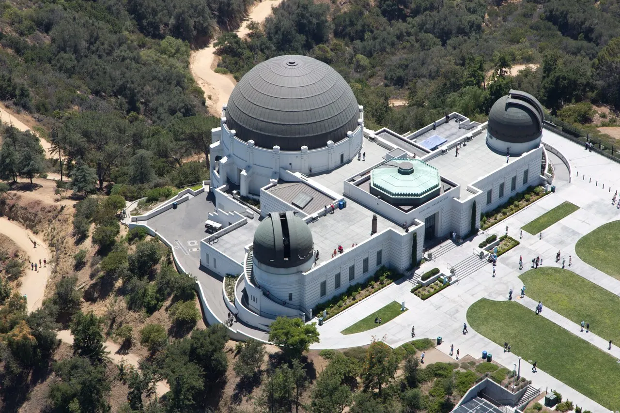
Opened on May 14, 1935 on the south flank of Mount Hollywood, with free admission as required by Griffith J. Griffith's will. It has the 30 cm Zeiss telescope, open to the public since opening day, the Foucault pendulum in the lobby and the best simultaneous view of the basin and the Hollywood Sign; the planetarium show costs about US$10, and parking is paid and hard to find. Go before 10am, when parking is still free any day; charges run until 10pm, which is also when the building closes.
Admission is free, and from there you can see the whole basin and the Hollywood Sign at once. Go before 10am, when the parking spot is still free.
Check access

Getty Center
A museum opened in December 1997 in Brentwood, designed by Richard Meier and clad in wire-cut Italian travertine. Admission is free and access is by an automated tram that climbs 800 m of hillside; you pay only for parking (about US$25). The Getty Villa, in Pacific Palisades, holds the Greco-Roman collection, survived the January 2025 fire, and reopened in mid-2025.
You only pay for parking, about US$25.
Check access
Santa Monica Pier, Venice Beach, and the canals
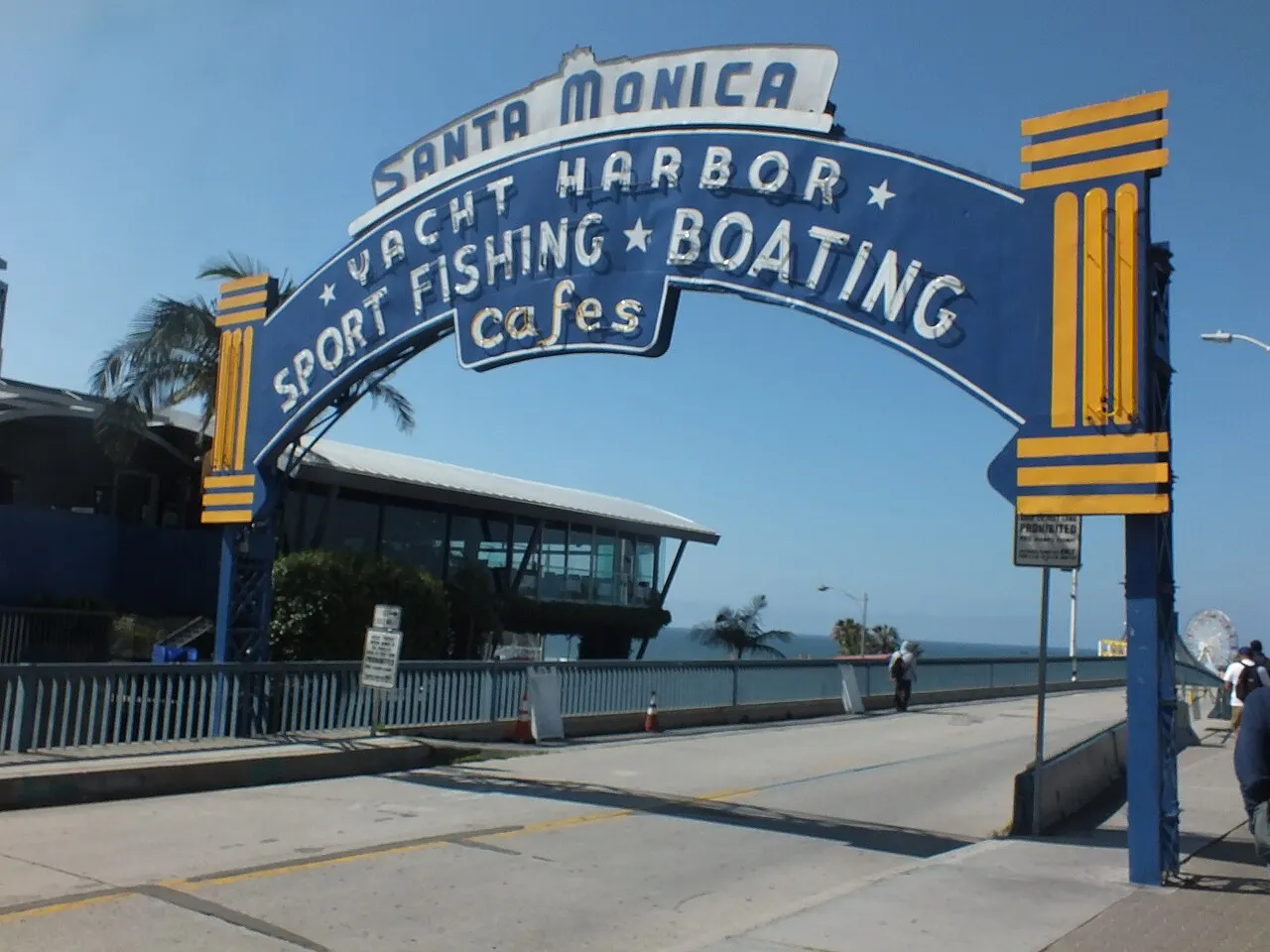
Santa Monica Pier has operated since 1909, has the Pacific Park solar Ferris wheel, and the sign marking the end of Route 66. Three kilometers south, the Venice boardwalk brings together a basketball court, a skating rink, Muscle Beach from 1934, and vendors; two blocks away survive six of the canals Abbot Kinney opened in 1905, now quiet and residential. The Marvin Braude bike path links all of it along 35 km of sand.
Six of the canals opened in 1905 survive.
Check access
The Broad and Walt Disney Concert Hall
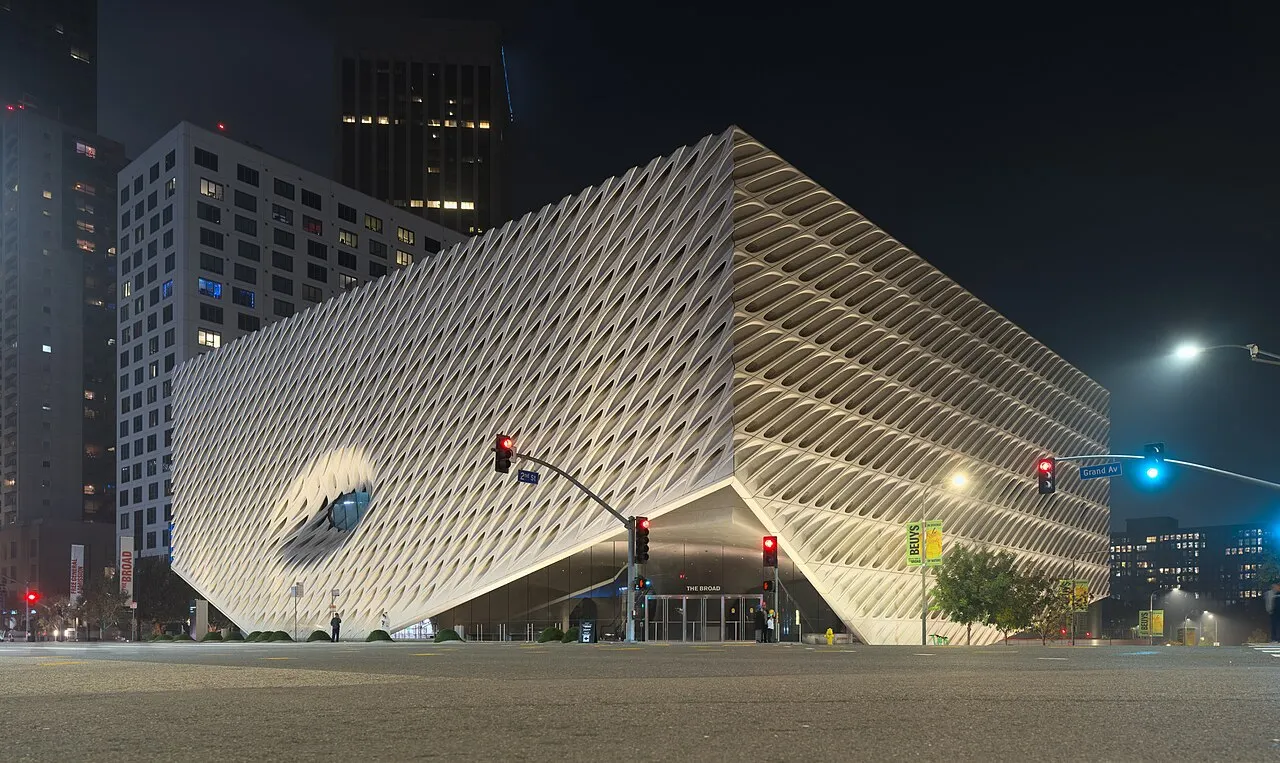
On Grand Avenue, side by side. Disney Hall, by Frank Gehry, opened in October 2003 with a stainless-steel shell and a 2,265-seat “vineyard” hall, home of the Los Angeles Philharmonic. The Broad, opened in September 2015, has free general admission and 2,000 works of contemporary art; Yayoi Kusama's mirror room requires a separate booking, made online weeks ahead.
The mirror room requires a separate reservation.
Check access

LACMA and the La Brea Tar Pits
On the Miracle Mile, on Wilshire Blvd. LACMA is the largest art museum in the western US; on the sidewalk stand “Urban Light” by Chris Burden (2008, 202 vintage streetlamps) and “Levitated Mass” (2012, a 340-ton boulder). The campus was rebuilt with the David Geffen Galleries building, by Peter Zumthor, spanning the avenue, with a staggered opening in 2026: check the schedule. Next door, the natural asphalt pools of La Brea keep bubbling and have already yielded over 3.5 million fossils from the last roughly 50,000 years.
It's the largest art museum in the western US.
Check access
Watts Towers
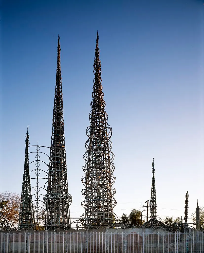
Seventeen structures built single-handedly by Simon Rodia, an Italian mason, between 1921 and 1954, in his backyard in Watts. The tallest is 30 m, made of rebar, mortar, and shards of bottle, tile, and shell, and in 1959 it went through a tension test the city applied in order to tear it down: the tower held. Guided visits at limited hours; the arts center next door has operated since 1970.
These are the seventeen structures that Simon Rodia, an Italian mason, built alone between 1921 and 1954 in his backyard, with rebar, mortar and shards of bottles, tile and shell. Guided visits have limited hours, so book before crossing the city to Watts.
Check access

El Pueblo and Olvera Street
The founding block from 1781, next to Union Station. The Avila Adobe, from 1818, is the oldest standing house in the city; Olvera Street was reorganized in 1930 as a Mexican marketplace and still holds food and craft stalls. The Church of Nuestra Señora la Reina de los Ángeles, from 1822, is still in use and the starting point of the annual procession in September.
Olvera Street keeps food and craft stalls.
Check access
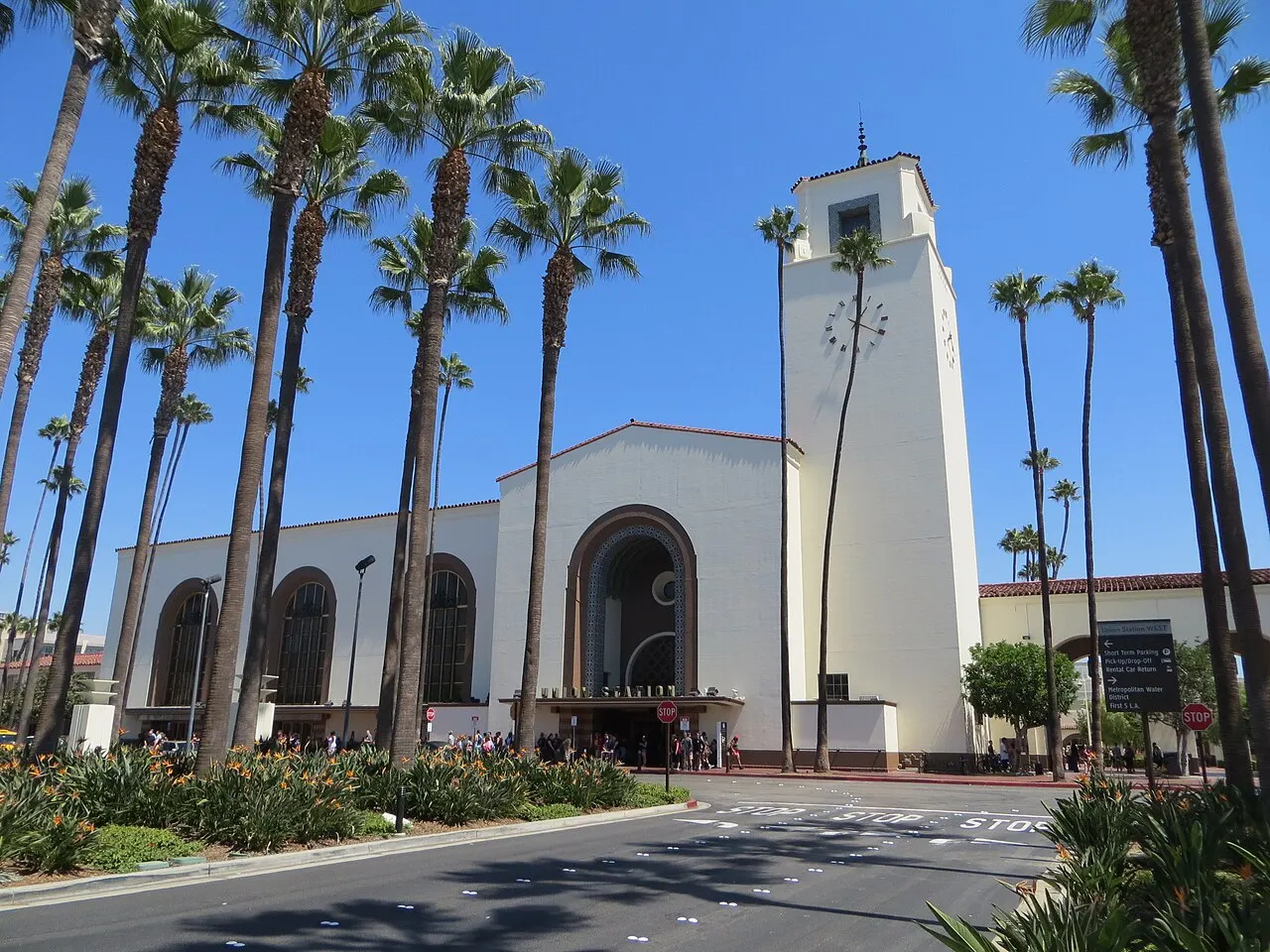
Union Station and the Bradbury Building
Union Station opened in May 1939 as the last great railroad station built in the US, blending Mission Revival, art deco, and streamline moderne; the 16-m-high lobby is open to anyone who just wants to look. Twenty minutes on foot away, the Bradbury Building (1893) has a five-story atrium in cast iron, brick, and skylight. The ground floor is open to the public during business hours, and it appeared in “Blade Runner”.
The last great railway station built in the US.
Check access
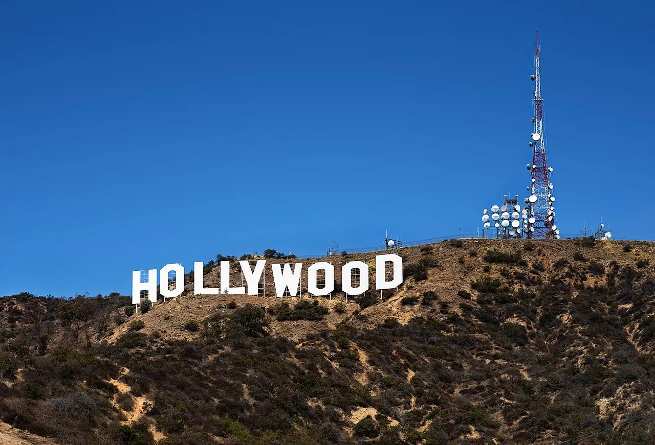
Hollywood Sign and Griffith Park
The nine 13.7-m letters went up in 1923 as an ad for the HOLLYWOODLAND subdivision and only lost the last four in 1949. There's no public access to the letters: the views come from Lake Hollywood Park, the Brush Canyon trail, or the observatory itself. Griffith Park covers 17 km², is one of the largest urban parks in the US, and includes the Greek Theatre, the zoo, and a 1926 carousel.
There's no public access to the letters: the nine 13.7 m letters, from 1923, can only be seen from a distance, and the best view of them is from Griffith Observatory itself. What's left as its own activity is a 30-to-60-minute walk in the 17 km² park along the Brush Canyon Trail, which leads to the back of the sign.
Check access
Nilo’s itinerary
Start with the basic programme and choose extensions for the time you have.
Plan my days in the app ↗Day 1 · Historic downtown, the Eastside, and a Mexican night
Start at 9am at El Pueblo: the 1818 Avila Adobe, the 1822 church, and the Olvera Street stalls, all on one block, then cross the street to the lobby of the 1939 Union Station.
Walk to the Grand Central Market (1917) for lunch, go up Broadway to the atrium of the Bradbury Building (1893), and take the Angels Flight funicular, from 1901, for US$1 up to Bunker Hill.
On Grand Avenue, see the steel shell of Disney Hall and go into The Broad: free general admission, but book online ahead if you want the mirror room.
Late afternoon in the Arts District or Little Tokyo, on foot, then cross the river to Boyle Heights: Mariachi Plaza early evening and street tacos between First and Cesar Chavez.
In season, April to September, swap the evening for a Dodgers game at Chávez Ravine, 3 km from downtown.
Day 2 · Griffith, Miracle Mile, and Koreatown
Get to Griffith Observatory before 10am, while parking is still free, and see the basin and the 1923 sign from the terraces; the building, which is free and has the Zeiss telescope, opens at 10am on weekends and 12pm on weekdays.
Walk 30 to 60 minutes on a Griffith Park trail (Brush Canyon leads to the back of the letters), then head down for lunch in Los Feliz or Thai Town.
Spend the afternoon on Miracle Mile, between “Urban Light” on the LACMA sidewalk, the galleries, the La Brea Tar Pits next door and, if time allows, the Academy Museum on the corner.
Head to Koreatown in the late afternoon for a Korean spa or a coffee, and have tabletop barbecue for dinner, sharing galbi and banchan.
If you still have the energy, end the night at a repertory cinema, the New Beverly or the Vista, which screen in 35 mm almost every night.
Day 3 · Westside, the beach, and sunset over the Pacific
Open the day at the Getty Center, in Brentwood: free admission, tram up to the top, Robert Irwin's garden, and a view of the whole basin when the air is clear.
Head down for lunch on Abbot Kinney, in Venice, and walk to the six surviving 1905 canals, residential and quiet, two blocks from the beach.
Rent a bike and ride 3 km along the Marvin Braude bike path, passing Muscle Beach, to the 1909 Santa Monica Pier and the End of Route 66 sign.
Head back along Ocean Ave for sunset, with the option of a 20-minute drive up the Pacific Coast Highway to a Malibu beach.
If you prefer, swap the beach for the south of the city and the San Gabriel Valley, to the east: visit the Watts Towers in the morning, have dim sum for lunch in the Valley before 3pm, when the halls stop serving, and end the afternoon in Leimert Park, back in the south.
Day 4 · A whole day of eating
Start the morning in the San Gabriel Valley: Monterey Park, Alhambra and San Gabriel form the largest concentration of Chinese restaurants outside Asia.
Order Cantonese dim sum, served until 3pm, or Shanghai xiao long bao and hand-pulled Shaanxi noodles; a dim sum lunch runs US$20–30 a person.
In the afternoon, head to Boyle Heights and East LA, between First and Cesar Chavez, for a birria taco with melted cheese and a little cup of consommé to dip it in.
Try the golden shrimp tacos and the aguachile from a Sinaloa-style seafood truck too, dishes between US$4 and US$15.
Close the night with an In-N-Out Double-Double “animal style,” from the chain founded in 1948 in Baldwin Park, ordered off the unprinted menu.


If you stay longer
Day 5 · Malibu and the Pacific Coast Highway
Day trip
40 to 70 km west on Route 1, 45 to 90 minutes by car depending on traffic. Point Dume, El Matador, and Zuma are the reference beaches, and there's the Malibu Creek lagoon for a hike. The highway and the neighborhoods hit by the January 2025 fire remain under reconstruction. Check for closures before you go.
Food
 AI illustration
Street taco
The basic unit of Los Angeles food: small corn tortilla, meat grilled on a flat top or al pastor off the trompo, onion, and cilantro. Sold from trucks and sidewalk stands that open around 6pm and run into the small hours, especially in Boyle Heights, East LA, Pico-Union, and the south San Fernando Valley. Costs US$2.50–4 a piece; asking “¿con todo?” means onion and cilantro on top.
 AI illustration
Birria and quesabirria
A meat stew (originally goat, here almost always beef) cooked in guajillo chile broth, served as a taco with melted cheese and a small cup of consommé for dipping. It arrived from Tijuana and became standard in Los Angeles starting in 2018; today there are dozens of dedicated trucks, many in Boyle Heights and the Valley.
 AI illustration
Sinaloa-style seafood
Seafood trucks serve golden fried shrimp tacos, aguachile, ceviche tostadas, and shrimp cocktail in the mid-afternoon, with a line on the sidewalk. It's an entire cuisine run out of a truck, mostly in Mexican neighborhoods east and south of the city; dishes between US$4 and US$15.
 AI illustration
Korean barbecue
In Koreatown, the KBBQ houses grill galbi (marinated short ribs) and samgyeopsal (pork belly) right on the table's own grill, with ten to twenty free banchan that keep getting refilled. Many stay open until 2am or 24 hours; the all-you-can-eat runs US$35 to US$60 per person, and the custom is to split everything.
 AI illustration
Pastrami and french dip
Two early-20th-century holdovers still served at the same addresses. The pastrami sandwich on double-baked rye is the specialty of the Westlake delicatessen open since 1947; the french dip (roast beef or pork on bread dipped in the roasting juices) is claimed by two downtown establishments, both opened in 1908. US$12–25.
 AI illustration
The San Gabriel Valley table
East of downtown, Monterey Park, Alhambra, San Gabriel, and Rowland Heights form the largest concentration of Chinese restaurants outside Asia, organized by region: Shanghai xiao long bao, hand-pulled Shaanxi noodles, Cantonese dim sum served until 3pm, Chongqing hotpot, and Taiwanese bubble tea shops. Dim sum lunch US$20–30 per person.
 AI illustration
In-N-Out and the chili dog
The In-N-Out chain, founded in 1948 in Baldwin Park, serves a four-item menu; the Double-Double “animal style” (mustard grilled into the patty, caramelized onion, extra sauce) is ordered off the unprinted menu. The chili dog and the chili burger, served at spots from 1939 and 1946 still operating in the same locations, make up the other half of the tradition, with a line at any hour.
 AI illustration
Fruit cart, elote, and the bacon-wrapped hot dog
The umbrella cart sells freshly cut fruit (mango, jicama, cucumber, watermelon) with lime, salt, and chile powder, for US$5–8. Elote is corn boiled and topped with mayonnaise, cotija cheese, and chile; the “danger dog”, a hot dog wrapped in bacon and fried on a flat top with onion and bell pepper, shows up outside stadiums, concerts, and bars after midnight.
Day trips

Malibu and the Pacific Coast Highway
40 to 70 km west on Route 1, 45 to 90 minutes by car depending on traffic. Point Dume, El Matador, and Zuma are the reference beaches, and there's the Malibu Creek lagoon for a hike. The highway and the neighborhoods hit by the January 2025 fire remain under reconstruction. Check for closures before you go.

Pasadena, the Huntington, and Mount Wilson
18 km northeast, 30 to 45 minutes by car or about 50 minutes on the A Line. Old Pasadena is one of the few walkable grids in the region; the Huntington Library, in San Marino, holds a Gutenberg Bible and 50 hectares of gardens. From the Mount Wilson Observatory, at 1,740 m, came Hubble's 1929 measurement of the expansion of the universe.

Santa Catalina Island
35 km offshore, with a ferry from Long Beach or San Pedro taking about 1 hour 10 minutes (about US$80 round trip). Avalon is a village of 3,500 residents where almost no cars circulate, you get around on foot or by electric cart, and the clear water is good for scuba diving or kayaking. Go and come back the same day, leaving early.
Where to begin
Historic downtown, the Eastside, and a Mexican night
Start at 9am at El Pueblo: the 1818 Avila Adobe, the 1822 church, and the Olvera Street stalls, all on one block, then cross the street to the lobby of the 1939 Union Station.
Griffith, Miracle Mile, and Koreatown
Get to Griffith Observatory before 10am, while parking is still free, and see the basin and the 1923 sign from the terraces; the building, which is free and has the Zeiss telescope, opens at 10am on weekends and 12pm on weekdays.
Westside, the beach, and sunset over the Pacific
Open the day at the Getty Center, in Brentwood: free admission, tram up to the top, Robert Irwin's garden, and a view of the whole basin when the air is clear.
Money
The currency is the US dollar, and contactless cards work for practically everything, including Metro fare gates and food trucks. Even so, carry US$20–40 in cash for street stalls and valets. Sales tax is about 9.75% in the city of Los Angeles and tops 10% in some cities in the county, and it's added at the register, never included on the price tag. Hotel rates also carry about 15.5% in city and tourism taxes. For food, coffee runs US$4.50–6.50, a street taco US$2.50–4, a burrito or lunch bowl US$13–18 and a sit-down dinner US$35–65 per person, before drinks, tax and tip. Draft beer costs US$8–11 and a cocktail US$16–22. Museums range from US$0 (Getty, The Broad, Griffith) to US$28–35 (LACMA, Academy Museum, Huntington), a mid-range hotel runs US$200–350 a night and gas about US$5 per 3.8-liter gallon. In practice, tipping isn't optional: 18–22% at restaurants with table service, US$1–2 per drink at the bar, 15–20% for taxis and ride-hailing and US$3–5 for the valet. Since 2023, many places add a 3% to 5% “service charge” to the bill to cover staff health care, printed in small type and charged on top of the tip. Check the bill before doing the math, because it's easy to pay for two things with the same name without noticing.
From the airport to the center
Guide estimate
Scroll to compare all columns
| Route | Time | Price |
|---|---|---|
| LAX → Union Station · FlyAway bus | 40–60 min | about US$10 |
| LAX → downtown · flat-fare taxi | varies | about US$70–90 with tip |
| LAX → LAX/Metro Transit Center · shuttle and Metro (C and K lines) | varies | US$1.75 per Metro ride |
Getting there and around
LAX, 30 km from downtown: four ways out of the airport
LAX is 30 km southwest of downtown and is the main airport in the western US, with four ways out. The new LAX/Metro Transit Center station, on the metro's C and K Lines, connects to the terminals by shuttle; the Automated People Mover, a 3.6 km train, was still in testing with no confirmed opening date in September 2026, so check its status before you travel. The FlyAway bus runs to Union Station for about US$10, in 40–60 minutes, and taxis have a flat fare to downtown, about US$70–90 with tip. Ride-hailing cars pick up only at the LAX-it lot, reached by free shuttle from the terminals. Consider the alternative airports: Hollywood Burbank (BUR) is 22 km from downtown and you're out of it in ten minutes, John Wayne (SNA) serves Orange County, and Long Beach (LGB) and Ontario (ONT) handle domestic flights with shorter lines. Before boarding, remember that Brazilians need a B1/B2 visa, with interview waits that in 2026 were still long at several consulates; ESTA, at US$40.27 since January 1, 2026, is only for Visa Waiver Program countries, which don't include Brazil.
Public transit: 175 km of rail network
The Metro network has six rail lines (A, B, C, D, E and K), about 175 km, plus two dedicated busways (G and J). The fare is US$1.75 per ride, with free transfers for two hours, and the TAP card, at US$2, caps spending at US$5 a day and US$18 for seven days. The D Line extension along Wilshire toward Beverly Hills, Century City and Westwood opens in stages between 2025 and 2027, and changes Westside trips considerably. Trains run roughly from 4am to 1am. The network is rounded out by Metrolink, a seven-line regional railroad, downtown's DASH (US$0.50), Santa Monica's Big Blue Bus and the Culver CityBus. Even so, most visitors rent a car: US$50–90 a day, plus US$20–50 a night for hotel parking and US$10–20 for valet at restaurants. Rush hours run from 7am to 10am and from 3pm to 7pm, and Friday is the worst day. The Marvin Braude bike path runs 35 km along the beach, from Will Rogers to Torrance.
Safety
Los Angeles is a big city with very uneven risk by neighborhood and time of day, and the statistical problem for visitors is almost never violence: it's theft of and from vehicles. Break-ins cluster in the parking lots at Griffith Park, the Runyon Canyon trails, the Getty, the beaches and Dodger Stadium, so leave your car empty and visibly so, no exceptions. Downtown, Skid Row covers about fifty blocks east of Main between Third and Seventh. The area is living through a public health crisis, with tents on the sidewalks, and there's no reason to walk through it without a purpose. Hollywood Blvd after midnight, some metro stations in the small hours and parts of MacArthur Park call for the usual big-city caution. The unhoused population in the county is about 72,000 people (2025 count), and tents on sidewalks are visible in many neighborhoods. Aggressive encounters are rare: keep your distance and keep walking. Environmental risks call for more planning than crime: earthquakes (the official instruction is drop, cover and hold on, away from windows), wildfires and smoke between September and December, when it's worth following the air quality index, and rip currents at the beaches, where you should swim near a lifeguard tower, staffed from about 9am to sunset in summer. The emergency number is 911.
Etiquette tips
Read the whole parking sign
The signs stack three to five rules on the same pole: street cleaning on a fixed day and hour, residential permit zone, a two-hour limit, an overnight ban. Get it wrong and the car gets ticketed (US$60–90) or towed, and getting it back costs over US$300 and half a day.
In Los Angeles, distance is measured in minutes
In Los Angeles, nobody says “it's 20 km away,” but rather “it's about 25 minutes.” The number assumes a clear road, so double it at rush hour. Leave a margin when you set meetings, and don't stack two appointments at opposite ends of the city on the same day.
Confirm the plan on the day itself
Making plans a week ahead is normal, but confirming by message a few hours before is part of the protocol, not distrust. Without it, the other person can reasonably assume it's off.
The tip and the service charge are different things
The “service charge” that shows up on the bill mostly doesn't go to whoever served you. The 18–22% tip is still expected on top of it, and the card reader always offers the screen with suggested amounts. The smallest button is usually 18%.
Don't approach anyone you recognize
Spotting someone you know from TV at a restaurant, gym, or park is routine, and the local custom is to look straight ahead. Asking for a photo or autograph on the street is considered invasive, even by people standing nearby.
Marijuana is legal, smoking in public isn't
Recreational sale is allowed to those 21 and over at licensed shops, with photo ID. Using it on a sidewalk, beach, park, in a car, or in a hotel is ticketed, and taking the product out of California is a federal crime.
Mistakes to avoid
Hollywood as the geographic center
Staying in Hollywood thinking it's the geographic center of the city. From Hollywood Blvd to Santa Monica takes 40–70 minutes, to downtown 25–45, and to the San Gabriel Valley more than an hour. Choose the neighborhood for what you plan to do, not for its name.
A whole day on the Walk of Fame
Setting aside a whole day for the Walk of Fame. The 2,700 stars run along a 2.5-km sidewalk, with T-shirt shops and costumed impersonators. They charge for the photo, sometimes before the camera is even raised. Half an hour is enough, and the rest of the time pays off better at Griffith, the Getty, or Koreatown.
Leaving anything visible in the car
Leaving anything visible inside the car. Break-ins are the most common street crime against visitors, especially in trailhead, beach, and museum parking lots. Backpack, jacket, and charger go in the trunk before you arrive, never after you park. Whoever is watching the lot is watching for exactly that move.
Counting on sun at the coast in June
Counting on guaranteed sun at the coast in June. The morning haze can fail to lift all day, especially near the beach. If you want heat, cross into the Valley or head east, where the difference reaches 10 °C.
Eating only where the hotels are
Eating only where the hotels are. The food that defines the city is in Boyle Heights, the San Gabriel Valley, Koreatown, Thai Town, and the trucks that park after 6pm. It costs a fraction of what you'd pay the same night in Beverly Hills.
Useful phrases
The 405, the 10, the 101
Freeways take the definite article in Los Angeles; saying “405” without the “the” marks you as new in town in the first minute
The Valley / over the hill
The San Fernando Valley, behind the Santa Monica Mountains; “over the hill” means crossing from one side to the other via Cahuenga or Laurel Canyon
June Gloom / marine layer
The gray marine layer that covers the coast until mid-morning between May and July, with guaranteed sun just a few kilometers inland
It's like twenty minutes
Distance measured in drive time with no traffic; during rush hour, double it before you accept the invitation
¿Con todo?
“With everything?”: the taco vendor's question, asked in Spanish even to English speakers; it means onion and cilantro on top
What do you do?
The standard opening question; here it's about work, it's literal, and it usually opens a long conversation about projects still not closed
Districts
Downtown (DTLA)
Historic and administrative center undergoing a revival since 1999, when a law allowed empty office buildings to be converted into apartments. It holds the 1781 El Pueblo, Little Tokyo, Chinatown, the 1917 Grand Central Market, the cultural axis of Grand Avenue, and the Arts District; it also holds Skid Row, roughly fifty blocks east of Main with the country's largest unhoused population.
Hollywood and West Hollywood
Hollywood has been a Los Angeles neighborhood since 1910 and mixes the Walk of Fame with residential buildings and neighborhood shops; to the east, on Hollywood Blvd between Normandie and Western, sits Thai Town, the only officially designated Thai neighborhood in the US. West Hollywood has been its own city since 1984, home to the Sunset Strip, Santa Monica Blvd, and the region's historic center of LGBTQ+ life.
Koreatown
California's densest neighborhood, at over 16,000 people/km², along the Wilshire corridor west of downtown. Restaurants, karaoke rooms, and bathhouses run into the small hours, and 1920s art deco architecture sits alongside hangul signage; it's also one of the city's largest Oaxacan, Bangladeshi, and Salvadoran hubs.
Eastside: Silver Lake, Echo Park, Los Feliz, and Highland Park
Hills northeast of downtown, with modernist houses from the 1920s–60s, public stairways linking streets, and the Silver Lake Reservoir. Los Feliz gives access to Griffith Park; Echo Park has the lake with paddle boats and lotus flowers; Highland Park and Eagle Rock, along York and Figueroa, hold onto the Latino businesses that rising rents keep pushing out.
Boyle Heights and East LA
East of the river, the Mexican-American heart of the city since the 1940s, when it was also Jewish, Japanese, and Russian. Mariachi Plaza has had musicians waiting to be hired since 1930, Whittier Blvd is the lowrider cruising street, and the street food between First and Cesar Chavez is the most consistent in the region.
South LA and Leimert Park
South of downtown, the historic axis of Black life in Los Angeles: Central Avenue was the jazz corridor of the 1920s–50s, and Leimert Park, designed in 1927 by the Olmsted brothers, became the city's African American cultural center from the 1960s on, with bookstores, drum circles in the park on Sundays, and the Vision Theatre. Watts, further south, has the Simon Rodia towers.
Westside: Santa Monica, Venice, Beverly Hills, and Culver City
The strip between the 405 freeway and the sea. Santa Monica is its own city, with a pier from 1909 and pedestrian shopping on the Third Street Promenade; Venice was founded in 1905 by Abbot Kinney as a replica of the Italian city, with the canals that remain today; Beverly Hills and Rodeo Drive have sold luxury since the 1910s; Culver City holds the original MGM lot, now Sony, and the E Line metro.
The valleys: San Fernando and San Gabriel
The San Fernando Valley, annexed in 1915, has 1.8 million residents, summers 8–10 °C hotter than the coast, and most of the TV studios (Burbank, Studio City, the NoHo Arts District). To the east, the San Gabriel Valley (Monterey Park, Alhambra, San Gabriel, Rowland Heights) is the largest concentration of Chinese and Taiwanese communities in the US, and the best place in the region to eat.
History
until 1769 · The Tongva basin
The Tongva (called Gabrieleños by the Spanish) had occupied the basin for thousands of years, with dozens of villages linked by trails; Yaanga sat near today's downtown, by the river. The Chumash held the coast from Malibu on, a word that comes from the place name Humaliwo.
1769–1771 · Portolá and the mission
On August 2, 1769, Gaspar de Portolá's expedition camps by the river, which Father Juan Crespí names Río de Nuestra Señora la Reina de los Ángeles de Porciúncula. In 1771 Mission San Gabriel Arcángel is founded, the agricultural and Indigenous-labor base of the region.
1781 · Founding of the pueblo
On September 4, 1781, 44 pobladores (eleven families from Sonora and Sinaloa, most of African, Indigenous, and mixed descent) establish the pueblo by order of governor Felipe de Neve. The original plaza is today's El Pueblo, next to Olvera Street.
1821–1848 · Mexican period and the ranchos
With Mexico's independence in 1821, Los Angeles becomes a ciudad in 1835 and capital of Alta California. Secularization of the missions splits the land into hundreds of ranchos, and the economy turns to cattle, tallow, and hides.
1848–1885 · Annexation and the railroads arrive
The Treaty of Guadalupe Hidalgo hands California to the US in 1848, and the city is incorporated on April 4, 1850, with about 1,600 residents. The Southern Pacific arrives in 1876 and the Santa Fe in 1885; the fare war between the two touches off the real-estate boom of the 1880s.
1892–1930 · Oil, oranges, and the first surge
Edward Doheny drills a well near today's Echo Park in 1892, opening the oil era; by the 1920s Southern California's fields accounted for about a quarter of world production. Population jumps from 102,000 in 1900 to 1.24 million in 1930.
1913 · The Owens Valley aqueduct
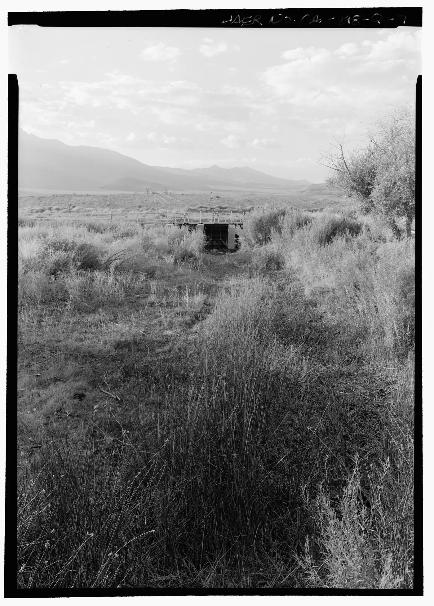
On November 5, 1913, William Mulholland opens the 375-km aqueduct that brings water from Owens Valley, east of the Sierra Nevada. The valley dries up, the city quadruples in area, and the fight over water runs through the entire 20th century.
1911–1929 · Film moves west
The Nestor Studio, Hollywood's first, opens in October 1911 at the corner of Sunset and Gower. Steady sun, cheap land, varied scenery less than an hour away, and distance from Edison's patents in New Jersey concentrate nearly all American production here by 1915.
1940–1961 · Airplanes, freeways, and the end of the streetcar
The Arroyo Seco Parkway, the first freeway in the American West, opens on December 30, 1940; Douglas, Lockheed, and North American make the region the country's aerospace hub during World War II. In 1961 the last Pacific Electric streetcar runs, on what was once the largest interurban network in the world.

1965–1994 · Uprisings, migration, and earthquake
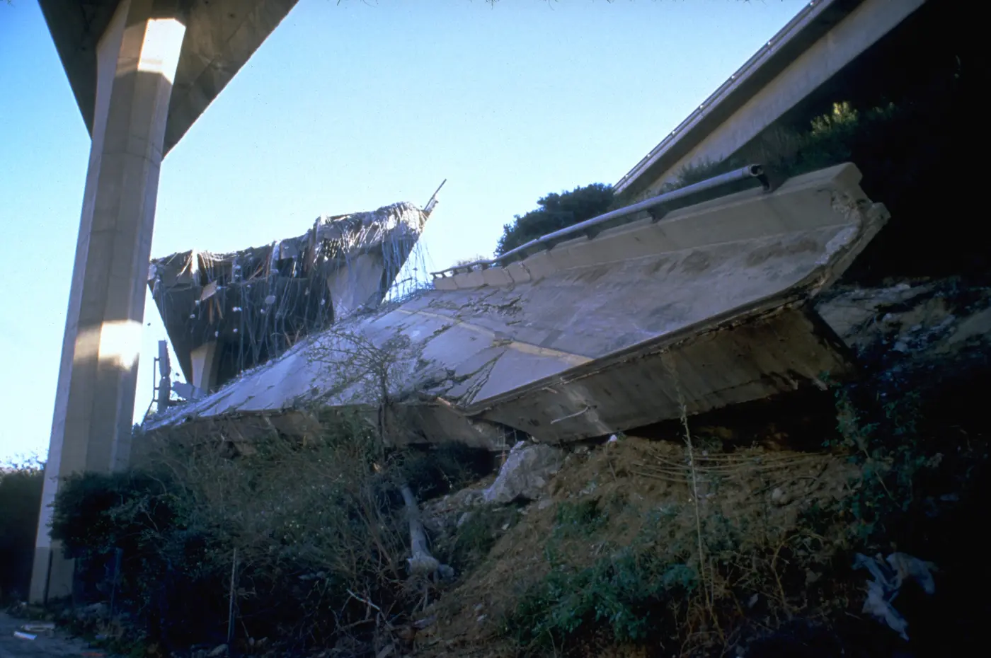
Watts burns in August 1965 (34 dead) and the city burns again between April 29 and May 4, 1992, after the acquittal of the officers who beat Rodney King, leaving 63 dead. On January 17, 1994, the magnitude-6.7 Northridge earthquake kills 57 people and brings down stretches of freeway.
1990–2028 · Rail comes back, fire, and the Games
The rail network is reborn in 1990 with today's A Line and expands with the 2016 Measure M; the Regional Connector opens in June 2023. After the Palisades and Eaton fires in January 2025, the city rebuilds while preparing for the Olympic Games of July 14–30, 2028.
 AI illustration
Complete history
The 1781 pueblo and the river's water
The city begins with water and an administrative decision. The Tongva had occupied the basin for millennia, with villages like Yaanga beside the river, when Gaspar de Portolá's expedition camped there on August 2, 1769. The San Gabriel Arcángel mission, from 1771, organized the region's farm economy with Indigenous labor; ten years later, on September 4, 1781, Governor Felipe de Neve set up the civil pueblo with 44 pobladores recruited in Sonora and Sinaloa, most of them of African, Indigenous and mestizo descent, a fact the city only began to acknowledge publicly at the end of the 20th century. The pueblo was placed there because, at the spot where the river ran shallow, a zanja could be dug to divert water to the gardens. Securing water for a city in a place with little rain remained, from then on, the central problem of Los Angeles.
Mexican between 1821 and 1848
Between 1821 and 1848 Los Angeles was Mexican: it became a ciudad in 1835, served as capital of Alta California and saw the mission lands carved up into hundreds of cattle ranchos. The Treaty of Guadalupe Hidalgo transferred California to the United States in 1848, and the city was incorporated on April 4, 1850 with about 1,600 inhabitants and a reputation for violence. The first crowd arrived by train: the Southern Pacific in 1876, the Santa Fe in 1885 and, between the two, a fare war that at one point sold tickets from Missouri for a few dollars and produced the real estate boom of the 1880s. Then came Doheny's oil (1892), oranges shipped in refrigerated railcars and the artificial port of San Pedro. To reach it, the city annexed the shoestring strip in 1906, a band of land about 800 m wide and 26 km long. Three years later, in 1909, it incorporated San Pedro and Wilmington.
Growth ran into the rain
Growth ran into the rain: about 380 mm a year can't sustain a metropolis. The answer was the Owens Valley aqueduct, opened on November 5, 1913, with 375 km of canal, tunnels, and siphons engineered by William Mulholland over land quietly bought up by city agents. Water was sold only to those who annexed to Los Angeles, and so the municipality grew from about 230 km² in 1910 to over 1,100 km² in 1930, swallowing Hollywood (1910), the San Fernando Valley (1915), Venice (1926), and the corridor down to the port. In the same span the film business moved in (the Nestor Studio opened in October 1911 at Sunset and Gower), bringing a second export industry that needed no local raw material, just light. By 1930 the city had 1.24 million residents and no center.
The war made it the country's biggest aerospace hub
World War II turned the region into the country's biggest aerospace hub: Douglas, Lockheed, North American, and Northrop drew hundreds of thousands of workers, among them the Great Migration arriving from Texas and Louisiana. The same decade produced the incarceration of Japanese Americans in 1942, which emptied Little Tokyo (reoccupied by Black residents and renamed Bronzeville), the zoot suit riots of 1943, and a map of restrictive covenants and redlining that decided, street by street, who could buy a house where. The Arroyo Seco Parkway opened on December 30, 1940, and the freeways that followed cut straight through Mexican and Black neighborhoods; in 1959 the last families of Chávez Ravine were removed and Dodger Stadium rose on the site, opening in 1962. By the time the last Pacific Electric streetcar stopped, in 1961, the city's geography was already the car's.
The 1965 Watts riots and the 1992 Los Angeles riots
The Watts riots, in August 1965, and those of April 1992 showed the price of a city divided street by street by redlining and freeways. Between the two, the 1965 immigration law and the wars in Central America remade the population: today the county is home to the largest Mexican community outside Mexico, the largest Armenian community outside Armenia and the largest Korean, Thai and Salvadoran communities outside their respective countries. The Northridge earthquake, on January 17, 1994, brought down sections of freeway just as the city was getting back on track. The A Line had opened in 1990, Measure M dedicated half a percentage point of sales tax to transit in 2016, and the Regional Connector, in June 2023, joined the tracks into the longest light-rail line in the world, about 78 km between Long Beach and Azusa, which the extension to Pomona, in September 2025, stretched to about 93 km. The problems of the present are the price of housing and the roughly 72,000 people without homes in the county (2025 count); in January 2025 the Palisades and Eaton fires destroyed about 16,000 structures and killed about 30 people, and the rebuilding runs in parallel with preparations for the 2028 Olympic Games.
The 800 m-wide strip of land that Los Angeles annexed in 1906 to reach the port of San Pedro still shows up on the map, squeezed between neighboring cities.
Geography and shape of the city
The basin and the mountains that close it in
Los Angeles fills the coastal basin of Southern California, an alluvial plain closed off to the north by the Santa Susana and San Gabriel Mountains, where Mount San Antonio, “Baldy,” reaches 3,069 m, to the east by the Puente Hills and to the west and south by the Pacific. The Santa Monica Mountains cross the city from east to west and separate the basin from the San Fernando Valley, which is why “over the hill” is a direction used every day. The city's highest point is to the north, in the San Gabriels: Mount Lukens, at 1,547 m.
The concrete river and the faults
The Los Angeles River runs 82 km from Canoga Park to Long Beach and was lined with concrete by the Army Corps of Engineers after the 1938 flood, which explains the straight, empty channel that shows up in so many films. The city is seismically active: the San Andreas Fault runs about 55 km to the northeast, but the real risk comes from urban faults like the Newport-Inglewood and the Puente Hills, the latter directly under downtown.
Climate, Santa Ana winds, and the grid
The climate is Mediterranean with dry summers, about 380 mm of rain a year concentrated between November and March, and a marine layer that covers the coast most mornings from roughly May to July; in October and November the Santa Ana winds blow from the desert toward the sea, drying the air and turning any spark into a fire. The layout is a grid of very long boulevards (Sepulveda runs about 68 km) overlaid by twelve freeways, and the average density of about 3,200 people/km² hides extremes: Koreatown tops 16,000, the hillside neighborhoods don't reach a thousand.
The river runs eighty-two kilometers inside concrete.
Culture
The film and television industry
Los Angeles is a city that produces images at industrial scale, and that shapes social life: studios and production companies employ over 100,000 people in the region, the Writers Guild and SAG-AFTRA halted production for months in 2023, and the strike, followed by production moving to Georgia, New Mexico, and abroad, shrank the number of local filming days, a running topic of conversation ever since. The practical consequence for a visitor is that many of the people who serve, drive, or wait on you work in the industry at some point in the cycle, and the question “what do you do?” is literal, not small talk. The Academy Museum, opened in 2021 on Wilshire, and the Margaret Herrick Library treat the industry as heritage; repertory theaters (the New Beverly, the Egyptian, the Vista, the Aero) screen 35mm nearly every night.
Jazz, folk, punk, Chicano rock and hip-hop
The city's music was born in several different places and never merged. Central Avenue was the West Coast jazz corridor between 1920 and 1950, with Dexter Gordon coming out of Jefferson High School and Charles Mingus out of Jordan, in Watts. Laurel Canyon was home to the folk-rock of 1966–74. Punk came from the South Bay beach towns, with Black Flag in Hermosa Beach, and East LA's Chicano rock runs from Ritchie Valens in the 1950s to Los Lobos, formed in 1973. West Coast hip-hop, from Compton, Long Beach and Watts, redrew the genre from 1988 on and remains the most accurate portrait of the city's geography. All of it can be heard in venues ranging from the Hollywood Bowl, an open-air amphitheater from 1922 with 17,500 seats, to hundred-person clubs in Echo Park.
Literature, visual arts and sports
The city's literature is almost entirely about distance and illusion: Raymond Chandler mapped the boulevards in seven novels starting in 1939, John Fante wrote Bunker Hill, Joan Didion chronicled the Santa Ana wind and Walter Mosley reconstructed the Black South LA of the 1940s. The same light and open space fed the visual arts: the Ferus Gallery opened in 1957 and launched the generation of Ed Ruscha and Ed Kienholz, the Light and Space movement, with James Turrell and Robert Irwin, is a direct product of the local light, and the Chicano muralism of the 1970s left works like the “Great Wall of Los Angeles,” 800 m painted along a channel in the Valley starting in 1976. Sports also spread across the basin: the Dodgers have played in Chávez Ravine since 1962, the Lakers and Clippers share basketball, the Rams and Chargers have filled SoFi Stadium in Inglewood since 2020, and soccer has two clubs, LAFC and the Galaxy, with fan bases divided by class and geography.
Chandler wrote seven novels about these boulevards.
Festivals and events
Rose Parade and Rose Bowl
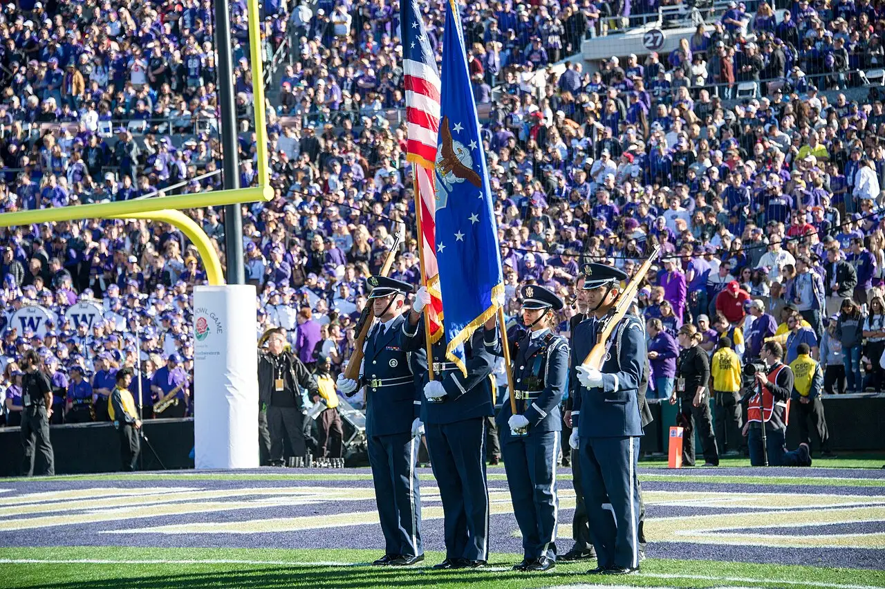
January 1, in Pasadena, since 1890: about 40 floats covered entirely in plant material travel 9 km down Colorado Blvd, followed by the college football game at the 1922 stadium. People camp on the sidewalk the night before; the A Line is the sensible way to get there.

The Academy Awards
Usually in March, at the Dolby Theatre on Hollywood Blvd. The avenue closes for several days before and after, traffic across the region locks up, and nearby hotels double their rates: worth knowing the date to avoid it, or to catch the red-carpet setup.

Día de los Muertos
Late October and November 1–2. The biggest celebrations happen at Hollywood Forever Cemetery, on Olvera Street, and in Boyle Heights, where Self Help Graphics has organized the festival since 1972, with altars, a procession, and printmaking workshops.

LA Pride
June. The world's first police-permitted pride parade took place on Hollywood Blvd on June 28, 1970, a year after Stonewall; today the parade alternates between Hollywood and downtown, and West Hollywood keeps its own program the same month.

CicLAvia
Several times a year, since 2010: a 10-to-20-km stretch of avenues closes to cars for six hours and is handed over to pedestrians and bikes, moving to a different neighborhood each edition. It's the only time you cross the city on foot down the middle of the road, and registration is free.
Books and films
“Chinatown” (1974), by Roman Polanski, written by Robert Towne
The fiction that best explains the city's real structure: the theft of Owens Valley's water and the speculation over dried-out land, transposed to 1937. Once you've seen it, the 1913 aqueduct stops being a technical detail and becomes the key to the geography.
“City of Quartz”, by Mike Davis (1990)
A historical essay on who runs Los Angeles: developers, police, gated communities, and the manufacture of urban fear. Written two years before the 1992 uprising, it anticipates almost everything the uprising exposed.
“good kid, m.A.A.d city”, by Kendrick Lamar (2012)
An album narrated as a single day inside a car in Compton, with real addresses, streets, and times. It's the best sonic description of how the city gets crossed and of what the distance between neighborhoods means.
Frequently asked questions
Los Angeles: Is Hollywood in the center of the city?
No: from Hollywood Blvd to Santa Monica takes 40 to 70 minutes, to downtown 25 to 45, and to the San Gabriel Valley more than an hour. Choose the neighborhood for what you plan to do, not for its name.
Los Angeles: Where do you catch a rideshare at LAX?
Rideshare cars only pick up at the LAX-it lot, reached by free shuttle from the terminals.
Los Angeles: How do you pay, with card or cash?
The currency is the US dollar, and contactless cards work for practically everything, including Metro fare gates and food trucks. Even so, carry US$20 to 40 in cash for street stalls and valets.
Los Angeles: What's the climate like throughout the year?
There are more than 280 sunny days a year, and the rain, about 380 mm, falls almost entirely between November and March.
Los Angeles: Why are the parking signs so confusing?
The signs stack three to five rules on the same pole: street cleaning on a fixed day and hour, residential permit zone, a two-hour limit, an overnight ban.
Other cities in the country
United States ↗- Days
- 4–5
- When
- Apr–Jun · Sep–Oct
- Per person/day
- Average 180–320 USDMid-range · per person/day
Cost scope
Per person per day: accommodation, meals, urban transport, visits and a small allowance for extras. Flights excluded; larger purchases vary. Editorial estimate, not a quote.
- Days
- 3
- When
- Sep–Oct
- Per person/day
- Average 180–280 USDMid-range · per person/day
Cost scope
Per person per day: accommodation, meals, urban transport, visits and a small allowance for extras. Flights excluded; larger purchases vary. Editorial estimate, not a quote.
- Days
- 4
- When
- May–Jun · Sep–Oct
- Per person/day
- Average 150–260 USDMid-range · per person/day
Cost scope
Per person per day: accommodation, meals, urban transport, visits and a small allowance for extras. Flights excluded; larger purchases vary. Editorial estimate, not a quote.
- Days
- 2–3
- When
- Jan–Apr · Nov–Dec
- Per person/day
- Average 200–350 USDMid-range · per person/day
Cost scope
Per person per day: accommodation, meals, urban transport, visits and a small allowance for extras. Flights excluded; larger purchases vary. Editorial estimate, not a quote.
- Days
- 3
- When
- Feb–May · Oct–Dec
- Per person/day
- Average 250–350 USDMid-range · per person/day
Cost scope
Per person per day: accommodation, meals, urban transport, visits and a small allowance for extras. Flights excluded; larger purchases vary. Editorial estimate, not a quote.
- Days
- 2–3
- When
- Mar–May · Oct–Nov
- Per person/day
- Average 200–350 USDMid-range · per person/day
Cost scope
Per person per day: accommodation, meals, urban transport, visits and a small allowance for extras. Flights excluded; larger purchases vary. Editorial estimate, not a quote.
- Days
- 3
- When
- Mar–May
- Per person/day
- Average 220–320 USDMid-range · per person/day
Cost scope
Per person per day: accommodation, meals, urban transport, visits and a small allowance for extras. Flights excluded; larger purchases vary. Editorial estimate, not a quote.
- Days
- 2–3
- When
- Sep–Oct
- Per person/day
- Average 190–330 USDMid-range · per person/day
Cost scope
Per person per day: accommodation, meals, urban transport, visits and a small allowance for extras. Flights excluded; larger purchases vary. Editorial estimate, not a quote.
- Days
- 2–3
- When
- Jun–Sep
- Per person/day
- Average 130–220 USDMid-range · per person/day
Cost scope
Per person per day: accommodation, meals, urban transport, visits and a small allowance for extras. Flights excluded; larger purchases vary. Editorial estimate, not a quote.
- Days
- 5–6
- When
- Jan–Apr · Nov–Dec
- Per person/day
- Average 368 USDMid-range · per person/day
Cost scope
Per person per day: accommodation, meals, urban transport, visits and a small allowance for extras. Flights excluded; larger purchases vary. Editorial estimate, not a quote.
- Days
- 4–6
- When
- Apr–May · Sep
- Per person/day
- Average 329 USDMid-range · per person/day
Cost scope
Per person per day: accommodation, meals, urban transport, visits and a small allowance for extras. Flights excluded; larger purchases vary. Editorial estimate, not a quote.
- Days
- 2
- When
- Apr–May · Sep–Oct
- Per person/day
- Average 203 USDMid-range · per person/day
Cost scope
Per person per day: accommodation, meals, urban transport, visits and a small allowance for extras. Flights excluded; larger purchases vary. Editorial estimate, not a quote.
- Days
- 3
- When
- Apr · Sep–Oct
- Per person/day
- Average 251 USDMid-range · per person/day
Cost scope
Per person per day: accommodation, meals, urban transport, visits and a small allowance for extras. Flights excluded; larger purchases vary. Editorial estimate, not a quote.
- Days
- 3
- When
- May–Jun · Sep–Oct
- Per person/day
- Average 158 USDMid-range · per person/day
Cost scope
Per person per day: accommodation, meals, urban transport, visits and a small allowance for extras. Flights excluded; larger purchases vary. Editorial estimate, not a quote.