United States
Boston
Freedom Trail, museums, the North End and Cambridge
Days Start with the basic programme and choose extensions for the time you have.
How the guide reaches this number
If there's a third, give the morning to Cambridge, with Harvard and MIT, and the afternoon to the Seaport, with the Institute of Contemporary Art and the waterfront boardwalk. Don't come for the nightlife, because the subway stops around 12:30am and the night ends earlier than the city's size suggests. With just one day, follow the Freedom Trail's red line from Boston Common to the USS Constitution, having lunch in the North End along the way. If you still have energy, take the subway to Copley Square and go into Bates Hall at the Boston Public Library, the city's most beautiful room, free to enter. What disappoints is Quincy Market, nice to look at and expensive to eat at, when the North End is three blocks away. Also budget for an expensive hotel, because a mid-range room runs above $250 a night.
2–3
When Mid-September through the end of October; May and early June as a second option
How the guide reaches this number
The best window runs from mid-September to late October, with days of 15 to 22°C, little rain and dry air. The foliage changes color between early and late October, when the whole region heads out to see the trees, so book ahead. May and early June come second, at 15 to 24°C, but May coincides with college graduations, and rooms vanish for two weekends. Summer, in July and August, reaches 28–32°C with high humidity and late-afternoon thunderstorms, and it's the season for lobster, the harbor islands and street festivals. In winter, January has an average high around 2°C and a low of −6°C, the city gets about 110 cm of snow a year, and a nor'easter can shut airports and schools for 24 to 48 hours. Spring is short, and April can still bring 5°C with wind off the sea. If you can, avoid mid-January to early March; if you do come then, make the most of the museums, libraries and concert halls.
Per person/day about US$190–330 per person with a mid-range hotel, meals, and transport (2026)
How the guide reaches this number
Per person per day: accommodation, meals, urban transport, visits and a small allowance for extras. Flights excluded; larger purchases vary. Editorial estimate, not a quote.
 What Nilo thinks
Set aside two days in Boston: the first for the colonial city, on foot, along the Freedom Trail, and the second for Copley Square, the museums and Fenway Park. If there's a third, give the morning to Cambridge, with Harvard and MIT, and the afternoon to the Seaport, with the Institute of Contemporary Art and the waterfront boardwalk. Don't come for the nightlife, because the subway stops around 12:30am and the night ends earlier than the city's size suggests. With just one day, follow the Freedom Trail's red line from Boston Common to the USS Constitution, having lunch in the North End along the way. If you still have energy, take the subway to Copley Square and go into Bates Hall at the Boston Public Library, the city's most beautiful room, free to enter. What disappoints is Quincy Market, nice to look at and expensive to eat at, when the North End is three blocks away. Also budget for an expensive hotel, because a mid-range room runs above $250 a night.A red line of brick and paint runs for 4 km along Boston's sidewalks and links sixteen sites where American independence began, from Boston Common to the Bunker Hill Monument. Along the way stand the Old North Church, where two lanterns were hung in 1775 to warn of the British advance, and the USS Constitution, the world's oldest floating warship. On Copley Square, Bates Hall at the Boston Public Library is free to enter, and in the Fenway the Isabella Stewart Gardner still displays the empty frames from the 1990 heist. Across the Charles River, Harvard and MIT show what the city lives on today: universities, hospitals and biotechnology. Eat clam chowder, Duxbury oysters at the raw bar and cannoli made on the spot in the North End. Come from mid-September to late October, when the foliage changes color, and set aside two days, or three for Cambridge and the Seaport.
Quick facts
- Population
- about 673,000 in the city; about 5 million in the metropolitan area (2025 estimates)
- Founded
- September 7, 1630, by English colonists led by John Winthrop
- Country and region
- United States · Massachusetts, New England, Atlantic coast
- Language
- English; at home, Spanish, Haitian Creole, Portuguese, and Cantonese follow close behind
- Currency
- US dollar (USD, $); the 6.25% state sales tax doesn't show on the price tag
- Time zone
- Eastern Time, UTC−5 (UTC−4 during daylight saving, March to November)
- Best time to visit
- Mid-September through the end of October; May and early June as a second option
- Average daily cost
- about US$190–330 per person with a mid-range hotel, meals, and transport (2026)
When to go
Mid-September through the end of October; May and early June as a second option
January
-5° to 3°C
86 mm of rain
February
-4° to 4°C
82 mm of rain
March
0° to 8°C
106 mm of rain
April
5° to 14°C
92 mm of rain
May
10° to 19°C
83 mm of rain
June
15° to 25°C
99 mm of rain
July
19° to 28°C
83 mm of rain
August
18° to 27°C
82 mm of rain
November
3° to 11°C
93 mm of rain
December
-1° to 6°C
109 mm of rain
How the year changes
The best window runs from mid-September to late October, with days of 15 to 22°C, little rain and dry air. The foliage changes color between early and late October, when the whole region heads out to see the trees, so book ahead. May and early June come second, at 15 to 24°C, but May coincides with college graduations, and rooms vanish for two weekends. Summer, in July and August, reaches 28–32°C with high humidity and late-afternoon thunderstorms, and it's the season for lobster, the harbor islands and street festivals. In winter, January has an average high around 2°C and a low of −6°C, the city gets about 110 cm of snow a year, and a nor'easter can shut airports and schools for 24 to 48 hours. Spring is short, and April can still bring 5°C with wind off the sea. If you can, avoid mid-January to early March; if you do come then, make the most of the museums, libraries and concert halls.
The same numbers as a table
| Month | Temperature °C | Rain mm |
|---|---|---|
| January | -5 to 3 | 86 |
| February | -4 to 4 | 82 |
| March | 0 to 8 | 106 |
| April | 5 to 14 | 92 |
| May | 10 to 19 | 83 |
| June | 15 to 25 | 99 |
| July | 19 to 28 | 83 |
| August | 18 to 27 | 82 |
| September · | 15 to 23 | 90 |
| October · | 9 to 17 | 102 |
| November | 3 to 11 | 93 |
| December | -1 to 6 | 109 |
Nilo's tips
Leave Logan without paying a thing
The Silver Line SL1 leaves from every terminal and is free heading downtown. Another free option is the Massport shuttle to Airport station, where you board the Blue Line. In the late afternoon, taxis and ride-hails get expensive and slow.
Pick one payment method and don't switch
The current pilot's free transfer only applies if the payment method doesn't change, and switching methods partway through the day charges the same trip twice. Use your phone or a card, never both on the same day. The subway costs $2.40, the bus $1.70, and the $11 day pass only pays off after five separate rides.
The best free things happen on a weekday morning
The guided tour of the Massachusetts State House is free only on weekdays, and starting early gets you to the Bunker Hill obelisk before the last climb, at 4:30pm. The State House, the USS Constitution at the Charlestown Navy Yard, and the old building of the Boston Public Library, with its reading room and the panels painted by Sargent, are all free. For the State House and the Constitution, bring your passport, because entry requires photo ID. From the Constitution, walk the few blocks to Bunker Hill and climb the 294 steps, also free and with no elevator.
Oysters at half price in the late afternoon
At raw bars, Massachusetts coast oysters cost $3–4 apiece, dropping to $1.50–2.50 during late-afternoon happy hour. Arrive right when the deal starts and grab a seat at the bar while it's still empty, because spots fill fast and the discount only applies during those hours.
If the line at Mike's wraps around the corner, go to Modern
The two cannoli shops on Hanover Street draw a line. If Mike's line wraps the corner, walk one block and settle it at Modern instead. Have lunch first on Salem Street, and skip Quincy Market: there you pay more for the same plate.
On the third weekend of October, book a hotel early
The Head of the Charles Regatta falls in the week when the foliage changes color, which is why hotels get expensive and sell out early. The regatta brings together about 11,000 rowers over a 4.8 km course upriver, and you can watch for free from the bridges and the banks, in Cambridge and Allston. In October, Salem, to the north, also fills up with the Halloween festival that takes over the town, and the train from North Station leaves packed.
Explore the map
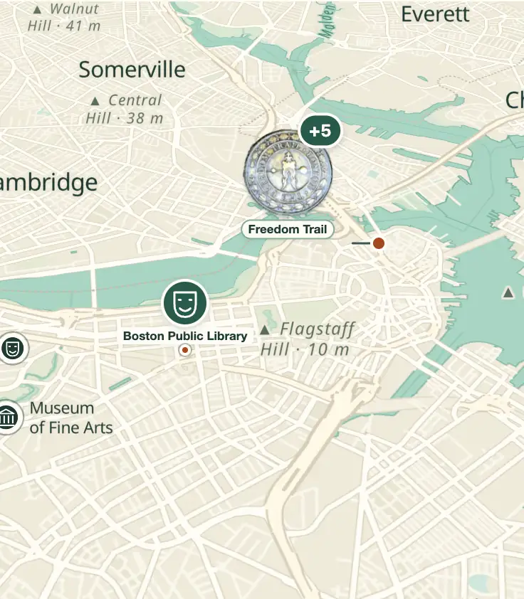
© OpenStreetMap · OpenFreeMap · © OpenMapTiles
Explore the map, read about the other places and plan your travel days in the app.
Open the appWhat to see
Boston: The peninsula and the three hills
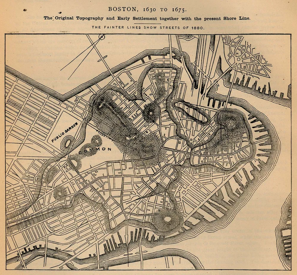
Boston was born on the Shawmut peninsula, tied to the mainland by a narrow isthmus, today's Washington Street, and crowned by three hills, of which only Beacon Hill remains: the others were leveled between 1799 and 1824 to fill in the surrounding bays.

Freedom Trail
A 4 km route marked by a red line of brick and paint on the sidewalk, created in 1951, linking 16 sites between Boston Common and the Bunker Hill monument. Walking it is free; guided tours with period-costume actors cost about $18–20 and last 90 minutes.
It's the simplest way to see colonial Boston: just follow the red line on foot, with no guide or ticket needed. Start in the morning at Boston Common and head toward Charlestown, having lunch in the North End along the way; the guided version, with period actors, costs about $18–20.
Check access

USS Constitution and Bunker Hill Monument
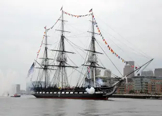
Launched in 1797 and still in service in the US Navy, the Constitution is the oldest floating warship in the world; the visit is free, with photo ID, at the Charlestown Navy Yard. A few blocks away, the granite Bunker Hill obelisk, completed in 1843, stands 67 m tall with 294 steps to the top, no elevator, no charge.
It's the end of the Freedom Trail and the stretch that gives the most for free: the ship is visited at no cost, with photo ID, and the obelisk is climbed free of charge. The 294 steps have no elevator, so save your breath.
Check access

Boston Public Library and Trinity Church
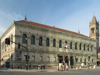
The BPL, from 1848, was the first major free municipal library in the US; the 1895 McKim building has the Bates Hall reading room, an interior courtyard, and murals by John Singer Sargent: all open with no ticket. Across Copley Square, H. H. Richardson's Trinity Church (1877) appears reflected in the glass facade of 200 Clarendon (1976), at 240 m the tallest building in New England.
The BPL was the first major free municipal library in the US. The library's 1895 building, free to enter, holds the Bates Hall reading room, the courtyard and murals by Sargent. On Copley Square, Trinity Church is reflected in the glass of 200 Clarendon, which stands 240 m tall and is the tallest building in New England.
Check access

Boston Common and Public Garden
The Common dates to 1634, the oldest public park in the United States, and served as common pasture until 1830. Next door, the Public Garden (1837) was the country's first public botanical garden; its pedal-powered Swan Boats have run since 1877, operated by the same Paget family, from April to September, for a few dollars.
It's the park where the Freedom Trail begins, and it's worth a walk around before following the red line. From April to September, the Swan Boat ride on the Public Garden lake costs just a few dollars.
Check access
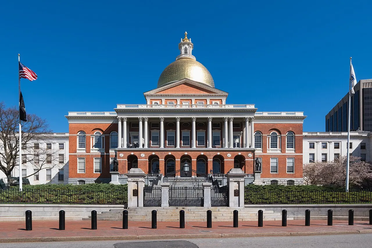
Massachusetts State House
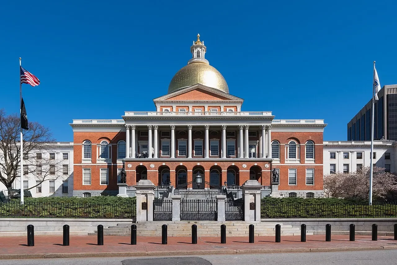
Seat of the state government since 1798, designed by Charles Bulfinch on a pasture that had belonged to John Hancock. The dome was covered in copper by Paul Revere in 1802 and gilded in 1874; free guided tours on weekdays, with ID.
The guided tour is free on weekdays, with ID, and shows the inside of the state government's seat. From outside, the golden dome appears right at the start of the Freedom Trail.
Check access
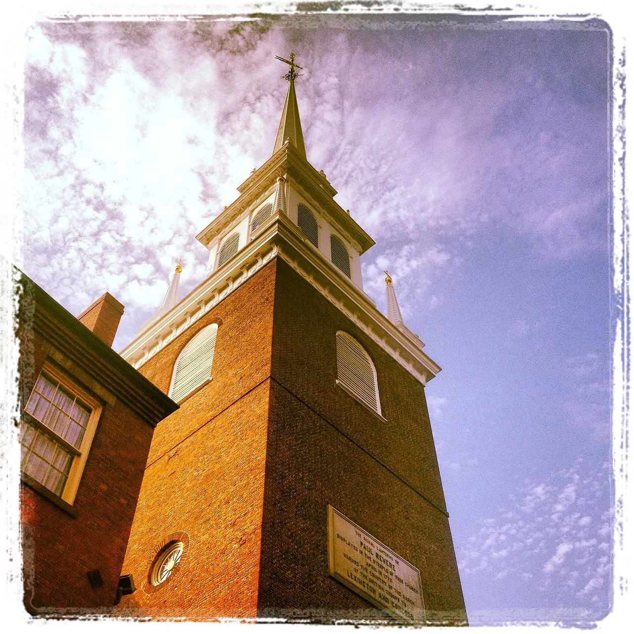
Old North Church and Paul Revere House
The Old North (Christ Church, 1723) is the oldest surviving church in the city and the place from which, on April 18, 1775, the two lanterns that warned of the British advance were hung. Five minutes away, the Paul Revere House, from around 1680, is the oldest residential building downtown; admission about $6.
The church of the 1775 lanterns and the Paul Revere House are five minutes apart in the North End, and the house charges about $6. Combine both visits with lunch in the neighborhood.
Check access

Fenway Park
Opened on April 20, 1912, it's the oldest ballpark still in use in the major leagues, with just over 37,000 seats and the 11.3 m left-field wall known as the Green Monster. Guided tours run nearly every day for about $25–40; a Red Sox game starts at around $30 for bleacher seats.
I'd trade the guided tour for a Red Sox game in the bleachers, starting at about $30, to see the oldest stadium in the major leagues full. With no game on your date, the tour costs about $25–40.
Check access

Isabella Stewart Gardner Museum
A Venetian-courtyard palace opened in 1903 to house the personal collection of Isabella Stewart Gardner, whose will forbids rearranging the works. On March 18, 1990, thieves made off with 13 pieces valued at about $500 million, including a Vermeer; the empty frames still hang on the wall. Anyone named Isabella gets in free.
Anyone named Isabella gets in free at the 1903 palace, and the frames from the March 18, 1990 theft still hang empty because the will forbids rearranging the works.
Check access

Faneuil Hall and Quincy Market
Faneuil Hall was donated by Peter Faneuil in 1742 as a market and meeting hall, and expanded by Bulfinch in 1806; the grasshopper weathervane dates to 1742. Quincy Market, from 1826, was restored in 1976 and became the model copied by dozens of cities: good to look at, pricey to eat at.
The 1742 assembly hall upstairs at Faneuil Hall can be seen in fifteen minutes, with the same grasshopper weather vane on top. The rest of the block is the 1826 Quincy Market, a food hall priced for tourists: have lunch on Salem Street, three blocks ahead instead.
Check access
Nilo’s itinerary
Start with the basic programme and choose extensions for the time you have.
Plan my days in the app ↗Day 1 · The colonial city, on foot, along the red line
Start at Boston Common at 9am and follow the Freedom Trail's red line: State House (free guided tour on weekdays), Park Street Church, and the Granary Burying Ground, where Paul Revere, John Hancock, and Samuel Adams are buried.
Continue to the Old State House (1713) and the circular stone marker on the sidewalk noting the 1770 massacre; then Faneuil Hall, to see the upstairs meeting hall, not to eat.
Have lunch in the North End: pizza or a mortadella sandwich on Salem Street, and a cannoli made fresh on Hanover Street.
Visit the Paul Revere House (about $6) and the Old North Church, and cross the bridge to Charlestown for the USS Constitution (free, with photo ID).
Climb the 294 steps of the Bunker Hill Monument before 4:30pm, when the last climb is allowed, and head back by ferry from the Navy Yard to Long Wharf (the T fare).
Day 2 · The 19th century, the museums, and baseball
Start at Copley Square: Trinity Church (1877) and, across from it, the Boston Public Library's McKim building. Go in to see Bates Hall, the interior courtyard, and Sargent's murals, no ticket needed.
Walk down the central mall of Commonwealth Avenue to the Public Garden and Boston Common, with a spin on the Swan Boats if it's between April and September.
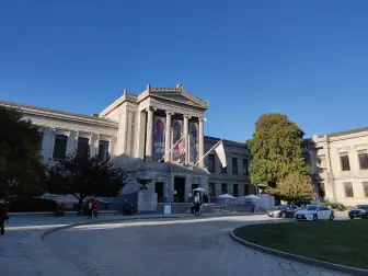
Afternoon in the Fenway: choose between the Museum of Fine Arts (about $32, half a day) and the Isabella Stewart Gardner (about $25, two hours, with the empty frames from the 1990 heist).
Before dinner, take the guided tour of Fenway Park or buy bleacher seats if the Red Sox are playing at home; the season runs from April to early October.
Have dinner in the South End, on Tremont Street, or catch a concert at Symphony Hall, a ten-minute walk from the MFA.




If you stay longer
Day 3 · The river, Cambridge, and the water
Take the Red Line to Harvard: Harvard Yard, the Coop bookstore, and the Harvard Art Museums, in Renzo Piano's 2014 building.
Walk or take one subway stop to Kendall Square to see the MIT campus, Frank Gehry's Stata Center and Eero Saarinen's chapel and auditorium, and the biotech-lab block.
Head back to Boston across the Longfellow Bridge on foot, with a view of the Charles and Back Bay, and have lunch in the Seaport.
Afternoon at the Institute of Contemporary Art and the waterfront boardwalk; from May to October, swap it for a ferry to Georges Island, in the harbor islands park.
Finish at the View Boston observatory, on the 52nd floor of the Prudential Center, in the late afternoon, to see the city's landfill layout from above.
Food
 AI illustration
New England clam chowder
A thick white soup of quahogs (local clams), potato, salt pork, milk, and cream, served with square crackers on top. A cup costs $8–14 at any raw bar; the Union Oyster House, open since 1826, is the country's oldest continuously operating restaurant.
 AI illustration
Lobster roll
Lobster in a hot-dog bun toasted in butter, served hot with butter (Connecticut style) or cold with mayonnaise (Maine style); Boston serves both. It costs $25–38 in 2026 and is better and cheaper between July and September.
 AI illustration
Raw oysters
The oysters come from the Massachusetts coast: from Duxbury (Island Creek), south of Boston, and from Wellfleet and Cotuit, on Cape Cod. They're sold by the piece at raw bars on ice, at $3–4 each or $1.50–2.50 during late-afternoon happy hour, with lemon and mignonette.
 AI illustration
Fried clams
Whole clams, belly and all, breaded in corn flour and fried, first documented in Essex, on the North Shore, in 1916. They come with french fries and tartar sauce; the strips-only version is considered inferior.
 AI illustration
Boston cream pie
It isn't a pie: it's two layers of sponge cake with pastry cream in between and a chocolate glaze, created at the Parker House in 1856. It's been the official dessert of the state of Massachusetts since 1996.
 AI illustration
North End cannoli
Fried pastry shell with a sweet ricotta filling, typical of the cannoli shops in the North End.
 AI illustration
North Shore-style roast beef sandwich
Thinly sliced, rare roast beef on a sesame-seed hamburger bun, with barbecue sauce, mayonnaise, and American cheese. It's neighborhood counter food, open late, $10–15.
 AI illustration
Dunkin' iced coffee
The chain was born in Quincy, south of the city, in 1950, and there's a store every few blocks. Ordering “regular” means with cream and sugar already mixed in, and much of the city drinks it iced even in January.
Day trips

Salem
26 km north: 30–35 minutes by commuter rail from North Station (Newburyport/Rockport line) or 55 minutes by ferry from Long Wharf, May to October. City of the 1692 witch trials, with the Peabody Essex Museum, the House of the Seven Gables, and a historic seaport center. In October the whole city turns into a Halloween fair and gets packed.

Lexington and Concord
25 to 35 km west: about 40 minutes by car, or the train from North Station (Fitchburg Line) to Concord, in about 40 minutes. This is where the War of Independence began, on April 19, 1775, and Minute Man National Historical Park and the Old North Bridge mark the battles. Concord is also home to Louisa May Alcott's house and Thoreau's Walden Pond, with a beach open for swimming in summer.
Provincetown, on Cape Cod
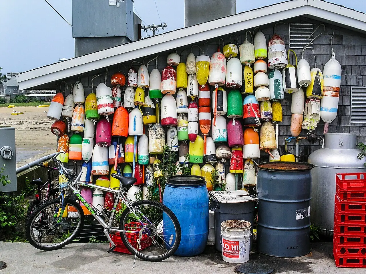
195 km by land, but a 90-minute fast ferry from Long Wharf, May to October, for about $80–110 round trip. A sandy tip where the Mayflower first anchored, in November 1620; today it has Commercial Street, dunes in the Cape Cod National Seashore, and whale-watching trips over Stellwagen Bank.
Where to begin
The colonial city, on foot, along the red line
Start at Boston Common at 9am and follow the Freedom Trail's red line: State House (free guided tour on weekdays), Park Street Church, and the Granary Burying Ground, where Paul Revere, John Hancock, and Samuel Adams are buried.
The 19th century, the museums, and baseball
Start at Copley Square: Trinity Church (1877) and, across from it, the Boston Public Library's McKim building. Go in to see Bates Hall, the interior courtyard, and Sargent's murals, no ticket needed.
Money
The currency is the US dollar, and the price on the tag isn't what you pay: the 6.25% state sales tax is added only at the register. At restaurants, the tax rises to 7% (6.25% state plus 0.75% city), and on lodging it reaches about 15%, between state, city and convention center taxes, so check the total before you book. Tipping is mandatory in practice: 18% to 22% at sit-down restaurants, $1–2 per drink at the bar and 15% to 20% for taxis and ride-hails. Card readers usually suggest 20/25/30%, but you can enter another amount. Cards are accepted everywhere, including food trucks and market stalls, and ATMs outside banks charge $3–5 in fees. Approximate 2026 ranges: coffee $4–6, breakfast $12–18, quick lunch $16–26, dinner with a drink $45–80 per person, draft beer $8–11 and museums $25–40. A midrange hotel costs $250–420 a night and climbs sharply in May, with graduations, and in September and October, with fall foliage and conventions. Since 2019, short-term rentals have been restricted to registered units occupied by their owners, so supply is small and nearly everyone ends up in a hotel.
Getting there and around
Logan, five kilometers from downtown
Logan Airport (BOS) is in East Boston, just 5 km from downtown, one of the closest major airports to a city center in the US. The Silver Line SL1 takes about 20 minutes to South Station and is free heading into the city. For the Blue Line, take the free Massport shuttle to Airport station, where the subway reaches downtown in about 15 minutes. A taxi or ride-hail costs $30–55, plus the tunnel toll and the airport pickup fee, and can take 45 minutes at rush hour; there's also a ferry to Long Wharf and the Seaport. By train, South Station serves Amtrak's Acela and Northeast Regional, with New York 3 hours 35 minutes to 4 hours 15 minutes away, and North Station, beneath the TD Garden arena, serves northern Massachusetts, New Hampshire and Maine.
Nobody says MBTA: here it's “the T”
The local system is the MBTA, which nobody calls by its initials: here it's “the T.” There are four color-coded subway lines: Red, Orange, Blue and the Green, a light-rail line with four branches. Add the Silver Line, a bus corridor, plus twelve commuter rail lines and ferries. In 2026, the subway costs $2.40 with a CharlieCard or a contactless card, and the bus costs $1.70. Tap-to-pay has worked on both since August 2024. Since September 1, 2026, the MBTA has been testing a pilot: unlimited transfers between bus, subway and ferry within two hours. You pay only the highest fare, as long as you use the same payment method from start to finish. A 1-day pass costs $11, a 7-day pass $22.50 and the monthly LinkPass $90. Children up to 11 ride free. Trains run from 5am to 12:30–1am, with no overnight service. The city is compact and walkable: the North End to Back Bay is about 45 minutes on foot. There are Bluebikes, with about 500 stations and a day pass of around $12. Skip the rental car: parking costs $40–70 a day, and the colonial streets are one-way.
Safety
Boston has one of the lowest violent crime rates among major US cities, and what little there is concentrates in specific areas, far from the usual visitor route. What actually goes wrong for visitors is much smaller: bike theft, car break-ins with a bag in view, phones snatched on crowded subway platforms and bar fights near Fenway after a game. Avoid, at any hour, the stretch of Massachusetts Avenue at Melnea Cass Boulevard, known as “Mass and Cass,” where there's open-air drug use and encampments. At night, parts of Roxbury, Mattapan and northern Dorchester also call for caution, though that doesn't mean those neighborhoods are off-limits by day, because they aren't. In winter, ice is the most common cause of tourist accidents, especially on brick sidewalks. The emergency number is 911. Tap water, from the Quabbin Reservoir, is safe and good. The hospital network is one of the best in the world and one of the most expensive: an ER visit without coverage costs thousands of dollars, so travel insurance with medical coverage isn't optional.
Etiquette tips
Don't wear Yankees gear at Fenway
The rivalry with New York has been taken seriously since the sale of Babe Ruth in 1919. No one will lay a hand on you, but the joke lasts nine innings and comes from several rows at once.
Order everything at once at the counter
At a diner, Dunkin', or raw bar, the order is expected ready in a single sentence: size, item, payment. Hesitating over the menu with a line behind you is the easiest local faux pas to make.
Respect the “space saver” after a snowstorm
Whoever digs their own car out of the snow marks the spot with a chair, a cone, or a bucket. City hall tolerates the marker for 48 hours after a snow emergency ends, and moving someone else's object is a real neighborhood conflict.
Cross the street with conviction
The Boston pedestrian crosses outside the crosswalk and against the light, and the driver counts on it. Stopping mid-street to reconsider is more dangerous than keeping pace with whoever's beside you.
Don't call the city “Beantown”
The nickname only shows up on souvenir T-shirts and out-of-town newspaper headlines. Locals say “Boston,” or, within the region, “the city.”
Pronounce the names the way the city does
Faneuil is “FAN-yul,” Quincy is “KWIN-zee,” Worcester is “WUSS-ter,” Gloucester is “GLOSS-ter,” Peabody is “PEE-buh-dee,” Copley is “COP-lee.” Saying the names the local way helps you communicate with residents.
Mistakes to avoid
Renting a car in a city with a 17th-century street layout
Renting a car. Downtown streets still follow a 17th-century layout, and there are rotaries with no clear right of way. Parking costs $40–70 a day. Practically every tourist destination is within ten minutes of a T station. The time lost hunting for parking cancels out any advantage of a car, even for half a day.
Harvard and MIT are across the river
Confusing Cambridge with Boston. Harvard and MIT are in a different city, across the river. Walking from Harvard Square to Back Bay takes about 50 minutes. Booking a hotel “near Harvard” can mean a 30-minute subway ride to the Freedom Trail.
Eating every meal at Quincy Market
Eating every meal at Quincy Market, where the food is ordinary and expensive. Three blocks away is the North End, and ten minutes by subway are Chinatown and Fields Corner, in Dorchester, where you eat better for half the price.
Forgetting the subway stops at 12:30am
Forgetting that the subway stops around 12:30am. There's no overnight line, and night buses are few. Settle on your last ride home, or budget the rideshare fare, before you head out for drinks, especially if you're staying in Cambridge or Somerville.
Wrong clothes: humid heat in July, icy sidewalks in January
Underestimating the weather. July and August are humid enough that you'll want a fresh shirt by midday, and from December to March the harbor wind makes it feel 8 to 10°C colder. Black ice on brick sidewalks causes falls in winter, so bring a windproof jacket, thick-soled shoes and layers.
Useful phrases
Wicked good
“Very good.” Wicked works as an intensifier throughout New England: wicked cold, wicked far, wicked expensive.
Take the T
“Take the subway.” No one says subway here; you say “the T,” or the color's name: “take the Red Line to Park.”
Bubbler
Drinking fountain. Outside New England and Wisconsin almost no one uses the word; asking for a “water fountain” also works.
The packie
The liquor store, from package store. Not every supermarket sells alcohol in Massachusetts, so “stop at the packie” is its own step in a night out.
A regular coffee
Coffee with cream and sugar already mixed in: not black coffee. If you want it plain, ask for “black, no sugar.”
Rotary
Traffic circle. In Massachusetts you don't say roundabout: “take the second exit off the rotary.”
Districts
Beacon Hill
A hillside of 1800–1850 brick row houses, gas lamps, and uneven brick sidewalks, between the State House and the river. Louisburg Square and Acorn Street are the photos; the north slope was, in the 19th century, the center of Boston's free Black community, with the 1806 African Meeting House still standing.
North End
The longest continuously inhabited neighborhood in the city, and Italian since the early 20th century. Narrow streets, Hanover Street full of cafés and pastry shops, the Paul Revere House and the Old North Church three blocks apart, and patron-saint processions on weekends in August.
Back Bay
Landfill from 1857–1890 turned into a regular grid, the city's genteel address. Shop on Newbury Street, walk the central mall of Commonwealth Avenue, see Copley Square with Trinity Church and the public library facing each other.
South End
The largest continuous stretch of Victorian brick row houses in the United States, with oval squares and tall stoops. It concentrates restaurants on Tremont and Washington, the SoWa gallery district with a market on Sundays from May to October, and it's the city's historic center of LGBTQ+ life.
Seaport (South Boston Waterfront)
A neighborhood built almost entirely after 2000 on parking lots and rail yards: glass towers, the convention center, the Institute of Contemporary Art, and a waterfront boardwalk. This is where the city looks new, and where high tide is a matter of engineering.
Charlestown
Charlestown occupies the tip of land between the mouth of the Charles and the Mystic, across the river, and you reach it on foot over the North End bridge, following the Freedom Trail, or by ferry. It holds the Navy Yard with the frigate USS Constitution, the Bunker Hill obelisk and steep streets of Federal-style houses; it was an Irish working-class neighborhood and is expensive today.
Jamaica Plain, Roxbury, and Dorchester
The southern arc of the city, where most Bostonians live. Jamaica Plain has Centre Street, the pond, and the Arnold Arboretum; Roxbury is the historic center of Black Boston, with Nubian Square; Dorchester is the largest neighborhood, with Vietnamese Fields Corner and a Cape Verdean, Haitian, and Irish presence.
Cambridge and Somerville
Separate cities across the Charles, connected by the Red Line and the Green Line. Cambridge has Harvard Square, Central Square and Kendall Square, the biotech block next to MIT; Somerville has Davis Square, on the Red Line, and Union Square, which got the Green Line in 2022, with Portuguese and Brazilian restaurants.
History
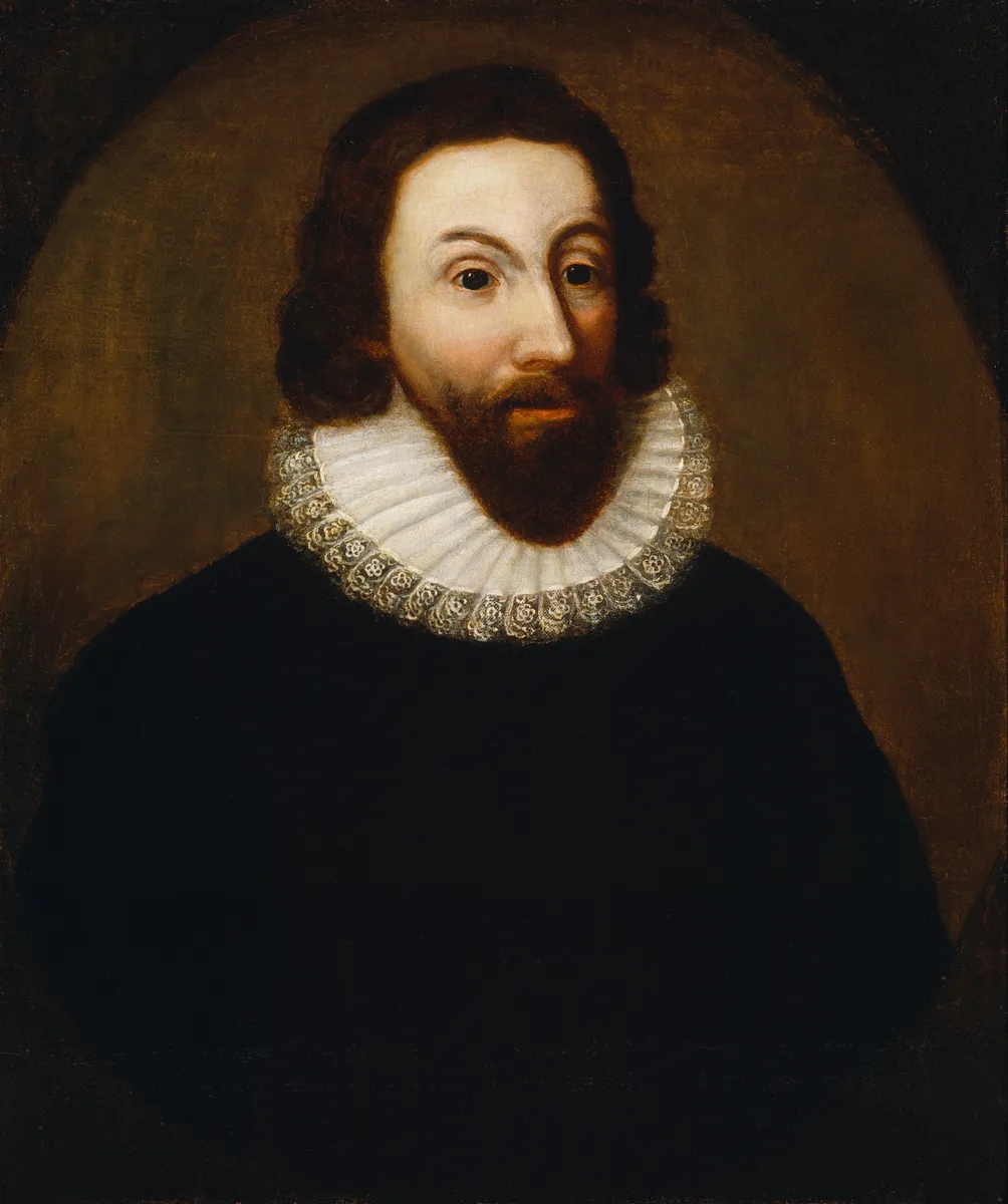
1630 · Puritan founding at Shawmut
On September 7, 1630, English colonists led by John Winthrop named the Shawmut peninsula, where the clergyman William Blaxton had lived alone since 1625, Boston. The name came from Boston, in the English county of Lincolnshire, where part of the group had sailed from.
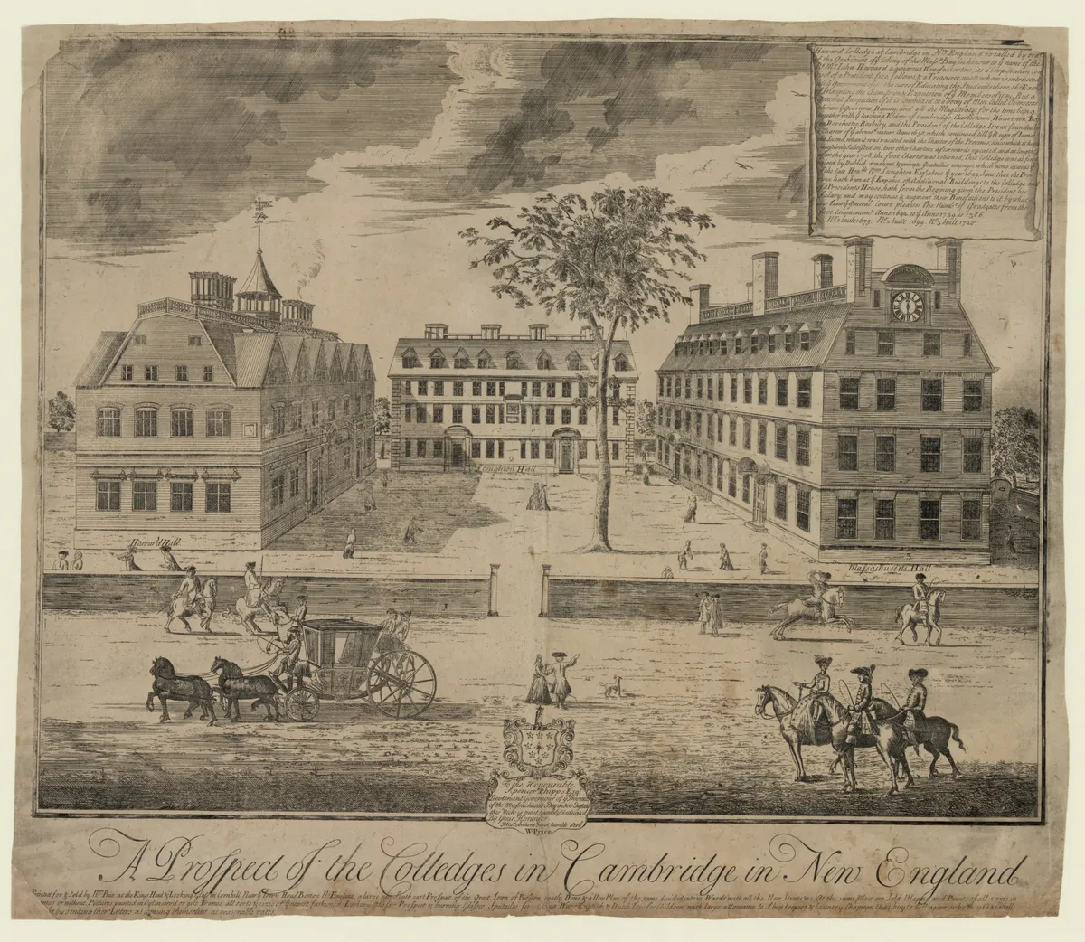
1635–1636 · The first school and the first college
Boston Latin School opened in 1635 and is still running; the following year the colony's court voted 400 pounds for a school across the river, in Newtowne, which in 1639 took the name of John Harvard, the minister who left it his library and half his estate when he died. It was the first institution of higher education in the English colonies in America.
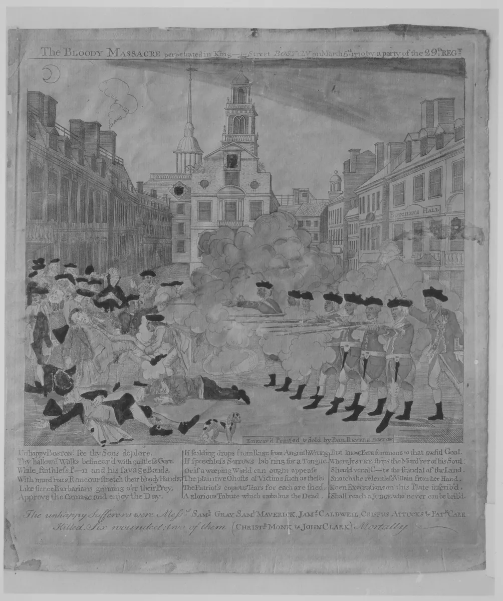
1770–1773 · The massacre and the tea in the harbor
On March 5, 1770, British soldiers killed five civilians on King Street, among them Crispus Attucks. On December 16, 1773, colonists in disguise threw 342 chests of East India Company tea into the harbor water.
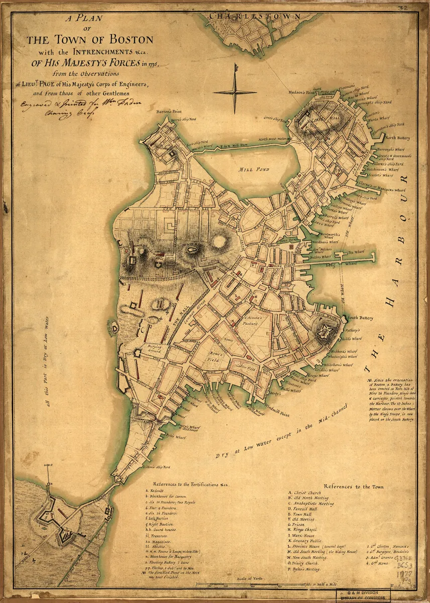
1775–1776 · The siege and the evacuation
After Lexington and Concord, on April 19, 1775, and the Battle of Bunker Hill, on June 17, the militias laid siege to the city for eleven months. The British sailed away on March 17, 1776, a date still marked as a municipal holiday, Evacuation Day.
1799–1890s · The city built on landfill
Boston leveled the hills at the top of the peninsula and used the earth to fill in the coves: first Mill Pond and the South End, then Back Bay, filled with gravel brought by train from Needham between 1857 and the 1890s. The area of dry land more than tripled.
1845–1920 · The immigrant city
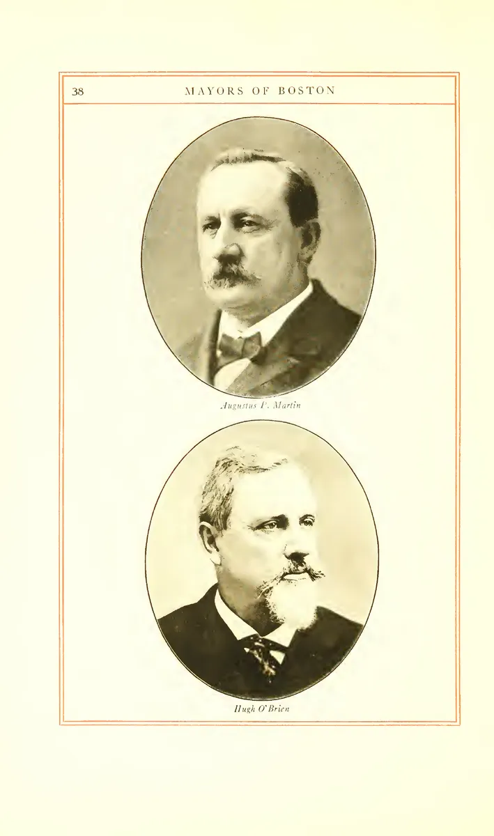
The potato famine brought hundreds of thousands of Irish to the port starting in 1845; by around 1900, Italians occupied the North End and Eastern European Jews the West End. In 1884 the city elected its first Irish-Catholic mayor, and local politics stopped being Puritan for good.
1872 · The great fire
Between November 9 and 10, fire destroyed 776 buildings across about 26 hectares of the commercial district. The mandatory rebuilding in stone and brick gave the Financial District the layout it still has.

1897 · North America's first subway
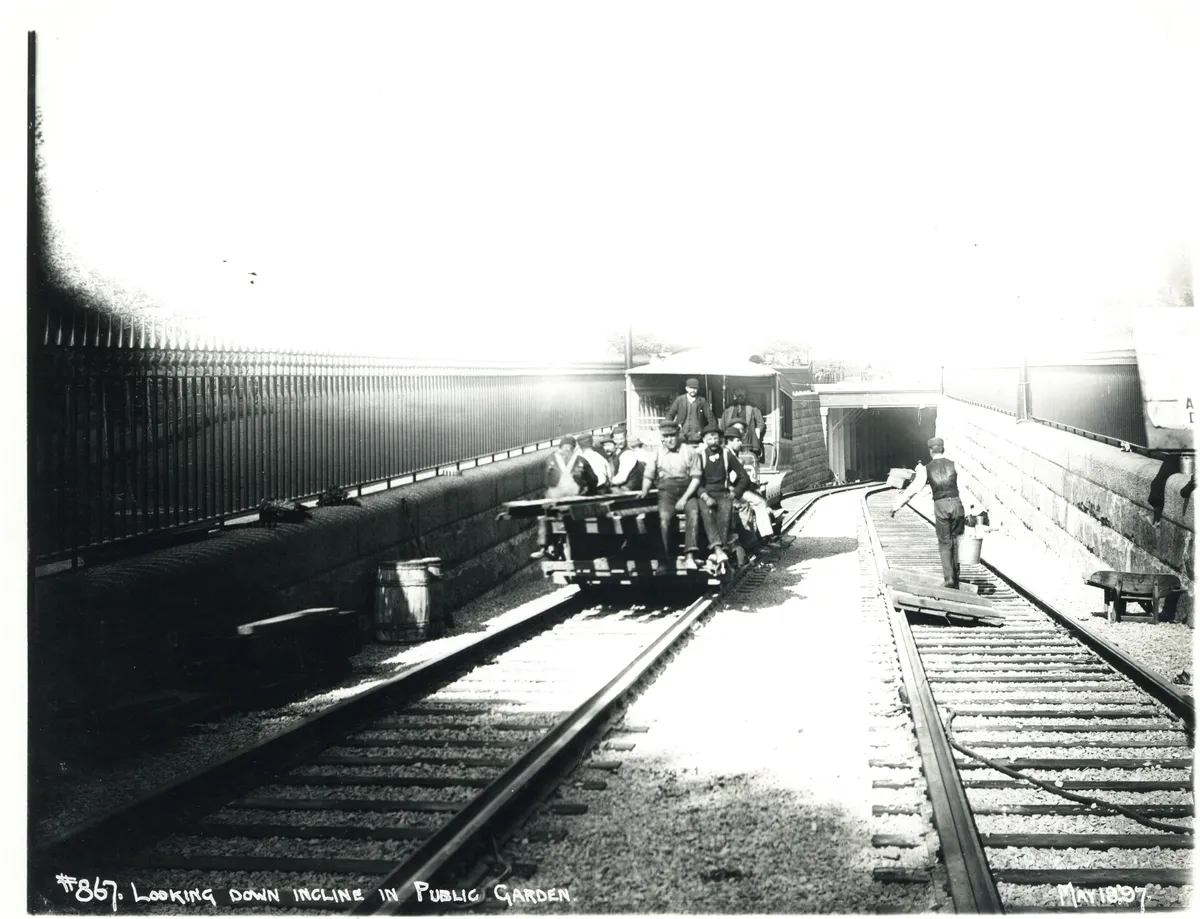
The Tremont Street subway opened on September 1, 1897, to get streetcars off the congested street, ahead of any other subway on the continent. That same year, on April 19, the first Boston Marathon was run, with fifteen entrants.
1958–1974 · Demolition, the elevated highway, and busing
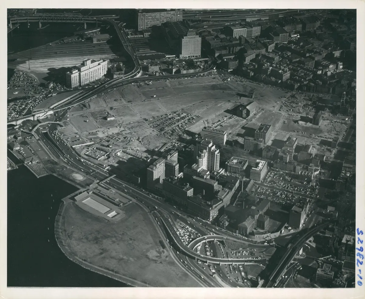
Urban renewal razed the entire West End in 1958, displacing about 2,700 families, and cut through downtown with the elevated Central Artery in 1959. In June 1974, Judge W. Arthur Garrity ordered busing between schools to desegregate the city's school system, and the clashes in South Boston and Charlestown lasted for years.
1991–2008 · The Big Dig
The city buried the Central Artery in a 5.6 km tunnel and opened the Ted Williams Tunnel to the airport, at a cost of roughly $15 billion: over $24 billion counting interest, the most expensive public works project in American history. In place of the elevated highway, the Rose Kennedy Greenway linear park opened in 2008.
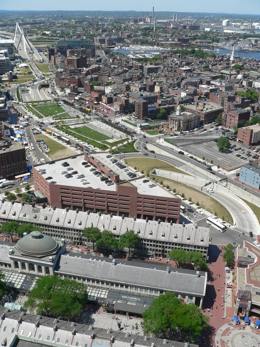
2025–2026 · The 250th anniversary and the World Cup
In April 2025 the region marked the 250th anniversary of Lexington and Concord, and on July 4, 2026, that of the Declaration of Independence, with Boston at the center of the calendar. Between June and July 2026, the stadium in Foxborough, 45 km from the city, hosted seven World Cup matches.

Complete history
It exists because of the shape of the land
Boston exists because of the shape of the land. The Shawmut peninsula had fresh spring water, a deep, sheltered harbor, and an isthmus a few hundred meters wide connecting it to the mainland: easy to defend, easy to charge a toll on. The Puritans who landed in 1630 had come to build a model religious society, the “city on a hill” of Winthrop's sermon. Two obsessions survived that founding and explain the city today: schooling (Boston Latin in 1635, Harvard in 1636, a compulsory-schooling law in 1647) and putting everything in writing.
Cod, rum, and triangular trade
In the 18th century the port lived off cod, rum, and triangular trade: Massachusetts legalized slavery in 1641 and was one of the first places to abolish it, by court ruling, in 1783. When London decided to fund its wars by taxing colonial trade, the blow landed here first: the Stamp Act in 1765, the Townshend Acts in 1767, the massacre of 1770, the tea in the harbor in 1773, and, in 1774, the closing of the port as punishment. It was that closure that united the other colonies with Boston. Fifteen years of local conflict turned into the war of independence, and turned, two centuries later, into the economic backbone of the city's tourism: the Freedom Trail was created in 1951, at a journalist's suggestion, to link the sites in a single line.
The Erie Canal took away the primacy
The 19th century took Boston's commercial primacy away. The Erie Canal, opened in 1825, shifted trade from the interior to New York, and the city reinvented itself on three fronts: textile industry in the Merrimack Valley (Lowell, Lawrence), finance run by the Brahmin families, with the “Boston trustee” model and the first mutual fund in the US, created here in 1924, and moral reform, with William Lloyd Garrison's abolitionism and his newspaper The Liberator starting in 1831, Concord transcendentalism, and the creation of pioneering public hospitals and libraries. At the same time it was filling in its bays: Back Bay and the South End were born in these decades, and Frederick Law Olmsted stitched together six parks into a continuous system of about 11 km, the Emerald Necklace, between 1878 and 1896.
Change of command and an urban-planning mistake
The 20th century brought a change of command and an urban-planning mistake. Irish, Italian, and Jewish residents took politics out of Protestant hands; the textile industry moved South; urban renewal in the 1950s and 1960s demolished entire neighborhoods and put up an elevated highway over downtown. The busing crisis, starting in 1974, exposed the city's segregation and marked its reputation for a generation; public-school enrollment plummeted. The population fell from 801,000 in 1950 to 563,000 in 1980: rock bottom.
The recovery came from schools and hospitals
The recovery came from what Boston had been cultivating for centuries: its schools, going back to Boston Latin and Harvard in the 17th century, and the hospitals founded from the 19th century on. Route 128 drew electronics companies in the 1960s; Kendall Square, next to MIT, became the largest biotech cluster in the world; the Longwood Medical Area brings together Mass General Brigham, Dana-Farber and Boston Children's within a few blocks; and about 35 colleges and universities in the region take in more than 150,000 students a year. The Big Dig gave the waterfront back to downtown; the harbor cleanup, ordered by a court in 1986 and carried out with the Deer Island treatment plant in the 1990s, made the water swimmable; and the Seaport was built from scratch on parking lots after 2000. The bill is steep: Boston has one of the most expensive housing markets in the US, and public debate in 2026 centers on housing, transit and sea level.
Boston was founded there because of the terrain: a deep port, fresh water, and an isthmus that was easy to defend.
The red route was born in 1951, a journalist's idea.
Geography and shape of the city
The peninsula and the three hills
Boston covers 232 km², of which about 125 km² are dry land, at the bottom of Massachusetts Bay, where the Charles and Mystic rivers meet the Atlantic. The original core is the Shawmut peninsula, connected to the mainland by a narrow isthmus (today's Washington Street, still called “the Neck”) and crowned by three hills, of which only Beacon Hill remains: the others were leveled between 1799 and 1824 to serve as landfill.
Crooked colonial streets and the Back Bay grid
From this come the city's two overlapping urban layouts: the colonial center of short, crooked, right-angle-free streets (Financial District, North End, Beacon Hill), which confuses anyone's mental map, and the filled-in areas with a designed layout; Back Bay is a regular grid of French inspiration, with cross streets in alphabetical order from Arlington to Hereford, and the South End has oval squares in the London style.
Boston's geography: low relief, climate, and tide
The terrain is low, almost all of it under 15 m; the waterfront adds up to about 76 km of shoreline and 34 harbor islands, now a national recreation area. The climate is humid continental with an ocean influence: snowy winters and nor'easters, hot, muggy summers, and dry, clear falls. The backbone of green space is Olmsted's Emerald Necklace, which still works as a drainage system. The landfill left the city exposed to the sea: much of Back Bay and the Seaport sits just a few decimeters above high tide, and the city is planning coastal defenses for the coming decades.
Culture
This is where knowledge gets made
Boston runs on universities, teaching hospitals, and research centers. September is collective moving month, and late May is graduation season, which sells out the hotels. Harvard (1636) and MIT (1861, in Cambridge since 1916) anchor the axis across the river; Berklee (1945) and the New England Conservatory (1867) train musicians; the Longwood Medical Area concentrates hospitals that show up on any American clinical ranking. This translates into programming: near-daily public lectures, the Harvard Art Museums, the MIT Museum, and the Ig Nobel, the science-humor prize handed out every September.
The Boston Symphony Orchestra has played Symphony Hall since 1900
Classical music has a fixed address: the Boston Symphony Orchestra, founded in 1881, has played at Symphony Hall since 1900, a hall whose acoustics were calculated by Wallace Clement Sabine and are still used as a world reference. The Boston Pops, created in 1885, handle the popular repertoire and the outdoor July 4 concert. The Handel and Haydn Society, from 1815, is the country's oldest continuously operating concert-music ensemble. On the other side, the city has exported Aerosmith, Pixies, Mission of Burma, Dropkick Murphys, Donna Summer, and New Kids on the Block; “Dirty Water,” by the Standells (1966), plays at Fenway after every Red Sox win.
Fenway Park and the Boston Marathon
Sports fill the city year-round. Fenway Park, opened in 1912, is the oldest ballpark in use in Major League Baseball, and the Boston Marathon, run since 1897, closes the streets from Hopkinton to Boylston Street on the third Monday in April, the state holiday of Patriots' Day. Away from the stadiums, Boston's streets also show up often on screen, in films such as Good Will Hunting (1997), Mystic River (2003), The Departed (2006) and Spotlight (2015).
Festivals and events
Boston Marathon
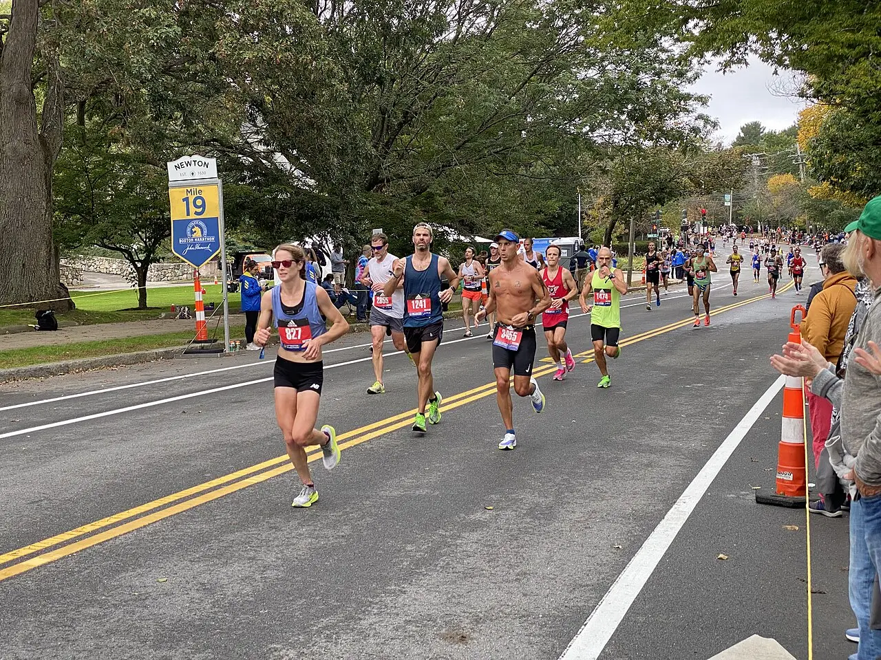
Third Monday of April, on the state holiday of Patriots' Day. A race run since 1897, the world's oldest annually held marathon: 42.195 km from Hopkinton to Boylston Street, with about 30,000 entrants and a minimum qualifying time. Streets close and the Green Line runs packed all day.
Boston Pops Fireworks Spectacular
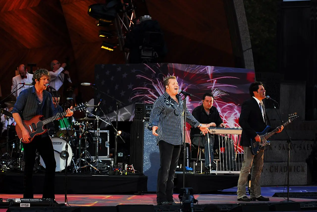
July 4, at the Hatch Shell, on the banks of the Charles. Free outdoor concert with the 1812 Overture and fireworks over the river; hundreds of thousands of people and a security check at the entrance, with arrival recommended in the early afternoon.

Head of the Charles Regatta
Third weekend of October. The world's largest three-day regatta, with about 11,000 rowers on a 4.8 km upriver course; watch for free from the bridges and banks in Cambridge and Allston.

North End feasts
Weekends in July and August, peaking with the Saint Anthony's Feast and the Fisherman's Feast, in the last days of August. Saint's-day processions dating to the 1910s, arancini and zeppole stands, and bands on Hanover Street.

First Night
December 31 since 1976. It was the first New Year's Eve festival of its kind in the world. Ice sculptures, performances in churches and museums, and two fireworks shows, at 7pm for families and at midnight over the harbor.
Books and films
Common Ground, by J. Anthony Lukas (1985)
Follows three families (Black, Irish, and middle-class white) through the 1970s busing crisis. It's the best book ever written on how race, neighborhood, and school organized Boston, and it won the 1986 Pulitzer.
Spotlight (Tom McCarthy, 2015)
Reconstructs the Boston Globe investigation that revealed, in 2002, the systematic cover-up of sexual abuse in the archdiocese. It shows the city working from the inside: parish, courthouse, school, and newspaper all on a first-name basis.
Mystic River, by Dennis Lehane (1998)
A novel set in the Irish neighborhoods of the city's south side, adapted by Clint Eastwood in 2003 as Mystic River. It explains block loyalty, distrust of the police, and the weight of never leaving the street you were born on.
Frequently asked questions
Boston: how do you get from Logan Airport to downtown?
The Silver Line SL1 takes about 20 minutes to South Station, free of charge heading into the city.
Boston: how do you get to Salem?
Salem is 26 km to the north, 30 to 35 minutes by commuter rail from North Station (Newburyport/Rockport line) or 55 minutes by ferry from Long Wharf, May to October.
Boston: does the price tag already include tax?
No: the 6.25% state tax is only added at the register, and at restaurants it rises to 7%.
Boston: when is the best time to go?
The best window runs from mid-September to late October, with days of 15 to 22°C, little rain and dry air. The foliage changes color between early and late October, when the whole region heads out to see the trees, so book ahead.
Boston: what happens if I go to Fenway wearing Yankees gear?
No one will lay a hand on you, but the joke lasts nine innings and comes from several rows at once.
Other cities in the country
United States ↗- Days
- 4–5
- When
- Apr–Jun · Sep–Oct
- Per person/day
- Average 180–320 USDMid-range · per person/day
Cost scope
Per person per day: accommodation, meals, urban transport, visits and a small allowance for extras. Flights excluded; larger purchases vary. Editorial estimate, not a quote.
- Days
- 4–5
- When
- Apr–May · Nov
- Per person/day
- Average 220–330 USDMid-range · per person/day
Cost scope
Per person per day: accommodation, meals, urban transport, visits and a small allowance for extras. Flights excluded; larger purchases vary. Editorial estimate, not a quote.
- Days
- 3
- When
- Sep–Oct
- Per person/day
- Average 180–280 USDMid-range · per person/day
Cost scope
Per person per day: accommodation, meals, urban transport, visits and a small allowance for extras. Flights excluded; larger purchases vary. Editorial estimate, not a quote.
- Days
- 4
- When
- May–Jun · Sep–Oct
- Per person/day
- Average 150–260 USDMid-range · per person/day
Cost scope
Per person per day: accommodation, meals, urban transport, visits and a small allowance for extras. Flights excluded; larger purchases vary. Editorial estimate, not a quote.
- Days
- 2–3
- When
- Jan–Apr · Nov–Dec
- Per person/day
- Average 200–350 USDMid-range · per person/day
Cost scope
Per person per day: accommodation, meals, urban transport, visits and a small allowance for extras. Flights excluded; larger purchases vary. Editorial estimate, not a quote.
- Days
- 3
- When
- Feb–May · Oct–Dec
- Per person/day
- Average 250–350 USDMid-range · per person/day
Cost scope
Per person per day: accommodation, meals, urban transport, visits and a small allowance for extras. Flights excluded; larger purchases vary. Editorial estimate, not a quote.
- Days
- 2–3
- When
- Mar–May · Oct–Nov
- Per person/day
- Average 200–350 USDMid-range · per person/day
Cost scope
Per person per day: accommodation, meals, urban transport, visits and a small allowance for extras. Flights excluded; larger purchases vary. Editorial estimate, not a quote.
- Days
- 3
- When
- Mar–May
- Per person/day
- Average 220–320 USDMid-range · per person/day
Cost scope
Per person per day: accommodation, meals, urban transport, visits and a small allowance for extras. Flights excluded; larger purchases vary. Editorial estimate, not a quote.
- Days
- 2–3
- When
- Jun–Sep
- Per person/day
- Average 130–220 USDMid-range · per person/day
Cost scope
Per person per day: accommodation, meals, urban transport, visits and a small allowance for extras. Flights excluded; larger purchases vary. Editorial estimate, not a quote.
- Days
- 5–6
- When
- Jan–Apr · Nov–Dec
- Per person/day
- Average 368 USDMid-range · per person/day
Cost scope
Per person per day: accommodation, meals, urban transport, visits and a small allowance for extras. Flights excluded; larger purchases vary. Editorial estimate, not a quote.
- Days
- 4–6
- When
- Apr–May · Sep
- Per person/day
- Average 329 USDMid-range · per person/day
Cost scope
Per person per day: accommodation, meals, urban transport, visits and a small allowance for extras. Flights excluded; larger purchases vary. Editorial estimate, not a quote.
- Days
- 2
- When
- Apr–May · Sep–Oct
- Per person/day
- Average 203 USDMid-range · per person/day
Cost scope
Per person per day: accommodation, meals, urban transport, visits and a small allowance for extras. Flights excluded; larger purchases vary. Editorial estimate, not a quote.
- Days
- 3
- When
- Apr · Sep–Oct
- Per person/day
- Average 251 USDMid-range · per person/day
Cost scope
Per person per day: accommodation, meals, urban transport, visits and a small allowance for extras. Flights excluded; larger purchases vary. Editorial estimate, not a quote.
- Days
- 3
- When
- May–Jun · Sep–Oct
- Per person/day
- Average 158 USDMid-range · per person/day
Cost scope
Per person per day: accommodation, meals, urban transport, visits and a small allowance for extras. Flights excluded; larger purchases vary. Editorial estimate, not a quote.