United States
Yosemite
Granite walls, snowmelt waterfalls, giant sequoias and high Sierra
Days Start with the basic programme and choose extensions for the time you have.
How the guide reaches this number
A single-day round trip from San Francisco eats up seven to eight hours on the road there and back and leaves little more than a quick pass by the valley overlooks.
3
When May, June, September and October; May and June are peak waterfall season from snowmelt (but Tioga Road may open only in late May or June), July and August bring heat and the biggest crowds in the valley, and from November to March snow closes the high roads and chain controls often require chains in the car.
How the guide reaches this number
The month you choose completely changes what is open and what you see in Yosemite. May and June are the months of greatest visual impact in Yosemite Valley: the melting of the snow that built up in the range brings Yosemite Falls, Bridalveil Fall, Vernal Fall and Nevada Fall to peak flow, Mirror Lake is full and the meadows are green; on the other hand, Tioga Road and Glacier Point Road usually reopen only between the second half of May and mid-June (or later after very severe winters). July and August have all the high roads and Tuolumne Meadows open, but bring strong heat on the valley floor (30 °C or more), parking lots full by midmorning and a gradual drop in the flow of Yosemite Falls, which often dries up in August. September and October offer settled weather, excellent temperatures for long hikes in the valley and on Tioga Road, fall colors in the oaks and maples and shorter lines, though Yosemite Falls and Mirror Lake are usually dry (Vernal and Nevada Falls keep running, if with less water) and the Half Dome cables are taken down in mid-October. From November to March, snow closes Tioga Road, Glacier Point Road and the Mariposa Grove shuttle, but Yosemite Valley stays open via Highway 140, with quiet winter scenery and the Horsetail Fall phenomenon in February.
Per person/day Budget around USD67; mid-range around USD158; comfortable around USD335 per person per day, based on spending reported by travelers to Budget Your Trip (checked October 2026).
How the guide reaches this number
Indicative figures, excluding travel to the destination.
Budget around USD67; mid-range around USD158; comfortable around USD335 per person per day, based on spending reported by travelers to Budget Your Trip (checked October 2026). Indicative figures, excluding travel to the destination.
Per person per day: accommodation, meals, urban transport, visits and a small allowance for extras. Flights excluded; larger purchases vary. Editorial estimate, not a quote.
 What Nilo thinks
I'd book three full days for Yosemite: the first for Yosemite Valley, starting early on the Mist Trail to the top of Vernal Fall (or Nevada Fall, if you are prepared for 5 to 6 hours) and leaving the afternoon for Yosemite Village, Lower Yosemite Fall, Cook's Meadow, El Capitan Meadow and the end-of-day light at Tunnel View; the second for the southern sector, with the giant sequoias of Mariposa Grove and the Glacier Point Road overlooks (Taft Point and Glacier Point); and the third for crossing the high range on Tioga Road to Olmsted Point, Tenaya Lake and Tuolumne Meadows (substituting Hetch Hetchy if the trip falls between late October or November and late May or June, when Tioga Road closes with snow). A single-day round trip from San Francisco eats up seven to eight hours on the road there and back and leaves little more than a quick pass by the valley overlooks.I'd start planning Yosemite by choosing the season before booking the room, because the park in May and the park in September feel like two different places. In late spring, the Sierra Nevada snowmelt sends water crashing down Yosemite Falls, Bridalveil Fall and the Mist Trail, filling the valley floor with mist and the roar of rapids; in late summer and early fall, Yosemite Falls dries up, but the high roads are clear of snow and open the way to the Glacier Point overlook and to the lakes and meadows at 2,600 meters on Tioga Road.
Read more
In any month, what impresses is the scale. The valley floor is a plain 11 km long by about 1.5 km wide, and the walls around it rise almost a thousand meters without a step: El Capitan stands about 914 m above the meadow, and the climbing teams who spend days on it, sleeping in suspended tents, show up from the ground as colored dots. To the south, the giant sequoias of Mariposa Grove add the scale of time, with the Grizzly Giant estimated at about 3,000 years old. And it was here, with the Yosemite Grant signed by Abraham Lincoln in 1864, that a natural landscape was first protected for public use, an idea that later gave rise to the national parks.
Quick facts
- Population
- Federal conservation area with no municipality of its own; the park received 4,285,729 visits in 2024, according to National Park Service statistics.
- Founded
- Ancestral territory of the Southern Sierra Miwok and Ahwahneechee peoples; the Yosemite Grant was signed on June 30, 1864 to protect the valley and Mariposa Grove, and Congress created Yosemite National Park on October 1, 1890.
- Country and region
- United States, east-central California, Sierra Nevada range (spanning parts of Mariposa, Tuolumne, Madera and Mono counties).
- Language
- English; safety signs, official maps at the visitor centers and visitor services have supporting materials in Spanish and other languages.
- Currency
- US dollar (USD).
- Time zone
- America/Los_Angeles (Pacific Time): UTC−8 in standard time and UTC−7 in daylight saving time, from the second Sunday in March to the first Sunday in November.
- Best time to visit
- May, June, September and October; May and June are peak waterfall season from snowmelt (but Tioga Road may open only in late May or June), July and August bring heat and the biggest crowds in the valley, and from November to March snow closes the high roads and chain controls often require chains in the car.
- Average daily cost
- Budget around USD67; mid-range around USD158; comfortable around USD335 per person per day, based on spending reported by travelers to Budget Your Trip (checked October 2026). Indicative figures, excluding travel to the destination.
When to go
May, June, September and October; May and June are peak waterfall season from snowmelt (but Tioga Road may open only in late May or June), July and August bring heat and the biggest crowds in the valley, and from November to March snow closes the high roads and chain controls often require chains in the car.
How the year changes

The month you choose completely changes what is open and what you see in Yosemite. May and June are the months of greatest visual impact in Yosemite Valley: the melting of the snow that built up in the range brings Yosemite Falls, Bridalveil Fall, Vernal Fall and Nevada Fall to peak flow, Mirror Lake is full and the meadows are green; on the other hand, Tioga Road and Glacier Point Road usually reopen only between the second half of May and mid-June (or later after very severe winters). July and August have all the high roads and Tuolumne Meadows open, but bring strong heat on the valley floor (30 °C or more), parking lots full by midmorning and a gradual drop in the flow of Yosemite Falls, which often dries up in August. September and October offer settled weather, excellent temperatures for long hikes in the valley and on Tioga Road, fall colors in the oaks and maples and shorter lines, though Yosemite Falls and Mirror Lake are usually dry (Vernal and Nevada Falls keep running, if with less water) and the Half Dome cables are taken down in mid-October. From November to March, snow closes Tioga Road, Glacier Point Road and the Mariposa Grove shuttle, but Yosemite Valley stays open via Highway 140, with quiet winter scenery and the Horsetail Fall phenomenon in February.
Nilo's tips
Park in the valley before 8:30 a.m. and use the free shuttle
On spring weekends and all summer long, the parking areas at Yosemite Village, Curry Village and Yosemite Falls fill up before 9 a.m. I'd leave the car in the first space I found and use only the free shuttle and the valley's flat trails for the rest of the day.
Choose Highway 140 in winter or take the YARTS bus from Merced
If the trip falls between November and March (or in April, when it can still snow), I'd avoid depending on the higher highways (120 and 41) during storms and would come in via Highway 140, which follows the low Merced River canyon. Since chain controls require carrying chains in the car even in 4x4 and rental vehicles, I'd confirm with the rental company before booking that the contract allows using them; anyone who prefers not to drive in snow can solve the arrival with the YARTS bus leaving from Merced.
Take everything with a scent out of the car before nightfall
In Yosemite, a forgotten granola bar in a backpack, a soda can or a tube of lip balm in the console is enough for a black bear to force open the car door and earn you a federal fine. I'd go over the whole vehicle with a fine-tooth comb every late afternoon and lock everything in the metal lockers in the parking areas.
Combine Mariposa Grove and Glacier Point on the same trip south
Since the Mariposa Grove sequoia grove and the Glacier Point Road entrance are both on the southern axis of Highway 41, a little over an hour from the valley, I'd group the two on the same day between late May and October, instead of climbing the range twice.
Explore the map
Explore the map, read about the other places and plan your travel days in the app.
Open the appWhat to see
Tunnel View
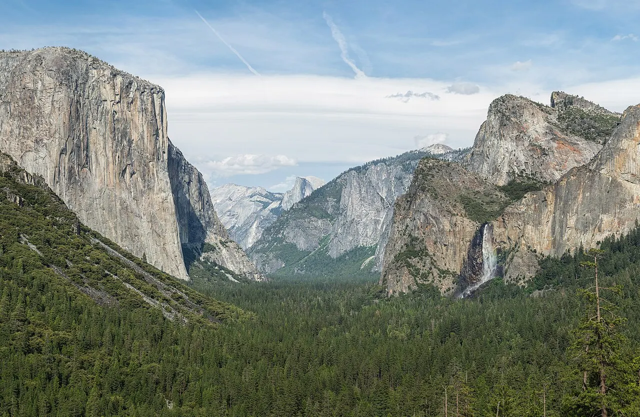
An overlook on the edge of Highway 41 (Wawona Road), just east of the mouth of the Wawona Tunnel, opened in 1933. It is the classic vantage point on Yosemite's glacial structure: in a single frame you see the vertical wall of El Capitan on the left, Bridalveil Fall on the right, the towers of Cathedral Rocks and the profile of Half Dome in the background. It has two free parking pullouts right on the highway; in late afternoon the light hits the granite head-on, but in winter or high season the spaces turn over quickly.
Check access

Bridalveil Fall
A 189 m waterfall that plunges from a hanging valley right at the western entrance to Yosemite Valley. It flows all year, with peak volume during the snowmelt peak in May and June, when the wind spreads mist across the base. The area's rehabilitation project, begun in 2019 and completed in fall 2024, reorganized the parking lot, replaced the old restrooms and improved access to the viewing platform at the end of a short paved trail.
Check access

El Capitan
A continuous granite monolith rising to 2,308 m of elevation, about 914 m above the floor of Yosemite Valley. More than a viewpoint to climb to, it is best experienced from the meadow at its base (El Capitan Meadow), on Northside Drive: bring binoculars in fall or spring to spot climbers on The Nose and Salathé Wall routes, and walk only on the marked trails so you don't trample the meadow's damp vegetation.
Check access
Yosemite Falls
A set of three successive drops (Upper Yosemite Fall at 440 m, the Middle Cascades at 206 m and Lower Yosemite Fall at 98 m) totaling 739 m of vertical drop, one of the tallest in North America. The visit splits into two completely different levels of effort: the Lower Yosemite Fall Trail is a flat, paved 1.6 km loop (30 minutes, stop 6 on the valley shuttle) that leads to the bridge at the foot of the lower fall; the Upper Yosemite Fall Trail, by contrast, is a steep, tiring climb of 11.6 km round trip (with more than 800 m of elevation gain and 6 to 8 hours). Fed exclusively by melted snow, the fall roars in spring and usually dwindles to a thread or dries up between late August and October.
Check access
Vernal Fall and Nevada Fall (Mist Trail)
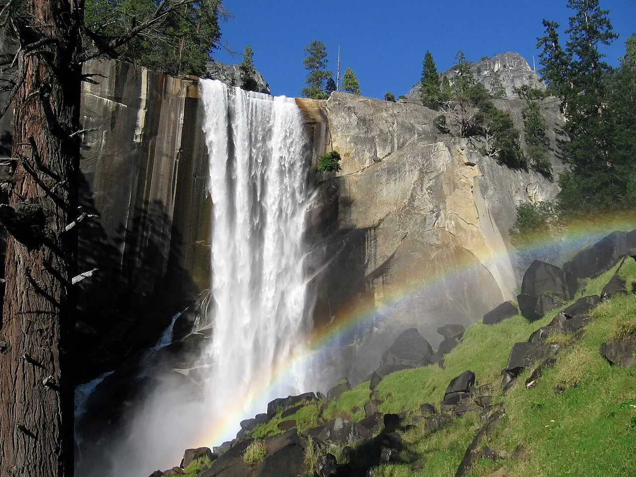
The park's most important waterfall hike starts at shuttle stop 16 (Happy Isles) and follows the cascading course of the Merced River. The first goal is the Vernal Fall Footbridge, with a view of the 97 m fall: 2.6 km round trip, 120 m of climbing and 1 to 1.5 hours, a turnaround point for anyone who wants a moderate walk. From there, the Mist Trail climbs more than 600 granite steps under the spray of Vernal Fall to the top of the drop (3.9 km round trip, 300 m of climbing, about 3 hours) and can continue to the top of the 181 m Nevada Fall (8.7 km round trip via the Mist Trail, 610 m of climbing, 5 to 6 hours). The longer John Muir Trail (about 6.4 km each way to Nevada Fall) serves as an alternate route down and as a detour. In winter, the lower section of the Mist Trail near Vernal Fall closes because of the risk of falling ice and rocks; in 2026 there were also weekday closures of the upper section for construction, with a detour via the John Muir Trail, so check the NPS conditions page before you climb.
Check access

Half Dome
Yosemite's ultimate symbol, the granite dome sheared plumb on its northwest face reaches 2,695 m of elevation (about 1,460 m above the valley floor). While its silhouette can be admired from almost everywhere in the park, the trail to the summit is a grueling journey of 22.5 to 26 km (round trip from Happy Isles, 10 to 12 hours and almost 1,500 m of cumulative elevation gain), whose final 120 m stretch on smooth rock is climbed between two steel cables. Whenever the cables are up (normally from the Friday before the Memorial Day holiday, in late May, until the day after the second Monday in October), going beyond the base of the subdome requires an individual permit seven days a week, awarded by lottery on Recreation.gov (a preseason lottery in March and a daily lottery two days before the date). Never climb the cables when the rock is wet or thunderstorms are on the horizon.
Check access

Glacier Point
An overlook on a cliff edge at 2,199 m of elevation, about 980 m above Curry Village. It offers the widest view of the park's upper basin, putting you level with the face of Half Dome and in front of Vernal Fall, Nevada Fall, Yosemite Falls and the peaks of the High Sierra. Access by car on Glacier Point Road (26 km from Chinquapin, on Highway 41) works only from spring through fall, closing with the first snowfalls, in October or November, until late May or early June.
Check access
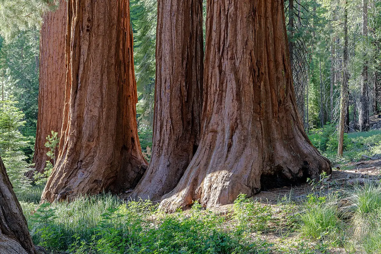
Mariposa Grove of Giant Sequoias
Located by the park's southern entrance (Highway 41), it protects about 500 mature giant sequoias (Sequoiadendron giganteum), including the Grizzly Giant (estimated at about 3,000 years old), the Bachelor and Three Graces and the California Tunnel Tree, tunneled in 1895. You park at the Mariposa Grove Welcome Plaza, where a free shuttle (running from mid-April, never before April 15, until November 30, weather permitting) takes you in 10 minutes to the start of the trails, which range from the Big Trees Loop (500 m, accessible) to the Grizzly Giant Loop (3.2 km) and the Mariposa Grove Trail to Wawona Point (11 km). Between December and mid-April, when the bus does not run, reaching the trees means walking an extra 6.4 km (round trip) on the Washburn Trail or along the closed road.
Check access

Tuolumne Meadows
One of the largest subalpine meadows in the Sierra Nevada, stretching at about 2,600 m of elevation along the Tuolumne River, on the eastern stretch of Tioga Road. Colder, quieter and less crowded than Yosemite Valley, it is a starting point for acclimatization hikes such as the climb to Lembert Dome, the walk to Soda Springs and Parsons Lodge or the easy trail along the river toward Lyell Canyon. There is no fuel in Tuolumne, and during the first month after the road opens and from September onward, food, water and other services may not be available. The whole sector closes with the snow in October or November and reopens in late May or June.
Check access
Nilo’s itinerary
Start with the basic programme and choose extensions for the time you have.
Plan my days in the app ↗Day 1 · Yosemite Valley: Mist Trail in the morning, the valley in the afternoon and Tunnel View at day's end
Enter the valley before 8 a.m., park at Curry Village and take the free shuttle to stop 16 (Happy Isles). The car stays parked until late afternoon.
Climb the Mist Trail to the top of Vernal Fall (3.9 km round trip, about 3 hours). If you are well prepared, continue to the top of Nevada Fall (8.7 km round trip, 5 to 6 hours) and come down by the John Muir Trail. If the steps are closed (ice in winter or construction, such as the weekday closures of 2026; check the NPS conditions page), go up by the John Muir Trail detour; in spring, anyone who prefers something flat can swap the climb for Mirror Lake (stop 17).
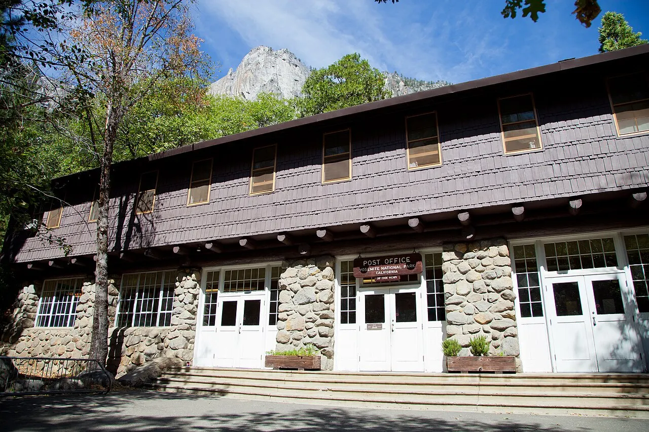
Have lunch at Curry Village or Yosemite Village and spend the afternoon on foot and by shuttle in the center of the valley: the Yosemite Valley Welcome Center, the Yosemite Museum (open until 4 or 5 p.m., depending on the season), the Ansel Adams Gallery and the public lounges of The Ahwahnee.
Late in the afternoon, do the flat Lower Yosemite Fall loop and cross the Cook's Meadow boardwalk to see the walls all around.
Go back to the car and leave via Northside Drive, stopping at El Capitan Meadow to look for climbers on the wall. Cross to Southside Drive, pass Bridalveil Fall and go up Highway 41 to Tunnel View for the late-afternoon light over the valley; then have dinner in the valley or head to your lodging.
Day 2 · Giant sequoias at Mariposa Grove and the edge of Glacier Point
Leave early on Highway 41 South to the Mariposa Grove Welcome Plaza (about 60 km, a little over an hour from the valley). Board the free shuttle (which runs from April 15, or later, until November 30, weather permitting) and do the Grizzly Giant Loop Trail (3.2 km) to see the Grizzly Giant and the California Tunnel Tree, or extend it to the Guardians Loop (10.5 km) to walk in silence in the upper part of the grove.
Have lunch in the Wawona area or bring a picnic for the afternoon climb.
When Glacier Point Road is open (normally from late May to October), turn in at Chinquapin and stop at the Taft Point / Sentinel Dome parking lot to do one of the two short 3.5 km round-trip trails to the edge of the granite abyss.
Continue to the final Glacier Point overlook (2,199 m) to watch the late-afternoon light over Half Dome, Vernal Fall and Nevada Fall. In winter or early spring, when Glacier Point Road and the Mariposa Grove shuttle are closed, devote the whole day to the winter walk to the sequoias on the Washburn Trail or to the sunny trails on the north side of Yosemite Valley.
Day 3 · The high Sierra on Tioga Road and Tuolumne Meadows (or Hetch Hetchy in the shoulder season)
Between late May/June and October, go up Highway 120 East (Tioga Road) into the high Sierra. Make your first stop at Olmsted Point to walk on the glacial granite slabs and see Half Dome from the opposite angle.
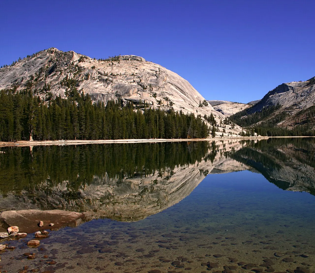
Continue to the sandy shores of Tenaya Lake (2,484 m) for a lakeside walk and a lunch break in front of the crystal-clear water.
In the afternoon, reach Tuolumne Meadows (2,600 m) and choose between the easy walk along the Tuolumne River to Soda Springs and Parsons Lodge or the panoramic climb up Lembert Dome, returning before dark.
If you visit between late October or November and late May or June, when Tioga Road is closed by snow, replace this day with the northwest sector of Hetch Hetchy (road open all year from sunrise to sunset, except with snow), walking across O'Shaughnessy Dam to Wapama Falls.


Food
Historic dinner in The Ahwahnee Dining Room
The dining room of the 1927 hotel, with its 10-meter ceiling, exposed pine beams and windows facing the granite, serves breakfast, lunch and a fixed-menu dinner in a formal-rustic setting. For dinner, a reservation is recommended and dressy attire is requested; breakfast and brunch are casual, and anyone who just wants to see the space can come to those meals or to the lobby bar.
Pizza Deck and quick meals at Curry Village
A classic late-afternoon meeting place for hikers, the open-air terrace at Curry Village serves big pizzas baked to order, salads and local beers beneath the Glacier Point wall, next to the Seven Tents pavilion and the seasonal taco and coffee counters.
Base Camp Eatery and Degnan's Kitchen for the trail
Because most long trails have no kiosks or treated water, the practical custom in the valley is to have an early breakfast at the Base Camp Eatery (next to Yosemite Valley Lodge) and to buy ready-made sandwiches, fruit and nuts at Degnan's Kitchen or the Village Store, in Yosemite Village, before catching the shuttle.
Sierra cooking and craft beer in the gateway towns
Outside the park, in base towns such as Mariposa (Highway 140), Oakhurst (Highway 41) and Groveland (Highway 120), family restaurants, barbecue places and local breweries offer more variety and better value than the concession snack bars inside the valley.
Where to eat
- Yosemite Village and Yosemite Valley Lodge
Practical meals and trail provisions in the center of the valley. Degnan's Kitchen and the Village Store supply sandwiches, salads and supplies to carry in your pack; at Yosemite Valley Lodge, the Base Camp Eatery opens early with counter service and The Mountain Room serves sit-down dinners with a view of Yosemite Falls.
- Curry Village and The Ahwahnee (east of the valley)
Two extremes of experience inside the park: the Pizza Deck and the Seven Tents pavilion in Curry Village serve people coming down the Mist Trail looking for quick food and beer outdoors; the historic dining room of The Ahwahnee, on the other hand, serves breakfast, lunch and a fixed-menu dinner with a reservation recommended and dressy attire.
- Mariposa, El Portal, Oakhurst and Groveland (gateway towns)
Independent restaurants, cafes, barbecue places and full supermarkets on the access roads. It is worth having dinner or doing your grocery shopping in these towns before heading up to the park, where restaurants close early and have more limited menus.
· 2026-10-17
Day trips
Hetch Hetchy and Wapama Falls
Located in the northwest corner of the park (about 61 km and 1 hour 15 minutes to 1 hour 30 minutes by car from Yosemite Valley via Big Oak Flat Road and Evergreen Road), Hetch Hetchy Valley was dammed in 1923 but keeps granite walls and waterfalls similar to those of the main valley, with a fraction of the crowds. The road opens from sunrise to sunset and closes when it snows or snow is forecast overnight; the 8 km (round trip) hike goes through the tunnel in the rock and follows the reservoir shore to the bridges at the foot of Wapama Falls, excellent in spring and winter.
Mono Lake and the ghost town of Bodie (via Tioga Pass)
Only between late May/June and October, when Tioga Road (Highway 120 East) is open, driving down the eastern side of Tioga Pass to Lee Vining (20 km past the east entrance) leads to Mono Lake, an alkaline lake famous for the tufa limestone towers on its south shore. Another 50 km north on Highway 395 is Bodie State Historic Park, a former gold mining town from 1876 preserved in a state of arrested decay at 2,550 m of elevation.
Mariposa and the California State Mining and Mineral Museum
About 70 km (1 hour 15 minutes by car or YARTS bus on Highway 140) west of Yosemite Valley, the historic town of Mariposa was born in the Gold Rush of 1849. It preserves the oldest courthouse still in operation in California (1854), nineteenth-century commercial streets and the state mining and mineral museum, making for a half-day outing on arrival or departure along the Merced River route.
Where to begin
Yosemite Valley: Mist Trail in the morning, the valley in the afternoon and Tunnel View at day's end
Enter the valley before 8 a.m., park at Curry Village and take the free shuttle to stop 16 (Happy Isles). The car stays parked until late afternoon.
Giant sequoias at Mariposa Grove and the edge of Glacier Point
Leave early on Highway 41 South to the Mariposa Grove Welcome Plaza (about 60 km, a little over an hour from the valley). Board the free shuttle (which runs from April 15, or later, until November 30, weather permitting) and do the Grizzly Giant Loop Trail (3.2 km) to see the Grizzly Giant and the California Tunnel Tree, or extend it to the Guardians Loop (10.5 km) to walk in silence in the upper part of the grove.
The high Sierra on Tioga Road and Tuolumne Meadows (or Hetch Hetchy in the shoulder season)

Between late May/June and October, go up Highway 120 East (Tioga Road) into the high Sierra. Make your first stop at Olmsted Point to walk on the glacial granite slabs and see Half Dome from the opposite angle.
Money

The currency is the US dollar (USD). Inside the park, entrance stations, concession stores and restaurants prioritize payment by card or contactless, and the entrance stations do not accept cash. As of the October 2026 check, entry by private vehicle costs $35 for seven days, and each visitor 16 or older who does not reside in the United States also pays a $100 nonresident fee, unless entering with an annual pass (America the Beautiful costs $250 for nonresidents and $80 for residents). The valley's internal bus is free, and nightly rates inside the park vary widely among the canvas tents of Curry Village, the rooms of Yosemite Valley Lodge and the historic luxury of The Ahwahnee, all of which are in demand up to a year in advance on the concessionaire's official website. Because cell signal is weak or nonexistent on most roads and trails outside the center of Yosemite Village, bring offline maps and your campground, lodging or Half Dome confirmations already saved or printed. There is no gas station in Yosemite Valley or at Tuolumne Meadows: inside the park, the stations are at Wawona and Crane Flat, and there is another at El Portal, all open 24 hours with a card; anyone continuing along Tioga Road will find no fuel past Crane Flat, so fill up beforehand or in the gateway towns.
Getting there and around
Getting to Yosemite takes attention to the distances from big cities and to the elevation of the three western highways and the eastern entrance. From San Francisco to Yosemite Valley it is about 300 km by road (3.5 to 4.5 hours by car). The airport with the most routes in the region is Fresno Yosemite International Airport (FAT), about 150 km south on Highway 41 (about 2 hours 15 minutes to the valley); since July 1, 2026, Merced Yosemite Regional Airport (MCE) also receives regional flights from Contour Airlines from Los Angeles (LAX) and Las Vegas, in Merced, the city where the year-round YARTS bus line on Highway 140 begins. Highway 140 (El Portal Road), which follows the Merced River canyon past Mariposa and El Portal, is the lowest-elevation entrance and the best choice in winter because snow rarely accumulates on the canyon floor. It skirts the Ferguson slide by a temporary detour, with restrictions on long vehicles, and can close because of rockfall; before going with a trailer or motorhome, check conditions with Caltrans. Highway 120 West (Big Oak Flat Road, via Groveland) and Highway 41 South (Wawona Road, via Oakhurst) stay open all year but climb above 1,800 m and often require snow chains during winter storms. Highway 120 East (Tioga Road, which connects the park to Highway 395 and Mono Lake over Tioga Pass at 3,031 m) and Glacier Point Road beyond Badger Pass close with the snow in October or November and reopen in late May or June: in winter and spring, it is impossible to cross the range through the park.
As of the October 2026 check, the National Park Service confirms that no timed-entry reservation is required to enter Yosemite by car in 2026. An entrance fee applies, valid for seven consecutive days: $35 per private vehicle (all occupants included), $30 per motorcycle or $20 per person entering on foot, by bicycle or by bus (children under 16 do not pay the individual fee). Since 2026, people who do not reside in the United States and are 16 or older also pay a nonresident fee of $100 per person, added to the entrance fee and charged to each nonresident occupant of a car as well; anyone entering with an annual pass is exempt. The America the Beautiful annual pass costs $80 for residents and $250 for nonresidents. The entrance stations accept cards and contactless payment, with no cash. Between November and March (and during any off-season cold front), when chain controls are in effect, every vehicle entering the controlled area must carry snow chains, even 4x4/AWD cars and rental vehicles.
For people traveling without a car or who prefer not to drive in the mountains, the regional YARTS bus system (Yosemite Area Regional Transportation System) runs the Highway 140 line year-round from Merced (connecting the Amtrak San Joaquins train and Greyhound station to Mariposa, El Portal and Yosemite Valley; $22 each way or $44 round trip between Merced and the valley as of the October 2026 check), plus seasonal summer lines from Fresno (Highway 41), Sonora/Groveland (Highway 120 West) and Mammoth Lakes/Lee Vining (Highway 120 East/395). The YARTS fare does not include park entry or the nonresident fee, which each passenger pays separately. Once inside Yosemite Valley, the practical advice is to park the car in one of the large lots by 8:30 or 9 a.m. and not take it out of the space until it is time to leave: the park runs free circulating bus lines (Valleywide Shuttle and East Valley Shuttle) every 8 to 22 minutes between visitor centers, hotels and trailheads, plus flat paved bike paths and the seasonal free Mariposa Grove shuttle.
Safety
The main risks in Yosemite come from cold water, falls on rock and dehydration or hypothermia on mountain trails. In spring and early summer, the Merced River runs high, fast and icy with snowmelt: keep your distance from the smooth granite banks at the tops of Vernal and Nevada Falls. On walls and overlooks without a continuous railing, such as the cracks at Taft Point and the edge of Glacier Point, watch where you step before raising your camera. Summer thunderstorms form quickly in the afternoon on exposed summits such as Half Dome, Clouds Rest and Lembert Dome: start those climbs at dawn so you are back in the forest before midafternoon. From summer to fall, wildfires and prescribed burns can bring smoke to the valley and close roads and trails, and the park usually restricts campfires and open flames in dry periods, with rules that change by elevation and season; the day before and the day of your trip, check the current restrictions and alerts on the NPS conditions page or by phone at 209-372-0200. If you encounter a black bear, do not run or approach; keep a distance of at least 45 meters (50 yards) and make firm noise so it moves away. There is no reliable cell coverage on most trails; in emergencies, in areas with signal or from a pay phone, call 911.
Etiquette tips
Mandatory food storage against black bears (bear lockers)
The Sierra's black bears have a keen sense of smell and open doors or break vehicle windows to reach food. It is against federal law to leave any food, drink, trash, cooler, sunscreen, toothpaste or scented product in the car after dark (and even by day, food must stay out of sight, in the closed trunk). When staying overnight in campgrounds or at Curry Village, move everything to the outdoor metal lockers (food lockers). Overnight stays in the wilderness require a wilderness permit all year, with a quota per trailhead (from late April to October, 60% of the spots are released by lottery 24 weeks ahead), and on overnight trips a hard-sided approved canister is mandatory.
Never enter the river above waterfalls or go past guardrails
The polished granite rocks near Vernal Fall, Nevada Fall, Emerald Pool and Silver Apron are extremely slippery even when they look dry, and the cold snowmelt current sweeps swimmers over the edge. Stay on the trail and never enter the water above waterfalls.
Drones are strictly prohibited throughout the park
Using drones is illegal anywhere in Yosemite National Park, to protect wildlife (such as the peregrine falcons that nest on the granite walls), the safety of helicopter rescue operations and the quiet of visitors.
Pet restrictions on trails
Dogs and other domestic animals are allowed only on paved roads, parking lot sidewalks and campgrounds, always on a leash. They are prohibited on all dirt trails, in Mariposa Grove, on shuttle buses and inside buildings.
Mistakes to avoid
Planning a trip between San Francisco, Yosemite and Las Vegas or Death Valley between late October or November and late May or June and counting on crossing the range via Tioga Road (Highway 120 East). With Tioga Pass closed by snow, the road detour to the north (Lake Tahoe) or the south (Bakersfield) adds five to seven hours of driving.
Blindly trusting your phone's GPS in winter, which may send the driver down unpaved or snowy secondary forest roads. Use only the main highways 140, 41 and 120 and check the NPS road conditions phone line (209-372-0200).
Taking the car out of its space in Yosemite Valley at midday in the height of summer to go have lunch somewhere else in the valley. You will hardly find another space available and will lose hours stuck in traffic on the loop road.
Hiking the Half Dome trail without a valid permit or trying the cables with rain threatening. Rangers check permits and photo ID at the base of the subdome, and the smooth granite turns into a frictionless ramp at the first drizzle.
Starting a long trail without enough water. Outside Happy Isles and the start of the trail in Yosemite Village, there are almost no treated drinking water taps on the slopes (the facilities at Vernal Fall Footbridge and Glacier Point may have the water turned off outside summer); carry at least two to three liters per person or a water filter.
Useful phrases
Ahwahnee / Ahwahneechee
The original name of Yosemite Valley in the local Native language, and the people who lived in the region.
Bear locker / Bear canister
The fixed metal locker in parking lots and campgrounds, and the portable hard-sided cylinder required for storing food on overnight treks.
Cables up / Cables down
An expression that indicates whether the steel cables on the final stretch of Half Dome are up on their posts (late May to mid-October) or down on the ground.
Chain control (R1, R2, R3)
The three levels of snow tire and chain requirements on the park's roads during winter storms.
YARTS
The regional public bus system that connects Merced, Fresno, Sonora and Mammoth Lakes to the interior of Yosemite Valley.
Where to stay
- Inside Yosemite Valley (Yosemite Valley Lodge, Curry Village and The Ahwahnee) · People who want to set out on foot for the trails at dawn without facing an hour on winding road or lines at the entrance stations.: It is the unbeatable location for enjoying the valley early and at night, using only the free shuttle. The drawback is that rooms sell out up to twelve months ahead (when the booking window opens on the concessionaire's official website), prices are high for the level of comfort delivered, and the canvas tents of Curry Village have thin walls and a shared bathroom and require storing everything in the bear locker.
- El Portal and the Highway 140 corridor (including Mariposa) · People who could not get a spot inside the valley or are traveling in winter and spring, including by YARTS bus.: El Portal sits just outside the Arch Rock entrance station, at the low elevation of the Merced River canyon, about 30 minutes by car from the center of Yosemite Valley and on the year-round YARTS bus route; Mariposa, farther back on the same highway (about 1 hour 15 minutes from the valley), offers a greater variety of hotels, markets and restaurants.
- Wawona, Fish Camp and Oakhurst (South Corridor / Highway 41) · People arriving from the south (Fresno) who want to prioritize Mariposa Grove and Glacier Point Road in their itinerary.: It sits next to the giant sequoias at the southern entrance. The Wawona Hotel, the sector's historic lodging inside the park, has been closed for repairs since December 2024, with no reopening date, so the corridor's lodging is concentrated outside the federal boundaries, in Fish Camp and Oakhurst. The trade-off is that going back and forth every day to the floor of Yosemite Valley takes anywhere from under an hour each way from Wawona to about 1 hour 15 minutes from Fish Camp and 1 hour 30 minutes from Oakhurst, on a winding mountain road subject to snow chains in winter.
- Groveland and the Highway 120 West corridor · People coming by car from San Francisco who plan to split their time between the valley, Hetch Hetchy and Tioga Road in summer.: It is the most direct route for anyone leaving from the Bay Area and gives quick access to Hetch Hetchy and the climb to Tioga Road, but it is about 1 hour 15 minutes of winding road from the floor of Yosemite Valley.
- Park campgrounds (Pines in the valley, Camp 4, Wawona and those on Tioga Road) · People traveling with a tent or trailer who want to sleep inside the park at the lowest price.: The campgrounds are near the trails and, in the valley, the free shuttle, but competition is fierce: reservations are released on Recreation.gov at 7 a.m. Pacific Time and sell out in minutes. Upper, Lower and North Pines, Wawona and Hodgdon Meadow open five months ahead, on the 15th of each month; half of Tuolumne Meadows opens two months ahead, the other Tioga Road campgrounds two weeks ahead and Camp 4 one week ahead. Food goes in the bear lockers, and staying overnight outside the campgrounds, in the wilderness, requires a wilderness permit.
· 2026-10-17
Districts
Yosemite Valley
The heart of the park at 1,200 m of elevation, served by a one-way loop road: Southside Drive takes people entering the valley eastbound and Northside Drive takes people leaving westbound. Free shuttle lines connect the main points. The valley concentrates the Yosemite Valley Welcome Center, the Yosemite Museum, the Ansel Adams Gallery, The Ahwahnee and Yosemite Valley Lodge hotels, the cabin and tent complex of Curry Village and the starting points for Yosemite Falls, Mirror Lake, the Mist Trail and Half Dome.
Glacier Point Road and Badger Pass
A 26 km side road that branches off Highway 41 at Chinquapin and runs through conifer forests and rock domes to the Glacier Point overlook, passing the trailheads for Sentinel Dome and Taft Point. In winter, the road is plowed only as far as the Badger Pass ski area (the first 8 km) and stays closed to cars all the way to the overlook from the first snowfalls, in October or November, until late May or early June.
Wawona and Mariposa Grove
At the southern entrance on Highway 41, about 60 km (a little over an hour by car) from Yosemite Valley. It is home to the Mariposa Grove Welcome Plaza, where the seasonal shuttle leaves for the park's main giant sequoia grove, as well as the historic Wawona area and the South Fork Merced River valley. The Wawona Hotel, the sector's historic hotel, has been closed for repairs since December 2024 (the NPS announced the closure for December 2 of that year), with no reopening date.
Tioga Road, Tuolumne Meadows and Hetch Hetchy
Highway 120 crosses the high part of the park for about 76 km (47 miles) between Crane Flat and Tioga Pass (3,031 m), passing Olmsted Point, Tenaya Lake and the subalpine meadows of Tuolumne Meadows. It closes with the snow in October or November and reopens in late May or June; there is no gas station past Crane Flat. Farther west and at a lower elevation, a side road leads to the dam and waterfalls of Hetch Hetchy, open year-round from sunrise to sunset, except when it snows or snow is forecast overnight.
Gateway communities: El Portal, Mariposa, Oakhurst and Groveland
Outside the federal boundaries are the towns that hold most of the region's hotels and restaurants: El Portal (about 30 minutes from the valley on Highway 140) and Mariposa (about 1 hour 15 minutes on Highway 140) to the west; Oakhurst and Fish Camp to the south on Highway 41; Groveland to the northwest on Highway 120; and Lee Vining east of Tioga Pass (reachable only when the pass is open).
History
Millennia before 1851 · Ahwahnee and the native peoples of the Sierra
The Ahwahneechee (Southern Sierra Miwok), alongside Paiute, Mono and Chukchansi groups, lived in the valley (called Ahwahnee) and managed the oak meadows with controlled burns that kept the valley floor open.
1851 · The Mariposa Battalion enters the valley
During the California Gold Rush, the Mariposa Battalion militia entered the valley in March 1851 to subdue Chief Tenaya and force the Ahwahneechee onto reservations in the Central Valley.
1864 · Abraham Lincoln's Yosemite Grant
On June 30, 1864, in the middle of the Civil War, President Abraham Lincoln signed the act granting Yosemite Valley and the Mariposa Grove to the state of California for public use and preservation, a founding landmark of the national park idea.
1890–1906 · Creation of the national park and federal unification
After John Muir's campaigns against the damage sheep grazing did to the high meadows, Congress created Yosemite National Park on October 1, 1890; in 1906, after Theodore Roosevelt's visit with Muir, California returned the valley and Mariposa Grove to federal administration.
1899–1904 · The Buffalo Soldiers protect the park
Before the National Park Service was created (1916), the U.S. Army guarded Yosemite, and in 1899, 1903 and 1904 the task fell to Black regiments, the Buffalo Soldiers of the 24th Infantry and the 9th Cavalry. They patrolled the park against poachers and illegal grazing, fought fires, built trails and, in 1904, created an arboretum near the South Fork of the Merced River.
1913 · The Raker Act and the Hetch Hetchy dam
Despite national opposition led by John Muir and the Sierra Club, Congress authorized San Francisco to dam the Tuolumne River in Hetch Hetchy Valley, in the northwest of the park, and the O'Shaughnessy Dam was completed in 1923.
1926–1927 · The All-Year Highway and the opening of The Ahwahnee
The opening of Highway 140 through the Merced River canyon in 1926 allowed automobile access throughout the winter, followed in July 1927 by the opening of The Ahwahnee hotel, designed by Gilbert Stanley Underwood.
1958–2017 · Big-wall climbing on El Capitan
Warren Harding and his team completed the first ascent of The Nose route on El Capitan in 1958, in 45 days; decades later, Lynn Hill made the first free climb (1993), Tommy Caldwell and Kevin Jorgeson free climbed the Dawn Wall (2015) and Alex Honnold climbed the Freerider route without ropes in 2017.
2018–2024 · Restoration of Mariposa Grove, the Welcome Center and Bridalveil Fall
The park finished removing the asphalt among the sequoia roots in Mariposa Grove (2018), opened the Yosemite Valley Welcome Center at Village Square in 2023 and completed the rehabilitation project for the Bridalveil Fall area in fall 2024.
Complete history
Yosemite's physical landscape was sculpted in two geological stages: first, the formation of immense granite plutons deep in the crust about 100 million years ago and the later uplift of the Sierra Nevada, which steepened the Merced River's slope; second, the Pleistocene glaciations, when tongues of ice filled the canyon, widened its floor into a U shape and cut the hanging valleys from which Yosemite Falls and Bridalveil Fall now plunge. When the ice retreated and ancient Lake Yosemite filled with sediment, the valley floor took shape. For thousands of years, the Ahwahneechee people managed this flat floor with periodic burns that kept conifers from closing in and preserved the oaks that produced acorns, the basis of the local diet.
That balance ended abruptly with the California Gold Rush. In March 1851, the state militia of the Mariposa Battalion invaded the valley to forcibly remove Chief Tenaya's group; the expedition's doctor, Lafayette Bunnell, proposed the name Yosemite, from the Miwok term used by neighboring tribes. Within a few years, artists such as Carleton Watkins (whose photographs on giant glass plates were taken to Washington) and the painter Albert Bierstadt spread word of the walls' scale in the eastern United States. On the strength of those images and the advocacy of figures such as Frederick Law Olmsted, President Abraham Lincoln signed the Yosemite Grant on June 30, 1864, protecting a natural landscape for public enjoyment for the first time.
In the following decades, the Scottish-American naturalist John Muir traveled on foot through the high basins of the range, demonstrated the glacial origin of the valley and denounced the destruction of subalpine flora by sheep herds. His articles led Congress to create Yosemite National Park on October 1, 1890 around the state-run area, and in 1906 the valley and the Mariposa Grove were returned to the federal park. Before the National Park Service was founded in 1916, the territory was guarded by the U.S. Army, with a decisive role played by the Buffalo Soldiers in 1899, 1903 and 1904. The bitterest dispute in the history of American conservation came shortly afterward, when the city of San Francisco obtained authorization in 1913 to flood the twin valley of Hetch Hetchy, on the Tuolumne River, for urban water supply.
Over the twentieth century, the opening of Highway 140 (1926), the Wawona Tunnel (1933) and the modern alignment of Tioga Road turned Yosemite into a mass automobile destination, while photographers such as Ansel Adams fixed the light of the waterfalls and Half Dome in the country's visual culture and climbers from Camp 4 turned the vertical walls of El Capitan into the world's laboratory of rock climbing. In the twenty-first century, park management has focused on restoring ecological processes and reorganizing visitor flow: prescribed fire is back in use in the meadows, the asphalt parking lot over the sequoia roots in Mariposa Grove was replaced by elevated walkways and a bus terminal in 2018, and access to the Bridalveil Fall trails and to the valley visitor center was remodeled between 2023 and 2024.
Before nineteenth-century travelers thought of Yosemite Valley as untouched landscape, the open meadows with views of the walls were already the result of centuries of controlled burns by the Ahwahneechee people.
Geography and shape of the city
The park spans the western slope of the Sierra Nevada from about 600 m of elevation, near El Portal in the Merced River canyon, to 3,997 m at the summit of Mount Lyell, on the range's eastern divide. That range in elevation divides a visit into four very different sectors: Yosemite Valley (at about 1,200 m, 11 km long by about 1.5 km wide, with the Merced River running through it, ringed by the monoliths of El Capitan, Cathedral Rocks, Sentinel Rock and Half Dome); the southern plateau of Wawona and the Mariposa Grove of Giant Sequoias (between 1,700 m and 2,000 m, near the southern entrance on Highway 41); the southern rim of the abyss at Glacier Point (at 2,199 m, reached by Glacier Point Road); and the subalpine region of Tioga Road / Highway 120 East, which climbs to Tuolumne Meadows (2,600 m) and crosses Tioga Pass at 3,031 m toward Mono Lake. Although two points may look close together on the map, the terrain forces long detours by car: getting from the floor of Yosemite Valley to the Glacier Point overlook, a thousand meters higher vertically, takes about 48 km and almost an hour of driving each way when the road is open. The climate is a mountain Mediterranean one: almost all annual precipitation falls between November and March, as snow above 1,800 m (and sometimes on the valley floor too), while summers are dry, with hot afternoons on the valley floor (often between 28 °C and 33 °C in July and August) and cold nights in the high meadows of Tuolumne.
I'd bring binoculars to the meadow at the base of El Capitan: finding a climber in a colorful shirt amid 900 meters of vertical granite is the best way to grasp the real size of that wall.
Culture
Yosemite's culture rests on three traditions that coexist in the same space: the living heritage of the Native tribes associated with the park, landscape photography as a tool of conservation and big-wall climbing. At the Yosemite Museum, in the Village, exhibits and demonstrations of basketry, flintknapping and beadwork present the history of the Miwok and Paiute peoples, and a trail behind the building runs through a reconstructed village that the local Native community still uses for ceremonies. Indigenous fire management shaped the ecology of the meadows long before nineteenth-century travelers arrived. A few steps away, The Ansel Adams Gallery has kept alive, since 1902, the photographic tradition that helped protect the Sierra Nevada.
On the other side of Cook's Meadow, Camp 4 (listed on the National Register of Historic Places) and the base of El Capitan remain a gathering place for climbers from all over the world. On spring and fall afternoons, it is common to see groups stretched out on the grass of El Capitan Meadow, following through binoculars the progress of climbing teams who sleep in suspended tents (portaledges) hundreds of meters off the ground.
Even if you are sleeping outside the park or in a canvas tent at Curry Village, I'd set aside half an hour to step into the public stone-and-timber rooms of The Ahwahnee hotel, from 1927, and the Ansel Adams Gallery.
Festivals and events
Horsetail Fall phenomenon (Firefall) in February
On some evenings from mid to late February, when the seasonal Horsetail Fall is flowing on top of El Capitan and the sky is clear, the setting sun lights it from behind in orange tones; haze or a few clouds are enough to kill the effect. During this period, the National Park Service imposes traffic restrictions every year: you park at Yosemite Falls Parking (or at Yosemite Village and Curry Village, with the free shuttle), one lane of Northside Drive is reserved for pedestrians, stopping and parking are prohibited between Lower Yosemite Fall and the El Capitan Crossover, and the viewing area at the El Capitan Picnic Area is about 2.4 km each way on foot. The rules and the map, including whether a reservation is required, are published every year on the NPS Horsetail Fall page; in 2026 no reservation was required.
Seasonal opening of Tioga Road and the Half Dome cables
More than a festival on a fixed date, late May marks the park's annual turning point: the installation of the Half Dome cables for the Memorial Day holiday and the completion of snow clearing on Tioga Road and Glacier Point Road, which reopen access to the high Sierra.
Yosemite Facelift
An annual cleanup and conservation volunteer effort organized in September by the Yosemite Climbing Association in partnership with the park, bringing together climbers and volunteers for evening talks and trash collection on the trails and walls.
Bracebridge Dinner at The Ahwahnee
A musical and theatrical banquet inspired by an English Renaissance Christmas, staged in December in The Ahwahnee's main dining room almost every year since 1927 (the production was suspended during World War II and returned in 1945). The first edition was created and directed by Garnet Holme, hired by Donald Tresidder, president of the Yosemite Park and Curry Company; Ansel Adams, who performed in the cast, rewrote the show in 1929, after Holme's death, and stayed with the production until 1973.
Books and films
The Yosemite (1912) and My First Summer in the Sierra (1911), by John Muir
Classic accounts by the naturalist: the first follows the summer of 1869 in the range up to Tuolumne Meadows, and the second explains the glacial formation of the valleys, describes the storms among the sequoias and carries the defense of Hetch Hetchy, written while the dam was in dispute, two decades after Muir's campaigns for the high meadows helped create the park in 1890.
Yosemite and the Range of Light, by Ansel Adams (1979)
Brings together the black-and-white photographs Adams made in the Sierra Nevada over decades, including Monolith, the Face of Half Dome (1927) and winter views from Tunnel View.
Valley Uprising (2014), by Peter Mortimer and Nick Rosen, and Free Solo (2018), by Elizabeth Chai Vasarhelyi and Jimmy Chin
The first documentary reconstructs fifty years of rock-climbing counterculture at Camp 4 and on the walls of Yosemite Valley; the second follows Alex Honnold's preparation for and rope-free ascent of the 900 meters of El Capitan.
Frequently asked questions
Yosemite: how do I get to the park?
From San Francisco to Yosemite Valley it is about 300 km by road (3.5 to 4.5 hours by car). The airport with the most routes in the region is Fresno Yosemite International Airport (FAT), about 150 km south on Highway 41 (about 2 hours 15 minutes to the valley); since July 1, 2026, Merced Yosemite Regional Airport (MCE) also receives regional flights from Contour Airlines from Los Angeles (LAX) and Las Vegas. Without a car, the YARTS bus runs the Highway 140 line year-round from Merced, connecting the Amtrak San Joaquins train and Greyhound station to Mariposa, El Portal and Yosemite Valley ($22 each way or $44 round trip as of the October 2026 check), plus seasonal summer lines from Fresno, Sonora/Groveland and Mammoth Lakes/Lee Vining; the fare does not include park entry or the nonresident fee. Highway 140 is the lowest-elevation entrance and the best choice in winter, but it skirts the Ferguson slide by a temporary detour, with restrictions on long vehicles, and can close because of rockfall; before going with a trailer or motorhome, check conditions with Caltrans.
Yosemite: do I need a reservation to enter, and how much is the entrance fee?
As of the October 2026 check, the National Park Service confirms that no timed-entry reservation is required to enter Yosemite by car in 2026. An entrance fee applies, valid for seven consecutive days: $35 per private vehicle (all occupants included), $30 per motorcycle or $20 per person entering on foot, by bicycle or by bus (children under 16 do not pay the individual fee). Since 2026, people who do not reside in the United States and are 16 or older also pay a nonresident fee of $100 per person, added to the entrance fee and charged to each nonresident occupant of a car as well; anyone entering with an annual pass is exempt. The America the Beautiful annual pass costs $80 for residents and $250 for nonresidents. The entrance stations accept cards and contactless payment, with no cash.
Yosemite: how many days should I stay?
I'd book three full days for Yosemite: the first for Yosemite Valley, starting early on the Mist Trail to the top of Vernal Fall (or Nevada Fall, if you are prepared for 5 to 6 hours) and leaving the afternoon for Yosemite Village, Lower Yosemite Fall, Cook's Meadow, El Capitan Meadow and the end-of-day light at Tunnel View; the second for the southern sector, with the giant sequoias of Mariposa Grove and the Glacier Point Road overlooks (Taft Point and Glacier Point); and the third for crossing the high range on Tioga Road to Olmsted Point, Tenaya Lake and Tuolumne Meadows (substituting Hetch Hetchy if the trip falls between late October or November and late May or June, when Tioga Road closes with snow). A single-day round trip from San Francisco eats up seven to eight hours on the road there and back and leaves little more than a quick pass by the valley overlooks.
Yosemite: when are Tioga Road and Glacier Point Road open?
Highway 120 East (Tioga Road, which connects the park to Highway 395 and Mono Lake over Tioga Pass at 3,031 m) and Glacier Point Road beyond Badger Pass close with the snow in October or November and reopen in late May or June: in winter and spring, it is impossible to cross the range through the park. Anyone planning a trip between San Francisco, Yosemite and Las Vegas or Death Valley between late October or November and late May or June has to count on the road detour to the north (Lake Tahoe) or the south (Bakersfield), which adds five to seven hours of driving.
Yosemite: do I need snow chains in winter?
Between November and March (and during any off-season cold front), when chain controls are in effect, every vehicle entering the controlled area must carry snow chains, even 4x4/AWD cars and rental vehicles. Highway 120 West and Highway 41 South stay open all year but climb above 1,800 m and often require chains during winter storms; Highway 140, through the Merced River canyon, is the lowest-elevation entrance and the best choice in winter. Before booking, confirm with the rental company that the contract allows using chains; anyone who prefers not to drive in snow can arrive on the YARTS bus leaving from Merced.
Yosemite: when is the best time to go?
May and June are the months of greatest visual impact in Yosemite Valley, with the waterfalls at peak flow and Mirror Lake full; on the other hand, Tioga Road and Glacier Point Road usually reopen only between the second half of May and mid-June (or later after very severe winters). July and August have all the high roads and Tuolumne Meadows open, but bring strong heat on the valley floor (30 °C or more), parking lots full by midmorning and a gradual drop in the flow of Yosemite Falls, which often dries up in August. September and October offer settled weather, excellent temperatures for long hikes and shorter lines, though Yosemite Falls and Mirror Lake are usually dry and the Half Dome cables are taken down in mid-October. From November to March, snow closes Tioga Road, Glacier Point Road and the Mariposa Grove shuttle, but Yosemite Valley stays open via Highway 140.
Yosemite: how do I get a permit to climb Half Dome?
The trail to the summit is a grueling journey of 22.5 to 26 km (round trip from Happy Isles, 10 to 12 hours and almost 1,500 m of cumulative elevation gain), whose final 120 m stretch on smooth rock is climbed between two steel cables. Whenever the cables are up (normally from the Friday before the Memorial Day holiday, in late May, until the day after the second Monday in October), going beyond the base of the subdome requires an individual permit seven days a week, awarded by lottery on Recreation.gov (a preseason lottery in March and a daily lottery two days before the date). Rangers check permits and photo ID at the base of the subdome. Never climb the cables when the rock is wet or thunderstorms are on the horizon.
Yosemite: where should I stay?
Inside Yosemite Valley (Yosemite Valley Lodge, Curry Village and The Ahwahnee), you can set out on foot for the trails at dawn using only the free shuttle, but rooms sell out up to twelve months ahead, when the booking window opens on the concessionaire's official website, and the canvas tents of Curry Village have thin walls and a shared bathroom. Outside the park, El Portal sits just outside the Arch Rock entrance station, about 30 minutes by car from the center of the valley and on the year-round YARTS bus route; Mariposa, farther back on the same highway (about 1 hour 15 minutes from the valley), has more hotels, markets and restaurants. At the park campgrounds, reservations are released on Recreation.gov at 7 a.m. Pacific Time and sell out in minutes: Upper, Lower and North Pines, Wawona and Hodgdon Meadow open five months ahead, on the 15th of each month; half of Tuolumne Meadows opens two months ahead, the other Tioga Road campgrounds two weeks ahead and Camp 4 one week ahead.
Yosemite: what do I do with food because of the bears?
The Sierra's black bears have a keen sense of smell and open doors or break vehicle windows to reach food. It is against federal law to leave any food, drink, trash, cooler, sunscreen, toothpaste or scented product in the car after dark (and even by day, food must stay out of sight, in the closed trunk). When staying overnight in campgrounds or at Curry Village, move everything to the outdoor metal lockers (food lockers). On overnight trips in the wilderness, which require a wilderness permit, a hard-sided approved canister is mandatory.
Yosemite: how do I visit the Mariposa Grove sequoias?
Mariposa Grove is by the park's southern entrance (Highway 41). You park at the Mariposa Grove Welcome Plaza, where a free shuttle (running from mid-April, never before April 15, until November 30, weather permitting) takes you in 10 minutes to the start of the trails, which range from the Big Trees Loop (500 m, accessible) to the Grizzly Giant Loop (3.2 km) and the Mariposa Grove Trail to Wawona Point (11 km). Between December and mid-April, when the bus does not run, reaching the trees means walking an extra 6.4 km (round trip) on the Washburn Trail or along the closed road.
Yosemite: where can I get gas, and is there cell signal?
There is no gas station in Yosemite Valley or at Tuolumne Meadows: inside the park, the stations are at Wawona and Crane Flat, and there is another at El Portal, all open 24 hours with a card; anyone continuing along Tioga Road will find no fuel past Crane Flat, so fill up beforehand or in the gateway towns. Because cell signal is weak or nonexistent on most roads and trails outside the center of Yosemite Village, bring offline maps and your campground, lodging or Half Dome confirmations already saved or printed.
Other cities in the country
United States ↗- Days
- 4–5
- When
- Apr–Jun · Sep–Oct
- Per person/day
- Average 180–320 USDMid-range · per person/day
Cost scope
Per person per day: accommodation, meals, urban transport, visits and a small allowance for extras. Flights excluded; larger purchases vary. Editorial estimate, not a quote.
- Days
- 4–5
- When
- Apr–May · Nov
- Per person/day
- Average 220–330 USDMid-range · per person/day
Cost scope
Per person per day: accommodation, meals, urban transport, visits and a small allowance for extras. Flights excluded; larger purchases vary. Editorial estimate, not a quote.
- Days
- 3
- When
- Sep–Oct
- Per person/day
- Average 180–280 USDMid-range · per person/day
Cost scope
Per person per day: accommodation, meals, urban transport, visits and a small allowance for extras. Flights excluded; larger purchases vary. Editorial estimate, not a quote.
- Days
- 4
- When
- May–Jun · Sep–Oct
- Per person/day
- Average 150–260 USDMid-range · per person/day
Cost scope
Per person per day: accommodation, meals, urban transport, visits and a small allowance for extras. Flights excluded; larger purchases vary. Editorial estimate, not a quote.
- Days
- 2–3
- When
- Jan–Apr · Nov–Dec
- Per person/day
- Average 200–350 USDMid-range · per person/day
Cost scope
Per person per day: accommodation, meals, urban transport, visits and a small allowance for extras. Flights excluded; larger purchases vary. Editorial estimate, not a quote.
- Days
- 3
- When
- Feb–May · Oct–Dec
- Per person/day
- Average 250–350 USDMid-range · per person/day
Cost scope
Per person per day: accommodation, meals, urban transport, visits and a small allowance for extras. Flights excluded; larger purchases vary. Editorial estimate, not a quote.
- Days
- 2–3
- When
- Mar–May · Oct–Nov
- Per person/day
- Average 200–350 USDMid-range · per person/day
Cost scope
Per person per day: accommodation, meals, urban transport, visits and a small allowance for extras. Flights excluded; larger purchases vary. Editorial estimate, not a quote.
- Days
- 3
- When
- Mar–May
- Per person/day
- Average 220–320 USDMid-range · per person/day
Cost scope
Per person per day: accommodation, meals, urban transport, visits and a small allowance for extras. Flights excluded; larger purchases vary. Editorial estimate, not a quote.
- Days
- 2–3
- When
- Sep–Oct
- Per person/day
- Average 190–330 USDMid-range · per person/day
Cost scope
Per person per day: accommodation, meals, urban transport, visits and a small allowance for extras. Flights excluded; larger purchases vary. Editorial estimate, not a quote.
- Days
- 2–3
- When
- Jun–Sep
- Per person/day
- Average 130–220 USDMid-range · per person/day
Cost scope
Per person per day: accommodation, meals, urban transport, visits and a small allowance for extras. Flights excluded; larger purchases vary. Editorial estimate, not a quote.
- Days
- 5–6
- When
- Jan–Apr · Nov–Dec
- Per person/day
- Average 368 USDMid-range · per person/day
Cost scope
Per person per day: accommodation, meals, urban transport, visits and a small allowance for extras. Flights excluded; larger purchases vary. Editorial estimate, not a quote.
- Days
- 4–6
- When
- Apr–May · Sep
- Per person/day
- Average 329 USDMid-range · per person/day
Cost scope
Per person per day: accommodation, meals, urban transport, visits and a small allowance for extras. Flights excluded; larger purchases vary. Editorial estimate, not a quote.
- Days
- 2
- When
- Apr–May · Sep–Oct
- Per person/day
- Average 203 USDMid-range · per person/day
Cost scope
Per person per day: accommodation, meals, urban transport, visits and a small allowance for extras. Flights excluded; larger purchases vary. Editorial estimate, not a quote.
- Days
- 3
- When
- Apr · Sep–Oct
- Per person/day
- Average 251 USDMid-range · per person/day
Cost scope
Per person per day: accommodation, meals, urban transport, visits and a small allowance for extras. Flights excluded; larger purchases vary. Editorial estimate, not a quote.