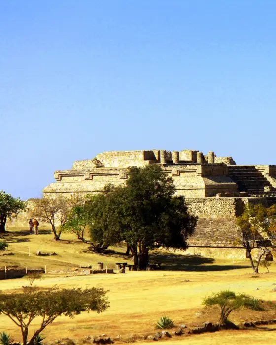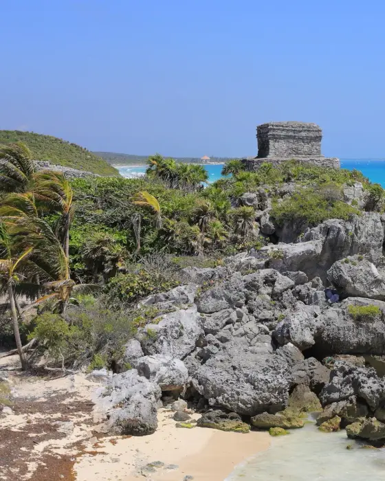
Mexico
Mexico City
Aztec ruins under downtown, museums and street food
Days Start with the basic programme and choose extensions for the time you have.
How the guide reaches this number
With a fifth day, go to Puebla. Don't try to cover the city on foot, because distances run from 12 to 30 km and traffic is heavy; use the metro from the moment you arrive. With just one day, go into the Templo Mayor at 9am and cross the square to the Cathedral and the Zócalo. Have a comida corrida at a fonda around 2pm and take the metro to Chapultepec, saving the whole afternoon for the Museo Nacional de Antropología, which is closed on Mondays. In November, I'd trade the Día de Muertos parade on Reforma, which is a recent invention, for the cemeteries and the altars at home, where families still observe the day. In Xochimilco, the trajinera from Nativitas tends to be more of a party with loudspeakers than a ride along the canal.
4–5
When October and November; second-best window, the second half of February
How the guide reaches this number
Forget tropical Mexico: the capital's climate is a high-altitude one, with highs of 22 to 26 °C almost all year and nights of 6 to 12 °C, dropping to 2–5 °C in December and January. The dry season runs from November to April; the rainy season, from May to October, when a heavy storm hits almost every day between 4pm and 8pm: the rain keeps a schedule, and the rest of the day is usually clear. April and May are the hottest months (28–30 °C) and the worst for air quality: that's when ozone rises and the government may declare an environmental contingency, restricting car traffic. July and August are the rainiest months. The best windows are October and November, with the rains ending, the air washed clean and Día de Muertos, and the second half of February. High season and high prices: Holy Week, July, the week of September 15, the days around November 2 and the end of December. Do your walking in the morning, always: the rain arrives in the afternoon, and so does the traffic.
Per person/day about 1,100–2,000 pesos per person (US$60–110), splitting a mid-range hotel double room
How the guide reaches this number
Per person per day: accommodation, meals, urban transport, visits and a small allowance for extras. Flights excluded; larger purchases vary. Editorial estimate, not a quote.
 What Nilo thinks
Plan on four days, one area per day: the historic center, over the ruins of the Templo Mayor; Chapultepec and the Paseo de la Reforma; the south, from Coyoacán to Xochimilco; and Teotihuacán on the fourth, arriving at 9am, before the heat. With a fifth day, go to Puebla. Don't try to cover the city on foot, because distances run from 12 to 30 km and traffic is heavy; use the metro from the moment you arrive. With just one day, go into the Templo Mayor at 9am and cross the square to the Cathedral and the Zócalo. Have a comida corrida at a fonda around 2pm and take the metro to Chapultepec, saving the whole afternoon for the Museo Nacional de Antropología, which is closed on Mondays. In November, I'd trade the Día de Muertos parade on Reforma, which is a recent invention, for the cemeteries and the altars at home, where families still observe the day. In Xochimilco, the trajinera from Nativitas tends to be more of a party with loudspeakers than a ride along the canal.Beneath the Zócalo lies Tenochtitlan, the Aztec capital founded in 1325: in 1978, electricians ran into the Coyolxauhqui monolith and rediscovered the Templo Mayor, on the same block as the Cathedral. The Spanish city was built with the stone of the demolished temples, over the clay bed of Lake Texcoco, and that's why its buildings sink unevenly: the Palacio de Bellas Artes has dropped about 4 m. The Museo Nacional de Antropología holds the Sun Stone and Pakal's jade mask; in Coyoacán, the house where Frida Kahlo was born; in Xochimilco, the canals left over from the chinampas. Eat the way the city eats: a guajolota at a metro entrance, a comida corrida at a fonda, tacos al pastor. Distances are huge, with 12 km from the Zócalo to Coyoacán, and the metro is how you cover them. Come in October or November, with the air washed clean by the rains, or in the second half of February, and allow four days.
Quick facts
- Population
- about 9.3 million in the city; about 22 million in the Valley of Mexico Metropolitan Area
- Founded
- 1325, as Mexico-Tenochtitlan; Spanish capital from 1521
- Country and region
- Mexico · Valley of Mexico, at 2,240 m altitude, 16 boroughs (alcaldías) in 1,495 km²
- Language
- Spanish; Nahuatl, Mixtec and other indigenous languages present through internal migration
- Currency
- Mexican peso (MXN)
- Time zone
- UTC−6 year-round, without daylight saving time since October 2022
- Best time to visit
- October and November; second-best window, the second half of February
- Average daily cost
- about 1,100–2,000 pesos per person (US$60–110), splitting a mid-range hotel double room
When to go
October and November; second-best window, the second half of February
January
8° to 21°C
5 mm of rain
February
10° to 23°C
5 mm of rain
March
11° to 25°C
10 mm of rain
April
13° to 27°C
17 mm of rain
May
14° to 27°C
46 mm of rain
June
14° to 25°C
109 mm of rain
July
13° to 24°C
133 mm of rain
August
13° to 24°C
132 mm of rain
September
13° to 23°C
124 mm of rain
December
9° to 21°C
2 mm of rain
How the year changes
Forget tropical Mexico: the capital's climate is a high-altitude one, with highs of 22 to 26 °C almost all year and nights of 6 to 12 °C, dropping to 2–5 °C in December and January. The dry season runs from November to April; the rainy season, from May to October, when a heavy storm hits almost every day between 4pm and 8pm: the rain keeps a schedule, and the rest of the day is usually clear. April and May are the hottest months (28–30 °C) and the worst for air quality: that's when ozone rises and the government may declare an environmental contingency, restricting car traffic. July and August are the rainiest months. The best windows are October and November, with the rains ending, the air washed clean and Día de Muertos, and the second half of February. High season and high prices: Holy Week, July, the week of September 15, the days around November 2 and the end of December. Do your walking in the morning, always: the rain arrives in the afternoon, and so does the traffic.
The same numbers as a table
| Month | Temperature °C | Rain mm |
|---|---|---|
| January | 8 to 21 | 5 |
| February | 10 to 23 | 5 |
| March | 11 to 25 | 10 |
| April | 13 to 27 | 17 |
| May | 14 to 27 | 46 |
| June | 14 to 25 | 109 |
| July | 13 to 24 | 133 |
| August | 13 to 24 | 132 |
| September | 13 to 23 | 124 |
| October · | 12 to 23 | 57 |
| November · | 10 to 22 | 15 |
| December | 9 to 21 | 2 |
Nilo's tips
Leave the airport by Metrobús with the card, or by taxi bought at the counter
These are the two ways out that take large luggage, because Metro Line 5, at 5 pesos, officially doesn't accept bulky baggage. Metrobús Line 4 requires the Movilidad Integrada card, sold for 15 pesos right at the terminal and valid afterward on the rest of the network. The taxi is bought at the counter inside the terminal, never on the sidewalk.
Mondays museums close: use it for Xochimilco and Coyoacán
Xochimilco, Coyoacán, the markets and the neighborhoods run normally on Monday, and the day isn't lost at the door of a closed museum. Save another morning for the Museo Nacional de Antropología, arrive at opening and start with the Mexica gallery and the Sun Stone. Set aside three hours, which is the minimum for the 22 galleries.
The main meal is at two in the afternoon
At neighborhood fondas, the comida corrida, with soup, a main course and water, is served between 2pm and 4pm. Anyone who heads out at 8pm expecting lunch ends up at the tacos, which at night are the right plan anyway. Breakfast also keeps hours: the guajolota is sold at metro entrances between 6am and 10am, for 25 to 40 pesos. Chilaquiles disappear from menus after noon, and barbacoa only exists on Saturday and Sunday mornings.
Casa Azul: book ahead; Palacio Nacional, confirm same day
The Casa Azul, the Museo Frida Kahlo, sells tickets only online and by time slot, and dates sell out weeks in advance. Buy before you leave home, because nothing is sold at the door. The Palacio Nacional, with the mural Rivera painted on the staircase between 1929 and 1935, has free entry with ID and no reservation, but it depends on the official schedule and may close on the day. Check that same morning before crossing the Zócalo, and keep the Templo Mayor, on the other side of the square, as plan B.
In Xochimilco, board at Cuemanco for a quiet ride
Nativitas, the busiest landing, has boat after boat with speakers blasting overhead, and Cuemanco suits those who'd rather see the chinampas than a party. The trajinera rents by the hour and by boat, 600 to 800 pesos split among the group. Agree on the price before boarding and bring cash, because cards don't work there. From November to April, arrive around 4:30pm and head back before dark; in the rainy season, save the ride for the morning.
Ruins in the morning, before the rain; walk Reforma on Sunday
In the rainy season, from May to October, a storm hits almost every day between 4pm and 8pm and passes quickly. Put ruins and walks in the morning and museums in the afternoon. On Sunday, the Paseo de la Reforma is closed to cars until 2pm, and morning is the time to walk it. Save the Torre Latinoamericana for a blue-sky day, because with a hazy horizon the ride up isn't worth the ticket.
Explore the map

© OpenStreetMap · OpenFreeMap · © OpenMapTiles
Explore the map, read about the other places and plan your travel days in the app.
Open the appWhat to see
Mexico City: The closed basin and the drained lake
The city occupies the bottom of an endorheic basin of about 9,600 km², at 2,240 m altitude, ringed by mountains on three sides: the Sierra de las Cruces to the west, the Ajusco and the Chichinautzin range to the south, and the Sierra Nevada to the east. On clear days, Popocatépetl (5,426 m, active since 1994) and Iztaccíhuatl (5,230 m) appear on the horizon to the east.
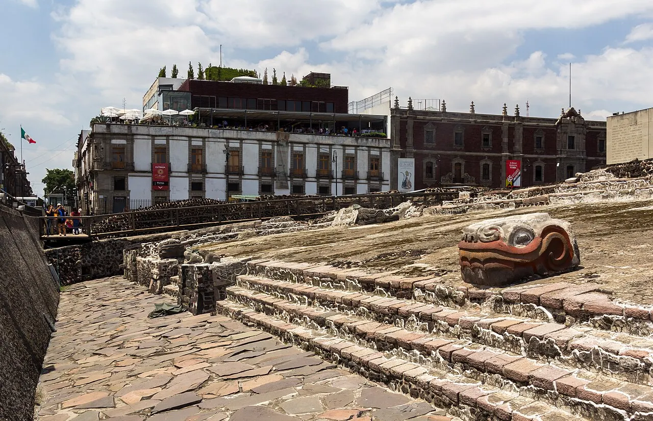
Templo Mayor
Ruins of Tenochtitlan's double temple, rediscovered in 1978 by electricians who hit the 3.2 m Coyolxauhqui monolith. There are seven overlapping construction stages; the museum next door holds thousands of pieces found in the excavations. Closed Mondays.
Seven building phases are stacked on top of each other, the site museum next door shows thousands of finds and closes on Mondays; it's Tenochtitlan's twin temple; Coyolxauhqui is 3.2 m across.
Check access
Palacio de Bellas Artes
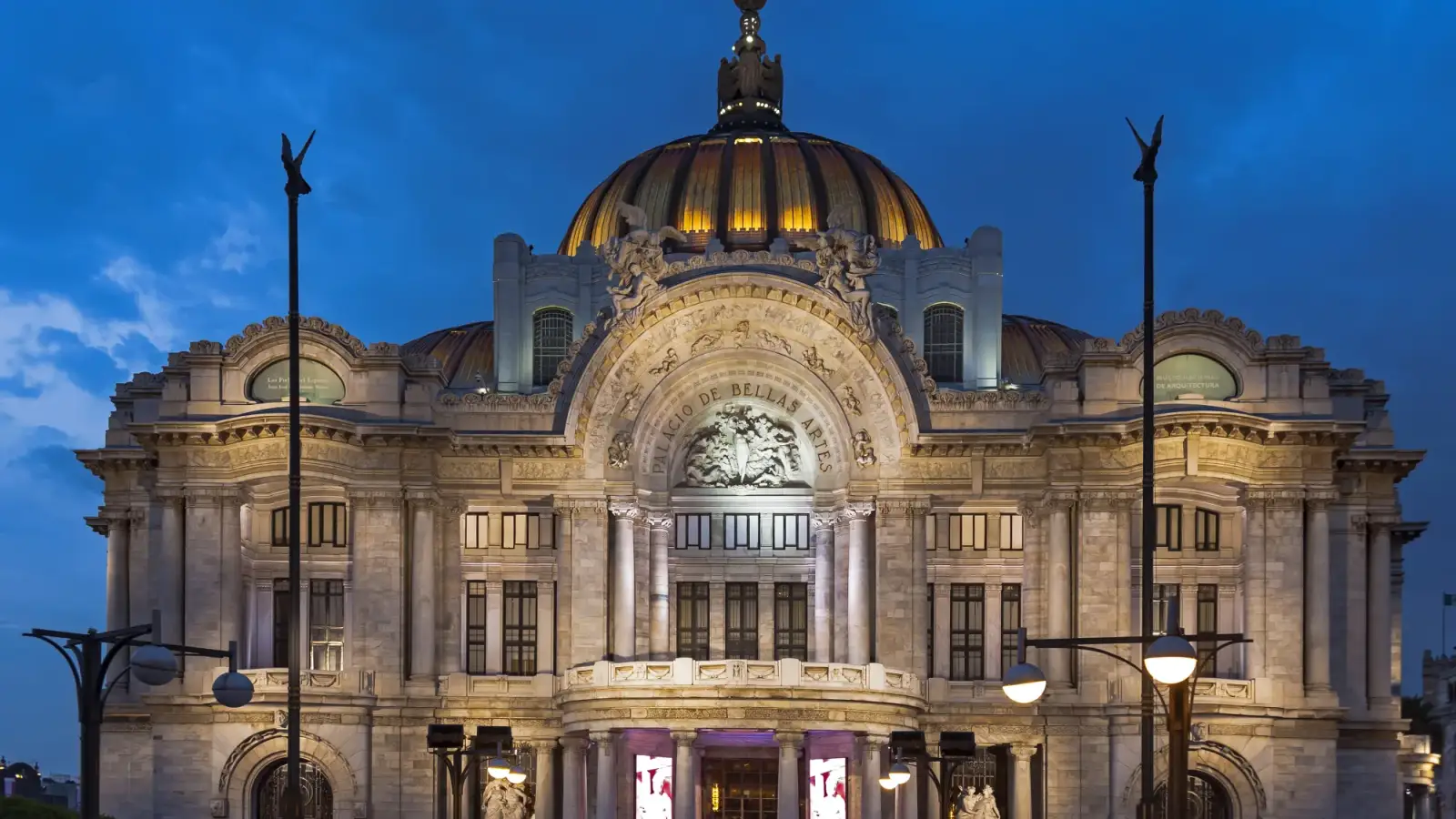
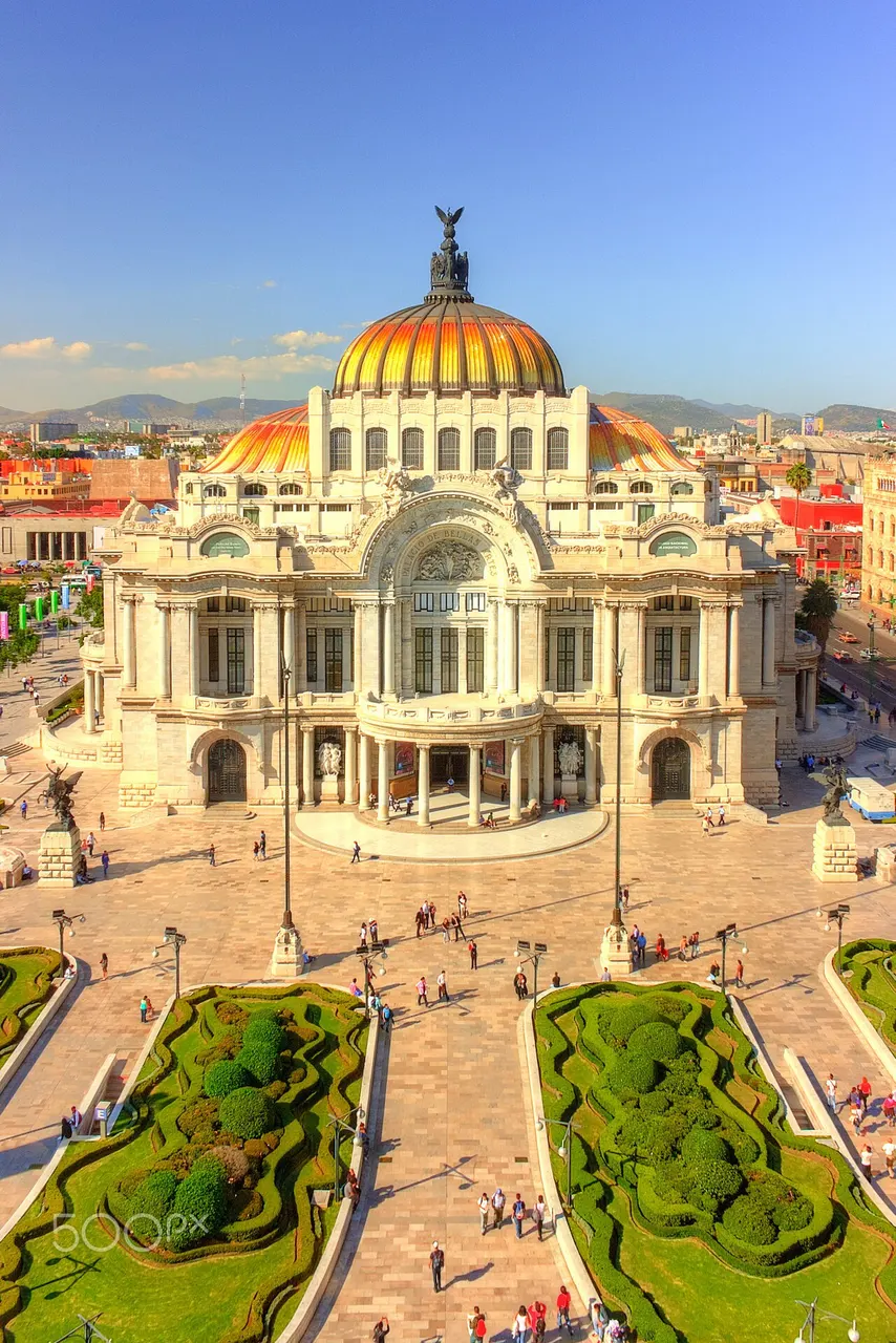
Carrara-marble theater and museum, begun in 1904 and finished in 1934, art nouveau outside and art deco inside. It has sunk about 4 m into the ground since it was built. Holds murals by Rivera, Orozco, Siqueiros and Tamayo and a Tiffany glass curtain with the volcanoes' silhouette.
The Carrara-marble theater, built from 1904 to 1934, holds the murals by Rivera, Orozco, Siqueiros and Tamayo and the Tiffany glass curtain with the volcanoes.
Check access
Museo Nacional de Antropología
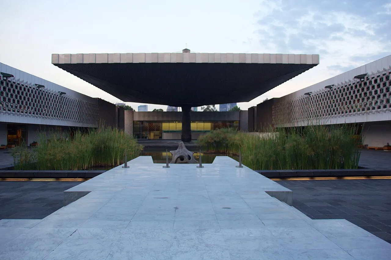
Opened in 1964, designed by Pedro Ramírez Vázquez: 22 galleries around a courtyard covered by a concrete umbrella held up by a single column. Holds the 24-ton Aztec Sun Stone and Pakal's jade mask. Closed Mondays; three hours is the minimum.
Opened in 1964, 22 galleries surround a concrete umbrella held up by a single column, the collection includes the Sun Stone and Pakal's mask, and the museum closes on Mondays; three hours is the minimum.
Check access

Zócalo (Plaza de la Constitución)
Square of about 240 by 240 m, one of the largest in the world, set over the Aztec ceremonial center. Every day an Army platoon raises the giant flag in the morning and lowers it in the late afternoon, with the square stopping around it.
An Army platoon raises the flag in the morning and lowers it in the late afternoon on the square built over the Aztec ceremonial center; the plaza measures about 240 by 240 m.
Check access
Catedral Metropolitana
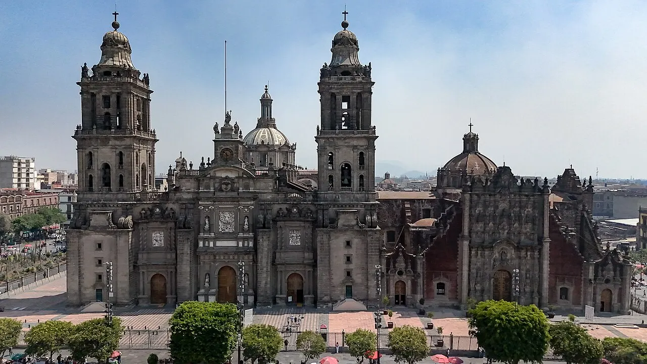
Built between 1573 and 1813 with stone from the demolished Aztec precinct, a mix of Renaissance, baroque and neoclassical. It sank unevenly into the lakebed clay and had its foundations reinforced by an engineering project between 1993 and 2000; the unevenness still shows on the floor.
The cathedral, mixing several styles and built with stone from the demolished precinct, sank unevenly into the lake clay and still shows the dip in the floor after the reinforcement; construction ran from 1573 to 1813, and the reinforcement from 1993 to 2000.
Check access

Palacio Nacional
Seat of the Executive, built over Montezuma's palace. On the main staircase is the mural “The Epic of the Mexican People,” painted by Diego Rivera between 1929 and 1935: the country's history on a single wall. Entry is free with ID, but depends on the official schedule, so confirm on the day.
The seat of the Executive was built over Montezuma's palace, Diego Rivera painted a mural with the country's history on a single wall on the staircase from 1929 to 1935, and the free visit, with ID, depends on the official schedule.
Check access

Bosque de Chapultepec and the Castle
About 800-ha park in four sections, almost twice the size of Central Park, used as a sacred grove since before the conquest. Atop the hill sits the only castle in the Americas that housed a monarch: Maximilian of Habsburg, between 1864 and 1867.
A park of about 800 ha, a sacred forest before the conquest, with the only castle in the Americas that housed a monarch; Maximilian of Habsburg lived there between 1864 and 1867.
Check access

Museo Frida Kahlo (Casa Azul)
House in Coyoacán where Frida Kahlo was born in 1907 and died in 1954, opened to the public in 1958 with her personal collection, the painted corsets and the intact studio. Entry is by timed ticket, sold only online, and dates sell out weeks in advance.
The house where she was born opened with her personal collection, the painted corsets and the intact studio, and the timed ticket sells out weeks in advance; Frida Kahlo was born in 1907 and died in 1954.
Check access

Basílica de Guadalupe
Shrine on Tepeyac hill. The current basilica, circular and seating about 10,000, dates from 1976, also by Ramírez Vázquez; the old one next to it visibly leans from sinking. It receives about 10 million pilgrims around December 12.
It's far from downtown and the south, the neighborhoods where the rest of the visit happens, and it's worth the trip around December 12, when about 10 million pilgrims arrive for the pilgrimage. Outside that date, the basilica in use, a 1976 concrete rotunda seating 10,000 people, holds little interest as a building; if you climb the Tepeyac, look at the old one next to it, tilted by subsidence.
Check access
Nilo’s itinerary
Start with the basic programme and choose extensions for the time you have.
Plan my days in the app ↗Day 1 · The historic center, over the ruins of the Templo Mayor
Go into the Templo Mayor and its site museum at 9am, starting with the model of the seven building phases; allow two hours and remember it's closed on Mondays.
At 11:30am cross over to the Catedral Metropolitana and notice, inside, the uneven floor left by the sinking of the old lake's clay; then, if the official schedule allows it that day, climb the staircase of the Palacio Nacional to see Diego Rivera's murals, free with ID.
Have lunch at 2pm at the Mercado de San Juan or at a fonda on Calle Motolinía, with a comida corrida, and then order churros at El Moro on Eje Central.
At 4pm visit the Palacio de Bellas Artes and, across the street, go up to the 44th-floor observation deck of the Torre Latinoamericana to see the size of the basin and the volcanoes, if the air is clear.
End at 8:30pm in a cantina downtown, with botana included with your beer, or hire a mariachi by the song at Plaza Garibaldi, going and coming back by ride-hailing app.
Day 2 · Chapultepec and the Reforma
Arrive at 9am at the Museo Nacional de Antropología, at opening time, and start with the Mexica hall.
At 1pm climb to Chapultepec Castle, at the top of the hill, for the rooms of Maximilian and Carlota and the straight-line view down the Paseo de la Reforma.
Have lunch at 3pm in Polanco and, next door, visit the Soumaya museum (free admission, a facade of 16,000 hexagonal aluminum plates) and the Jumex.
At 6pm walk along Reforma from the Diana Fountain to the Ángel de la Independencia; on Sundays the avenue closes to cars for cyclists and pedestrians until 2pm.
Have dinner at 9pm in Roma Norte and try mezcal at a mezcalería on Colima, Orizaba or Córdoba streets.
Day 3 · South: Coyoacán, San Ángel and Xochimilco's canals
Go into the Casa Azul, the Museo Frida Kahlo, at 10am, at the time on the ticket you bought online; on Wednesdays it opens at 11am, and it's closed on Mondays.
At 12pm walk through the plazas of Coyoacán, visit the Museo Casa de Leon Trotsky, with his study intact since August 1940, and eat tostadas at the Mercado de Coyoacán.
At 2pm continue to San Ángel, along its cobblestone streets, to the Casa Estudio Diego Rivera y Frida Kahlo, two houses linked by a bridge that Juan O'Gorman designed in 1932; if it's Saturday, stop by the Bazar Sábado on Plaza San Jacinto.
At 4:30pm rent a trajinera by the hour at the Xochimilco landings, in Nativitas or Cuemanco (about 600–800 pesos an hour per boat, split among the group); bring cash and agree on the price before boarding. In the rainy season, reverse the day and do Xochimilco in the morning.
If you prefer, swap Xochimilco for UNAM's Ciudad Universitaria, a UNESCO World Heritage Site since 2007, with Juan O'Gorman's stone mosaic mural covering all four sides of the Central Library.
Day 4 · Teotihuacán
Day trip
50 km to the northeast; 1 hour to 1 hour 15 minutes by bus from the Norte terminal, or by car. The Pyramid of the Sun stands 65 m tall and the Avenue of the Dead runs 2 km; the city was abandoned around the year 550 and was already a ruin when the Aztecs named it. Arrive at opening, 9am, ahead of the heat and the crowds.



If you stay longer
Day 5 · Puebla
Day trip
130 km to the east, about 2 hours by bus from the TAPO. Colonial center, Unesco World Heritage, Talavera-tile facades, mole poblano and cemitas; 15 km away is Cholula, with the largest pyramid in the world by volume, today a hill with a church on top and Popocatépetl behind it.
Food
 AI illustration
Tacos al pastor
Pork marinated in achiote and chile, stacked on a vertical spit inherited from Lebanese immigrants of the 1930s and sliced straight onto the tortilla, with pineapple on top. Comes on a small double tortilla, with onion, cilantro and lime; 15–25 pesos each.
 AI illustration
Guajolota (tamale sandwich)
A whole tamale inside a bolillo roll, a street breakfast sold at metro entrances between 6 and 10am, almost always paired with atole. Costs 25 to 40 pesos and explains why so many people eat standing up at seven in the morning.
 AI illustration
Tlacoyos and quesadillas
The tlacoyo is an oval of blue-corn dough filled with fava beans, requesón cheese or chicharrón, cooked on the griddle and topped with nopal. In Mexico City a quesadilla doesn't come with cheese unless you ask for it. The argument over this is national and never ends.
 AI illustration
Barbacoa and consomé
Lamb wrapped in maguey leaves and cooked in a pit in the ground overnight, served only on Saturday and Sunday mornings, in a taco, with the cooking broth in a cup on the side.
 AI illustration
Esquites and elotes
Corn cooked on the cob (elote) or off the cob in a cup (esquites), with mayonnaise, dry cheese, lime and chile powder. Corner cart from late afternoon on; 25–45 pesos.
 AI illustration
Chilaquiles
Fried tortilla pieces, quickly simmered in green or red salsa and served with cream, cheese, onion and egg or chicken. It's the city's sit-down breakfast and disappears from menus after noon.
 AI illustration
Churros and pan dulce
Fried dough rolled in sugar, eaten with thick hot chocolate; the churrería El Moro has been open since 1935, and its Eje Central location runs 24 hours. In the afternoon the bakery sells pan dulce (concha, oreja, cuernito); you serve yourself with a tray and tongs.
 AI illustration
Pulque, mezcal and aguas frescas
Pulque is the fermented sap of the maguey, a pre-Hispanic drink of viscous texture, served plain or in fruit-flavored curados at pulquerías. Mezcal comes in a small cup with worm salt; in cantinas the beer arrives with a free botana snack, and at fondas the pitcher holds jamaica, horchata or tamarindo.
Day trips

Teotihuacán
50 km to the northeast; 1 hour to 1 hour 15 minutes by bus from the Norte terminal, or by car. The Pyramid of the Sun stands 65 m tall and the Avenue of the Dead runs 2 km; the city was abandoned around the year 550 and was already a ruin when the Aztecs named it. Arrive at opening, 9am, ahead of the heat and the crowds.
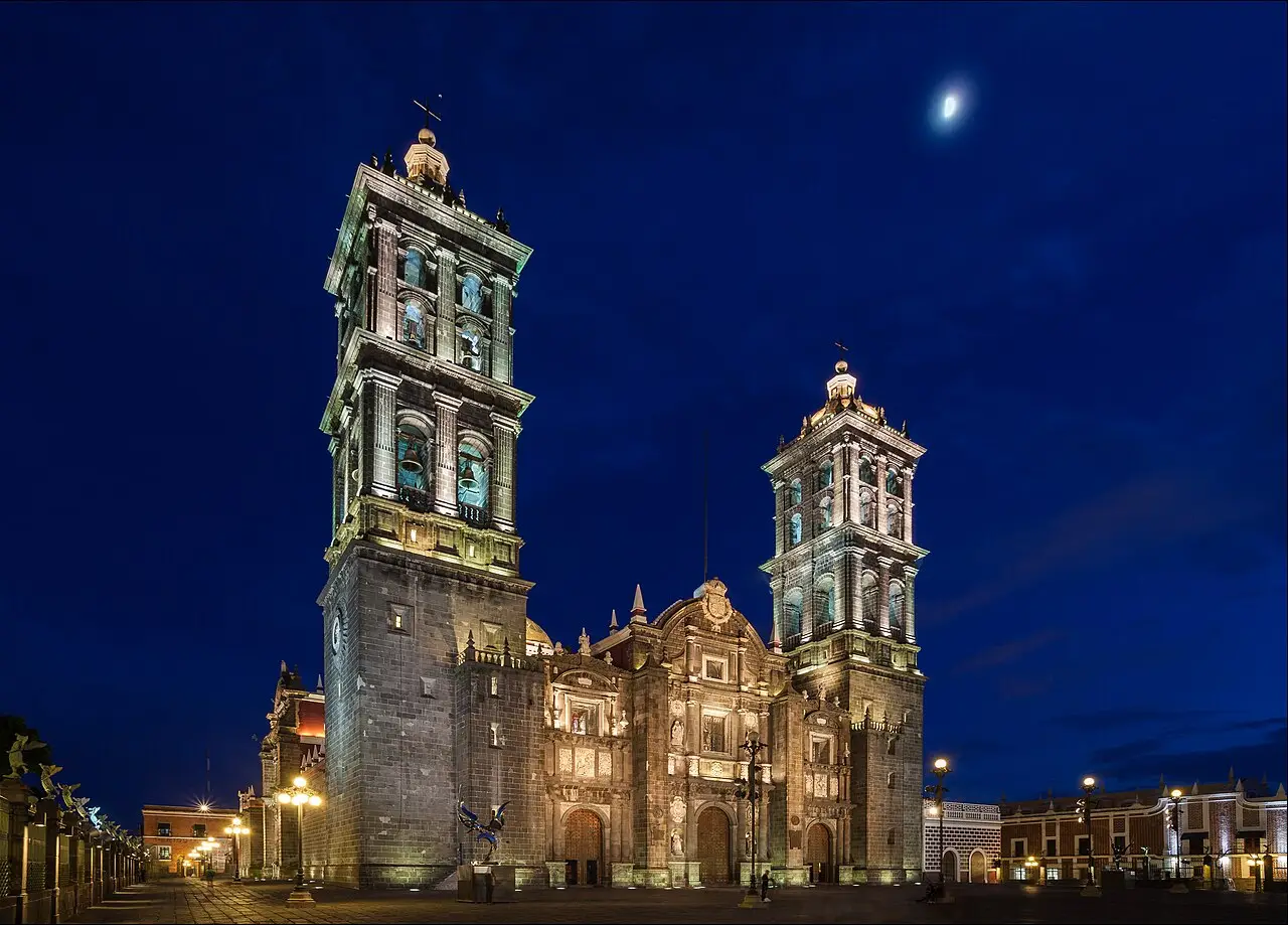
Puebla
130 km to the east, about 2 hours by bus from the TAPO. Colonial center, Unesco World Heritage, Talavera-tile facades, mole poblano and cemitas; 15 km away is Cholula, with the largest pyramid in the world by volume, today a hill with a church on top and Popocatépetl behind it.

Tepoztlán
80 km to the south, 1 hour 15 minutes on the Cuernavaca highway. Village in the state of Morelos, 600 m lower and warmer, with a weekend market and the steep, roughly 2-km trail up to the Tepozteco pyramid, 400 m above the town.
Where to begin
The historic center, over the ruins of the Templo Mayor
Go into the Templo Mayor and its site museum at 9am, starting with the model of the seven building phases; allow two hours and remember it's closed on Mondays.
Chapultepec and the Reforma
Arrive at 9am at the Museo Nacional de Antropología, at opening time, and start with the Mexica hall.
South: Coyoacán, San Ángel and Xochimilco's canals
Go into the Casa Azul, the Museo Frida Kahlo, at 10am, at the time on the ticket you bought online; on Wednesdays it opens at 11am, and it's closed on Mondays.
Money
The currency is the Mexican peso (MXN), and it's written with the same sign as the dollar, so don't panic at the first menu: “$250” means 250 pesos. Check the day’s exchange rate with Banco de México before converting your budget. Approximate 2026 price ranges: a street taco 15–25 pesos; a guajolota 25–40; a comida corrida lunch, with soup, main and agua fresca, 90–160; specialty coffee 55–80; a beer in a cantina 45–80; dinner at a midrange restaurant in Roma or Condesa 400–800 per person; a three-star hotel 1,200–2,400 a night. Cards work in restaurants, hotels, large markets and shops, but street food, public markets, trajineras and concession buses take cash only: carry 20, 50 and 100 bills and coins for change. Withdraw money from ATMs inside bank branches or malls, never from standalone machines on the sidewalk, and decline conversion into your card's currency, which always comes out worse. Tipping is 10% to 15% in restaurants (check first whether it's already on the bill) and 10 to 20 pesos for whoever watches your car on the street and whoever bags your groceries at the supermarket.
Getting there and around
Benito Juárez Airport: 5 km from the Zócalo, with an internal aerotrén
Benito Juárez International Airport (MEX) is about 5 km east of the Zócalo and has two terminals linked by an internal airtrain that only takes passengers who already have a boarding pass. There are four ways into the center. An authorized taxi, with a ticket bought at the counter inside the terminal, costs 250 to 400 pesos to Centro, Roma or Condesa, and Uber, DiDi and Cabify pick up at designated points. Metrobús Line 4 leaves from both terminals and allows luggage; at the airport stations the fare is 30 pesos, compared with 6 pesos on the rest of the network, paid with the rechargeable card, never in cash. Metro Line 5, whose Terminal Aérea station is a few meters from T1, costs 5 pesos, but large suitcases are officially banned on the cars. The second airport, Felipe Ángeles (NLU), is about 45 km to the north, 1 hour to 1 hour 30 minutes by car. Buses to other cities leave from four terminals, one for each point of the compass: Norte (Teotihuacán and the north of the country), TAPO (Puebla, Veracruz, Oaxaca), Sur (Cuernavaca, Acapulco) and Observatorio (Toluca, Michoacán).
Twelve lines and 195 stations since 1969
The Metro has run since 1969, has 12 lines and 195 stations and carries several million passengers every weekday; in 2026 the fare is still 5 pesos, although the real cost of each trip is about 13 pesos, largely paid by the city's subsidy. Buy the Tarjeta de Movilidad Integrada as soon as you arrive, for 15 pesos plus credit: it pays for the Metro (5), Metrobús (6, or 30 at the airport stations), Cablebús (7) and Tren Ligero (3). Metrobús runs in dedicated lanes on the big avenues (Insurgentes, Reforma, Eje 4) and is more comfortable than the Metro outside rush hour. Cablebús is an urban cable car serving the hillside neighborhoods of Iztapalapa and Gustavo A. Madero, with Line 2 reaching 10.6 km. For car trips, use an app instead of hailing a taxi on the street. Ecobici has about 700 stations concentrated in Centro, Juárez, Roma, Condesa and Polanco, with 1-, 3- and 7-day passes. Walking works within each neighborhood and almost never between them, because the distances are long, the sidewalks are uneven and at 2,240 m even a short slope leaves you out of breath.
Safety
The real risk here is property crime, not violence against tourists: pickpocketing and opportunistic theft. Backpacks and phones are targets in crowded Metro cars, mainly on Lines 1, 2 and 8 and at the Pino Suárez, Hidalgo and Tacuba transfers, plus La Merced and the Zócalo on event days; keep your phone in a front pocket and don't use it on the platform. Don't hail a taxi off the street: call Uber, DiDi or Cabify, or ask the restaurant for a sitio taxi, because express kidnapping by way of ATM stops still happens with cars parked on the curb. Avoid Tepito, La Merced at night, Doctores and the edges of the Centro after 10pm; Roma, Condesa, Juárez, Polanco, Coyoacán and San Ángel are safe to walk at night. Don't drink tap water: at home and in hotels you drink from the garrafón jug, and no one finds that odd. The city is seismic: if the warning siren sounds, walk calmly to the meeting point marked on the sidewalk, don't use the elevator and don't run for the stairs; on September 19 there's a national drill in memory of 1985 and 2017. The sound catches off guard anyone who wasn't warned. Protests at the Zócalo and along the Reforma are frequent on weekdays and almost always peaceful, but they close avenues: detour rather than cross.
Etiquette tips
Say “mande,” not “¿qué?”
When you don't catch what someone said, answer “mande” or “¿cómo?”. A blunt “¿qué?” sounds rude, especially with someone who is working.
Start with “usted”
Address vendors, drivers and older people as “usted” until they switch to “tú.” To call someone over, “joven,” “seño” and “maestro” work much better than “amigo.”
“Provecho” between tables
When you walk into or out of a small restaurant, people commonly wish “provecho” to whoever is eating. Reply “gracias, igualmente”: it's a polite formula and doesn't call for conversation.
“Ahorita”: anywhere from five minutes to never
“Ahorita” can mean in five minutes, in three hours, or never. If you need a time, ask for a time: “¿a qué hora?”.
Women's car and bus section
The Metro's front cars and the front section of the Metrobús are reserved for women, children and the elderly all day, not just at peak hours. There's a pink line on the floor and police on the platform; men don't board.
“¿Pica?” is courtesy: ask for salsa on the side
When they ask “¿pica?” before serving, it's courtesy. Ask for the salsa on the side if you don't know your limit; sending a plate back half-eaten is worse than asking for less.
Mistakes to avoid
At 2,240 m alcohol hits faster
Arriving from sea level and rushing around. At 2,240 m your breath shortens, alcohol hits faster and the hangover is worse: it's easy to walk too much on the first day and pay for it on the second. Drink water, eat early and take the first day slow.
It's 12 km from the Zócalo to Coyoacán
Thinking the city can be covered on foot. It's 12 km from the Zócalo to Coyoacán and almost 30 from the center to Xochimilco; use the Metro or an app for long distances and walk within each neighborhood.
The main meal is between 2pm and 4pm
Having lunch at noon and dinner at 8pm. The main meal is between 2pm and 4pm, many fondas close at 6pm and at night people eat tacos, not a full lunch. If you stick to European hours, you'll find the kitchen closed and the dining room empty.
Anthropology and Templo Mayor on Monday
Scheduling museums for Monday. Museo Nacional de Antropología, Templo Mayor, Chapultepec Castle, Casa Azul and almost the whole public network close on Mondays; leave that day for markets, parks and neighborhoods.
Buying the ticket before getting the Mexican visa
Brazilians have needed a visa to enter Mexico since 2022, when the free electronic authorization ended. Since February 5, 2026, those arriving by air for tourism get the electronic visa online, on the Mexican foreign ministry's site (visaelectronica.sre.gob.mx), without going to the consulate: it costs US$10 and is valid for a single entry and a stay of up to 180 days. Holders of a valid visa or permanent residence in the US, Canada, Japan, the UK or the Schengen area are exempt, but must carry the document.
Useful phrases
¿Me da un taco al pastor, por favor?
Could I get a taco al pastor, please
¿Cuánto le debo?
How much do I owe you? The usual way to close the bill on the street and at the market
Sin chile, por favor / con la salsa aparte
No chile, please / with the salsa on the side
Mande
“Sorry, what?”: the polite way to ask someone to repeat
Con permiso
Excuse me: said when passing someone or getting up from the table
¿Está muy lejos caminando?
Is it very far on foot?
Districts
Centro Histórico
Rectangle around the Zócalo with over 1,500 catalogued buildings from the 16th to 19th centuries, Unesco World Heritage since 1987. Still works by specialized streets: Donceles sells used books, Bolívar sells musical instruments, República de Cuba and Regina concentrate bars.
Roma Norte and Roma Sur
Neighborhood laid out in 1902 for the Porfirian upper class, with art nouveau and art deco mansions; it was among the hardest hit in 1985 and stayed cheap for decades. Today it concentrates restaurants, specialty cafés and galleries, and the Plaza Río de Janeiro has a replica of Michelangelo's David.
Condesa and Hipódromo
Oval layout inherited from the Jockey Club racetrack, closed in 1926 and turned into Parque México, ringed by 1920s and 30s art deco. Tree-lined streets, bars, restaurants and the largest concentration of foreigners living in the city.
Polanco
Subdivided in the 1930s and 40s north of Chapultepec, with streets named after writers and philosophers. It brings together expensive hotels, Presidente Masaryk avenue, the Soumaya and Jumex museums and the country's highest density of award-winning restaurants.
Coyoacán
Colonial village absorbed by the city in the 20th century; it was Cortés's base after 1521. Squares with cypresses and fountains, Frida Kahlo's Casa Azul, the house where Trotsky was assassinated in August 1940, and a market known for its tostadas.
San Ángel
Colonial village to the southwest, with cobblestone streets, mansions behind walls, and the Casa Estudio Diego Rivera y Frida Kahlo, designed by Juan O'Gorman in 1932. The Bazar Sábado runs only on Saturdays, at Plaza San Jacinto, since 1960.
Xochimilco
Far south: about 170 km of canals and chinampas built before the conquest and still farmed, Unesco World Heritage since 1987. The trajineras leave from nine piers; Nativitas is the busiest, Cuemanco the quietest.
Santa María la Ribera
Neighborhood from the late 19th century north of the center, now with rents lower than Roma and Condesa. It has the Kiosco Morisco, an iron pavilion designed by José Ramón Ibarrola for the 1884 New Orleans exposition and brought to the square in 1910.
History
1325 · Founding of Mexico-Tenochtitlan
A Mexica group coming from the north founds the city on an islet in Lake Texcoco. The chinampas, garden plots built over the shallow lake bed, yield up to seven harvests a year and sustain its growth.
1428 · The Triple Alliance
Tenochtitlan, Texcoco and Tlacopan form the alliance that dominates central Mexico through tribute. In 1519 the city has between 150 and 200 thousand people, the Chapultepec aqueduct and three causeways linking the island to the mainland.
1521 · Fall of Tenochtitlan
On August 13, after a 75-day siege and a smallpox epidemic, Cuauhtémoc surrenders to Cortés. The capital is rebuilt on the exact same spot: the cathedral over the sacred precinct, the palace over Montezuma's house.
1607–1900 · The Desagüe: draining the lake
Colonial floods, including the one in 1629 that left the center underwater for almost five years, lead to three centuries of drainage tunnels and canals, from Huehuetoca to the Gran Canal of 1900. The lakes disappear, and the ground, without water, begins to sink.
1821–1847 · Independence and invasion
On September 27, 1821, the Army of the Three Guarantees enters the city and ends three centuries of viceroyalty. On September 13, 1847, US troops take Chapultepec Castle and occupy the Zócalo; the following year's treaty costs Mexico half its territory.
1864–1911 · Reform and the Porfiriato
Maximilian of Habsburg lives in the castle between 1864 and 1867 and has the Paseo de la Reforma opened to link it to the center, copying European boulevards. Under Porfirio Díaz come streetcars, electric light, train stations and the works on the Palacio de Bellas Artes, begun in 1904.
1910–1929 · Revolution and murals
The Decena Trágica, in February 1913, brings artillery into the center's streets; Villa and Zapata enter the city in December 1914. From 1922 the State hires Rivera, Orozco and Siqueiros to paint history on public walls; UNAM gains autonomy in 1929.

1940–1980 · The population explosion
Industrialization drives migration from the countryside that takes the city from 1.6 million inhabitants in 1940 to over 13 million in the metropolitan area by 1980. The west and south, on volcanic rock, keep the high incomes; the flat east of the old lakebed receives Iztapalapa and Nezahualcóyotl.
1968 · Olympics and Tlatelolco
On October 2 the Army opens fire on students in the Plaza of the Three Cultures, in Tlatelolco. Ten days later the city opens the Olympic Games, the first in Latin America.
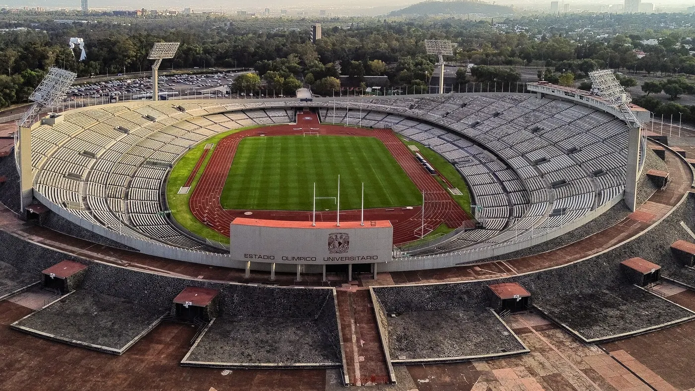
1985 and 2017 · The 1985 earthquake: another on the same day, 32 years later
The magnitude-8.1 earthquake of 1985 brings down hundreds of buildings and kills thousands; the government's slow response and the rescue done by volunteers found the city's civic politics. Exactly 32 years later, on September 19, 2017, a magnitude-7.1 quake kills 369 people, 228 of them in the capital.
 AI illustration
1997–2026 · Autonomy since 1997 and the renovated Azteca in 2026
In 1997 the city elects its own head of government for the first time; in 2016 it stops being the Federal District and enacts its own constitution in 2017. On June 11, 2026, the renovated Estadio Azteca hosted the opening of the World Cup, with four more matches through July 5.
 AI illustration
Complete history
The city begins on an island
According to Mexica tradition, in 1325 a migrant group founded Mexico-Tenochtitlan at the spot on Lake Texcoco where they saw an eagle perched on a nopal cactus, the scene that's on the Mexican flag today. The choice was defensive and agricultural at the same time: the water protected them and the chinampas fed them. In 1428, the alliance with Texcoco and Tlacopan turned the city into a tribute machine over much of central Mexico. When the Spanish arrived, in November 1519, Tenochtitlan had between 150 and 200 thousand people, three causeways several kilometers long, an aqueduct coming from Chapultepec and a market in Tlatelolco that Bernal Díaz del Castillo compared to those of Constantinople.
Siege of 1521: 75 days to the fall
On August 13, 1521, after a 75-day siege, the city fell. Cortés decided to rebuild it over its own rubble, and that decision created the problem the capital still manages: heavy stone over lakebed clay, in a basin with no natural outlet to the sea. Floods repeated throughout the colonial period, and the 1629 one left the center underwater for nearly five years. The response was the Desagüe, a drainage project started in 1607 in Huehuetoca and continued for three centuries, which dried out the valley's five lakes. Drying them shrank the soil: the historic center's sinking starts there, not in the 20th century.
Loss of territory and change of regime
The 19th century brought loss of territory and change of regime. Independence came in September 1821; in 1847 the US Army occupied the Zócalo; between 1864 and 1867 an Austrian emperor lived in Chapultepec Castle and opened the Paseo de la Reforma to reach the center in a straight line. The Porfiriato (1876–1911) equipped the city with streetcars, electricity, new drainage and imported architecture, and concentrated so much inequality that the Revolution began in 1910. In February 1913, during the Decena Trágica, cannons exchanged fire inside the center for ten days.
After 1940 the city multiplied
After 1940 the city multiplied: 1.6 million people that year, 5 million in 1960, more than 13 million in the metropolitan region in 1980. The areas on firm ground were the ones with the highest incomes. The first arrivals settled the west and south, on solid rock; later migration filled the flat east of the dry lakebed, where the ground sinks and shakes more. Two events shape the political memory: October 2, 1968, when the army opened fire on students in Tlatelolco ten days before the opening of the Olympics, and September 19, 1985, when a magnitude 8.1 earthquake brought down the center and civil society organized the rescue while the government hesitated. The brigades of 1985 are the direct origin of the movement that led to the election of the city's first head of government, in 1997.
Its own constitution since 2017
The city has governed itself under its own constitution since 2017, the year another September 19 brought a magnitude-7.1 quake and 369 deaths. It's still sinking, from a few centimeters to a few dozen a year in parts of Iztapalapa, imports about a quarter of the water it consumes from the Cutzamala system, 130 km away, and has become one of the world's remote-work destinations, which pushed rents up in Roma and Condesa and sparked protests against gentrification in 2025. In June and July 2026 it hosted five World Cup matches at the renovated Estadio Azteca (renamed Estadio Banorte and called Estadio Ciudad de México during the tournament) with accelerated mobility works in the south and contested removals nearby. None of this erased the oldest layer: in 1978, electricians digging by the cathedral corner found the Coyolxauhqui monolith and returned the Templo Mayor to the surface, 200 meters from the Zócalo. Today's city is literally built over the previous one, and archaeology reappears every time someone digs a trench for the metro.
Today's city was built over the Aztec one, and almost every excavation finds ruins.
Geography and shape of the city
The closed basin and the drained lake
The city occupies the bottom of an endorheic basin of about 9,600 km², at 2,240 m altitude, ringed by mountains on three sides: the Sierra de las Cruces to the west, the Ajusco and the Chichinautzin range to the south, and the Sierra Nevada to the east, with Popocatépetl (5,426 m, active since 1994) and Iztaccíhuatl (5,230 m) visible on clear days. The basin has no natural outlet to the sea, and the five shallow lakes that occupied the bottom were drained through artificial tunnels between 1607 and the 20th century; more than half the urban sprawl sits on that saturated clay bed.
The ground that sinks and shakes
Two consequences govern daily life: the ground sinks when water is pumped from the aquifer (the Cathedral and the Palacio de Bellas Artes have dropped meters since they were built) and the clay amplifies seismic waves, which explains why earthquakes with an epicenter 300 km away bring down buildings here.
The layers of the grid and the boroughs
The urban grid reads in layers: the colonial checkerboard around the Zócalo; the Paseo de la Reforma cutting diagonally since 1865 and concentrating the skyscrapers; the Ejes Viales, fast one-way avenues imposed in 1979 over the old fabric; and the 20th-century expansion, which climbed the west and south and filled the east with Iztapalapa and Nezahualcóyotl. Mexico City has 1,495 km² divided into 16 boroughs, and about 59% of that territory is officially conservation land: forest, volcanoes and farming in the south, which recharge the aquifer.
The grid has layers: the colonial grid around the Zócalo, the Paseo de la Reforma from 1865 and the Ejes Viales from 1979.
Culture
The State painted history on the wall
After the Revolution the State hired painters to teach history on the walls: between 1922 and the 1950s, Diego Rivera, José Clemente Orozco and David Alfaro Siqueiros covered the Escuela Nacional Preparatoria, the Secretaría de Educación Pública, the Palacio Nacional and Bellas Artes with murals that are still today's official version of the Mexican past. The city has over 150 museums (Anthropology, Tamayo, Carrillo Gil, Soumaya, Jumex, MUAC) and the modern architecture that came with them: UNAM's Ciudad Universitaria (1952, Unesco World Heritage since 2007), Luis Barragán's house-studio (1948, Unesco since 2004) and the Anahuacalli, a volcanic-stone museum Rivera built for his own pre-Hispanic collection.
Mariachi, cumbia, rock, lucha libre and soccer
Mariachi, cumbia sonidera and Spanish-language rock share the city's soundtrack. Mariachi has had a fixed address at Plaza Garibaldi since the 1920s and is hired by the song rather than by the hour. Cumbia sonidera fills whole blocks in Iztapalapa and Tepito, with sonideros sending shout-outs over the microphone in the middle of the track, and Spanish-language rock came out of here in the 1980s and '90s with Caifanes, Café Tacvba and Molotov. Beyond music, lucha libre is weekly theater with fixed rules (técnicos against rudos, mask wagered against hair), and Arena México, from 1956, has about 16,000 seats and a show on Friday nights. In soccer, América plays at the Azteca and Pumas at the Estadio Olímpico Universitario, while Cruz Azul, with no stadium of its own, has moved home several times since 2025.
Novels, films, shrines and nightlife
The city is a character in books and films that help you understand it before you arrive: “Where the Air Is Clear” (Carlos Fuentes, 1958), “The Savage Detectives” (Roberto Bolaño, 1998), which roams the Roma and Juárez of the 1970s, and “The Labyrinth of Solitude” (Octavio Paz, 1950); on screen, from Luis Buñuel's “Los Olvidados” (1950) to “Amores Perros” (2000) and “Roma” (2018). On the streets, popular religion coexists with Catholicism without asking permission: the Santa Muerte altar on Calle Alfarería, in Tepito, holds its devotion on the 1st of every month, and the Basilica of Guadalupe receives more pilgrims than any other Christian shrine outside the Vatican. The night starts late: bars open after 9pm, the old cantinas close around midnight and the dance floors of Roma and Juárez keep going until 3am.
Between 1922 and the 1950s, the State commissioned history murals from Rivera, Orozco and Siqueiros, and they cover the walls of public buildings downtown.
Festivals and events

Día de Muertos
November 1 and 2: altars (ofrendas) in homes, offices, squares and cemeteries, with cempasúchil flowers, a photo of the deceased and the food they liked. The parade on the Paseo de la Reforma is a recent invention. It began in 2016, copied from the opening scene of the film Spectre (2015).

Grito de Independencia
September 15, around 11pm: the president repeats Hidalgo's grito from the balcony of the Palacio Nacional to the packed Zócalo, followed by fireworks. On the 16th there's a military parade through the Zócalo and along the Reforma; the whole city shuts down.
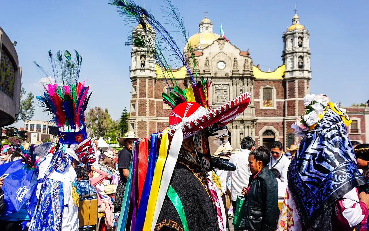
Virgen de Guadalupe
December 12. Pilgrims arrive on foot, by bicycle and by pickup truck from all over the country starting on the 9th, and spend the night in the Basilica's atrium with the mañanitas sung at midnight. It's the largest annual religious gathering in the Americas.

Semana Santa in Iztapalapa
Reenactment of the Passion on Cerro de la Estrella, performed by residents of the eight original neighborhoods since 1843, as a vow made after a cholera epidemic. It draws hundreds of thousands of people on Good Friday.
 AI illustration
Vive Latino and Corona Capital
The city's two big festivals: Vive Latino, of rock and Ibero-American music, in March, and Corona Capital, of international pop and indie, in November. Both happen at the Estadio GNP Seguros complex (formerly Foro Sol), at the racetrack.
Books and films
“Where the Air Is Clear,” Carlos Fuentes (1958)
The novel that turned the city into a character: dozens of voices crossing classes in a capital that jumped from 3 to 5 million inhabitants. The title is ironic. It comes from Alfonso Reyes's line about the valley's air, which by then no longer existed.
“Roma,” Alfonso Cuarón (2018)
Shot in black and white in the Colonia Roma of 1970 and 1971, it rebuilds street by street a middle-class home, domestic labor and the 1971 Corpus Christi massacre seen from the sidewalk.
“Massacre in Mexico,” Elena Poniatowska (1971)
A montage of testimonies about the Tlatelolco massacre, built from the voices of people who were there. It's the key to understanding the city's distrust of power and what gets commemorated on October 2.
Frequently asked questions
Mexico City: How much does the taxi from the airport to downtown cost?
The authorized taxi, with a ticket bought at the counter inside the terminal, costs 250 to 400 pesos to Centro, Roma or Condesa, and Uber, DiDi and Cabify pick up at designated points.
Mexico City: What's the currency, and how are prices written?
The currency is the Mexican peso (MXN), and it's written with the same sign as the dollar, so don't panic at the first menu: “$250” means 250 pesos.
Mexico City: What's the climate like throughout the year?
The climate is a high-altitude one, without tropical heat: highs of 22 to 26 °C almost all year and nights of 6 to 12 °C, dropping to 2 to 5 °C in December and January. The dry season runs from November to April; from May to October it rains almost every day, in a heavy storm between 4pm and 8pm.
Mexico City: What's the real risk for tourists?
The real risk here is property crime, not violence against tourists: pickpocketing and opportunistic theft.
Mexico City: What are tacos al pastor, and how much do they cost?
Tacos al pastor are made with pork marinated in achiote and chile, stacked on a vertical spit inherited from Lebanese immigrants of the 1930s and sliced straight onto the tortilla, with pineapple on top. They come on a small, doubled tortilla, with onion, cilantro and lime; 15 to 25 pesos each.
Other cities in the country
Mexico ↗- Days
- 3
- When
- Feb–Apr · Oct–Nov
- Per person/day
- Average 900–1,800 MXNMid-range · per person/day
Cost scope
Per person per day: accommodation, meals, urban transport, visits and a small allowance for extras. Flights excluded; larger purchases vary. Editorial estimate, not a quote.
- Days
- 2–3
- When
- Jan–Apr · Dec
- Per person/day
- Average 2,400 MXNMid-range · per person/day
Cost scope
Per person per day: accommodation, meals, urban transport, visits and a small allowance for extras. Flights excluded; larger purchases vary. Editorial estimate, not a quote.
- Days
- 3–4
- When
- Jan–Apr · Dec
- Per person/day
- Average 2,820 MXNMid-range · per person/day
Cost scope
Per person per day: accommodation, meals, urban transport, visits and a small allowance for extras. Flights excluded; larger purchases vary. Editorial estimate, not a quote.
- Days
- 3–4
- When
- Jan–Apr · Dec
- Per person/day
- Explore costsGuide estimate
Cost scope
Per person per day: accommodation, meals, urban transport, visits and a small allowance for extras. Flights excluded; larger purchases vary. Editorial estimate, not a quote.