Ecuador
Quito
Colonial center, volcanoes, TelefériQo and the equator
Days Start with the basic programme and choose extensions for the time you have.
How the guide reaches this number
With a third, go to the Mitad del Mundo and the El Panecillo lookout. A fourth is only worth it for Otavalo on a Saturday, Cotopaxi or Mindo. For the first 24 to 48 hours, at 2,850 m, keep a slow pace, because people who ignore the altitude tend to feel sick on the second day. With a single day, do the center on foot from 9am to 6pm, from Plaza Grande to La Compañía de Jesús and the San Francisco complex. Have lunch at the Mercado Central, climb the Basílica towers while there's light and finish on La Ronda with a canelazo. The center disappoints at night, when the noisy commerce of eleven in the morning gives way to almost empty streets by nine. Dinner ends up being in the north, by taxi. The Mitad del Mundo also lets down anyone expecting the exact line, since the monument sits 240 m off latitude zero. Make the most of the mornings, when clear skies show the mountains, because in the afternoon the clouds usually close in.
2–3
When June to September (dry season); December 1 to 6 for the Fiestas de Quito
How the guide reaches this number
Quito has no hot summer or cold winter: the temperature stays between 9 °C and 21 °C all year, and the swing within a single day is bigger than the difference between January and July. What changes is the rain. The dry season runs from June to September, with clearer skies, strong afternoon wind and cold nights. The rainy season runs from October to May, peaking in April, and the rain usually arrives as a downpour from mid-afternoon on, which keeps the mornings free for outdoor plans. June to September is the best window for hiking and for seeing Cotopaxi. The first week of December is the liveliest and the most expensive, because of the Fiestas de Quito. April is the rainiest month of the year and the one with the worst mountain visibility. In any season, head out with a windbreaker and sunscreen. Ultraviolet radiation on the equator at 2,850 m goes past 11 on the international scale and burns in twenty minutes without you feeling hot.
Per person/day US$35–60 budget, US$90–160 comfortable (2026)
How the guide reaches this number
Per person per day: accommodation, meals, urban transport, visits and a small allowance for extras. Flights excluded; larger purchases vary. Editorial estimate, not a quote.
 What Nilo thinks
Stay two days in Quito: one in the historic center, taken slowly, and another for altitude, art and the north, with the TelefériQo and the Capilla del Hombre. With a third, go to the Mitad del Mundo and the El Panecillo lookout. A fourth is only worth it for Otavalo on a Saturday, Cotopaxi or Mindo. For the first 24 to 48 hours, at 2,850 m, keep a slow pace, because people who ignore the altitude tend to feel sick on the second day. With a single day, do the center on foot from 9am to 6pm, from Plaza Grande to La Compañía de Jesús and the San Francisco complex. Have lunch at the Mercado Central, climb the Basílica towers while there's light and finish on La Ronda with a canelazo. The center disappoints at night, when the noisy commerce of eleven in the morning gives way to almost empty streets by nine. Dinner ends up being in the north, by taxi. The Mitad del Mundo also lets down anyone expecting the exact line, since the monument sits 240 m off latitude zero. Make the most of the mornings, when clear skies show the mountains, because in the afternoon the clouds usually close in.Churches are the reason to travel to Quito: La Compañía de Jesús has its interior covered in gold leaf, and on the towers of the Basílica del Voto Nacional the gargoyles are turtles and iguanas. From the top of the TelefériQo, at 3,945 m, you can see Cotopaxi and Cayambe on clear days, and the equator line is less than an hour away by car. Have locro de papa and hornado for lunch at the Mercado Central, and at dusk order a canelazo and an empanada de viento in La Ronda. The altitude wears you out within two blocks, so walk slowly for the first few days, with a jacket and sunscreen at hand. Come between June and September, in the dry season, and set aside two days, plus one more for the Mitad del Mundo.
Quick facts
- Population
- about 1.8 million in the urban area; about 2.7 million in the Metropolitan District (2022 Census, INEC)
- Founded
- December 6, 1534, as San Francisco de Quito, over the burned Inca city
- Country and region
- Ecuador, Pichincha province, Andean highlands; 2,850 m, 0°13′ S
- Language
- Spanish; Kichwa is an official language of intercultural relations under the 2008 Constitution
- Currency
- United States dollar (USD), adopted in January 2000
- Time zone
- UTC−5, no daylight saving; sun rises around 6am and sets around 6pm year-round
- Best time to visit
- June to September (dry season); December 1 to 6 for the Fiestas de Quito
- Average daily cost
- US$35–60 budget, US$90–160 comfortable (2026)
When to go
June to September (dry season); December 1 to 6 for the Fiestas de Quito
How the year changes
Quito has no hot summer or cold winter: the temperature stays between 9 °C and 21 °C all year, and the swing within a single day is bigger than the difference between January and July. What changes is the rain. The dry season runs from June to September, with clearer skies, strong afternoon wind and cold nights. The rainy season runs from October to May, peaking in April, and the rain usually arrives as a downpour from mid-afternoon on, which keeps the mornings free for outdoor plans. June to September is the best window for hiking and for seeing Cotopaxi. The first week of December is the liveliest and the most expensive, because of the Fiestas de Quito. April is the rainiest month of the year and the one with the worst mountain visibility. In any season, head out with a windbreaker and sunscreen. Ultraviolet radiation on the equator at 2,850 m goes past 11 on the international scale and burns in twenty minutes without you feeling hot.
Nilo's tips
Monday at 11am: changing of the guard at Plaza Grande
This is the changing of the presidential guard, carried out by the Guardia de Granaderos de Tarqui in front of the Palacio de Carondelet, the seat of the Presidency. Arrive at 10:30am and stand on the palace side. Afterward, cross over to La Compañía de Jesús and leave your camera put away inside, because photography indoors is forbidden.
On Sunday, Amazonas is a bike path from 8am to 2pm
It's the only day the avenue closes to cars and the city rides bikes. Sunday is also the day for encebollado at breakfast and hornado before noon, in the north-central markets. The US$3–5 almuerzo, however, only runs Monday to Friday, and on Sunday you pay restaurant prices.
Withdraw few times and save the 10s for small shops
Markets, taxis, stalls and buses take cash only, and many shops refuse even a 20 in the morning. Each withdrawal costs US$2 to 5, with a limit of US$200–500 per withdrawal, so make few withdrawals, each close to the limit. Use the 20s and your card at the hotel, at formal restaurants and at the supermarket, and save the 10s for small shops.
Pay US$0.45 on the metro to cross the city north to south
The metro covers the north–south axis faster than any car at rush hour. Pay in coins or with the Cuenta Ciudad, which also works on the bus corridors. To leave the axis, call an app taxi or take a yellow taxi with a visible unit number.
Ride the TelefériQo's first cabin of the day, before clouds
In the rainy season, from October to May, cloud closes over the top from mid-afternoon on, and the only clear sky comes right at opening time. On the second day, walk at most 40 minutes along the Cruz Loma ridge and go back down. The trail to the summit of Rucu Pichincha (4,698 m) takes 5 to 6 hours round trip and only makes sense after two or three days of acclimatization.
The GPS-measured equator line runs 240 m north of the monument
The official monument at San Antonio de Pichincha follows the line calculated in 1736, and GPS puts the zero parallel about 240 m north of it. The Intiñán museum, a few steps away, advertises itself as the true line, but it doesn't sit exactly on it either. Do both on the same morning and, on the way back, stop at the Pululahua crater, a dormant volcano with an inhabited and cultivated caldera floor.
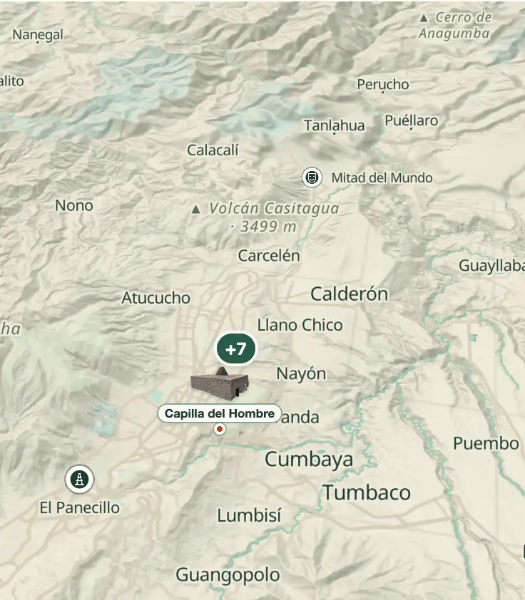
Explore the map
© OpenStreetMap · OpenFreeMap · © OpenMapTiles
Explore the map, read about the other places and plan your travel days in the app.
Open the appWhat to see
Quito: The long basin and the single axis
To the west, the Pichincha massif closes off the valley like a wall: Rucu Pichincha stands 4,698 m and the active Guagua Pichincha, 4,784 m; to the east, the land drops away into the valleys of Cumbayá, Tumbaco and Los Chillos, between 2,200 and 2,500 m, linked to the upper city by the Ruta Viva and Av. Simón Bolívar.
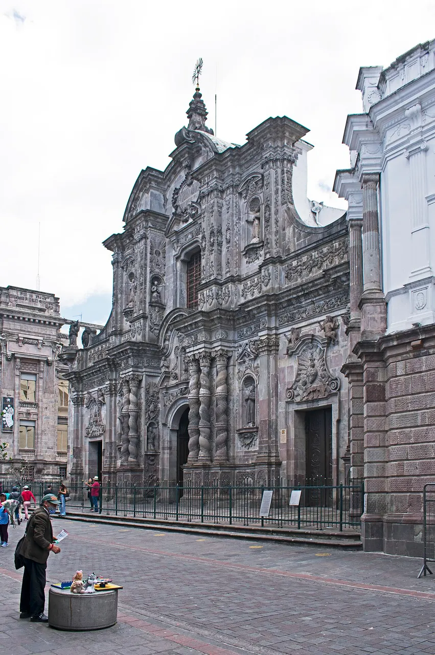
Iglesia de la Compañía de Jesús
Jesuit baroque built over 160 years, from 1605 to 1765, with a carved volcanic-stone façade and an interior entirely covered in gold leaf. Photography inside is forbidden; admission is paid and the line usually moves quickly.
The work took 160 years, from 1605 to 1765, with a volcanic-stone facade and gold leaf inside; indoor photography is forbidden, admission is charged at the door and the line moves fast.
Check access
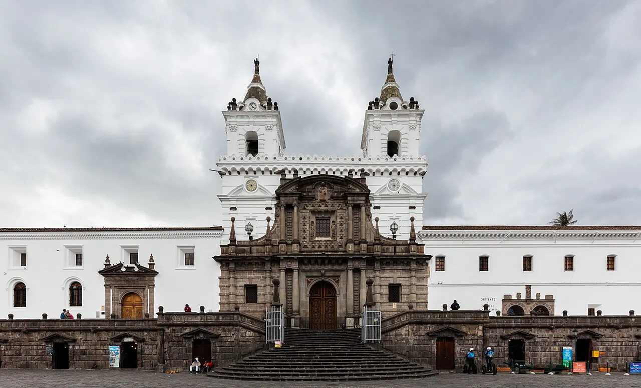
Conjunto de San Francisco
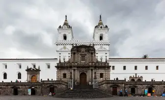
The largest colonial religious complex in the Americas: over 3 hectares, begun around 1536 on the site of an Inca palace. It holds Bernardo de Legarda's Virgen de Quito (1734), the winged virgin that served as the model for the statue on El Panecillo.
The largest colonial religious complex in the Americas began on the grounds of an Inca palace and holds the winged Virgin of 1734, which served as the model for the statue on El Panecillo.
Check access
Basílica del Voto Nacional
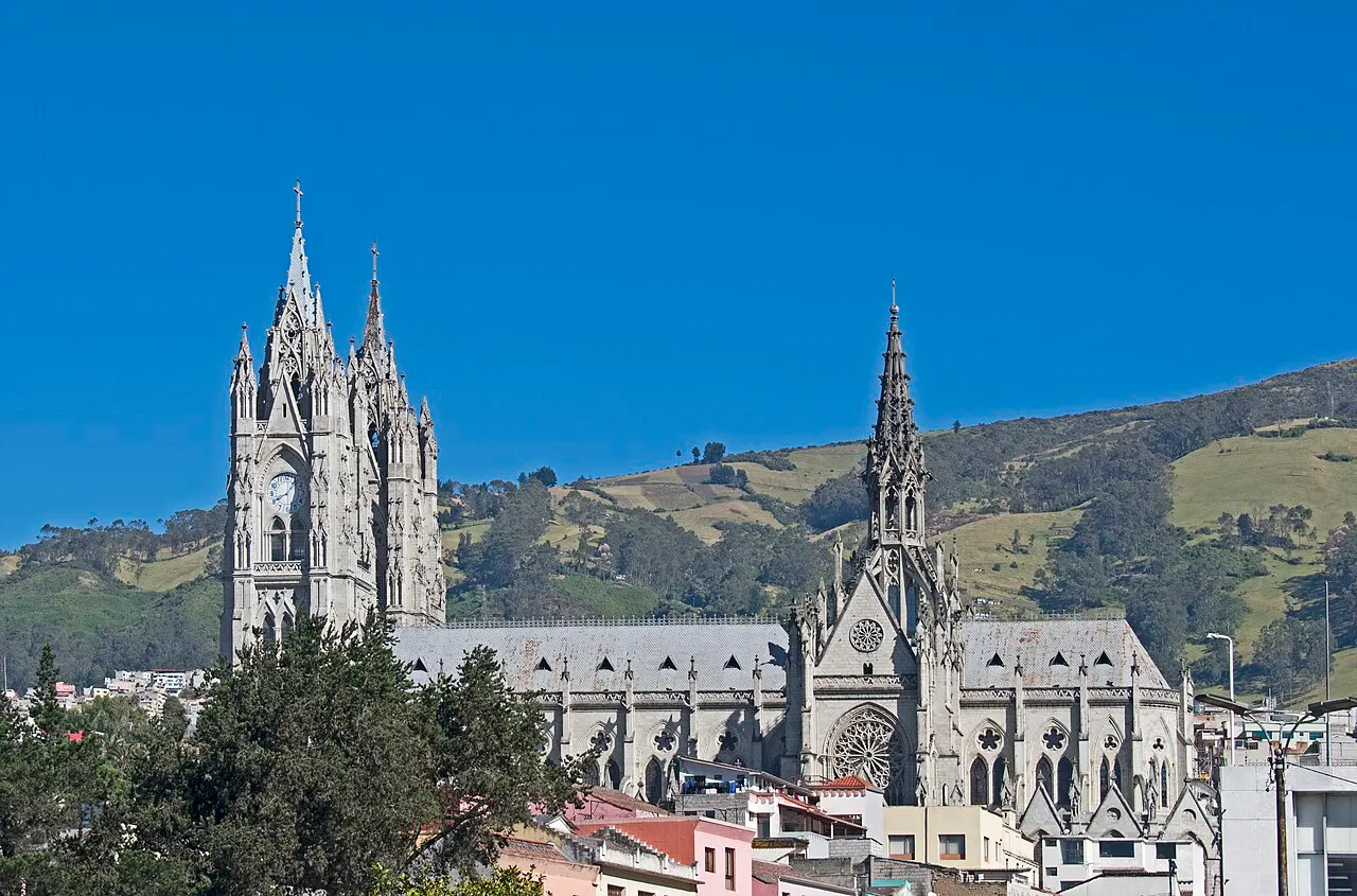
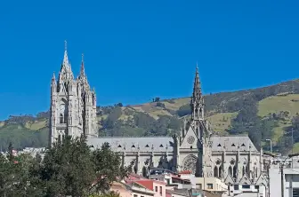
Neo-Gothic, begun in 1892 and never formally finished, with towers about 115 m tall. The gargoyles were replaced with Ecuadorian wildlife: Galápagos tortoises, iguanas, armadillos, condors. Climbing to the towers requires wooden ladders and open walkways; admission is around US$2 for foreigners (2026).
The towers of about 115 m swap gargoyles for Ecuadorian wildlife, and the climb uses wooden ladders; admission for foreigners is around US$2.
Check access

Plaza Grande (Plaza de la Independencia)
The country's political center since 1534, surrounded by the Palacio de Carondelet (the Presidency's seat), the Metropolitan Cathedral, the Archbishop's Palace and City Hall. The changing of the presidential guard happens on Monday mornings, around 11am, with the Guarda de Granaderos de Tarqui.
The country's political center since 1534 is surrounded by the president's house, the Cathedral, the archbishopric and City Hall, and the changing of the guard falls on Monday mornings, around 11am.
Check access

El Panecillo and the Virgen de Quito
A 3,016 m hill that divides the center from the south, crowned since 1975 by a 41 m winged aluminum virgin, assembled from about 7,000 pieces by the Spaniard Agustín de la Herrán Matorras. Go up by taxi or tourist bus; the access stairways on foot have a history of muggings.
It's worth it for the lookout: from the top of El Panecillo you see the historic center from above, at the foot of the aluminum winged Virgin, and the climb is done by car, because access on foot isn't safe.
Check access
TelefériQo
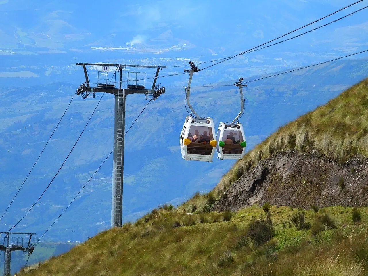
A cable car opened in 2005 that climbs from 2,950 m to Cruz Loma, at 3,945 m, in about 18 minutes. From the top a trail leads to the summit of Rucu Pichincha (4,698 m), 5 to 6 hours round trip, only advisable after two or three days of acclimatization.
The cable car climbs from 2,950 m to Cruz Loma, at 3,945 m, and heading to Rucu Pichincha, at 4,698 m, is only advisable after two or three days of acclimatization; the cable car ride takes about 18 minutes.
Check access
Calle La Ronda
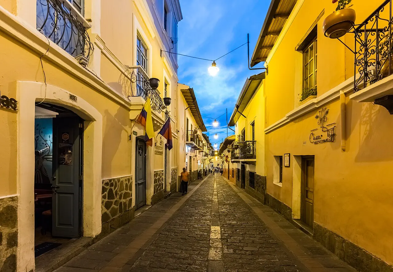
The Juan de Dios Morales street, one of the oldest stretches in the city, restored between 2006 and 2008. Colorful houses with balconies, artisan workshops, live music and canelazo and empanadas de viento stalls from late afternoon on.
The stretch restored between 2006 and 2008 is one of the oldest in the capital and fills with workshops, live music and food stalls as the light fades. Go in the late afternoon to order canelazo and empanada de viento in front of the houses with balconies.
Check access
Capilla del Hombre and Museo Guayasamín
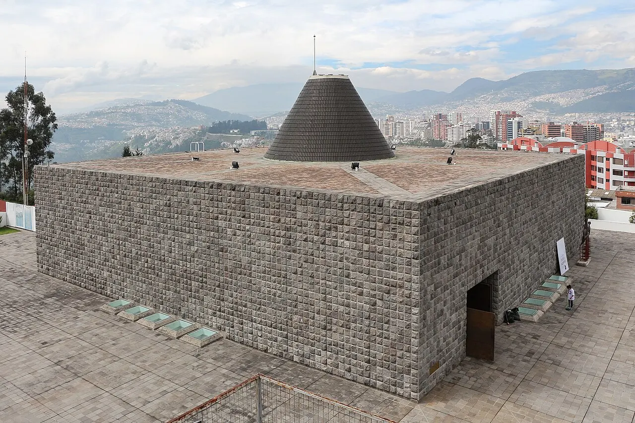
A complex in Bellavista dedicated to Oswaldo Guayasamín (1919–1999), Ecuador's best-known painter. The chapel, opened in 2002 after the artist's death, holds the large panels on violence in Latin America; the house-museum next door keeps his personal collection of pre-Columbian and colonial art.
The complex in Bellavista, dedicated to the painter Guayasamín, includes the chapel opened in 2002 with panels on violence in Latin America, and the house-museum holds the pre-Columbian and colonial collection.
Check access
Mitad del Mundo
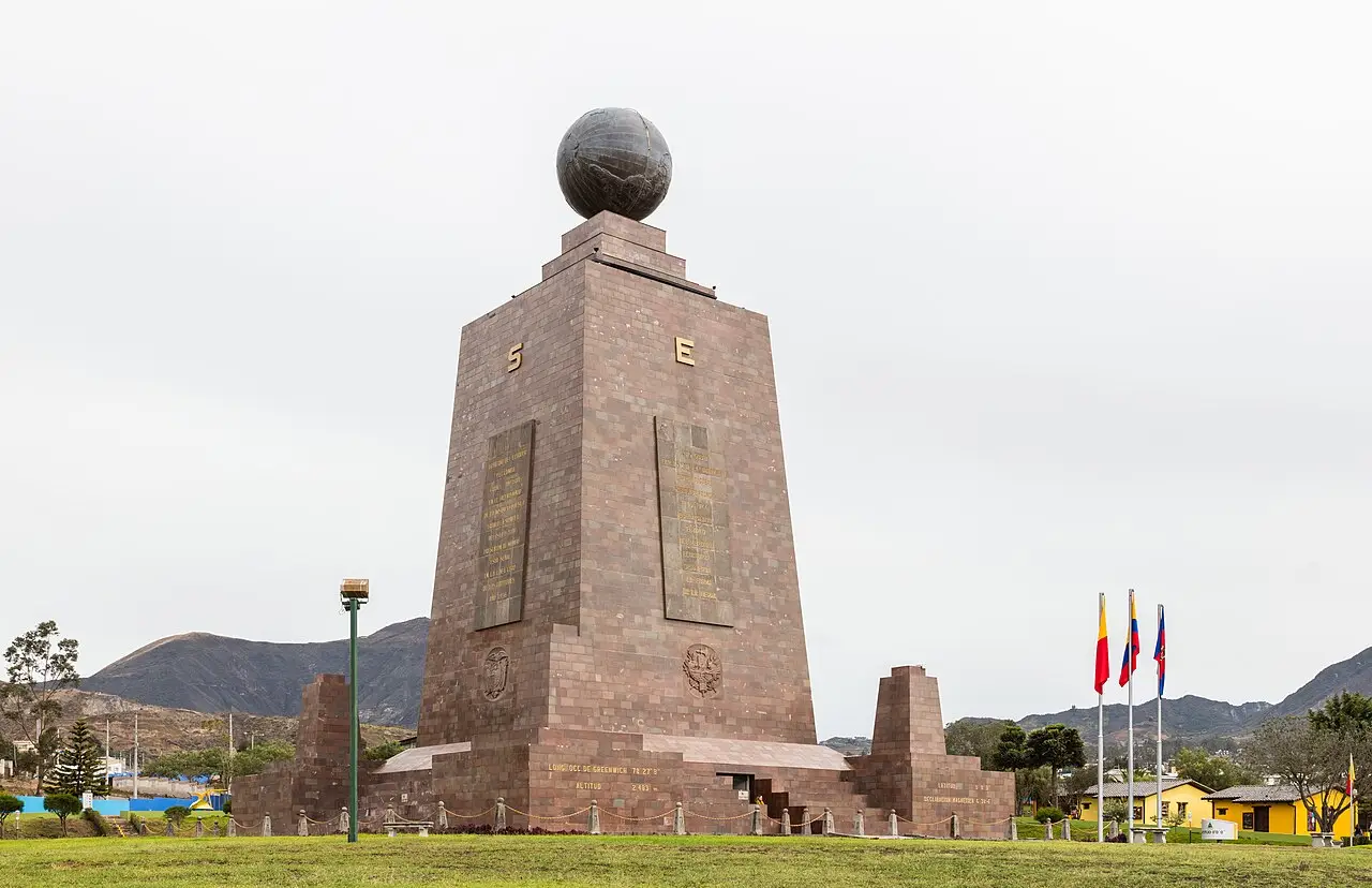
A complex in San Antonio de Pichincha, about 26 km north of downtown, with a 30 m monument built between 1979 and 1982 over the line calculated by the 1736 mission. GPS shows that the zero parallel actually runs about 240 m north of the monument. Next door is the Intiñán museum, which advertises itself as the true line, but the measurement doesn't put it exactly on the equator either.
The official monument sits about 240 m south of the GPS-measured latitude, and the charm of the visit ends up being that error. It's about 26 km and 40 to 60 minutes by car each way, so it's only worth it if you tack on the Pululahua crater on the way back.
Check access
Nilo’s itinerary
Start with the basic programme and choose extensions for the time you have.
Plan my days in the app ↗Day 1 · Historic center, slowly
Start at 9am at Plaza Grande; if it's a Monday, stay for the changing of the presidential guard, around 11am.
Go into La Compañía de Jesús and then the San Francisco complex, two blocks on: together they explain three centuries of colonial economy.
Have a locro de papa with hornado for lunch at the Mercado Central or a fonda on Calle Chile, for US$4–6.
Go to the Basílica del Voto Nacional in the mid-afternoon and climb the towers while there's still light; look for the turtle and iguana gargoyles on the façade.
Finish in La Ronda at dusk, with canelazo and empanadas de viento, and head back by app taxi or yellow taxi with a visible unit number.
Day 2 · Height, art and the north
Go up the TelefériQo right at opening, while the sky is still clear, and walk no more than 40 minutes along the Cruz Loma ridge (3,945 m).
Head down to Bellavista and set aside two hours for the Capilla del Hombre and the Guayasamín house-museum.
Have lunch in La Floresta and walk the neighborhood streets; the Ocho y Medio cinema screens Latin American film.
Spend the late afternoon in Parque La Carolina or at the Mercado Iñaquito, which has the city's best home-cooking counters.
Have dinner in González Suárez, with a view over the Cumbayá valley.


If you stay longer
Day 3 · The equator line and the lookout
Leave early for the Mitad del Mundo, about 26 km to the north (40 to 60 minutes by car), and visit the 1982 monument and the Intiñán museum, right next door; the zero parallel measured by GPS runs about 240 m north of the monument.
On the way back, stop at the Pululahua crater, a dormant volcano with an inhabited and cultivated caldera floor.
Have fritada with llapingachos for lunch at a fonda along the San Antonio de Pichincha road.
Go up to El Panecillo by taxi in the late afternoon, when the low light shows the whole valley from north to south.
Wrap up at the Museo Nacional, in the Casa de la Cultura, or at a café in La Mariscal to try single-origin Ecuadorian cacao.
Food
 AI illustration
Locro de papa
A thick potato soup with fresh cheese and milk, served with avocado slices and a pot of aji on the side. It's the most common starter of a Quito lunch and the safest bet for the first day at altitude.
 AI illustration
Hornado
Hornado, whole roast pork, is a market and weekend dish: order your slice before the whole pig sells out.
 AI illustration
Llapingachos
Flattened mashed-potato patties stuffed with cheese, browned on a griddle and served with peanut sauce, chorizo, fried egg and beet salad. They show up as a side dish and as a main course.
 AI illustration
Fritada
Pork cooked in its own fat with water, garlic and cumin until it dries out and fries, served with mote (hominy), toasted corn, fried ripe plantain and cheese. Sold at neighborhood fritada stands and on the roads out of the city.
 AI illustration
Encebollado
A fresh tuna soup with cassava, tomato and red onion cured in lime, served with chifles (fried banana chips) and toasted corn. It's coastal in origin, but in Quito it has become the Sunday breakfast and the universal cure for chuchaqui.
 AI illustration
Empanadas de viento and morocho
The empanada de viento is fried, filled only with cheese, puffed up and dusted with sugar; morocho is a hot drink of white corn with milk, cinnamon and raisins. The stalls in the center sell the two together, especially in the afternoon and evening.
 AI illustration
Colada morada and guaguas de pan
A hot purple-corn drink with Andean fruits, cloves and herbs, served with baby-shaped breads decorated with icing. People have them during the week of the Day of the Dead, November 2, and bakeries start selling them by mid-October.
 AI illustration
Canelazo
A hot infusion of cinnamon and naranjilla with cane liquor (puntas), served in a small cup in the late afternoon. It's the street drink of La Ronda and the Fiestas de Quito; the alcohol-free version is called canelazo de agua.
Day trips
Otavalo
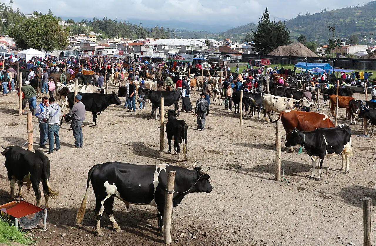
110 km to the north, 2 hours to 2 hours 30 minutes by car or bus from the Terminal Carcelén. The Plaza de Ponchos craft market runs every day, but Saturday, when the animal market and the pre-dawn food market also open, is the real day; pair it with the Peguche waterfall and Lake Cuicocha.

Cotopaxi National Park
About 2 hours south along the Panamericana. The volcano is 5,897 m and one of the highest active volcanoes in the world; you can drive to the parking lot at 4,500 m and walk to the José Rivas refuge, at 4,864 m, in 45 to 90 minutes of hard effort. Only worth it with prior acclimatization and a departure before 7am, to catch a clear sky.
Mindo
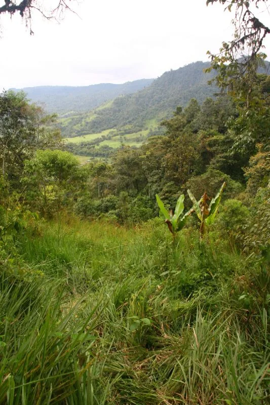
80 km to the northwest, 2 hours to 2 hours 30 minutes via the Calacalí road. Cloud forest at 1,250 m (20 °C, high humidity and about 400 bird species, including dozens of hummingbirds) with zip-lining, river tubing and cacao farms that make chocolate on site. It's the fastest way to trade the páramo for the subtropics.
Where to begin
Historic center, slowly
Start at 9am at Plaza Grande; if it's a Monday, stay for the changing of the presidential guard, around 11am.
Height, art and the north
Go up the TelefériQo right at opening, while the sky is still clear, and walk no more than 40 minutes along the Cruz Loma ridge (3,945 m).
The equator line and the lookout
Leave early for the Mitad del Mundo, about 26 km to the north (40 to 60 minutes by car), and visit the 1982 monument and the Intiñán museum, right next door; the zero parallel measured by GPS runs about 240 m north of the monument.
Money
The currency has been the US dollar since January 2000, which does away with exchange but creates a practical problem: almost nobody breaks US$50 or US$100 bills, and many shops refuse even a 20 in the morning. Arrive with small bills and keep 25- and 50-cent coins, including Ecuadorian ones, which circulate alongside American coins. Price ranges in 2026: almuerzo, the set menu of soup, main, juice and dessert served Monday to Friday, US$3–5; coffee in a café, US$1.50–3; dinner at a mid-range restaurant, US$12–25; beer, US$2–4; a hostel dorm bed, US$10–16; a mid-range hotel, US$45–90 a night. Restaurant bills usually come with 15% VAT (the rate went up from 12% to 15% in April 2024) and a 10% service charge already added. An extra tip is optional and not expected in simple places. Cards work in hotels, formal restaurants and supermarkets, but markets, taxis, stalls and buses take cash only. ATMs usually charge US$2–5 per withdrawal and cap withdrawals at US$200–500.
Getting there and around
Mariscal Sucre Airport, 38 km away in Tababela
Mariscal Sucre International Airport (UIO) is in Tababela, about 38 km east of the north-central area. The ride takes 45 to 70 minutes along the Ruta Viva, longer at rush hour. An official taxi costs around US$26–35 to the north-central area and US$30–40 to the historic center. Uber, Cabify, DiDi and InDrive operate in the city and pick up at a signposted point at the airport (approximate prices, 2026). The Aeroservicios bus links the terminal to Parque Bicentenario, at the old airport, for about US$8, and there's a cheaper public route from Río Coca station. There's a physiological detail almost nobody anticipates: the airport sits at 2,400 m, about 450 m below the city, so the drive up is your first real exposure to the altitude. Don't plan anything demanding for the next few hours.
The metro covers 22 km in 34 minutes
Within the city, Metro Line 1 covers the 22 km north–south axis in 15 stations, from Quitumbe to El Labrador, in about 34 minutes, for US$0.45. The dedicated bus corridors (the Trolebús, from 1995, the Ecovía and the Corredor Central Norte) charge US$0.35, the same fare as regular buses. Since April 2026 a single card, the Cuenta Ciudad, works on all three systems, though with different fares. Yellow taxis with a meter and a registration sticker are the safe option outside the apps: a short ride costs US$2–4, and I wouldn't get into a taxi without a visible unit number. The historic center is easy to walk, but it's all hills at 2,850 m, and short distances are more tiring than they look, because the altitude weighs more than the number of blocks. On Sundays, from 8am to 2pm, the Ciclopaseo closes about 30 km of avenues, including Amazonas, to cars and opens them to bikes.
Safety
Quito is much calmer than the cities on Ecuador's coast, where the country's security crisis is concentrated. In the capital, the real risk is street theft, higher than it was ten years ago and concentrated where there are tourists and few people around. Don't walk up to El Panecillo, whose access stairways have a history of muggings; go by taxi or tourist bus. The historic center empties out after 6pm, so at night leave La Ronda by ride-hailing app or by yellow taxi with a visible unit number. On crowded buses and the metro, wear your backpack in front and keep your phone out of your back pocket. In any emergency, call 911.
Etiquette tips
Greet before anything else
A “buenos días” or “buenas” when entering a shop, elevator, bus or office is mandatory; getting straight to the point is read as rudeness. Between women, and between a man and a woman, the social greeting is a kiss on the right cheek; between men, a handshake.
Use “usted” by default
In the Ecuadorian highlands “usted” is the normal form even between friends, colleagues, and parents and children. Switching to “tú” without an invitation sounds forward; let the other person switch first.
Ask with the diminutive
“Un ratito,” “un cafecito,” “ahorita.” In Quito, the diminutive makes a request sound more polite. At a restaurant, asking for the check is “¿me regala la cuenta?” and a vendor says “le regalo” to mean “I'll sell it to you.”
Treat “ya mismo” as a range
“Ya mismo” means “right away” and can mean five minutes or an hour; “mañana” sometimes means “not today.” Confirm times with explicit numbers when it matters.
Ask permission before photographing people
Ask permission before photographing market vendors and, above all, Indigenous people in Quito and Otavalo. A “¿le puedo tomar una foto?” does it; photographing from afar without asking is a common tourist offense.
Respect church rules
Covered shoulders and hat in hand; La Compañía de Jesús bans photography inside and several other churches ban flash. During mass, sightseeing should wait. The churches downtown are working parishes, not just monuments.
Mistakes to avoid
Climbing high on arrival day
Arriving in the morning and riding the TelefériQo or attempting Rucu Pichincha the same day. At 2,850 m, the city already floors people coming from sea level. Keep a slow pace for the first 24 to 48 hours, drink water, eat light and save the effort for later.
“Summer” here means the dry season
Trusting the calendar and not the sky. “Summer” here is the dry season, not heat: even in July the day starts at 10 °C, warms to 21 °C by noon and drops back to 10 °C by 7pm. Going out without a jacket and without an umbrella is a mistake in every season, common even by the second afternoon of a trip.
Underestimating the equator sun
Underestimating the sun. Here it burns without feeling strong, so treat sunscreen, a hat and sunglasses as travel gear.
Few places break a US$50 or US$100 bill
Arriving with US$50 and $100 bills. Bakeries, taxis, markets and buses have no change for them. For small purchases, keep small bills and 25- and 50-cent coins on hand.
The last digit of the plate decides your schedule
Renting a car and ignoring “pico y placa.” Plates with certain final digits are banned from driving from 6am to 9:30am and 4pm to 7:30pm on weekdays, by city zone, and the fine falls on the driver, not the rental company.
Useful phrases
Buenas, ¿me da un almuerzo?
the fixed midday menu, with soup, main course and juice for a few dollars.
Achachay
How cold! A Kichwa word used by everyone; the opposite, for what burns, is “arrarray”
Ya mismo
Right away: can mean five minutes or an hour, and the difference is rarely explained
¿Cuánto cuesta la carrera?
How much is the ride? Ask before getting into any taxi without the meter running
Estoy con chuchaqui
I'm hungover: another Kichwa word, said with no embarrassment at all
Dale nomás
Go ahead, no problem: “nomás” is the universal softener of Ecuadorian Spanish
Districts
Historic Center
The 320 heritage-listed hectares from 1978: Plaza Grande, San Francisco, La Compañía, La Ronda, cobbled streets and a church on nearly every block. Busy and commercial from 8am to 6pm, much emptier after that, outside the stretches with bars.
La Mariscal
The lodging and nightlife neighborhood since the 1980s, around Plaza Foch. It lost crowds after the pandemic and bar regulations; it still concentrates hostels, trekking agencies, cafés and currency exchanges.
La Floresta
A former 1930s residential neighborhood that became the city's creative hub: Ocho y Medio cinema, artist studios, cafés roasting their own beans, small restaurants. Tree-lined, walkable streets, a good alternative base to La Mariscal.
Guápulo
Tucked into the slope descending toward the Tumbaco valley, below Av. González Suárez, with staircases in place of streets and the 1649 sanctuary at the bottom. Traditionally bohemian and artistic; the view makes up for the climb back.
Iñaquito and La Carolina
The modern financial and commercial center, around Parque La Carolina (64 ha) and Av. Amazonas. Office towers, malls, the Mercado Iñaquito and most of the chain hotels.
González Suárez and Bellavista
The high, expensive strip on the valley's eastern rim, with buildings looking out toward Cumbayá and Cotopaxi. Home to the Capilla del Hombre, the Guayasamín museum, and much of the city's formal dining.
Cumbayá and Tumbaco
The valleys to the east, between 2,200 and 2,500 m of altitude and several degrees warmer than downtown, today a suburb of houses, universities and restaurants. Linked to downtown by the Ruta Viva; it's the natural route to the airport.
Quitumbe and the south
Solanda, Chillogallo, La Ecuatoriana and Quitumbe form the working-class, denser half of the city, the southern terminus of the metro and the bus system. This is where the cheapest, least touristy food markets are.
History
11th–15th c. · Quitus, Caras and the tianguez
The Quitu, Cara and Panzaleo peoples occupied the valley's slopes and kept a barter market that linked the Pacific coast, the páramo and the Amazon. Spondylus shells came up from the sea; cotton, salt and gold moved along the same trails.
c. 1470–1500 · Annexation to the Tawantinsuyu
The Incas incorporated the region under Túpac Yupanqui and Huayna Cápac, who made Quito the administrative center of the empire's north. It was there that Atahualpa built the power base for the civil war against Huáscar, between 1529 and 1532.
1534 · Rumiñahui burns the city
Facing the Spanish advance, general Rumiñahui burned warehouses and buildings so as to hand over nothing. On December 6, Sebastián de Benalcázar founded San Francisco de Quito over the razed ground.
1563 · Real Audiencia de Quito
Philip II created a court with jurisdiction from Pasto, to the north, down to the Amazon river. The Audiencia gave the city its own bureaucracy and drew the territory that would become Ecuador.
17th–18th c. · The Quito School
Painting and polychrome sculpture workshops (Miguel de Santiago, Bernardo de Legarda, Manuel Chili “Caspicara”) exported religious imagery across the viceroyalty. La Compañía de Jesús, built between 1605 and 1765, is the most visible product of that economy.
1736–1744 · French Geodesic Mission
La Condamine, Bouguer and Godin spent eight years measuring an arc of meridian to settle whether the Earth is flattened at the poles. They worked with the Quito-born Pedro Vicente Maldonado and left behind the name that would become the country's.
1809–1810 · The First Cry
On August 10, 1809, criollos deposed the president of the Audiencia and installed a junta: the first autonomist uprising in Spanish America. The repression ended in the massacre of the prisoners, on August 2, 1810.
1822 · Battle of Pichincha
On May 24, Antonio José de Sucre defeated the royalist troops on the slopes above the city, at about 3,500 m. Quito passed into Bolívar's Gran Colombia.
1830 · Capital of the Republic
Ecuador separated from Gran Colombia in May 1830 and Quito became capital of a country with a little over half a million people. The city itself had about 30,000 residents at the time.
1908 · Alfaro's train
The Guayaquil–Quito railway, 447 km and decades of construction pushed by Eloy Alfaro, reached the capital in June 1908. It was the first fast link between the highlands and the Pacific.
 AI illustration
1978–2023 · Heritage, the dollar and the metro
Quito made UNESCO's first World Heritage list in 1978; in January 2000 the country dropped the sucre for the dollar; in 2013 the airport moved to Tababela. Metro Line 1 went into full operation in December 2023.

Complete history
A crossroads before the Spanish
Before the Spanish, the Quito valley was already a trading crossroads. Quitus, Caras and Panzaleos occupied the slopes and kept a tianguez, a barter market, that tied together three ecosystems: the Pacific coast, the Andean páramo above 3,500 m, and the Amazon basin to the east. The Incas arrived around 1470 and, under Huayna Cápac, turned Quito into the administrative hub of the Tawantinsuyu's north, linked to Cusco by 2,000 km of royal road. It was from that base that Atahualpa contested the throne with his half-brother Huáscar between 1529 and 1532, a civil war the Spanish found already underway. Nothing of the Inca city was left standing: in 1534, with Sebastián de Benalcázar coming up from the valleys, general Rumiñahui burned it all.
The founding imposed a grid on sloped ground
The Spanish founding, on December 6, 1534, imposed a grid on terrain that didn't cooperate. The valley is slashed by deep ravines, which were filled in over four centuries and still explain why certain streets sink when it rains. In 1563, Philip II created the Real Audiencia de Quito, a court whose jurisdiction ran from Pasto to the Amazon River and which drew the outline of the future country. Far from the ports and without silver, the city became a workshop: in the 17th and 18th centuries, the Quito schools of painting and sculpture (Miguel de Santiago, Bernardo de Legarda, Manuel Chili “Caspicara”) produced polychrome religious images exported across the whole viceroyalty. The church of La Compañía de Jesús, begun in 1605 and finished in 1765, with its interior entirely covered in gold leaf, shows the wealth of those workshops better than any document.
The French Geodesic Mission measured the equator, in 1736
In 1736 the Enlightenment reached Quito with the French Geodesic Mission (Charles Marie de La Condamine, Pierre Bouguer and Louis Godin), charged with measuring one degree of meridian at the equator to settle, against the measurement taken in Lapland, whether the Earth is flattened at the poles. They stayed until 1744, trained the Quito cartographer Pedro Vicente Maldonado and left behind the word that would name the country. Seventy years later, the same enlightened social group took the political step: on August 10, 1809, a junta deposed the president of the Audiencia, and the Spanish crackdown ended in the massacre of August 2, 1810. The final break came on May 24, 1822, with Antonio José de Sucre's victory on the slopes of Pichincha; in 1830 Ecuador left Gran Colombia and Quito became the capital.
Isolation until the 1908 railway
The 19th century was one of isolation (the trip to Guayaquil took over a week by mule) until Eloy Alfaro's railway arrived in 1908, after conquering the Nariz del Diablo gorge. Physical expansion came much later, with Amazonian oil from 1972 on: the new revenue financed growth to the north, and La Mariscal and Iñaquito became the financial center while the historic center emptied out, decayed, and would only begin to be restored in the 1990s, with the Fondo de Salvamento del Patrimonio Cultural. In October 1999 the Guagua Pichincha covered the city in ash for days; in January 2000, after the worst banking crisis in the country's history, Ecuador dropped the sucre at 25,000 to the dollar and adopted the American currency.
The Trolebús and other projects shifted the growth axis
Three transport projects, between the late 20th century and the early 21st, reorganized Quito and shifted its axis. The Trolebús, opened in 1995, was Latin America's first electric bus corridor on a dedicated lane and served as a model for other cities. In February 2013 the airport moved out of the middle of the urban grid to Tababela, 38 km east, and the old runway became Parque Bicentenario, 125 hectares in the middle of the city. In December 2023 Metro Line 1 went into full operation: 22 km and 15 stations, from Quitumbe to El Labrador in about 34 minutes. Meanwhile, the valleys of Cumbayá, Tumbaco and Los Chillos absorbed the middle class and the south grew around Quitumbe, leaving the historic center restored, busy by day and much quieter at night. The organized-crime crisis that has gripped the country since 2021, which led to the state of emergency of January 2024, has been concentrated in Guayaquil, Durán, Esmeraldas and Manta, on the coast; Quito felt the indirect effect (more street theft, more policing at tourist sites) without coming close to the coast's rates.
The quebradas, deep valleys in the middle of the city, were filled in over four centuries, and some streets still sink.
Geography and shape of the city
The long basin and the single axis
Quito sits in an elongated basin about 50 km from north to south and 4 to 8 km wide, which explains everything in the city: traffic, transport and addresses run along a single north–south axis, and cross streets last only a few blocks.
The volcano walls and the ravines
To the west, the Pichincha massif closes off the valley like a wall: Rucu Pichincha stands 4,698 m and the active Guagua Pichincha, 4,784 m; to the east, the land drops away into the valleys of Cumbayá, Tumbaco and Los Chillos, between 2,200 and 2,500 m, linked to the upper city by the Ruta Viva and Av. Simón Bolívar. The ground is cut by deep ravines, many filled in since colonial times, and the subsoil is volcanic ash: together they produce landslides and mudflows during heavy rain. On clear days you can see Cotopaxi (5,897 m), Antisana (5,704 m) and Cayambe (5,790 m) from the city, the last of these being the only snow-covered point on Earth that sits exactly on the equator.
Spring climate and the city's expansion
The altitude and zero latitude create a permanent-spring climate with daily temperature swings larger than the annual ones, and ultraviolet radiation that routinely tops 11 on the international scale. The historic center sits at the narrowest, oldest point of the valley; the money moved north (Iñaquito, La Carolina, González Suárez) and the working-class growth, south (Solanda, Quitumbe, Chillogallo).
Culture
Legarda, Caspicara, and Santiago, still the colonial reference
The workshops of the Quito School supplied religious images to churches across Spanish America, and three names have survived as landmarks of colonial art: the painter Miguel de Santiago and the sculptors Bernardo de Legarda and Manuel Chili, known as “Caspicara.” Their works are still in the churches of the center, and Legarda's best known is the winged Virgin that inspired the statue on top of the hill to the south. To see what that wealth paid for, step into La Compañía de Jesús, built between 1605 and 1765 and covered in gold leaf inside.
Pasillo: the national musical form
Highland music finds its national form in the pasillo (a slow waltz, melancholic lyrics, voice and guitar) and in the sanjuanito the festive rhythm inherited from the Kichwa world, played on mandolin, rondador and bass drum. Over the last three decades Quito has also become the capital of Ecuadorian rock, partly thanks to Quitofest, a free independent-music festival the city has sustained since 2003. National cinema is young and almost entirely from Quito: “Ratas, ratones, rateros” (1999), by Sebastián Cordero, and “Qué tan lejos” (2006), by Tania Hermida, are the two titles that best explain the city and the country.
Holy Week, processions and soccer at altitude
The religious calendar still structures public life. Holy Week mobilizes the entire center, and the procession of Jesús del Gran Poder, on Good Friday, draws tens of thousands of people behind the purple-hooded cucuruchos. In soccer, the city has four first-division clubs (Liga de Quito, Copa Libertadores champion in 2008, El Nacional, Universidad Católica and Aucas), and altitude is a permanent topic: visiting teams have always complained about the 2,800 m of Estadio Rodrigo Paz Delgado, and Ecuador's national team built much of its World Cup qualifying record playing at home, at the Atahualpa.
In the 17th and 18th centuries, the workshops of the Quito School sold religious images throughout the viceroyalty.
On Good Friday, the procession of Jesús del Gran Poder fills the center with tens of thousands of people.
Festivals and events
 AI illustration
Fiestas de Quito (December 1 to 6)
Anniversary of the Spanish founding: chiva parades (open buses with a band on board), serenades, neighborhood fairs and the year's busiest street scene. Hotels and airfares go up; book weeks ahead.

Holy Week (March or April)
On Holy Wednesday the Cathedral holds the Arrastre de Caudas, a rite unique in the world in which a black flag is dragged over the faithful. On Good Friday, the procession of Jesús del Gran Poder crosses the center and the city eats fanesca, a twelve-grain soup with cod.
 AI illustration
Día de los Difuntos (November 2)
A national holiday when families go to the cemeteries with food and flowers and the whole city drinks colada morada with guaguas de pan. In the rural parishes and in Calderón, to the north, grave visits last all day.
 AI illustration
Año Viejo (December 31)
Papier-mâché figures representing politicians and the year's personalities are burned in the streets at midnight, along with wills read aloud. The northern avenues become a monigote fair in the last week of December.

Fiesta de la Luz (August)
Projections and light installations cover the facades of the historic center for four to six nights in August, with streets closed to traffic. The dates change every edition, so check that year's program before counting on the festival.
Books and films
“Huasipungo,” Jorge Icaza (1934)
The harshest indigenist novel in Ecuadorian literature, about the dispossession of Kichwa peasants by a landowner and a foreign company. It explains the highland land structure that drove decades of migration to Quito.
“Ratas, ratones, rateros,” Sebastián Cordero (1999)
The film that founded contemporary Ecuadorian cinema: two cousins, small-time theft and the Quito–Guayaquil road. Shot on the city's real streets in the year of the crisis that would lead to dollarization.
“The Mapmaker's Wife,” Robert Whitaker (2004)
An account of the 1736–1744 French Geodesic Mission and Isabel Godin's Amazon crossing. It explains why a group of academics spent eight years measuring mountains around Quito, and why the country is named Ecuador.
Frequently asked questions
Quito: can you ride the TelefériQo on arrival day?
It's not a good idea: the TelefériQo climbs to 3,945 m, at Cruz Loma, about a thousand meters above the city, and Quito's 2,850 m already weighs on anyone coming from sea level. Spend the first 24 to 48 hours at a slow pace, drink water, eat light and save the cable car for the second day.
Quito: what's the currency, and which bills should you bring?
The currency has been the US dollar since January 2000, so there's no exchange to do. Bring small bills and 25- and 50-cent coins, including the Ecuadorian ones, which circulate alongside the American ones, because almost nobody breaks US$50 or $100 bills, and many shops refuse even a 20 in the morning.
Quito: what's the climate like through the year?
In Quito the temperature stays between 9°C and 21°C all year round, and what changes is the rain. The dry season runs from June to September, with clearer skies and cold nights; the rainy season runs from October to May, peaking in April, with downpours from mid-afternoon on.
Quito: do you need to greet people when entering a shop?
Yes: a “good morning” or “good day” when entering a shop, elevator, bus or office is mandatory, and getting straight to the point is read as rude.
Quito: what's the real risk for visitors?
The real risk is street theft, higher than it was ten years ago and concentrated where there are tourists and few people around. Ecuador's security crisis is concentrated in the coastal cities, and Quito is much calmer than they are.
Other cities in the country
Ecuador ↗- Days
- 5
- When
- Jan–May · Dec
- Per person/day
- Average 90–160 USDMid-range · per person/day
Cost scope
Per person per day: accommodation, meals, urban transport, visits and a small allowance for extras. Flights excluded; larger purchases vary. Editorial estimate, not a quote.