Morocco
Sahara
Erg Chebbi dunes, oases, ksour and a night in camp
Days Start with the basic programme and choose extensions for the time you have.
How the guide reaches this number
The distance is part of the program, and anyone who wants scenery without travel time will resent the trip. With a single day, go early to the Rissani souk on market day, have medfouna for lunch and set off by camel around 4:30pm to sleep in the dunes. Don't expect dunes from horizon to horizon, because less than 20% of the ground is sand and the rest is stone and gravel. In Erg Chebbi, the letdown is the scene repeated at almost every camp: camel at sunset, drums at dinner and a photo on the crest. To escape it, cross over to the Draa Valley and, from M'Hamid, cover the 55 km of track to Erg Chigaga by 4x4; it gets a fraction of the visitors.
4
When October through April.
How the guide reaches this number
March–April and October–November give the best days; December and January bring clear sun and nights near 32°F (0°C). June through August tops 113°F (45°C) at midday and much of the camps close or run nights only.
October through April. March–April and October–November give the best days; December and January bring clear sun and nights near 32°F (0°C). June through August tops 113°F (45°C) at midday and much of the camps close or run nights only.
Per person/day 400–900 DH per person (about €37–85) at a mid-range standard, including camp, meals and local transport (2026).
How the guide reaches this number
Per person per day: accommodation, meals, urban transport, visits and a small allowance for extras. Flights excluded; larger purchases vary. Editorial estimate, not a quote.
 What Nilo thinks
I'd set aside four days for the Moroccan Sahara: on the first, drive down the Ziz Valley with stops at the Jorf khettaras and in Rissani; on the second, stay in the erg; on the third, split your time between Khamlia and the souk; on the fourth, leave through the Todra Gorge. The distance is part of the program, and anyone who wants scenery without travel time will resent the trip. With a single day, go early to the Rissani souk on market day, have medfouna for lunch and set off by camel around 4:30pm to sleep in the dunes. Don't expect dunes from horizon to horizon, because less than 20% of the ground is sand and the rest is stone and gravel. In Erg Chebbi, the letdown is the scene repeated at almost every camp: camel at sunset, drums at dinner and a photo on the crest. To escape it, cross over to the Draa Valley and, from M'Hamid, cover the 55 km of track to Erg Chigaga by 4x4; it gets a fraction of the visitors.In the Moroccan Sahara, south of the Atlas, the dunes of Erg Chebbi rise to about 150 m above the plain, and the reason for the trip is to sleep in a camp in the middle of them, with tajine for dinner and a sky free of light pollution. You arrive by camel in the late afternoon, leaving from the edges of Merzouga, and from the crest behind the tent you watch the sun rise over the sand. Around it, the desert is more rock than sand, dotted with date-palm oases irrigated by underground channels and with ksour, the rammed-earth villages with blank outer walls. Rissani, heir to the Sijilmassa of the gold route, keeps its souk on fixed days and bakes medfouna, the Berber pizza of meat and almonds, in a clay oven. In Khamlia, Gnawa groups play the guembri for anyone who sits down and accepts a glass of tea. Come between October and April, with a jacket for nights near 0 °C, and allow four days, because from Marrakech alone it's 9 to 11 hours by road.
Quick facts
- Population
- The whole Sahara has about 2.5 million inhabitants, under 0.4 per km². On the Moroccan side: Merzouga about 1,500, M'Hamid El Ghizlane about 2,500, Rissani about 22,000, Erfoud about 30,000, Zagora about 40,000, Errachidia about 120,000, Ouarzazate about 80,000 (2026).
- Founded
- Sijilmassa, next to present-day Rissani, founded in 757 by the Banu Midrar, of the Berber Miknasa tribe. It was the northern terminal of the trans-Saharan gold route, was already in ruins by the 16th c., was rebuilt in the 18th c., and was destroyed for good by the Aït Atta in 1818.
- Country and region
- Morocco; administrative region of Drâa-Tafilalet (created in 2015), southeast of the Atlas range, extending south to Guelmim-Oued Noun. Western Sahara, further southwest, is disputed territory with its own status and isn't covered here.
- Languages
- Moroccan Arabic (darija) and Tamazight, co-official since the 2011 Constitution: central Tamazight predominates in the southeast, with Tachelhit to the west and Hassaniya in the far south. French in commerce and hospitality; English and Spanish among younger guides.
- Currency
- Moroccan dirham (MAD, DH). About 1 € ≈ 10.5–11 DH and about US$1 ≈ 9–9.5 DH in 2026. Outside the larger towns, plan on cash only.
- Time zone
- UTC+1 year-round, dropping to UTC+0 during Ramadan
- Best time to visit
- October through April. March–April and October–November give the best days; December and January bring clear sun and nights near 32°F (0°C). June through August tops 113°F (45°C) at midday and much of the camps close or run nights only.
- Average daily cost
- 400–900 DH per person (about €37–85) at a mid-range standard, including camp, meals and local transport (2026).
When to go
October through April. March–April and October–November give the best days; December and January bring clear sun and nights near 32°F (0°C). June through August tops 113°F (45°C) at midday and much of the camps close or run nights only.
How the year changes
The year here splits into two very different seasons, with no shoulder season. From June to August, highs pass 45 °C and come close to 50 °C on the sand. The afternoon sun makes walking impossible, many camps close or run only at night, and even residents rearrange the day around dawn and late afternoon. From October to April, highs sit between 18 and 27 °C, the sky is clear almost every day and the temperature drops hard at night: in December and January, lows in the erg hover around 0 to 5 °C, with occasional frost on the hamada. With a daily swing of more than 20 °C, pack hot-weather clothes and a real jacket in the same bag. Rain is rare, between 30 and 100 mm a year, concentrated in short episodes in September and October and in March, which can turn a dry oued into a flash flood and cut roads for hours. February to April is the season of wind and blowing sand, with days of reduced visibility. High season is October and November and March and April, plus Christmas and New Year, when camps fill up and prices rise 30 to 50%. The month to avoid is July. Also check the Ramadan calendar (expected from about February 8 to March 9, 2027), when shops change their hours and the country's clocks go back an hour, from UTC+1 to UTC+0.
Nilo's tips
Go to the Rissani souk on Sunday, Tuesday, or Thursday
On other days, the town gets a fraction of the traffic, and you'll have traveled to see closed streets. Arrive before 9am to catch the kalia with egg and the sfenj on the straw cord, market-day breakfast, which disappears early. Order the medfouna as soon as you arrive, because it bakes for 20 to 30 minutes in the clay oven. Meanwhile, walk to the ruins of Sijilmassa, 2 km away.
Withdraw cash before heading into the sand
Merzouga has only one or two ATMs, and they can be empty on weekends. Withdraw beforehand, in one of the region's larger towns. Bring cash: camp, camel, tip and souk don't take cards. Plan on 350 to 1,200 DH per person for a night on the erg, and 150 to 300 DH for the camel ride.
Wake up at 6:30am to watch the sunrise from the crest
Climbing through sand is slow, and the crests of Erg Chebbi reach about 150 m above the plain. Leave the camp while it's still dark to be up top before the sun. If you get to Merzouga after the afternoon camel has left, a 4x4 still gets you to camp in 15 minutes, and you won't miss the sunrise.
Do the 55 km of track to Erg Chigaga, with fewer people
With no asphalt all the way to the foot of the dune, Erg Chigaga gets a fraction of Erg Chebbi's visitors. The track from M'Hamid takes 1 hour 30 minutes to 2 hours by 4x4 and costs 1,200 to 2,000 DH per vehicle; split four ways, it comes close to the price of a regular Merzouga tour. Go with a local driver, because a regular car gets stuck on the track.
Buy fossils only at an Erfoud workshop that cuts on-site
Roadside stalls sell resin fakes, painted casts and creatures pieced together from fragments, while at the workshop you watch the saw cutting the stone. Don't buy by the road, and be wary of a piece that's too perfect or too cheap.
Trade the quad bike for Gnawa music in Khamlia, 7 km away
Instead of engine noise on the dunes, you hear the music of the Gnawa community itself, played in a family home. South of Merzouga, the groups play sessions of about an hour, with the three-string guembri and metal castanets. There's no fixed price, so agree on the contribution with the group before sitting down; the tea comes free. Afterward, head to Dayet Srji, west of the dunes, and stay there until late afternoon.
Explore the map
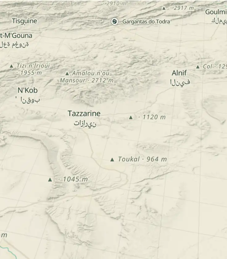
© OpenStreetMap · OpenFreeMap · © OpenMapTiles
Explore the map, read about the other places and plan your travel days in the app.
Open the appWhat to see
Sahara: More stone than sand: hamada, reg and the Atlas
The Sahara covers about 9.2 million km², but less than a fifth of that is dune sand: what's typical is hamada, the sun-darkened stone plateau, and reg, the gravel swept by wind.

Erg Chebbi
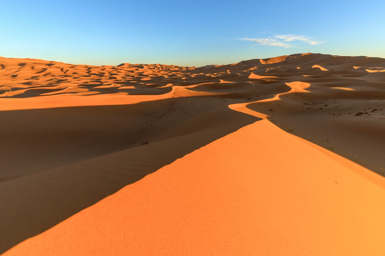
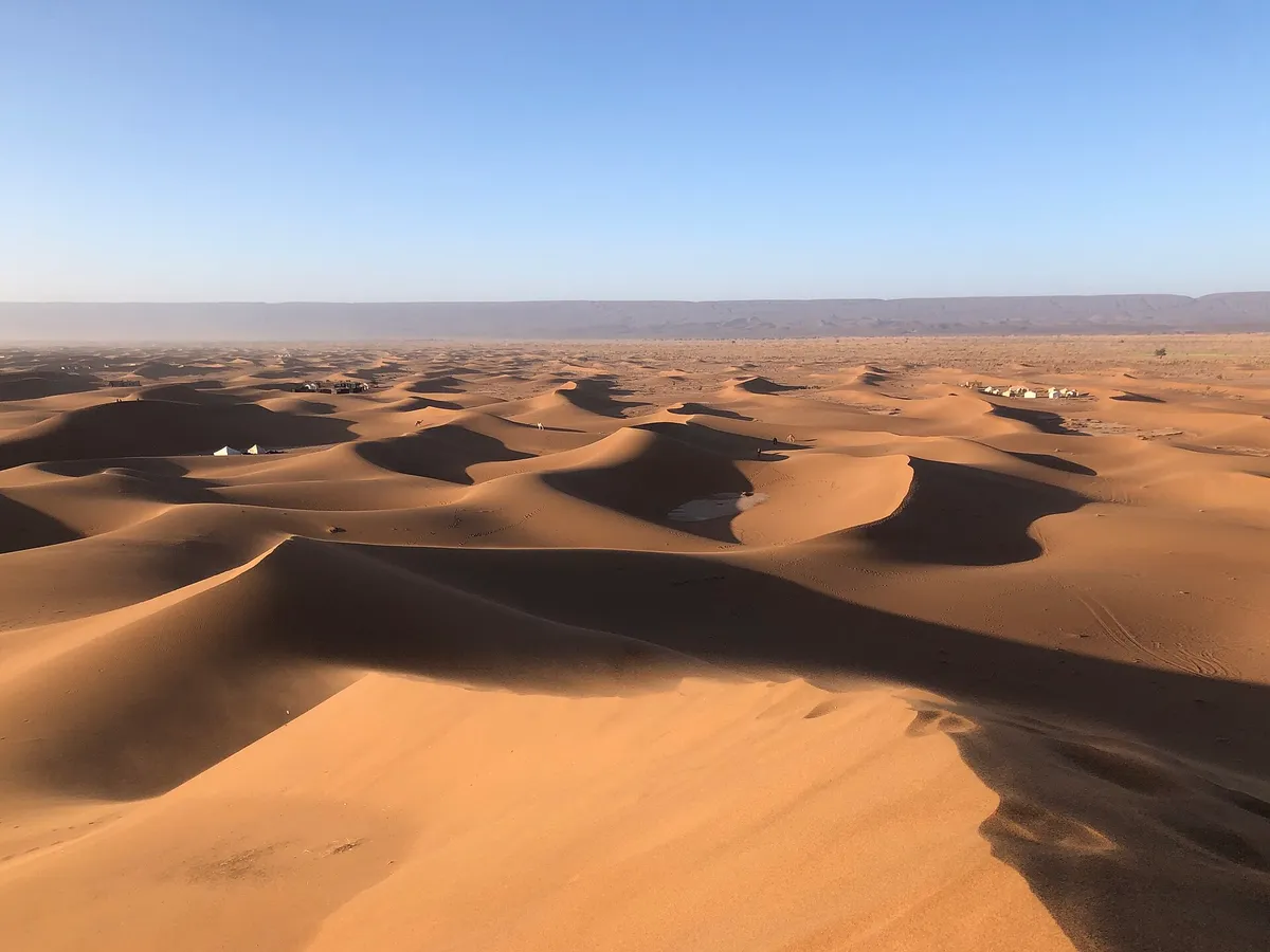
Morocco's tallest and most accessible dune field: about 28 km long by 5–7 km wide, with crests rising some 150 m above the plain. The dunes sit on ancient river sediment, not on endless sand: 3 km from the western edge you're already walking on stone.
In Morocco this is the tallest and most accessible dune field, with a paved road to Merzouga, and 3 km from the western edge the ground is already stone.
Check access

Khettaras of Jorf
About 15 km north of Erfoud, a row of shafts pierces the reg in a straight line, tracing from above the water channel that runs underneath, dug by hand to the palm grove. Some lines are more than 10 km long and still in use; you go down into a restored section with a guide from the local association.
Khettaras are hand-dug galleries that carry groundwater to the palm grove by gravity, and above them a row of wells marks a straight line across the reg. Some lines run more than 10 km and still irrigate the palm grove, and climbing down into one shows how the oasis survived without a pump.
Check access

Khamlia
A village 7 km south of Merzouga where Gnawa groups play a repertoire inherited from the peoples brought from the Sahel. Sessions last about an hour, revolve around the three-string guembri and metal castanets, and the contribution is usually an amount agreed with the group, plus tea.
The Gnawa repertoire comes from people brought from the Sahel, the session lasts about an hour with guembri and metal castanets, and the contribution is usually agreed on, plus the tea.
Check access

Erg Chigaga
Larger and more remote than Chebbi: about 40 km by 15 km, reached by 55 km of track from M'Hamid, between 1 hour 30 minutes and 2 hours by 4x4. With no paved road all the way to the dune's foot, it draws a fraction of the visitors, and camps are more spread out.
It's worth it for anyone willing to take 1 hour 30 minutes to 2 hours of 4x4 track from M'Hamid in exchange for a sand field bigger than Chebbi's and with far fewer people.
Check access
Ruins of Sijilmassa
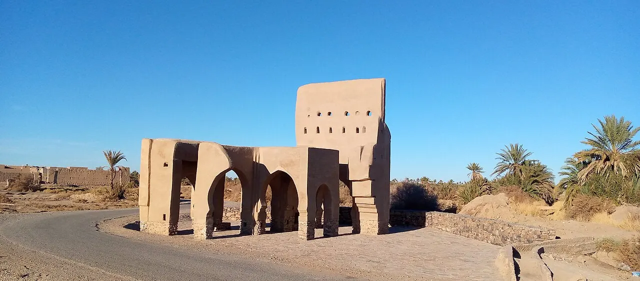
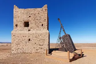
A field of mudbrick ruins about 2 km from Rissani, with stretches of wall, a minaret base and remains of neighborhoods excavated since the 1980s by Moroccan-American missions. It was the city that controlled trans-Saharan gold between 757 and the 14th c.; today it's visited as an open archaeological site, without fences.
The city controlled the trans-Saharan gold trade, stretches of wall and traces of neighborhoods remain, and the site is open to visit, with no fences, about 2 km from Rissani.
Check access
Zaouia of Moulay Ali Cherif
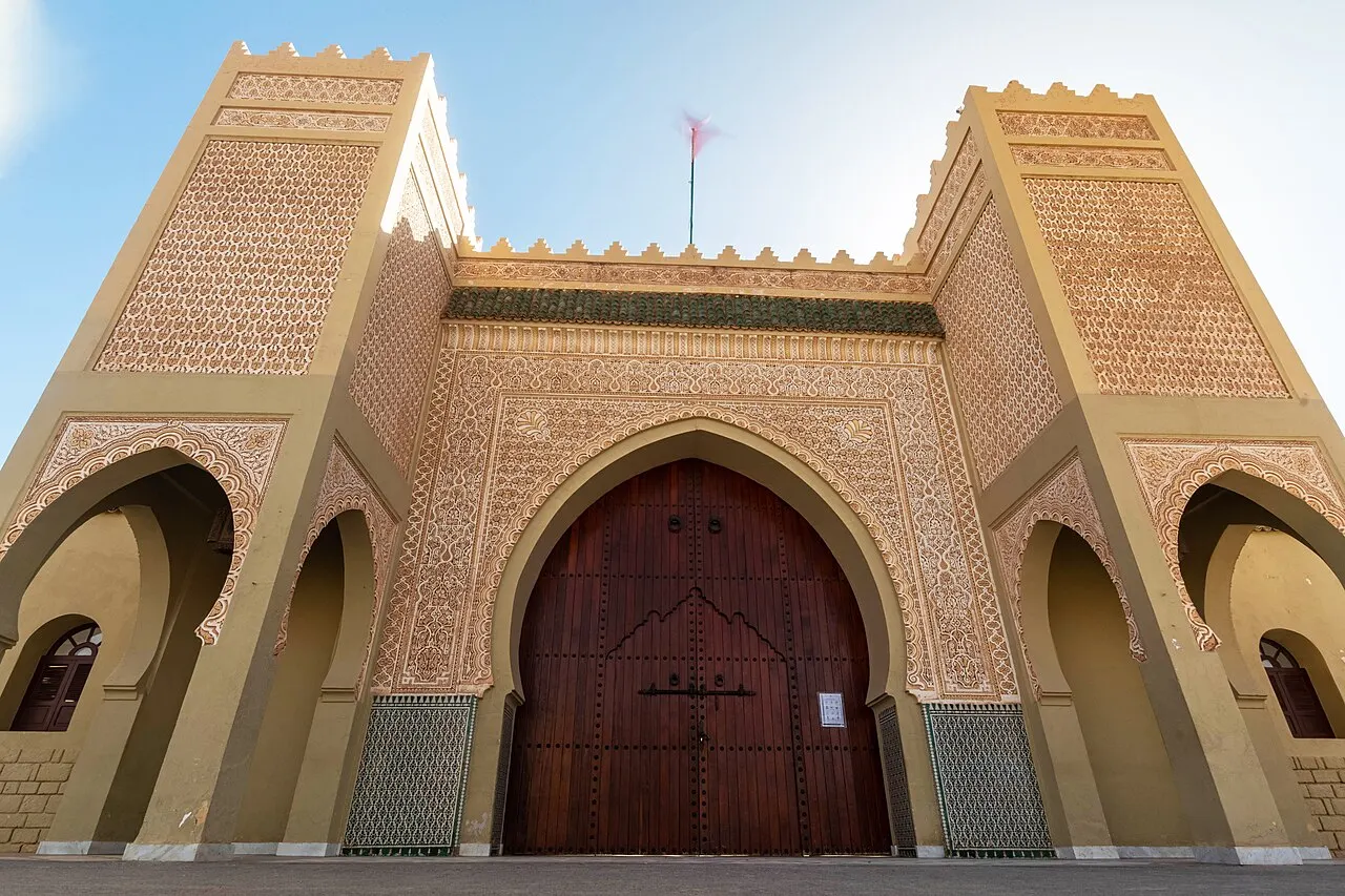
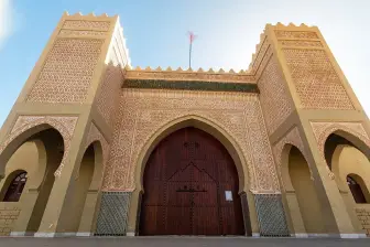
Mausoleum of the Alaouite dynasty's ancestor, in Rissani, rebuilt several times after Ziz floods. The interior is reserved for Muslims, but the courtyard and the zellige-and-carved-cedar portal are open to visit, and the complex explains why a town of 22,000 receives official visits from the monarchy.
The interior is reserved for Muslims, but the courtyard and the zellige-and-cedar gate can be visited, and the mausoleum of the Alaouites' ancestor explains why a city of 22,000 receives official visits from the monarchy.
Check access

Ksar of Aït Benhaddou
A fortified rammed-earth village on the Ouarzazate road, a UNESCO World Heritage Site since 1987, with towers decorated in geometric relief. A few families still live inside; upkeep depends on mud-and-straw plaster redone after every heavy rain, which makes the place a hands-on lesson in earth building.
Few families still live inside the fortified village, a World Heritage Site since 1987, and the mud-and-straw plaster is redone after every heavy rain.
Check access
Todra Gorge
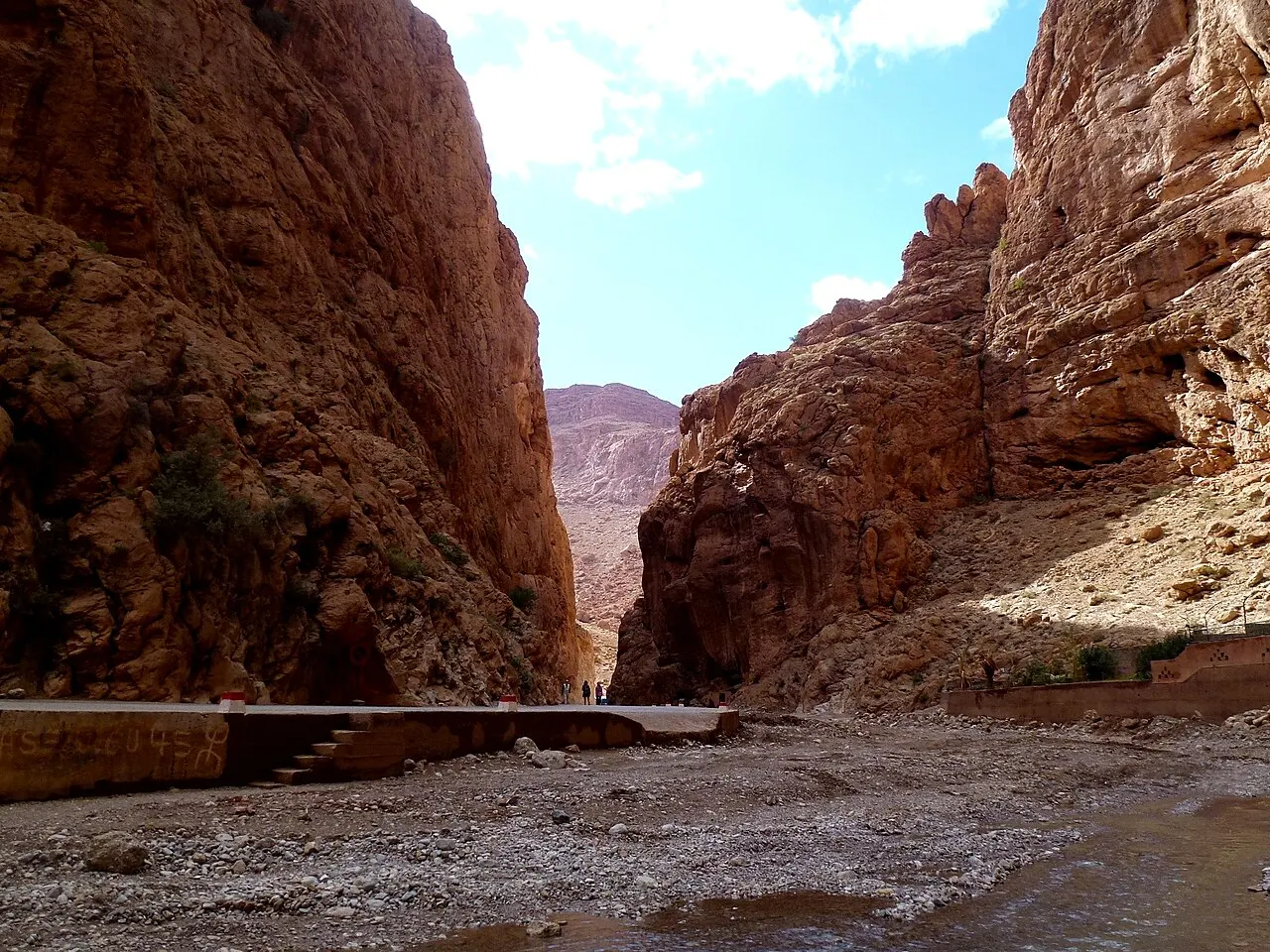
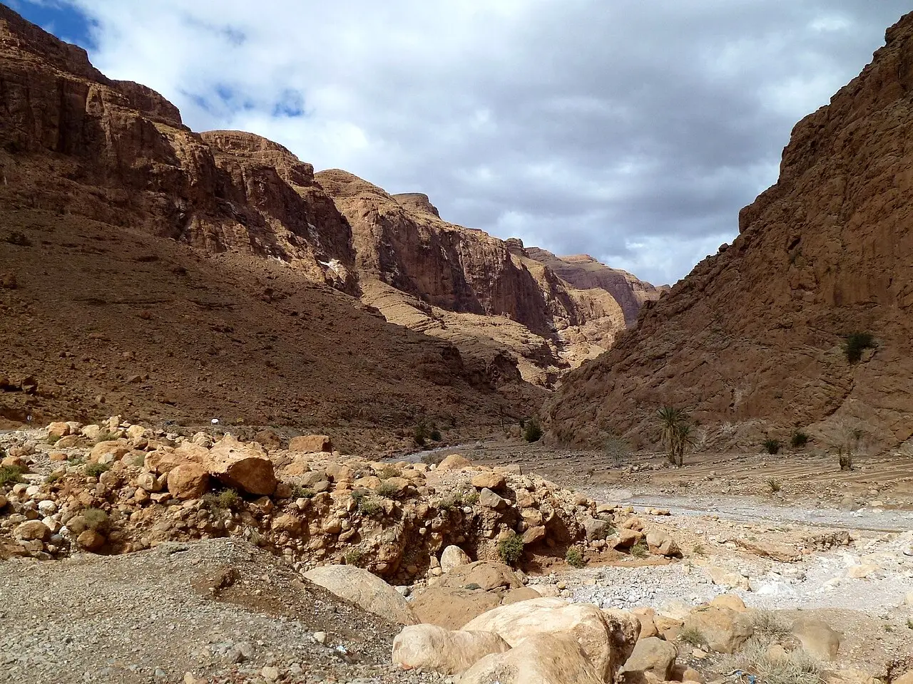
A limestone canyon 15 km from Tinghir, with walls up to about 300 m and a stretch where the gap narrows to about 10 m, the oued running through the middle. It's the main sport-climbing area in southern Morocco, with hundreds of routes opened since the 1980s.
15 km from Tinghir, the walls rise up to about 300 m and one stretch narrows the gap to about 10 m, with the river running through the middle, in the south's main climbing area, with hundreds of routes.
Check access

Dayet Srji
A seasonal lake west of Erg Chebbi that only exists after rain or Atlas snowmelt. When it fills, it draws greater flamingos and other migratory birds between March and May; when dry, it turns into a white salt crust that reflects the dune at dawn.
It's only worth it if it has rained: outside the flood season, you cross over to see a white crust of salt. Set aside half an hour in the late afternoon and check beforehand whether the lake has water that year.
Check access
Nilo’s itinerary
Start with the basic programme and choose extensions for the time you have.
Plan my days in the app ↗Day 1 · From the Ziz valley to the first dune
Stop for 20 minutes at the lookout where the road reveals the Aoufous palm grove below, in the Ziz canyon.
Detour about 15 km to Jorf and go down into one of the restored galleries, with a local guide.
Have medfouna for lunch in Rissani and walk through the ruins of Sijilmassa, 2 km from the center, in the late morning or after 4pm.
Continue the roughly 35 km to Merzouga, leave your bag at the support hotel and head out by camel around 4:30pm in winter, 1 hour to 1 hour 30 minutes to the camp.
Have tajine for dinner, listen to the drums and climb the crest behind the tent to see the sky before the moon rises.
Day 2 · Taouz, the carvings and another night in the erg
In the morning, drive to Taouz, south of Merzouga, about half an hour away on a paved road, passing seasonal nomad camps that move from site to site.
See the rock-carving panels with savanna animals on the outskirts of the village, and stop on the way back at the old Mfis lead mines.
Head back to camp before midday: the whole excursion, there and back, is half a day.
Rest in the tent's shade through the afternoon heat and change clothes for the night: 27°C in the afternoon and near 0°C before dawn, inside the same tent.
Have tajine again and climb the crest behind the tent for a second night under the stars, before the Rissani souk the next day.
Day 3 · Souk, Gnawa and the edge of the erg
Wake at 6:30am for sunrise on the crest; the walk down takes a third of the time of the climb up.
Go to the Rissani souk on a market day (traditionally Sunday, Tuesday and Thursday) and see the separate sections for dates, animals and tools.
Pass through the courtyard of the zaouia of Moulay Ali Cherif (the interior is reserved for Muslims) and head back via Erfoud, stopping at a fossil workshop that shows the cutting.
Spend the afternoon in Khamlia, 7 km south of Merzouga, listening to a local Gnawa group.
End the day at Dayet Srji, west of the dunes.
Day 4 · West, through the gorges
Leave before 8am for Tinghir, about 200 km and about 3 hours on paved road.
Walk 1 km into the Todra Gorge, between walls of about 300 m, and watch the climbing routes on the narrowest stretch.
Have lunch in Tinghir and walk through a section of the 30 km palm grove along the old side of the valley, with the irrigation channels in view.
Head down the Dades valley to Boumalne and stop at the Tamnalt formations in the low light of late afternoon.
Sleep in Ouarzazate and, the next morning, before continuing the trip, cover the 30 km to Aït Benhaddou early, before the tour buses.



Food
 AI illustration
Medfouna
Rissani's so-called “Berber pizza”: two disks of dough sealed with a filling of minced meat, onion, almond, egg and spices, baked in a clay oven for 20 to 30 minutes. It's ordered on arrival at the souk and eaten cut into slices, with tea.
 AI illustration
Slow-cooked tajine
The staple dish of every home: lamb, chicken or vegetables cooked for hours in a clay cone over embers, with almost no water added. In the desert it often comes with olives and preserved lemon, and at camp it's set straight in the middle of the table, to eat with bread.
 AI illustration
Khobz mdfoun
Buried bread: the dough is placed in a hole in the hot sand, covered and dug up half an hour later, the crust beaten off before serving. It's herding and camp food, not restaurant food.
 AI illustration
Majhoul dates from the Tafilalet
The Majhoul variety, large and dark, is native to this region and sold by the sack at the Rissani souk, alongside Boufeggous, Bouittob and Jihel. Harvest runs from September to October; outside that window, taste the date before buying by the kilo.
 AI illustration
Atay b'naanaa
Gunpowder green tea with a bunch of mint and sugar in a loaf, poured from height to build foam and repeated three times in the same sitting: each round sweeter than the last. It's the opener to any business or social conversation; whoever refuses the first glass never gets to the conversation.
 AI illustration
Friday couscous
Served after the noon prayer, with seven vegetables and meat, in one shared dish. On any day but Friday it's hard to find done well, and at the camps it appears when visitors ask for it, not by the calendar.
 AI illustration
Camel meat and milk
Dromedary meat shows up at the Rissani souk and in Merzouga restaurants, usually in a tajine or grilled on skewers, with a sweeter taste than beef. Fresh milk is sold in bottles on market mornings and shouldn't be bought if it hasn't been kept cold.
 AI illustration
Kalia and sfenj
Kalia is shredded meat fried in fat, served with egg at souk stalls early in the morning, and sfenj are dough rings fried on the spot and sold strung on a straw cord. Both are market-day breakfast.
Day trips
Todra and Dades gorges
200 km west of Merzouga, 3 hours by car on paved roads. You can get back the same day if you leave before 8am. It combines the roughly 300 m Todra canyon, Tinghir's 30 km palm grove and, farther west, the bends of the Dades and the Tamnalt rock formations.

Taouz, Mfis and the rock engravings
Taouz is south of Merzouga, about a half-hour drive on a paved road, and the trip takes half a day. Along the way are the old Mfis lead mines and rotating nomad camps, and on the outskirts of the village are the panels of prehistoric carvings with savanna animals.

Erg Chigaga from M'Hamid
A sand track of an hour and a half to two hours by 4x4 with a local driver, along the Draa valley axis. It's worth a full day or an overnight, because the dune field gets a fraction of Erg Chebbi's traffic.
Where to begin
From the Ziz valley to the first dune
Stop for 20 minutes at the lookout where the road reveals the Aoufous palm grove below, in the Ziz canyon.
Souk, Gnawa and the edge of the erg
Wake at 6:30am for sunrise on the crest; the walk down takes a third of the time of the climb up.
West, through the gorges
Leave before 8am for Tinghir, about 200 km and about 3 hours on paved road.
Money
The currency is the dirham (MAD, DH), and it's a closed currency: you can't buy it outside the country and shouldn't take it home, so change money on arrival and spend what's left before your flight. In 2026, €1 ≈ 10.5–11 DH and US$1 ≈ 9–9.5 DH. ATMs exist in Errachidia, Erfoud, Rissani, Ouarzazate and Zagora, and there are one or two in Merzouga that may run out of cash on weekends: withdraw before heading down to the desert. Cards work in mid-range and large hotels and at gas stations; camps, camels, tips, the souk and craft cooperatives run on cash. Typical ranges: tea 5–15 DH, coffee 12–20 DH, tajine at a roadside restaurant 50–90 DH, medfouna for two 80–140 DH, a 1.5 L bottle of water 6–10 DH, a double room in a simple riad 250–500 DH, a camp in the erg 350–1,200 DH per person with dinner and breakfast, a sunset camel ride 150–300 DH, a chartered 4x4 to Chigaga 1,200–2,000 DH per vehicle. Tipping is expected and small: 10 to 20 DH for whoever carries your bags, 10% at restaurants with table service, 100–200 DH a day for a driver-guide. There's also a municipal tourist tax charged per night at classified hotels, usually from a few dirhams to a few dozen per person, added to the bill and paid in cash.
Getting there and around
No train: fly to the edge, then drive
There is no train south of Marrakech or east of Oujda: access is by plane to an edge airport and then by road, and there's no shortcut for this part. The useful airports are Errachidia (ERH), 130 km from Merzouga, Ouarzazate (OZZ), Zagora (OZG, few flights), and, for international flights, Marrakech (RAK) and Fez (FEZ). From Marrakech to Merzouga is about 560 km via Tizi n'Tichka, Ouarzazate, and the Dades Gorges: 9 to 11 hours by car, usually done over two days. The long-distance buses are CTM and Supratours, with tickets bought online or at the counter: Marrakech–Merzouga costs around 140–200 DH and takes 11 to 13 hours, and Marrakech–Zagora is around 140 DH in about 8 hours (2026; confirm before traveling). There is also the grand taxi, a shared sedan for six passengers that only leaves when full and connects nearby towns for 20 to 60 DH per seat: cheap, fast, and cramped. The wait for the last passenger can run over an hour.
A regular car covers all the asphalt
Within the region, a rental car gives you independence, and a regular vehicle is enough for all the paved roads: the N13 in the Ziz Valley, the N9 in the Draa Valley and the N10 between Ouarzazate and Errachidia. You only need a 4x4 on the sand tracks, such as the 55 km from M’Hamid to Erg Chigaga (1 hour 30 minutes to 2 hours) and the detours south of Taouz, and those crossings should be done with a local driver, not on your own. From the Merzouga parking lot to the camp in the erg, the trip is by camel, 1 hour to 1 hour 30 minutes, or by 4x4 in 15 minutes. Take a small backpack, because everything else stays at the base hotel. Fuel: fill up in Errachidia, Erfoud, Rissani, Zagora or Ouarzazate, and don't count on a gas station open overnight in the villages. Drive by day whenever you can: loose animals, trucks without headlights and unmarked oued crossings make night driving the most dangerous part of the trip. Cycling works between October and March if you carry your own water. On foot, you can get around Merzouga, Hassilabied and the edges of the erg, but heading into the dunes alone and without a bearing is like getting lost at sea with no landmark: every crest looks like the last one.
Safety
The risks here are environmental before they're criminal, and that order matters. Heat and dehydration top the list: plan on 3 to 4 liters of water per person per day in summer, walk early morning and late afternoon, and use a hat or chèche, sunglasses and sunscreen. At night, in winter, the drop toward 0 °C catches out anyone who slept in a tent without warm layers. Driving is the most dangerous part: avoid the road after dark because of loose animals, poorly lit trucks and unmarked oued crossings, and never cross a bed with running water. The September 2024 flash flood on the Draa showed how fast it can rise. Scorpions and vipers exist, but finding one is rare: shake out your shoes before putting them on, don't leave footwear outside the tent, and don't reach into a crevice in the rock. Outside the erg, violent crime is uncommon and the typical hassle is commercial: unlicensed guides on arrival in Merzouga and Rissani, insistence on “just seeing the shop,” a tour promised over the phone and delivered by another operator. Get everything in writing, with the camp's name and the price. Don't approach the border with Algeria, to the east, closed since 1994 and under military control, and don't drive off-track in old mining areas near Mfis and Taouz. Check your government's official travel advisory before heading to areas near the eastern border and the deep south, and make long crossings in convoy or with a local operator.
Etiquette tips
Accept the first glass of tea
Refusing the tea ends the conversation before it starts; it's the preamble to any negotiation, visit or request for information. It's served three times, and the sweetness increases each round: leaving after the third is the right moment.
Eat with your right hand, only on your side of the plate
The shared dish is mentally split into sectors and each person advances only into their own slice, never sweeping the center. The left hand doesn't touch the food; bread serves as the utensil, for pushing and scooping.
Ask before photographing people, homes and herds
Ask permission before photographing nomadic families, women in general and the inside of the ksour, where people live. If the answer is no, accept it without insisting; if it's yes, a purchase or a contribution agreed beforehand is often expected.
Dress for the sun and for the village
Shoulders and knees covered outside the camp and the hotel pool solve both local modesty and sunburn. The chèche is a work garment (it protects neck, mouth and eyes from the wind) not a costume; sellers usually wrap it on you for free.
Don't eat or drink in the street during Ramadan daylight hours
During Ramadan, roadside restaurants may stay closed until sunset, and shops change their hours. Eating discreetly inside your hotel is normal; doing it on the sidewalk, in front of people who are fasting, is not.
Bargain slowly and without drama
The first price on a rug, fossil or craft item is a starting point, and the back-and-forth is part of the service. Only start haggling if you intend to buy, and politely backing out midway is accepted: what you don't do is settle on a price and then back out.
Mistakes to avoid
It's 560 km one way just to reach Merzouga
Treating the desert as a day trip from Marrakech. The one-way trip takes 9 to 11 hours by car on mountain roads, and “3-day” packages spend two whole days inside the vehicle to deliver one night in the dunes. Set aside at least four days, or split the drive in two stages, sleeping along the way.
From 27 °C in the afternoon to 3 °C at night, under canvas
Packing only hot-weather clothes. In winter, afternoons sit between 18 and 27 °C and nights can drop to 3 °C, inside a canvas camp. A jacket, a hat and thick socks make a real difference.
Counting on a card inside the desert
Counting on a card and ATM inside the desert. Camps, camels, tips, souk and cooperatives run on cash, and Merzouga's cash machine can be empty on weekends: withdraw in Erfoud, Rissani or Errachidia.
Resin, painted mold and assembled trilobite
Buying a “fossil” without looking closely. Around Erfoud and along the roadside there circulate resin pieces, painted molds and trilobites assembled from fragments. Buy from a workshop that lets you see the cut and the saw, and be wary of perfect symmetry and prices that are too low.
Entering the dunes on your own
Entering the dunes or the sand track on your own. Without a guide, GPS or water, visual landmarks vanish within minutes, and a regular car gets stuck within meters. For Erg Chigaga, hire someone who has already driven the track before.
Useful phrases
السلام عليكم: as-salamu 'alaykum (as-salámu aláikum)
“Peace be upon you.” The standard greeting, answered with “wa 'alaykum as-salam.”
بشحال؟: bech-hal? (bech-hál)
“How much is it?” The first useful phrase at any souk; whatever number comes back is where the conversation starts.
لا شكرا: la, shukran (lá, chúkran)
“No, thank you”: said with a hand on the chest, it closes an offer without rudeness.
الماء: l-ma (el-má)
“Water”: ask for “l-ma dyal l-bousta” for bottled water; at camp, it comes by truck and is counted.
ⴰⵣⵓⵍ / ⵜⴰⵏⵎⵎⵉⵔⵜ: azul / tanemmirt (azúl / tanemírt)
“Hello” and “thank you” in Tamazight: using both words visibly changes the temperature of any conversation in the southeast.
إن شاء الله: inch'Allah (inchalá)
“God willing”: works as “probably,” “tomorrow,” and also as a polite “no”; read it by context.
Districts
Merzouga and Hassilabied
Two villages side by side at the foot of Erg Chebbi, about 35 km from Rissani on the road paved in 2006: before that, you got there by dirt track. Hassilabied, 4 km north, is the older and quieter half; Merzouga has the agencies, the chèche shops and the quad bikes, and it's where the camels leave from in the late afternoon.
Rissani
The market town of the Tafilalet, direct heir to Sijilmassa, whose ruins lie 2 km away. The souk runs on fixed days (traditionally Sunday, Tuesday and Thursday) and is the closest thing to a commodities exchange in the desert: dates by the sack, live animals, tools and medfouna baked in a clay oven.
Erfoud
A colonial-grid town, built as a French administrative post in the 1910s–1920s, today the capital of fossil and date. Marble workshops cut and polish Devonian blocks with orthoceras and trilobites some 380 million years old; the Fête des Dattes takes place in October.
Errachidia and the Ziz valley
A provincial capital of about 120,000 people, with a hospital, a university and ERH airport: the service hub for the whole region. To the south, the road cuts through the Ziz gorge and passes a lookout over the Aoufous palm grove, a green strip dozens of kilometers long inside the canyon.
Zagora and the Draa valley
A linear town in the southern half of the Draa, 165 km from Ouarzazate, known for the sign announcing “Tombouctou 52 jours”: 52 days by camel. It serves as a cheap base for the small dunes of Tinfou and Nakhla, much smaller than Erg Chebbi, and for visiting the ksour of Amezrou and Tamegroute, with its Quranic library and green pottery.
M'Hamid El Ghizlane
Where the N9's asphalt ends, 98 km from Zagora: a village of about 2,500 people that is the last outpost before Erg Chigaga. Starting point for multi-day crossings and home to two desert music festivals; the old ksar of M'Hamid Bali sits on the other side of the riverbed.

Ouarzazate
Gateway from the west, at 1,160 m elevation, born as a French military post in 1928. Home to the Taourirt kasbah, the film studios opened in 1983, the OZZ airport and, about 10 km away, the Noor solar complex; it's where you rent a car and stock up before heading south.
Khamlia and Taouz
Khamlia, 7 km south of Merzouga, was settled by descendants of people brought from the Sahel along enslavement routes and still keeps the community's Gnawa music: guembri, metal castanets and drum, played in family homes. Farther south, about a half-hour drive from Merzouga on a paved road, Taouz gives access to the rock carvings and the old Mfis mines.
History
roughly 9000–3000 BCE · The green Sahara
An African humid period covers the region in lakes, savanna and cattle. Rock engravings around Taouz and the Draa show elephants, giraffes and hunters where there's now only gravel; aridification is complete by around 3000 BC.
3rd–4th c. · The dromedary arrives
The spread of the camel across North Africa turns the crossing from feat into business. A caravan can now cover about 40 km a day and last more than ten days between wells, and the south–north route stops being an exception.
757 · Sijilmassa is founded
The Banu Midrar found the city in the Ziz valley, at the desert's northern exit. Sijilmassa becomes the trading post where gold from Ghana and later Mali is exchanged for salt, cloth and horses, and even mints its own coinage.
1054 · The Almoravids take the oasis
Sanhaja warriors from the western Sahara capture Sijilmassa and set out from there to conquer Morocco and Al-Andalus, founding Marrakech in 1070. Revenue from the salt and gold route funds the conquest.
1352 · Ibn Battuta sets out for Mali
The traveler from Tangier leaves Sijilmassa with a caravan bound for the salt mines of Taghaza and for Timbuktu, returning in 1354. The account dictated in 1355 is the best medieval description of the crossing.
13th–15th c. · Khettaras and ksour
Underground galleries dug by hand, with maintenance shafts every 10–15 m, carry groundwater to the palm groves by gravity, without a pump. Clustered around them, ksour are born: rammed-earth villages with blank outer walls, covered streets and a single gate.
1631 · The Alaouites leave the Tafilalet
The dynasty that still rules Morocco today originates in Rissani, home to the mausoleum of its ancestor Moulay Ali Cherif. Sijilmassa was already in ruins when the family took power in the north, and it would only be rebuilt in the 18th century.
1912–1956 · Protectorate and roads
France occupies the southeast late and by force: Amazigh resistance from the Aït Atta is only defeated at the battle of Jbel Bougafer, in 1933. Ouarzazate is born as a military post in 1928, and the Tizi n'Tichka road, opened in 1936, links the desert to Marrakech.
1963–1994 · The border that closed
The Sand War in 1963, and the 1994 crisis, close the land border with Algeria, east of Merzouga; it remains closed. East–west trade disappears and the desert's whole economic axis turns north, toward Fez and Marrakech.
 AI illustration
1983–2016 · Film and sun
Atlas Studios opens in Ouarzazate in 1983, and the region becomes the set for dozens of international productions. In 2016 the Noor solar complex, about 580 MW, comes online on the same stone plateau.

2019–2024 · Drought and flood
Six years of drought shrink palm groves, empty Draa reservoirs and speed up the settling of the last Aït Khebbach nomads. In September 2024, exceptional rains filled Lake Iriqui, dry for about half a century.
Complete history
The green Sahara (9000 to 3000 BC) and the arrival of the dromedary
Between roughly 9000 and 3000 BC, a shift in the monsoons covered North Africa in lakes and pasture; rock engravings south of Taouz and along the Draa show giraffes, elephants and cattle in a place that now gets under 50 mm of rain a year. When the climate dried, the population concentrated in the valleys that still had groundwater (Ziz, Draa, Guir, Rheris) and the rest became distance to cross. That crossing only became economically viable from the 3rd and 4th centuries, with the spread of the dromedary: an animal that covers about 40 km a day carrying 150 kg and lasts more than ten days between wells turned the Sahara from barrier into corridor.
Sijilmassa exists because of trade
Sijilmassa, founded in 757 in the Ziz Valley, existed because of the gold caravan route. It was the last city before the sand and the first after it, and there the gold that came from Ghana and, later, from the Mali Empire was traded for salt from the Taghaza mines, cloth and wheat. The city minted its own coins, sustained dynasties and was fought over by all of them: the Almoravids took it in 1054 and used its revenue to conquer Morocco and the Iberian Peninsula. Ibn Battuta set out from there in 1352 for Timbuktu. The decline came from outside, and slowly: when Portuguese caravels began buying gold directly in the Gulf of Guinea, from the 15th century on, the overland route lost its purpose, and Sijilmassa was gradually taken apart in local feuds until it became the field of mudbrick ruins you see today, 2 km from Rissani.
Water engineering: what held the population in the desert
Water engineering is what kept people living in the desert. The khettaras are underground channels with hundreds of maintenance shafts, dug by hand since at least the 13th century, which tap the water table at the foot of the mountain and carry it by gravity, on a slope of a few millimeters per meter, to the palm grove. There the water comes out into the open and is shared among families in timed turns. Around this system the ksour grew up, rammed-earth villages with blank outer walls, streets covered against the sun and a single gate. The Tafilalet also gave Morocco the Alaouites, the dynasty that has ruled the country since 1631 and whose cradle is Rissani, and the longest resistance to French colonialism: the Amazigh confederation of the Aït Atta was only defeated in 1933, at Jbel Bougafer, twenty-one years after the protectorate was signed.
The closed border and the rural exodus, from 1963 to the 1990s
In the 20th century, politics isolated the desert. In 1963, the Sand War opened a conflict between Morocco and Algeria that led, with the 1994 crisis, to the permanent closure of the land border, a few kilometers east of Merzouga, and the region stopped being a route to the east. At the same time, successive droughts and bayoud, the disease that kills date palms, emptied the countryside: between the 1970s and 1990s, many families moved to Casablanca, to Europe or to the mines of Mfis and Bou Azzer. Nomadic life, which still involved thousands of Aït Khebbach families in the 1960s, is now down to a few dozen camps that rotate.
Cinema, solar power and tourism, from 1983 to 2024
After the caravans, the region's economy came to revolve around cinema, solar power and tourism. Atlas Studios opened in Ouarzazate in 1983 and the region became a permanent set for foreign productions, with a local economy of extras, drivers and set designers. In 2016 the Noor solar complex, of about 580 MW, came online, and dune tourism established Merzouga and M’Hamid as two whole industries (camps, 4x4s, dromedaries) built in thirty years. The pressure now is water: six years of drought between 2019 and 2024 lowered the Draa's reservoirs and killed palms, and every camp in the erg depends on tanker trucks. In September 2024, violent rains reversed the picture for a few weeks and filled Lake Iriqui, dry for about fifty years, an event that made news around the world and that, for residents, mainly meant roads cut off. Since the 1990s, it's the paved road that decides which oases get visitors and which keep emptying out.
Geography and shape of the city
More stone than sand: hamada, reg and the Atlas
The Sahara covers about 9.2 million km², but less than a fifth of that is dune sand: what's typical is hamada, the sun-darkened stone plateau, and reg, the gravel swept by wind. The Moroccan edge begins where the High Atlas and Anti-Atlas block Atlantic moisture: past the Tizi n'Tichka, at 2,260 m, rainfall drops below 100 mm a year, and in Merzouga it's near 50 mm.
The two rivers, the palm grove and the ergs
Two rivers organize settlement: the Ziz, which comes down from the Imilchil region, cuts through gorges and feeds the Tafilalet palm grove before disappearing into the sand; and the Draa, the country's longest at about 1,100 km, which flows in the open as far as M’Hamid and then becomes a dry bed all the way to the Atlantic, with water only after heavy rain. Each palm grove has its ksar, the rammed-earth village with a blank outer wall and covered streets, built right next to the khettaras, the underground channels that bring the water table by gravity. The two big dune areas are exceptions fed by ancient river sediment: Erg Chebbi, about 28 km from north to south and 5–7 km wide, with crests of up to about 150 m above the plain, and Erg Chigaga, larger and lower, about 40 km by 15 km, some 55 km from M’Hamid by dirt track.
Cities in a line along the road, with the chergui wind from the east
There's no urban grid in the usual sense: the towns are linear, strung along a single road (the N13 on the Ziz axis, the N9 on the Draa axis), with the palm grove on one side and the hamada on the other. The daily temperature swing exceeds 20 °C, the prevailing wind is the chergui from the east, and the dust it lifts crosses the Atlantic and falls as nutrients on the Amazon.
In Zagora, a sign announces “Tombouctou 52 jours”: the distance to Timbuktu counted in camel days.
Just 3 km from the western edge of Erg Chebbi you're already walking on stone, because the dunes rest on ancient river sediment.
Culture
Music organizes social life
Music shapes much of social life. In the ksour of the Tafilalet and the Draa, ahidous and ahwach bring together two lines of dancers, frame drum (bendir) and call-and-response singing, at weddings and harvest festivals. In Khamlia, Gnawa has another origin and another purpose: the three-string guembri, metal castanets and songs in a mix of Darija and words from Sahel languages, inherited from the peoples taken north along enslavement routes and historically used in healing ceremonies (lila). Since the 2000s, festivals in M’Hamid have put these repertoires alongside Malian Tuareg music and rock, and a circuit of local musicians has started recording and touring Europe.
Craft is utilitarian
Craft here grows out of a household need. Rugs made by Aït Khebbach women are coarse wool weaves with geometric patterns and little bought pigment; the green-glazed pottery of Tamegroute, in the Draa, comes out of wood-fired kilns and gets its color from copper oxide and manganese; in Erfoud, an entire sector cuts Devonian limestone slabs with fossilized orthoceras and trilobites some 380 million years old, turned into sinks, tables and trays. Tamegroute also holds a Quranic library with manuscripts dating back to the 17th c., tied to the Naciria zaouia, which was a center of teaching and arbitration between tribes.
Ouarzazate lives on film
Ouarzazate has lived off cinema since 1983: Atlas Studios and, later, CLA Studios support a local chain of extras, drivers, carpenters and set designers who serve international productions shot on the hamada and in the ksour. The desert has also become a stage for sport and stargazing. The Marathon des Sables has run through the desert since 1986, and the lack of light pollution between Merzouga and Zagora draws amateur astronomers and supports a handful of camps with telescopes. All of this lives alongside a religious calendar that still rules: Fridays, Ramadan and the moussems set when commerce opens, when it closes and when the whole village moves to the forecourt of a shrine.
Tea is served in three rounds, each sweeter than the last, and the right moment to leave is after the third.
It's worth buying about four meters of indigo cotton and wearing it wrapped around your head all day, against the sun.
Festivals and events

Festival International des Nomades (M'Hamid El Ghizlane)
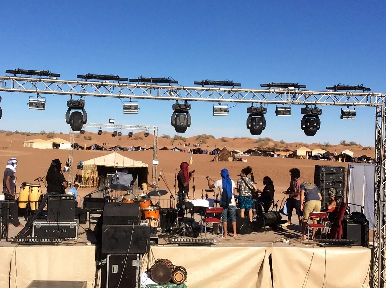
In March, since 2004: three days of nomadic music, oral poetry, camel racing and workshops, set up in the sand at the edge of the village. It's the largest annual gathering of southern Moroccan groups in one place.
Taragalte (M'Hamid El Ghizlane)
Usually between October and November, in a camp set up on the Lehmada dunes: it mixes Sahel and Moroccan music with a gathering on water, herding and climate. Tickets and camping are bought as a package.
 AI illustration
Moussem of Moulay Ali Cherif (Rissani)
Annual pilgrimage to the mausoleum of the Alaouite dynasty's ancestor, on a date that follows the Islamic calendar. It combines a fair, fantasia horsemanship (tbourida) and a floating population that multiplies the town for several days.
 AI illustration
Fête des Dattes (Erfoud)
In October, at the end of the harvest: an exhibition of the Tafilalet's varieties, wholesale trading, a parade and music. It's the time of year when date prices are set for the whole region.

Marathon des Sables
In April, since 1986: about 250 km in six stages across the southeastern desert, with runners carrying their own food and gear and receiving only water and a tent. It closes roads and fills up Ouarzazate and Errachidia's hotels for a week.
Books and films
Wind, Sand and Stars: Antoine de Saint-Exupéry (1939)
Written from the years the author ran the Cap Juby stopover, in southern Morocco, for the airmail service, and from his crash in the Libyan desert in 1935. It explains better than any guidebook the relationship between distance, water and luck in the Sahara.
Rihla: The Travels of Ibn Battuta (dictated in 1355)
The chapter on the crossing that began in Sijilmassa in 1352, bound for the salt mines of Taghaza and for Timbuktu, describes the caravan, wells, guides and gold trade with a detail no other medieval source has. It's the founding text of the route that created the Tafilalet's cities.
The Sheltering Sky: Bernardo Bertolucci (1990)
An adaptation of Paul Bowles's novel, shot partly in southern Morocco, including the Erfoud and Ouarzazate area. It works as a document of how foreigners project emptiness and redemption onto a place with a thousand years of irrigated farming.
Frequently asked questions
Sahara: Can I visit the desert on a day trip from Marrakech?
No: the one-way trip to Merzouga alone takes 9 to 11 hours by car on mountain roads. Allow at least four days, or split the trip into two legs, sleeping along the way.
Sahara: How do I get from Marrakech to Merzouga?
From Marrakech to Merzouga it's about 560 km via Tizi n'Tichka, Ouarzazate, and the Dades Gorge: 9 to 11 hours by car, usually split over two days. The long-distance buses are CTM and Supratours, with tickets bought online or at the counter: Marrakech–Merzouga costs around 140 to 200 DH and takes 11 to 13 hours, and Marrakech–Zagora runs close to 140 DH in about 8 hours (2026; confirm before traveling).
Sahara: What's the currency, and where can I exchange money?
The currency is the dirham (MAD, DH), a closed currency you can't buy outside the country: change or withdraw money on arrival and, before heading down to the sand, at the cash machines in Errachidia, Erfoud, Rissani, Ouarzazate, or Zagora, because the ones in Merzouga can run empty on weekends. Spend what's left before your flight home.
Sahara: Should I accept the tea I'm offered?
Yes: refusing the tea ends the conversation before it starts, because it's the preamble to any negotiation, visit, or request for information.
Sahara: What is medfouna?
Medfouna is Rissani's so-called “Berber pizza”: two discs of dough sealed around a filling of minced meat, onion, almond, egg, and spices, baked in a clay oven for 20 to 30 minutes.
Other cities in the country
Morocco ↗- Days
- 3
- When
- Mar–May · Oct–Nov
- Per person/day
- Average 700–1,400 MADMid-range · per person/day
Cost scope
Per person per day: accommodation, meals, urban transport, visits and a small allowance for extras. Flights excluded; larger purchases vary. Editorial estimate, not a quote.
- Days
- 2–3
- When
- Mar–May · Sep–Nov
- Per person/day
- Average 800–1,400 MADMid-range · per person/day
Cost scope
Per person per day: accommodation, meals, urban transport, visits and a small allowance for extras. Flights excluded; larger purchases vary. Editorial estimate, not a quote.
- Days
- 2–3
- When
- Apr · Jun · Sep–Oct
- Per person/day
- Average 800–1,400 MADMid-range · per person/day
Cost scope
Per person per day: accommodation, meals, urban transport, visits and a small allowance for extras. Flights excluded; larger purchases vary. Editorial estimate, not a quote.