Peru
Arequipa
Arequipa, the sillar city at the foot of Misti and the gateway to Colca Canyon
Days Start with the basic programme and choose extensions for the time you have.
How the guide reaches this number
The first goes to the sillar center: the Plaza de Armas, the Cathedral museum, the Compañía, the Museo Santuarios Andinos, and the Monasterio de Santa Catalina, which needs at least an afternoon. The second crosses the city from the Mercado San Camilo to the Museo de Arte Virreinal de Santa Teresa, passes through San Lázaro and over the Puente Bolognesi to La Recoleta, and ends with lunch at a picantería and sunset at the Mirador de Yanahuara. With a third day, I'd head out to the Ruta del Sillar in the morning and to the Sabandía campiña in the afternoon. Colca Canyon is another trip: I'd add two more days, with a night in the valley, rather than trying to go and return the same day.
2–3
When April to November; the city's scant rain is concentrated from January to March, and in the Colca valley the Chivay weather station records more than 100 mm a month in January and February.
How the guide reaches this number
Arequipa is dry and sunny most of the year: it gets 75 to 100 mm of rain a year, almost all of it between January and March, and from April to November the months pass with rain close to zero. Average highs stay between about 21 and 25 °C all year, but the nights get cold, with average lows near 5 °C in June and July. The dry winter, from June to August, is the season of the clearest skies for seeing the volcanoes, and it coincides with the Fiestas Patrias on July 28 and 29 and the city's anniversary on August 15, holidays that boost domestic tourism. In Colca, the Chivay weather station records average lows below 0 °C from May to August and more than 100 mm of rain in January and February, which weighs more on choosing your date than the city's weather.
Per person/day Budget around PEN83; mid-range around PEN209; comfortable around PEN545 per person per day, based on spending reported by travelers to Budget Your Trip (checked October 2026).
How the guide reaches this number
Indicative figures, excluding travel to the destination.
Budget around PEN83; mid-range around PEN209; comfortable around PEN545 per person per day, based on spending reported by travelers to Budget Your Trip (checked October 2026). Indicative figures, excluding travel to the destination.
Per person per day: accommodation, meals, urban transport, visits and a small allowance for extras. Flights excluded; larger purchases vary. Editorial estimate, not a quote.
 What Nilo thinks
I'd stay two full days in Arequipa. The first goes to the sillar center: the Plaza de Armas, the Cathedral museum, the Compañía, the Museo Santuarios Andinos, and the Monasterio de Santa Catalina, which needs at least an afternoon. The second crosses the city from the Mercado San Camilo to the Museo de Arte Virreinal de Santa Teresa, passes through San Lázaro and over the Puente Bolognesi to La Recoleta, and ends with lunch at a picantería and sunset at the Mirador de Yanahuara. With a third day, I'd head out to the Ruta del Sillar in the morning and to the Sabandía campiña in the afternoon. Colca Canyon is another trip: I'd add two more days, with a night in the valley, rather than trying to go and return the same day.Arequipa is an entire city made of the same stone. Sillar, white from Chachani or pink from Misti, holds up the Cathedral, the portals of the Compañía, and the inner streets of the Monasterio de Santa Catalina, where walls painted in bright colors have drawn a city within the city since 1579. Each earthquake forced a rebuilding, and that is why the center, a World Heritage Site since 2000, looks so uniform. Across the Chili River, Yanahuara and Cayma keep the picanterías, the place where Arequipa cooking, with its rocoto relleno and chupe de camarones, is best explained, and the viewpoints that frame the three volcanoes. The city's 2,328 m also serve as an acclimatization step for what comes next: Colca Canyon, the condors of the Cruz del Cóndor, and the puna of the vicuñas, above 4,000 m, begin a few hours away by road.
Quick facts
- Population
- About 1.32 million residents in Arequipa Province, which includes the urban area and neighboring districts, according to the INEI 2025 National Census (results released in July 2026). The Arequipa department totaled about 1.815 million.
- Founded
- August 15, 1540, by Juan de la Torre and Garcí Manuel de Carbajal, as a town; sources record the name as Villa Hermosa de Nuestra Señora de la Asunta or Villa de la Asunción de Nuestra Señora del Valle Hermoso de Arequipa. A royal decree of Charles V raised it to city status in September 1541.
- Country and region
- Peru, Arequipa department and province, in the Chili River valley, in the southern Andes.
- Language
- Spanish.
- Currency
- Peruvian sol (PEN), written S/.
- Time zone
- America/Lima: UTC-5 year-round, no daylight saving time.
- Best time to visit
- April to November; the city's scant rain is concentrated from January to March, and in the Colca valley the Chivay weather station records more than 100 mm a month in January and February.
- Average daily cost
- Budget around PEN83; mid-range around PEN209; comfortable around PEN545 per person per day, based on spending reported by travelers to Budget Your Trip (checked October 2026). Indicative figures, excluding travel to the destination.
When to go
April to November; the city's scant rain is concentrated from January to March, and in the Colca valley the Chivay weather station records more than 100 mm a month in January and February.
January
11° to 21°C
28 mm of rain
February
11° to 20°C
38 mm of rain
March
10° to 21°C
21 mm of rain
December
10° to 22°C
3 mm of rain
How the year changes
Arequipa is dry and sunny most of the year: it gets 75 to 100 mm of rain a year, almost all of it between January and March, and from April to November the months pass with rain close to zero. Average highs stay between about 21 and 25 °C all year, but the nights get cold, with average lows near 5 °C in June and July. The dry winter, from June to August, is the season of the clearest skies for seeing the volcanoes, and it coincides with the Fiestas Patrias on July 28 and 29 and the city's anniversary on August 15, holidays that boost domestic tourism. In Colca, the Chivay weather station records average lows below 0 °C from May to August and more than 100 mm of rain in January and February, which weighs more on choosing your date than the city's weather.
The same numbers as a table
| Month | Temperature °C | Rain mm |
|---|---|---|
| January | 11 to 21 | 28 |
| February | 11 to 20 | 38 |
| March | 10 to 21 | 21 |
| April · | 10 to 22 | 1 |
| May · | 8 to 22 | 0 |
| June · | 8 to 21 | 0 |
| July · | 7 to 21 | 1 |
| August · | 8 to 22 | 1 |
| September · | 8 to 22 | 1 |
| October · | 9 to 22 | 0 |
| November · | 9 to 22 | 0 |
| December | 10 to 22 | 3 |
Nilo's tips
Santa Catalina without hurry
To get the 1.5 to 2 hours the visit needs, I'd go in by 3 p.m. on regular days, or by 5 p.m. on Tuesdays and Wednesdays. On Tuesdays and Wednesdays, entering late in the afternoon, I'd see the inner streets in the low light.
Picantería at lunch
I'd keep the main meal for lunch at a picantería in Yanahuara or Cayma, arriving near noon, because the lunch of the day runs until 3 p.m. or until it runs out. If it's your first time with rocoto, I'd order one dish to share.
Ticket category
Tickets vary by age and nationality, and the bigger discounts are usually reserved for Peruvians. I'd carry my passport on museum days.
Colca with an overnight
I'd sleep one night in Chivay or in a village in the valley: it is about 3.5 hours by road to Chivay and about another hour to the Cruz del Cóndor, and the condors show up in the early morning.
Explore the map
Explore the map, read about the other places and plan your travel days in the app.
Open the appWhat to see
Monasterio de Santa Catalina
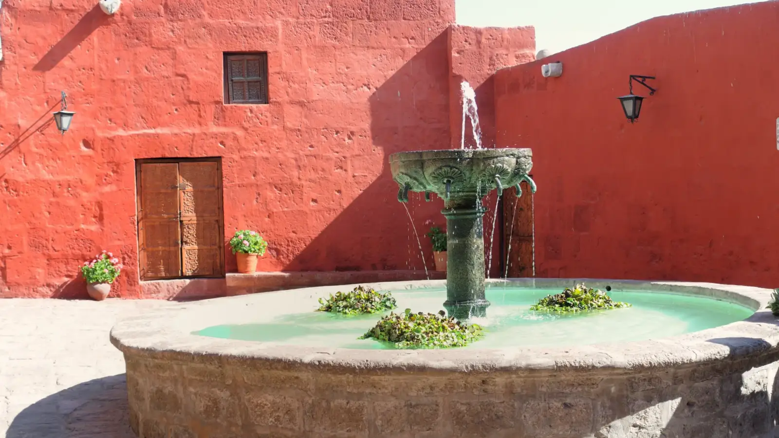
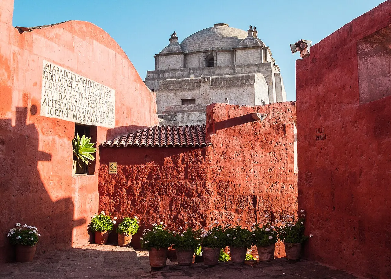
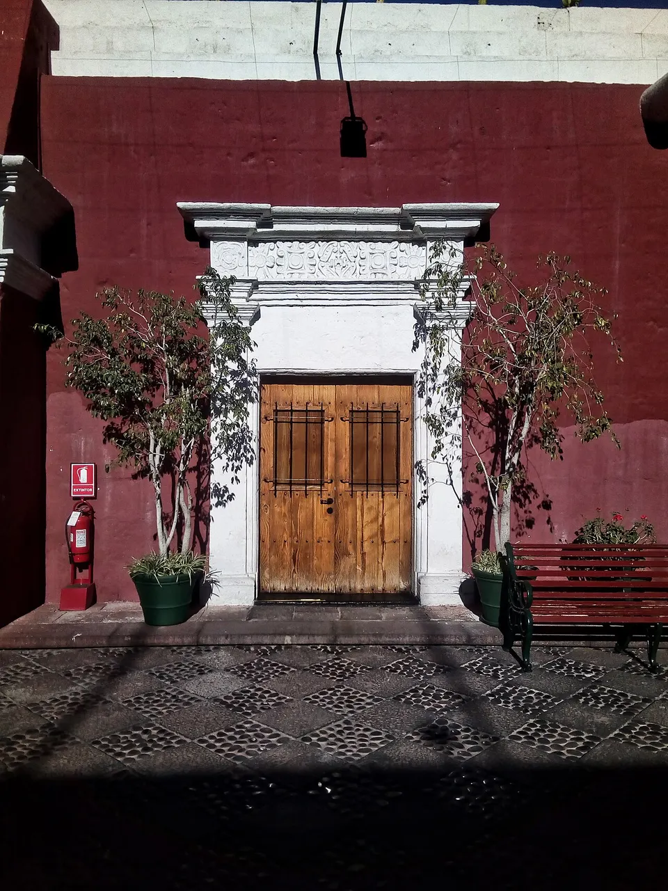
A walled citadel of 20,000 m² in the center, founded in 1579 and organized like a small town, with inner streets, cloisters, cells, kitchens, and a gallery of 92 paintings, including rooms of works from the Cusco school. The lanes and courtyards have walls painted in bright colors, such as the red of one of the inner squares, over the sillar. It stayed closed to the public until 1970, and nuns still live in the western part of the complex. The published hours are Monday to Sunday, 9 a.m. to 5 p.m., with last admission at 5 p.m., and on Tuesdays and Wednesdays until 8 p.m., with the ticket office and last admission at 7 p.m.; it closes on Good Friday, December 25, and January 1. To get the 1.5 to 2 hours the visit needs, I'd go in by 3 p.m. on regular days, or by 5 p.m. on Tuesdays and Wednesdays. When checked on October 17, 2026, adult admission cost S/ 50 (the same for foreigners and Peruvians), S/ 30 for foreigners aged 7 to 18, and it was free for accompanied children under 7. The guided tour, optional and paid directly to the guide at the entrance, lasts about an hour, in seven languages; on your own, allow 1.5 to 2 hours.
Check access
Plaza de Armas de Arequipa
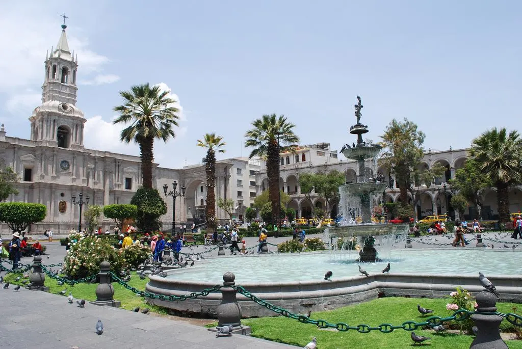
The main square has at its center a fountain with the Tuturutú, the statue that personifies the city, and is surrounded by sillar portals: the Portal de Flores, the Municipalidad, and San Agustín. The Cathedral takes up the entire north side.
Check access
Basílica Catedral de Arequipa
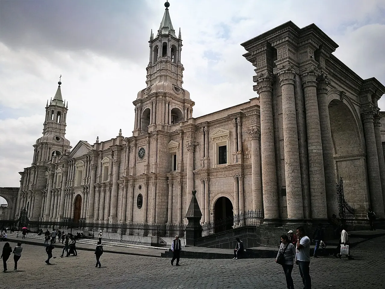
It occupies the north side of the Plaza de Armas, with a sillar facade of seventy columns and two towers. The present church is a neoclassical reconstruction after the fire of 1844; the towers fell in the earthquakes of 1868 and 2001 and were rebuilt. Inside are a Belgian organ, one of the largest in South America, and a wooden pulpit carved in the Buisine-Rigot workshop in Lille. The Cathedral museum is open Monday to Saturday, 10 a.m. to 4:15 p.m., with the entrance on the side, on calle Santa Catalina; check at the door for the ticket price and how the route is run.
Check access
Iglesia de la Compañía de Jesús
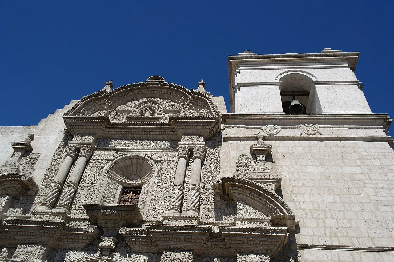
The Jesuit complex at the corner of calles General Morán and Álvarez Thomas, beside the Plaza de Armas, was built between 1590 and 1698. The facade is a carpet of shallow sillar reliefs, a technique imposed by the porous stone, and the interior holds gilded retablos, a carved wooden pulpit from the 17th century, and more than 60 paintings of the Cusco school, with works by Bernardo Bitti and Diego de la Puente. The former sacristy houses the San Ignacio chapel, with polychrome murals, and the cloisters stand next to the church.
Check access
Mirador de Yanahuara
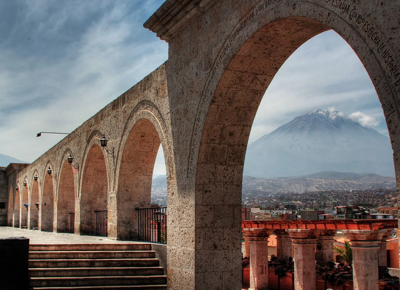
A gallery of sillar arches beside the square and the church of Yanahuara, from 1750, with a view of the city and Misti, Chachani, and Pichu Pichu behind it. It is across the Chili River from the center.
Check access
Museo Santuarios Andinos
An archaeological museum of the Universidad Católica de Santa María, at calle La Merced 110, created in 1996 to display the material from Inca capac cocha offerings found on the region's volcanoes. The best-known piece is Juanita, the Inca girl sacrificed on the Ampato volcano between about 1440 and 1480 and found in September 1995; the collection also includes the mummies Urpicha and Sarita. The Juanita display may vary through the year: before you go, confirm with the museum whether she will be on view on your date, along with the hours and the ticket.
Check access
Barrio de San Lázaro
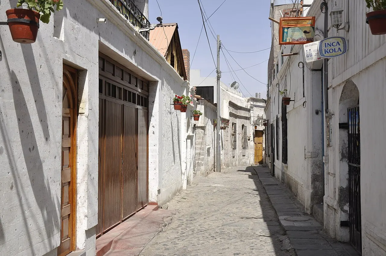
The oldest neighborhood in Arequipa, next to the center, keeps narrow lanes and houses of the kind built before the great reconstructions in sillar. It makes a short walk between the center and the river.
Check access
Mercado San Camilo
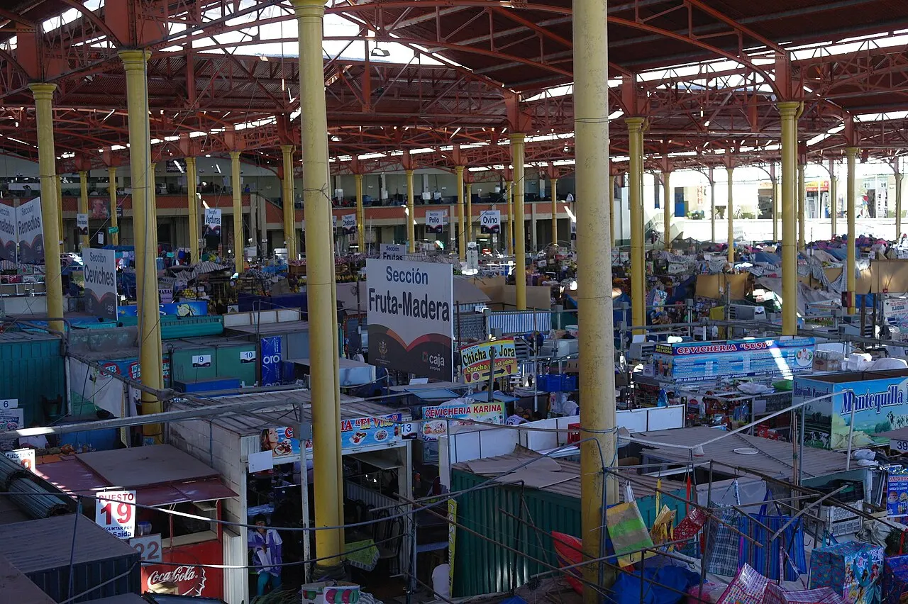
The city's oldest supply market, three blocks from the Plaza de Armas. It operated outdoors from 1881, got its present building in 1938, and was declared a Monumental Historic Heritage site in 1987. Through the 20th century it was the city's main supply point, and a morning stroll shows the variety of produce that arrives from the valley and the highlands.
Check access

Museo de Arte Virreinal de Santa Teresa
The Discalced Carmelite monastery, at calle Melgar 303, was founded in 1710 and opened part of its spaces to the public in 2001. Its twelve rooms display more than 300 works of painting, sculpture, and furniture from the 16th to the 19th centuries, and some areas remain in use by the nuns at certain hours. Check the current hours before the visit.
Check access
Nilo’s itinerary
Start with the basic programme and choose extensions for the time you have.
Plan my days in the app ↗Day 1 · The sillar center: Plaza de Armas, Cathedral, Compañía, and Santa Catalina
Start at the Plaza de Armas in the morning and walk the portals of Flores, the Municipalidad, and San Agustín.
At 10 a.m., enter the Cathedral museum by the side entrance on calle Santa Catalina (Monday to Saturday, 10 a.m. to 4:15 p.m.).
Cross the square to the Iglesia de la Compañía, at the corner of General Morán and Álvarez Thomas, for the relief facade, the San Ignacio chapel, and the cloisters.
Before lunch, continue to the Museo Santuarios Andinos, at calle La Merced 110, after confirming with the museum the time of the guided visit and whether Juanita is on display.
Have lunch in the center and enter the Monasterio de Santa Catalina, two blocks from the square, around 2:30 or 3 p.m.: with last admission at 5 p.m. on regular days, that secures the 1.5 to 2 hours of the self-guided visit. On Tuesdays and Wednesdays, you can enter until 5 p.m. and stay until closing, at 8 p.m.
Finish with sunset at the Plaza de Armas, from one of the terraces of the portals.
Day 2 · San Camilo, San Lázaro, the Chili River, and Yanahuara
Start early at the Mercado San Camilo, three blocks from the Plaza de Armas, to see the stalls before the midday bustle.
Continue to the Museo de Arte Virreinal de Santa Teresa, at calle Melgar 303, after confirming the hours, and from there walk through the lanes of San Lázaro down to the river.
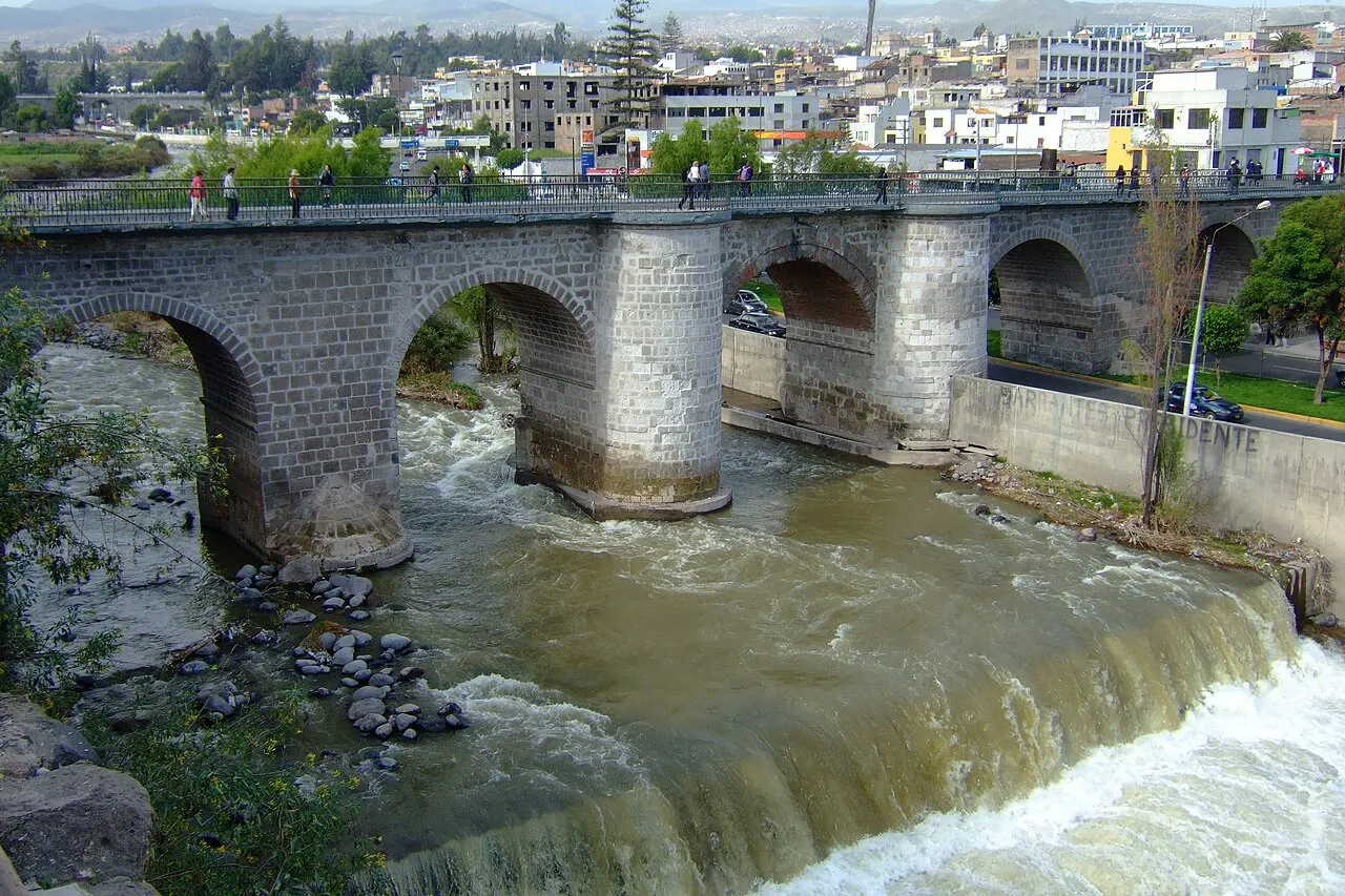
Cross the Chili over the Puente Bolognesi and visit the Convento de La Recoleta, with its library of more than twenty thousand books.
Continue by a short taxi ride to Yanahuara and have lunch at a picantería in the neighborhood: rocoto relleno, chupe de camarones, or whatever the daily board offers.
In the middle of the afternoon, if you also want to see the city from Cayma, take a taxi to the Mirador de Carmen Alto; then return to Yanahuara for the end of the day at the Mirador de Yanahuara, with Misti, Chachani, and Pichu Pichu between the arches.

If you stay longer
Day 3 · Ruta del Sillar and the Sabandía campiña
In the morning, go on a tour or a prearranged taxi to the Añashuayco quarries, in Cerro Colorado, and the Culebrillas ravine, to see where the city's stone comes from.
Return to the center for lunch or continue straight to the southeast, crossing the city toward the campiña.
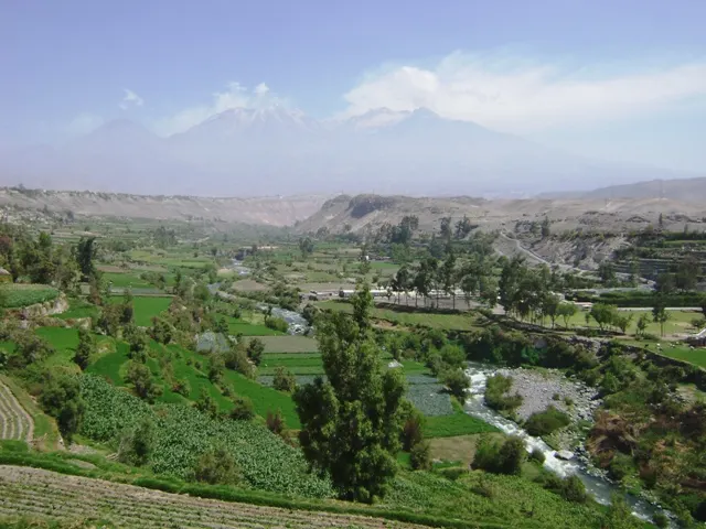
In the afternoon, visit the Molino de Sabandía and the Mansión del Fundador, in Huasacache, after confirming hours, and enjoy the landscape of cultivated terraces with the volcanoes behind.
Return to the center at the end of the afternoon; if Colca comes next, check the day before the departure time of the tour, which can be very early.

Food
Rocoto relleno
The city's signature dish: a rocoto, a round pepper the size of an apple, very hot and slightly sweet, stuffed with ground beef or pork, olives, peas, and fresh cheese, and baked in the oven. In Arequipa it comes with pastel de papa, layers of potato with fresh cheese and egg. It can be very hot; ask at the picantería.
Chupe de camarones
A thick, spicy soup of river shrimp, traditionally caught in the Ocoña, Camaná, and Majes rivers, with yellow potato, fresh cheese, milk, fava beans, corn, and egg, seasoned with ají colorado and huacatay. It is served in the city's picanterías.
Adobo arequipeño
Pork marinated in garlic, ají panca or rocoto, and vinegar or chicha de guiñapo, cooked in a clay pot in its own marinade liquid. It is the Sunday breakfast: in the picanterías, it is served from the early morning until about 10:30 a.m., with three-point bread for dipping in the broth.
Queso helado
A cold, creamy dessert typical of Arequipa that, despite the name, has no cheese among its main ingredients. The traditional method spins the cooked mixture in a metal container set inside a wooden one with ice and salt. The Municipalidad celebrates the Día del Queso Helado on the fourth Sunday of January, in the Plaza de Armas.
Chicha de guiñapo
A fermented black corn drink that gave its name to the old chicherías, the predecessors of the picanterías. It is still served in them and also goes into the adobo marinade.
Where to eat
- Picanterías of Yanahuara, Cayma, and Sachaca
This is where Arequipa cooking makes sense. The lunch, a robust soup followed by a smaller dish, comes out between noon and 3 p.m. or until it runs out, with a dish of its own for each day of the week; à la carte, until about 5 p.m., there are rocoto relleno with pastel de papa, chupe de camarones, ocopa, and chicha de guiñapo. On Sunday, the adobo is served early, until about 10:30 a.m. The picanterías have been Cultural Heritage of the Nation since 2014; I'd arrive near noon to find the lunch of the day.
- Portals of the Plaza de Armas
The restaurants on the upper floors of the portals have a view of the Cathedral; I'd choose them for the sunset, more than for the cooking, and I'd reserve a balcony table if the date is a holiday.
- Center and Plaza de Armas
Look for the queso helado, the city's typical cold dessert; on the fourth Sunday of January, the Plaza de Armas itself hosts the Día del Queso Helado.
· 2026-10-17
Day trips
Colca Canyon
One of the deepest canyons in the world, at about 3,200 m, in Caylloma province, recognized in 2019 by UNESCO as the Colca y Volcanes de Andagua World Geopark. By bus or car, Chivay, the valley's main town, at 3,635 m, is about 3.5 hours from Arequipa, and the Cruz del Cóndor viewpoint is about another hour. In the valley, agricultural terraces follow the river, there are the La Calera hot springs, 3 km from Chivay, and condors usually fly in the early morning. I'd do it in two days, with a night in the valley, rather than going and coming back the same day. The tourist ticket is charged separately: PromPerú gave a reference price of S/ 70 for foreigners (checked October 17, 2026).
Salinas y Aguada Blanca National Reserve
About 110 km east of the city, covering 366,936 hectares at an average altitude of 4,300 m. It was created to protect the vicuñas and Arequipa's water sources; the brackish Salinas lagoon hosts flamingos. It is usually combined with the trip to Colca; confirm on the tour itinerary.
Volcán Misti
Agencies in the city offer the climb of the volcano, at about 5,820 m, in two-day programs, considered low difficulty; Chachani, at 6,057 m, is medium difficulty. Altitude is the biggest obstacle: only with prior acclimatization and with an accredited professional operator.
Where to begin
The sillar center: Plaza de Armas, Cathedral, Compañía, and Santa Catalina
Start at the Plaza de Armas in the morning and walk the portals of Flores, the Municipalidad, and San Agustín.
San Camilo, San Lázaro, the Chili River, and Yanahuara
Start early at the Mercado San Camilo, three blocks from the Plaza de Armas, to see the stalls before the midday bustle.
Ruta del Sillar and the Sabandía campiña
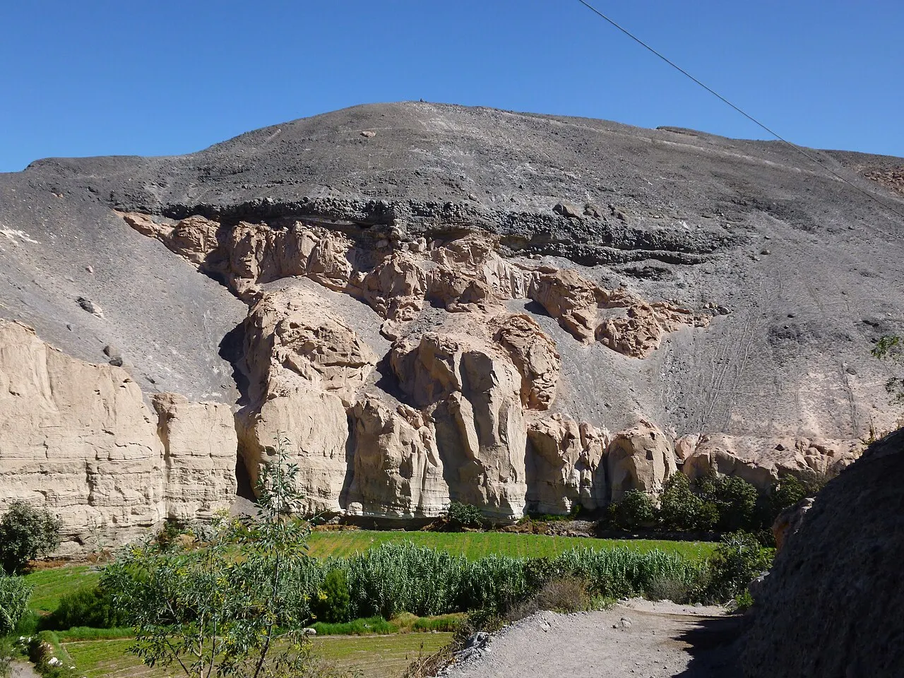
In the morning, go on a tour or a prearranged taxi to the Añashuayco quarries, in Cerro Colorado, and the Culebrillas ravine, to see where the city's stone comes from.
Money
The currency is the Peruvian sol (PEN), written S/. The Monasterio de Santa Catalina accepts Visa, Mastercard, American Express, Diners Club, UnionPay, and Maestro, and also sells tickets online. Admission prices vary by visitor category: at Santa Catalina, when checked on October 17, 2026, adults paid S/ 50, foreigners aged 7 to 18 paid S/ 30, and children under 7 did not pay, with discounts and promotional days reserved for Peruvians; bring your passport or a document that proves your category. The guides at Santa Catalina and other monuments charge separately, directly, with a price set by language, duration, and group size; agree on the amount before starting. For Colca, the tourist ticket (boleto turístico) is charged apart from transport: PromPerú gave a reference price of S/ 70 for foreigners, S/ 20 for Peruvians, and S/ 5 for Peruvian students (checked October 17, 2026); confirm the current amount with the operator. In markets, stalls, and small picanterías, I'd carry soles in small bills.
Getting there and around
Alfredo Rodríguez Ballón International Airport (AQP) is about 8 km from the center, in the Zamácola area; from Lima, the flight takes about 1h15. There is no regular public transportation between the airport and the center: use a taxi from the airport's official companies or the transfer arranged with your lodging, and confirm the fare before getting in the car.
The historic center is covered on foot: the Plaza de Armas, the Cathedral, the Compañía, Santa Catalina, and the museums are a few blocks from one another. For Yanahuara and La Recoleta, cross the Chili River on foot by one of the bridges or take a short taxi ride. Cayma, Carmen Alto, the Sabandía campiña, and the Ruta del Sillar call for a taxi, a car, or a tour.
A taxi is the most practical means for visitors, and also where the risk lies: the British government warns of criminals posing as taxi drivers at airports and bus terminals in Peru. Use a taxi called by phone or app, ask your lodging to book the car, and do not take a taxi on the street; at terminals, use the registered taxis.
Long-distance buses leave from the Terminal Terrestre and the Terrapuerto, neighbors, about 3 km from the center. To Puno, allow about 5 to 6 hours; to Cusco, 9 to 11 hours depending on the company, generally on an overnight trip; from Lima, about 16 hours. For Colca, most visitors go on a tour or by bus to Chivay, about 3.5 hours by road, and from Chivay to the Cruz del Cóndor viewpoint it is about another hour.
Safety
The British government points to theft and street robbery as a problem in Lima, Cusco, Arequipa, and other large cities in Peru: stay alert in public places and when withdrawing cash at ATMs, and do not leave valuables in view. The risk most cited for visitors involves fake taxi drivers, sometimes linked to express kidnappings at night; use a taxi called by phone, app, or through your lodging, and do not take a car on the street. The same advisory records personal assaults, infrequent, especially in the Cusco and Arequipa regions, and recommends hiring only licensed agencies for adventure activities. Arequipa has also seen protests; avoid crowds and follow the local news. The risk most particular to the region is altitude: the city is at 2,328 m, Chivay at 3,635 m, the road to Colca crosses the Salinas y Aguada Blanca National Reserve, at an average altitude of 4,300 m, and the summits of Misti and Chachani exceed 5,800 m; those arriving from sea level should ascend gradually. Misti is an active volcano, monitored around the clock by INGEMMET and the Instituto Geofísico del Perú. The region is seismic, as the earthquakes of 1868 and 2001 show; at your lodging, it is worth locating the exit route.
Etiquette tips
Monasteries that are still homes
Santa Catalina and Santa Teresa shelter religious communities; at Santa Teresa, some areas remain in use by the nuns at certain hours. Follow the signs, keep your voice down, and respect the closed areas.
Photography without flash
At Santa Catalina photography is allowed, without flash indoors. In churches with Mass in progress, wait for the end of the service to take photos.
Guide hired at the door
At Santa Catalina, the guides are independent professionals hired at the entrance, and payment goes directly to them. Agree on language, duration, and price before starting.
Mistakes to avoid
Arriving at Santa Catalina close to last admission: it is at 5 p.m. on regular days and 7 p.m. on Tuesdays and Wednesdays, and the self-guided visit takes 1.5 to 2 hours.
Saving Sunday for the Cathedral museum: it is open only Monday to Saturday, 10 a.m. to 4:15 p.m.
Treating Colca as a half-day outing: Chivay is about 3.5 hours by road, and the Cruz del Cóndor viewpoint is about another hour beyond.
Going up to Colca, the Salinas y Aguada Blanca Reserve, or Misti right after arriving from the coast, without a few days at 2,328 m.
Taking a taxi on the street instead of asking for a car through your lodging, by phone, or by app.
Useful phrases
Buenos días, ¿a qué hora cierra?
Good morning, what time does it close?
¿Cuánto cuesta la entrada para extranjeros?
How much is admission for foreigners?
¿Me puede pedir un taxi de una empresa?
Can you call me a taxi from a company?
¿Pica mucho el rocoto?
Is the rocoto very hot?
La cuenta, por favor.
The check, please.
Where to stay
- Historic Center (Cercado) · First-time visitors without a car who want to see the monuments, the museums, and the restaurants of the Plaza de Armas on foot.: Puts Santa Catalina, the Cathedral, the Compañía, and the Mercado San Camilo a few blocks away. The main streets have traffic and bustle; at night, I'd go back by a taxi called through your lodging, by phone, or by app.
- San Lázaro · Those who prefer quieter streets without moving away from the center.: The lanes of the oldest neighborhood are a short walk from the Plaza de Armas and the Chili River. There are fewer restaurants and services than in the Cercado, and some streets are narrow for cars.
- Yanahuara · Those who want a residential neighborhood with picanterías and the viewpoint nearby, and don't mind crossing the river to the center.: It sits on the right bank of the Chili, near the Mirador de Yanahuara and La Recoleta. For the center and for nightlife, you depend on a walk over the bridge or a taxi, especially at night.
· 2026-10-17
Districts
Historic Center (Cercado)
The colonial grid around the Plaza de Armas holds the Cathedral, the Compañía, the Monasterio de Santa Catalina, the museums, and about 500 casonas, of which more than 250 are protected as heritage. It is where most visitors spend their first day, on foot.
San Lázaro
Considered the oldest neighborhood in the city, it sits right against the center, beside the Chili River. Its narrow lanes preserve adobe and sillar houses of the kind built in the 18th and 19th centuries, before the great reconstructions.
Yanahuara
A district on the right bank of the Chili, declared Villa Hermosa de Yanahuara in 1870, with stone streets, the sillar church of 1750, and the arched viewpoint that frames Misti. It also has a concentration of traditional picanterías.
Cayma
A district north of Yanahuara, higher up, with the church of the Virgen de la Candelaria, viewpoints such as Carmen Alto over the campiña, and picanterías frequented by locals.

Campiña arequipeña (Sabandía, Socabaya, and Huasacache)
The agricultural zone around the city, with cultivated terraces of pre-Hispanic origin, the Molino de Sabandía, and the Mansión del Fundador, in Huasacache. You visit by car or on a tour, usually in an afternoon.
History
Before 1540 · An irrigated valley before the Spanish
The Chili valley was already inhabited and cultivated before the Spanish arrived. One hypothesis for the name Arequipa links it to the Puquina language, spoken by the region's first inhabitants, and a Puquina urban settlement, Kasa-Patak, was identified in 1942.
1540 · Spanish founding
On August 15, 1540, Juan de la Torre and Garcí Manuel de Carbajal, a lieutenant of Francisco Pizarro, founded the town in the Chili valley, with an initial grid layout of 49 blocks, on land already occupied by Indigenous settlements. In September 1541, a royal decree of Charles V granted it the title of city.
1579 · Founding of Santa Catalina
With the estate of doña María de Guzmán, the Dominican monastery dedicated to Saint Catherine of Siena was founded; it grew to occupy 20,000 m² in the center and remained a cloistered convent for centuries.
1582–1600 · Earthquake and the Huaynaputina eruption
The 1582 earthquake pushed builders toward sillar as a structural solution, and the 1600 eruption of the Huaynaputina volcano forced further rebuilding. From then on, volcanic stone came to define the city's architecture.
1784 · Baroque reconstruction
The 1784 earthquake destroyed much of the city. The rebuilding in sillar consolidated the Baroque portals and the manor-style casonas that characterize the center today.
1868 · The earthquake that remade the center
On August 13, 1868, an earthquake brought down the Cathedral's towers and a good part of the colonial casonas. Many of the houses you visit in the center were rebuilt in the 19th century on the foundations of earlier ones.
1882 · Provisional capital of Peru
During the war with Chile, on August 31, 1882, President Lizardo Montero declared Arequipa the capital of Peru and convened a National Congress there.
1958–1960 · Earthquakes and growth
The earthquakes of 1958 and 1960, together with drought on the high plateau, accelerated migration to the city and the growth of the outlying neighborhoods.
2000 · World Heritage Site
UNESCO inscribed the historic center of Arequipa on the World Heritage List.
2001 · Earthquake of June 23
An earthquake in southern Peru brought down the Cathedral's left tower and damaged the right one. The restored towers were handed over on the city's anniversary, August 15, 2002.
2019 · Creative City of Gastronomy
Arequipa joined the UNESCO Creative Cities Network in the gastronomy category, five years after the picanterías were recognized as Cultural Heritage of the Nation, in 2014.
Complete history
Arequipa was born as a Spanish city on August 15, 1540, but it settled a valley that was already irrigated and cultivated. The 49-block grid, with the main square and the plots for the main church, the cabildo, and the religious orders, is still legible in the center today. During the colonial period, the city gained economic importance in a valley that links the coastal desert to the puna, and the religious orders left a concentration of churches and convents that is rare for a city of its size.
The city's physical history is the history of its earthquakes. The one in 1582 and the Huaynaputina eruption in 1600 made sillar, a porous and lightweight volcanic stone, the answer for building; the one in 1784 opened the way for the great Baroque portals; the one in 1868 brought down the Cathedral's towers and a good part of the casonas, which were rebuilt on the same spot over the course of the 19th century. That is why the center looks so uniform: walls 1 to 1.5 meters thick in the houses and more than 2 meters in the churches, vaults and round arches, almost all in the same material.
In the 19th century, the city played a political role that earned it nicknames such as León del Sur and Ciudad Caudillo: in 1835 a government set up there, and in 1882, during the war with Chile, it was even declared the capital of Peru. The earthquakes of 1958 and 1960 and the drought on the high plateau brought a wave of migration that doubled the population in a decade and spread the city across the hillsides, toward the volcanoes.
In 2000 the historic center joined the UNESCO World Heritage List, and the following year the earthquake of June 23, 2001 brought down one of the Cathedral's towers, restored in 2002. Today, with about 1.32 million residents in the province, Arequipa is one of the largest regional economies in Peru, and the combination of a preserved center, a cuisine recognized by UNESCO in 2019, and access to Colca makes it one of the stops on the tourist circuit of southern Peru.
I'd read the facades through the earthquakes: much of what looks colonial in the center was rebuilt after 1784 or 1868, and the Cathedral you see today is the reconstruction after the fire of 1844, with its towers rebuilt after 2001.
Geography and shape of the city
The city occupies the valley of the Chili River, which runs through it from north to southwest, at 2,328 m in the center; neighborhoods range from about 2,041 m, in the Huayco area, to 2,810 m in the upper parts. To the north and east, the valley is closed in by three volcanoes: Misti, at about 5,820 m, active and monitored since 1969; Chachani, at 6,057 m, inactive; and Pichu Pichu, at 5,665 m. The climate is arid, with an annual average of about 14.5 °C and 75 to 100 mm of rain a year, almost all of it between January and March. The historic center lies on the left bank of the Chili, in a grid radiating from the Plaza de Armas; across the river are Yanahuara and, farther north, Cayma, from where you can see the city against the volcanoes. All around, the campiña, the agricultural belt with terraces of pre-Hispanic origin, still separates parts of the urban area from districts such as Sabandía and Socabaya, to the southeast.
I'd choose the viewpoint by the hour: Carmen Alto, in Cayma, in the middle of the afternoon, and Yanahuara for the end of the day, with Misti behind the city.
Culture
Architecture is the first thing you learn in Arequipa. Sillar, which comes in white, from Chachani, and in pink, from Misti, is too porous for deep reliefs, and so the portals of the Compañía and of so many churches and casonas cover the stone with shallow, dense designs, like a carpet. The city organizes its architectural history by earthquakes: the founding period until 1582, the Baroque until 1784, the Rococo and neoclassical revisions until 1868, and the neocolonial evocations until about 1960, before contemporary architecture.
The cooking is the second. Arequipa records more than 500 typical dishes, and the place where they live is the picantería, the regional-cooking restaurant recognized as Cultural Heritage of the Nation in 2014. The picantería lunch, a robust soup followed by a smaller dish, is served between noon and 3 p.m. or until it runs out, and each day of the week has its own, such as chaqué on Monday and chairo on Tuesday; the menu of local dishes usually runs until 5 p.m. In 2019, the city joined the UNESCO Creative Cities Network in the gastronomy category. The reference work on the subject is La gran cocina mestiza de Arequipa, by Alonso Ruiz Rosas.
The city also has a long literary and musical tradition. Mariano Melgar (1790–1815), a poet and revolutionary of independence, brought yaravíes, sentimental songs of popular origin, into poetry and is seen by many critics as a precursor of Romanticism in the Americas; he gives his name to the soccer club FBC Melgar. The composer Benigno Ballón Farfán became known for yaravíes and marineras and for the waltz «Melgar». Mario Vargas Llosa, Nobel laureate in Literature in 2010, was born in the city, and the house where he was born became the Casa Museo Mario Vargas Llosa, opened in 2014, with 17 rooms and limited daily capacity; check availability before you go. Religious life is visible in the calendar: the Virgen de la Candelaria de Cayma in February, the pilgrimage to the shrine of the Virgen de Chapi in May, and the city's anniversary, the day of the Virgen de la Asunta, on August 15.
I'd treat the picantería as part of the itinerary, and not just a meal: it is there that you understand why the city joined the UNESCO gastronomy network.
Festivals and events
Día del Queso Helado
On the fourth Sunday of January, since 2012, the Municipalidad Provincial brings together makers of the typical ice cream in the Plaza de Armas.
Virgen de la Candelaria de Cayma
On February 2, Candelaria day, the festival of the patron saint mobilizes the Cayma district, one of the centers of devotion to the Virgin of Candelaria in the region.
Holy Week
Movable dates, in March or April. Processions fill the center, and the Monasterio de Santa Catalina closes on Good Friday.
Virgen de Chapi
The central day is May 1, with a pilgrimage to the Chapi shrine, about 90 km from the city, in the desert. The devotion is also celebrated on February 2 and September 8.
Arequipa Anniversary
On August 15, the day of the 1540 founding and of the Virgen de la Asunta, the city's patron. Among the city's parades is the Corso de la Amistad, a pasacalle with delegations from the region's districts; check the date in the Municipalidad's program.
Books and films
Peregrinations of a Pariah, by Flora Tristan (1838)
The French-Peruvian writer spent 1833 and 1834 in Arequipa trying to collect her uncle's inheritance, and the diary of that stay is a portrait of the city and of local society at the time.
La gran cocina mestiza de Arequipa, by Alonso Ruiz Rosas
The reference book on Arequipa cooking, with the dishes, the chupes, the stews, and the desserts you find in the picanterías.
Frequently asked questions
Arequipa: how do I get from the airport to the center?
Alfredo Rodríguez Ballón International Airport (AQP) is about 8 km from the center, in the Zamácola area. There is no regular public transportation between the airport and the center: use a taxi from the airport's official companies or the transfer arranged with your lodging, and confirm the fare before getting in the car.
Arequipa: how many days should I plan?
I'd stay two full days in Arequipa. The first goes to the sillar center: the Plaza de Armas, the Cathedral museum, the Compañía, the Museo Santuarios Andinos, and the Monasterio de Santa Catalina, which needs at least an afternoon. The second crosses the city from the Mercado San Camilo to the Museo de Arte Virreinal de Santa Teresa, passes through San Lázaro and over the Puente Bolognesi to La Recoleta, and ends with lunch at a picantería and sunset at the Mirador de Yanahuara. With a third day, I'd head out to the Ruta del Sillar in the morning and to the Sabandía campiña in the afternoon. Colca Canyon is another trip: I'd add two more days, with a night in the valley, rather than trying to go and return the same day.
Arequipa: can I go to Colca Canyon and back in one day?
By bus or car, Chivay, the valley's main town, at 3,635 m, is about 3.5 hours from Arequipa, and the Cruz del Cóndor viewpoint is about another hour; condors usually fly in the early morning. I'd do it in two days, with a night in the valley, rather than going and coming back the same day, and I'd first spend at least two days in Arequipa, at 2,328 m: the road crosses the Salinas y Aguada Blanca National Reserve, at an average altitude of 4,300 m. The tourist ticket (boleto turístico) is charged apart from transport: PromPerú gave a reference price of S/ 70 for foreigners, S/ 20 for Peruvians, and S/ 5 for Peruvian students (checked October 17, 2026); confirm the current amount with the operator.
Arequipa: what are the hours and prices at the Monasterio de Santa Catalina?
The published hours are Monday to Sunday, 9 a.m. to 5 p.m., with last admission at 5 p.m., and on Tuesdays and Wednesdays until 8 p.m., with the ticket office and last admission at 7 p.m.; it closes on Good Friday, December 25, and January 1. To get the 1.5 to 2 hours the visit needs, I'd go in by 3 p.m. on regular days, or by 5 p.m. on Tuesdays and Wednesdays. When checked on October 17, 2026, adult admission cost S/ 50 (the same for foreigners and Peruvians), S/ 30 for foreigners aged 7 to 18, and it was free for accompanied children under 7, with discounts and promotional days reserved for Peruvians; bring your passport or a document that proves your category. The guided tour, optional and paid directly to the guide at the entrance, lasts about an hour, in seven languages.
Arequipa: when is the best time to go?
April to November; the city's scant rain is concentrated from January to March, and in the Colca valley the Chivay weather station records more than 100 mm a month in January and February. The dry winter, from June to August, is the season of the clearest skies for seeing the volcanoes, and it coincides with the Fiestas Patrias on July 28 and 29 and the city's anniversary on August 15, holidays that boost domestic tourism.
Arequipa: is it safe, and how should I take a taxi?
The British government points to theft and street robbery as a problem in Lima, Cusco, Arequipa, and other large cities in Peru: stay alert in public places and when withdrawing cash at ATMs, and do not leave valuables in view. The risk most cited for visitors involves fake taxi drivers, sometimes linked to express kidnappings at night; use a taxi called by phone, app, or through your lodging, and do not take a car on the street. At terminals, use the registered taxis. Arequipa has also seen protests; avoid crowds and follow the local news.
Other cities in the country
Peru ↗- Days
- 2–3
- When
- Jan–Apr
- Per person/day
- Average 350–550 S/Mid-range · per person/day
Cost scope
Per person per day: accommodation, meals, urban transport, visits and a small allowance for extras. Flights excluded; larger purchases vary. Editorial estimate, not a quote.
- Days
- 4–5
- When
- Apr–May · Sep–Oct
- Per person/day
- Average 350–600 S/Mid-range · per person/day
Cost scope
Per person per day: accommodation, meals, urban transport, visits and a small allowance for extras. Flights excluded; larger purchases vary. Editorial estimate, not a quote.
- Days
- 1–2
- When
- Apr–Oct
- Per person/day
- Average 425 S/Mid-range · per person/day
Cost scope
Per person per day: accommodation, meals, urban transport, visits and a small allowance for extras. Flights excluded; larger purchases vary. Editorial estimate, not a quote.
- Days
- 2–3
- When
- May–Oct
- Per person/day
- Explore costsGuide estimate
Cost scope
Per person per day: accommodation, meals, urban transport, visits and a small allowance for extras. Flights excluded; larger purchases vary. Editorial estimate, not a quote.
- Days
- 2–3
- When
- Jan–Apr · Dec
- Per person/day
- Average 294 PENMid-range · per person/day
Cost scope
Per person per day: accommodation, meals, urban transport, visits and a small allowance for extras. Flights excluded; larger purchases vary. Editorial estimate, not a quote.