Bolivia
Uyuni Salt Flat
World's largest salt flat, Incahuasi, southern lagoons
Days Start with the basic programme and choose extensions for the time you have.
How the guide reaches this number
The first is for acclimatizing, seeing the Train Cemetery and choosing an agency; the second, for the crossing to Incahuasi; the third, for the north of the salt flat, with the Tunupa and the Coquesa mummies. Anyone with the stamina swaps the crossing and the north of the salt flat for the three-day circuit to the Laguna Verde, which already passes through Incahuasi, and the trip stretches to four days counting the acclimatization day. Anyone looking for comfort will suffer, because the trip is made of cold, dust, hours of jeep and early alarms. With just one day, do the classic salt flat tour, which leaves around 10:30am and passes the salt mounds of Colchani, the Isla Incahuasi and the sunset on the crust. It gets back around 7pm, in time for the night bus. What can disappoint is the mirror effect, which isn't guaranteed on any date. In February there can be 30 cm of water, with half the salt flat closed to traffic.
3
When May to October for dry crust; mid-January to early March for the mirror effect, not guaranteed
How the guide reaches this number
There are two Uyunis, and choosing between them defines the trip: you can't have both in the same week. May to October is the dry season: clear skies almost every day, highs of 13–20°C, lows of −5 to −15°C in town and below −20°C inside the salt flat in June and July, a firm crust, visible hexagons and guaranteed access to Incahuasi and Tunupa. From December to March, the rainy season brings the 100–200 mm of annual rainfall and forms the sheet of water that produces the mirror effect. The peak usually runs from mid-January to early March, with highs of 17–20°C and lows near 0°C. The mirror is unpredictable: it needs 5 to 15 cm of water, and above that parts of the salt flat are closed to traffic, which can knock Incahuasi off the itinerary. April and November are transition months and fall between the two, usually with fewer people. High season is July, August and the turn of the year: book your hotel and tour in advance for those dates. If you can't handle cold nights, avoid the second half of June and the first half of July; if you want to cross the whole salt flat on dry ground, avoid February. In any month, the sun at 3,656 m, the salt flat's altitude, calls for SPF 50 and category 3 or 4 sunglasses. Apply sunscreen under your chin and nose too, because the salt reflects the sun from below.
Per person/day US$40–70 with a shared tour, meals and simple lodging (2026)
How the guide reaches this number
Per person per day: accommodation, meals, urban transport, visits and a small allowance for extras. Flights excluded; larger purchases vary. Editorial estimate, not a quote.
 What Nilo thinks
I'd give Uyuni three days. The first is for acclimatizing, seeing the Train Cemetery and choosing an agency; the second, for the crossing to Incahuasi; the third, for the north of the salt flat, with the Tunupa and the Coquesa mummies. Anyone with the stamina swaps the crossing and the north of the salt flat for the three-day circuit to the Laguna Verde, which already passes through Incahuasi, and the trip stretches to four days counting the acclimatization day. Anyone looking for comfort will suffer, because the trip is made of cold, dust, hours of jeep and early alarms. With just one day, do the classic salt flat tour, which leaves around 10:30am and passes the salt mounds of Colchani, the Isla Incahuasi and the sunset on the crust. It gets back around 7pm, in time for the night bus. What can disappoint is the mirror effect, which isn't guaranteed on any date. In February there can be 30 cm of water, with half the salt flat closed to traffic.At the Salar de Uyuni, the salt crust is so flat and so white that, past Colchani, 22 km from the city, you can no longer see where the ground ends and the sky begins. It's 10,582 km² at 3,656 m of altitude, the world's largest salt flat, and in the middle of it the Isla Incahuasi, a former reef of a submerged volcano, holds up cacti as tall as 12 m. The town of Uyuni was born in 1890 as a station on the British railway that carried Bolivian ore to the Pacific, and the retired steam locomotives are still rusting at the Train Cemetery, 3 km from downtown. Further south, the jeep circuit reaches the Laguna Colorada, full of flamingos, and the Laguna Verde, at the foot of the Licancabur volcano. What you find depends on the month: from May to October the dry crust forms hexagons, and from mid-January to early March the rain can leave the sheet of water that reflects the entire sky. Set aside three days, counting one to get used to the city's 3,669 m.
Quick facts
- Population
- about 11,000 in the city, about 30,000 in the municipality of Uyuni
- Founded
- July 11, 1890, by decree of President Aniceto Arce
- Country and region
- Bolivia: department of Potosí, Antonio Quijarro province; 3,669 m altitude
- Language
- Spanish; Quechua and Aymara in the surrounding communities and the market
- Currency
- Boliviano (Bs, BOB), notes from 10 to 200; economy almost entirely in cash
- Time zone
- UTC−4 year-round, no daylight saving
- Best time to visit
- May to October for dry crust; mid-January to early March for the mirror effect, not guaranteed
- Average daily cost
- US$40–70 with a shared tour, meals and simple lodging (2026)
When to go
May to October for dry crust; mid-January to early March for the mirror effect, not guaranteed
How the year changes
There are two Uyunis, and choosing between them defines the trip: you can't have both in the same week. May to October is the dry season: clear skies almost every day, highs of 13–20°C, lows of −5 to −15°C in town and below −20°C inside the salt flat in June and July, a firm crust, visible hexagons and guaranteed access to Incahuasi and Tunupa. From December to March, the rainy season brings the 100–200 mm of annual rainfall and forms the sheet of water that produces the mirror effect. The peak usually runs from mid-January to early March, with highs of 17–20°C and lows near 0°C. The mirror is unpredictable: it needs 5 to 15 cm of water, and above that parts of the salt flat are closed to traffic, which can knock Incahuasi off the itinerary. April and November are transition months and fall between the two, usually with fewer people. High season is July, August and the turn of the year: book your hotel and tour in advance for those dates. If you can't handle cold nights, avoid the second half of June and the first half of July; if you want to cross the whole salt flat on dry ground, avoid February. In any month, the sun at 3,656 m, the salt flat's altitude, calls for SPF 50 and category 3 or 4 sunglasses. Apply sunscreen under your chin and nose too, because the salt reflects the sun from below.
Nilo's tips
Buy the train to Oruro at the station, one or two days ahead
The two Ferroviaria Andina trains add up to only four departures a week from Oruro. I'd choose the Expreso del Sur, which leaves Tuesdays and Fridays at 2:30pm and arrives around 9:20pm, in time to sleep before the tour. The Wara Wara del Sur, on Wednesdays and Sundays at 7pm, lands at 2:20am. The fare costs 60 to 150 Bs, depending on class, and the train is more comfortable than the 10 to 12 hours of overnight bus from La Paz.
Train Cemetery before 9am, on your own
After 9am, the jeeps from the one-day tour arrive en masse, since it's their first stop, and the light turns harsh. The cemetery is 3 km southwest of the city, free to enter, with no fence and no guard, a 40-minute walk or mototaxi ride for 10–15 Bs. Going on your own, you spend less than the tour and find the place empty.
Withdraw cash in La Paz, Sucre or Potosí: not here
Uyuni's ATMs tend to run out of cash on holidays and in July. They're the ones from Banco Unión, BNB and Mercantil Santa Cruz, near Plaza Arce and Avenida Potosí. Bring cash for what the circuit charges on the spot: the reserve, the island, the hot springs and the restrooms. In the communities and at the market, nobody accepts cards.
Compare three counters on Avenida Potosí and check the jeep
On Avenida Potosí, four blocks hold the highest concentration of agencies in the country, and prices level out on their own. Choose by the vehicle: ask to see the car and count the seat belts. Also confirm whether there's a second driver on the three-day circuit and whether there's a radio or satellite phone. In 2026, ask the day before whether the agency has already fueled up, because diesel lines delay departures by a few hours.
The municipal market only really runs from 6 to 10am
It's the window when the covered market cooks and fills up; after 10am, the activity drops and only picks up again in the late afternoon, along with the bus companies around it. Api con pastel goes for 8–15 Bs and the set lunch for 15–30 Bs, against 45–90 Bs for a tourist dinner. Salteñas are sold in the morning until they run out, around 11am, at 6–12 Bs each.
Set the return time in writing, the day before
The salt flat tour gets back around 7pm, and that time decides whether you'll catch the night bus. The departure scheduled for 10:30am usually happens between 10:45 and 11:30, and complaining at the counter doesn't speed anything up. Nail down in writing, the day before, the return time and the exact stops on the route. Also leave a spare day before any international flight, because road blockades can isolate the city for a day or two.
Explore the map
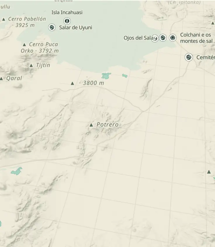
© OpenStreetMap · OpenFreeMap · © OpenMapTiles
Explore the map, read about the other places and plan your travel days in the app.
Open the appWhat to see
Uyuni Salt Flat: The absolute flatness and the water
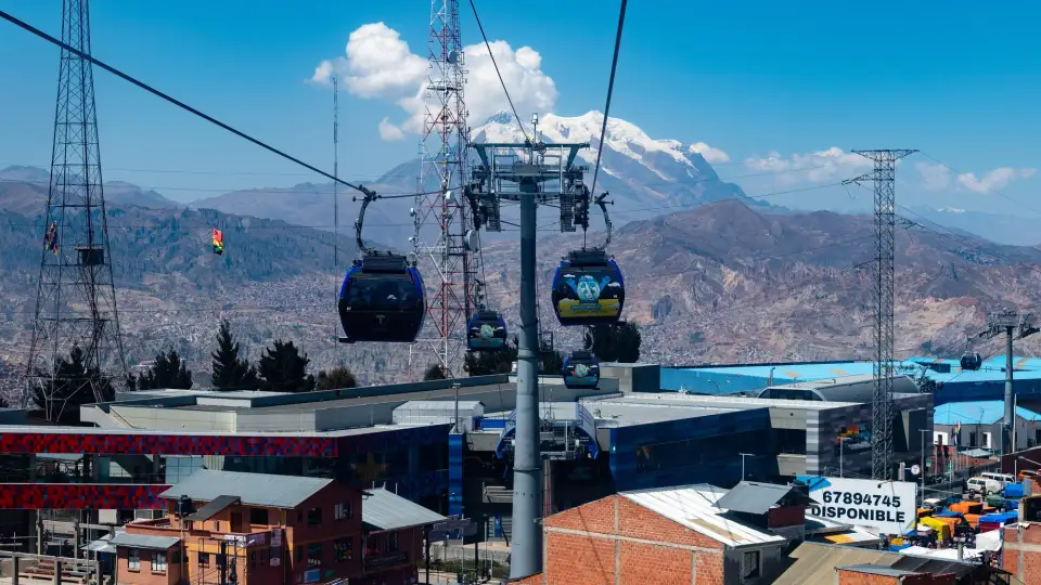
Uyuni is a flat grid around the railway: the tracks cut through the city from north to south, Avenida Ferroviaria runs alongside them with craft stalls, money changers and thermal-clothing shops, and within five or six blocks the streets dissolve into the altiplano.

Salar de Uyuni
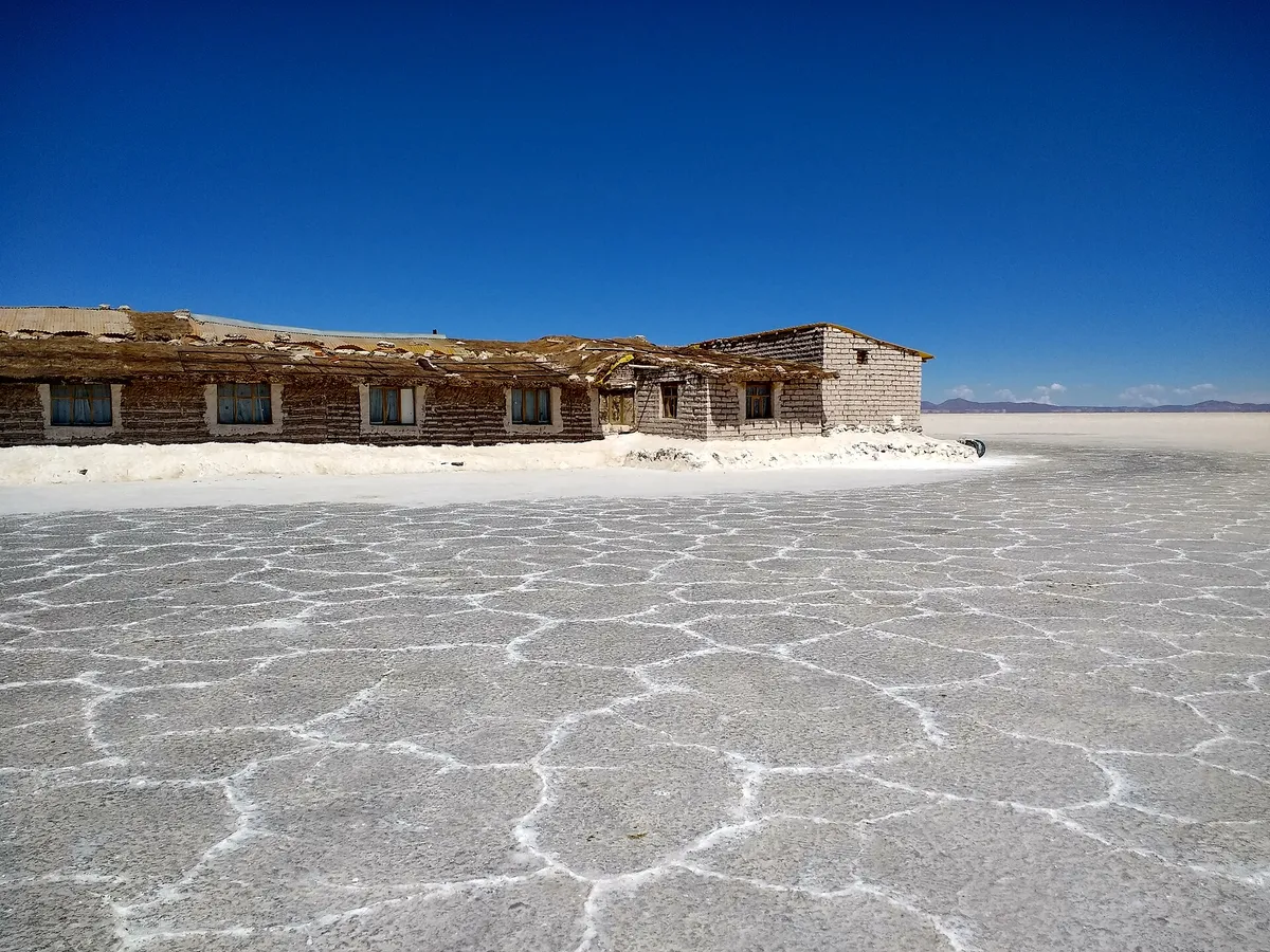
The world's largest salt flat covers 10,582 km² of salt crust at 3,656 m. In the dry season the surface forms hexagonal polygons 0.8 to 1.5 m on a side, shaped by brine convection beneath the crust; in the rain, a sheet of 5 to 15 cm of water turns everything into a mirror; above that, parts of the salt flat close to traffic.
In the dry season the crust forms polygons, with rain the 5 to 15 cm sheet becomes a mirror, and above that parts of the salt flat close to traffic, over an area of 10,582 km² at 3,656 m.
Check access
Train Cemetery
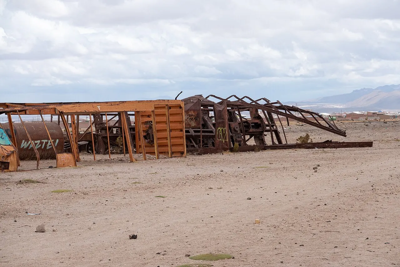
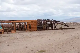
About thirty British steam locomotives and railcars from the 1900s to the 1940s, abandoned 3 km southwest of the city after the tin collapse. Free entry, no fence and no guard; the light is best before 9am.
Check access

Isla Incahuasi
A former reef of a submerged volcano, now a rocky island of 24 hectares about 80 km from the city, covered in Echinopsis atacamensis cacti up to 10–12 m tall that grow about 1 cm a year. Entry 30 Bs in cash; a 45-minute trail to the top, 100 m above the crust.
The former reef of a submerged volcano is covered with Echinopsis atacamensis cacti that grow about 1 cm a year, the entry fee is 30 Bs in cash and the trail to the top takes 45 minutes.
Check access

Colchani and the salt mounds
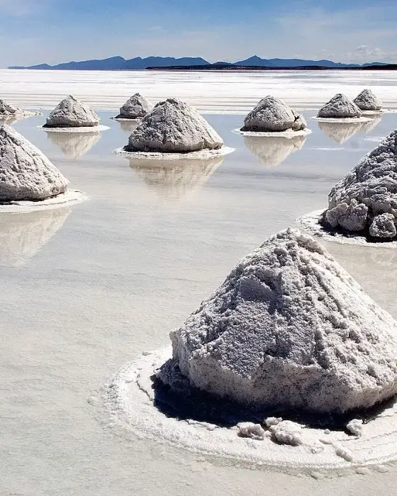
Family cooperatives scrape the crust into cone-shaped mounds about 1 m tall to dry before grinding and iodizing. The region's artisanal output runs around 25,000 tons a year, almost all for Bolivian domestic consumption.
A tour stop 22 km from the city, right at the entrance to the salt flat: you can see family cooperatives scraping the crust into conical mounds about 1 m tall, which dry before becoming table salt, in an artisanal production of about 25,000 tons a year.
Check access
Tunupa volcano
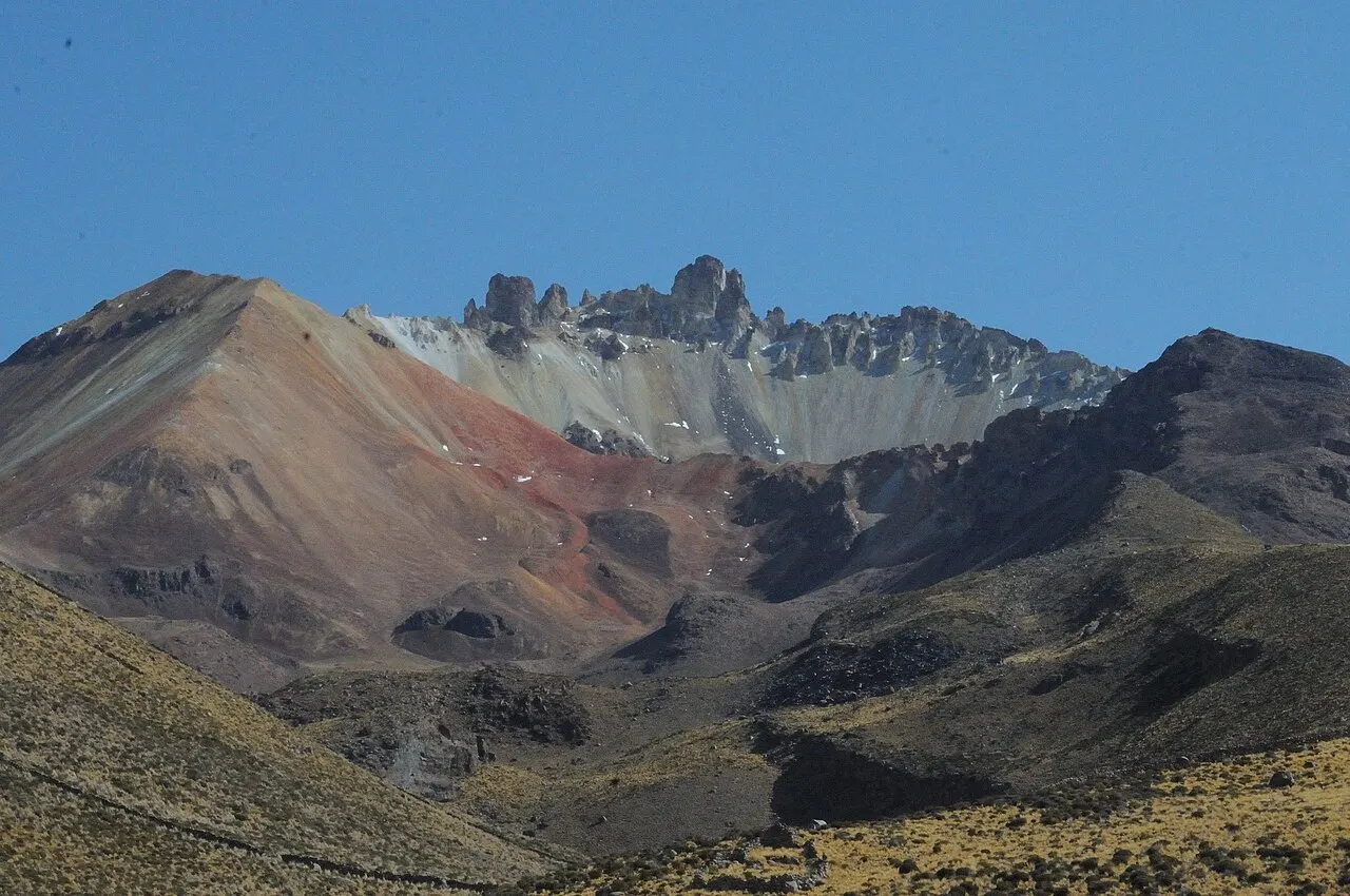
A stratovolcano of 5,321 m on the northern edge, with slopes streaked red, ochre and green by oxidation. The usual climb starts from Coquesa and goes up to the lookout at about 4,200 m, in 2 to 3 hours round trip.
The 5,321 m cone on the northern edge shows slopes colored by oxidation, and the usual hike starts from Coquesa and stops at the lookout at about 4,200 m, well below the summit, in 2 to 3 hours round trip.
Check access

Coquesa mummies
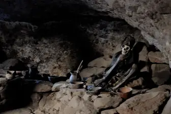
Pre-Hispanic bodies in fetal position, attributed to local populations from about 500 to 1,200 years ago, preserved by the dry air in a lava cave on the Tunupa's slope. Visit with a community guide and a local fee of 15–20 Bs.
The bodies in fetal position, about 500 to 1,200 years old, are preserved by the dry air in the Tunupa's cave, and the visit requires a community guide and a local fee of 15 to 20 Bs.
Check access
Laguna Colorada
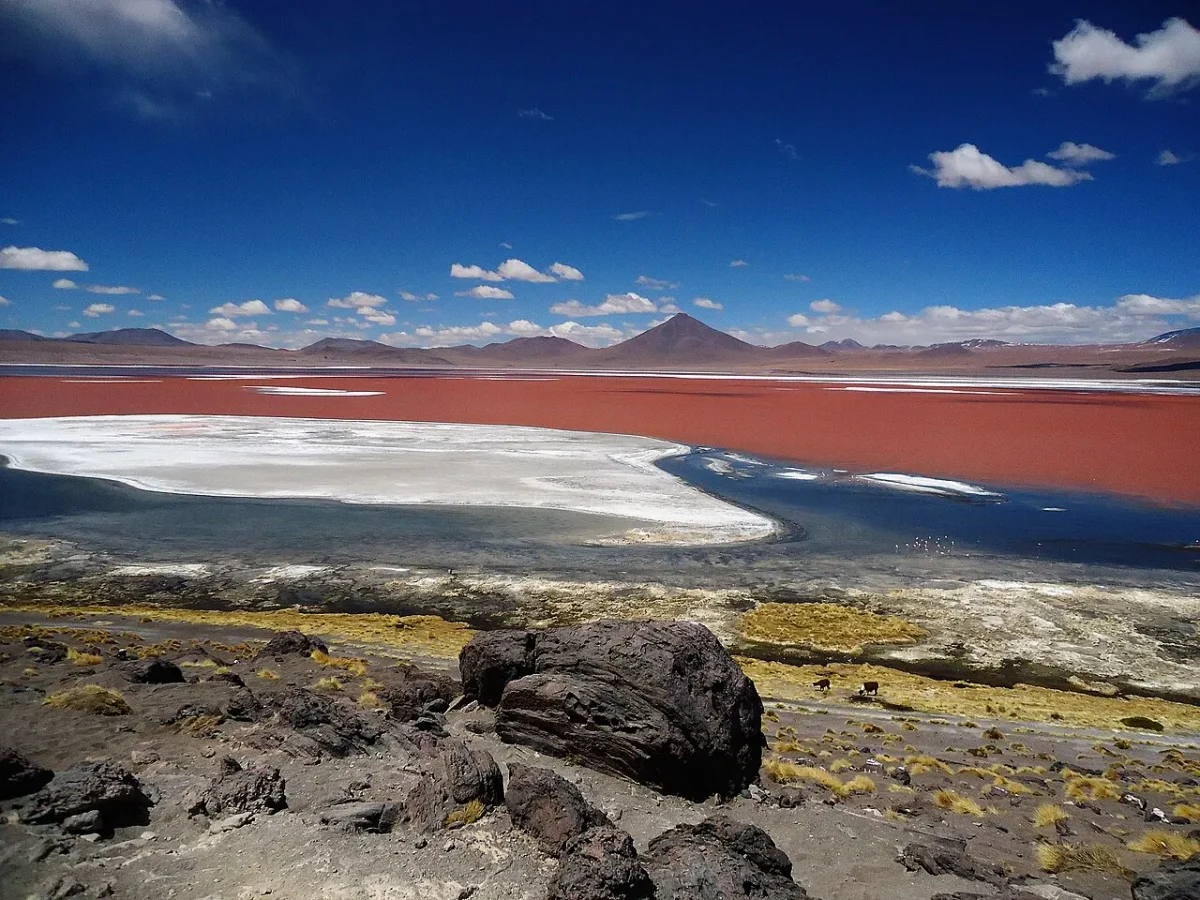
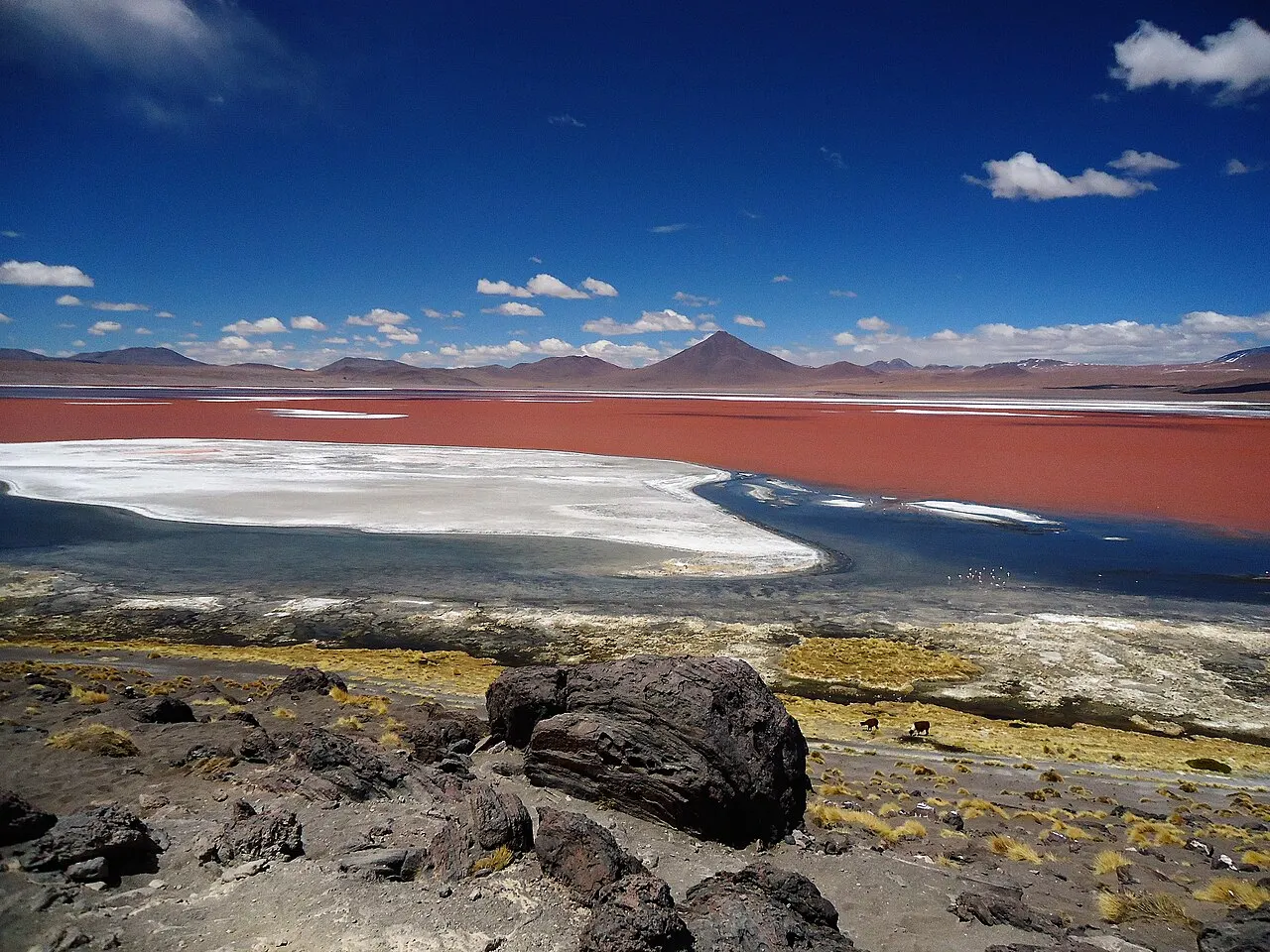
A shallow lake of 60 km² at 4,278 m, inside the Eduardo Avaroa Reserve, colored red by algae and sediment. It's home to all three Andean flamingo species, including the James's flamingo (parina chica), rediscovered there in 1957.
It's the stop that justifies the three-day circuit: the shallow lake at 4,278 m turns red from algae and sediment and gathers the three species of Andean flamingo.
Check access

Sol de Mañana and Laguna Verde
A geothermal field of fumaroles and boiling mud pools at about 4,850 m, visited at dawn, and the turquoise-green lagoon at 4,350 m at the foot of the Licancabur volcano (5,916 m), whose color comes from dissolved arsenic and magnesium.
The circuit reaches the Sol de Mañana geysers, at about 4,850 m, at dawn, and continues to the Laguna Verde, at the foot of the Licancabur, whose turquoise color comes from dissolved arsenic and magnesium.
Check access

Ojos del Salar
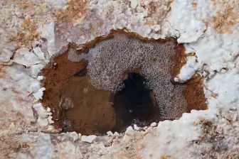
Pools where pressurized groundwater breaks through the crust and bubbles to the surface, a few kilometers from Colchani. They're unprotected: the edge is thin and the water is saturated with salt, so you don't step in.
Worth ten minutes if the jeep already passes by on the way back: the water bubbling up in the middle of the salt is curious, but doesn't justify a detour on the way to Incahuasi, and the thin edge doesn't let you get close.
Check access
Nilo’s itinerary
Start with the basic programme and choose extensions for the time you have.
Plan my days in the app ↗Day 1 · Acclimatizing, trains and choosing an agency
Arrive in the morning, drop your bag and walk slowly: at 3,669 m, the first day is for moving little and drinking water and coca tea.
Go to the Train Cemetery, 3 km southwest, on foot in 40 minutes or by mototaxi for 10–15 Bs; the light and quiet are best before 9am.
Compare three agencies on Avenida Potosí: ask to see the jeep, confirm the seatbelts, the exact route, whether there's a second driver and what's included in cash.
Have lunch at the municipal market for 15–30 Bs and try api con pastel; in the afternoon, buy a hat, gloves and SPF 50 sunscreen on Avenida Ferroviaria.
Have an early dinner, set your thermal clothes aside and sleep under two blankets: the city's low sits between −5 and −15 °C in winter.
Day 2 · Crossing the salt flat to Incahuasi
Head out around 10:30am toward Colchani (22 km) and see the salt mounds, the cooperative, the museum and the craft market where the blocks are sawn.
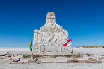
Stop at Playa Blanca, the Dakar salt monument and the flag plaza, already out on the crust.
Hike the 45-minute trail on Isla Incahuasi among cacti up to 12 m tall, with a 360° view of the white plain; entry costs 30 Bs in cash.
Have lunch on the crust, cooked by the jeep's cook, and take the perspective photos in mid-afternoon, when shadows are short.
Watch the sunset on the crust or on the sheet of water, depending on the season, and head back to Uyuni around 7pm.
Day 3 · North of the salt flat: Tunupa, Coquesa and Ojos del Salar
Leave at 8am crossing the salt flat toward Tahua, at the northern foot of the Tunupa volcano (5,321 m), 3 to 4 hours by jeep depending on the route.
Visit the Coquesa mummy cave with a guide, with a community fee of 15–20 Bs, and the chullpas on the slope.
Climb the Tunupa from Coquesa to the lookout at about 4,200 m, 2 to 3 hours round trip, with views of the oxide stripes and the entire salt flat.
Have a lunch of royal quinoa and llama meat in Tahua and talk with the producers about the grain's cycle.
Return along the eastern side, stopping at the Ojos del Salar, where groundwater bubbles up through the crust, and reach Uyuni at nightfall.


Food
 AI illustration
Api con pastel
A hot, thick drink of purple corn with cinnamon and clove, served with a fried pastry filled with cheese. The market's standard breakfast, from 6 to 10am, for 8–15 Bs.
 AI illustration
Ch'arki de llama
Llama meat salted and dehydrated by the altiplano's sun and cold, a pre-Hispanic method. It shows up fried with corn and egg in charquekan, or rehydrated in soups on the jeep circuit.
 AI illustration
Royal quinoa
A large-grain variety grown at the edge of the salt flat and in Salinas de Garci Mendoza, the only region in the world where royal quinoa grows. It comes in soup (sopa de quinua), in pesque with cheese and milk, or as a side to llama steak.
 AI illustration
Salteña
A baked pastry of slightly sweetened dough with broth, meat or chicken, potato, olive and egg. Sold in the morning until it runs out, around 11am; 6–12 Bs each.
 AI illustration
Chuño and tunta
Potatoes dehydrated by a cycle of freezing overnight, treading and drying in the sun: chuño is the dark version, tunta the white one washed in running water. They accompany almost every hot dish in the region and are the altiplano's oldest preservation technology.
 AI illustration
Pique macho and chairo
Two hearty lunch dishes: pique macho is cubed meat with fried potatoes, onion, tomato and locoto; chairo is a thick soup of chuño, lamb and vegetables. Both for 25–45 Bs at a street restaurant.
 AI illustration
Llajua
A fresh sauce of locoto and tomato ground on stone, present at every Bolivian table. It's made fresh and its heat varies from house to house; taste it before dousing your plate.
 AI illustration
Singani and chuflay
A muscatel grape brandy distilled in Tarija, with Bolivian denomination of origin. Drunk straight or in a chuflay, with ginger ale, ice and lime; at 3,600 m the effect kicks in faster than at sea level.
Day trips

Southwest circuit and Eduardo Avaroa Reserve: 3 days, about 600 km round trip
The classic jeep route: Laguna Colorada (4,278 m) with flamingos, the Sol de Mañana geysers (about 4,850 m) at dawn, the Polques hot springs, the Stone Tree in the Siloli desert and Laguna Verde at the foot of Licancabur (5,916 m). Reserve entry 150 Bs in cash; nights at 4,200 m with no heating. You can also end the circuit here and cross straight into Chile.

Pulacayo: 22 km, 30 minutes by car
Former camp of the Huanchaca silver mine, worked since 1833 and essentially frozen in time since the 1950s. It holds the first locomotive to run in Bolivia and a railcar that local tradition links to the robbery by Butch Cassidy and the Sundance Kid, killed in San Vicente, to the south, in 1908.

San Cristóbal and the southern route: 90 km, 1 hour 30 minutes by road
An entire village moved stone by stone in the 2000s to make way for an open-pit silver, zinc and lead mine, including the 17th-century colonial church, rebuilt on the new site. It's the natural stop for those continuing on to Villa Alota and the reserve.
Where to begin
Acclimatizing, trains and choosing an agency
Arrive in the morning, drop your bag and walk slowly: at 3,669 m, the first day is for moving little and drinking water and coca tea.
Crossing the salt flat to Incahuasi
Head out around 10:30am toward Colchani (22 km) and see the salt mounds, the cooperative, the museum and the craft market where the blocks are sawn.
North of the salt flat: Tunupa, Coquesa and Ojos del Salar
Leave at 8am crossing the salt flat toward Tahua, at the northern foot of the Tunupa volcano (5,321 m), 3 to 4 hours by jeep depending on the route.
Money
The currency is the boliviano (Bs). After decades with a managed exchange rate of around 6.9 Bs to the dollar, the rate began to float, and in 2026 there's a significant gap between the official rate and that of exchange offices and street changers: treat any rate you read online as approximate and confirm it on the day. Uyuni is a cash economy, and the town's ATMs run empty on holidays and in July, so arrive with bolivianos withdrawn in La Paz, Sucre or Potosí. Cards work in hotels, some agencies and tourist-oriented restaurants, almost always with a 5% surcharge. At the market and in the communities, they don't. 2026 price ranges: api con pastel 8–15 Bs; set lunch 15–30 Bs; dinner at a tourist restaurant 45–90 Bs; beer 15–25 Bs; dorm bed 50–90 Bs; basic double room 150–300 Bs; salt hotel 600–1,500 Bs. One-day salt flat tour 200–350 Bs; three-day circuit 1,100–1,800 Bs (US$150–250). The circuit's entry fees are paid in cash, stop by stop: 150 Bs for the Eduardo Avaroa Reserve, 30 Bs for Isla Incahuasi, about 6 Bs for the Polques hot springs and 5 Bs for the restroom at each stop. Tipping isn't mandatory; the custom is 10% at tourist restaurants and 50–100 Bs per passenger, split between the driver and the cook at the end of the three-day circuit.
Getting there and around
Airport: 4 km north, with a daily flight from La Paz
Joya Andina Airport (UYU), opened in 2011, is about 4 km north of town and receives daily flights from La Paz (El Alto) on Boliviana de Aviación, lasting just under an hour; a taxi to the center costs 15–30 Bs. Overland, night buses from La Paz take 10 to 12 hours and cost 100 to 250 Bs depending on the seat (2026). Potosí is 4–5 hours away, Sucre 7–8, Oruro 6–7 and Tupiza 4–6, on paved roads. The bus companies are clustered near the market and the bus terminal, a few blocks from Plaza Arce. By train, Ferroviaria Andina links Oruro to Uyuni with two services: the Expreso del Sur, on Tuesdays and Fridays, leaves at 2:30pm and arrives around 9:20pm, and the Wara Wara del Sur, on Wednesdays and Sundays, leaves at 7pm and arrives at 2:20am, with fares from 60 to 150 Bs. Travelers coming from Chile do the three-day circuit in reverse: they leave from San Pedro de Atacama, start the tour at the Hito Cajón border post, pass the lagoons and finish at the salt flat and in Uyuni.
No public transport: the town is a 15- to 20-minute walk
There's no public transport in Uyuni, and none is needed: you can cross the whole town on foot in fifteen to twenty minutes, and mototaxis charge 5–15 Bs to anywhere, including the Train Cemetery. For Colchani there are shared minivans that leave from Avenida Ferroviaria when full, for 10–20 Bs, but the salt flat itself can only be crossed in a 4x4 with an agency: there are no marked roads, no signs, and navigation is by GPS and the driver's memory. Before booking an agency, check that the jeep has seat belts in every seat, a second driver and a radio, and avoid scheduling a night crossing. In 2026, the diesel shortage causes lines at gas stations and departure delays of a few hours; ask the day before whether the agency has already fueled up. Bikes can be rented at two or three agencies on Avenida Potosí for 60–100 Bs a day, and you can ride to Colchani on a windless morning; in the afternoon, wind and radiation make the ride back tough.
Safety
The real risks in Uyuni are environmental and road-related, not criminal, and it's worth understanding that before setting off. Altitude sickness is the most common: hydrate, avoid alcohol in the first 24 hours, drink coca tea and seek care if a persistent cough, confusion or shortness of breath at rest appears. Those are signs of pulmonary or cerebral edema and call for immediate descent. The second risk is transport: the salt flat and the Eduardo Avaroa Reserve have no marked road, rescue is slow, and there have been fatal collisions between tourist jeeps, including in 2008 and 2017. Choose an agency that states it rotates drivers and refuse a vehicle without seatbelts. Hypothermia and carbon monoxide are lodging hazards: don't sleep with a gas heater running without ventilation. UV radiation is extreme, and the salt's reflection causes corneal burns within hours without proper glasses. Crime against tourists is rare in the city; the typical incidents are luggage theft from overnight bus holds and at the terminal, so keep documents, money and electronics with you. In 2026, protests tied to the economic crisis and the fuel shortage produce road blockades and stoppages that can isolate Uyuni for a day or two. Check the state of the routes before buying a ticket and leave slack before an international flight. The local hospital is basic (serious cases go to Potosí, 4–5 hours away) and insurance with altitude and evacuation coverage makes sense here.
Etiquette tips
Wait out the ch'alla before boarding the jeep
Drivers and communities pour a bit of drink onto the ground for the Pachamama before setting off or entering the salt flat. It's not staged for tourists: stay quiet, let it finish, and only then get in.
Accept the coca leaves with both hands
The akhulliku circulates among drivers and workers at every stop. Taking a handful with both hands and returning the little bag the same way is the right gesture, even if you don't chew.
Ask before photographing people
In Colchani, Tahua, Coquesa and San Juan, photographing cooks, children, salt workers or llama caravans without asking is frowned upon. A “¿puedo?” settles it, and sometimes the answer is no.
Call the vendor caserita
In the market, “casera” or “caserita” is the normal form of address between vendor and customer and signals regular custom. “Señora” sounds formal and distant.
Don't stray from the tracks inside the salt flat
There are known routes and subtle signs that drivers read. Straying off them in the rainy season breaks the crust and opens holes the next car can't see, and in the dry season you get stuck in pockets of mud.
Wait out the tour delay without fighting the front desk
At the agencies on Avenida Potosí, the tour's departure is often delayed, and demanding punctuality from the clerk only creates friction without moving the jeep any faster. Wait calmly, and save your firmness for what was agreed: the jeep, the route and what's included.
Mistakes to avoid
Tacking Sucre or Chile onto the circuit
Tacking Sucre (2,750 m) or Chile straight onto the three-day circuit. The route sleeps above 4,200 m in Huayllajara and passes through Sol de Mañana at about 4,850 m. Without 24 to 48 hours of acclimatization at 3,600 m, soroche ruins the second day, and it's not rare for it to hit half the passengers in a jeep.
Avaroa and Incahuasi only take bolivianos
Arriving with only dollars or only a card. The Eduardo Avaroa Reserve entry (150 Bs), Isla Incahuasi (30 Bs), the restrooms and the communities only take bolivianos in cash, and Uyuni's ATM can be empty exactly on the day you need it.
Booking the tour on price, without seeing the vehicle
Booking the tour for the lowest price without seeing the vehicle. The recurring cause of serious accidents on the salt flat and the southern circuit is a tired driver, excessive hours at the wheel and alcohol. Ask to see the jeep, confirm the seatbelts, ask how many hours the driver drives a day and where he sleeps.
The light bounces back and burns from below
Underestimating sun and cold at the same time. The light bounces back off the crust and burns from below: the nose, the chin, the roof of the mouth of anyone walking open-mouthed. The lodging on the circuit's first night rarely has heating, with 5 to 8 °C inside the room before dawn.
Counting on the mirror on any given date
Counting on the mirror effect on any given date. In July there isn't a drop of water on the salt flat; in February there can be 30 cm and stretches closed off. If the mirror is the reason for the trip, go between mid-January and early March, and accept it's still a gamble.
Useful phrases
¿Cuánto cuesta, casera?
How much does it cost, ma'am? The normal address in the market and the stalls on Avenida Ferroviaria.
Estoy con soroche
I have altitude sickness. Just say this at any restaurant to get coca tea.
¿A qué hora salimos, en serio?
What time are we really leaving? A useful question the day before, asked with good humor at the agency's counter.
¿Hay agua caliente y calefacción?
Is there hot water and heating? The answer changes what you pack for the circuit's first night.
Imaynalla kashanki?
How are you?, in Quechua (i-mai-NA-lha ka-SHAN-ki). Common reply: “Waliqlla” (wa-LIK-lha), I'm fine.
Yuspagarasunki
Thank you, in Quechua (yus-pa-ga-ra-SUN-ki). In Spanish, “gracias” works everywhere.
Districts
Avenida Ferroviaria
The commercial axis parallel to the tracks, with craft stalls, money changers, thermal-clothing shops and the fair for the city's anniversary. It's where you rent rubber boots in the rainy season and buy a hat and gloves for 20–50 Bs.
Plaza Arce and the civic center
The main square, with the clock, the town hall and the church. It has the city's most reliable Wi-Fi cafés and is the meeting point set by nearly every agency.
Avenida Potosí
Bolivia's most concentrated tourist avenue, block after block of agencies.
Municipal market and terminal area
A covered market with soups, api con pastel and lunch for 15–30 Bs, surrounded by bus companies. It's busy from 6am to 10am and again in the late afternoon.
Barrio Estación and the Train Cemetery
The area around the Ferroviaria Andina station and, 3 km southwest, the field of abandoned steam locomotives. A windy area with no commerce, walked or reached by mototaxi.
Colchani
A village of about 600 people 22 km away, on the edge of the crust, where cooperatives scrape, dry, iodize and bag salt and saw the construction blocks. It has a craft market, a salt museum and the Dakar monument.
Tahua and Coquesa
Quechua and Aymara communities on the northern base of the Tunupa, on the other side of the salt flat. They live off royal quinoa, llamas and simple lodgings; they keep the pre-Hispanic chullpas and mummies in lava caves.
History
40,000–14,000 years ago · Lakes Minchín and Tauca
Two large lakes covered the central altiplano in successive glacial cycles. As they evaporated they left behind the Uyuni and Coipasa salt flats and lakes Poopó and Uru Uru.
12th–15th c. · Lípez, Killakas and the Inca
Aymara lordships control the edges of the salt flat and the llama caravans that traded salt and dried meat for corn from the valleys. The Tawantinsuyu absorbs the region in the 15th century.
1545 · The silver of Potosí
The discovery of Cerro Rico, about 200 km to the northeast, creates the colonial mining economy that four centuries later would justify the railway. Salt from the salt flat supplied the amalgamation process and fed the mines.
1879–1884 · War of the Pacific
Bolivia loses its coastline to Chile and is left without a port of its own. The ore's outlet comes to depend on tracks that cross the altiplano to Antofagasta.
1889–1892 · The British railway
The tracks of the Antofagasta (Chili) & Bolivia Railway reach Uyuni in 1889 and Oruro in 1892. Uyuni becomes the largest railway junction in southern Bolivia, with workshops, a roundhouse and a water depot.
1890 · Founding of the city
On July 11, a decree by President Aniceto Arce officially founds the settlement, laid out in a rigid grid around the station. The date remains the municipal anniversary.
1900–1930 · Patiño's tin and Pulacayo's silver
Simón Patiño's tin and the silver from the Huanchaca and Pulacayo mines flow out through Uyuni's tracks. Hotels, a railway club, schools and a population of British, Chilean and Croatian immigrants appear.
1952–1964 · Nationalization and the end of steam
The 1952 Revolution nationalizes the mines under COMIBOL, and the railway is nationalized in 1964. Dozens of British steam locomotives are retired and abandoned 3 km southwest of the city.
1985 · Decree 21060 and the exodus
The economic adjustment closes state mines and lays off thousands of miners. Uyuni shrinks; part of the population migrates to Cochabamba, the Chapare and Argentina.
1993–1998 · The salt hotels and the jeep
Juan Quesada builds the first Palacio de Sal on the crust, near Colchani, with blocks sawn from the salt flat itself. 4x4 tourism replaces the railway as the city's main income.
2008–2023 · The State's lithium
Bolivia declares lithium a strategic resource and creates the state company now called YLB. In December 2023 the Llipi industrial lithium carbonate plant opens on the southern edge of the salt flat, with a nominal capacity of 15,000 tons a year.
 AI illustration
Complete history
An engineered city over a dry lakebed
Uyuni is an engineered city, but the geography came first: between 40,000 and 14,000 years ago, the paleo-lakes Minchín and Tauca covered the central altiplano; as they dried, they left an endorheic basin of 10,582 km² with a sodium chloride crust 2 to 10 meters thick, and beneath it, alternating layers of salt and mud saturated with brine. That brine concentrates lithium, potassium, magnesium and boron, and that's why a place with no river, no port and no tree ended up at the center of 21st-century Bolivian economic policy.
The basin was already a corridor before the tracks
Before the tracks, the basin was already a corridor. The Aymara lordships of the Lípez and the Killakas organized llama caravans that carried salt and ch'arki from the altiplano to the valleys of Cochabamba and Tarija and came back with corn and wood; the Inca absorbed the network in the 15th century and the colony reused it to supply Potosí, whose Cerro Rico began to be mined in 1545. Uyuni exists at the crossing of those two logics: the salt that always circulated and the metal that needed to get out.
A direct consequence of the War of the Pacific
The city is a direct consequence of the War of the Pacific. Landlocked since 1879, Bolivia handed the railway concession to the British Antofagasta (Chili) & Bolivia Railway, whose tracks reached the point where Uyuni now stands in 1889 and continued on to Oruro in 1892. The presidential decree that formally founded the settlement came shortly after, laying it out in a grid of wide streets around the station. Over the next three decades, Patiño's tin and Pulacayo's silver passed through there: workshops, a locomotive roundhouse, a railway club, hotels, and a mixed population of Bolivians, Chileans, British and Croatians.
From the fall of tin to the end of steam
Uyuni's decline followed that of tin and steam. The fall in tin prices from the 1930s on, the nationalization of the mines in 1952, the state takeover of the railway in 1964 and the switch from steam to diesel left dozens of British locomotives abandoned on the plain southwest of town. What tourism today calls the Train Cemetery is, in practice, a scrapyard nobody cleared away: the dry altiplano air keeps the carcasses standing, although the salt-laden wind speeds up the rust. The final blow came with Supreme Decree 21060, of 1985, which closed state mines and emptied the altiplano, and within a few years Uyuni lost its purpose and its population.
A salt hotel in 1993, then jeep tourism
The reinvention began with a salt hotel. In 1993, Juan Quesada built a hotel of salt blocks near Colchani, and in the 2000s the three-day jeep circuit to the Andean park to the south turned the city into a logistics base. The Dakar Rally crossed the salt flat between 2014 and 2018 and left behind a monument and a grove of flagpoles at the entrance to Colchani. At the same time, the Bolivian state declared lithium a strategic resource and opened the Llipi lithium carbonate plant on the southern edge in December 2023. Since 2025, though, the currency crisis and diesel shortages have disrupted the routine again: in 2026 there are fuel lines, unstable boliviano exchange rates and occasional road blockades, and tour prices quoted in dollars change week to week.
Geography and shape of the city
The absolute flatness and the water
Uyuni sits on the southeastern edge of the salt flat's endorheic basin, at 3,669 m, on absolutely flat terrain. The elevation difference across the entire salt flat, over more than a hundred kilometers, is a few decimeters, which made it the calibration surface for satellite altimeters like ICESat. There's no permanent river in the city; water comes from wells and from the Tunupa's slopes, and the only significant watercourse in the region, the Río Grande de Lípez, enters the salt flat from the south.
The railway grid
The urban layout is a classic railway grid: the railway line cuts the city north to south, Avenida Ferroviaria runs parallel to the tracks as the commercial axis, and the streets cross at right angles until they dissolve into the altiplano after five or six blocks.
Colchani, the volcanoes and the climate
To the north, 22 km away, Colchani marks the entrance to the crust; to the northwest rises the Tunupa volcano (5,321 m); to the southwest, the land climbs toward the Siloli desert, the altiplano lagoons and the volcanic chain of the Chilean border, with Licancabur at 5,916 m. The climate is high-altitude desert: a daily temperature swing of 25 to 30 °C, annual rainfall of around 100–200 mm concentrated between December and March, steady afternoon wind and extreme ultraviolet radiation, amplified by the salt's albedo.
Culture
Quechua, Aymara and the ch'alla ritual
Uyuni's population is Quechua and Aymara, in a town laid out by the railway. Spanish dominates commerce, but Quechua is the language of the surrounding communities (Colchani, Tahua, Coquesa, San Juan de Rosario) and resurfaces at the markets, in nicknames and in prayers. The Andean calendar overlaps the Catholic one without visible conflict: the ch'alla, the gesture of pouring a drink on the ground for the Pachamama, is done before setting out in the jeep, when inaugurating a house and at Carnival, and nobody treats it as folklore. Llama caravans still exist in small numbers, and raising camelids and growing royal quinoa remain the livelihood of the families who haven't gone into tourism.
Music of the Potosí altiplano: charango, sikus, bumbo drum
The region's music is that of the Potosí altiplano: ten-string charango, sikus, bass drum, and the huayño and tinku repertoire that shows up at civic festivals. The biggest reference is Luzmila Carpio, a Quechua singer born in Qala Qala, in northern Potosí, who recorded in Quechua when that wasn't done on record. Half a day away by bus, Oruro hosts the biggest mask festival in the Andes every February, inscribed by Unesco in 2001, and many Uyuni residents travel there to dance. In the city itself, nightlife is short: two or three bars on Avenida Potosí that close around midnight, because the next day's tour leaves early.
Salt-flat photography became the economy
What Uyuni produces today, besides salt and quinoa, is image. Perspective photography on the crust and the sky's reflection on the water sheet became a visual genre recognizable worldwide, and the local economy has organized itself around it: drivers who know the hour and the angle, agencies that carry props, lodgings built from blocks sawn from the ground itself. The salt flat is also a film set: Werner Herzog shot there in 2016, and the Star Wars production used the white plain as the planet Crait in 2017. The underlying tension is lithium: the state plant at Llipi has operated on the southern edge since 2023, and the debate over how much brine can be pumped without affecting the mirror and tourism runs through any local conversation about the future.
Before heading out onto the salt flat, many drivers pour a little drink on the ground for the Pachamama: it's the ch'alla, and passengers wait for the gesture to finish before getting in.
The drivers know how to set up the perspective photo on the salt, and usually position passengers using only arm gestures.
Festivals and events
 AI illustration
Uyuni's anniversary: July 11
A civic parade, school bands and a fair on Avenida Ferroviaria mark the 1890 founding decree. It's the busiest week of winter, with hotels full and nighttime lows of −15 °C.
 AI illustration
Carnival and the ch'alla: February or March
Three days of comparsas, water and streamers, preceded by the ch'alla: houses, shops and jeeps are decked out with streamers and doused with alcohol and beer for the Pachamama. Many people travel to the Carnival of Oruro, about 7 hours away by bus.
 AI illustration
Day of the Sea: March 23
A civic date, with no official day off, that marks the loss of the coastline in 1879. Schools parade with flags and sing the naval march at 3,669 m of altitude and 400 km from the nearest ocean.
Willkakuti, Andean New Year: June 21
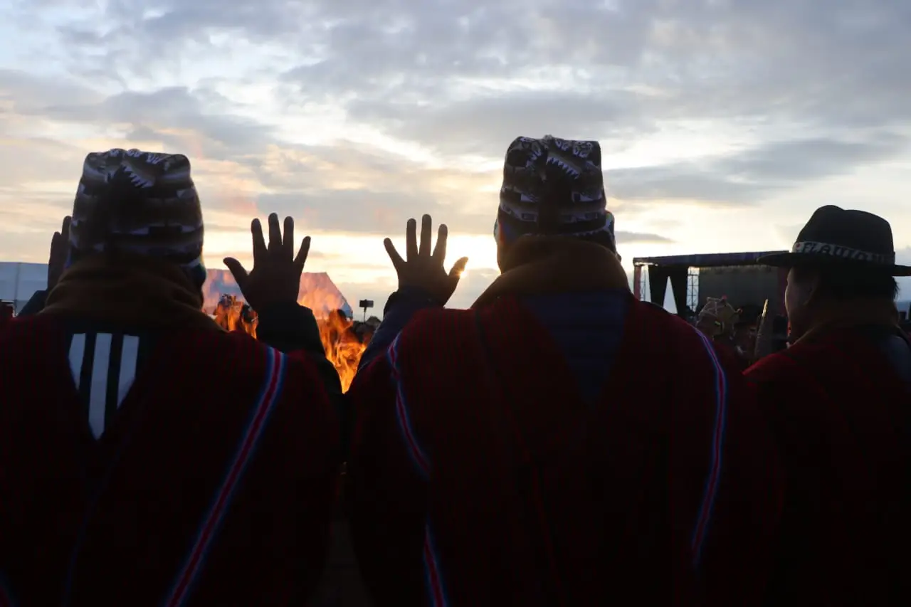
Welcoming the solstice's first sunlight in altiplano communities, with offerings and a vigil. The night before tends to be the coldest of the year in the region, with lows below −15 °C.
 AI illustration
All Saints: November 1 and 2
Tables are set with t'anta wawas (bread shaped like children), fruit and the deceased's favorite food; on the 2nd, families spend the day at the cemetery. Restaurants and agencies run on reduced hours.
Books and films
Open Veins of Latin America, Eduardo Galeano (1971)
The chapter on the silver of Potosí explains why a British railway crosses a salt desert, and why today's debate over lithium sounds so familiar to residents.
Salt and Fire, by Werner Herzog (2016)
Shot on the salt flat itself and in the Tunupa region, it's the film that best captures the scale and the absence of horizon of the plain, with the crust and the ojos as characters.
Yuyay Jap'ina Tapes, by Luzmila Carpio
Recordings by the Quechua singer born in northern Potosí, with charango, children's chorus and lyrics in Quechua: the real soundtrack of the altiplano that begins on the way out of Uyuni.
Frequently asked questions
Uyuni Salt Flat: can you arrive from Sucre or Chile and head straight into the circuit?
Not without acclimatizing: the route sleeps above 4,200 m in Huayllajara and passes through Sol de Mañana at about 4,850 m. Without 24 to 48 hours at 3,600 m, soroche ruins the second day.
Uyuni Salt Flat: how do you get there by plane?
The Joya Andina Airport (UYU) is about 4 km north of town and receives daily flights from La Paz on Boliviana de Aviación, lasting just under an hour. A taxi to downtown costs 15 to 30 Bs.
Uyuni Salt Flat: what do you see on the three-day southwest circuit?
The classic jeep circuit passes the Laguna Colorada (4,278 m), with flamingos, the Sol de Mañana geysers at dawn, the Polques hot springs, the Stone Tree and the Laguna Verde, at the foot of the Licancabur (5,916 m).
Uyuni Salt Flat: how should you carry money for the trip?
In bolivianos in cash, withdrawn in La Paz, Sucre or Potosí: Uyuni runs on cash, and the city's ATMs run empty on holidays and in July. The exchange rate has started floating, so confirm the rate on the day.
Uyuni Salt Flat: is it better to go in the dry season or the rainy season?
It depends on what you want to see: from May to October, in the dry season, the sky is clear and the firm crust shows the hexagons; from mid-January to early March, the rain can leave the sheet of water for the mirror effect, but it's not guaranteed on any date. You can't have both in the same week.
Other cities in the country
Bolivia ↗- Days
- 2–3
- When
- May–Sep
- Per person/day
- Average 70–110 USDMid-range · per person/day
Cost scope
Per person per day: accommodation, meals, urban transport, visits and a small allowance for extras. Flights excluded; larger purchases vary. Editorial estimate, not a quote.