Bolivia
La Paz
Cable cars over the canyon, Aymara markets and Alasitas
Days Start with the basic programme and choose extensions for the time you have.
How the guide reaches this number
A third, if you have it, goes to Tiwanaku or Copacabana, outside the valley. It's not a city for anyone in a hurry, because at 3,640 m every hill costs breath. With only one day, have api con pastel at Mercado Lanza before 9am and walk on to Plaza Murillo and Calle Jaén. Eat a salteña before noon, when they run out. This means missing the clear view at 8am, so take the Red Line in the afternoon up to El Alto, cross the valley on the Yellow Line and finish at the Killi Killi lookout, watching the city light up. Anyone expecting a postcard center will be disappointed: the Casco Viejo has half a dozen colonial blocks, and the Choqueyapu River runs buried under the Prado. The Valle de la Luna, for its part, can be explored on a 45-minute hike.
2–3
When May to September: dry season, clear skies, dawns near 0 °C
How the guide reaches this number
In La Paz, the year divides into a dry season and a rainy season, and the downtown average stays near 11 °C all year. Within a single day, however, temperatures can swing by 20 °C. From May to September it's dry, with clear skies, 15–18 °C in the midday sun and −2 to 3 °C before dawn. June and July are the coldest months. From December to March it rains almost every afternoon, hail falls, traffic seizes up and trails turn to mud. On the other hand, the valley turns green and there are far fewer people. April and October are comfortable, inexpensive transition months. High season runs from June to August, peaking during the June festivals: book hotels and buses to Copacabana in advance. The UV index tops 11 almost every day of the year, so at noon sunscreen and sunglasses count for more than a jacket. You'll want the jacket again at 6pm, when the sun disappears behind the canyon rim.
Per person/day US$25–45 per person traveling simply; US$70–110 with a mid-range hotel
How the guide reaches this number
Per person per day: accommodation, meals, urban transport, visits and a small allowance for extras. Flights excluded; larger purchases vary. Editorial estimate, not a quote.
 What Nilo thinks
La Paz calls for two days, allowing for the altitude: the first in the historic center, taken slowly, and the second in the canyon seen from the cable car and El Alto. A third, if you have it, goes to Tiwanaku or Copacabana, outside the valley. It's not a city for anyone in a hurry, because at 3,640 m every hill costs breath. With only one day, have api con pastel at Mercado Lanza before 9am and walk on to Plaza Murillo and Calle Jaén. Eat a salteña before noon, when they run out. This means missing the clear view at 8am, so take the Red Line in the afternoon up to El Alto, cross the valley on the Yellow Line and finish at the Killi Killi lookout, watching the city light up. Anyone expecting a postcard center will be disappointed: the Casco Viejo has half a dozen colonial blocks, and the Choqueyapu River runs buried under the Prado. The Valle de la Luna, for its part, can be explored on a 45-minute hike.La Paz occupies the walls of an Andean canyon. From its rim at El Alto, at 4,100 m, you can see the entire city at once, with unplastered brick houses on the slopes and Illimani in the background. Ride down the canyon wall by cable car, on the world's largest urban network, alongside commuters. Here the wealthy neighborhoods lie lower down, in the Zona Sur at 3,200 m, with more oxygen and a milder climate. Downtown, the Congress clock on Plaza Murillo runs backward, and at the Mercado de las Brujas the yatiris sell herbs, amulets and dried llama fetuses for offerings to Pachamama. Eat on the city's schedule: api con pastel at the market, a salteña in the morning before they sell out, and anticucho from a street cart at night. Come from May to September, in the dry season, and allow two days, including time to adjust to the 3,640 m altitude.
Quick facts
- Population
- about 760,000 in the municipality and about 1.9 million in the conurbation with El Alto (based on the 2024 census)
- Founded
- October 20, 1548
- Country and region
- Bolivia, department of La Paz; Andean altiplano, between 3,200 and 4,100 m
- Language
- Spanish and Aymara day to day; the 2009 Constitution recognizes 37 official languages
- Currency
- Boliviano (Bs, BOB); about Bs 12 per US$1 in September 2026
- Time zone
- UTC−4, no daylight saving
- Best time to visit
- May to September: dry season, clear skies, dawns near 0 °C
- Average daily cost
- US$25–45 per person traveling simply; US$70–110 with a mid-range hotel
When to go
May to September: dry season, clear skies, dawns near 0 °C
January
4° to 15°C
137 mm of rain
February
4° to 15°C
108 mm of rain
March
3° to 15°C
85 mm of rain
April
1° to 15°C
33 mm of rain
October
1° to 16°C
46 mm of rain
November
2° to 17°C
48 mm of rain
December
4° to 16°C
104 mm of rain
How the year changes
In La Paz, the year divides into a dry season and a rainy season, and the downtown average stays near 11 °C all year. Within a single day, however, temperatures can swing by 20 °C. From May to September it's dry, with clear skies, 15–18 °C in the midday sun and −2 to 3 °C before dawn. June and July are the coldest months. From December to March it rains almost every afternoon, hail falls, traffic seizes up and trails turn to mud. On the other hand, the valley turns green and there are far fewer people. April and October are comfortable, inexpensive transition months. High season runs from June to August, peaking during the June festivals: book hotels and buses to Copacabana in advance. The UV index tops 11 almost every day of the year, so at noon sunscreen and sunglasses count for more than a jacket. You'll want the jacket again at 6pm, when the sun disappears behind the canyon rim.
The same numbers as a table
| Month | Temperature °C | Rain mm |
|---|---|---|
| January | 4 to 15 | 137 |
| February | 4 to 15 | 108 |
| March | 3 to 15 | 85 |
| April | 1 to 15 | 33 |
| May · | -2 to 15 | 11 |
| June · | -4 to 14 | 7 |
| July · | -4 to 14 | 8 |
| August · | -3 to 15 | 10 |
| September · | -1 to 16 | 25 |
| October | 1 to 16 | 46 |
| November | 2 to 17 | 48 |
| December | 4 to 16 | 104 |
Nilo's tips
Go up by cable car at 8am, with the reloadable card
After 8am, the morning fog rises and hides the view of the valley. At the first ticket booth, ask for the rechargeable card: with it the first line costs Bs 3 and each transfer, Bs 2, while the single ticket charges the full fare again with every change. Go up on the Red Line to El Alto; to see the canyon with the Illimani straight ahead, cross on the Yellow Line.
Go to El Alto on Thursday or Sunday, fair days
The 16 de Julio fair in El Alto, at 4,050 m, only takes place on Thursdays and Sundays; on other days, anyone who goes up finds ordinary streets. If your day up there falls outside those dates, swap the fair for Freddy Mamani's cholets, the architect's colorful buildings near Avenida Alfonso Ugarte. At the fair, keep your wallet in front of your body, because it's where the most theft in the city happens.
Salteña until noon, anticucho after 7pm
Salteñas are sold from 8am to noon and they really do run out, and anticucho only appears at the carts starting at 7pm. On Sundays, fricasé also has its hour and disappears after 11am. For breakfast, api con pastel is available from 6am at Mercado Lanza or the Rodríguez, which peaks on Saturday mornings.
Change money by Friday: on weekends the ATMs run out of bills
ATMs run out of bills on weekends and holidays. Exchange money at a casa de cambio on Calle Colón or the Prado, with your passport and dollars in new bills: a torn note is refused at the counter, no discussion. Ask for small bills, because street stalls rarely have change for Bs 100.
Go down on foot, up by cable car
The hills reach a 20% grade, and the map is misleading, because just a few blocks can change the altitude a lot. Plan the day in the downhill direction, from Sagárnaga to San Francisco, and do every uphill stretch by cable car or minibus. On the minibus, the fare is Bs 2–3 and the conductor shouts the route out the window; to get off, shout “¡Esquina, por favor!”
Head to the airport with a wide margin
Roadblocks and protests close the Prado, Plaza Murillo and access to the airport without warning. In 2025 and 2026, protests over fuel and prices were frequent. On the morning of your flight, check the local press and double the expected travel time, since on a normal day the taxi from the arrivals hall takes 30–45 minutes. Since there's no Uber, call inDrive, Yango or a radio taxi and check the license plate before getting in.
Explore the map
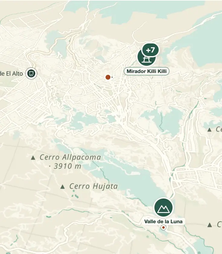
© OpenStreetMap · OpenFreeMap · © OpenMapTiles
Explore the map, read about the other places and plan your travel days in the app.
Open the appWhat to see
La Paz: The canyon and the three altitudes
The administrative center sits around 3,640 m; the Zona Sur drops to 3,200 m; El Alto, on the western rim, sits at 4,050 to 4,100 m. The higher the neighborhood, the less oxygen and the colder it gets, which is why the wealthy neighborhoods are down below.
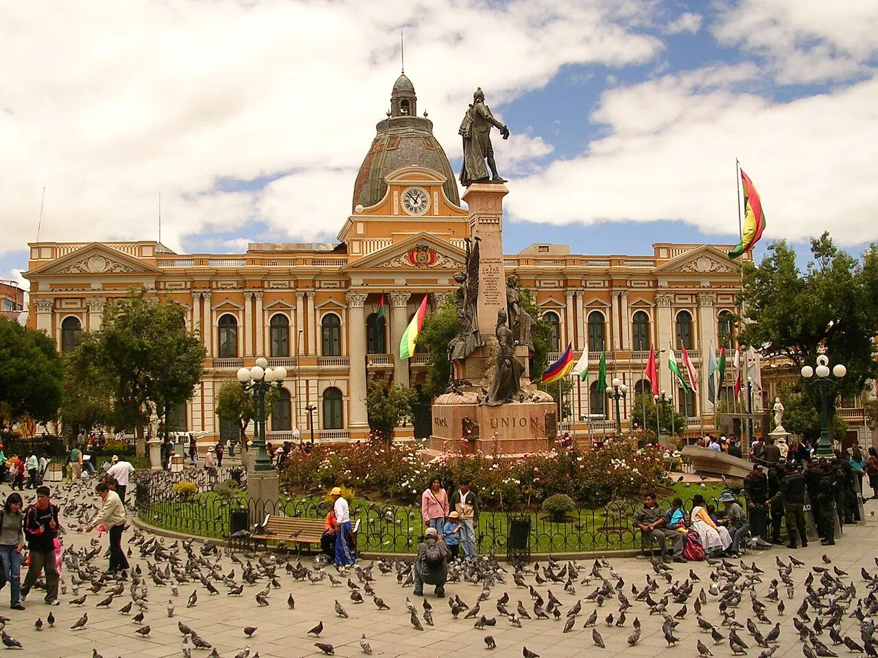
Plaza Murillo
The central square since the 16th century, with the metropolitan cathedral completed in 1925, the Palacio Quemado (burned in 1875 and rebuilt) and the Casa Grande del Pueblo, a 29-story tower opened in 2018. On the Congress building, the clock hands have run backward since 2014, an idea from then-foreign minister David Choquehuanca to mark a “southern time.”
On the central square, the metropolitan cathedral was completed in 1925, the Palacio Quemado was burned down in 1875 and rebuilt, and on the Congress building the clock hands have run backward since 2014 because Choquehuanca wanted to mark southern time; the 29-story tower opened in 2018.
Check access
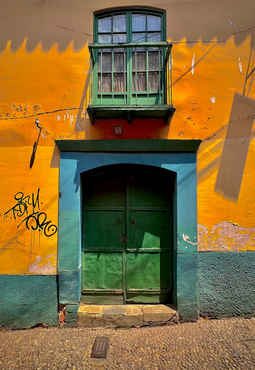
Calle Jaén
A colonial street about 200 m long, with preserved 18th-century houses and five municipal museums in a row, including the Litoral and the Precious Metals museums. A single cheap ticket covers all of them.
The colonial street measures about 200 m, with five municipal museums in a row, including the Litoral and the Precious Metals museums, and a single cheap ticket covers all of them. The 18th-century row houses remain preserved.
Check access

Mi Teleférico
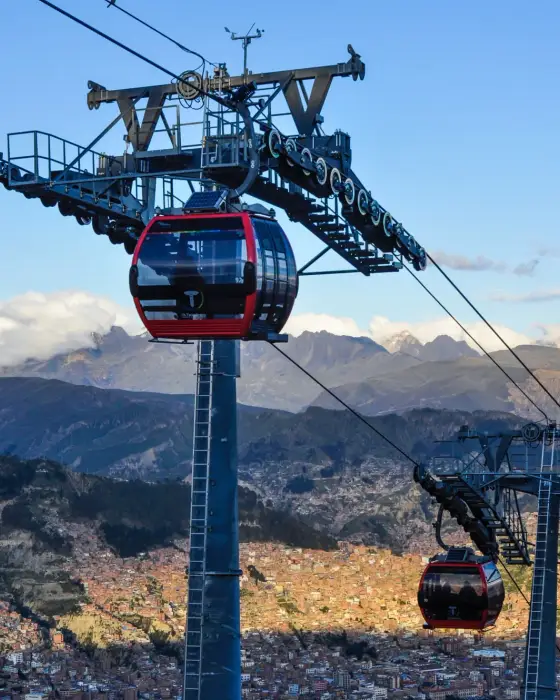
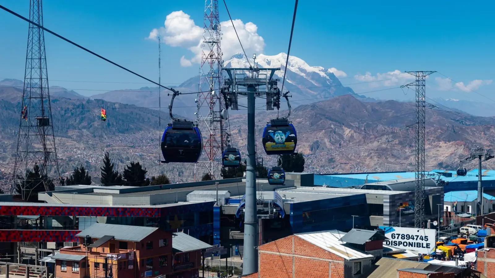
Ten color-coded lines, about 33 km, and more than 30 stations, opened starting May 30, 2014: the world's largest urban cable car network. The Red Line climbs to El Alto in about 10 minutes; the Yellow Line crosses the canyon with the best view of the Illimani.
Ten lines and more than 30 stations make up the world's largest urban cable car network; the Red Line climbs to El Alto and the Yellow Line has the best view of the Illimani; they date from May 2014 and add up to about 33 km.
Check access

Basilica of San Francisco
Founded in 1548 and rebuilt between 1743 and 1790, after snow brought down the first church. The mestizo baroque facade mixes Catholic saints with mermaids, monkeys, and Andean fruit; the museum ticket grants access to the choir, the crypt, and the roof.
The facade mixes Catholic saints with mermaids and monkeys.
Check access

Mercado de las Brujas
On Calles Linares and Melchor Jiménez, the yatiris sell herbs, resins, amulets, and dried llama fetuses, buried as an offering to the Pachamama beneath new buildings. Photographing the stalls without asking is frowned upon.
Llama fetuses are buried as an offering to the Pachamama.
Check access

Mirador Killi Killi
A ridge at about 3,750 m above downtown, from which Túpac Katari commanded the 1781 siege. A 360-degree view of the whole basin; best in the late afternoon or once the city lights are on.
From this spur, Túpac Katari commanded the siege of 1781.
Check access
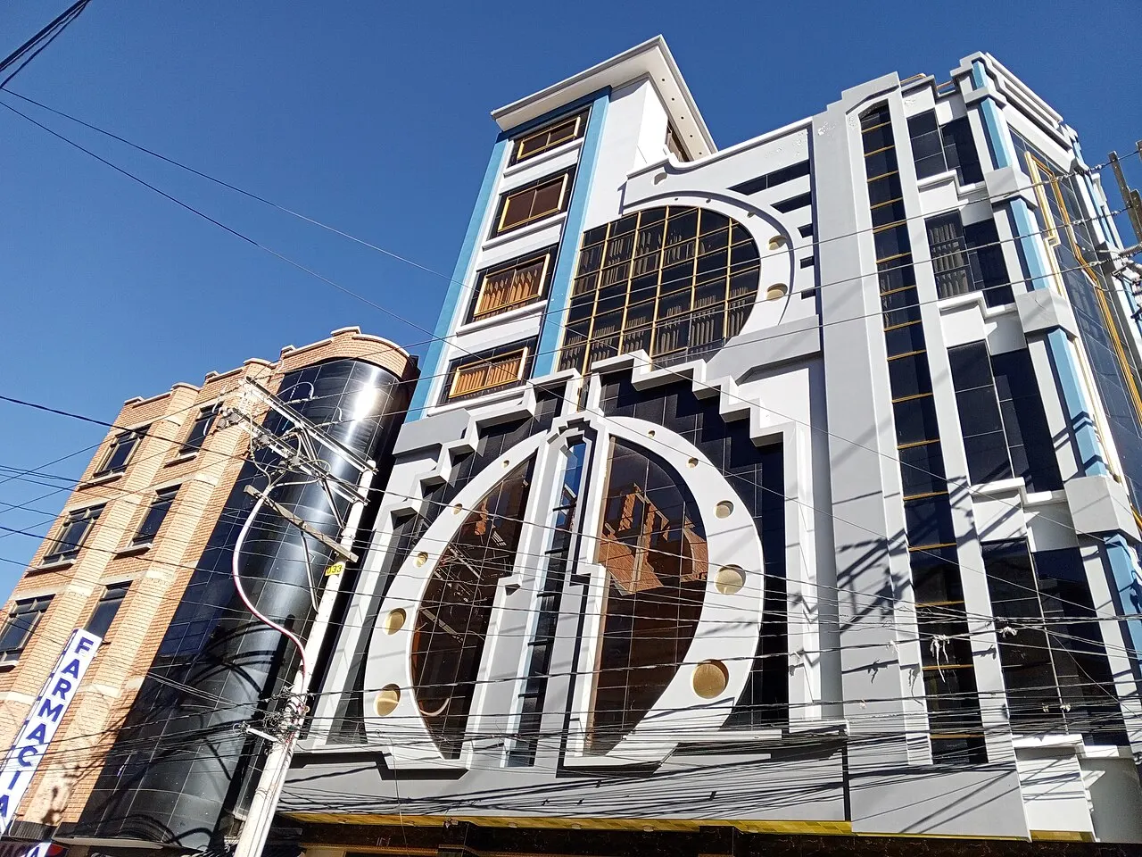
El Alto cholets
The five- to seven-story buildings that Freddy Mamani has designed since 2005 have boldly colored facades, a party hall on the first floor and patterns inspired by Tiwanaku iconography. The biggest concentration is near Avenida Alfonso Ugarte.
The buildings have a party hall on the first floor.
Check access
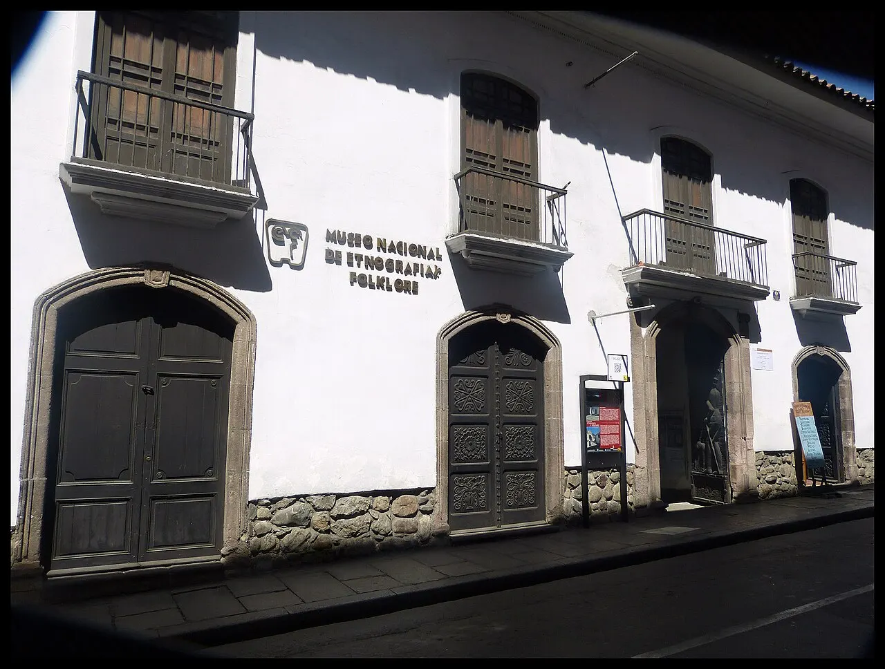
MUSEF
The National Museum of Ethnography and Folklore, housed in the 1775 palace of the counts of Arana, on the corner of Ingavi and Jenaro Sanjinés. The collection of dance masks and the jalq'a and candelaria textiles are the best introduction to the country.
Masks and textiles are the best introduction to the country.
Check access

Valle de la Luna
Eroded clay formations in Mallasa, about 10 km south of downtown, with two marked trails of about 15 and 45 minutes. The terrain is clay and sandstone, not rock: the shapes change with every rainy season.
These are clay formations about 10 km from downtown, with marked trails of 15 and 45 minutes, and the whole visit wraps up in an hour. It's worth it as a short stop on the way to the Zona Sur, but anyone expecting a nature park will be disappointed.
Check access
Nilo’s itinerary
Start with the basic programme and choose extensions for the time you have.
Plan my days in the app ↗Day 1 · Historic center, slowly
Have the paceño breakfast, api con pastel, at Mercado Lanza or Rodríguez before 9am.
Walk to Plaza Murillo to see the cathedral, the Casa Grande del Pueblo and the Congress clock running backward.
Walk up Calle Jaén and do two of the five municipal museums with the single ticket.
Eat a salteña before noon, on the street or at a downtown salteñería, because after that they're gone.
Visit MUSEF in the afternoon and walk down Sagárnaga to San Francisco, with nothing planned for the evening: this is your acclimatization day.
Day 2 · The canyon seen from above
Take the Red Line cable car up to El Alto around 8am, before the mid-morning fog.
On Thursday or Sunday, walk through the 16 de Julio fair; on other days, see Freddy Mamani's cholets near Avenida Alfonso Ugarte.
Come back via the Blue Line and switch to the Yellow and Green Lines, crossing the valley to Irpavi with a view of the Illimani.
Have lunch in San Miguel or Calacoto and compare prices and temperature with downtown, 400 m up.
Watch the sun go down from the Killi Killi lookout and eat anticucho from a street cart after 7pm.


If you stay longer
Day 3 · Outside the valley
Leave at 8am for Tiwanaku, 72 km west, about 1 hour 30 minutes by car or 2 hours by bus.
At the site, walk through the Gate of the Sun, the semi-subterranean temple with its tenon heads, the Akapana pyramid and the two museums, which close in the late afternoon.
Come back through El Alto and ride the cable car down with the sun low over the canyon.
Have dinner in Sopocachi and end the night with a chuflay at a bar on Calle Belisario Salinas.
Food
 AI illustration
Salteña
A baked pastry with slightly sweetened dough, filled with broth, beef or chicken, olive, egg, and potato. Sold from 8am to noon and then gone; hold it upright and bite the tip first so you don't lose the broth. Bs 8–15.
 AI illustration
Api con pastel
A market breakfast: api, a hot, thick purple-corn drink with cinnamon and cloves, served with a fried pastry with cheese and powdered sugar. Served from 6am at the Mercado Lanza and the Rodríguez.
 AI illustration
Anticucho
Charcoal-grilled beef heart skewers, with boiled potato and peanut sauce, sold from street carts from around 7pm. It's night food; no one eats anticucho at lunch.
 AI illustration
Fricasé
A pork soup with ají amarillo, mote corn, and chuño (potato freeze-dried by the altiplano cold) served boiling hot on Sunday mornings. It's La Paz's hangover dish, and it's gone after 11am.
 AI illustration
Plato paceño
Choclo corn, boiled fava beans, potato, and a thick slice of fried cheese, no meat. Local tradition ties its origin to the 1781 siege, when the city ran out of meat.
 AI illustration
Llajua
A fresh tomato sauce with locoto pepper and quirquiña, ground on stone, that sits on the table of every restaurant. You ask “¿hay llajua?” and the pot comes at no charge.
 AI illustration
Singani and chuflay
A brandy made from Muscat of Alexandria grapes distilled above 1,600 m, with Bolivian denomination of origin since 1992. The chuflay mixes singani, ginger ale, and lime, and is the standard drink in any bar in the city.
 AI illustration
Marraqueta paceña
Hard-crusted bread with an airy crumb, baked at 3,640 m, where the pressure changes the fermentation and the two-lobed shape. It costs pennies, comes out of the oven before dawn, and is what the whole city eats for breakfast.
Day trips

Tiwanaku
72 km to the west, about 1 hour 30 minutes by car or 2 hours by bus leaving from the Cementerio General. A ceremonial center that dominated the altiplano between 500 and 1000 AD; the Gate of the Sun and the Bennett monolith explain half the Andean iconography seen around the city. UNESCO World Heritage Site since 2000.
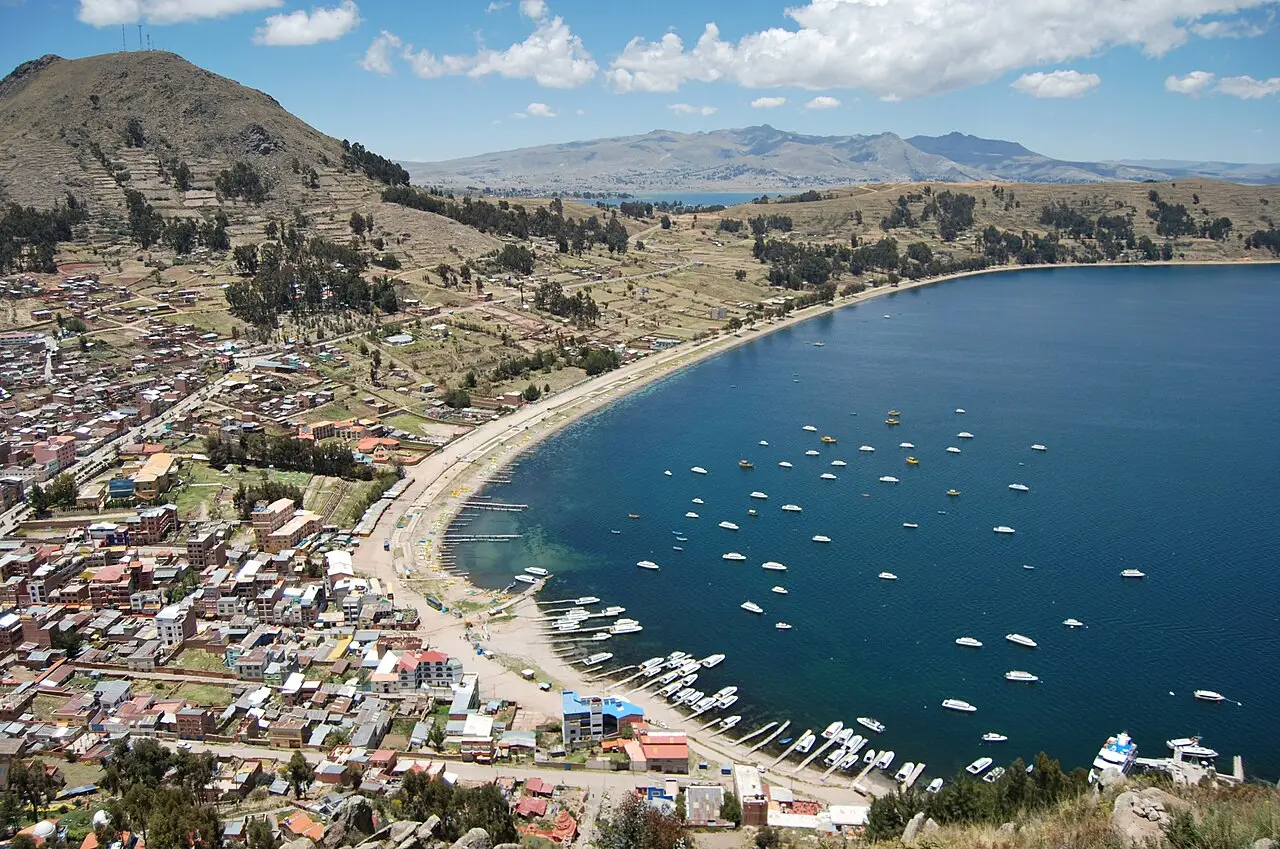
Copacabana and the Isla del Sol
155 km, 3 hours 30 minutes to 4 hours by bus, with a ferry crossing at the Tiquina Strait. A pilgrimage town on the shore of Lake Titicaca, at 3,812 m, with the Virgin of Copacabana carved in 1583; boats leave from there for about 1 hour 30 minutes to the Isla del Sol, where Inca mythology places the birth of the sun. It's worth spending a night.
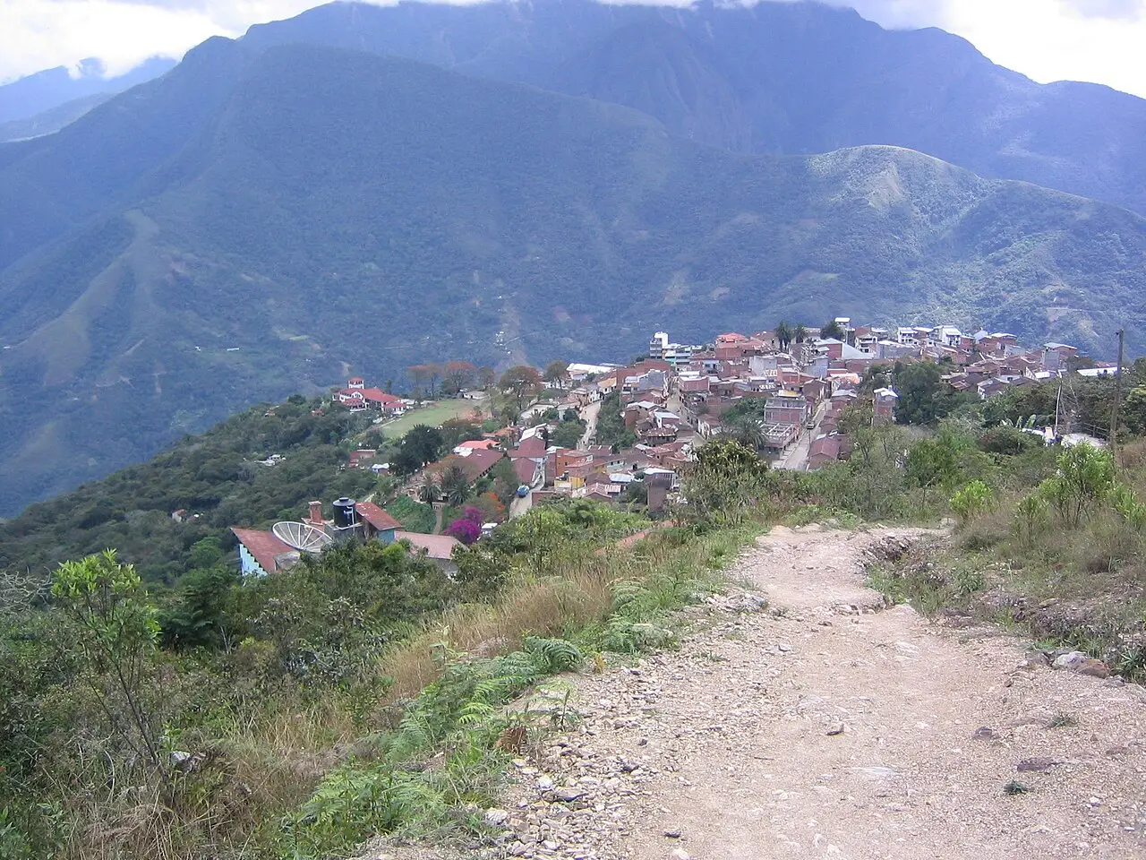
Coroico and the Yungas Road
The old Yungas Road drops about 3,500 m over 64 km, from the La Cumbre pass (4,650 m) down to Yolosa, between cliff walls with no guardrails; today it's used almost only by cyclists, with agencies departing La Paz around 7am. It ends in Coroico, at 1,700 m, with a subtropical climate: the fastest way out of the cold.
Where to begin
Historic center, slowly
Have the paceño breakfast, api con pastel, at Mercado Lanza or Rodríguez before 9am.
The canyon seen from above
Take the Red Line cable car up to El Alto around 8am, before the mid-morning fog.
Money
The currency is the boliviano (Bs). After almost twenty years with the exchange rate pegged at Bs 6.96 to the dollar, Bolivia adopted a managed float in June 2026. In September 2026 the official dollar rate hovers around Bs 12, and the parallel rate has practically converged with it. With inflation projected above 25% a year, every price in bolivianos goes stale quickly. Think in dollars and confirm the amount on the spot, because a range noted one week may not hold the next. Ranges from September 2026: coffee or api Bs 8–15; almuerzo with soup, main course and a drink Bs 15–30 downtown and Bs 45–80 in the Zona Sur; dinner at a good restaurant Bs 90–180; beer Bs 15–25; cable car Bs 3; hostel Bs 70–120 and a mid-range hotel Bs 350–650 a night. Carry cash, because outside the malls of the Zona Sur many places don't take cards. ATMs still run out of bills on weekends and holidays. Exchange offices only take dollars in good condition, with your passport in hand. Tipping isn't mandatory: round up the bill or leave 10% at sit-down restaurants.
Getting there and around
El Alto Airport, 10 km from downtown, with a 400 m descent
El Alto International Airport (LPB) sits at 4,061 m, about 10 km from downtown, and is one of the highest international airports in the world. The drop of about 400 m down to the city already works in favor of acclimatization. The official taxi from the arrivals hall to downtown costs around Bs 70–120 and takes 30–45 minutes; the minibus on the same route costs a few bolivianos. There's no Uber. inDrive and Yango work, and a radio taxi called by phone or app is the safest option, especially after dark. On the first day, don't haul your luggage uphill: at 4,000 m, without acclimatization, the effort knocks out healthy, fit people.
Mi Teleférico, ten color-coded lines across the city
Mi Teleférico is the backbone of the system: ten color-coded lines, about 33 km in all, generally running from 6am to 10pm or 11pm depending on the line. In 2026 the fare is Bs 3 for the first line and Bs 2 per transfer; you buy access at the ticket booth, by card or QR code. On the street, three different things circulate that look like one from a distance: white minibuses, with a conductor shouting the route out the window (Bs 2–3), old micros, and trufis, which are fixed-route taxis. The PumaKatari and Chikititi municipal buses charge a flat fare and stop only at marked stops. You can walk downtown, but slopes reach a 20% grade: go down on foot and come back up by cable car or minibus. At the downtown crosswalks, the “cebras” (young people dressed as zebras, a municipal program since 2001) direct the crossing, and drivers tend to obey the costume rather than the traffic light.
Safety
The biggest risk in La Paz isn't crime, it's altitude: 3,640 m downtown and 4,061 m at the airport cause headaches, nausea, and insomnia, and the answer is to climb slowly, drink water, avoid alcohol in the first 48 hours, and see a pharmacy if symptoms don't ease. On crime, theft predominates: wallets and phones in crowded minibuses, at the 16 de Julio fair, and around the Mercado Rodríguez. Two scams are classic and have repeated for decades. The first is the plainclothes fake police officer who asks to “check” your passport and money, sometimes with an accomplice posing as a tourist: refuse, keep walking, and demand to go to a real police station. The second is the unregistered taxi that turns into an express kidnapping to an ATM, avoided by calling a car ahead of time and checking the driver's ID. At night, avoid the area around the Cementerio General, around the Central Station, and walking alone through El Alto. Demonstrations and road blockades are political routine in La Paz and close major roads without warning, with protests over fuel and prices growing more frequent. Check the local press on the day and head to the airport with a wide margin of time.
Etiquette tips
Greet before asking
“Buenos días” or “buenas tardes” comes before any question, including the price one. Asking straight off sounds like an order.
Call the seller casera
At the market, “casera” (or “casero”) is the correct form of address and opens the negotiation. “Señora” works; using “cholita” with someone you don't know doesn't.
Ask permission before photographing
Ask before photographing women in pollera skirts, yatiris and stalls at the Mercado de las Brujas. Many charge a few bolivianos for a photo, and others simply refuse.
Don't refuse coca outright
Coca leaf and coca tea are legal, everyday, and offered both as hospitality and as a remedy for altitude. Accepting a handful, even without chewing it, is a courteous gesture.
Pour out the first sip
At toasts, openings and family lunches, pour a little on the ground for the Pachamama before drinking: that's the ch’alla. Nobody explains the gesture, so do what the others at the table do.
Bargain lightly and without drama
At markets and fairs, a discount of about 10% is normal; at a shop with price tags, you don't haggle. Insisting after the second “no” ends the conversation.
Mistakes to avoid
Walking and eating heavy on arrival
Getting off the plane and going straight to walk, eat heavy, or drink. The first 24 hours call for rest, water, and light food: soroche knocks people down regardless of age or fitness, and it has knocked down marathon runners too.
Six blocks can mean 100 m of elevation
Assuming downtown is flat. Six blocks on the map can mean 100 m of elevation change, so check the grade before deciding to walk, and always prefer the downhill direction.
The stall won't break a Bs 100 bill
Counting on cards and ATMs. A good part of commerce runs on cash only, and street stalls rarely have change for a Bs 100 bill.
Salteña in the afternoon
Looking for salteñas in the afternoon or fricasé after 11am on Sunday. Each dish has a fixed time in the city and simply runs out once that time passes, with no sign or warning.
Hailing a street taxi without calling ahead
Hailing a taxi on the street without calling ahead, especially after dark. It's the entry point for the express kidnapping, the city's most recurring scam.
Useful phrases
¿Cuánto está, casera?
“How much is it?”: the standard way to ask for a price at the market
Kamisaraki: Waliki
“How are you?” and “I'm well,” in Aymara (ka-mi-sa-RA-ki / wa-LI-ki)
Jikisiñkama
“See you later,” in Aymara (rri-ki-si-NYA-ka-ma)
¿Hay llajua?
“Is there llajua?” (LYA-rrua). The locoto sauce that goes with almost everything
Estoy con soroche
“I have altitude sickness”: a phrase any pharmacist understands right away
¡Esquina, por favor!
“Corner, please!”: what you shout to get off the minibus
Districts
Casco Viejo (downtown)
Colonial blocks around Plaza Murillo and the San Francisco church, with the Congress, the Casa Grande del Pueblo, and nearly all the museums. Busy from 8am to 7pm, and empty after that.
Sopocachi
A middle-class neighborhood west of the Prado, made of 1920s mansions and 1970s apartment buildings. It concentrates restaurants, bars, bookshops, and adult nightlife; the Montículo lookout is the meeting point.
San Pedro
South of downtown, organized around the square and the San Pedro prison, a prison-city where inmates rent their own cells. Small shops, cheap guesthouses, and the Rodríguez market a few blocks away.
Miraflores
A residential plateau to the east, home to the Hernando Siles stadium at 3,637 m and the country's largest hospital complex. Wide, tree-lined streets, little tourist life, and lots of business lunches.
Max Paredes and Gran Poder
The northwestern slope, the Aymara commercial heart: whole streets devoted to a single product, and home to the Gran Poder festival. Heavy traffic, occupied sidewalks, wholesale prices.
Rosario and Sagárnaga
A few blocks above San Francisco, home to the tour agencies, the hostels, and the Mercado de las Brujas. It's the most touristy zone and the most obvious place to compare prices before booking any tour.
Zona Sur
Calacoto, San Miguel, Obrajes, and Achumani, between 3,200 and 3,400 m: malls, offices, pricey restaurants, and the mildest climate in the city. Prices here run double downtown's.
El Alto
On the rim of the canyon, at 4,050 m, mostly Aymara: from Freddy Mamani's cholets to the Thursday and Sunday fair.
History
15th c. · Chuquiago under the Inca
Aymara villages in the Choqueyapu river valley come under the Qullasuyu, the southern quarter of the Tawantinsuyu. Gold panned from the river gives the place its name: Chuqiyapu, “gold field” in Aymara.
1548 · Spanish founding
Alonso de Mendoza founds Nuestra Señora de La Paz in Laja on October 20, to mark the end of the civil war between Pizarrists and Almagrists. Three days later the settlement is moved to the sheltered bottom of the valley.

1781 · Túpac Katari's siege
Julián Apaza, who took the name Túpac Katari, and Bartolina Sisa lay siege to the city twice, totaling more than 180 days and thousands of deaths from hunger. Katari is drawn and quartered in Peñas on November 14.
1809 · Junta Tuitiva
On July 16, Pedro Domingo Murillo leads one of the first autonomous governments in Spanish America. Murillo is hanged in the central square on January 29, 1810, and the square is later named after him.
1825 · Bolivia is born
Independence is proclaimed on August 6 and the city receives the surname “de Ayacucho,” honoring the 1824 battle. La Paz is then the new country's most populous city.
1899 · Federal War
The paceño liberals defeat the Sucre conservatives with the support of Pablo Zárate Willka's Aymara troops, later suppressed. Sucre keeps the title of capital and the Judiciary; La Paz gets the Executive and the Legislature.
1900–1930 · Tin, trams, and the Prado
Simón Patiño's tin boom finances the railway, electric trams, and the opening of Avenida 16 de Julio, the Prado. The city moves beyond the colonial blocks and starts climbing the slopes.
1932–1952 · From the Chaco to the Revolution
Defeat in the Chaco War against Paraguay (1932–1935) demoralizes the elite and creates a generation of politicized veterans. On April 9, 1952, the National Revolution brings universal suffrage, agrarian reform in 1953, and the nationalization of the mines.
1985 · Decree 21060 and El Alto
Supreme Decree 21060 ends hyperinflation with a market shock and lays off about 20,000 miners. El Alto, an autonomous municipality since March of that year, absorbs the migration and within a generation becomes a bigger city than La Paz.
2003 · Gas War
Blockades launched from El Alto against exporting gas through Chile end with more than sixty deaths in October. President Gonzalo Sánchez de Lozada resigns and leaves the country on October 17.

2014–2026 · Cable car and crisis
The Red Line of Mi Teleférico opens on May 30, 2014, launching the world's largest urban cable car network. From 2023, falling gas production drains dollar reserves; Rodrigo Paz takes office on November 8, 2025, and floats the exchange rate in June 2026.

Complete history
Aymara communities before the Incas
The Choqueyapu Valley was home to Aymara communities when the Incas incorporated it into Qullasuyu, around 1450, and set people to panning gold in the riverbed. On October 20, 1548, Alonso de Mendoza founded Nuestra Señora de La Paz in Laja, on the plain, to celebrate the end of the war between the Pizarro and Almagro factions; three days later, he moved the settlement to the sheltered floor of the canyon, some 400 m lower. That choice defines the city to this day: those who could choose stayed at the bottom, where there's more oxygen and less wind. La Paz became a rest stop on the route that carried silver from Potosí to the port of Lima, with the Indigenous population on the slopes of the west bank and the Spanish on the other side of the river, around the main square.
Besieged twice in 1781
In 1781 the city was besieged twice by Julián Apaza, who took the name Túpac Katari, and by Bartolina Sisa, leading tens of thousands of Aymara fighters; the sieges totaled more than 180 days and killed thousands of people by starvation inside the improvised walls. Katari was drawn and quartered in Peñas on November 14 of that year. Twenty-eight years later, on July 16, 1809, Pedro Domingo Murillo's Junta Tuitiva installed one of the first autonomous governments in Spanish America; Murillo was hanged in the central square on January 29, 1810. Bolivia's independence only came on August 6, 1825, and the city gained the surname “de Ayacucho.”
The Federal War brought power here
The Federal War of 1898–1899 pitted La Paz liberals against Sucre conservatives. José Manuel Pando won with the support of Pablo Zárate Willka's Aymara troops and then suppressed his own allies. The result split the state into two pieces that remain separate: Sucre kept the title of capital and the Judiciary, La Paz got the Executive, the Legislature, and the budget. Then came the tin boom, from Simón Patiño: the railway, electric trams, the opening of Avenida 16 de Julio. Defeat in the Chaco War (1932–1935) demoralized the elite and produced the generation that made the National Revolution of April 9, 1952: universal suffrage, agrarian reform in 1953, state-run mining.
The decree that ended hyperinflation
In August 1985, Supreme Decree 21060 ended hyperinflation of over 20,000% with a market shock and laid off about 20,000 miners. The so-called “relocalización” pushed entire families from the mining interior to the edge of the canyon, and El Alto, an autonomous municipality since March 1985, became within a generation an Aymara city with more inhabitants than La Paz. That's where the 2003 blockades came from: in the Gas War, more than sixty deaths in October brought down President Gonzalo Sánchez de Lozada, who left the country on the 17th. On January 22, 2006, Evo Morales was sworn in as Bolivia's first indigenous president.
The cable car changed the social geography
On May 30, 2014, the Red Line of Mi Teleférico opened, the first of ten lines totaling about 33 km, cutting the trip between El Alto and the Zona Sur from two hours to forty minutes. From 2023, falling gas production drained dollar reserves and the country entered its worst economic crisis in decades, with fuel lines and high inflation in 2025 and 2026. Rodrigo Paz took office as president on November 8, 2025, ending twenty years of MAS governments, adopted a managed floating exchange rate in June 2026, and dropped the visa requirement for tourists from seven countries, including the United States. In September 2026 the official dollar rate hovers near Bs 12 and projected annual inflation exceeds 25%.
With inflation projected above 25% in 2026, even the marraqueta, the two-lobed bread roll that costs cents, can change price from one week to the next.
Geography and shape of the city
The canyon and the three altitudes
La Paz has no plain: the whole city is the wall of a canyon about 20 km long that the Choqueyapu River carved into the altiplano, with a drop of nearly 1,000 m between the rim and the bottom. The administrative center sits around 3,640 m; the Zona Sur drops to 3,200 m; El Alto, on the western rim, sits at 4,050–4,100 m.
Inverted social geography and unstable soil
The social geography is inverted compared to most cities in the world: the lower you go, the warmer, more oxygen-rich, and more expensive it gets, and the poorer neighborhoods climb the slopes. The river was channeled beneath the main avenue, Mariscal Santa Cruz, the Prado, and barely shows above ground. The soil is clayey and unstable: the Callapa megalandslide, on February 26, 2011, destroyed about a thousand houses, and the hailstorm of February 19, 2002, flooded downtown and killed dozens of people.
Vertical growth and Illimani as a compass
With no room to grow outward, the city climbed the slopes and, since 2014, has had the cable car, which works as a vertical metro between the valley floor and the rim. To the southeast, Illimani, at 6,438 m, appears from almost every lookout and serves as a landmark for getting your bearings.
If you get lost, look for Illimani, which appears from almost every lookout and lies southeast of the city.
Culture
The chola paceña and Aymara identity
La Paz is a majority-Aymara city that spent much of the 20th century presenting itself as something else. The shift shows on the street: the chola paceña (pollera skirt, embroidered shawl, bowler hat adopted in the 1920s) is no longer a mark of subordination but a public identity, with fashion shows, TV presenters and the Cholitas Luchadoras, who have wrestled in El Alto on Sundays since the early 2000s. Freddy Mamani's neo-Andean architecture and an Aymara bourgeoisie that pays for festivals, bands and entire buildings point in the same direction.
Folk-parade bands, film and literature
The city produces brass band music that carries the folkloric entradas (morenada, caporales, diablada) and, alongside it, a scene of rock, Aymara rap, and cumbia centered in Sopocachi. In film, Jorge Sanjinés and the Ukamau group reinvented Andean political cinema with “Yawar Mallku” (1969) and “La nación clandestina” (1989); Antonio Eguino portrayed four classes and four altitudes of the city in “Chuquiago” (1977), and Juan Carlos Valdivia filmed the Zona Sur elite in “Zona Sur” (2009). In literature, Jaime Saenz wrote the paceño canon in “Felipe Delgado” and “Aniversario de una visión,” and Juan de Recacoechea turned downtown into a crime novel in “American Visa” (1994).
Soccer at 3,637 meters, Mass and ch’alla
Soccer is played at 3,637 m in Hernando Siles stadium, an altitude advantage FIFA tried to ban in 2007 before backing down, and Bolívar and The Strongest split the city. Outside the stadium, faith also has two faces: the same family goes to Mass at the cathedral and does the ch’alla, pouring the first sip on the ground for the Pachamama, before christening a car, house or shop, often on the same day.
The Cholitas Luchadoras wrestle in El Alto on Sundays.
Festivals and events
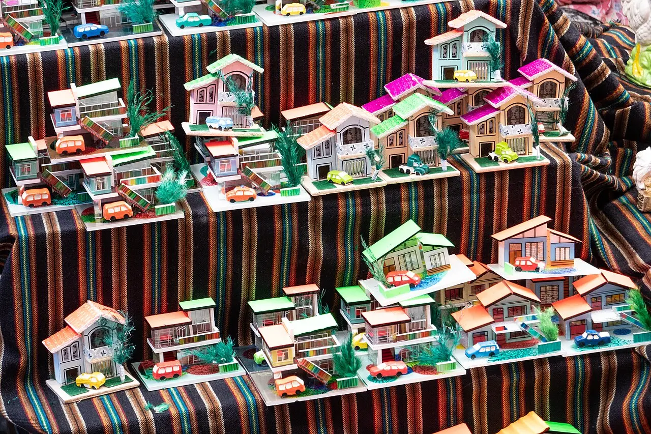
Alasitas
Starts January 24 and lasts about three weeks, at the Parque Urbano Central. People buy miniatures (houses, cars, diplomas, wads of bills) that the Ekeko, the god of abundance, is supposed to turn into real objects; the purchase must be made at noon and the object blessed with incense. UNESCO Intangible Heritage since 2017.
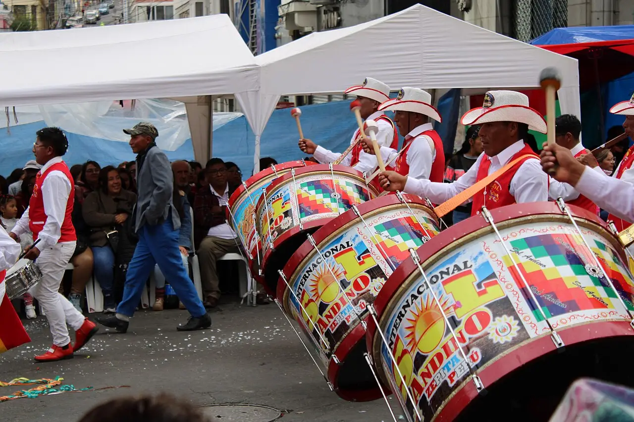
Jisk'a Anata (Carnival)
February or March, depending on the calendar. A parade of comparsas along the Prado, ch'alla at homes and shops with streamers and alcohol, and water thrown in the street for days on end.

Fiesta del Señor Jesús del Gran Poder
A Saturday in late May or early June. About 40,000 dancers and thousands of musicians come down from the Max Paredes area to downtown in morenadas, caporales, and diabladas, for some fifteen hours straight. UNESCO Intangible Heritage since 2019.
 AI illustration
Willkakuti, the Andean New Year
June 21, the winter solstice. Thousands greet the year's first sun with palms raised at Tiwanaku and on the city's hills; it's been a national holiday since 2010.
 AI illustration
Entrada Universitaria
Late July or August. Students from the Universidad Mayor de San Andrés parade with dances from every region of the country. It's the younger, cheaper, and longer version of the folkloric entradas.
Books and films
“Chuquiago” (1977), by Antonio Eguino
“Chuquiago” (1977) and “Zona Sur” (2009): two decades, two readings of the same social ladder.
“American Visa” (1994), by Juan de Recacoechea
A crime novel set in the cheap hotels and streets of downtown, about a teacher trying to get a visa to the United States. It explains the city through the underside of its bureaucracy.
“La nación clandestina” (1989), by Jorge Sanjinés
A man expelled from his community returns to the altiplano to dance his own death. A key film for understanding the relationship between La Paz and the Aymara world around it.
Frequently asked questions
La Paz: is it okay to walk around and eat heavy right after arrival?
No: in the first 24 hours, rest, drink water and eat light, because soroche, altitude sickness, hits people of any age and fitness level, even marathon runners.
La Paz: how do you get to Tiwanaku?
Tiwanaku is 72 km to the west, about 1 hour 30 minutes by car or 2 hours by bus leaving from the Cementerio General.
La Paz: what's the currency, and how much is the dollar worth?
The currency is the boliviano (Bs), which left its fixed exchange rate in June 2026. In September 2026 the official dollar rate hovers around Bs 12, and the parallel rate has practically stuck to it.
La Paz: what's the climate like through the year?
La Paz has a dry season and a rainy season, with an average near 11°C downtown all year round. From May to September the sky stays clear, with 15 to 18°C in the midday sun and −2 to 3°C at dawn; from December to March it rains almost every afternoon, sometimes with hail.
La Paz: do I need to greet someone before asking the price?
Yes: “good morning” or “good afternoon” comes before any question, including about price, and asking directly comes across as an order.
Other cities in the country
Bolivia ↗- Days
- 3
- When
- May–Oct
- Per person/day
- Average 40–70 USDMid-range · per person/day
Cost scope
Per person per day: accommodation, meals, urban transport, visits and a small allowance for extras. Flights excluded; larger purchases vary. Editorial estimate, not a quote.