Chile
San Pedro de Atacama
Valle de la Luna, geysers at dawn and lagoons above 4,000 m
Days Start with the basic programme and choose extensions for the time you have.
How the guide reaches this number
The first is for acclimatization in town, with the church, the museum and the Pukará de Quitor in the late afternoon. The second goes to the Valle de la Luna in the morning and Laguna Cejar in the afternoon, at the same altitude as the town. Cejar admits independent visitors from 9 a.m. to 1 p.m. and agency groups in the afternoon. Without an agency, visit Cejar in the morning and the Valle by vehicle in the afternoon, because bicycles can only enter the Valle in the morning; check both booking calendars. The third starts before dawn at the Géiseres del Tatio, at about 4,300 m, and the fourth is for the altiplano lagoons, with the Miscanti and Miñiques lagoons, Toconao and Laguna Chaxa. With a fifth day, I'd go to the Termas de Puritama or keep it as a spare, because the weather closes high roads without warning. San Pedro is not for anyone who wants to arrive and tack Tatio onto the next morning: the body needs time at altitude, and the most beautiful outings are precisely the highest ones. It is also not a cheap trip, because each outing charges agency and ticket separately. With a single day, I'd keep the Valle and Cejar combination within those same access windows and leave Tatio for another trip. For sleeping, I'd stay in the center on a first trip, because everything is done on foot and the agencies pick up at the hotel; the ayllus around it, like Quitor, are quieter, but need a bike or car at night.
4–5
When April and May, September to November; outside the storms of the so-called invierno altiplánico, from December to March, and the coldest nights of June and July, when snow closes high roads
How the guide reaches this number
The desert around San Pedro is dry and sunny almost all year, and what changes the trip is the cold before dawn and the weather at altitude. On average, highs are near 31 °C in January and lows near −1.5 °C in July, and at Tatio, at dawn, the temperature is near 0 °C in any month. From December to March comes the invierno altiplánico: afternoon storms on the altiplano, the year's little rain concentrated in those months, full rivers and canceled high-altitude outings. From June to August, the nights are the coldest, and snow and wind can close the roads to the lagoons and Tatio. Weather closures also happen outside those seasons: on October 13, 2026, the Socaire community suspended ticket sales for the lagoons because of weather conditions. April and May and September to November are the best windows, with mild days and less risk of closed roads. For stargazing, moonless nights, near the new moon, show far more. In any month, wear sunscreen, a hat and sunglasses, and bring a jacket for late afternoon.
Per person/day Budget about CLP 27,100; mid-range about CLP 66,200; comfortable about CLP 153,000 per person, based on spending that travelers report to Budget Your Trip (checked October 2026).
How the guide reaches this number
Per person per day: accommodation, meals, urban transport, visits and a small allowance for extras. Flights excluded; larger purchases vary. Editorial estimate, not a quote.
 What Nilo thinks
I'd stay four days in San Pedro. The first is for acclimatization in town, with the church, the museum and the Pukará de Quitor in the late afternoon. The second goes to the Valle de la Luna in the morning and Laguna Cejar in the afternoon, at the same altitude as the town. Cejar admits independent visitors from 9 a.m. to 1 p.m. and agency groups in the afternoon. Without an agency, visit Cejar in the morning and the Valle by vehicle in the afternoon, because bicycles can only enter the Valle in the morning; check both booking calendars. The third starts before dawn at the Géiseres del Tatio, at about 4,300 m, and the fourth is for the altiplano lagoons, with the Miscanti and Miñiques lagoons, Toconao and Laguna Chaxa. With a fifth day, I'd go to the Termas de Puritama or keep it as a spare, because the weather closes high roads without warning. San Pedro is not for anyone who wants to arrive and tack Tatio onto the next morning: the body needs time at altitude, and the most beautiful outings are precisely the highest ones. It is also not a cheap trip, because each outing charges agency and ticket separately. With a single day, I'd keep the Valle and Cejar combination within those same access windows and leave Tatio for another trip. For sleeping, I'd stay in the center on a first trip, because everything is done on foot and the agencies pick up at the hotel; the ayllus around it, like Quitor, are quieter, but need a bike or car at night.Around San Pedro de Atacama, a town at about 2,400 m, one of the driest deserts on the planet changes shape with every step up in altitude. At 13 km, the Valle de la Luna is salt and clay folded into ridges and dunes. Farther south, flamingos wade in the shallow water of Laguna Chaxa, and in Laguna Piedra the salt makes your body float. Above 4,000 m, the Miscanti and Miñiques lagoons lie under volcanoes of almost 6,000 m, and at Tatio, at dawn, about 80 geysers release steam into air near 0 °C. The territory belongs to the Atacameños, who have lived in these oases for thousands of years and today look after entry to much of these places. At night, away from the light of Calle Caracoles, the clear sky that brought the observatories here is also there for visitors.
Quick facts
- Population
- 9,843 inhabitants in the municipality of San Pedro de Atacama, which includes Toconao, Socaire and Peine (2024 census)
- Founding
- Human occupation since about 11,000 BC; Spanish expeditions from 1536 and 1540; municipality created in 1979, separated from Calama
- Country and region
- Chile, South America; Antofagasta region, El Loa province, at about 2,400 m, in the oasis on the northern edge of the Salar de Atacama
- Language
- Spanish; Kunza, the language of the Atacameños, stopped being spoken in the early 20th century and is now studied and taught by the communities
- Currency
- Chilean peso (CLP); about CLP 964 per dollar (Sept. 24, 2026)
- Time zone
- UTC−4 in standard time and UTC−3 in daylight saving time, from early September to early April
- Best time to visit
- April and May, September to November; outside the storms of the so-called invierno altiplánico, from December to March, and the coldest nights of June and July, when snow closes high roads
- Average daily cost
- Budget about CLP 27,100; mid-range about CLP 66,200; comfortable about CLP 153,000 per person, based on spending that travelers report to Budget Your Trip (checked October 2026).
When to go
April and May, September to November; outside the storms of the so-called invierno altiplánico, from December to March, and the coldest nights of June and July, when snow closes high roads
How the year changes
The desert around San Pedro is dry and sunny almost all year, and what changes the trip is the cold before dawn and the weather at altitude. On average, highs are near 31 °C in January and lows near −1.5 °C in July, and at Tatio, at dawn, the temperature is near 0 °C in any month. From December to March comes the invierno altiplánico: afternoon storms on the altiplano, the year's little rain concentrated in those months, full rivers and canceled high-altitude outings. From June to August, the nights are the coldest, and snow and wind can close the roads to the lagoons and Tatio. Weather closures also happen outside those seasons: on October 13, 2026, the Socaire community suspended ticket sales for the lagoons because of weather conditions. April and May and September to November are the best windows, with mild days and less risk of closed roads. For stargazing, moonless nights, near the new moon, show far more. In any month, wear sunscreen, a hat and sunglasses, and bring a jacket for late afternoon.
Nilo's tips
Go up in steps: town, salt flat, then Tatio and the high lagoons
The body adjusts to altitude gradually, and the order of the outings does that for you. Spend the first day in town and the second at places of the same altitude, like the Valle de la Luna and Laguna Cejar, and only then go to Tatio, at about 4,300 m, and the Miscanti and Miñiques lagoons, at about 4,120 m. The night before the high outings, avoid alcohol, drink water and sleep early, because the departure for Tatio is before dawn.
Buy tickets before the trip
Valle de la Luna, Laguna Cejar, Termas de Puritama and the Socaire lagoons sell only online, with a set date and sometimes a set time, and the ticket expires at the end of the day. The Valle de la Luna requires at least one day's notice. Buy as soon as you settle the itinerary, allowing for the Valle’s closure on October 6, 13, 20 and 27, 2026 and checking Cejar’s calendar, and check with the agency whether the tour includes the ticket or not: usually, it does not.
Separate cash and card by place
The museum and the Aldea de Tulor accept cash only; Puritama, Cejar and the Valle de la Luna, only electronic payment on the online purchase; Tatio charges at the gate by card or transfer. Outside town there is no continuous cell signal, so carry the QR saved on your phone.
For stargazing, pick the night by the moon
The desert sky is dark enough to see the Milky Way with the naked eye, but a full moon washes out the faint stars. If stargazing is a priority, plan the trip near the new moon, take the telescope outing on one of the first nights, to have a margin if the weather closes in, and bring winter clothing.
Check the weather notice the day before
Snow, wind and storms close the high roads and access points in several months, and the communities suspend sales or access when that happens. The day before, look at the place's official site and leave a spare day at the end of the trip to rebook a canceled outing.
Explore the map
Explore the map, read about the other places and plan your travel days in the app.
Open the appWhat to see
San Pedro de Atacama: An oasis between the salt flat and the volcanoes
The air is very dry, the sun is strong and the temperature swing is large: on average, highs are near 31 °C in January and lows near −1.5 °C in July. It rarely rains, and almost only between December and March, in the so-called invierno altiplánico, when humid air from the Amazon causes afternoon storms on the altiplano. The few blocks around the plaza, the San Pedro church and Calle Caracoles, the pedestrian street where agencies, restaurants, cafés and hostels cluster.
Valle de la Luna
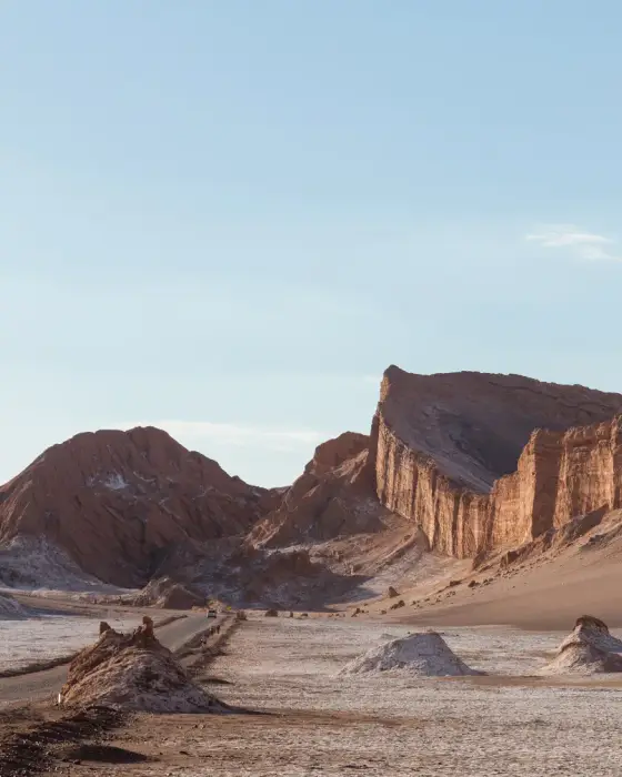
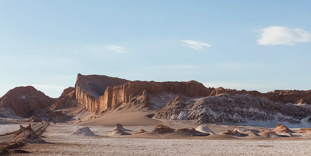
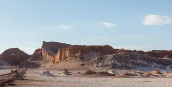
A valley in the Cordillera de la Sal, 13 km west of town, with dunes, salt and clay ridges and formations such as the Tres Marías, managed by the Asociación Indígena Valle de la Luna within the Reserva Nacional Los Flamencos. Tickets are sold only online, at least one day ahead, for a set date, and cost CLP 10,800 (CLP 5,400 for ages over 60 and 11 to 17; under 11 free). You cannot enter on foot: from September to March, bicycles enter from 9 a.m. to 11 a.m. and vehicles from 9 a.m. to 5 p.m.; from April to August, from 8 a.m. to 11 a.m. and from 8 a.m. to 4 p.m. The Mirador de Kari has been closed since May 27, 2026 for assessment after an earthquake, and in October 2026 the valley is not open on Tuesdays, the 6th, 13th, 20th and 27th (Oct. 2026).
The dunes and salt-and-clay ridges 13 km from town define the trip’s landscape; they are at the same altitude as town and therefore fit the second day, with online tickets for a fixed date and entry only by bicycle or vehicle.
Check access
Géiseres del Tatio
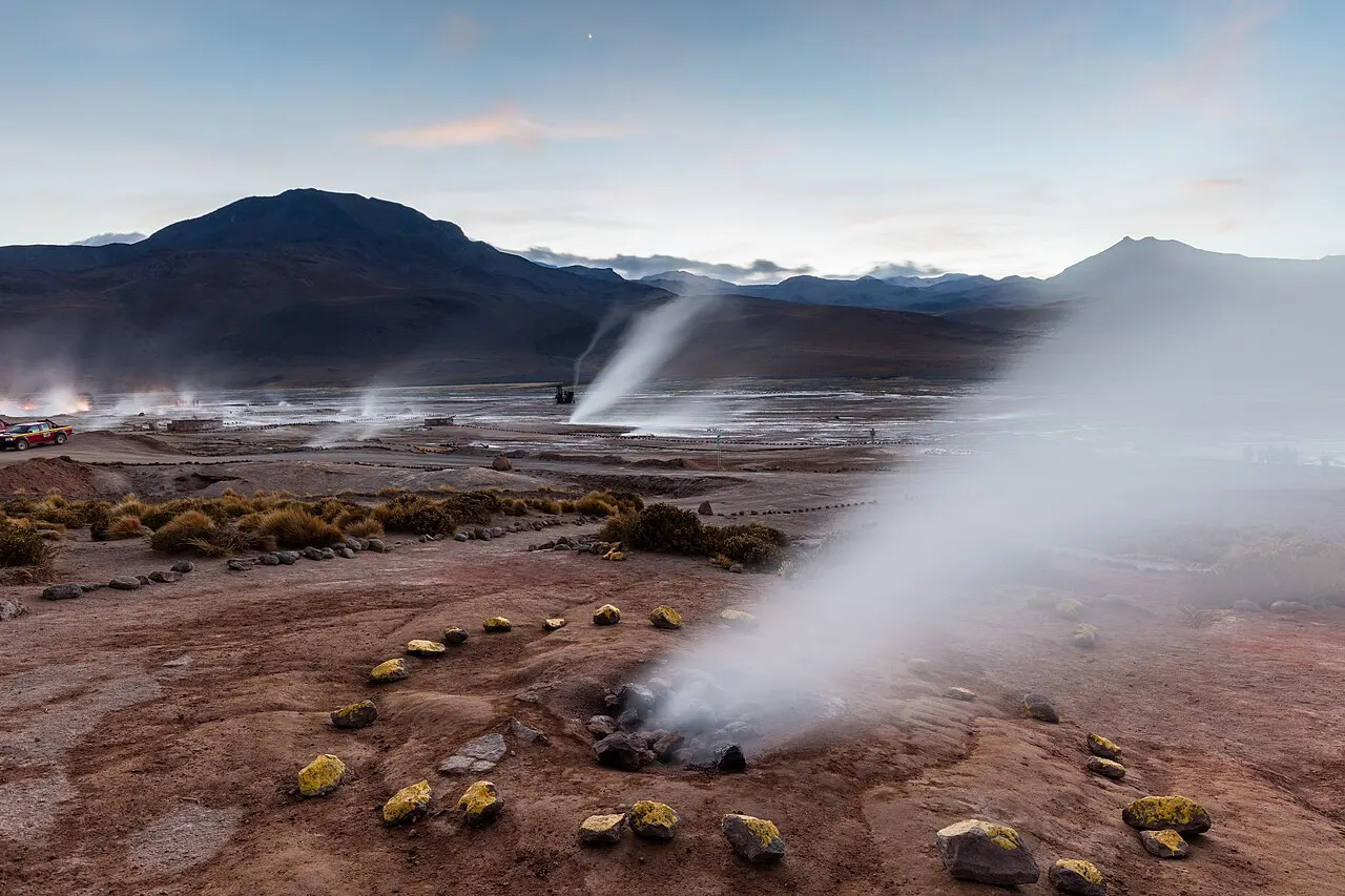
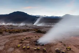
The largest geyser field in the Southern Hemisphere, with about 80 geysers, lies at about 4,300 m and 80 km from town. It is open from 6 a.m. to 4 p.m., and the steam is most visible from opening until about 7 a.m., when the air is near 0 °C and the water comes out above 85 °C. General admission costs CLP 15,000, paid at the gate by card or transfer (official rate in force since 2021, checked in Oct. 2026). Pregnant women and children under 9 are not admitted, and the rules advise against visiting for anyone over 70.
The Southern Hemisphere’s largest geyser field, with about 80 geysers at around 4,300 m, shows its steam in the dawn cold, from opening at 6 a.m. until about 7 a.m.; this calls for a departure before dawn and two days of acclimatization beforehand. Under the site’s rules, pregnant visitors and children under 9 are not admitted, and visits are discouraged for people over 70.
Check access
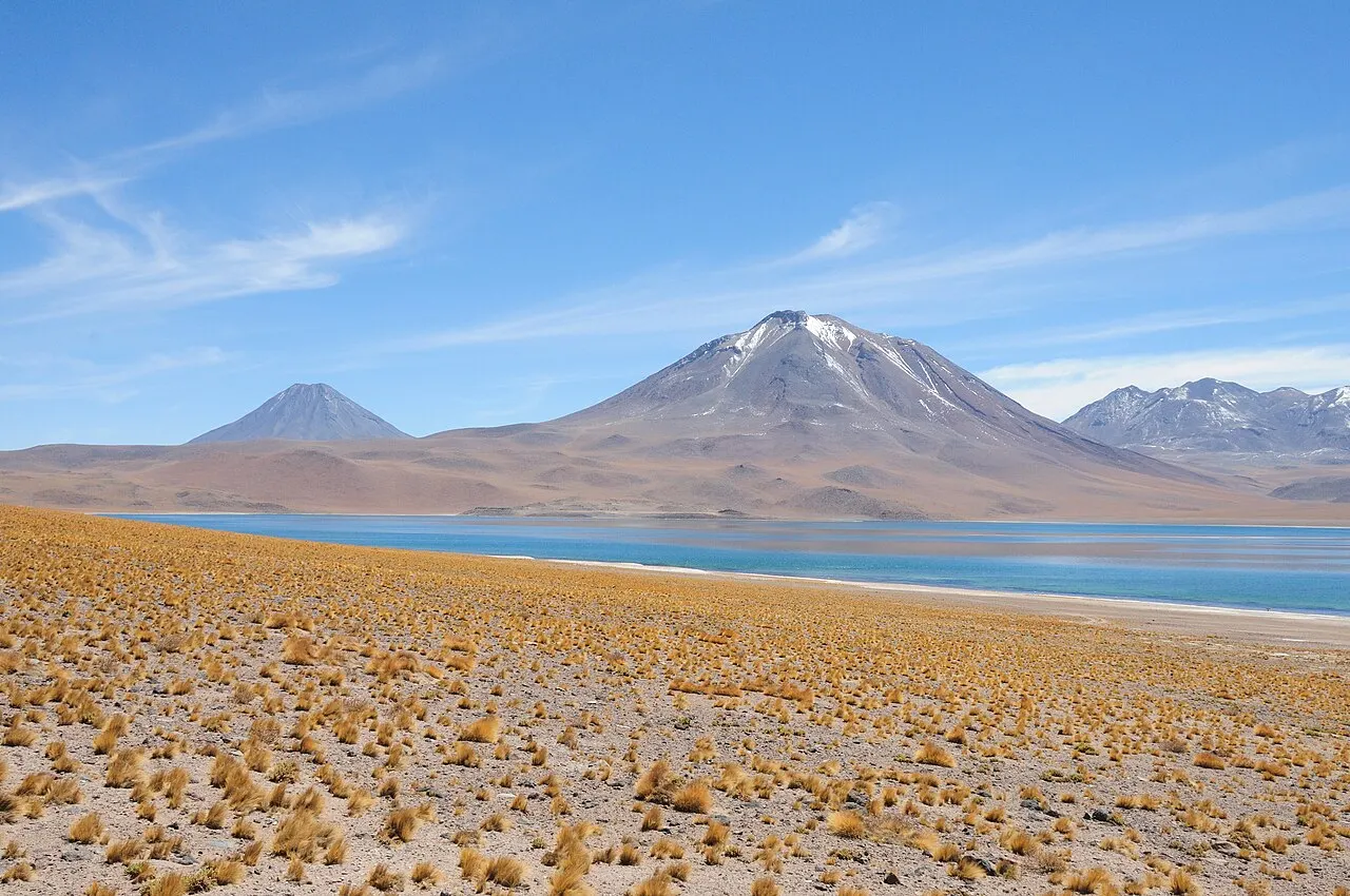
Lagunas Miscanti y Miñiques
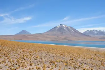
Two lagoons at about 4,120 m and 117 km from town, separated by a lava flow from the Miñiques volcano (5,910 m), in the high sector of the Reserva Nacional Los Flamencos. You may not enter the water. The Socaire community sells tickets only online, for a set time slot, with a package that may include the Salar de Aguas Calientes Sur, the one with the Piedras Rojas, at 3,940 m. The printed ticket is collected at the control office in Socaire one hour before the reservation time, and sales can be suspended because of weather, as on October 13, 2026. The price appears on the site at the time of purchase.
The two lagoons at about 4,120 m, beneath the Miscanti and Miñiques volcanoes, are the highest and most beautiful point of the lagoon day, with tickets sold only online by the Socaire community and sales suspended when weather closes the road.
Check access
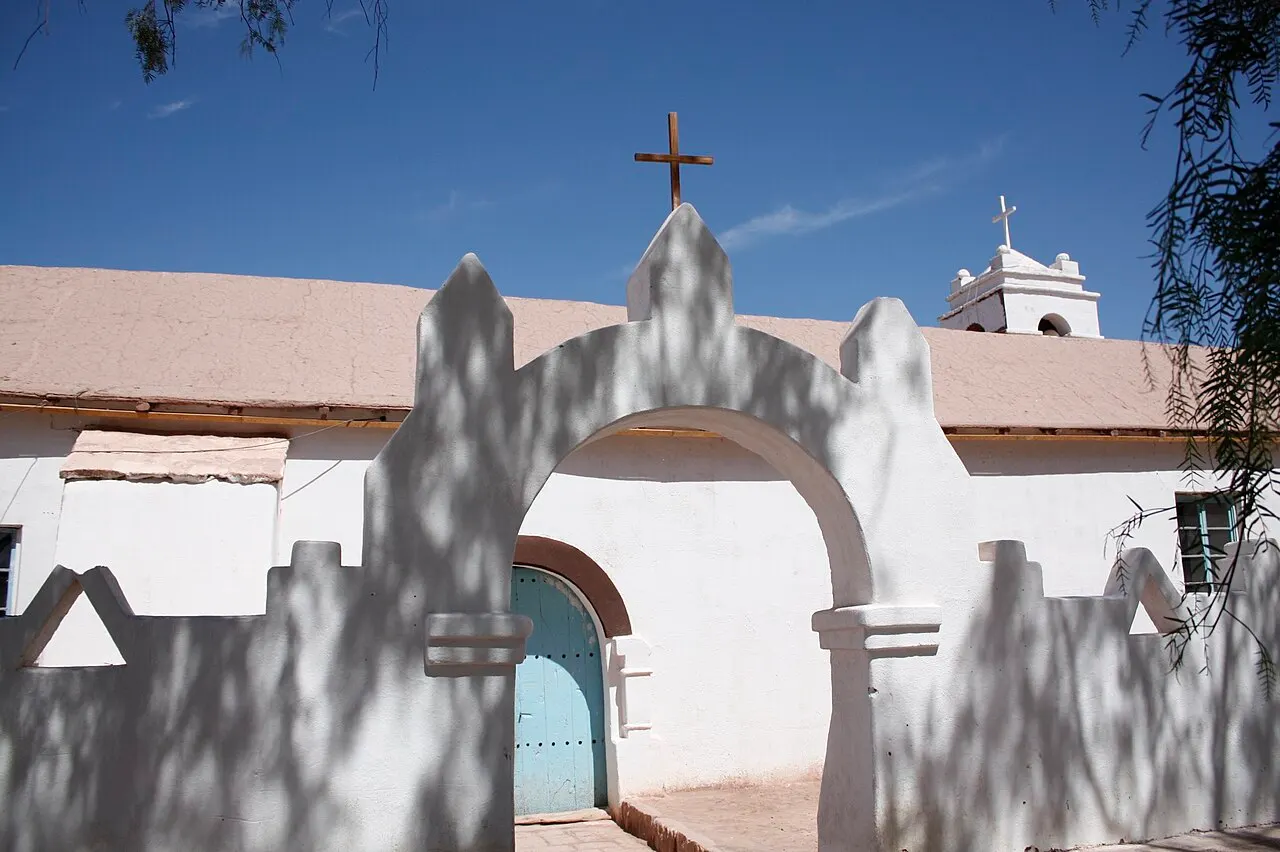
Iglesia de San Pedro de Atacama
The adobe church beside the plaza has its current walls from 1744, a choir organ from 1776 that sounds again after the restoration begun in 2014, and a tower from 1964. It has been a national monument since 1951, and the patron saint's festival, on June 29, is held with dances in front of it.
The adobe church beside the square, with walls from 1744, a restored 1776 organ and a 1964 tower, has been a national monument since 1951 and lies on the way through town on any day, so a visit takes only a few minutes.
Check access
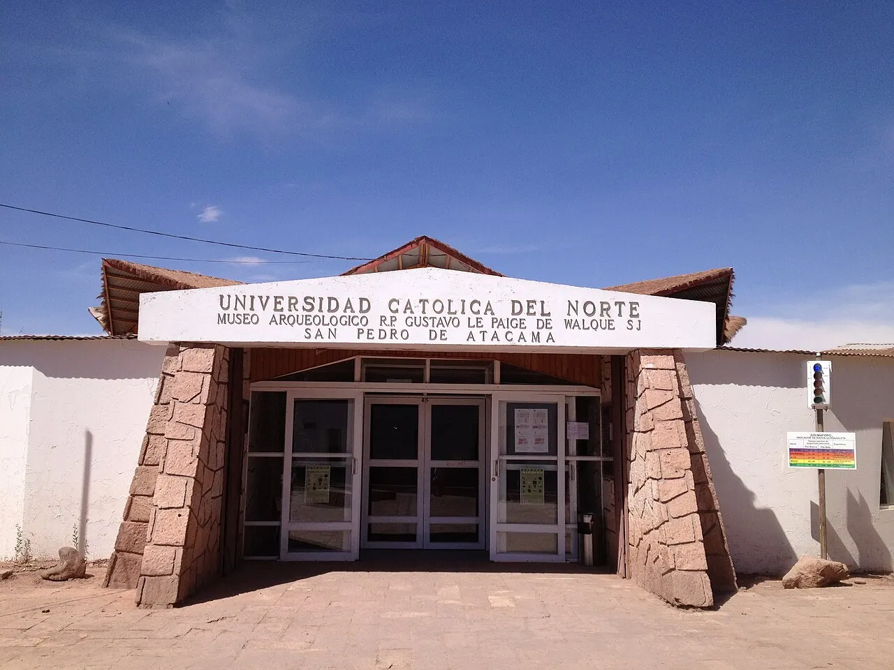
Museo Arqueológico Gustavo Le Paige
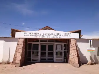
The exhibition hall of the Instituto de Investigaciones Arqueológicas y Museo of the Universidad Católica del Norte shows objects from the prehistory of the salt flat oases, with a tactile station of replicas and a QR audio guide. It is open Monday to Thursday from 9 a.m. to 12:30 p.m. and from 2:30 to 6 p.m., and on Friday from 9 a.m. to 12:30 p.m. and from 1 to 5 p.m., closed on weekends and holidays, admits groups of ten at a time and charges CLP 2,500, cash only (Oct. 2026).
The archaeological institute’s exhibition room at the Universidad Católica del Norte explains the oases before visits to Valle de la Luna and Tulor, for CLP 2,500 in cash, and fits into the acclimatization day’s afternoon; closed weekends and holidays.
Check access
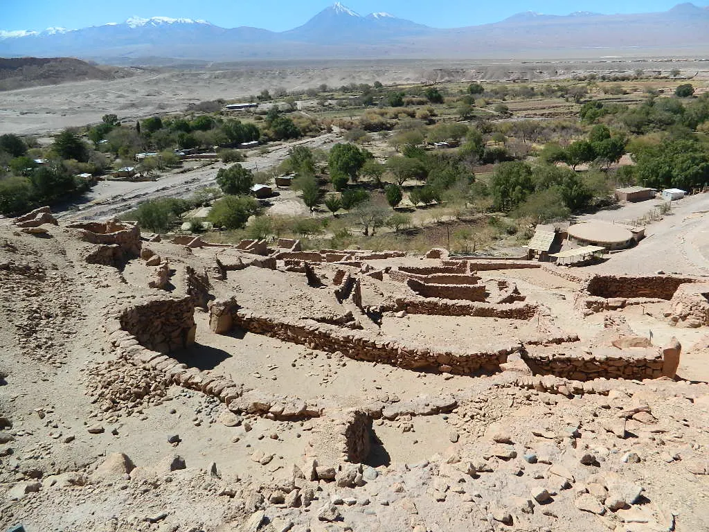
Pukará de Quitor
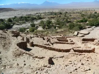
The 12th-century Atacameño fortress climbs an 80 m hill 3 km north of town, with a perimeter stone wall and about 160 terraced enclosures above the San Pedro river valley. It has been a national monument since 1982, and the climb to the top is steep.
The 12th-century Atacameño fortress lies 3 km from town, reachable by bicycle; from its 80 m hill it overlooks the San Pedro river valley and the whole oasis, making it a good fit for the acclimatization day.
Check access
Laguna Cejar
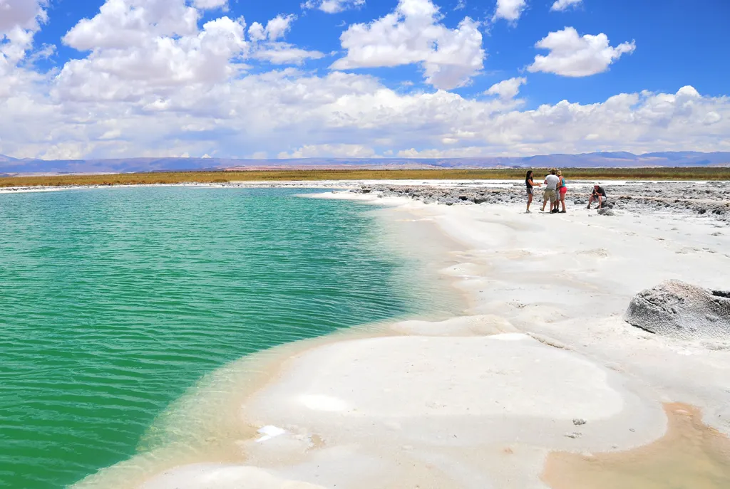
The Solor community's complex, 28 km south along Route CH 23, has two lagoons on one ticket: Cejar, for viewing, with walkways, flamingos and Licancabur in the background, and Piedra, where the salt water makes you float. A ticket costs CLP 15,000 for ages 13 to 59, is bought online for a set time and gives you one hour on site; arriving more than 15 minutes late voids the ticket. Hours for the general public are 9 a.m. to 1 p.m., and agencies take groups in the afternoon. In Piedra, 20 minutes at most in the water, with no sunscreen or lotion on the body, without putting your head under and only from age 6, under the community's rules. One agency guide says the complex closes on Tuesdays; the official site does not say, so check the closed days on the booking calendar (Oct. 2026).
At Laguna Piedra, the salt water makes you float, while neighboring Cejar has flamingos and Licancabur in the background, on one timed ticket costing CLP 15,000 for ages 13–59. The site is at town altitude; general admission is from 9 a.m. to 1 p.m., with agency groups only in the afternoon, which determines how it can fit the Valle de la Luna day. Under the community’s rules, entering the water at Piedra is allowed only from age 6, for at most 20 minutes, with no lotion or sunscreen on the body and without putting your head under.
Check access
Laguna Chaxa
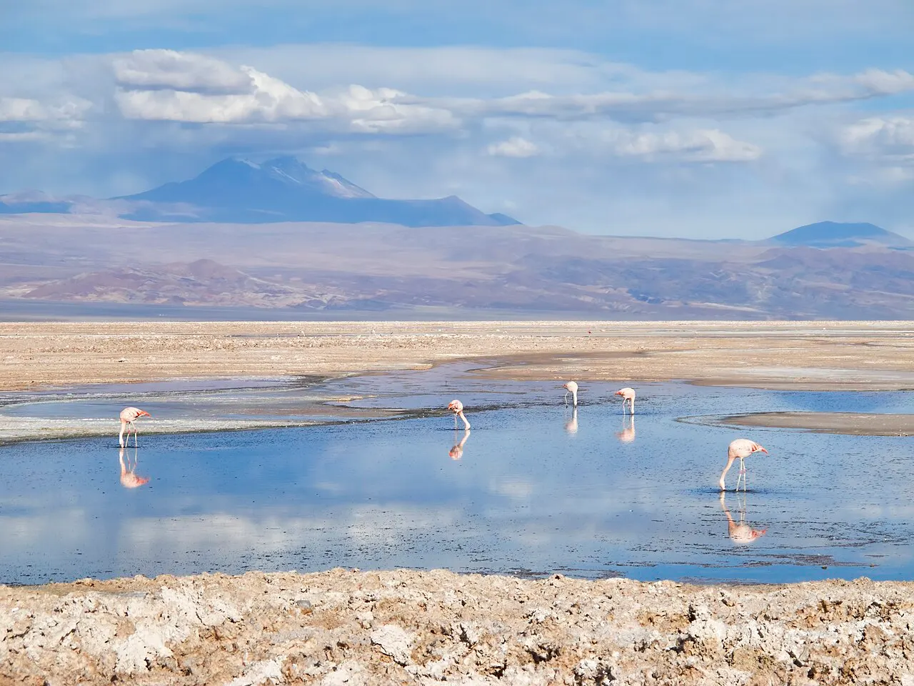
A shallow lagoon in the Soncor sector of the Reserva Nacional Los Flamencos, 7 km from Toconao and just under 50 km from town, at about 2,300 m, where you can see the region's three species of flamingo. The Toconao community manages entry with CONAF; the combined ticket with the Valle de Jere costs CLP 13,714 for a foreign adult and CLP 10,285 for a Chilean adult, and hours are 8 a.m. to 8 p.m. in summer and 7 a.m. to 7 p.m. in winter (Oct. 2026).
The shallow lagoon in the Soncor sector is the easiest place to see the region’s three flamingo species; it stays open into the late afternoon and lies on the return route from the altiplano lagoons, so it fits the same day.
Check access
Aldea de Tulor
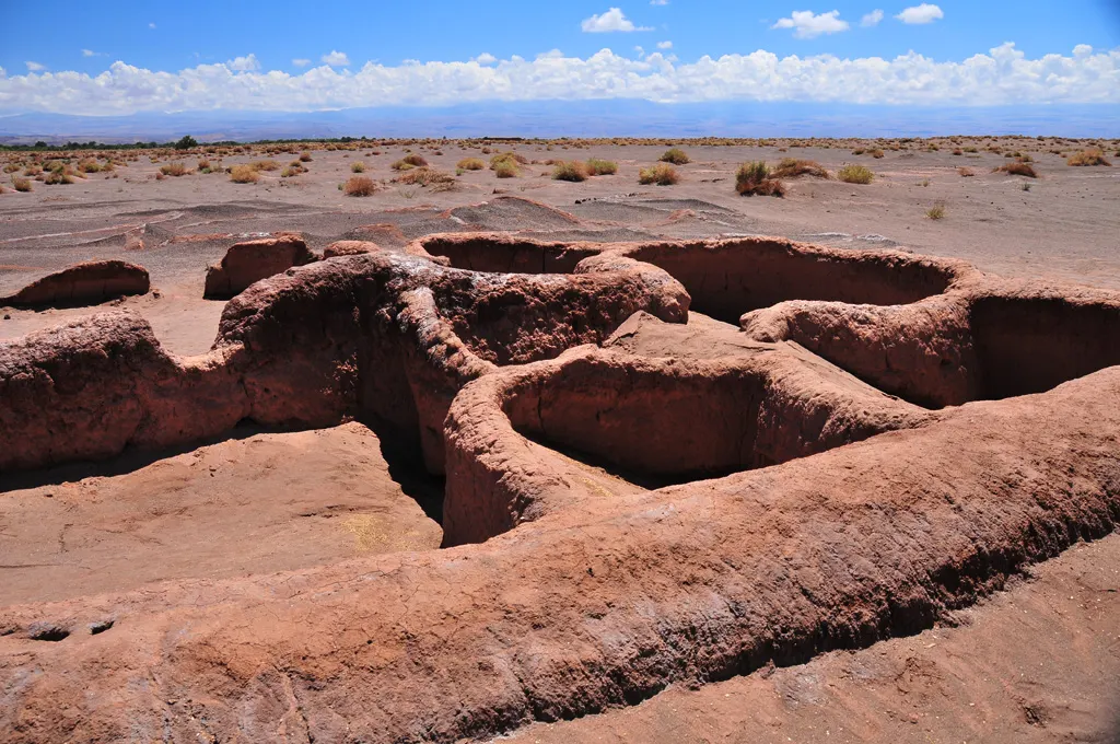
A set of interconnected circular clay houses, 7.7 km southwest of town, occupied until about the 5th century and found by Father Le Paige in 1956, with the dunes advancing over it. The Coyo community manages the site: admission costs CLP 5,000, in cash, visits are by reservation by email and it is open Monday to Friday (Oct. 2026).
The village of circular houses, occupied until around the 5th century, is one of northern Chile’s oldest sedentary sites, but requires booking by email, opens only on weekdays and accepts cash only; the town museum already tells its story through objects. Include it with time to spare.
Check access
Nilo’s itinerary
Start with the basic programme and choose extensions for the time you have.
Plan my days in the app ↗Day 1 · Arrival and acclimatization in the oasis
Arrive from Calama in the morning, on a transfer or bus of about 1.5 hours, and drop your bags. The first day stays at the altitude of the town, at about 2,400 m, with no high outing.
Walk to the plaza and go into the adobe Iglesia de San Pedro de Atacama, with its 1744 walls and 1776 organ.
On a weekday, visit the hall of the Museo Arqueológico Gustavo Le Paige, on Calle Tebenquiche (CLP 2,500 in cash; groups of ten; closed on weekends).
Check the tickets bought before the trip (Valle de la Luna, Laguna Cejar and the Socaire lagoons) and settle with the agency the Tatio and Cejar outings, confirming whether the ticket is included.
In the late afternoon, bike or walk 3 km north to the Pukará de Quitor and slowly climb the 80 m hill to see the San Pedro river valley.
Have an early dinner, without alcohol, and drink plenty of water.
Day 2 · Valle de la Luna and Laguna Cejar
In October 2026, do not schedule this day on Tuesdays the 6th, 13th, 20th or 27th, when the Valle de la Luna is closed. Check available dates separately on Laguna Cejar’s booking calendar; its official site does not confirm a weekly closing day.
In the morning, go to the Valle de la Luna, 13 km west: by bicycle, entering between 9 a.m. and 11 a.m. from September to March (8 a.m. to 11 a.m. from April to August), or on an agency tour. Bring the ticket QR and plenty of water.
Walk the marked trails between the dunes and the salt ridges, and pass by the Tres Marías.
Return to town for lunch and rest during the hours of strongest sun.
In the afternoon, continue to Laguna Cejar, 28 km south, with an agency: the tours leave around 1:30 p.m. and return at 7 p.m. If you go on your own you can only enter from 9 a.m. to 1 p.m., and then Cejar swaps places with the Valle, which admits vehicles until 5 p.m. from September to March (4 p.m. from April to August).
Float for up to 20 minutes in Laguna Piedra, without sunscreen on your body, and watch the flamingos from the Cejar walkways.
At night, if the moon is small, take a stargazing outing with a telescope, dressed for the cold.
Day 3 · Géiseres del Tatio at dawn
Leave before dawn, with an agency or by car, to reach Tatio, at about 4,300 m and 80 km from town, when it opens, at 6 a.m. Wear all your layers, a hat and gloves: the temperature is near 0 °C.
Pay admission at the gate (CLP 15,000, card or transfer) and walk the field from opening until about 7 a.m., when the steam is most visible, without leaving the trail.
On the way back, stop in Machuca for a llama anticucho or an empanada.
Reach town in the early afternoon and rest: the day started early and high.
Day 4 · Altiplano lagoons, Toconao and Laguna Chaxa
The day before, check on the Socaire community's site whether sales and the road are open.
Leave early for Socaire, on the way to the lagoons, and reach the control office one hour before your reservation time to swap the QR for the printed ticket. The village shops open at 9 a.m.
Go up to the Lagunas Miscanti y Miñiques, at about 4,120 m and 117 km from town, at your reserved time, and walk slowly on the trail.
If your package includes it, continue to the Salar de Aguas Calientes Sur, the one with the Piedras Rojas, at 3,940 m.
On the way back, have lunch in Socaire and stop in Toconao to see the church and bell tower of San Lucas, built of liparite stone.
Finish at Laguna Chaxa, 7 km past Toconao, to see the flamingos in the late afternoon; the last entry is at 7 p.m. in summer and 6 p.m. in winter.


If you stay longer
Day 5 · Termas de Puritama, 28 km north
Day trip
Thermal pools between 28 °C and 31 °C in a ravine, on the B-245 road, the same one that goes to Tatio. They run in two sessions, from 9:30 a.m. to 1:30 p.m. and from 2:30 to 6 p.m., with tickets bought beforehand online (CLP 38,000 for adults, Oct. 2026) and no cash accepted. There is no public transport or shuttle from the site: go by car, taxi or agency. It is worth going on a day of its own, in the morning: those who arrive on the way back from Tatio find the pools more crowded.
Food
Rica-rica
An aromatic altiplano herb, used in northern Chile as a seasoning, in tea and mate, in artisanal ice cream and in a sour, the rica-rica sour.
Arrope de chañar
A dark, very sweet syrup made from the fruit of the chañar, the tree of the oases. On the town's menus it appears in a sauce for savory dishes and in coffee with chañar.
Patasca
An Andean stew of mote, hulled corn boiled until it bursts open, with meat. In San Pedro it appears as a typical Atacameño corn dish and also as a salad.
Calapurca
A northern Chilean soup with ají de color, meats (including llama), mote, potato and scallion, which in some versions arrives at the table with a hot stone bubbling in the bowl. It is considered food for recovering your strength.
Llama anticucho
A skewer of llama meat grilled over coals, sold in the village of Machuca, on the way back from Tatio, along with empanadas.
Empanada
The de pino, with meat, onion and egg, is the Chilean classic, and the cafés on Calle Caracoles also sell napolitana and mushroom versions. It is the cheapest snack in town.
Quinoa
A traditional Atacameño crop, planted on terraces alongside potato, and now found in restaurant dishes, from breaded cutlets to salads.
Pebre with bread
The Chilean sauce of tomato, onion, cilantro and a little ají, served with warm bread before the meal, including at lunches in villages such as Socaire.
Where to eat
- Café Adobe · Calle Caracoles · $$
A restaurant opened in 1997, with a fire pit in the courtyard and a menu that uses arrope de chañar, quinoa, patasca and rica-rica.
Source · 2026-10-15
- Emporio Andino · Calle Caracoles at Domingo Atienza · $
A café with empanadas from CLP 3,500 and breakfasts from CLP 6,900 to 11,900 (July 2025 menu).
Source · 2026-10-15
- Machuca, on the way back from Tatio · $
Llama anticucho and empanadas sold in the village, at the stop for geyser tours.
- Socaire, on lagoon day · $
A village lunch with pebre and bread, on the way to the Miscanti and Miñiques lagoons.
$: café: empanada at CLP 3,500, breakfast from CLP 6,900 to 11,900 (July 2025 menu) · $$: restaurant with a regional menu on Calle Caracoles; check the price on the menu, because it varies a lot · $$$: dinner included in a luxury hotel package, charged together with the lodging · 2026-10-15
Day trips
Termas de Puritama, 28 km north
Thermal pools between 28 °C and 31 °C in a ravine, on the B-245 road, the same one that goes to Tatio. They run in two sessions, from 9:30 a.m. to 1:30 p.m. and from 2:30 to 6 p.m., with tickets bought beforehand online (CLP 38,000 for adults, Oct. 2026) and no cash accepted. There is no public transport or shuttle from the site: go by car, taxi or agency. It is worth going on a day of its own, in the morning: those who arrive on the way back from Tatio find the pools more crowded.
Jeep crossing to Uyuni, three days
It is not a day trip: agencies in town sell the three-day circuit that crosses the border into Bolivia, passes the lagoons and geysers of the Reserva Eduardo Avaroa, at more than 4,000 m, and ends at the Salar de Uyuni. It makes sense for those continuing their trip through Bolivia who are already acclimatized after a few days in San Pedro.
Where to begin
Arrival and acclimatization in the oasis
Arrive from Calama in the morning, on a transfer or bus of about 1.5 hours, and drop your bags. The first day stays at the altitude of the town, at about 2,400 m, with no high outing.
Géiseres del Tatio at dawn
Leave before dawn, with an agency or by car, to reach Tatio, at about 4,300 m and 80 km from town, when it opens, at 6 a.m. Wear all your layers, a hat and gloves: the temperature is near 0 °C.
Altiplano lagoons, Toconao and Laguna Chaxa
The day before, check on the Socaire community's site whether sales and the road are open.
Money
The currency is the Chilean peso (CLP), at about CLP 964 per dollar on September 24, 2026. The biggest expense in San Pedro is tours and tickets, charged separately. An agency tour to the Valle de la Luna starts at CLP 35,000 and an astrophotography tour at CLP 25,000, without the ticket. Tickets checked in October 2026: Valle de la Luna CLP 10,800; Géiseres del Tatio CLP 15,000 (rate in force since 2021); Laguna Cejar and Piedra CLP 15,000; Laguna Chaxa with Valle de Jere CLP 13,714 for foreigners; Aldea de Tulor CLP 5,000; archaeological museum CLP 2,500. The Termas de Puritama cost CLP 38,000. How you pay changes from place to place, and that is what confuses people most: Valle de la Luna, Cejar, Puritama and the Socaire lagoons sell only online, by card; Tatio charges at the gate by card or transfer; Tulor and the museum accept only cash. Carry both. For food, an empanada costs from CLP 3,500 and a breakfast at a café on Caracoles runs CLP 6,900 to 11,900. Hostel dorm beds cost about US$8 to $32 a night (Hostelworld, Oct. 15, 2026). In restaurants, a 10% tip is usually suggested on the bill and is voluntary.
Getting there and around
From Calama, about 100 km
San Pedro has no commercial flights: the nearest airport is El Loa (CJC), 6 km southeast of Calama, with flights by JetSmart, LATAM and Sky to Santiago, La Serena and Concepción. From the airport, transfer vans such as Transvip go straight to your hotel in town, and buses of several companies leave from the Calama bus terminal, with a trip of about 1.5 hours. Check price and schedule at the counter or in the app, because they change with the season. There are also buses from Antofagasta, and for Argentina, via Jujuy and Salta, the road climbs to the Paso de Jama, 155 km from town and about 4,200 m. For Bolivia, the most popular crossing is the three-day jeep circuit to Uyuni.
On foot in town, on agency tours or by car
The center is small, and almost everything is a few blocks from the plaza; Calle Caracoles is pedestrian-only. For the outings, most people use an agency with hotel pickup, and the tour price generally does not include the ticket, which is bought separately, and at some places only online. Rental bikes work for the Pukará de Quitor, Tulor and the Valle de la Luna, which admits cyclists only in the morning and does not accept anyone arriving on foot. With a car rented in Calama, most roads are paved or in good dirt condition, but there is no gas station or continuous cell signal outside town: fill up in San Pedro. There is no public transport to the Termas de Puritama or the lagoons.
Safety
San Pedro is a quiet town with little violent crime; what is recorded, now and then, is bicycle and car theft. Street dogs are many and generally gentle, but some chase cyclists. The greater risk is the environment: altitude, sun, cold and dehydration. The town sits at about 2,400 m, and Tatio and the altiplano lagoons go above 4,000 m; headache, nausea and shortness of breath that get worse call for descending and medical care. Tatio does not admit pregnant women and advises against visiting for anyone over 70; if you are over 60 or have a health condition, tell the staff at the entrance. At Laguna Cejar neither water nor food is sold, and dehydration is quick: bring enough water for the outing. If you drive, fill up in town and expect stretches without cell signal. Emergencies in Chile: 133 for Carabineros, 131 for ambulance, 132 for firefighters.
Etiquette tips
Stay on the marked trail
In the Valle de la Luna, at Laguna Cejar and in CONAF areas, leaving the marked path is prohibited, as is taking rocks, salt or plants. Salt crusts and desert soils stay marked for years.
Enter Laguna Piedra without sunscreen
The Solor community's rule protects the lagoon's microfauna: no sunscreen, oil or lotion on the body, 20 minutes at most, no putting your head underwater. In the showers, water only, no shampoo or soap.
Leave the drone at home
The Valle de la Luna, Laguna Cejar and the areas of the Reserva Nacional Los Flamencos prohibit drones, unless you have specific authorization for research or professional filming.
At Tatio, do not touch the water
The water comes out above 85 °C. Do not leave the trails, do not touch the water or the fumaroles, and do not eat or prepare food inside the field.
Respect the communities' management
The hours, rules and closures of many places are decided by the Atacameño communities that manage them, including training days and community activities. When a place closes, check the notice on the official site before complaining to the agency.
Mistakes to avoid
Going up to Tatio on the day you arrive
People coming from sea level who go to the geysers, at about 4,300 m, in the predawn hours after arriving usually feel ill. The Solor community recommends at least one day in town before any outing, no alcohol the night before and plenty of water.
Arriving at the gate without a ticket
Valle de la Luna, Laguna Cejar, Termas de Puritama and the Socaire lagoons sell only online, for a set date and, in some cases, a set time. The ticket is not valid for another day, and at Cejar arriving more than 15 minutes late voids the ticket. Buy before the trip: the Valle de la Luna requires at least one day's notice.
Walking to the Valle de la Luna
The valley does not admit visitors on foot: only by bicycle, in the morning, or in a vehicle. Anyone planning to walk from town is stopped at the gate.
Trusting an old itinerary
Operators still advertise sunset at the Mirador de Kari, closed since May 27, 2026, and the public visit to ALMA, suspended in October 2026. Ask the agency what the tour actually includes that week.
Carrying only card or only cash
Puritama does not accept cash; Tulor and the museum accept only cash; Tatio charges at the gate by card or transfer. With no cell signal outside town, contactless payment can also fail.
Useful phrases
Alabalti
Welcome, in Kunza. It is the word that greets visitors at the entrance to the Valle de la Luna
¿Cuánto vale la entrada?
How much is the ticket? “Vale” is how you ask a price in Chile
¿Incluye la entrada?
Is the ticket included? The question to ask before paying for any agency tour
Una luca
A thousand pesos. That is how prices are said on the street and in shops
Tengo mal de altura
I have altitude sickness: a phrase for the front desk, the guide or the pharmacy
Al tiro
Right away, right now, which in practice can mean “in a little while”
Where to stay
- Town center · First trip, no car · $$: It is a few blocks from the plaza, Calle Caracoles and the agencies, which pick up at your hotel. It is where you dine on foot, and also where there is more nightlife.
- Town center · Little money and a backpack · $: It concentrates the hostels, with dorm beds at about US$8 to $32 a night (Hostelworld, Oct. 15, 2026), close to everything you do on foot.
- Ayllu de Quitor · For quiet, if you go by bicycle · $$: It runs along the river, to the north, among fields, up to 3 km from the center. At night, getting back from Caracoles takes a bike with a light or a car.
- Ayllu de Larache · For comfort with organized outings · $$$: This is where the larger hotels are, some sold as multi-night packages with the excursions included, next to town.
$: dorm bed, about US$8 to $32 a night (starting prices on Hostelworld) · $$: private room in a hostal, about US$12 to $50 a night (starting prices on Hostelworld) · $$$: hotel with outings included, sold as a multi-night package; price on request · 2026-10-15
Districts
Town center
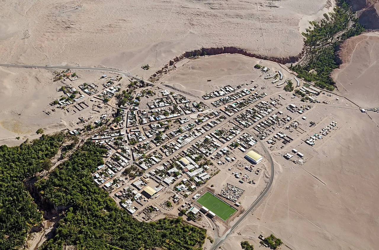
The few blocks around the plaza, the San Pedro church and Calle Caracoles, the pedestrian street where agencies, restaurants, cafés and hostels cluster. Almost everything in town can be done on foot from here.
Ayllu de Quitor
To the north, along the San Pedro River, with irrigated fields at the foot of the Pukará de Quitor hill, 3 km from the center. It has lodging scattered among the fields, away from the bustle of Caracoles.
Ayllu de Larache
Next to town, where the municipality's first luxury hotel opened in 1998. It is a lodging area outside the center.
Ayllu de Coyo
To the southwest, toward the Aldea de Tulor and the Baltinache lagoons, which the Coyo community manages.
Ayllu de Solor
South of town, toward the salt flat. The Atacameño community of Solor manages the complex of the Cejar and Piedra lagoons, 28 km away by road.
Toconao
A village at about 2,475 m, on the way to the altiplano lagoons, built entirely of liparite, a light-colored volcanic stone. It has the church and bell tower of San Lucas, a national monument, and the community that looks after Laguna Chaxa and the Valle de Jere.
History
about 11,000 BC · The first hunters of the oases
Groups of hunter-gatherers settle the ravines and oases around the Salar de Atacama. The rivers coming down from the mountains provide water in one of the driest places on the planet.
4th century BC to 5th century AD · The Aldea de Tulor
A village of interconnected circular houses, 7.7 km southwest of the present-day town, marks the shift to settled life, with agriculture irrigated by the San Pedro River. Pacific shell beads found there show trade by llama caravans between the coast, the altiplano and the puna.
900–1200 · Tiwanaku influence
Objects and practices of the Tiwanaku state, centered on Lake Titicaca, appear in the cemeteries of the oases.
12th century · The Pukará de Quitor
The Atacameños build a stone fortress on a hill 3 km north of the oasis, with a perimeter wall and about 160 terraced enclosures, to control the San Pedro river valley and the trade routes.
15th century · Inca rule
The Tawantinsuyu incorporates the region under Túpac Yupanqui and brings a new social organization, sun worship and the ritual use of coca.
1536–1557 · The Spanish arrival
Diego de Almagro is said to have passed through the region in 1536, and the expeditions of Pedro de Valdivia and Pedro Sancho de Hoz arrive in 1540. Atacameño resistance lasts until a peace agreement in 1557.
1744 · The adobe church
The San Pedro church gets the walls that still stand today, after the destruction of an older temple. The choir organ dates from 1776, and the tower was added in 1964.
1879–1904 · From Bolivian to Chilean
After independence the territory goes to Bolivia. The War of the Pacific places it under Chilean control, and the 1904 treaty confirms the border.
1957 · Father Le Paige's museum
The Belgian Jesuit Gustavo Le Paige, the town's parish priest, opens the archaeological museum with the collection he gathered by excavating the region's cemeteries, with support from the Universidad del Norte. According to the sociologist Jorge Pavez, he rewarded Atacameño children with coins or clothing for the mummies they brought from the cemeteries.
1979–1997 · Municipality, Indigenous law and development area
San Pedro becomes a municipality in 1979. The 1993 Indigenous law opens the way for the Atacama La Grande Indigenous Development Area, created in 1997, which brings together the Atacameño communities of the salt flat basin.
1998–2002 · The town becomes a destination
The municipality's first luxury hotel opens in 1998 in the ayllu of Larache, and in 2002 San Pedro is declared a Tourist Interest Zone. Tourism becomes the main economic activity, ahead of small-scale farming.
Complete history
Water explains the place
San Pedro exists because two rivers, the San Pedro and the Vilama, come down from the mountains and die out in the basin of the Salar de Atacama, one of the driest places on Earth. Where the water arrives, there is an oasis of chañar, algarrobo and small plots of farmland, and people have lived there for more than 10,000 years. At the Aldea de Tulor, occupied until about the 5th century, the circular houses show the shift from hunting to farming, and the Pacific shell beads found at the site show that the oasis was already a trading point between the coast, the altiplano and the Argentine puna, linked by llama caravans.
Tiwanaku, the pukarás and the Inca
Between 900 and 1200, the influence of the Tiwanaku state, from Lake Titicaca, reaches the cemeteries of the oases. In the 12th century, the Atacameños fortify the hill of Quitor, above the river valley, and in the 15th century the Inca Tawantinsuyu incorporates the region under Túpac Yupanqui, with a road, sun worship and ritual coca. The Spanish arrive in 1540, with Pedro de Valdivia and Pedro Sancho de Hoz, and Atacameño resistance lasts until a peace agreement in 1557. Under the encomienda and the Church, Kunza, the local language, gradually loses speakers until it disappears as a living language in the early 20th century.
Bolivia, Chile and the communities
After independence, the Atacama Desert goes to Bolivia; the War of the Pacific and the 1904 treaty make it Chilean. In the mid-20th century, the Jesuit priest Gustavo Le Paige excavates the region's cemeteries and in 1957 opens the museum that put San Pedro on the map of archaeology, work that is now debated for the way the mummies were removed. From 1993, Chile's Indigenous law recognizes the Atacameño communities, and the Atacama La Grande Indigenous Development Area, from 1997, gives them the basis to manage much of what visitors pay to see: the Valle de la Luna, Laguna Cejar, Tulor, the Socaire lagoons.
From farming oasis to destination
In 1998 the first luxury hotel opens in the ayllu of Larache, and in 2002 the town is declared a Tourist Interest Zone. Since then tourism has become the municipality's main activity, and Calle Caracoles concentrates agencies, hostels and restaurants. At the same time, the salt flat to the south is Chile's main lithium deposit.
Geography and shape of the city
An oasis between the salt flat and the volcanoes
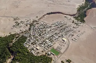
The town sits at about 2,400 m, on the northern edge of the Salar de Atacama basin, where the San Pedro and Vilama rivers arrive from the mountains and spread into irrigation channels. To the west rises the Cordillera de la Sal, a range of sedimentary rock, salt and clay folded by faults, where the Valle de la Luna lies. To the east, the line of volcanoes on the border with Bolivia and Argentina, with Licancabur (5,916 m) 32 km from town and Miñiques (5,910 m) farther south.
Steps of altitude
The outings go up and down in steps. The salt flat and the Cejar and Chaxa lagoons sit at the height of the town, around 2,300 to 2,400 m. The Miscanti and Miñiques lagoons are at about 4,120 m, and the Géiseres del Tatio at about 4,300 m, in a geothermal field with about 80 geysers. The road up to the Paso de Jama, the Argentine border 155 km away, goes above 4,800 m. The difference in altitude between town and these places is what sets the order of the days.
The climate of the high desert
The air is very dry, the sun is strong and the temperature swing is large: on average, highs are near 31 °C in January and lows near −1.5 °C in July. It rarely rains, and almost only between December and March, in the so-called invierno altiplánico, when humid air from the Amazon causes afternoon storms on the altiplano. In the high areas, snow and wind close roads and access points outside that season too.
Licancabur, at 5,916 m, is 32 km from town and marks the border with Bolivia; its name, in Kunza, means something like “mountain of the people.”
Culture
A people who own their territory
The Atacameños, who call themselves Lickanantay (something like “the inhabitants of the territory” in Kunza), numbered 30,369 in Chile's 2017 census. The Council of Atacameño Peoples, formed in 1994, represents 18 communities in the Atacama La Grande area, and that is why so many tickets in the region are sold by communities: Solor, Coyo, Toconao, Socaire, the Asociación Indígena Valle de la Luna. At Laguna Cejar, the Solor community says the ticket pays for conservation and the local team. The traditional economy was herding llamas and alpacas, terrace farming and trading jerky with coastal fishermen.
Kunza and the words of the place
Kunza stopped being a spoken language in the early 20th century, after holding out longest in Peine, Socaire and Caspana. The communities are working to recover it, and in 2019 a dictionary app with more than 1,200 words came out. It survives in the names on the map: Licancabur means something like “mountain of the people,” and Tatio comes from Tata-iu, “the grandfather who weeps.” At the entrance to the Valle de la Luna, the sign says “Alabalti,” welcome in Kunza.
Science and sky
The dry air, the altitude and the little artificial light have made the desert one of the best places in the world to observe the sky. The ALMA radio telescope has its operations base at km 121 of Route CH 23, near town, and the documentary Nostalgia for the Light, by Patricio Guzmán, used this setting. In town, agencies run night outings with a telescope away from the lit center. The museum and the archaeological institute of the Universidad Católica del Norte publish the journal Estudios Atacameños.
Tatio comes from the Kunza Tata-iu, “the grandfather who weeps,” because of the steam that rises from the geysers before dawn.
Festivals and events
Virgen de la Candelaria, early February
A religious festival beside the San Pedro church, with dancers and rattles in the colors of the Chilean flag.
San Pedro y San Pablo, June 29
The town's patron saint festival, with traditional dances in front of the adobe church.
Books and films
Nostalgia for the Light (2010), by Patricio Guzmán
The documentary puts side by side the astronomers of the Atacama Desert observatories and the women who search the same ground for the remains of relatives disappeared under the dictatorship. It helps explain why the sky and the dry soil of the region preserve so much.
Estudios Atacameños, journal of the IIAM at the Universidad Católica del Norte
The academic journal of the institute that runs the town's museum publishes research on the archaeology, history and communities of the salt flat basin. It suits anyone who wants to go beyond the text in the display cases.
Frequently asked questions
San Pedro de Atacama: How do you get there from Calama airport?
From El Loa airport (CJC), transfer vans such as Transvip go straight to your hotel in town, and buses of several companies leave from the Calama bus terminal, with a trip of about 1.5 hours. Check price and schedule at the counter or in the app, because they change with the season.
San Pedro de Atacama: How many days should you stay?
Four days: one for acclimatization in town, one at the Valle de la Luna and Laguna Cejar, one at the Géiseres del Tatio and one at the altiplano lagoons. With a fifth day, I'd go to the Termas de Puritama or keep it as a spare, because the weather closes high roads without warning.
San Pedro de Atacama: Can you go to Tatio the morning after you arrive?
It isn't advisable: people coming from sea level who go to the geysers, at about 4,300 m, in the predawn hours after arriving usually feel ill. The Solor community recommends at least one day in town before any outing, no alcohol the night before and plenty of water.
San Pedro de Atacama: Is it better to bring cash or a card?
Both: Puritama does not accept cash, Tulor and the museum accept only cash, and Tatio charges at the gate by card or transfer. With no cell signal outside town, contactless payment can also fail.
San Pedro de Atacama: When is the best time to go?
April and May, and September to November. That keeps you outside the storms of the so-called invierno altiplánico, from December to March, and the coldest nights of June and July, when snow closes high roads.
Other cities in the country
Chile ↗- Days
- 2–3
- When
- Mar–May · Sep–Nov
- Per person/day
- Average 110,000 CLPMid-range · per person/day
Cost scope
Per person per day: accommodation, meals, urban transport, visits and a small allowance for extras. Flights excluded; larger purchases vary. Editorial estimate, not a quote.
- Days
- 1–2
- When
- Jan–Mar · Nov–Dec
- Per person/day
- Average 80–130 USDMid-range · per person/day
Cost scope
Per person per day: accommodation, meals, urban transport, visits and a small allowance for extras. Flights excluded; larger purchases vary. Editorial estimate, not a quote.
- Days
- 6–7
- When
- Jan–Mar · Nov–Dec
- Per person/day
- Average 99,900 CLPMid-range · per person/day
Cost scope
Per person per day: accommodation, meals, urban transport, visits and a small allowance for extras. Flights excluded; larger purchases vary. Editorial estimate, not a quote.
- Days
- 4
- When
- Jan–Apr · Oct–Dec
- Per person/day
- Average 93,600 CLPMid-range · per person/day
Cost scope
Per person per day: accommodation, meals, urban transport, visits and a small allowance for extras. Flights excluded; larger purchases vary. Editorial estimate, not a quote.
- Days
- 3
- When
- Jan–Apr · Oct–Dec
- Per person/day
- Average 121,000 CLPMid-range · per person/day
Cost scope
Per person per day: accommodation, meals, urban transport, visits and a small allowance for extras. Flights excluded; larger purchases vary. Editorial estimate, not a quote.