Canada
Banff
Banff, glacial lakes and trails in the Canadian Rockies
Days Start with the basic programme and choose extensions for the time you have.
How the guide reaches this number
Without a car, I'd do the canyon on Roam Transit Route 9 and leave Peyto Lake for a tour. With four days, you can add Yoho National Park (Emerald Lake and Takakkaw Falls) or stretch the Icefields Parkway to the Athabasca Glacier without rushing. In winter, the same three days change subject: skiing at the park's three resorts, white lakes and hikes with crampons, with no Moraine Lake. A round trip from Calgary in a single day takes more than three hours of driving and leaves little time beyond two crowded viewpoints.
3–4
When June to September; the thaw of the alpine lakes usually ends between late May and early June, and late September brings golden larches before the Moraine Lake road closes in mid-October.
How the guide reaches this number
June to September is the main window for hiking without winter gear and seeing the lakes thawed in turquoise. Lake Louise and Moraine Lake usually thaw between late May and the first half of June; the Moraine Lake road opens on June 1 and closes after Canadian Thanksgiving, in the second week of October. The last two weeks of September and the start of October bring the yellowing of the larches on the alpine trails, with cold mornings and less heat. From November to April, the lakes are covered in snow and white ice: the trip shifts its focus to skiing at the park's three resorts (Sunshine Village, Lake Louise Ski Resort and Mount Norquay), hikes with crampons and ice skating when conditions allow. Johnston Canyon, a winter classic, is closed for construction from October 13 to December 11, 2026.
Per person/day Budget around CAD62; mid-range around CAD145; comfortable around CAD308 per person per day, based on spending reported by travelers to Budget Your Trip (checked October 2026).
How the guide reaches this number
Indicative figures, excluding travel to the destination.
Budget around CAD62; mid-range around CAD145; comfortable around CAD308 per person per day, based on spending reported by travelers to Budget Your Trip (checked October 2026). Indicative figures, excluding travel to the destination.
Per person per day: accommodation, meals, urban transport, visits and a small allowance for extras. Flights excluded; larger purchases vary. Editorial estimate, not a quote.
 What Nilo thinks
I'd stay at least three full days in Banff, preferably between June and mid-October, when Moraine Lake and the shuttles are running: the first for the center of town, Cave and Basin, Sulphur Mountain and the Lake Minnewanka or Vermilion Lakes loop; the second, all of it, for Lake Louise and Moraine Lake using the reserved shuttle; and the third, by car or on a tour, for Johnston Canyon combined with the southern stretch of the Icefields Parkway to Bow Lake and Peyto Lake. Without a car, I'd do the canyon on Roam Transit Route 9 and leave Peyto Lake for a tour. With four days, you can add Yoho National Park (Emerald Lake and Takakkaw Falls) or stretch the Icefields Parkway to the Athabasca Glacier without rushing. In winter, the same three days change subject: skiing at the park's three resorts, white lakes and hikes with crampons, with no Moraine Lake. A round trip from Calgary in a single day takes more than three hours of driving and leaves little time beyond two crowded viewpoints.I'd go to Banff for the closeness between a town you can cover on foot and some of the most striking glacial landscapes in North America. Banff Avenue ends at the bridge over the Bow River, with a slanted Mount Rundle behind it; across the river are Bow Falls, the railway castle of the Fairmont Banff Springs and, at the end of a quiet street, the steaming cave of Cave and Basin, where in 1883 began the story that gave Canada its first national park.
Read more
The rest of the park reveals itself in layers. From the crest of Sulphur Mountain you can see how the valleys are laid out. About 55 km from town, Lake Louise and, a little farther on, Moraine Lake take on the turquoise of the rock flour the glaciers release into the water, and the Icefields Parkway climbs among icefields to the milky blue of Peyto Lake. Above Lake Louise, a teahouse with no electricity, open since 1905, still serves tea and cake to those who climb on foot.
Quick facts
- Population
- 8,305 residents in the municipality (Town of Banff), according to the 2021 Statistics Canada census.
- Founding
- In 1883, Canadian Pacific railway workers found the hot springs on the slope of Sulphur Mountain; the federal reserve of 1885 gave rise to Canada's first national park.
- Country and region
- Canada, province of Alberta, Canadian Rocky Mountains (census division no. 15).
- Language
- English and French in Parks Canada's federal services; everyday service in Alberta's shops and hotels is mainly in English.
- Currency
- Canadian dollar (CAD).
- Time zone
- America/Edmonton (Mountain Time): UTC-7 in standard time and UTC-6 in daylight saving time.
- Best time to visit
- June to September; the thaw of the alpine lakes usually ends between late May and early June, and late September brings golden larches before the Moraine Lake road closes in mid-October.
- Average daily cost
- Budget around CAD62; mid-range around CAD145; comfortable around CAD308 per person per day, based on spending reported by travelers to Budget Your Trip (checked October 2026). Indicative figures, excluding travel to the destination.
When to go
June to September; the thaw of the alpine lakes usually ends between late May and early June, and late September brings golden larches before the Moraine Lake road closes in mid-October.
January
-13° to -4°C
20 mm of rain
February
-13° to -1°C
20 mm of rain
March
-8° to 3°C
29 mm of rain
April
-4° to 9°C
39 mm of rain
May
0° to 14°C
50 mm of rain
October
-2° to 9°C
32 mm of rain
November
-8° to 1°C
29 mm of rain
December
-14° to -5°C
25 mm of rain
How the year changes
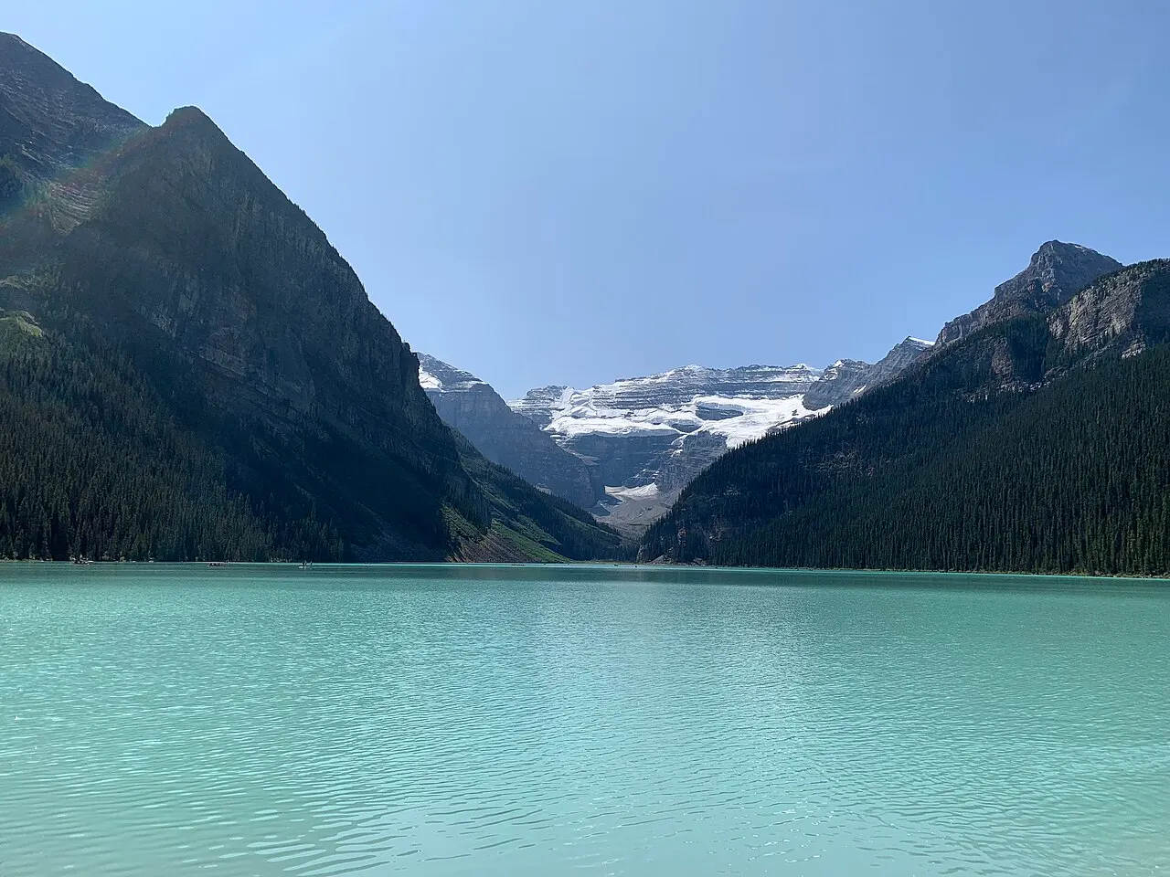
June to September is the main window for hiking without winter gear and seeing the lakes thawed in turquoise. Lake Louise and Moraine Lake usually thaw between late May and the first half of June; the Moraine Lake road opens on June 1 and closes after Canadian Thanksgiving, in the second week of October. The last two weeks of September and the start of October bring the yellowing of the larches on the alpine trails, with cold mornings and less heat. From November to April, the lakes are covered in snow and white ice: the trip shifts its focus to skiing at the park's three resorts (Sunshine Village, Lake Louise Ski Resort and Mount Norquay), hikes with crampons and ice skating when conditions allow. Johnston Canyon, a winter classic, is closed for construction from October 13 to December 11, 2026.
The same numbers as a table
| Month | Temperature °C | Rain mm |
|---|---|---|
| January | -13 to -4 | 20 |
| February | -13 to -1 | 20 |
| March | -8 to 3 | 29 |
| April | -4 to 9 | 39 |
| May | 0 to 14 | 50 |
| June · | 4 to 18 | 71 |
| July · | 7 to 23 | 39 |
| August · | 6 to 22 | 42 |
| September · | 2 to 17 | 47 |
| October | -2 to 9 | 32 |
| November | -8 to 1 | 29 |
| December | -14 to -5 | 25 |
Nilo's tips
Set an 8 a.m. MDT alarm for the lake shuttle
If you didn't get a seat when reservations opened in April, I'd log in to the Parks Canada system at exactly 8 a.m. (Mountain Daylight Time, MDT) two days before the outing, when the additional batch of seats for Lake Louise and Moraine Lake is released.
Use Route 8X if you're in town without a car
For those who sleep in Banff without renting a vehicle, I'd book the Roam Transit Route 8X Super Pass: it leaves from Banff High School, drops you at Lake Louise and includes the Parks Canada connector to Moraine Lake.
Keep Cave and Basin apart from the Upper Hot Springs
I'd visit Cave and Basin for the history and the original 1883 cave, knowing there is no soaking there. To get into the outdoor hot water, I'd keep the towel for the Banff Upper Hot Springs, higher up the same mountain.
Buy lunch in Banff before heading up to the lakes
Food options on the shores of Lake Louise and Moraine Lake are limited and crowded. I'd stop at a bakery or market on Banff Avenue early and bring cash if the plan is to have tea at the Lake Agnes Tea House, which does not take cards.
Explore the map
Explore the map, read about the other places and plan your travel days in the app.
Open the appWhat to see
Lake Louise
About 55 km northwest of Banff town along Trans-Canada Highway 1, the glacial lake shows an intense turquoise in front of Victoria Glacier, especially from late June to September, when suspended rock flour reflects the light. The flat walk along the right shore leads to the head of the valley, while trails that gain elevation climb to the Lake Agnes Tea House (about 3.5 km each way and 400 m of elevation gain) and the Plain of Six Glaciers. From mid-May to mid-October, parking by the lake is paid and usually fills before dawn; take the Parks Canada shuttle from the Park and Ride or Roam Transit's Route 8X, which runs year-round.
Check access

Moraine Lake
Set in the Valley of the Ten Peaks, 14 km from the Lake Louise road, the lake receives visitors only between June 1 and Canadian Thanksgiving in mid-October, when the road closes because of avalanche risk. Private cars never enter Moraine Lake Road: only reserved Parks Canada shuttles (departing from the Lake Louise Park and Ride, with a link via the Lake Connector), Roam Transit buses with the Super Pass, licensed commercial operators and registered guests of Moraine Lake Lodge get through. Cycling is another option when the road is open, shared with constant bus traffic from June to October. The short Rockpile trail delivers the classic elevated view over the blue water; for hikes such as Consolation Lakes, Larch Valley or Sentinel Pass, check whether a seasonal minimum group size is required because of grizzly bears.
Check access

Johnston Canyon
About 25 km west of Banff along the Bow Valley Parkway (Highway 1A), the canyon carved by Johnston Creek into the limestone is crossed by metal catwalks fixed to the walls. It is 1.2 km to the Lower Falls, where a bridge and a short passage in the rock bring you close to the waterfall, and 2.5 km each way to the Upper Falls, which drop about 30 meters. Parks Canada closed the trail, the day-use area and the P1 parking lot from October 13 to December 11, 2026 for work to stabilize the canyon walls; since the work may continue in other phases, check the park bulletins before going. Outside closures, the waterfalls freeze in winter and the trail calls for hiking crampons (ice cleats) attached to your boots. In summer, arrive early or take Roam Transit's Route 9.
Check access

Banff Gondola and Sulphur Mountain
At the end of Mountain Avenue, about 4 km from downtown Banff (served by Roam Transit Route 1), the gondola climbs in about eight minutes to the summit complex, at 2,281 meters above sea level. Up top, a wooden boardwalk follows the ridge to the old Sanson's Peak weather station, built in 1903, with views over the Bow Valley and the Minnewanka massif. If you prefer to walk, you can climb the 5.5 km of switchbacks beneath the cables; gondola tickets have dynamic pricing by time slot, and it is wise to book ahead on clear days.
Check access
Cave and Basin National Historic Site
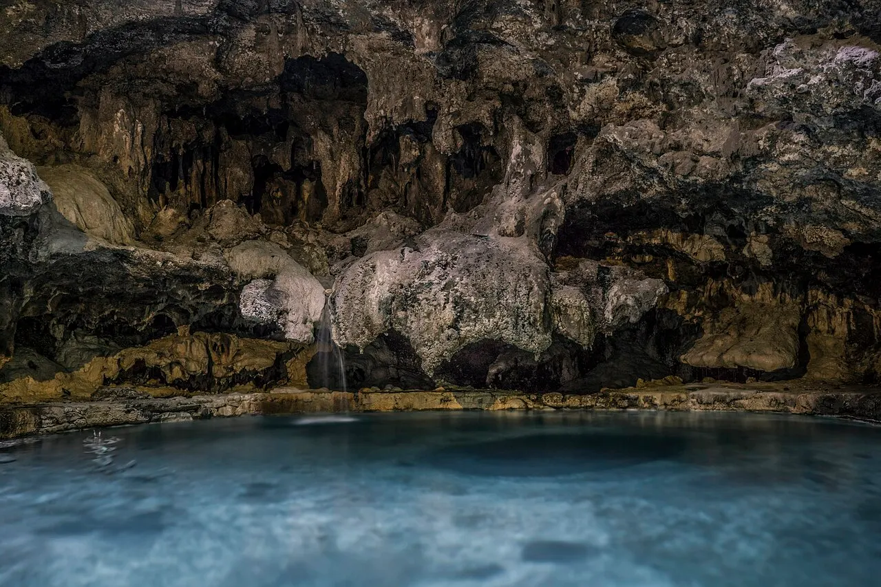
At the end of Cave Avenue, on the south bank of the Bow River, this national historic site preserves the underground sulfurous-water cave that gave rise to Canada's national parks in the 1880s. A short tunnel leads to the steaming natural chamber, while the outdoor pavilions explain the Indigenous history, the old public baths and the protection of the Banff Springs snail (Physella johnsoni), an endangered species that lives only in these springs. Swimming is not allowed here; as checked in October 2026, the site was open daily from mid-May to mid-October (9:30 a.m. to 5 p.m.) and Thursday to Monday the rest of the year (11 a.m. to 5 p.m.), with admission included in the Discovery Pass.
Check access
Lake Minnewanka
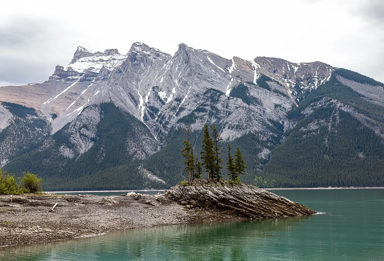
About 10 km northeast of Banff town, this dammed glacial lake, 21 km long, is the largest body of water in the park and the only one where motorboats are allowed on a limited basis. The shore offers picnic tables, kayak rentals, seasonal cruises to the Devil's Gap gorge and the trail to Stewart Canyon. Beneath the water lie the foundations of the old summer village of Minnewanka Landing, submerged when the dam was raised in 1941. In summer, Roam Transit's Route 6 spares you the fight for a parking space.
Check access

Peyto Lake and Bow Summit
About 40 km north of Lake Louise along the Icefields Parkway (Highway 93N), at the highest point of the road inside the park (Bow Summit, about 2,088 meters), a short paved walk leads to the wooden platform renovated by Parks Canada above Peyto Lake. Fed by the Peyto Glacier, the lake draws an elongated outline of milky light blue on the valley floor. The viewpoint may have accumulated snow until June; it does not require a shuttle, but it does require the park's daily pass.
Check access

Banff Upper Hot Springs
Next to the base of the gondola on Sulphur Mountain, at 1,585 meters above sea level, this is the heated mineral-water outdoor pool where bathing is permitted inside the park. The water emerges at between 37 °C and 40 °C, and the pool's edge looks out toward Mount Rundle. In the Parks Canada rate table checked in October 2026, a single admission cost 19.75 CAD for adults and 17.25 CAD for youth aged 3 to 17 and seniors (the federal free admission for under-18s applies at the park gate but not to the hot pool), with a locker token included and optional towel and swimsuit rental. There is no online booking: access is first come, first served, from 10 a.m. to 10 p.m., with an annual maintenance closure in the fall.
Check access

Two Jack Lake
On the Lake Minnewanka Scenic Drive loop, about 11 km from town, the smaller lake has shallow, greenish water that mirrors the jagged face of Mount Rundle. In the picnic area are the red Parks Canada chairs, facing the water, and the shore is good for walking or for paddling a kayak or stand-up paddleboard in waters more sheltered from the wind than those of Minnewanka.
Check access
Nilo’s itinerary
Start with the basic programme and choose extensions for the time you have.
Plan my days in the app ↗Day 1 · Banff town, Sulphur Mountain and the Minnewanka loop
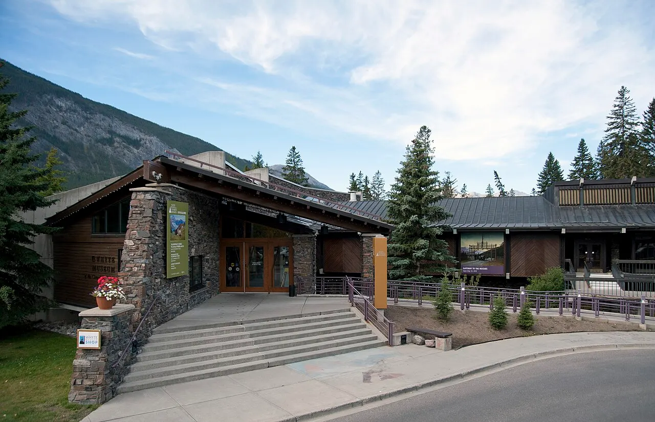
Start on the south bank of the Bow River. At the end of Cave Avenue, west of the bridge, the Cave and Basin National Historic Site tells the story of the park's origin in the 1883 thermal cave; from mid-May to mid-October it is open every day from 9:30 a.m., and the rest of the year only Thursday to Monday, from 11 a.m. Return along the riverbank to the Banff Avenue bridge, pass the Buffalo Nations Luxton Museum and follow the wooded trail to Bow Falls and the terrace of the Fairmont Banff Springs.
Cross the bridge back to downtown. Right at the end of it, the Banff Park Museum shows the 1903 natural history collection (Thursday to Monday, mid-May to mid-October); then have lunch on Banff Avenue or Bear Street. If the weather turns, the Whyte Museum of the Canadian Rockies is open every day.
In the afternoon, take Roam Transit Route 1 to the Banff Gondola and go up Sulphur Mountain (or hike the 5.5 km trail if you have the fitness and time); walk the wooden boardwalk to Sanson's Peak and, on the way down, stop at the Banff Upper Hot Springs, next to the base, which run first come, first served and close for a few weeks in the fall for maintenance.
In the late afternoon, choose between the Lake Minnewanka and Two Jack Lake loop (by car, or on Roam Transit Route 6 in summer), Vermilion Lakes Road on foot or by bicycle for sunset on Mount Rundle, or Surprise Corner and the Hoodoos, on the Tunnel Mountain side, east of downtown.
Day 2 · Lake Louise and Moraine Lake with reserved transport
Leave early with your confirmed Parks Canada shuttle reservation (boarding at the Lake Louise Park and Ride) or with the Roam Transit Route 8X Super Pass, departing from the Banff High School terminal.
Start at Moraine Lake and climb the short Rockpile trail to see the Valley of the Ten Peaks in the morning light; if you want to walk more, do the route to Consolation Lakes or, in late September, climb Larch Valley, respecting any group rules.
Take the connector bus (Lake Connector) on to the shore of Lake Louise; walk the flat path along the water or climb the 3.5 km to the Lake Agnes Tea House for tea and a snack (it is open June to October and takes cash only).
Come down in the afternoon and return to Banff by bus or by the Park and Ride, with dinner in the center of town.
Day 3 · Johnston Canyon and the southern Icefields Parkway to Peyto Lake
This day calls for a car or a tour, because Roam Transit does not go to the Icefields Parkway. Arrive early at Johnston Canyon via the Bow Valley Parkway (Highway 1A) and walk the catwalks to the Lower Falls (1.2 km) and the Upper Falls (2.5 km each way). Between October 13 and December 11, 2026, with the trail closed for construction, head straight to the Icefields Parkway.
Pass Lake Louise and enter the Icefields Parkway (Highway 93N) with a full tank and offline maps downloaded; from November 1 to April 1, the car needs winter tires or chains.
Stop at the Crowfoot Glacier viewpoint and on the shores of Bow Lake, where the glacier and the historic red-wood lodge are reflected in the shallow water.
Climb to Bow Summit (2,088 m) and walk to the observation platform over Peyto Lake to see the milky turquoise color of the lake far below; return to Banff via Highway 1 in the late afternoon.
Without a car, do Johnston Canyon on Roam Transit Route 9 in summer and use the afternoon for Tunnel Mountain; Peyto Lake is left for a one-day tour along the Icefields Parkway.

If you stay longer
Day 4 · Yoho National Park and Emerald Lake
Day trip
Just past the British Columbia border, about 35 km west of Lake Louise (70 to 85 km from Banff on Highway 1, about 1 hour by car), Yoho National Park holds the natural rock bridge over the Kicking Horse River and Emerald Lake, where you can walk along the shore or rent a canoe without the shuttle requirement of Moraine Lake. Takakkaw Falls, with a main drop of 254 m, open via Yoho Valley Road from late June to mid-October. On the British Columbia side, Highway 1 requires winter tires from October 1, with the end date for each stretch on the provincial government's map (DriveBC).
Food
Bison and Alberta game meat
Mountain restaurants in Banff serve cuts of bison, elk and Alberta beef in burgers, stews, charcuterie boards and fondues. These are dishes made for the cold and for the return from long hikes.
Trout and smoked salmon
Farmed rainbow trout and Pacific salmon appear grilled, smoked or in creamy soups on menus along Banff Avenue and in Lake Louise.
Afternoon tea at the trail teahouses
From June to October, the historic teahouses of Lake Agnes (since 1905) and Plain of Six Glaciers (since 1927), on the trails above Lake Louise, serve loose-leaf teas, soups, breads and cakes made with supplies carried in on foot, by horse or by air early in the season; the Lake Agnes teahouse runs without electricity. Neither accepts cards or digital payment: bring cash.
Craft breweries and local spirits
The town has microbreweries and distilleries that use Alberta barley and glacial water from the Bow Valley. In the pubs on Banff Avenue and Bear Street, tasting flights come with poutine and pub dishes.
Where to eat
- Bear Street and the blocks parallel to Banff Avenue
Bear Street was redesigned as a shared street with wide sidewalks and holds bistros, bakeries, pizzerias and contemporary mountain restaurants that are less crowded than those on the main avenue. Look for places that work with trout, bison and Alberta ingredients; in summer and on weekends, book dinner ahead.
- Banff Avenue and around the Bow River bridge
Holds craft breweries, Swiss-Canadian fondue houses, Alberta beef steakhouses and cafés that open early for those catching the 7 a.m. shuttle. For a trail lunch, stop at a bakery or market downtown before boarding for Lake Louise, where options are few and pricey.
- Lake Louise (Samson Mall village and trail teahouses)
By the highway, the bakery and small market at Samson Mall handle sandwiches and coffee before the outings. On the trails above the lake, the teahouses of Lake Agnes and Plain of Six Glaciers open from June to October with soup, homemade bread, cake and hot tea; both take cash only.
· 2026-10-17
Day trips
Canmore and Kananaskis Country
Located 25 km east of Banff on the Trans-Canada Highway (about 20 minutes by car or 25 minutes on Roam Transit's regional Route 3), Canmore offers open views of the Three Sisters peaks, cafés on 8th Street, the flat walk along Policeman's Creek and access to the Grassi Lakes trails and Kananaskis Country (which requires its own Kananaskis Conservation Pass to park vehicles). In good weather, you can ride the Banff Legacy Trail, 29 km of paved bike path between Canmore and the Bow Valley Parkway that passes the Vermilion Lakes and is not maintained in winter.
Yoho National Park and Emerald Lake
Just past the British Columbia border, about 35 km west of Lake Louise (70 to 85 km from Banff on Highway 1, about 1 hour by car), Yoho National Park holds the natural rock bridge over the Kicking Horse River and Emerald Lake, where you can walk along the shore or rent a canoe without the shuttle requirement of Moraine Lake. Takakkaw Falls, with a main drop of 254 m, open via Yoho Valley Road from late June to mid-October. On the British Columbia side, Highway 1 requires winter tires from October 1, with the end date for each stretch on the provincial government's map (DriveBC).
Columbia Icefield and Athabasca Glacier
About 185 km northwest of Banff along the Icefields Parkway (Highway 93N), a 2 hour 30 minute to 3 hour drive each way without stops, the Athabasca Glacier is the most accessible tongue of the Columbia Icefield, already at the border with Jasper National Park. It is a long, full-day round trip with a stop at the Glacier Discovery Centre; never walk on the ice beyond the marked areas without a certified guide, because of hidden crevasses.
Where to begin
Banff town, Sulphur Mountain and the Minnewanka loop
Start on the south bank of the Bow River. At the end of Cave Avenue, west of the bridge, the Cave and Basin National Historic Site tells the story of the park's origin in the 1883 thermal cave; from mid-May to mid-October it is open every day from 9:30 a.m., and the rest of the year only Thursday to Monday, from 11 a.m. Return along the riverbank to the Banff Avenue bridge, pass the Buffalo Nations Luxton Museum and follow the wooded trail to Bow Falls and the terrace of the Fairmont Banff Springs.
Lake Louise and Moraine Lake with reserved transport
Leave early with your confirmed Parks Canada shuttle reservation (boarding at the Lake Louise Park and Ride) or with the Roam Transit Route 8X Super Pass, departing from the Banff High School terminal.
Johnston Canyon and the southern Icefields Parkway to Peyto Lake
This day calls for a car or a tour, because Roam Transit does not go to the Icefields Parkway. Arrive early at Johnston Canyon via the Bow Valley Parkway (Highway 1A) and walk the catwalks to the Lower Falls (1.2 km) and the Upper Falls (2.5 km each way). Between October 13 and December 11, 2026, with the trail closed for construction, head straight to the Icefields Parkway.
Money
The currency is the Canadian dollar (CAD), and contactless cards are accepted nearly everywhere in town, on buses and at Parks Canada ticket booths. The important exception is the Lake Louise trail teahouses (Lake Agnes and Plain of Six Glaciers), which accept neither cards nor digital payment: bring cash. Alberta charges no provincial sales tax, so shopping and restaurants pay only the federal tax (GST) of 5%. Lodging adds to the GST Alberta's Tourism Levy, which rose from 4% to 6% on April 1, 2026, and, in Banff, the Tourism Improvement Fee of 2% on the nightly rate, a fee (not a tax) that hotels collect for Banff & Lake Louise Tourism. At restaurants with table service, the usual tip ranges from 15% to 20% before tax. When planning your budget, set aside the daily park pass (12.25 CAD per adult or 24.50 CAD per car as checked in October 2026), the booking of shuttles or regional buses and the high cost of lodging between June and September.
Getting there and around

The nearest international airport is Calgary's (YYC), about 145 km east of Banff along Trans-Canada Highway 1 (about 1 hour 30 minutes to 1 hour 45 minutes of driving without delays). Private express buses, such as Banff Airporter and Brewster Express, link the airport and downtown Calgary to hotels in Banff and Canmore, with advance booking. The On-It Regional Transit summer bus that used to leave from downtown Calgary did not operate in the 2026 season; the website carfreebanff.ca collects the car-free alternatives.
To enter and stop anywhere in Banff National Park, by car or by bus, a Parks Canada admission pass is required. In the current rate table checked in October 2026, the daily admission cost 12.25 CAD per adult (18 to 64), 10.75 CAD per senior (65+), 24.50 CAD per family/group vehicle (up to seven people in one car) and was free for youth up to 17; the annual Discovery Pass cost 83.50 CAD for an adult or 167.50 CAD for a family/group.
Inside the park, the public Roam Transit system runs urban and regional routes from Banff town: Route 1 goes to the gondola and the Upper Hot Springs, Route 2 passes Tunnel Mountain and the Fairmont Banff Springs, Route 4 serves Cave and Basin in summer, Route 6 runs the Lake Minnewanka loop, Route 9 goes to Johnston Canyon and Route 8X (Lake Louise Express) runs year-round to the shore of Lake Louise, with a reservation recommended.
To visit Moraine Lake (open June 1 to mid-October), private cars cannot enter. Those who drive to the area leave the vehicle free of charge at the Lake Louise Park and Ride (at Lake Louise Ski Resort) and board the reserved Parks Canada shuttle, which includes the connector bus between Lake Louise and Moraine Lake. Reservations open in April, on a date announced by Parks Canada at reservation.pc.gc.ca: about 40% of the seats go on opening day, at 8 a.m. MDT, and the other 60% are released at 8 a.m. MDT two days before each travel date. To drive the Icefields Parkway (Highway 93N) to Peyto Lake and Jasper, a rental car or a tour is still necessary, since Roam Transit does not cover that highway; from November 1 to April 1, Parks Canada requires winter tires (with the M+S symbol or the mountain-and-snowflake symbol) or chains on it.
Safety
Banff is a very safe urban destination as far as crime goes, but a high-mountain environment with serious natural hazards. Grizzly bears and black bears live throughout the park: hike in a group, make noise with your voice at trail bends, carry bear spray on your belt (never inside your pack) and know how to unlock it; remember that the spray is prohibited on airplanes, both in carry-on and checked bags, and must be bought or rented locally. The weather changes fast above 2,000 meters, with the possibility of snow and hypothermia even in summer. In winter and spring, avalanches require respecting Parks Canada closures and never going beyond the Rockpile viewpoint at Moraine Lake when there is risk on the slopes. In an emergency, call 911; to report a carnivore sighting or a conflict with wildlife, contact Banff Dispatch at 403-762-1470.
Etiquette tips
Required distance from wildlife
Never approach or feed wild animals. Parks Canada rules require staying at least 100 meters from bears, wolves, cougars and coyotes, and at least 30 meters from elk, moose, bighorn sheep and deer. If you spot an animal by the roadside, do not stop in the travel lane or get out of the car to take photos.
Trails and leave no trace
Stay on marked trails so as not to destroy the slow-growing alpine vegetation, and carry out all waste, including fruit peels. Portable speakers on the trails spoil the setting and reduce your ability to hear animals approaching.
Parking and residential areas
In Banff town, respect the streets with residents-only parking. In summer, use the free parking beside the railway station (Train Station Public Parking) and walk a few minutes to Banff Avenue.
Mistakes to avoid
Driving straight to Moraine Lake or trying to park at Lake Louise at 10 a.m. in summer. The Moraine Lake road is closed to private cars and the paid parking lot at Lake Louise usually fills before dawn; without a shuttle reservation or Roam Transit, you miss the trip.
Visiting in April or early May expecting turquoise lakes. In that transition period, Lake Louise and Moraine Lake are still frozen under snow and the Moraine Lake road stays closed until June.
Mixing up Cave and Basin with the bathing pool. Cave and Basin is a museum and historic site where you cannot enter the water; to swim in the hot springs, go to Banff Upper Hot Springs, higher up on Mountain Avenue.
Entering the Icefields Parkway (Highway 93N) with little fuel or relying on a cell signal to open maps and vouchers. Fill up in Banff or Lake Louise Village and download maps and reservations before setting out.
Underestimating the elk inside Banff town. In spring (calving season) and fall (rutting season), they wander the lawns and fields of the town and can attack anyone who comes within 30 meters.
Useful phrases
Park Pass / Discovery Pass
The Parks Canada permit required to stop inside the national park, sold by the day or as an annual version.
Bear spray
Pepper spray made specifically for bears, sold or rented at Banff sporting goods stores; an essential safety item on the trails.
Park and Ride
A parking lot at the base of Lake Louise Ski Resort from which the reserved Parks Canada shuttles to the two lakes depart.
Larch season
The period from late September to early October when the needles of the alpine larches turn golden yellow before falling.
Ice cleats / microspikes
Metal spikes attached to the sole of a boot for walking safely on ice at Johnston Canyon and on Tunnel Mountain in winter.
Where to stay
- Downtown Banff (Banff Avenue and Bear Street) · People traveling without a car or who want restaurants, shops and Roam Transit boarding points on foot.: Puts the Banff High School bus terminal, markets and museums a few blocks away. Rates from June to September are high, rooms sell out early and hotels on the main avenue see more activity; book months ahead.
- Tunnel Mountain Road · Families and groups with a car looking for lodges with kitchens, cabins and quieter access.: It sits on elevated ground 2–3 km from downtown, linked to town by Roam Transit Route 2. It gives more space and easy parking, but walking back from downtown at night means facing a steep climb.
- Lake Louise (village and lakeshore) · Anyone who wants an early start on the alpine trails and a shorter route to the Icefields Parkway.: It cuts the 55 km morning transfer from Banff. The supply of beds and restaurants is small, prices are high and there is almost no urban life at night; even staying in the village, you still need a shuttle or bus to get up to Moraine Lake.
- Canmore (outside the park, 25 km away) · Those who want larger apartments, better value or are traveling for several days by car.: It sits just outside the park's east gate and is linked by Roam Transit Route 3. It saves on the nightly rate and offers great cafés and markets, but adds 20 to 30 minutes of travel each way to downtown Banff.
· 2026-10-17
Districts

Banff Townsite
It holds Banff Avenue, Bear Street, the museums, supermarkets, outfitters and the Banff High School bus hub. Everything here is done on foot, with direct access to the Tunnel Mountain trail and the shores of the Vermilion Lakes.

South bank of the Bow River and Sulphur Mountain
Past the Banff Avenue bridge over the Bow River are the Park Administration gardens, the Buffalo Nations Luxton Museum, Bow Falls, the historic Fairmont Banff Springs hotel and, up Mountain Avenue, the gondola and the hot springs of Sulphur Mountain, plus Cave and Basin to the west.
Minnewanka Loop
A road loop northeast of town that passes Cascade Ponds, Johnson Lake and Two Jack Lake and ends at Lake Minnewanka. It works well by car or on Roam Transit's seasonal Route 6.
Bow Valley Parkway (Highway 1A)
A scenic road running parallel to the Trans-Canada Highway between Banff and Lake Louise, where Johnston Canyon is. Certain stretches of the road have seasonal restrictions on motor vehicles in spring and fall to favor cyclists and wildlife; check the Parks Canada calendar.
Lake Louise Corridor
Located 55 km northwest of Banff, it is divided into the small service village by the highway (Samson Mall and the station), the Park and Ride lot at Lake Louise Ski Resort, the shore of Lake Louise and the restricted road to Moraine Lake.
Icefields Parkway (Highway 93N)
A mountain highway that leaves Lake Louise toward Jasper, with no gas stations or cell coverage for most of the drive. The southern stretch inside Banff National Park includes Crowfoot Glacier, Bow Lake and the Peyto Lake viewpoint.
History
Millennia before the park · Indigenous presence in the Bow Valley
The Stoney Nakoda, the nations of the Blackfoot Confederacy, the Tsuut'ina, Ktunaxa, Secwépemc and Métis used the Bow Valley and the Rocky Mountain passes for hunting, trade and spiritual practices tied to the hot springs.
1883–1885 · The railway and the hot springs reserve
Three Canadian Pacific Railway workers found the thermal cave on Sulphur Mountain in 1883. In 1885, the federal government set aside the area around the spring, the seed of Canada's national park system.
1887–1888 · Rocky Mountains Park and the grand railway hotel
The 1887 act enlarged the protected area as Rocky Mountains Park, and in 1888 the Canadian Pacific opened the Banff Springs Hotel, joining state conservation with railway tourism.
1884–1890 · Laggan and the first Lake Louise chalet
In 1884, the Canadian Pacific set up a railway camp about 55 km northwest of Banff, called Holt City and later Laggan, which would not be renamed Lake Louise until 1914. In 1890, the company opened a small chalet on the lakeshore, the starting point for the mountaineering expeditions that later hired Swiss guides.
1984 · UNESCO World Heritage Site
Banff National Park was inscribed on the UNESCO list as part of the Canadian Rocky Mountain Parks, alongside Jasper, Yoho and Kootenay.
1990 and 2023 · Municipal autonomy and traffic management
In 1990, Banff became the first incorporated municipality inside a Canadian national park, with strict growth limits; from 2023, Parks Canada closed the Moraine Lake road to private cars permanently.
Complete history
Long before the railway and the park boundaries, the Bow River valley was a corridor for travel, hunting and gathering for the Stoney Nakoda, Siksika, Kainai, Piikani, Tsuut'ina, Ktunaxa, Secwépemc and the Métis Nation. The thermal cave at the foot of Sulphur Mountain was already known and respected by these communities when the Canadian Pacific Railway tracks pushed through the Rockies in the 1880s. For decades, the policy behind the creation of the park restricted Indigenous access to the territory, a relationship now retold in the Parks Canada interpretive centers and at the Buffalo Nations Luxton Museum.
In November 1883, three railway workers climbed down through the opening at the top of the steaming Cave and Basin cavern. The commercial dispute over ownership of the waters led the government in Ottawa to create, in 1885, a 26 km² federal reserve around the springs. Two years later, in 1887, Parliament passed the Rocky Mountains Park Act, turning the reserve into the country's first national park, later renamed Banff National Park.
To make the transcontinental line pay, the Canadian Pacific Railway, under the direction of William Cornelius Van Horne, built grand mountain hotels. The Banff Springs Hotel opened in 1888 above the confluence of the Bow and Spray rivers. Farther northwest, the Laggan railway stop had existed since 1884, and in 1890 the company built the first chalet on the shore of Lake Louise, the forerunner of today's hotel. Alpine guides brought from Switzerland starting in 1899 opened routes on the peaks of the Continental Divide and consolidated the mountaineering culture that now appears in the Whyte Museum's collection.
In the second half of the 20th century, the paving of the Trans-Canada Highway (Highway 1) and the Icefields Parkway (Highway 93N) replaced the train with the automobile as the dominant way to arrive. UNESCO recognition in 1984 and the municipal incorporation of the Town of Banff in 1990 established a singular model: the town has a fixed urban boundary and residency rules tied to the need to work in the park, while the pressure of millions of visitors a year led to the strengthening of Roam Transit and the permanent closure of Moraine Lake Road to private cars.
I wouldn't skip Cave and Basin: understanding that Canada's whole park system was born from a dispute over a hot-water cave with a tiny snail changes how you see the town.
Geography and shape of the city
The town of Banff sits at about 1,380 meters above sea level on the floor of the Bow Valley, surrounded by the slanted profiles of Mount Rundle (2,949 m), Cascade Mountain (2,998 m), Tunnel Mountain (1,692 m) and Sulphur Mountain. The park is organized along the southeast–northwest axis formed by the Trans-Canada Highway 1 and the slower parallel road, the Bow Valley Parkway (Highway 1A), which leads to Johnston Canyon. About 55 km northwest of town is the Lake Louise junction: from there run the road to the shore of Lake Louise, Moraine Lake Road (14 km, closed to private cars and open only from June to mid-October to authorized transport) and the start of the Icefields Parkway (Highway 93N), which climbs toward Bow Summit and Peyto Lake. Because the distances between the town center and the lakes in the west are long, it makes sense to divide the days by geographic corridor rather than cross the highway several times.
I'd group the outings by road: town and Minnewanka on one day, the two shuttle lakes on the next and Highway 93N on the third. Coming back to Banff in mid-afternoon to head out again to the west wastes more than a hundred kilometers.
Culture

Banff's cultural identity grows out of the tension between a compact urban core and federal conservation administration. Because the town has a boundary fixed by law and a "need to reside" rule (only people who work or have a functional tie to the park may live here), the population combines families established for generations, park wardens, mountain guides and a young seasonal workforce from across Canada and abroad.
On the artistic and intellectual side, the Banff Centre for Arts and Creativity, on the slope of Tunnel Mountain, projects the town well beyond scenery tourism. The institution hosts literary and music residencies and every fall organizes the Banff Centre Mountain Film and Book Festival, one of the world's leading gatherings of film and literature on mountains, mountaineering and the environment.
In recent years, the presence of the First Nations has regained public visibility through Indigenous Peoples Day events in June, the exhibitions at the Buffalo Nations Luxton Museum and at Cave and Basin, and the request, submitted in 2016 by First Nations of the region and not yet made official, to rename Tunnel Mountain as Sacred Buffalo Guardian Mountain.
If the trip falls in late September, I'd prioritize a larch trail such as Larch Valley: the trees that turn golden in fall before losing their needles last only a few weeks.
Festivals and events
SnowDays and Ice Magic
In January and early February, downtown Banff and the Lake Louise area host ice sculptures, skijoring shows (skiers pulled by horses on Banff Avenue) and outdoor winter activities.
Banff Centre Mountain Film and Book Festival
Held between late October and early November at the Banff Centre, it brings together premieres of documentaries on mountaineering, expeditions and environmental conservation, talks with authors and photo exhibits.
Books and films
A Hunter of Peace (Mary T. S. Schäffer, ed. E. J. Hart)
An edition compiled by the historian E. J. Hart from Old Indian Trails of the Canadian Rockies (1911), the book gathers the accounts of the explorer Mary Schäffer, who traveled the Rockies in the early 20th century with Indigenous guides such as Samson Beaver. The first edition came out from the Whyte Foundation in 1980, and the second from the Whyte Museum in 2014.
Bear 71 (interactive documentary by the National Film Board, by Jeremy Mendes and Leanne Allison, 2012)
Directed by a Canmore resident, the short follows, through surveillance cameras, the real life of a radio-collared female grizzly in Banff National Park, explaining plainly the conflict among highways, trains, tourists and wildlife in the Bow Valley.
Frequently asked questions
Banff: how many days should I allow?
I'd stay at least three full days in Banff, preferably between June and mid-October, when Moraine Lake and the shuttles are running: the first for the center of town, Cave and Basin, Sulphur Mountain and the Lake Minnewanka or Vermilion Lakes loop; the second, all of it, for Lake Louise and Moraine Lake using the reserved shuttle; and the third, by car or on a tour, for Johnston Canyon combined with the southern stretch of the Icefields Parkway to Bow Lake and Peyto Lake. Without a car, I'd do the canyon on Roam Transit Route 9 and leave Peyto Lake for a tour. With four days, you can add Yoho National Park (Emerald Lake and Takakkaw Falls) or stretch the Icefields Parkway to the Athabasca Glacier without rushing. In winter, the same three days change subject: skiing at the park's three resorts, white lakes and hikes with crampons, with no Moraine Lake. A round trip from Calgary in a single day takes more than three hours of driving and leaves little time beyond two crowded viewpoints. Between October 13 and December 11, 2026, the Johnston Canyon trail is closed for construction.
Banff: how do I get there from Calgary airport?
The nearest international airport is Calgary's (YYC), about 145 km east of Banff along Trans-Canada Highway 1 (about 1 hour 30 minutes to 1 hour 45 minutes of driving without delays). Private express buses, such as Banff Airporter and Brewster Express, link the airport and downtown Calgary to hotels in Banff and Canmore, with advance booking. The On-It Regional Transit summer bus that used to leave from downtown Calgary did not operate in the 2026 season; the website carfreebanff.ca collects the car-free alternatives.
Banff: do I need a pass to enter the park, and how much is it?
To enter and stop anywhere in Banff National Park, by car or by bus, a Parks Canada admission pass is required. In the current rate table checked in October 2026, the daily admission cost 12.25 CAD per adult (18 to 64), 10.75 CAD per senior (65+), 24.50 CAD per family/group vehicle (up to seven people in one car) and was free for youth up to 17; the annual Discovery Pass cost 83.50 CAD for an adult or 167.50 CAD for a family/group.
Banff: how do I get to Moraine Lake if private cars cannot enter?
The lake receives visitors only between June 1 and Canadian Thanksgiving in mid-October, when the road closes because of avalanche risk. Private cars never enter Moraine Lake Road: only reserved Parks Canada shuttles (departing from the Lake Louise Park and Ride, with a link via the Lake Connector), Roam Transit buses with the Super Pass, licensed commercial operators and registered guests of Moraine Lake Lodge get through. Those who drive to the area leave the vehicle free of charge at the Lake Louise Park and Ride (at Lake Louise Ski Resort) and board the reserved Parks Canada shuttle, which includes the connector bus between Lake Louise and Moraine Lake. Reservations open in April, on a date announced by Parks Canada at reservation.pc.gc.ca: about 40% of the seats go on opening day, at 8 a.m. MDT, and the other 60% are released at 8 a.m. MDT two days before each travel date. Cycling is another option when the road is open, shared with constant bus traffic from June to October.
Banff: how do I get to Lake Louise without a car or a fight for parking?
Lake Louise is about 55 km northwest of Banff town along Trans-Canada Highway 1. From mid-May to mid-October, parking by the lake is paid and usually fills before dawn; take the Parks Canada shuttle from the Park and Ride or Roam Transit's Route 8X, which runs year-round. For those who sleep in Banff without renting a vehicle, I'd book the Route 8X Super Pass: it leaves from Banff High School, drops you at Lake Louise and includes the Parks Canada connector to Moraine Lake during the Moraine Lake season, from June 1 to mid-October.
Banff: what do I need to drive the Icefields Parkway to Peyto Lake?
To drive the Icefields Parkway (Highway 93N) to Peyto Lake and Jasper, a rental car or a tour is necessary, since Roam Transit does not cover that highway; from November 1 to April 1, Parks Canada requires winter tires (with the M+S symbol or the mountain-and-snowflake symbol) or chains on it. The highway has no gas stations or cell coverage for most of the drive: fill up in Banff or Lake Louise Village and download maps and reservations before setting out.
Banff: when is the best time to go?
June to September is the main window for hiking without winter gear and seeing the lakes thawed in turquoise. Lake Louise and Moraine Lake usually thaw between late May and the first half of June; the Moraine Lake road opens on June 1 and closes after Canadian Thanksgiving, in the second week of October. The last two weeks of September and the start of October bring the yellowing of the larches on the alpine trails, with cold mornings and less heat. From November to April, the lakes are covered in snow and white ice: the trip shifts its focus to skiing at the park's three resorts (Sunshine Village, Lake Louise Ski Resort and Mount Norquay), hikes with crampons and ice skating when conditions allow. Johnston Canyon, a winter classic, is closed for construction from October 13 to December 11, 2026.
Banff: is Johnston Canyon open?
Parks Canada closed the trail, the day-use area and the P1 parking lot from October 13 to December 11, 2026 for work to stabilize the canyon walls; since the work may continue in other phases, check the park bulletins before going. The canyon is about 25 km west of Banff along the Bow Valley Parkway (Highway 1A): it is 1.2 km to the Lower Falls and 2.5 km each way to the Upper Falls. Outside closures, the waterfalls freeze in winter and the trail calls for hiking crampons (ice cleats) attached to your boots. In summer, arrive early or take Roam Transit's Route 9.
Banff: where can I bathe in hot spring water?
Cave and Basin is a museum and historic site where you cannot enter the water; to swim in the hot springs, go to Banff Upper Hot Springs, higher up on Mountain Avenue, next to the base of the gondola on Sulphur Mountain. The water emerges at between 37 °C and 40 °C. In the Parks Canada rate table checked in October 2026, a single admission cost 19.75 CAD for adults and 17.25 CAD for youth aged 3 to 17 and seniors (the federal free admission for under-18s applies at the park gate but not to the hot pool), with a locker token included and optional towel and swimsuit rental. There is no online booking: access is first come, first served, from 10 a.m. to 10 p.m., with an annual maintenance closure in the fall.
Banff: what precautions should I take with bears and the mountains?
Banff is a very safe urban destination as far as crime goes, but a high-mountain environment with serious natural hazards. Grizzly bears and black bears live throughout the park: hike in a group, make noise with your voice at trail bends, carry bear spray on your belt (never inside your pack) and know how to unlock it; remember that the spray is prohibited on airplanes, both in carry-on and checked bags, and must be bought or rented locally. Parks Canada rules require staying at least 100 meters from bears, wolves, cougars and coyotes, and at least 30 meters from elk, moose, bighorn sheep and deer. The weather changes fast above 2,000 meters, with the possibility of snow and hypothermia even in summer. In winter and spring, avalanches require respecting Parks Canada closures and never going beyond the Rockpile viewpoint at Moraine Lake when there is risk on the slopes. In an emergency, call 911; to report a carnivore sighting or a conflict with wildlife, contact Banff Dispatch at 403-762-1470.
Banff: are cards accepted, and what taxes and tip should I add?
The currency is the Canadian dollar (CAD), and contactless cards are accepted nearly everywhere in town, on buses and at Parks Canada ticket booths. The important exception is the Lake Louise trail teahouses (Lake Agnes and Plain of Six Glaciers), which accept neither cards nor digital payment: bring cash. Alberta charges no provincial sales tax, so shopping and restaurants pay only the federal tax (GST) of 5%. Lodging adds to the GST Alberta's Tourism Levy, which rose from 4% to 6% on April 1, 2026, and, in Banff, the Tourism Improvement Fee of 2% on the nightly rate, a fee (not a tax) that hotels collect for Banff & Lake Louise Tourism. At restaurants with table service, the usual tip ranges from 15% to 20% before tax.
Banff: is the day trip to Yoho National Park worth it?
With four days, you can add Yoho National Park (Emerald Lake and Takakkaw Falls) to the three days in Banff. Just past the British Columbia border, about 35 km west of Lake Louise (70 to 85 km from Banff on Highway 1, about 1 hour by car), Yoho National Park holds the natural rock bridge over the Kicking Horse River and Emerald Lake, where you can walk along the shore or rent a canoe without the shuttle requirement of Moraine Lake. Takakkaw Falls, with a main drop of 254 m, open via Yoho Valley Road from late June to mid-October. On the British Columbia side, Highway 1 requires winter tires from October 1, with the end date for each stretch on the provincial government's map (DriveBC).
Other cities in the country
Canada ↗- Days
- 2–3
- When
- Sep–Oct
- Per person/day
- Average 130–260 C$Mid-range · per person/day
Cost scope
Per person per day: accommodation, meals, urban transport, visits and a small allowance for extras. Flights excluded; larger purchases vary. Editorial estimate, not a quote.
- Days
- 2–3
- When
- May–Oct
- Per person/day
- Average 160–280 C$Mid-range · per person/day
Cost scope
Per person per day: accommodation, meals, urban transport, visits and a small allowance for extras. Flights excluded; larger purchases vary. Editorial estimate, not a quote.
- Days
- 2–3
- When
- Jul–Sep
- Per person/day
- Average 190–330 CADMid-range · per person/day
Cost scope
Per person per day: accommodation, meals, urban transport, visits and a small allowance for extras. Flights excluded; larger purchases vary. Editorial estimate, not a quote.
- Days
- 2–3
- When
- Feb · Jun–Oct
- Per person/day
- Average 210 CADMid-range · per person/day
Cost scope
Per person per day: accommodation, meals, urban transport, visits and a small allowance for extras. Flights excluded; larger purchases vary. Editorial estimate, not a quote.