Argentina
El Chaltén
The granite spires of Fitz Roy and Cerro Torre, the trails that start on foot from the village, and Viedma Glacier
Days Start with the basic programme and choose extensions for the time you have.
How the guide reaches this number
On the first day, arriving in the morning by bus or by car over the 220 km from El Calafate, I would stop at the Ceferino Fonzo Visitor Center and in the afternoon climb to the Mirador de los Cóndores and the Mirador de las Águilas. On the second day, picking the morning with the steadiest weather, I would do the 20 km round trip to the Laguna de los Tres at the foot of Fitz Roy. On the third day, I would walk to the Laguna Torre or, to rest my knees from the previous day's descent, take the 10:30 a.m. boat to Viedma Glacier, leaving from Bahía Túnel, and leave the Chorrillo del Salto waterfall for after the return, at 2:30 p.m. The return to El Calafate is left for the morning of the fourth day; anyone with a whole fourth day gains the breathing room to climb the Loma del Pliegue Tumbado or go to Lago del Desierto.
3
When October to April; the long summer days (December to February) and the autumn of red forests in March and April offer the trails clearest of snow and ice, but tourist services only run regularly from October until Holy Week, and after it, in April, buses, lodging and restaurants stop operating regularly.
How the guide reaches this number
From May to August the cold closes much of the businesses and piles snow on the high ground, and regular services only return in October.
October to April; the long summer days (December to February) and the autumn of red forests in March and April offer the trails clearest of snow and ice, but tourist services only run regularly from October until Holy Week, and after it, in April, buses, lodging and restaurants stop operating regularly. From May to August the cold closes much of the businesses and piles snow on the high ground, and regular services only return in October.
Per person/day Budget around ARS41,600; mid-range around ARS95,400; comfortable around ARS184,000 per person per day, based on spending reported by travelers to Budget Your Trip (checked October 2026).
How the guide reaches this number
Indicative figures, excluding travel to the destination.
Budget around ARS41,600; mid-range around ARS95,400; comfortable around ARS184,000 per person per day, based on spending reported by travelers to Budget Your Trip (checked October 2026). Indicative figures, excluding travel to the destination.
Per person per day: accommodation, meals, urban transport, visits and a small allowance for extras. Flights excluded; larger purchases vary. Editorial estimate, not a quote.
 What Nilo thinks
I would stay three days and three nights in El Chaltén, counting the afternoon of arrival, as part of the southern Patagonia itinerary alongside El Calafate. On the first day, arriving in the morning by bus or by car over the 220 km from El Calafate, I would stop at the Ceferino Fonzo Visitor Center and in the afternoon climb to the Mirador de los Cóndores and the Mirador de las Águilas. On the second day, picking the morning with the steadiest weather, I would do the 20 km round trip to the Laguna de los Tres at the foot of Fitz Roy. On the third day, I would walk to the Laguna Torre or, to rest my knees from the previous day's descent, take the 10:30 a.m. boat to Viedma Glacier, leaving from Bahía Túnel, and leave the Chorrillo del Salto waterfall for after the return, at 2:30 p.m. The return to El Calafate is left for the morning of the fourth day; anyone with a whole fourth day gains the breathing room to climb the Loma del Pliegue Tumbado or go to Lago del Desierto.I would come to El Chaltén because very few mountain places in the world let you walk out the door of your guesthouse and reach, with no cable car or 4x4, the base of granite walls like Cerro Fitz Roy (3,405 m) and Cerro Torre (3,102 m). The village was founded in 1985 inside a glacial valley of the North Zone of Los Glaciares National Park, 220 km of pavement from El Calafate, and it works with rare simplicity: Avenida San Martín ends at the gate of the Laguna de los Tres trail.
Read more
The key here is not to underestimate the Patagonian wind or treat the trip as a rushed day trip. The Laguna de los Tres is 10 km one way and the Laguna Torre 9 km, and in the mountains it is the clouds that decide the day's plan. Setting aside three nights in the village lets you use the clearest morning for the last hour of the climb to the Laguna de los Tres and leave the other days for the Laguna Torre, the short viewpoints and the cruise to Viedma Glacier.
Quick facts
- Population
- 1,865 inhabitants in the 2022 INDEC national census (1,627 in the 2010 census).
- Founded
- October 12, 1985, by decree of Santa Cruz governor Arturo Puricelli, to populate the mountain zone of the province, then with sectors in dispute with Chile.
- Country and region
- Argentina, Santa Cruz province, Lago Argentino department, where the Río de las Vueltas and Río Fitz Roy meet, at about 400 m above sea level and 220 km from El Calafate.
- Language
- Argentine Spanish, with “vos” as the informal “you”.
- Currency
- Argentine peso (ARS, written $); the reference rate on September 24, 2026 was about ARS 1,517 per dollar.
- Time zone
- America/Argentina/Rio_Gallegos: UTC-3 year-round; Argentina does not observe daylight saving time.
- Best time to go
- October to April; the long summer days (December to February) and the autumn of red forests in March and April offer the trails clearest of snow and ice, but tourist services only run regularly from October until Holy Week, and after it, in April, buses, lodging and restaurants stop operating regularly. From May to August the cold closes much of the businesses and piles snow on the high ground, and regular services only return in October.
- Average daily cost
- Budget around ARS41,600; mid-range around ARS95,400; comfortable around ARS184,000 per person per day, based on spending reported by travelers to Budget Your Trip (checked October 2026). Indicative figures, excluding travel to the destination.
When to go
October to April; the long summer days (December to February) and the autumn of red forests in March and April offer the trails clearest of snow and ice, but tourist services only run regularly from October until Holy Week, and after it, in April, buses, lodging and restaurants stop operating regularly. From May to August the cold closes much of the businesses and piles snow on the high ground, and regular services only return in October.
How the year changes
The hiking season runs from October to April, and basic tourist services operate regularly from October until Holy Week, according to the municipality (in 2027, Holy Week ends on Easter Sunday, March 28). From December to February (austral summer), the sun stays about 16 hours above the horizon at the solstice, with sunset around 10 p.m., which lets you start the 20 km to the Laguna de los Tres at 7 a.m. and return with plenty of light. On the other hand, January and February bring the strongest winds and require booking lodging months in advance. October and November bring the spring thaw, the return of regular services and fewer people on the trails (although the final stretch to the Laguna de los Tres may still have accumulated snow in October, requiring a daily check at the Visitor Center). March and the first half of April are extraordinary: the wind usually eases and the lenga and ñire forests in the Fitz Roy and Torre valleys turn red and gold. After Holy Week, however, buses, lodging and restaurants stop operating regularly, and anyone traveling in April should confirm each service beforehand. From May to August (winter), the temperature drops below freezing on the trails, snow and ice cover the high climbs (requiring crampons, poles and winter experience), roads can be cut by snowstorms and many of the hotels, restaurants and agencies close until October.
Nilo's tips
Never do El Chaltén as a day trip if the goal is the Laguna de los Tres
Leaving El Calafate in the morning means facing 220 km each way on the same day, which squeezes or rules out the 20 km of the Laguna de los Tres trail, with about 4 h one way. I would sleep at least three nights in El Chaltén so I could start walking at 7:30 a.m.
Buy the APN ticket online and choose the pass by number of days
The trails that leave from El Chaltén have ticket checks at four gates (Cóndores, Cerro Torre, Fitz Roy and Río Eléctrico), and the Viedma Glacier boat also asks for the ticket, bought separately. For the three park days of this itinerary, I would buy the 3-day Flexipass (ARS 100,000 at the general rate) at ventaweb.apn.gob.ar, which is cheaper than three daily passes (ARS 125,000 even with the second-day discount), and I would save the QR code offline. For just two days, the 50% discount on the second day, within 72 hours, comes to ARS 75,000.
Look at the sun window before fixing the order of the trails
If the first whole day dawns with no clouds on top of Fitz Roy, climb straight away to the Laguna de los Tres, even if your legs haven't yet had a light warm-up. In Patagonia, wasting a morning with no wind or clouds on a short outing can cost you the view of the granite wall the next day.
Order the vianda the day before and bring pesos from El Calafate
Inside the National Park there is no sale of water or food, and in a village this size I would not depend on the ATM. I would bring pesos in cash from El Calafate and stop at a bakery on Avenida San Martín in the late afternoon to pay in advance for the next morning's lunch.
Explore the map
Explore the map, read about the other places and plan your travel days in the app.
Open the appWhat to see
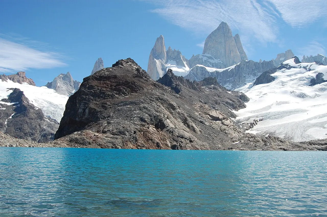
Laguna de los Tres
Located at the base of the granite walls of Cerro Fitz Roy (3,405 m) and the Poincenot and Saint-Exupéry needles, this glacial lagoon fed by the Glaciar de los Tres is the goal of the most famous hike in Argentine Patagonia. The trail starts at the far north end of Avenida San Martín (Portada Fitz Roy) and is 10 km and about 4 h one way, with 750 m of total elevation gain: 20 km round trip, which takes the whole day. The first 8 km, with 350 m of elevation gain, pass the Laguna Capri and the lenga forests to the Poincenot campsite; after crossing the Río Blanco the last hour of climbing begins, gaining the remaining 400 m in steep zigzags exposed to the wind. From the top of the moraine you can also see the Laguna Sucia below. It requires a Los Glaciares National Park ticket and an early start.
Check access
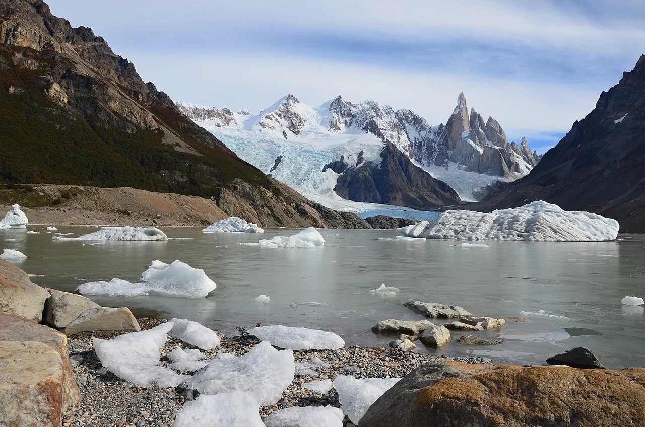
Laguna Torre
The second great classic trail that leaves on foot from the streets of El Chaltén follows the Río Fitz Roy valley for 9 km and about 3 h one way (18 km round trip), with 250 m of total elevation gain, much gentler than the final stretch to the Laguna de los Tres. The path passes the De Agostini campsite and ends on the moraine facing the Laguna Torre, from where you can see the Glaciar Grande and, when the clouds open at the back of the glacial cirque, the granite needle of Cerro Torre (3,102 m) and the neighboring spires. If you have the energy, you can continue along the moraine crest to the Mirador Maestri, 11 km and about 4 h from the village. It requires a national park ticket.
Check access
Mirador de los Cóndores
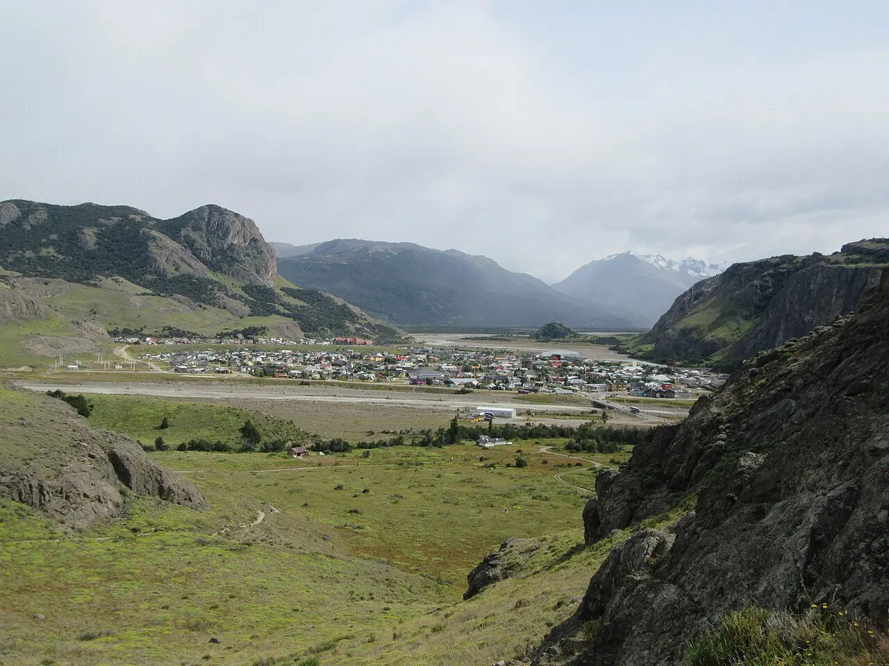
A short trail of 1 km and about 30 minutes of climbing, with 100 m of elevation gain, which starts at the Portada Los Cóndores, next to the Ceferino Fonzo Visitor Center, at the south entrance of the village. From the top of the hill you see the village wedged between the rivers, the Las Vueltas valley and the profile of the Fitz Roy and Cerro Torre massifs, and there is a good chance of seeing condors and black-chested buzzard-eagles in flight. It is the right outing for the afternoon you arrive by bus from El Calafate; it requires a park ticket at the gate.
Check access

Centro de Visitantes Ceferino Fonzo
The Administración de Parques Nacionales service office for the North Zone is at the south entrance of El Chaltén, before the Río Fitz Roy bridge. It has a topographic model of the massif and an interpretive room on the wildlife (such as the huemul deer), the flora and the history of climbing, plus the counter where park rangers give free, up-to-date information on trail conditions and the wind bulletin, and handle the mandatory registration for remote camping and climbing.
Check access

Laguna Capri
Located 4 km and about 1 h 45 min of walking from the end of Avenida San Martín, on a branch of the same main path that climbs to the Laguna de los Tres, this lagoon ringed by native forest of lengas and ñires works both as an intermediate stop and as a half-day destination for anyone who doesn't want to take on the full 20 km or the steep final climb after the Río Blanco. From the water's edge you get a direct view of the spires of the Fitz Roy massif. It requires a park ticket.
Check access
Mirador Fitz Roy
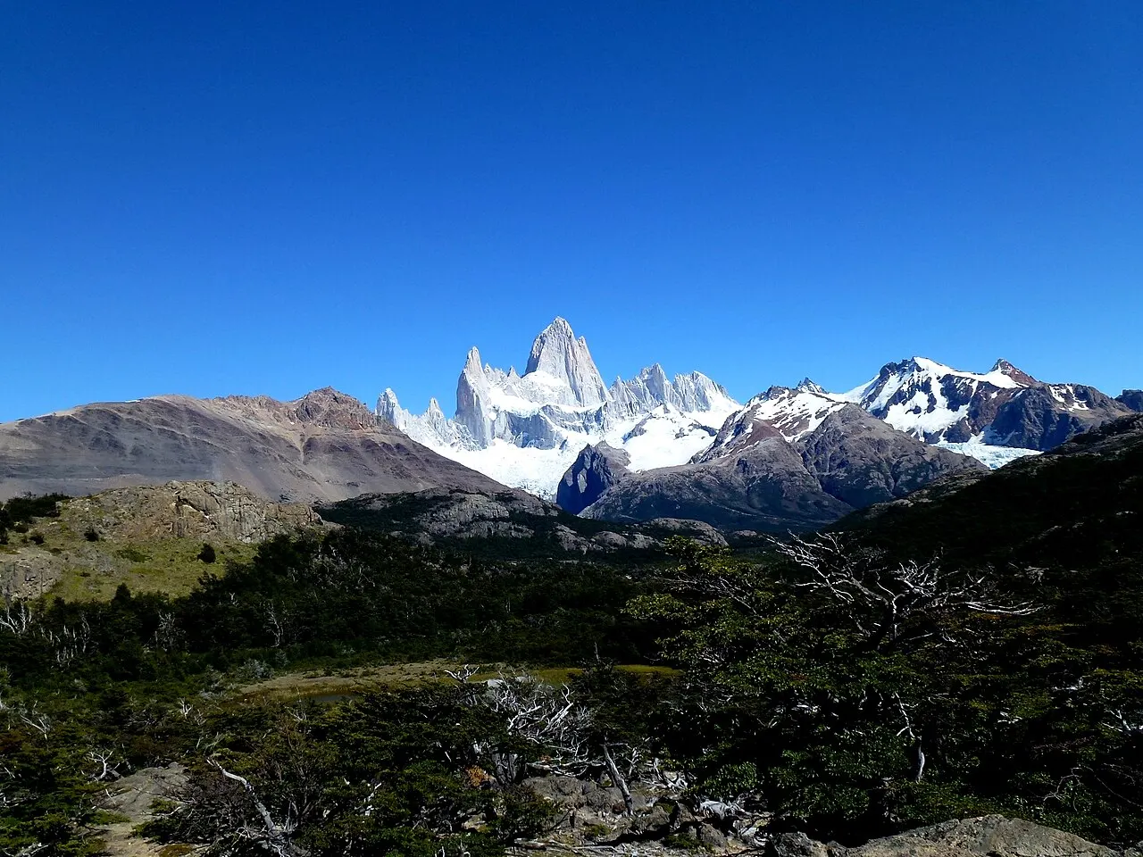
On the main Fitz Roy trail, between the village and the Poincenot campsite, this rocky viewpoint opens onto the Río Blanco valley, the Piedras Blancas Glacier in the distance and the main wall of Fitz Roy. It is a good option for a half-day hike, for the morning of your arrival or for when the cloud ceiling closes off the upper part of the mountain. It requires a park ticket.
Check access
Mirador del Cerro Torre
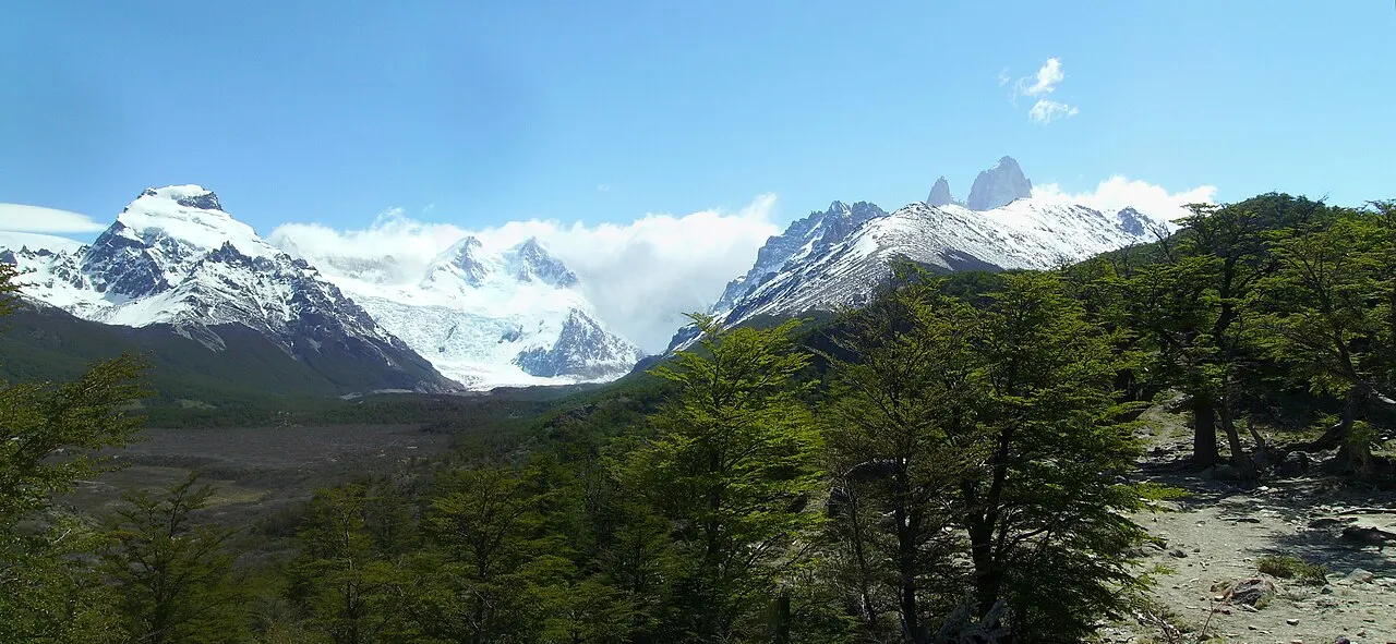
Located 3 km and about 1 h 15 min of walking from the start of the Laguna Torre path in the village, this natural viewpoint on the first terrace above the Río Fitz Roy canyon already frames the Adela range, Cerro Solo and the needle of Cerro Torre without your having to complete the 10 km to the lagoon shore. It works as a half-day outing or a decision point when the wind at the valley bottom is too strong. It requires a park ticket.
Check access
Mirador de las Águilas
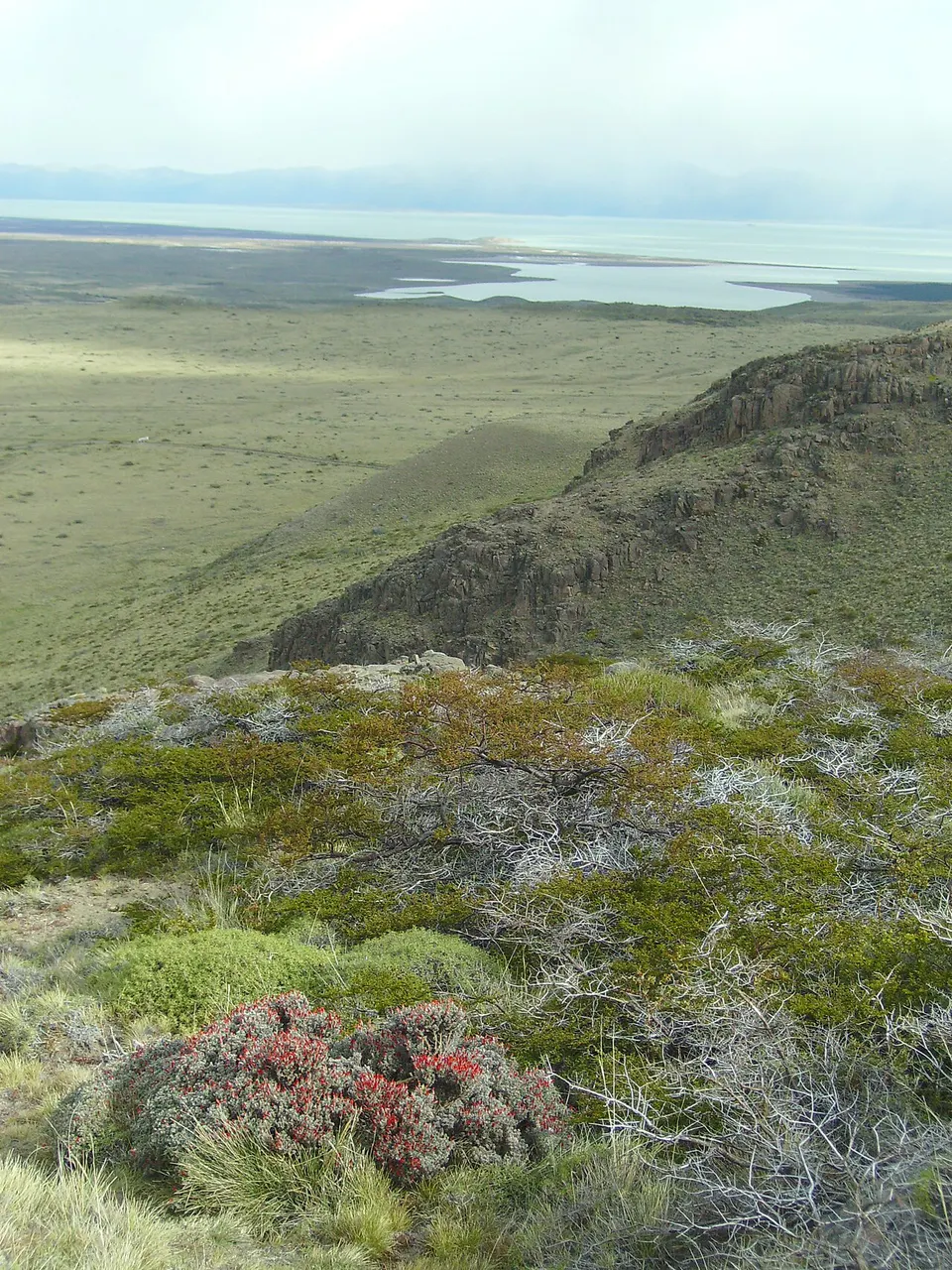
A fork on the way to the Mirador de los Cóndores extends the outing by another 1 km (2 km and about 45 minutes from the gate), turning its back on the mountain range and opening the view over the Patagonian steppe and Lago Viedma. It is worth adding on the same afternoon as the Mirador de los Cóndores, with the same ticket.
Check access
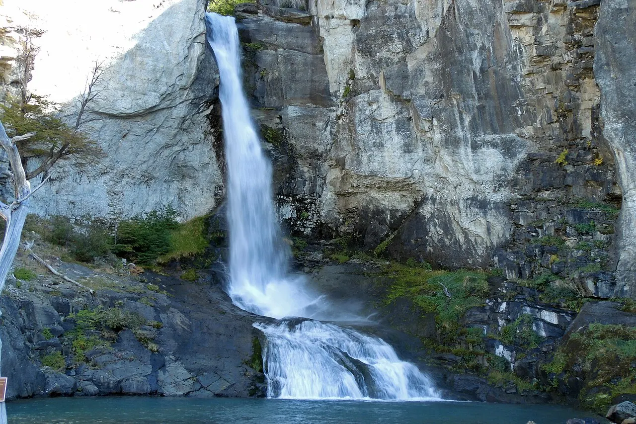
Chorrillo del Salto
A 20 m waterfall in a forest north of the village, next to Ruta Provincial 41. On foot, the trail starts at the same point as the Laguna Capri and Fitz Roy trails, north of Avenida San Martín, and is 3 km and about 1 h each way, with almost no elevation gain; part of it runs along a National Park path, and the park lists the Chorrillo viewpoint among the sites of the Portada Fitz Roy, where your ticket is checked. By car it is about 10 minutes along RP 41; ask at the Visitor Center whether road access also requires a ticket. It is El Chaltén's easiest outing for rest days for tired muscles or strong wind on the high ground.
Check access
Nilo’s itinerary
Start with the basic programme and choose extensions for the time you have.
Plan my days in the app ↗Day 1 · The road from El Calafate, the Visitor Center and the short viewpoints
Take the morning bus or drive out of El Calafate along the 220 paved kilometers of Ruta 40 and Ruta Provincial 41, with views of Lago Viedma and the east face of Fitz Roy on arrival.
Before entering the village, stop at the Ceferino Fonzo Visitor Center (APN) to check the forecast for the coming days, the state of the trails and how to validate your tickets bought at ventaweb.apn.gob.ar.
In the afternoon, with your first-day ticket, climb from the Portada Los Cóndores to the Mirador de los Cóndores (1 km, about 30 minutes, 100 m of elevation gain) to understand the geography of the village and see Fitz Roy and Cerro Torre together.
Continue along the fork to the Mirador de las Águilas (2 km and about 45 minutes from the gate), facing the steppe and Lago Viedma.
Late in the day, stop at a bakery on Avenida San Martín to order the next day's vianda and set out your windbreaker, hat, gloves and water.
Day 2 · The full trail to the Laguna de los Tres at the foot of Fitz Roy
Reserve for this outing the morning with the clearest weather and the least wind of your stay. Set out early (between 7 and 8 a.m.) through the Portada Fitz Roy at the north end of Avenida San Martín.
Climb the first stretch above the Río de las Vueltas valley and pass the Laguna Capri (4 km, about 1 h 45 min) or the Mirador Fitz Roy; if the weather closes in, those two points already guarantee a good outing without risking the final climb.
In steady weather, continue to the Poincenot campsite (km 8, about 2 h 45 min), cross the Río Blanco and take on the last hour of climbing, in steep zigzags, up to the Laguna de los Tres: 10 km and about 4 h each way, with 750 m of elevation gain.
At the edge of the Laguna de los Tres, take your lunch break facing the granite wall of Fitz Roy and, from the top of the moraine, look at the Laguna Sucia below.
Descend the same 10 km, allowing a margin of daylight, and have dinner of a lentil guiso or lamb on Avenida San Martín.
Day 3 · The Laguna Torre, or the Viedma Glacier boat and the Chorrillo del Salto
If your legs are fine and the day is clear, walk the Laguna Torre path: 9 km and about 3 h one way (18 km round trip), with 250 m of elevation gain, much gentler than at Fitz Roy, passing the Mirador del Cerro Torre (km 3, about 1 h 15 min) to the lagoon facing the needle of Cerro Torre.
If you would rather spare your knees after the previous day's 20 km, take the Aventura Viedma boat, which leaves at 10:30 a.m. from the port of Bahía Túnel, 18 km from the village (there is an optional transfer from the operator), and returns at 2:30 p.m. after passing in front of the Viedma Glacier face. In the afternoon, back in the village, walk to the 20 m waterfall at the Chorrillo del Salto (3 km and about 1 h from the village). Remember that the boat does not include the park ticket, and that from April to September it only runs on odd-numbered days and on Saturdays.
For those who stay a fourth day and want the 360-degree view of both massifs and Lago Viedma, the choice is the climb to the Loma del Pliegue Tumbado (12 km and about 4 h one way, 1,000 m of elevation gain).
Food
Patagonian lamb and bife de chorizo
After 20 km on the trails, dinner at the parrillas and bistros of Avenida San Martín revolves around slow-roasted Patagonian lamb and Argentine beef cuts grilled over embers.
Guiso de lentejas and lamb cazuela
On cold, windy days, the mountain restaurants and bars serve thick lentil stews with meat and sausage, or hot lamb cazuelas with vegetables, designed to restore calories fast.
Trail viandas and empanadas
Since there is no café, kiosk or food sales anywhere on the trails of Los Glaciares National Park, almost all the bakeries, rotiserías and guesthouses in the village prepare viandas (lunch boxes) with milanesa or ham-and-cheese sandwiches, baked empanadas, dried fruit and alfajores, to hand over the evening before.
Craft beer and calafate sweets
Avenida San Martín concentrates craft breweries, tea houses and chocolate shops (the municipal tourism website has a category for each), where the return from the trail ends in house beer, waffles, tarts and alfajores filled with calafate or rosehip jam.
Where to eat
- Avenida San Martín and cross streets (Lago del Desierto and Lionel Terray)
Parrillas, mountain bistros and craft breweries serving Patagonian lamb, bife de chorizo, trout, homemade pasta and steaming guiso de lentejas from 7 p.m. In January and February, arrive early to get a table.
- Bakeries and rotiserías on Avenida San Martín
Places where you order, the afternoon before, trail viandas (hearty sandwiches, beef or cheese-and-onion empanadas, dried fruit and alfajores), essential because no food is sold inside the park.
- Tea houses and pastry shops in the center
Late-afternoon stops for hot chocolate, waffles, tarts and alfajores filled with dulce de leche or calafate jam on the way back from the hikes.
· 2026-10-17
Day trips
Lago del Desierto and Glaciar Huemul
37 km north of El Chaltén on the gravel Ruta Provincial 41 (about 1 h 15 min by car or agency van), following the Río de las Vueltas among lenga forests and waterfalls. At Punta Sur on Lago del Desierto you can take the short but steep trail to the blue-green lagoon of the Glaciar Huemul (about 1 h of climbing, on private property with its own entrance fee in pesos) or board the boats that cross the lake to Punta Norte, on the border with Chile.
Cruise to Viedma Glacier from Bahía Túnel
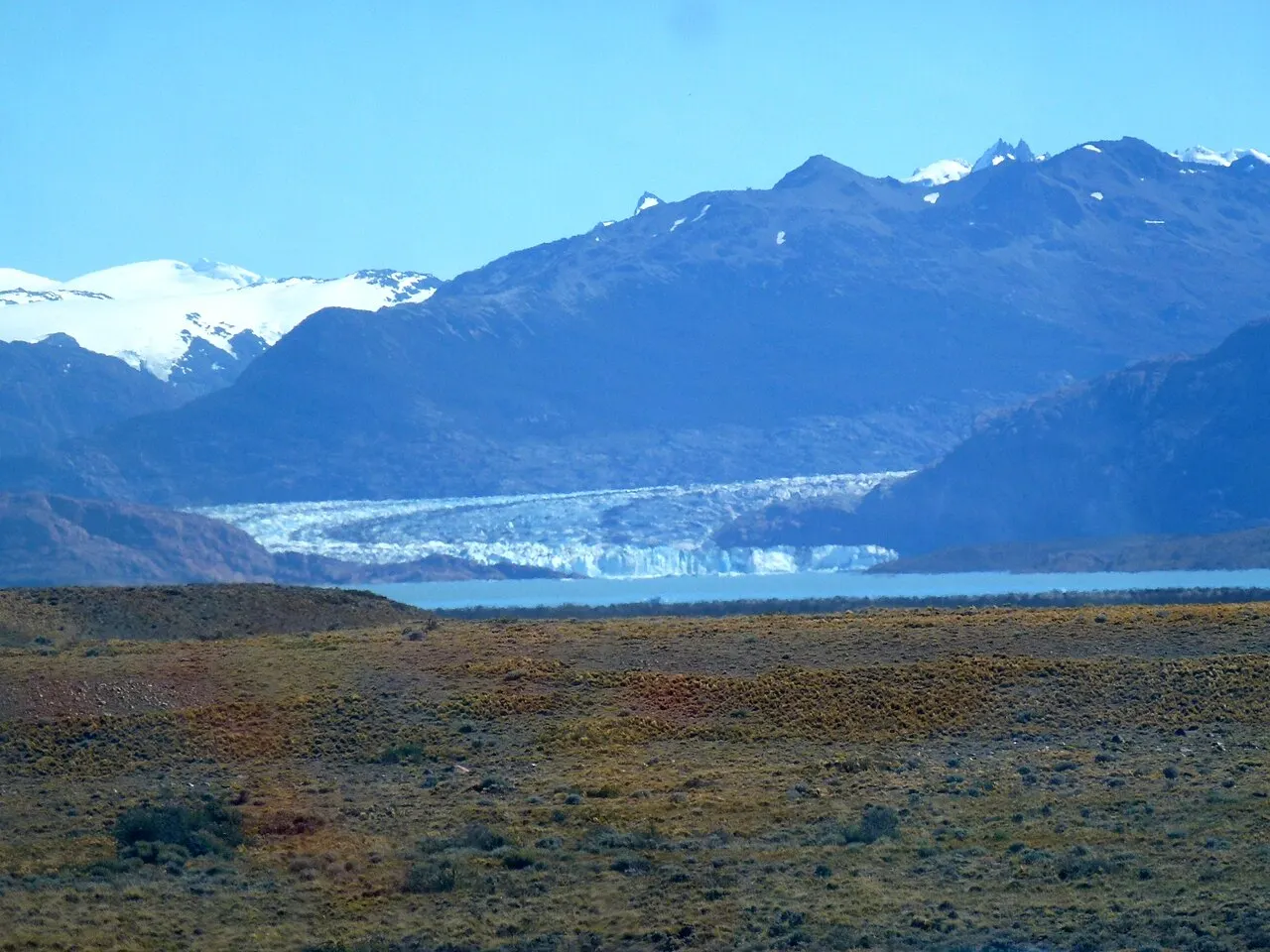
The port of Bahía Túnel is 18 km from El Chaltén, on the north shore of Lago Viedma, and Solo Patagonia offers an optional transfer from the village. The Aventura Viedma boat leaves at 10:30 a.m. and returns at 2:30 p.m., with an easy walk to the Bahía de los Témpanos viewpoint; those staying in El Calafate can take the full-day version, from 7:30 a.m. to 7:30 p.m., with a bus from there and stops in El Chaltén and at the Chorrillo del Salto. According to the operator's website (consulted on October 17, 2026), departures are daily from October to March and, from April to September, on odd-numbered days of the month and on Saturdays. The park ticket is bought separately.
Where to begin
The road from El Calafate, the Visitor Center and the short viewpoints
Take the morning bus or drive out of El Calafate along the 220 paved kilometers of Ruta 40 and Ruta Provincial 41, with views of Lago Viedma and the east face of Fitz Roy on arrival.
The full trail to the Laguna de los Tres at the foot of Fitz Roy
Reserve for this outing the morning with the clearest weather and the least wind of your stay. Set out early (between 7 and 8 a.m.) through the Portada Fitz Roy at the north end of Avenida San Martín.
The Laguna Torre, or the Viedma Glacier boat and the Chorrillo del Salto
If your legs are fine and the day is clear, walk the Laguna Torre path: 9 km and about 3 h one way (18 km round trip), with 250 m of elevation gain, much gentler than at Fitz Roy, passing the Mirador del Cerro Torre (km 3, about 1 h 15 min) to the lagoon facing the needle of Cerro Torre.
Money
The currency is the Argentine peso (ARS), written with $. At the reference rate of September 24, 2026, one dollar was worth about ARS 1,517; since nominal peso prices change often, treat the amounts below as a dated reference. The mandatory item in the budget is the Los Glaciares National Park ticket, checked at El Chaltén's four trail gates (Cóndores, Cerro Torre, Fitz Roy and Río Eléctrico). Under the schedule in force since June 1, 2026 (consulted in October 2026), the daily pass costs ARS 50,000 at the general rate, ARS 25,000 at the national rate and ARS 8,000 for residents of Santa Cruz province (children up to 6 years old are exempt). The second day of the visit, within 72 hours of the first entry, gets a 50% discount; for three days of hiking, the 3-day Flexipass (ARS 100,000 at the general rate) is cheaper than three daily passes (ARS 125,000), and there is a 7-day Flexipass (ARS 175,500). Buy in advance at ventaweb.apn.gob.ar with your ID in hand and save the receipt offline on your phone. The Viedma Glacier boat does not include the park ticket: on the Solo Patagonia website, on October 17, 2026, the cruise cost ARS 175,000 per adult. In the village, most restaurants and hotels accept cards; when booking, ask whether the rate for non-resident foreigners includes VAT. Bring Argentine pesos in cash from El Calafate or Buenos Aires: the municipal website lists an ATM among the village's services, but in a village this size I would not depend on it, and the internet is unreliable on days of strong wind.
Getting there and around
Getting there: from El Calafate (220 km)
El Chaltén has no airport; the air gateway is the Comandante Armando Tola International Airport (FTE), in El Calafate. The 220 km between El Calafate and El Chaltén are paved: Ruta Nacional 40 to the turnoff and, for the last 90 km, Ruta Provincial 41 along the north shore of Lago Viedma. There are three buses a day from El Calafate, according to the municipal tourism website; the companies Cal Tur, Chaltén Travel, Marga Taqsa and Don Atilio serve the El Chaltén Bus Terminal, and schedules and prices are checked with each one. In high season, buy the return ticket together with the outbound one: the municipality itself recommends checking availability for the return date.
In the village and on the Ruta Provincial 41 approaches
Within El Chaltén there is no city bus and no need for one: the main trails (Laguna de los Tres, Laguna Capri, Laguna Torre, Mirador de los Cóndores and Loma del Pliegue Tumbado) start on foot at the ends of the village streets. Motorized transport is only needed for three outings: the Río Eléctrico bridge (about 15 km north on the gravel RP 41, for the Piedra del Fraile or to enter the Fitz Roy trail from the north, with 8 km to the Poincenot campsite), Lago del Desierto (37 km north on RP 41) and the port of Bahía Túnel (18 km, for the Viedma Glacier boat, with an optional transfer from the operator). For these points there are bus and car services from agencies and local remises. Anyone driving a rental car will find a gas station in the village, and the municipality recommends traveling with an extra can of fuel and the spare tire in good shape.
Safety
El Chaltén is a small, safe village, where you can walk Avenida San Martín at any hour without urban worries. All the safety attention is on the mountain: Patagonian weather changes in under an hour, with gusts that can knock a hiker down on the exposed ridges of the Laguna de los Tres and the Loma del Pliegue Tumbado and cause hypothermia even in January. Work out your start time so you never come back in the dark, since there is no lighting or cell signal on the trails. The last hour of the climb to the Laguna de los Tres, after the Río Blanco, is very steep, over rocks that slip with rain, snow or ice; wear trekking footwear with good grip and use poles, and do not hesitate to stop at the Laguna Capri or the Mirador Fitz Roy if your physical condition or the weather worsens. For crossings off the daytime trails, remote camping or climbing, prior registration at the Ceferino Fonzo Visitor Center is mandatory. The area is puma habitat: do not hike alone on little-used trails and keep children close. Phone numbers from the municipal services guide (October 2026): Puesto Sanitario (health post) +54 9 2966 639230; police +54 9 2966 408258; Tourist Information Center +54 9 2966 769216.
Etiquette tips
Show your ticket at the gates and do not leave the marked trail
The park gates are at the approaches to the village (Cóndores, Cerro Torre and Fitz Roy) and at the Río Eléctrico; have the QR code from ventaweb.apn.gob.ar saved offline and the ID used for the purchase (passport or national ID). Staying on the beaten trail prevents erosion of the lenga slopes.
Carry out all your trash, including peels and yerba mate
In Patagonia's cold, dry climate, banana or orange peels, toilet paper and discarded yerba mate take years to decompose. Carry a plastic bag in your pack and bring absolutely everything back to the village's bins; never throw trash into the campsite latrines.
Absolute ban on fire, drones and pets
Making a campfire is strictly forbidden throughout Los Glaciares National Park; gas stoves may only be lit inside authorized camping areas (Poincenot, De Agostini and Laguna Capri). Flying drones and bringing dogs are forbidden to protect the condors and the huemul deer.
Yield to uphill hikers on narrow stretches
On the last hour of the climb to the Laguna de los Tres, after the Río Blanco, people going up have the right of way; give them space calmly and do not kick rocks down the slope.
Mistakes to avoid
Making a day trip from El Calafate to climb to the Laguna de los Tres
Adding 440 km of road (round trip from El Calafate) to the 20 km of trail, with about 4 h one way, in a single day leaves no margin for the pace of the final climb or for a change in the weather; the municipality itself advises against the day trip. Sleep at least three nights in El Chaltén.
Climbing the final stretch to the Laguna de los Tres without checking the wind and cloud forecast
The weather in the village is deceptive: it can be sunny on Avenida San Martín while a windstorm shuts down the Fitz Roy wall. Check with the Visitor Center and save your best morning of open weather for the Laguna de los Tres.
Heading out on the trail without a snack, water, a windbreaker and your ticket saved offline
There is no snack bar, closed shelter or cell phone signal on the El Chaltén trails. Buy your vianda the night before, set out with a water bottle, a waterproof jacket, a hat and gloves even in summer, and download your APN ticket before leaving the guesthouse Wi-Fi.
Arriving in El Chaltén without cash or a full tank
The village is small, has one gas station and few banking services, and the stretch of steppe to Ruta 40 is long. Fill up the car and withdraw pesos in El Calafate before hitting the road.
Useful phrases
¿Cómo viene la ventana de buen tiempo?
How is the good-weather window looking? The question everyone asks at the guesthouse reception and at the Visitor Center.
¿Me preparás una vianda para mañana?
Can you make me a trail lunch for tomorrow? An order placed the afternoon before at the bakeries and guesthouses.
¿Hasta dónde está habilitado el sendero hoy?
How far is the trail open today? Essential to ask in spring and fall, when there may be ice past the Río Blanco.
¿Tenés cambio en efectivo?
Do you have change in cash? Useful when the village's internet is unreliable.
Where to stay
- Avenida San Martín (north and central section) · Those coming without a car to hike the Laguna de los Tres, the Laguna Capri and the Laguna Torre on foot.: It puts you a few minutes' walk from the Portada Fitz Roy and the access to the Laguna Torre trail, and it concentrates bakeries, markets and restaurants. It is the most practical location in the village, and the offering runs from hotels and hosterías to apartments, cabins, hostels and campgrounds, all listed by category on the municipal tourism website.
- South end of the village (near the bus terminal and the bridge) · Those arriving and leaving by bus with heavy luggage, or prioritizing the Loma del Pliegue Tumbado and the Mirador de los Cóndores.: It makes getting off at the terminal easy and sits right next to the Ceferino Fonzo Visitor Center, but adds 15 to 20 minutes of flat walking along the avenue to reach the start of the Fitz Roy trail at the far north end.
- Río de las Vueltas Valley (Ruta Provincial 41 North) · Those with a rental car who are after country hosterías or lodges isolated in the forest.: It offers absolute quiet among lenga trees and proximity to the Río Eléctrico and Lago del Desierto, but requires driving on a gravel road whenever you want to have dinner or buy supplies in the village.
· 2026-10-17
Districts
Avenida San Martín and Centro
The main axis that cuts through the village from south to north for about fifteen blocks, from the arrival bridge and the bus terminal to the end of the pavement at the Fitz Roy Gate. It holds almost all the restaurants, breweries, bakeries, markets, the pharmacy, shops renting poles and boots, and guesthouses. Everything is flat and can be covered on foot in fifteen to twenty minutes.
South Entrance and Visitor Center (Portada Los Cóndores)
The south bank of the bridge over the Río Fitz Roy, before you properly enter the village's commercial blocks. It houses the Ceferino Fonzo Visitor Center of the Administración de Parques Nacionales and the starting gate for the trails to the Mirador de los Cóndores, the Mirador de las Águilas and the Loma del Pliegue Tumbado.
Ruta Provincial 41 North corridor (Río de las Vueltas and Lago del Desierto)
The 37 km gravel road that leaves the far north end of the village and climbs the Río de las Vueltas valley. Near the village is the Chorrillo del Salto; about 15 km out, the Río Eléctrico bridge, from which the private Piedra del Fraile trail and the northern access to the Poincenot campsite start; and at km 37 the road ends at Punta Sur on Lago del Desierto.
Bahía Túnel and North Shore of Lago Viedma
The lake port located 18 km southeast of El Chaltén, by a turnoff from Ruta Provincial 41, in an inlet sheltered from the wind on Lago Viedma, from which the boats leave for the front of Viedma Glacier.
History
Before the 20th century · The sacred Chaltén of the Aonikenk
For the Aonikenk (southern Tehuelche), who hunted guanaco between the steppe and the mountain range, the great granite needle was called Chaltén, “smoking mountain,” for the clouds the wind almost always forms on its summit.
1877 · Francisco Moreno names Monte Fitz Roy
While exploring the basin of the Río Santa Cruz and Lago Viedma in 1877, the expert Francisco Pascasio Moreno added the name Monte Fitz Roy to the maps, in honor of Robert FitzRoy, captain of HMS Beagle.
Early 20th century · The first settlers of the Río de las Vueltas
Sheep ranchers and Nordic and other European immigrants, such as Andreas Madsen, set up isolated estancias in the Río de las Vueltas valley long before any road or bridge existed.
1937 and 1981 · Los Glaciares National Park and UNESCO
Created in 1937 to protect the subantarctic forests and the Southern Patagonian Ice Field, Los Glaciares National Park was inscribed by UNESCO as a World Heritage Site in 1981.
1952 and 1959–1974 · The conquests of Fitz Roy and Cerro Torre
On February 2, 1952, the Frenchmen Lionel Terray and Guido Magnone reached the summit of Fitz Roy for the first time. On Cerro Torre, Cesare Maestri's alleged ascent in 1959 (in which Toni Egger died), the Compressor Route of 1970 and the ascent by the Ragni di Lecco in 1974 created one of the greatest controversies in the history of world mountaineering.
October 12, 1985 · The geopolitical founding of El Chaltén
Amid the border dispute with Chile over the Lago del Desierto sector, Santa Cruz province officially founded the village of El Chaltén. The 1994 international arbitration confirmed Argentine jurisdiction over the Lago del Desierto basin.
1994 and 2011 · National Capital of Trekking and municipality
On July 28, 1994, El Chaltén was declared the Capital Nacional del Trekking. On November 24, 2011, provincial law 3,249 made it a municipality, and the first elections for mayor and councilors took place in 2015.
June 2026 · The current ticket schedule
Since June 1, 2026, the Administración de Parques Nacionales schedule has applied that gives the El Chaltén Gate the same rate as Los Glaciares: ARS 50,000 for the daily pass at the general rate, with 3-day and 7-day Flexipasses.
Complete history
The smoking mountain and the hardest walls in the Andes
Seen from the steppe east of Lago Viedma, the 3,405 m granite needle seems to give off a constant column of vapor: these are lenticular clouds generated by the moist air rising from the Southern Patagonian Ice Field, which is why the Aonikenk people called it Chaltén, the smoking mountain, believing it to be a volcano. Although Francisco Moreno recorded it on the 1877 maps as Monte Fitz Roy, both names are still used side by side. From the 1930s on, European expeditions realized that those vertical granite towers, battered by winds of more than 100 km/h and capped with rime ice mushrooms, posed a technical challenge greater than that of much higher mountains: the Frenchmen Lionel Terray and Guido Magnone opened the summit of Fitz Roy in 1952, while the neighboring needle of Cerro Torre (3,102 m) became legendary for the disputes around Cesare Maestri's expeditions in 1959 and 1970 and the Italian team of Casimiro Ferrari in 1974.
A village founded in 1985 to hold the border
Unlike most Patagonian towns born in the age of the wool estancias, El Chaltén did not exist on the map until the mid-1980s. At that time, Argentina and Chile were engaged in a diplomatic dispute over the demarcation of the watershed line between Monte Fitz Roy and Lago del Desierto, 37 km to the north. To create a fait accompli of civilian occupation, the government of Santa Cruz province decreed the founding of the settlement on October 12, 1985, putting up half a dozen prefabricated houses, a Gendarmería post and a school on the alluvial plain where the Río Fitz Roy flows into the Río de las Vueltas. When the 1994 international arbitration tribunal resolved the Lago del Desierto question, mountaineers and hikers had already discovered that this small gravel street lay exactly at the mouth of the glacial valleys.
From the gravel road to the park gates
In the first decades, getting to El Chaltén meant hours on a gravel road from El Calafate. With pavement all the way to the village, it became an international hiking hub: the permanent population went from 1,627 residents in 2010 to 1,865 in 2022, and the main avenue filled with breweries, bakeries and mountain gear shops. Because the village is wedged inside Los Glaciares National Park, the trails that leave from it start at park gates, where your ticket, bought online on the Administración de Parques Nacionales schedule, is now checked.
Founded on October 12, 1985 to secure Argentine possession of the valley during the Lago del Desierto border dispute, El Chaltén only became a municipality in 2011.
Geography and shape of the city
A valley wedged between two rivers
The urban core of El Chaltén occupies a flat, narrow strip on the west bank of the Río de las Vueltas, at the point where the Río Fitz Roy, coming down from the Cerro Torre valley, passes the southern edge of the village and flows into the Río de las Vueltas. That geometry explains the elongated layout of the settlement along Avenida San Martín and why urban expansion is limited by the boundary of Los Glaciares National Park. From the center of the village you cannot see Cerro Torre, hidden behind the first folds of the valley, but the east face of the Fitz Roy massif dominates the end of the main avenue.
From the Southern Patagonian Ice Field to Lago Viedma
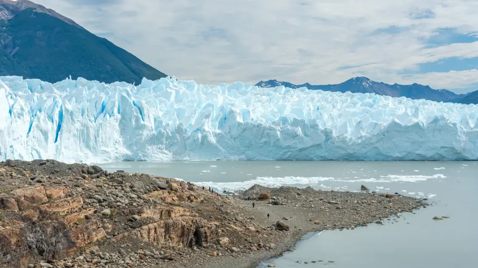
Immediately west of the granite spires stretches the Southern Patagonian Ice Field, the same ice cap that feeds, farther south, the Perito Moreno, the Upsala and the Spegazzini. In the North Zone, the largest outlet of that ice cap is Viedma Glacier, the largest glacier in Argentina, which flows straight into the west shore of Lago Viedma (a glacial lake of about 1,088 km² whose waters run through the Río La Leona to Lago Argentino). The Río de las Vueltas and Río Fitz Roy also flow into Lago Viedma, a few kilometers south of the village.
The wind barrier and the shift from steppe to lenga forest
Anyone who drives the last 90 km of Ruta Provincial 41 from Ruta 40 witnesses the abrupt transition from the arid steppe of coirón, neneo and guanacos to the Andean-Patagonian forest of lenga, ñire and guindo on the damp slopes. The climate is cold, windy and extremely unstable: moist Pacific air crosses the ice field and dumps clouds, wind gusts and sudden snow on the trails above 700 m even in the middle of January, while 5 km east of the village the sky over the steppe and Lago Viedma often stays blue.
The Tehuelche name Chaltén means “smoking mountain”: the early inhabitants thought the 3,405 m peak was a volcano because the moist wind from the Southern Patagonian Ice Field forms, almost every day, a plume of cloud clinging to the granite summit.
Culture
The routine of a village that wakes by the barometer
In El Chaltén social life is regulated by wind forecasts (such as Windguru) and by the height of the clouds at dawn. Early on, Avenida San Martín fills with hikers carrying poles and backpacks heading for the gates; in the middle of the day the village is almost silent; and in the late afternoon the breweries, bakeries and restaurants fill with people still in trail boots, comparing whether the window of sun opened over the Laguna de los Tres or the Laguna Torre. In early February, the Fiesta Nacional del Trekking celebrates that identity.
Mountain ethics and conservation in the North Zone
Because it is wedged inside Los Glaciares National Park, habitat of the huemul (an endangered Andean deer), the village takes the minimum-impact rules seriously: no fires are allowed anywhere in the park, pets are forbidden, and all trash goes back in your pack to the village's bins.
Festivals and events
Fiesta Nacional del Trekking, early February
The annual festival of the Capital Nacional del Trekking takes place in early February and includes a marathon along the Río de las Vueltas to Lago del Desierto. Check the date and program of each edition on the municipal tourism website.
El Chaltén anniversary, October 12
A civic parade, a gathering of pioneers and community activities celebrating the official founding of the settlement on October 12, 1985, which also marks the full opening of the spring season.
Books and films
Conquistadors of the Useless (1961), by Lionel Terray
The autobiography of the French mountaineer, published by Gallimard as Les Conquérants de l'inutile and translated into English as Conquistadors of the Useless, includes the account of the first ascent of Monte Fitz Roy, in 1952, alongside Guido Magnone.
Cerro Torre: Scream of Stone (1991), film by Werner Herzog
Shot in the mountains of El Chaltén a few years after the village was founded, Herzog's drama draws on the real rivalry and the controversies surrounding the climbing of Cerro Torre.
Frequently asked questions
El Chaltén: how do I get there?
El Chaltén has no airport; the air gateway is the Comandante Armando Tola International Airport (FTE), in El Calafate. The 220 km between El Calafate and El Chaltén are paved: Ruta Nacional 40 to the turnoff and, for the last 90 km, Ruta Provincial 41 along the north shore of Lago Viedma. There are three buses a day from El Calafate, according to the municipal tourism website; the companies Cal Tur, Chaltén Travel, Marga Taqsa and Don Atilio serve the El Chaltén Bus Terminal, and schedules and prices are checked with each one. In high season, buy the return ticket together with the outbound one: the municipality itself recommends checking availability for the return date.
El Chaltén: how many days should I stay?
Three days and three nights, counting the afternoon of arrival. On the first day, arriving in the morning by bus or by car from El Calafate, stop at the Ceferino Fonzo Visitor Center and in the afternoon climb to the Mirador de los Cóndores and the Mirador de las Águilas. On the second, picking the morning with the steadiest weather, do the 20 km round trip to the Laguna de los Tres. On the third, walk to the Laguna Torre or, to rest your knees, take the 10:30 a.m. boat to Viedma Glacier, leaving from Bahía Túnel, and leave the Chorrillo del Salto for after the return, at 2:30 p.m. The return to El Calafate is left for the morning of the fourth day; anyone with a whole fourth day can climb the Loma del Pliegue Tumbado or go to Lago del Desierto. A day trip from El Calafate does not work for the Laguna de los Tres: it adds 440 km of road to the 20 km of trail, and the municipality itself advises against it.
El Chaltén: how much is the park ticket and which pass should I buy?
The trails that leave from El Chaltén have Los Glaciares National Park ticket checks at four gates (Cóndores, Cerro Torre, Fitz Roy and Río Eléctrico). Under the schedule in force since June 1, 2026 (consulted in October 2026), the daily pass costs ARS 50,000 at the general rate, ARS 25,000 at the national rate and ARS 8,000 for residents of Santa Cruz province (children up to 6 years old are exempt). The second day of the visit, within 72 hours of the first entry, gets a 50% discount, which comes to ARS 75,000 for two days; for three days of hiking, the 3-day Flexipass (ARS 100,000 at the general rate) is cheaper than three daily passes (ARS 125,000), and there is a 7-day Flexipass (ARS 175,500). Buy in advance at ventaweb.apn.gob.ar with your ID in hand and save the QR code offline on your phone. The Viedma Glacier boat does not include the ticket, which is bought separately.
El Chaltén: Laguna de los Tres or Laguna Torre?
The Laguna de los Tres, at the foot of Fitz Roy, is 10 km and about 4 h one way, with 750 m of total elevation gain: the first 8 km add up to 350 m to the Poincenot campsite, and after the Río Blanco the last hour gains the remaining 400 m in steep zigzags exposed to the wind. The Laguna Torre is 9 km and about 3 h one way, with 250 m of elevation gain, much gentler, and the needle of Cerro Torre only appears when the clouds open at the back of the glacial cirque. Save your best morning of open weather for the Laguna de los Tres and check with the Visitor Center: it can be sunny on Avenida San Martín while a windstorm shuts down the Fitz Roy wall. If the weather closes in, the Laguna Capri and the Mirador Fitz Roy already make a good outing without risking the final climb.
El Chaltén: how does the Viedma Glacier boat work?
The Aventura Viedma boat, by Solo Patagonia, leaves from the port of Bahía Túnel, 18 km from El Chaltén, at 10:30 a.m. and returns at 2:30 p.m., passing among icebergs in front of the glacier face, with an easy walk to the Bahía de los Témpanos viewpoint. On the operator's website, consulted on October 17, 2026, the tour cost ARS 175,000 per adult, with an optional transfer from El Chaltén (ARS 36,000), and ran every day from October to March and, from April to September, on odd-numbered days of the month and on Saturdays. The park ticket is not included and is bought separately.
El Chaltén: do I need a car?
Within El Chaltén there is no city bus and no need for one: the main trails (Laguna de los Tres, Laguna Capri, Laguna Torre, Mirador de los Cóndores and Loma del Pliegue Tumbado) start on foot at the ends of the village streets. Motorized transport is only needed for three outings: the Río Eléctrico bridge (about 15 km north on the gravel RP 41), Lago del Desierto (37 km north on RP 41) and the port of Bahía Túnel (18 km, for the Viedma Glacier boat, with an optional transfer from the operator). For these points there are bus and car services from agencies and local remises. Anyone driving a rental car will find a gas station in the village, and the municipality recommends traveling with an extra can of fuel and the spare tire in good shape; fill up the car and withdraw pesos in El Calafate before hitting the road.
El Chaltén: do I need to bring cash?
In the village, most restaurants and hotels accept cards; when booking, ask whether the rate for non-resident foreigners includes VAT. Bring Argentine pesos in cash from El Calafate or Buenos Aires: the municipal website lists an ATM among the village's services, but in a village this size I would not depend on it, and the internet is unreliable on days of strong wind. Since nominal peso prices change often, treat published amounts as a dated reference.
El Chaltén: when is the best time to go?
The hiking season runs from October to April, and basic tourist services operate regularly from October until Holy Week, according to the municipality (in 2027, Holy Week ends on Easter Sunday, March 28). From December to February sunset is around 10 p.m. at the solstice, but January and February bring the strongest winds and require booking lodging months in advance. October and November bring the return of regular services and fewer people on the trails, although the final stretch to the Laguna de los Tres may still have accumulated snow in October, requiring a daily check at the Visitor Center. March and the first half of April usually have less wind and red and gold forests; after Holy Week, however, buses, lodging and restaurants stop operating regularly, and anyone traveling in April should confirm each service beforehand. From May to August snow and ice cover the high climbs and many of the hotels, restaurants and agencies close until October.
El Chaltén: what precautions should I take on the mountain?
The village is small and safe; all the attention goes to the mountain. Patagonian weather changes in under an hour, with gusts that can knock a hiker down on the exposed ridges of the Laguna de los Tres and the Loma del Pliegue Tumbado and cause hypothermia even in January. Work out your start time so you never come back in the dark, since there is no lighting or cell signal on the trails, and set out with your vianda, water, a waterproof jacket, a hat and gloves even in summer. On the last hour of the climb to the Laguna de los Tres, wear trekking footwear with good grip and use poles, and do not hesitate to stop at the Laguna Capri or the Mirador Fitz Roy if your physical condition or the weather worsens. For crossings off the daytime trails, remote camping or climbing, prior registration at the Ceferino Fonzo Visitor Center is mandatory. The area is puma habitat: do not hike alone on little-used trails and keep children close.
Other cities in the country
Argentina ↗- Days
- 3–4
- When
- Mar–May · Sep–Nov
- Per person/day
- Average 90–140 USDMid-range · per person/day
Cost scope
Per person per day: accommodation, meals, urban transport, visits and a small allowance for extras. Flights excluded; larger purchases vary. Editorial estimate, not a quote.
- Days
- 3
- When
- Jan–Mar · Dec
- Per person/day
- Average 90–160 USDMid-range · per person/day
Cost scope
Per person per day: accommodation, meals, urban transport, visits and a small allowance for extras. Flights excluded; larger purchases vary. Editorial estimate, not a quote.
- Days
- 4
- When
- Mar–Apr · Nov
- Per person/day
- Average 70–100 USDMid-range · per person/day
Cost scope
Per person per day: accommodation, meals, urban transport, visits and a small allowance for extras. Flights excluded; larger purchases vary. Editorial estimate, not a quote.
- Days
- 4–5
- When
- Mar–May · Oct–Nov
- Per person/day
- Average 83,200 ARSMid-range · per person/day
Cost scope
Per person per day: accommodation, meals, urban transport, visits and a small allowance for extras. Flights excluded; larger purchases vary. Editorial estimate, not a quote.
- Days
- 4–5
- When
- Jan–Apr · Oct–Dec
- Per person/day
- Average 86,300 ARSMid-range · per person/day
Cost scope
Per person per day: accommodation, meals, urban transport, visits and a small allowance for extras. Flights excluded; larger purchases vary. Editorial estimate, not a quote.
- Days
- 6–7
- When
- Apr–Nov
- Per person/day
- Average 66,100 ARSMid-range · per person/day
Cost scope
Per person per day: accommodation, meals, urban transport, visits and a small allowance for extras. Flights excluded; larger purchases vary. Editorial estimate, not a quote.