
Argentina
Bariloche
Glacial lake, skiing on Catedral and trails to mountain huts
Days Start with the basic programme and choose extensions for the time you have.
How the guide reaches this number
Spend the first day downtown and the second on the Circuito Chico. The third is a full day outside the city: Cerro Catedral in winter, or, in summer, the hike to Refugio Frey or the catamaran to Puerto Blest. Save the fourth for the Tronador, leaving early because of RP 82's one-way schedule. Beyond the Centro Cívico and the Museo de la Patagonia, downtown disappoints: Mitre street repeats the same chocolate shop block after block. With a single day, take the line 20 bus along Avenida Bustillo and go up Campanario before 11am. Then continue by bus to Llao Llao, at km 25, and have lunch in Colonia Suiza on the way back. October draws people with Bariloche a la Carta, about ten days of set menus at dozens of restaurants. But spring brings wind, mud on the high trails, and closed huts, so go for autumn instead. Avoid January and the two weeks of July school vacation, when the lines are longest.
4
When March and April (stable autumn) or November; July and August for snow
How the guide reaches this number
Summer seems like the obvious answer, but the best months are March and April: stable days, weaker wind, the lengas turning red by late April, off-peak prices, and trails still open. Summer (December to February) has highs of 23–24°C and lows of 7°C, sun until 9:30pm, almost no rain, and the biggest crowds; January is the packed month, and the lake water stays at 12–14°C even at its warmest. Winter (June to August) brings highs of 6–8°C, lows around zero, and most of the annual 800–900 mm of rainfall. The Catedral season usually opens in late June and closes in early October, and the two weeks of July school holidays are the absolute peak for prices and lines. Spring (September to November) is windy, with thaw, mud on the high trails, and refuges still closed, but November makes up for it with flowers and low prices. June gets the worst of both sides: cold, short days, and not enough snow yet to ski.
Per person/day about US$45 backpacker, US$70–100 mid-range, US$180+ with skiing in high season
How the guide reaches this number
Per person per day: accommodation, meals, urban transport, visits and a small allowance for extras. Flights excluded; larger purchases vary. Editorial estimate, not a quote.
 What Nilo thinks
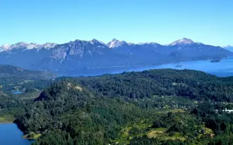
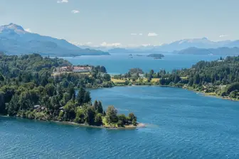
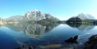
Stay four days in Bariloche and come for the mountains rather than for a colonial old town. Spend the first day downtown and the second on the Circuito Chico. The third is a full day outside the city: Cerro Catedral in winter, or, in summer, the hike to Refugio Frey or the catamaran to Puerto Blest. Save the fourth for the Tronador, leaving early because of RP 82's one-way schedule. Beyond the Centro Cívico and the Museo de la Patagonia, downtown disappoints: Mitre street repeats the same chocolate shop block after block. With a single day, take the line 20 bus along Avenida Bustillo and go up Campanario before 11am. Then continue by bus to Llao Llao, at km 25, and have lunch in Colonia Suiza on the way back. October draws people with Bariloche a la Carta, about ten days of set menus at dozens of restaurants. But spring brings wind, mud on the high trails, and closed huts, so go for autumn instead. Avoid January and the two weeks of July school vacation, when the lines are longest.Bariloche stretches along the shore of Nahuel Huapi, a glacial lake of more than 500 km², with the Andes across the water, and almost every plan here heads out into that landscape, by chairlift, on skis, on foot or by boat. Ride the chairlift up Cerro Campanario, at km 17.5 of Avenida Bustillo, for the most complete view of the region. In winter, ski Cerro Catedral, the largest ski area in South America. In summer, hike 4 to 5 hours to Refugio Frey, among granite spires, or take the catamaran to Puerto Blest. Back in town, try trout or lamb, merienda with a submarino and the chocolate sold by weight on Mitre street. Come in March or April, when the days are settled, and bring a windbreaker, because a 24°C afternoon turns into a 7°C night.
Quick facts
- Population
- 135,755 in the 2022 census; about 150,000 estimated in 2026, with more than 1 million visitors a year
- Founded
- May 3, 1902, the date of the agricultural-livestock colony; the general store that started the city dates from 1895
- Country and region
- Argentina: province of Río Negro, Andean Patagonia, about 1,600 km southwest of Buenos Aires
- Language
- Rio Platense Spanish (voseo, “sh” sound for ll/y); Mapudungun in nearby Mapuche communities
- Currency
- Argentine peso (ARS): about 1,535 per US$1 in September 2026
- Time zone
- UTC−3 year-round, no daylight saving
- Best time to visit
- March and April (stable autumn) or November; July and August for snow
- Average daily cost
- about US$45 backpacker, US$70–100 mid-range, US$180+ with skiing in high season
When to go
March and April (stable autumn) or November; July and August for snow
January
7° to 23°C
24 mm of rain
February
7° to 23°C
18 mm of rain
May
1° to 11°C
114 mm of rain
June
0° to 7°C
168 mm of rain
July
-2° to 7°C
126 mm of rain
August
-1° to 8°C
117 mm of rain
September
0° to 12°C
55 mm of rain
October
2° to 15°C
49 mm of rain
December
6° to 21°C
25 mm of rain
How the year changes
Summer seems like the obvious answer, but the best months are March and April: stable days, weaker wind, the lengas turning red by late April, off-peak prices, and trails still open. Summer (December to February) has highs of 23–24°C and lows of 7°C, sun until 9:30pm, almost no rain, and the biggest crowds; January is the packed month, and the lake water stays at 12–14°C even at its warmest. Winter (June to August) brings highs of 6–8°C, lows around zero, and most of the annual 800–900 mm of rainfall. The Catedral season usually opens in late June and closes in early October, and the two weeks of July school holidays are the absolute peak for prices and lines. Spring (September to November) is windy, with thaw, mud on the high trails, and refuges still closed, but November makes up for it with flowers and low prices. June gets the worst of both sides: cold, short days, and not enough snow yet to ski.
The same numbers as a table
| Month | Temperature °C | Rain mm |
|---|---|---|
| January | 7 to 23 | 24 |
| February | 7 to 23 | 18 |
| March · | 5 to 20 | 29 |
| April · | 2 to 15 | 57 |
| May | 1 to 11 | 114 |
| June | 0 to 7 | 168 |
| July | -2 to 7 | 126 |
| August | -1 to 8 | 117 |
| September | 0 to 12 | 55 |
| October | 2 to 15 | 49 |
| November · | 4 to 18 | 30 |
| December | 6 to 21 | 25 |
Nilo's tips
Buy the SUBE: the mountain bus costs ARS 8,049.37
Mi Bus doesn't take coins: buy the SUBE at a kiosk downtown in your first hour and load enough for the whole week at once. The regular fare is ARS 2,333.30 on sections I to III, but line 55, which climbs to Villa Catedral, charges ARS 8,049.37 per ride: two round trips to the mountain empty a small top-up, and there's no kiosk up there.
Campanario before 11am
The Campanario chairlift is at km 17.5 of Bustillo and goes up in seven minutes; the line only appears after 11am, when the tour groups arrive. If the line has already formed, walk: the trail climbs in 30 minutes.
See the curanto in Colonia Suiza, Wednesdays and Sundays at 1pm
The curanto cooks for hours in a pit in the ground over hot stones and only happens on Wednesdays and Sundays. The pot is uncovered around 1pm, and the show is the opening, not the finished dish: arrive before then and bring pesos in cash, because the village has about 25 houses and is in no hurry to take cards.
Register the trail the day before
Hiking in Nahuel Huapi National Park requires free registration, done online or at the Club Andino Bariloche desk, downtown. Do it the day before, not the morning of the climb: an hour lost at the desk changes your return time. Bring cash: that's how you pay at the refuge, and in summer you book ahead.
Mention at check-in that the card is foreign and save 21%
Anyone paying for lodging with a card issued outside Argentina, or by international transfer, gets the 21% VAT refunded on the spot by the hotel. The discount is applied at check-in and can't be claimed afterward: say right there that the card is foreign, before the bill is closed. It's the biggest discount available in the city, and no one offers it unless you ask.
Tronador: enter RP 82 between 10:30am and 2pm
The gravel stretch of RP 82 runs one way on a schedule, and the uphill slot only runs from 10:30am to 2pm: if you arrive later, you wait for the two-way window, at 7:30pm, and lose the day. It's 85 km from Bariloche to Pampa Linda, paved on RN 40 as far as Villa Mascardi and gravel from there on. The downhill slot is from 4pm to 6pm, so leave early and pass Villa Mascardi right after the uphill window opens, to have time up there. At the end of the road are the Ventisquero Negro and the waterfall lookout, and there's no gas station or signal along the way.
Explore the map

© OpenStreetMap · OpenFreeMap · © OpenMapTiles
Explore the map, read about the other places and plan your travel days in the app.
Open the appWhat to see
Bariloche: The lake and the ramp
Bariloche occupies glacial terraces on the south shore of Lake Nahuel Huapi, which sits at 764 m altitude, and climbs about 200 m within a few kilometers up to the Alto plateau, with downtown and the hotels by the water and most residents living up top.
Cerro Campanario
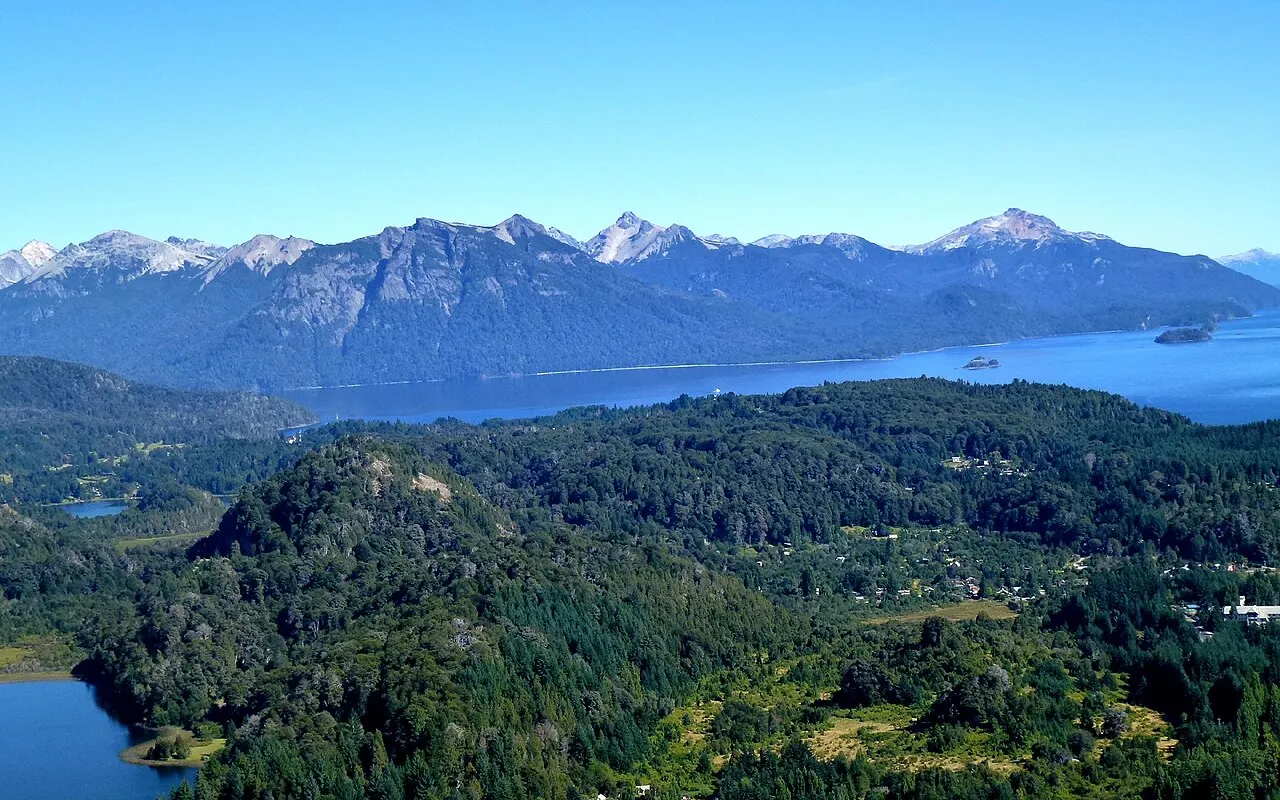
A 1,049 m viewpoint at km 17.5 of Bustillo, reached by a seven-minute chairlift or a 30-minute trail. From the top you see the lakes Nahuel Huapi and Moreno, the Llao Llao peninsula, and the Catedral all at once: the region's best geographic summary from a single point.
Going early avoids the line; if it's already there, the trail alongside is 30 minutes to the same viewpoint.
Check access
Llao Llao
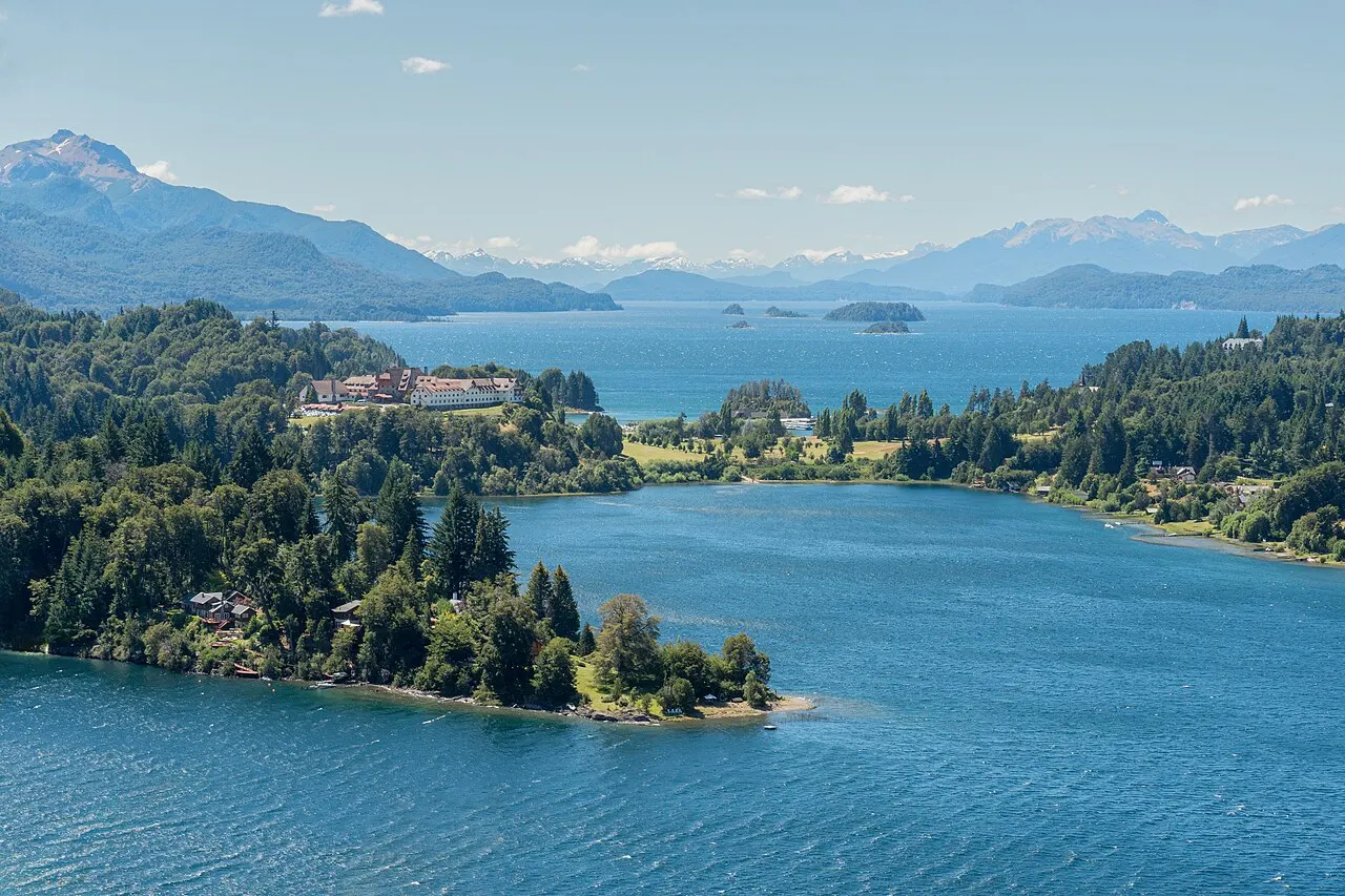
Bustillo's hotel, reopened in 1940 after the original wooden building burned down in 1939, plus the Capilla San Eduardo (1938), all in stone and timber. Next door, the Llao Llao Municipal Park has short trails to Lago Escondido, Villa Tacul, and the Brazo Tristeza viewpoint.
The stop at km 25 of the Circuito Chico is worth it for the Capilla San Eduardo and the façade of the 1940 hotel. Set aside time for the short Lago Escondido trail, in the municipal park, or continue to the Brazo Tristeza viewpoint.
Check access

Circuito Chico
A paved loop of about 60 km leaving the city via Bustillo, skirting Lago Moreno and returning through Colonia Suiza, with stops at the Punto Panorámico (km 18.3) and Bahía López. Doable by car in half a day, by bike in a full day, or combining bus and walking.
It's about 60 km for the full loop: half a day by car, a full day by bike, or buses and walks combined. If the day is Wednesday or Sunday, arrive at Colonia Suiza by 1pm for the opening of the curanto, and bring pesos in cash.
Check access

Centro Cívico
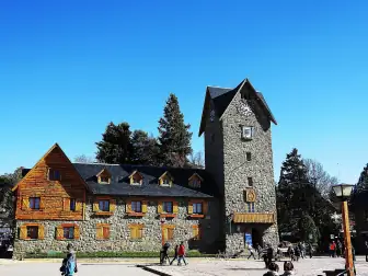
A 1938–1940 complex designed by Ernesto de Estrada in the region's green stone and cypress wood, with city hall, post office, museum and clock tower around a square open to the lake. The equestrian statue of Julio A. Roca in the middle is a recurring target of graffiti and of public debate over the Conquest of the Desert.
The equestrian statue of Julio A. Roca is a target of graffiti and the Conquest debate, the centerpiece of the civic square.
Check access
Museo de la Patagonia Francisco P. Moreno
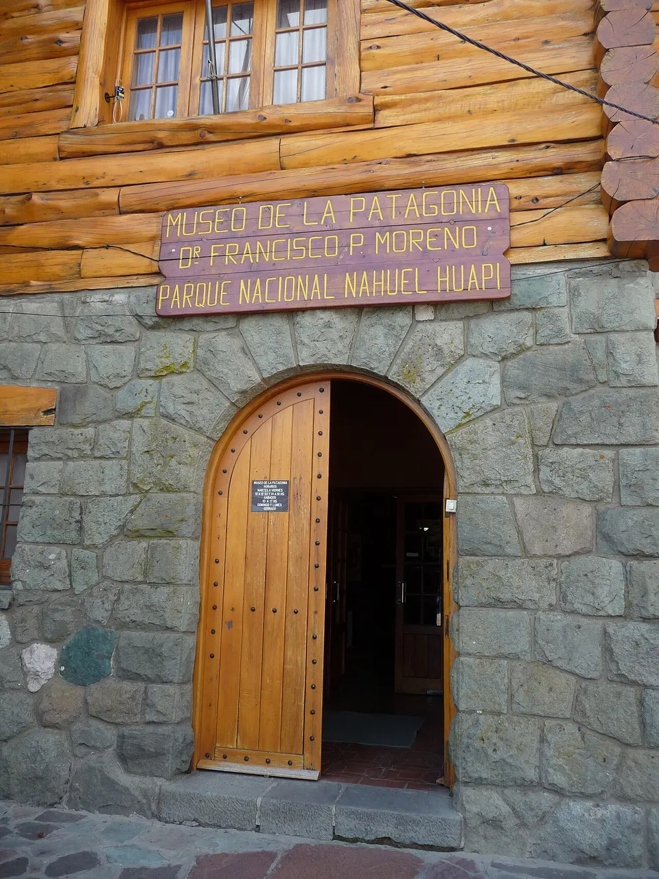
Inside the Centro Cívico, opened in 1940, it gathers Patagonian fauna, archaeology, Mapuche silverwork, and documentation of the region's military conquest. It's the only visit in town that explains who was here before 1881; a cheap ticket, paid in pesos.
Set aside an hour and bring pesos, because admission is cheap and paid in cash. It's the only visit that explains who lived in the region before 1881, and that changes how you look at the Centro Cívico and the Roca statue in the square.
Check access

Cerro Catedral
Cerro Catedral is the largest ski area in South America, 19 km from downtown, with a base at 1,030 m, a summit at 2,388 m, about 120 km of runs and close to 40 lifts. The season usually runs from late June to early October, and in summer the lifts operate for hikers and for the viewpoint.
It's the largest skiable area in South America, with about 120 km of runs, and in summer the lifts reach the high-altitude trails. Go on line 55 with your SUBE loaded, because the fare costs more than triple the regular one and there's nowhere to top up once you're up there.
Check access

Puerto Blest and Cascada Los Cántaros
A full-day catamaran trip leaving from Puerto Pañuelo to the lake's far western end, already in the rainy Valdivian forest, with a wooden staircase up to the waterfall and the Frías lakes. The same pier serves trips to Isla Victoria and the arrayanes forest.
It takes up the whole day: the catamaran leaves Puerto Pañuelo around 9:30am and returns after 5pm. It's worth it for the change of scenery, already in the Valdivian rainforest, where more than 3,500 mm of rain falls a year, and for the climb up to Cascada Los Cántaros.
Check access

Refugio Frey and Laguna Toncek
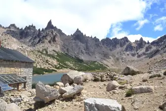
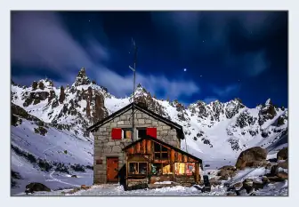
A stone Club Andino refuge at 1,700 m, surrounded by granite spires that made Argentine climbing famous. It's a 4–5 hour climb from Villa Catedral or from Villa Los Coihues; trail registration is mandatory and free before setting out.
It's not a half-afternoon walk: the climb from Villa Catedral takes 4 to 5 hours and the way back follows the same path, so count on the whole day. In summer there's daylight until 9:30pm; outside that season, leave early in the morning so you don't come down in the dark.
Check access
Catedral Nuestra Señora del Nahuel Huapi
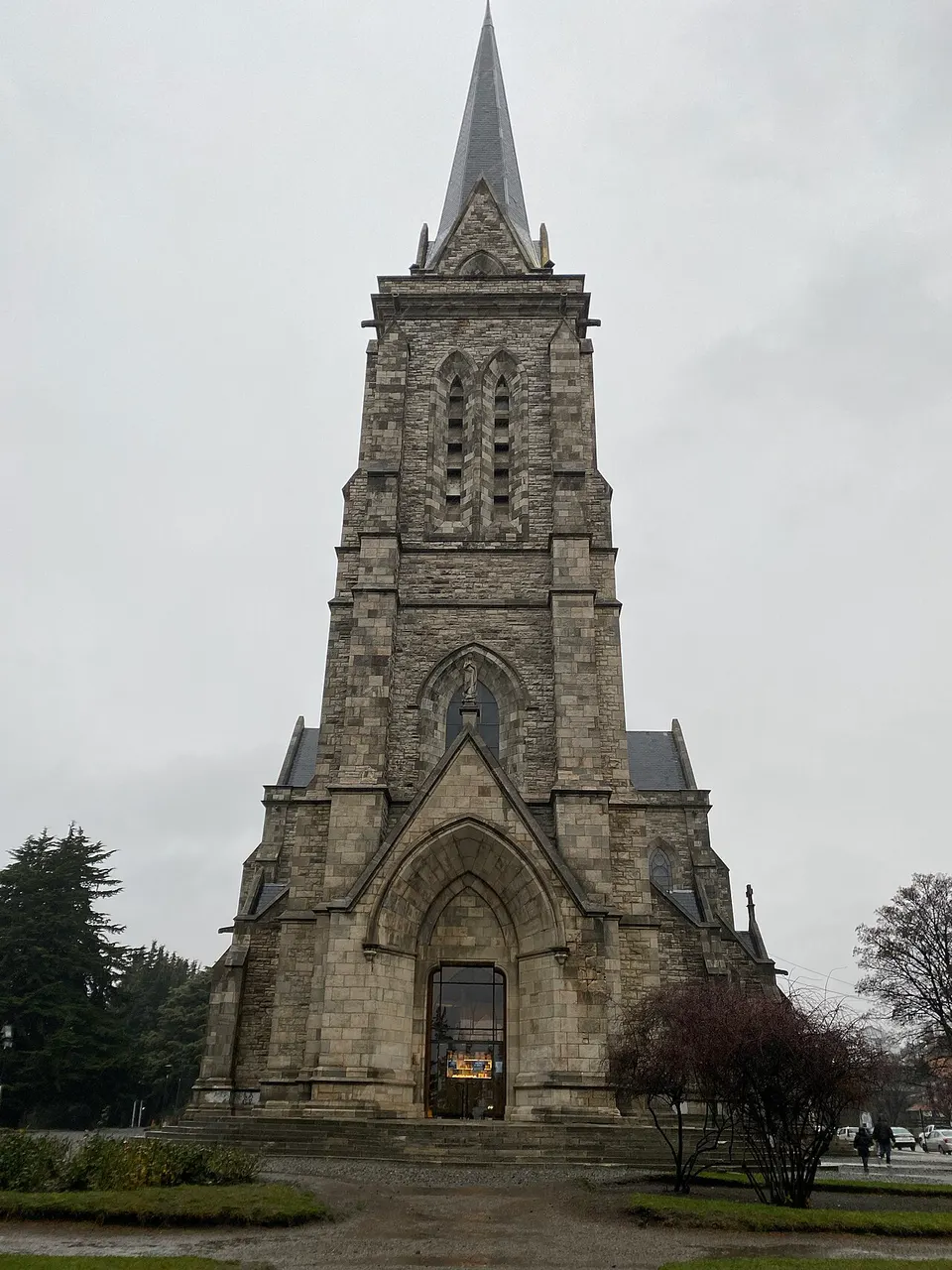
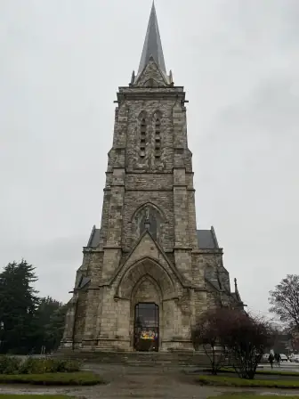
A neo-Gothic church designed by Alejandro Bustillo, construction begun in 1942, with stained glass and a tower finished decades later. It's four blocks east of the Centro Cívico, with the lake appearing behind the main altar.
Construction began in 1942 and the tower was only finished decades later, four blocks east of the Centro Cívico: the lake behind the main altar is what makes it distinctive, and it's the same lake as the square you set out from.
Check access
Nilo’s itinerary
Start with the basic programme and choose extensions for the time you have.
Plan my days in the app ↗Day 1 · The center built in the 1930s
Start at the Centro Cívico at 10am, and set aside an hour for the Museo de la Patagonia, which explains the region's indigenous and military history.
Head down Mitre street to the Catedral Nuestra Señora del Nahuel Huapi, four blocks east, and come back along the pedestrian strip, stopping at two or three chocolate shops.
Have lamb or trout for lunch downtown between 1pm and 3pm, which is when the kitchens are working.
Have your 5:30pm merienda with a submarino downtown, then take the bus to km 5 and ride the cable car up Cerro Otto, with the lake in low light.
Head back downtown for dinner and plan the next day by checking the wind forecast.
Day 2 · Circuito Chico, Llao Llao, and Colonia Suiza
Leave early along Avenida Bustillo, by rental car or line 20, and stop at Cerro Campanario (km 17.5) before 11am, when the chairlift line is short.
Continue to Llao Llao (km 25): Capilla San Eduardo, the façade of the 1940 hotel, and the short Lago Escondido trail in the municipal park.
Have lunch in Colonia Suiza: if it's Wednesday or Sunday, arrive at 1pm for the opening of the curanto pit.
Close the Circuito Chico via the Punto Panorámico and Bahía López, about 60 km for the full loop.
End at a brewery on Bustillo between km 8 and 12, before the last bus empties the avenue.
Day 3 · A full day out of town
In winter, go up Cerro Catedral on line 55 on the very first run and spend the day on the mountain; rent gear at the base, not downtown.
In summer, choose between the 4–5 hour hike to Refugio Frey or the full-day catamaran to Puerto Blest, with the Cascada Los Cántaros.
If hiking, do the free trail registration the day before and bring two liters of water, a windbreaker, and food. There's no shop along the way.
If you go by boat, leave Puerto Pañuelo around 9:30am and expect to be back after 5pm.
Have a Patagonian picada with smoked meats and wild-fruit preserves to close out the day, and leave the chocolate shopping for the way to the airport.
Day 4 · Cerro Tronador and Pampa Linda
Day trip
85 km southwest, about 2 hours 30 minutes by car: paved on RN 40 as far as Villa Mascardi, then the gravel RP 82, which runs one way at a time on a set schedule. The uphill slot runs from 10:30am to 2pm and the downhill slot from 4pm to 6pm, so leave Bariloche early and save the afternoon for the trip back. At the end of the road are the Ventisquero Negro, a glacier covered in dark sediment and visibly retreating, and the waterfall viewpoint; the 3,478 m summit marks the border with Chile.
Food
 AI illustration
Chocolate branch
The branch-shaped bar that became the city's edible souvenir, sold by weight in the shops on Mitre street since the 1950s. Ask for “media rama” to try it without taking home half a kilo.
 AI illustration
Curanto
Beef, chicken, sausage, potato, and vegetables cooked for hours in a pit in the ground over hot stones, covered with nalca leaves. In Colonia Suiza it happens on Wednesdays and Sundays: the pit is uncovered around 1pm and lunch is served right then.
 AI illustration
Patagonian spit-roast lamb
Lamb splayed on an iron cross and roasted for hours beside the embers, served with a simple salad and bread. It's a dish for a big table and a long lunch; few places serve it as an individual portion.
 AI illustration
Nahuel Huapi trout
Rainbow trout was introduced into the lakes in the early 20th century and became the region's fish, served grilled, smoked, or in ravioli. Farmed salmon and perch show up on the same menus.
 AI illustration
Deer, wild boar, and smoked meats
Species brought in for hunting in the 1920s that now sustain the “mountain” menu: deer goulash, smoked wild boar, deer salami. They also show up in the picada, with cheeses and breads.
 AI illustration
Craft beer
The region is the birthplace of Argentine craft beer: the first breweries opened on Avenida Bustillo and in Colonia Suiza in the late 1980s, and a second wave came in the 2000s. A pint cost somewhere between ARS 6,000 and 9,000 in September 2026.
 AI illustration
Wild-fruit preserves
Jams and liqueurs from rosehip, calafate, elderberry, and raspberry, grown or gathered in the Comarca Andina. They turn up at breakfast, in the picada, and on the tea table with walnut cake.
 AI illustration
Submarino
Very hot milk served with a chocolate bar on the side, which you sink into the mug and stir until it melts. It's the drink of the merienda at 5:30pm, between May and September.
Day trips

Villa La Angostura and the arrayanes forest
80 km north on RN 40, about 1 hour 15 minutes by car or 1 hour 30 minutes by bus. The Quetrihué peninsula holds the old-growth arrayanes forest, with its cinnamon-colored bark, reachable on foot (12 km) or by boat; it's also the start of the Ruta de los Siete Lagos, which continues another 110 km to San Martín de los Andes.
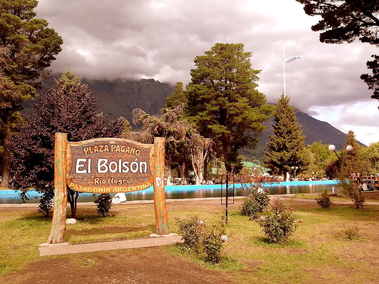
El Bolsón and Lago Puelo
125 km south via RN 40, about 2 hours by bus, in a warmer, greener valley. The craft fair on the plaza runs Tuesdays, Thursdays, Saturdays, and Sundays, and Lago Puelo National Park lies 15 km further on, with water warm enough to swim in by February.

Cerro Tronador and Pampa Linda
85 km southwest, about 2 hours 30 minutes by car: paved on RN 40 as far as Villa Mascardi, then the gravel RP 82, which runs one way at a time on a set schedule. The uphill slot runs from 10:30am to 2pm and the downhill slot from 4pm to 6pm, so leave Bariloche early and save the afternoon for the trip back. At the end of the road are the Ventisquero Negro, a glacier covered in dark sediment and visibly retreating, and the waterfall viewpoint; the 3,478 m summit marks the border with Chile.
Where to begin
The center built in the 1930s
Start at the Centro Cívico at 10am, and set aside an hour for the Museo de la Patagonia, which explains the region's indigenous and military history.
Circuito Chico, Llao Llao, and Colonia Suiza
Leave early along Avenida Bustillo, by rental car or line 20, and stop at Cerro Campanario (km 17.5) before 11am, when the chairlift line is short.
A full day out of town
In winter, go up Cerro Catedral on line 55 on the very first run and spend the day on the mountain; rent gear at the base, not downtown.
Money
The currency is the Argentine peso, trading at around ARS 1,535 to the dollar in September 2026, with the gap between the official and parallel rates down to about 1%: changing money at a “cueva” is no longer worth it, and a foreign card gets practically the same rate. ATM withdrawals have a low limit and a high flat fee per transaction, so withdraw rarely and in larger amounts. The 21% VAT on lodging is refunded to guests who pay with a foreign card, deducted on the spot by the hotel, but only if you ask at check-in. Prices in September 2026, all approximate, fall in these ranges: coffee or cortado ARS 3,500–5,500; medialuna ARS 1,500; simple lunch ARS 12,000–20,000; dinner at a parrilla with wine ARS 35,000–60,000; pint of craft beer ARS 6,000–9,000; chocolate ARS 40,000–60,000 a kilo; three-star hotel US$80–130 in high season; day ski pass at Catedral ARS 160,000 in the 2026 season. Tip 10% at restaurants, in cash, separate from the bill, and carry pesos in cash for mountain huts, curanto, park area fees and remises. Some towns in the region charge a nightly eco-tax on lodging; ask when you book.
Getting there and around
Airport to downtown: bus 72, shuttle or taxi
Teniente Luis Candelaria International Airport (BRC) is 13 km east of downtown, on RN 237, and is named for the pilot who flew across the Andes in 1918. The flight from Buenos Aires takes about 2 hours 15 minutes, and there are also connections to Córdoba, Mendoza, El Calafate and seasonal flights from Brazil. From the airport to downtown you have three options: city bus line 72, which only takes the SUBE card; shared shuttles for around US$8–12; and taxis or remises, which in September 2026 cost somewhere between ARS 25,000 and 40,000. The bus terminal and the train station sit side by side, 3 km east of downtown. Buses to Buenos Aires take 20 to 22 hours, to El Bolsón 2 hours, to San Martín de los Andes 4 hours and to Osorno or Puerto Montt, in Chile, 5 to 7 hours via the Cardenal Samoré Pass. The Tren Patagónico links Viedma to Bariloche in about 18 hours, a few times a week, and carries cars. Brazilians enter Argentina without a visa, with an ID card (RG) in good condition or a passport, and there's no entry fee.
SUBE only: cash doesn't work
The urban buses are run by Mi Bus and only take the SUBE card: cash doesn't work, even with the bill in hand. Buy and top up the card at a kiosk downtown as soon as you arrive. After the July 2026 fare hike, a regular fare is ARS 2,333.30 on sections I to III, rises to ARS 3,383 on section IV, and reaches about ARS 5,210 on the farthest sections. Line 55, which climbs to Villa Catedral, costs ARS 8,049.37, and registered residents pay about ARS 1,750. The useful lines for visitors are 20 (Avenida Bustillo to Llao Llao), 10 (Colonia Suiza), 50 (Lago Gutiérrez and Villa Los Coihues), 55 (Catedral), and 72 (airport). Confirm the branch at the stop, because there are variants sharing the same number. Downtown is walkable, but uphill; outside it, everything runs in a line along Bustillo and takes time. Uber and Cabify have spotty presence, and the norm is radio-taxi or remís. Renting a car pays off for the Circuito Chico, the Seven Lakes, and the Tronador; a bike works well on the Circuito Chico and poorly everywhere else.
Safety
Bariloche is a calm city for visitors, and almost none of the real risks are on the sidewalk. The most common crime is theft from cars parked at viewpoints and trailheads, such as those on the Circuito Chico, Cerro Campanario, Villa Los Coihues and Villa Catedral. Leave nothing visible, and don't stash your backpack in the trunk in front of everyone. In high season there are pickpockets on Mitre street and at the bus terminal. The bigger danger is the mountain: the weather turns within an hour, hypothermia happens in the middle of January, there's avalanche risk in the Frey valley in winter and rescue depends on the Club Andino's Comisión de Auxilio. That's why trail registration is mandatory. The lake is 12–14°C and has almost no lifeguards outside the city beaches. Hantavirus exists in Patagonia, spread by a wild rodent: air out closed cabins and huts before using them, and don't sweep dry dust indoors. At night, the bar zone on Juan Manuel de Rosas street fills with groups of graduating students. Don't leave your drink unattended, and go back by taxi. The Alto neighborhoods hold no tourist interest and aren't a place to walk at night without knowing the way. Emergencies: 911.
Etiquette tips
The mate gourd always returns to the same hand
The ritual has a fixed order: empty the gourd without touching the straw and hand it back always to the same hand, the one that poured it.
Eat dinner from 9pm and have merienda at 5:30pm
Hardly anyone eats dinner before 9pm, and dining rooms fill up at 10pm; lunch runs from 1pm to 3pm. In between comes merienda, around 5:30pm, with coffee, hot chocolate and something sweet.
Greet with a single kiss, on the right cheek
A kiss on the right cheek applies between men too, even on first introduction. When you walk into any shop, say “buen día” or “buenas,” because entering in silence gets noticed.
Register the trail before heading up
Registration is mandatory for any trail in the park, and it's free. At the mountain huts, pay in cash, book ahead in summer and carry your own trash back out.
Campfires outside authorized areas are banned all year
Lighting fires outside authorized areas is banned year-round, and enforcement is real, especially after the 2025 fires. Cigarette butts tossed from a car window trigger an immediate report.
Say “Mapuche community,” not “Indians”
The Mapuche presence in the region is current, and the dispute over land inside and around the park is a live political issue. It's better to ask than to offer an opinion on the topic without being well informed.
Mistakes to avoid
Paying the bus in cash
Trying to pay the bus in cash doesn't work: Mi Bus only takes the SUBE card. Buy and load the card at a kiosk downtown before your first ride, and load more than seems necessary, because the farthest sections cost double.
Booking without checking the kilometer
Booking “in Bariloche” without checking the kilometer. A hotel at km 20 of Avenida Bustillo is 20 km from downtown, and the week's taxi total usually eats up what you saved on the room rate.
“Dropping by” the Tronador in the afternoon
Thinking you can “drop by” the Tronador in the afternoon. RP 82 is one-way by the clock, with the uphill slot only from 10:30am to 2pm: whoever arrives at Villa Mascardi after 2pm doesn't get to go up.
Underestimating the January sun because the wind is cold
Underestimating sun and wind. At 770 m, with dry air and a west wind, you get sunburned in January while feeling cold.
Paper dollars for the parallel rate
Bringing paper dollars thinking the parallel rate still pays off. It no longer does: a foreign card earns nearly the same and still refunds the lodging VAT, which cash doesn't.
Useful phrases
¿Me cargás la SUBE?
Can you top up my transit card? The exact phrase used at the kiosk
Un submarino, por favor
A submarino, please: hot milk with a chocolate bar to melt inside it
¿Cómo está el cerro?
How's the mountain? A question about wind, snow, and whether the lifts opened
Media rama, por favor
Half a branch, please. The chocolate here is sold by weight, not by the piece
¿Cuánto sale?
How much is it? Locally “sale” replaces “cuesta”
Dale
Sure, sounds good: the Argentine “ok,” used all the time and in any tone
Districts
Centro Cívico and downtown
The 1940 green-stone quadrangle and the streets Mitre, Moreno, and Palacios: chocolate shops, agencies, exchange houses, and most of the tourist restaurants. Everything is walkable, but the north-south slopes are genuinely steep.
Barrio Belgrano
A residential hillside just above downtown, with wooden houses, small guesthouses, and lake views. It's a ten-minute walk from Mitre street: fifteen on the way back, which is uphill.
Bustillo corridor (km 3–17)
A coastal strip of hotels, cabins, breweries, and restaurants, with the beaches Playa Bonita and Melipal. Without a car, you depend on the bus lines running up and down the avenue all day.
Llao Llao and San Pedro Peninsula (km 18–25)
The western tip of the corridor, with the 1940 hotel, the Capilla San Eduardo, the Pañuelo pier, and the municipal park with short trails. It's the postcard, and also the priciest and most isolated end.
Colonia Suiza
A village founded by Swiss families in 1895 in the middle of the Circuito Chico, today with a craft fair and curanto cooked in a pit on Wednesdays and Sundays. About 25 houses, a couple of breweries, and no hurry.
Villa Catedral
Ski village at 1,030 m, 19 km southwest of downtown, at the foot of the resort. It lives four months a year in winter and becomes a trekking base for Refugio Frey in summer.
El Alto
The plateau to the south, with neighborhoods like Frutillar, Nahuel Hue, 2 de Abril, and Virgen Misionera, where most of the city lives. It's a residential area with no tourist attractions, home to the schools, health posts, and neighborhood shops.
Lago Gutiérrez and Villa Los Coihues
A neighborhood to the south, by another lake, with rocky beaches, climbing, and the start of trails to the Frey and Cerro Ventana. Cheaper to sleep in and well served by bus.
History
1670 · The Nahuel Huapi Jesuit mission
The Italian priest Nicolás Mascardi set up a mission on the lakeshore to reach the Poya and Puelche peoples from Chiloé. The mission was refounded and destroyed several times until it disappeared in 1717.
17th–18th c. · The Vuriloche pass
The indigenous route that crossed the mountain range at the foot of the Tronador gave the region its name: in Mapudungun, furi che means “people from behind the mountain.” That's where “Bariloche” comes from.
1881–1885 · The Conquest of the Desert reaches the lake
Divisions of the Argentine army commanded by Conrado Villegas reached Nahuel Huapi in 1881, as part of Julio A. Roca's campaign. Mapuche and Tehuelche communities were displaced, killed, or deported, and the land passed to the state.
1895 · The La Alemana store
The merchant Carlos Wiederhold, a Chilean of German descent, opened a general store on the lake's south shore. The settlement grew around it, supplied by boat from Puerto Montt, and spoke more German than Spanish.
1902 · Official founding
On May 3, 1902, the government created the Nahuel Huapi Agricultural-Livestock Colony, the date adopted as the city's anniversary. German, Swiss, Austrian, Italian, Slovenian, Lebanese, and Spanish immigrants formed the initial population.
1903 · Perito Moreno's donation
Francisco P. Moreno gave back to the state 7,500 ha he'd received as a reward for surveying the border, on condition it become a public park. It was Argentina's first protected area.
1934 · National park and train
Law 12,103 created Nahuel Huapi National Park, today about 710,000 ha. That same year, tracks coming from Buenos Aires reached the city, and tourism stopped depending on the boat.

1938–1940 · Bustillo invents the alpine image
Exequiel Bustillo, head of National Parks, commissioned his brother, the architect Alejandro Bustillo, to design the Hotel Llao Llao, and the Centro Cívico was designed by Ernesto de Estrada, a National Parks architect. The wooden hotel opened in 1938 burned down in 1939 and was rebuilt in stone and concrete, reopening in 1940.
1950–1955 · The Huemul Project and the Balseiro Institute
Perón announced in 1951 that the Austrian Ronald Richter had mastered nuclear fusion on an island in the lake; the project was a fraud and collapsed in 1952. The scandal gave rise to the Bariloche Atomic Center and the Balseiro Institute, in 1955.
1976–1994 · High technology and a Nazi fugitive
INVAP was created in 1976 and went on to export research reactors and build Argentine satellites. In 1994 a TV interview revealed that Erich Priebke, a former SS officer convicted for the Ardeatine Caves massacre, ran the city's German school; he was extradited to Italy in 1995.
 AI illustration
2011–2026 · Ash, pandemic, and record seasons
The eruption of the Puyehue–Cordón Caulle complex, in June 2011, covered the city in ash and closed the airport for months. Then came the 2020 shutdown, record seasons starting in 2022, and forest fires in the park in the summer of 2025.
 AI illustration
Complete history
A recent city on an ancient route
Bariloche is a recent city built on a very old route. The Vuriloche pass, at the foot of the Tronador, linked the steppe communities to those on the Chilean coast centuries before any border existed, and it was through it that the Jesuits tried to enter starting in 1670. Nicolás Mascardi's mission lasted a short time, and when the last religious outpost disappeared in 1717, the region went back to being indigenous territory for more than 160 years. The city's name preserves that period: furi che, “people from behind the mountain,” became vuriloche and then Bariloche.
The state's arrival came through violence
The state's arrival came through violence. Between 1881 and 1885 the divisions of the Conquest of the Desert reached Nahuel Huapi, displaced the Mapuche and Tehuelche communities, and opened the land to concessions. What came next was commerce: in 1895 Carlos Wiederhold opened the La Alemana store, and the settlement grew with its back to Buenos Aires, supplied by boat and mule from Puerto Montt. Until the 1930s, the everyday currency and much of the conversation were more Chilean and German than Argentine.
Exequiel Bustillo and the Alpine style of the Centro Cívico
The following decades brought a series of decisions that reshaped the city. After the 7,500-ha donation made by Perito Moreno in 1903, Law 12,103 created Nahuel Huapi National Park in 1934, and Exequiel Bustillo took over the direction of National Parks with the mission of “Argentinizing” the border through tourism. He brought the train in 1934, had roads built, the Centro Cívico (1938–1940) and the Llao Llao Hotel, and chose a style (local green stone, a gabled roof, cypress wood) inspired by the Alps. The city visitors photograph today is a public-policy decision from the 1930s.
The Balseiro Institute and the Nazi Erich Priebke
The 20th century gave Bariloche two unlikely layers. One is scientific: the fiasco of the Huemul Project, in which Perón announced in 1951 a nuclear fusion that never existed, left behind the Bariloche Atomic Center, the Balseiro Institute (1955), and, later, INVAP (1976), which exports research reactors and builds satellites. The other is dark: the German-speaking immigrant colony sheltered fugitives from Nazism, and the city only faced the matter publicly when Erich Priebke was identified in 1994, running the local German school.
Where residents live: the plateau south of downtown
The Bariloche of the hotels and the city where most people live are in different places. About 135,000 residents live largely in the Alto, the plateau south of downtown, far from the hotel strip along Avenida Bustillo; the events of June 2010, when police killed three young people in working-class neighborhoods, exposed that divide. Added to this are land disputes with Mapuche communities in and around the park, the ash from Puyehue in 2011, the 2020 shutdown, record seasons since 2022 and summers of wildfire, like that of 2025. All of it weighs on an economy that depends almost entirely on mountain tourism, in a climate that keeps getting drier.
The Centro Cívico, opened in 1940, was the first grouped complex of public buildings built in the country.
Geography and shape of the city
The lake and the ramp
The city sits on glacial terraces on the south shore of Lake Nahuel Huapi, which is at 764 m altitude, covers more than 500 km², and reaches about 460 m deep in some arms: water that flows to the Atlantic via the Limay river. From the lake up to the Alto plateau you climb about 200 m in a few kilometers, and that ramp organizes everything: the historic center and hotels sit down below, by the water, while most of the population lives up top, where it's cheaper, colder, and windier.
Bustillo Avenue: 25 km to Llao Llao, addresses by kilometer
To the west, the street grid stops being a grid and becomes a line: Avenida Bustillo runs 25 km along the coast to Llao Llao, and addresses are given in kilometers, not numbers, “km 8,” “km 17.5,” “km 25.”
The rain gradient
The terrain creates one of the sharpest rain gradients on the continent: Puerto Blest, 40 km to the west and already in Valdivian rainforest, gets more than 3,500 mm a year, the city sits around 800–900 mm, and 30 km to the east it's already steppe with less than 500 mm. The climate is cold-temperate with an inverted Mediterranean regime (rain and snow concentrated between May and August, dry and windy summers) and the prevailing westerly wind blows year-round.
Here the address is given in road kilometers, like “km 17.5”.
Culture
Club Andino Bariloche, founded in 1931
Local culture is organized around the mountain and has a birth date: the Club Andino Bariloche, founded in 1931, opened the first trails, built the network of refuges still in operation (Frey, Jakob, López, Laguna Negra, Otto Meiling), and trained generations of guides and rescuers. For residents, skiing, climbing, sleeping in a refuge, and coming back down are part of the social calendar, with a season, a wind report, and a standing conversation about the mountain's condition. From that same environment came granite climbing at Frey and the trail races that fill the autumn.
The scientific layer, almost invisible
Scientific Bariloche is almost invisible to anyone spending three days here. The Centro Atómico Bariloche and the Instituto Balseiro, created in 1955 in the wake of the Huemul Project fiasco, train physicists and nuclear engineers who settle in the city; INVAP, created in 1976 out of the same center, today designs reactors and builds satellites. Add the Fundación Bariloche (1963), CONICET, and the Universidad Nacional de Río Negro (2008). A good share of the city's skilled jobs comes from these institutes.
Nightlife and the social fracture
At night, Bariloche has two crowds that barely cross paths. The high school graduation trip became a national institution from the 1970s on and brings more than a hundred thousand students per season to the nightclubs on Juan Manuel de Rosas street, while people here for the trails head out early and steer clear of them. The same divide exists between the Bajo of the hotels, on the lakeshore, and the Alto, the plateau south of downtown where most people live, and the city debates that gap in public, along with the land disputes with Mapuche communities in and around the park.
Festivals and events

Fiesta Nacional de la Nieve
First half of August, since the 1960s: a parade at the Centro Cívico, competitions at the Catedral, and a nighttime torchlight descent on the slope, which is the high point.
 AI illustration
Fiesta Nacional del Chocolate
Holy Week (March or April). The chocolate shops build a giant Easter egg and a chocolate bar stretched over blocks of Mitre street, broken up and handed out to the public.
 AI illustration
City anniversary
May 3, with official ceremonies at the Centro Cívico and events in neighborhoods. It marks the creation of the colony in 1902 and usually coincides with the turn toward the low season.
 AI illustration
Bariloche a la Carta
About ten days in October, with fixed-price menus at dozens of restaurants, producer fairs, and live cooking. It's the best week of the year to eat well while spending little.
 AI illustration
Graduation-trip season
From July to November, outside the official calendar: buses, nightclubs, and entire hotels booked out by graduating classes. It's not a festival to visit. It's a logistical fact to factor in when booking.
Books and films
“Bariloche” (1999), novel by Andrés Neuman
The protagonist collects trash in Buenos Aires and assembles jigsaw puzzles of Patagonian landscapes. It explains less about the real city than about the place it occupies in the Argentine imagination: the destination wished for from afar.
“In Patagonia” (1977), by Bruce Chatwin
The journey that fixed Patagonia as a territory of exiles, unlikely colonies, and poorly told stories. It helps explain why a city of German and Swiss immigrants ended up here.
“The Aura” (2005), by Fabián Bielinsky
A thriller filmed in the region's Andean-Patagonian forests, with isolated cabins, gravel roads, and fog. It shows the landscape without the postcard: the same forest as the Circuito Chico, seen from inside and in winter.
Frequently asked questions
Bariloche: Can you pay the bus in cash?
No: Mi Bus's city buses only accept the SUBE card, even with bills in hand. Buy and load the card at a kiosk downtown before your first ride, and load extra credit, because the farthest sections cost double the regular fare.
Bariloche: How do you get there by plane?
The flight from Buenos Aires takes about 2 hours 15 minutes, and there are also connections to Córdoba, Mendoza, El Calafate and seasonal flights from Brazil.
Bariloche: Is it still worth changing cash dollars?
No: with the Argentine peso trading at around ARS 1,535 to the dollar in September 2026, and the gap between the official and parallel rates down to about 1%, changing money at a “cueva” is no longer worth it, and a foreign card gets practically the same rate.
Bariloche: What's the best time to go?
Summer seems like the obvious answer, but the best months are March and April: stable days, weaker wind, the lengas turning red by late April, off-peak prices, and trails still open.
Bariloche: How is mate drunk in a circle?
The ritual has a fixed order: empty the gourd without touching the straw and hand it back always to the same hand, the one that poured it.
Other cities in the country
Argentina ↗- Days
- 3–4
- When
- Mar–May · Sep–Nov
- Per person/day
- Average 90–140 USDMid-range · per person/day
Cost scope
Per person per day: accommodation, meals, urban transport, visits and a small allowance for extras. Flights excluded; larger purchases vary. Editorial estimate, not a quote.
- Days
- 3
- When
- Jan–Mar · Dec
- Per person/day
- Average 90–160 USDMid-range · per person/day
Cost scope
Per person per day: accommodation, meals, urban transport, visits and a small allowance for extras. Flights excluded; larger purchases vary. Editorial estimate, not a quote.
- Days
- 4–5
- When
- Mar–May · Oct–Nov
- Per person/day
- Average 83,200 ARSMid-range · per person/day
Cost scope
Per person per day: accommodation, meals, urban transport, visits and a small allowance for extras. Flights excluded; larger purchases vary. Editorial estimate, not a quote.
- Days
- 4–5
- When
- Jan–Apr · Oct–Dec
- Per person/day
- Average 86,300 ARSMid-range · per person/day
Cost scope
Per person per day: accommodation, meals, urban transport, visits and a small allowance for extras. Flights excluded; larger purchases vary. Editorial estimate, not a quote.
- Days
- 6–7
- When
- Apr–Nov
- Per person/day
- Average 66,100 ARSMid-range · per person/day
Cost scope
Per person per day: accommodation, meals, urban transport, visits and a small allowance for extras. Flights excluded; larger purchases vary. Editorial estimate, not a quote.
- Days
- 3
- When
- Jan–Apr · Oct–Dec
- Per person/day
- Average 95,400 ARSMid-range · per person/day
Cost scope
Per person per day: accommodation, meals, urban transport, visits and a small allowance for extras. Flights excluded; larger purchases vary. Editorial estimate, not a quote.

Itineraries through here
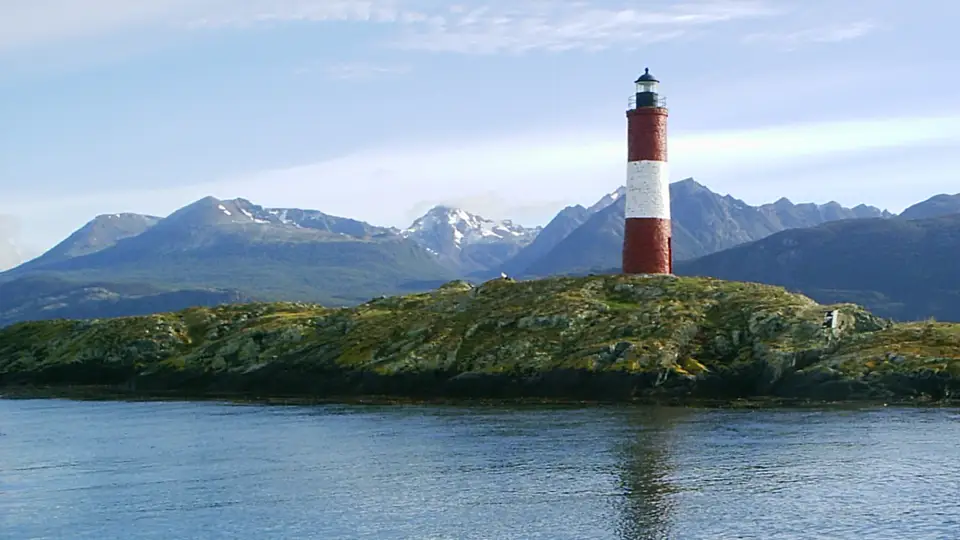
 Argentine Patagonia in 7 daysAndean lakes and the end of the worldBariloche · Ushuaia7 days2 cities
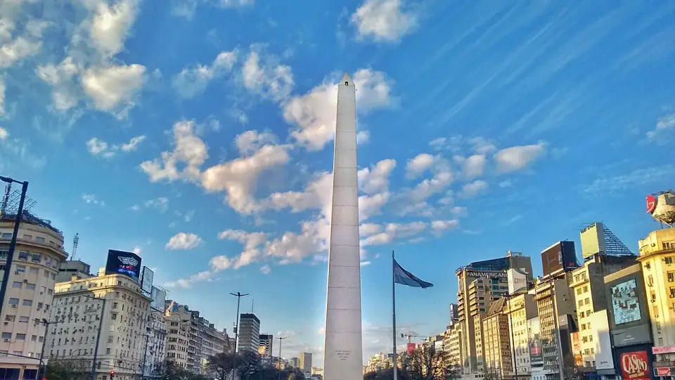
 Argentina in 10 daysFrom tango to the end of the worldBuenos Aires · Bariloche · Ushuaia10–11 days3 cities
 Buenos Aires and Bariloche in 7 daysTango and Andean lakesBuenos Aires · Bariloche7–8 days2 cities
 Chile and Argentina in 10 daysAcross the AndesSantiago · Bariloche · Buenos Aires9–11 days3 cities