Argentina
Ushuaia
Beagle Channel, national park, prison and Antarctica
Days Start with the basic programme and choose extensions for the time you have.
How the guide reaches this number
A fourth only pays off if you want to ski at Cerro Castor. Anyone looking for an old mountain village will be disappointed, because the city is a port, factory sheds and sheet-metal houses on steep slopes. It looks better from the channel and from above than up close. With just one day, spend the morning in the cellblocks of the old jail, at the prison museum, and have merluza negra for lunch on Avenida San Martín. At 3pm, board at the Muelle Turístico for the three-hour trip on the Beagle and finish with a submarino at a chocolate shop. The letdown is the Martial, 7 km from downtown, where almost no glacier is left.
3
When December to March for hiking and boat trips; July and August for firm snow (ski season from mid-June to early October)
How the guide reaches this number
High season is the austral summer, from December to March: highs of 9 to 15 °C, lows around 5 °C and up to 17 hours of daylight near the December 21 solstice, when it only gets dark after 10pm. It's the only window when boat trips, trails and the Antarctic season all run at the same time, and it's also when prices and lines peak. July and August are winter and the second high season, the snow one: highs of 0 to 4 °C, lows of −5 to −2 °C, about 7 hours of daylight, solid snow and Cerro Castor in operation. The shoulder seasons are the best deal: November brings long days at lower prices, and April's fall colors, with the red lenga trees, are the most photogenic time of year. It rains or snows all year, about 530 mm spread evenly, and the west wind makes it feel 8 to 10 °C colder without any effort. The months I'd avoid are May and June, when summer is over, the snow hasn't settled yet and many tours and restaurants close for maintenance.
Per person/day US$90–160 per person in a double room, approximate
How the guide reaches this number
Per person per day: accommodation, meals, urban transport, visits and a small allowance for extras. Flights excluded; larger purchases vary. Editorial estimate, not a quote.
 What Nilo thinks
I'd give Ushuaia three days: one for the prison and the channel boat trip, another for the National Park and the end of Ruta 3, and the third for Estancia Harberton and the penguins of Isla Martillo. A fourth only pays off if you want to ski at Cerro Castor. Anyone looking for an old mountain village will be disappointed, because the city is a port, factory sheds and sheet-metal houses on steep slopes. It looks better from the channel and from above than up close. With just one day, spend the morning in the cellblocks of the old jail, at the prison museum, and have merluza negra for lunch on Avenida San Martín. At 3pm, board at the Muelle Turístico for the three-hour trip on the Beagle and finish with a submarino at a chocolate shop. The letdown is the Martial, 7 km from downtown, where almost no glacier is left.Ushuaia is a strip of houses squeezed between the Beagle Channel and the snowy Martial range, and more than 90% of tourist expeditions to Antarctica leave from this port. The surrounding landscape is the reason to come: boats cross the channel to the red-and-white Les Éclaireurs lighthouse, while trails in Tierra del Fuego National Park pass through lenga forests to Bahía Lapataia, where Ruta 3 ends. The city itself is recent, with sheet-metal houses and steep streets, and its history is preserved in the 1902 prison, built by the inmates themselves and now a museum. Order centolla, the Beagle's king crab, and finish the afternoon with a submarino at a chocolate shop on San Martín. Come from December to March, when highs run between 9 and 15°C and days get up to 17 hours of light, and allow three days.
Quick facts
- Population
- 82,615 (2022 census); about 90,000 in 2026, approximate
- Founded
- October 12, 1884 (Anglican mission since 1869)
- Country and region
- Argentina: province of Tierra del Fuego
- Language
- Spanish, River Plate variant (voseo)
- Currency
- Argentine peso (ARS)
- Time zone
- UTC−3, no daylight saving
- Best time to visit
- December to March for hiking and boat trips; July and August for firm snow (ski season from mid-June to early October)
- Average daily cost
- US$90–160 per person in a double room, approximate
When to go
December to March for hiking and boat trips; July and August for firm snow (ski season from mid-June to early October)
April
3° to 10°C
47 mm of rain
May
2° to 7°C
39 mm of rain
June
0° to 5°C
50 mm of rain
July
0° to 5°C
36 mm of rain
August
0° to 6°C
35 mm of rain
September
1° to 8°C
33 mm of rain
October
3° to 10°C
31 mm of rain
November
4° to 11°C
37 mm of rain
How the year changes
High season is the austral summer, from December to March: highs of 9 to 15 °C, lows around 5 °C and up to 17 hours of daylight near the December 21 solstice, when it only gets dark after 10pm. It's the only window when boat trips, trails and the Antarctic season all run at the same time, and it's also when prices and lines peak. July and August are winter and the second high season, the snow one: highs of 0 to 4 °C, lows of −5 to −2 °C, about 7 hours of daylight, solid snow and Cerro Castor in operation. The shoulder seasons are the best deal: November brings long days at lower prices, and April's fall colors, with the red lenga trees, are the most photogenic time of year. It rains or snows all year, about 530 mm spread evenly, and the west wind makes it feel 8 to 10 °C colder without any effort. The months I'd avoid are May and June, when summer is over, the snow hasn't settled yet and many tours and restaurants close for maintenance.
The same numbers as a table
| Month | Temperature °C | Rain mm |
|---|---|---|
| January · | 6 to 13 | 46 |
| February · | 6 to 14 | 39 |
| March · | 5 to 12 | 42 |
| April | 3 to 10 | 47 |
| May | 2 to 7 | 39 |
| June | 0 to 5 | 50 |
| July | 0 to 5 | 36 |
| August | 0 to 6 | 35 |
| September | 1 to 8 | 33 |
| October | 3 to 10 | 31 |
| November | 4 to 11 | 37 |
| December · | 5 to 13 | 46 |
Nilo's tips
Arrive at the Muelle Turístico 20-30 minutes before the boat
The boat leaves at the scheduled time and doesn't wait for latecomers, and the boarding list is checked name by name, so show up with your ID in hand. In strong wind, the 3-hour boat trip can be canceled without notice. Book it for the first day of your trip and keep another day in reserve.
No coins on the city bus
The validator only accepts the SUBE card or your bank card. If you don't want to tap your bank card, get a SUBE card before going to the stop. The fare is less than half the real cost, and the city subsidizes the rest.
Ask for the 21% VAT refund at check-in
The front desk rarely offers the discount, and it needs to be applied before the first night is charged. It applies to foreigners who pay for the hotel with a foreign card, and it usually comes off the bill directly.
National Park: buy lunch before you leave
Food inside the park is scarce and expensive, so bring lunch bought on San Martín. The gate is 12 km from downtown on RN3, and in 2026 the entrance fee was around $40,000 for foreigners and $18,000 for Argentines, subject to increases. If you're taking the shuttle that leaves from Avenida Maipú, choose your return time when you buy the ticket, not at the end of the day.
Avoid May and June: cheap, but many places close
In those months, many tours and restaurants close for maintenance. For long days at lower prices, come in November. For guaranteed snow, come in July and August, when Cerro Castor, 26 km away, is open. The ski season runs from mid-June to early October.
Book Isla Martillo: the daily penguin quota sells out
The island has a daily visitor quota, and the Magellanic and gentoo penguins can only be seen up close with a spot booked in advance. Book as soon as your dates are set. On the day, leave at 8am on RN3 toward Estancia Harberton, next to the island, 85 km and about 2 hours each way, much of it on gravel.
Explore the map

© OpenStreetMap · OpenFreeMap · © OpenMapTiles
Explore the map, read about the other places and plan your travel days in the app.
Open the appWhat to see
Ushuaia: The strip between the channel and the range
The climate is oceanic subpolar (Cfc): no hot summer, no extreme winter, about 530 mm of precipitation well spread across the year, prevailing westerly wind, and the possibility of snow in any month. Twelve blocks concentrating tax-free electronics stores, chocolate shops, tour agencies, banks and most of the restaurants.

Museo Marítimo y del Presidio de Ushuaia
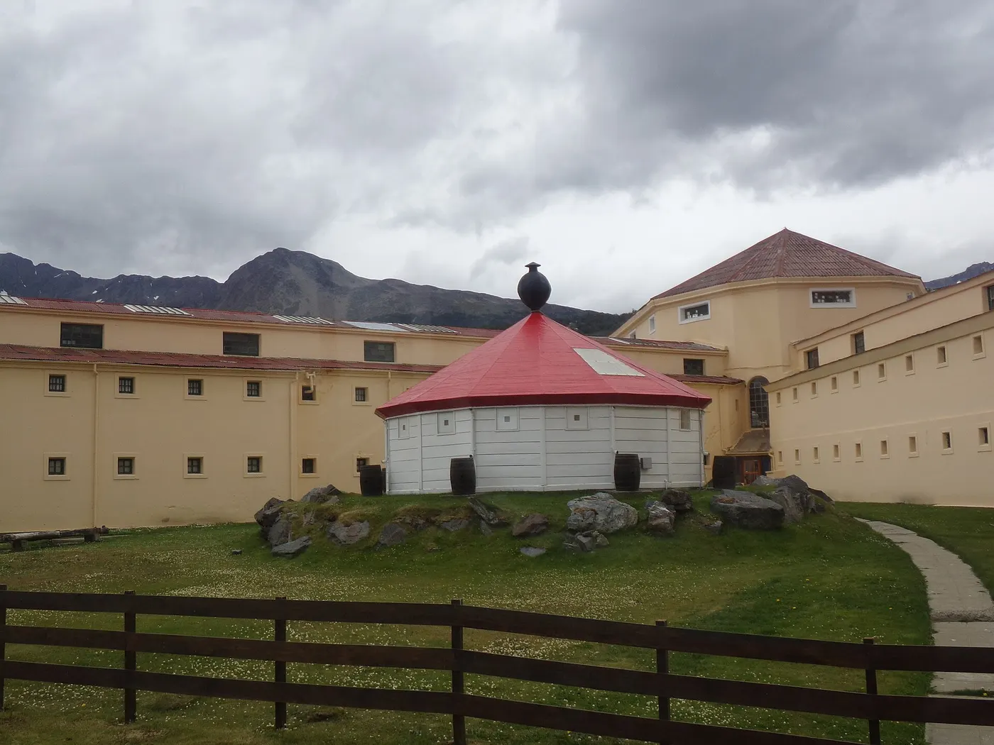
The five radial pavilions of the old reoffenders' prison, built by the inmates themselves between 1902 and 1920 and shut down in 1947. One wing kept the raw, unheated cells; another retraces the maritime and Antarctic history. Set aside 2 to 3 hours.
The fan-shaped pavilions were built by the inmates themselves, and one wing keeps the cells as they were, with no heating; from 1902 to 1920, it closed in 1947; set aside 2 to 3 hours.
Check access
Tierra del Fuego National Park
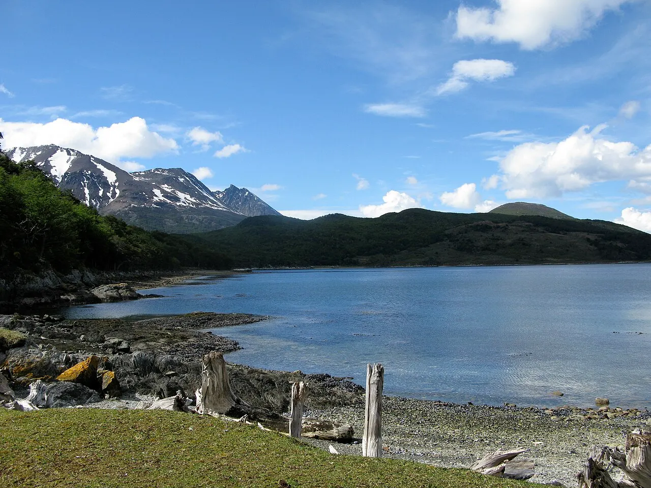
Created in 1960, with about 69,000 hectares of lenga forest, peat bogs, lakes and coastline, of which only a fraction is open to visitors. Entrance is 12 km from downtown along RN3; in 2026 the fee for foreigners stood at around $40,000 and for Argentines around $18,000 (peso amounts, subject to adjustment).
The protected area, created in 1960, totals about 69,000 hectares of lenga forest, peat bog, lakes, and coastline, and only a slice is open to visitors, accessed 12 km from downtown on RN3; in 2026, foreign visitors pay around 40,000 pesos and Argentines pay around 18,000.
Check access
Sailing the Beagle Channel
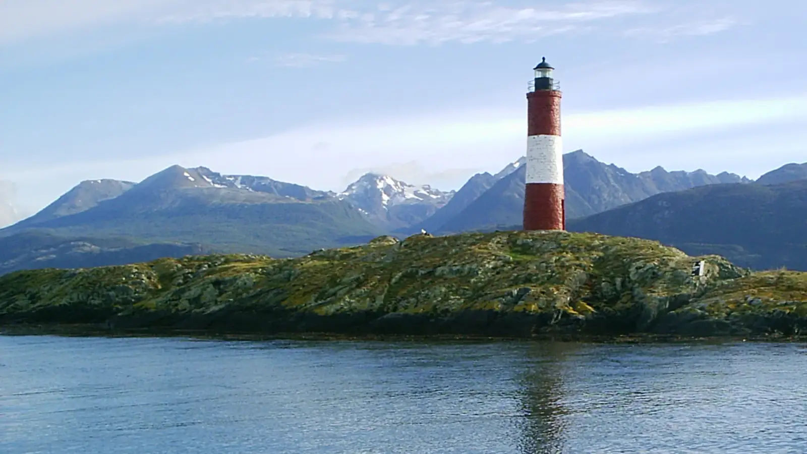
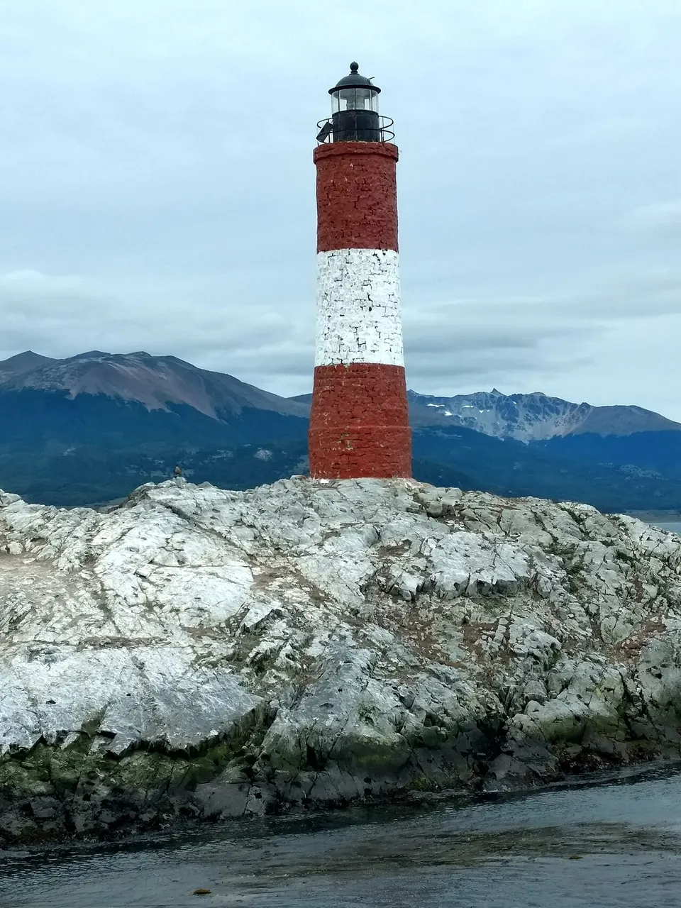
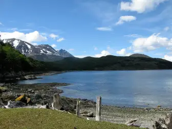
Trips of 2 hours 30 minutes to 4 hours from the Muelle Turístico, passing Isla de los Lobos (South American sea lions and South American fur seals), Isla de los Pájaros and the Les Éclaireurs lighthouse, built in 1920, striped red and white, on a low rock. Longer itineraries include a landing on Isla Bridges or at the penguin colony.
Trips of 2 hours 30 minutes to 4 hours from the Muelle Turístico, passing Isla de los Lobos (one-haired and two-haired sea lions), Isla de los Pájaros, and the Les Éclaireurs lighthouse, built in 1920, striped red and white, on a low rock.
Check access
Bahía Lapataia and the end of Ruta 3
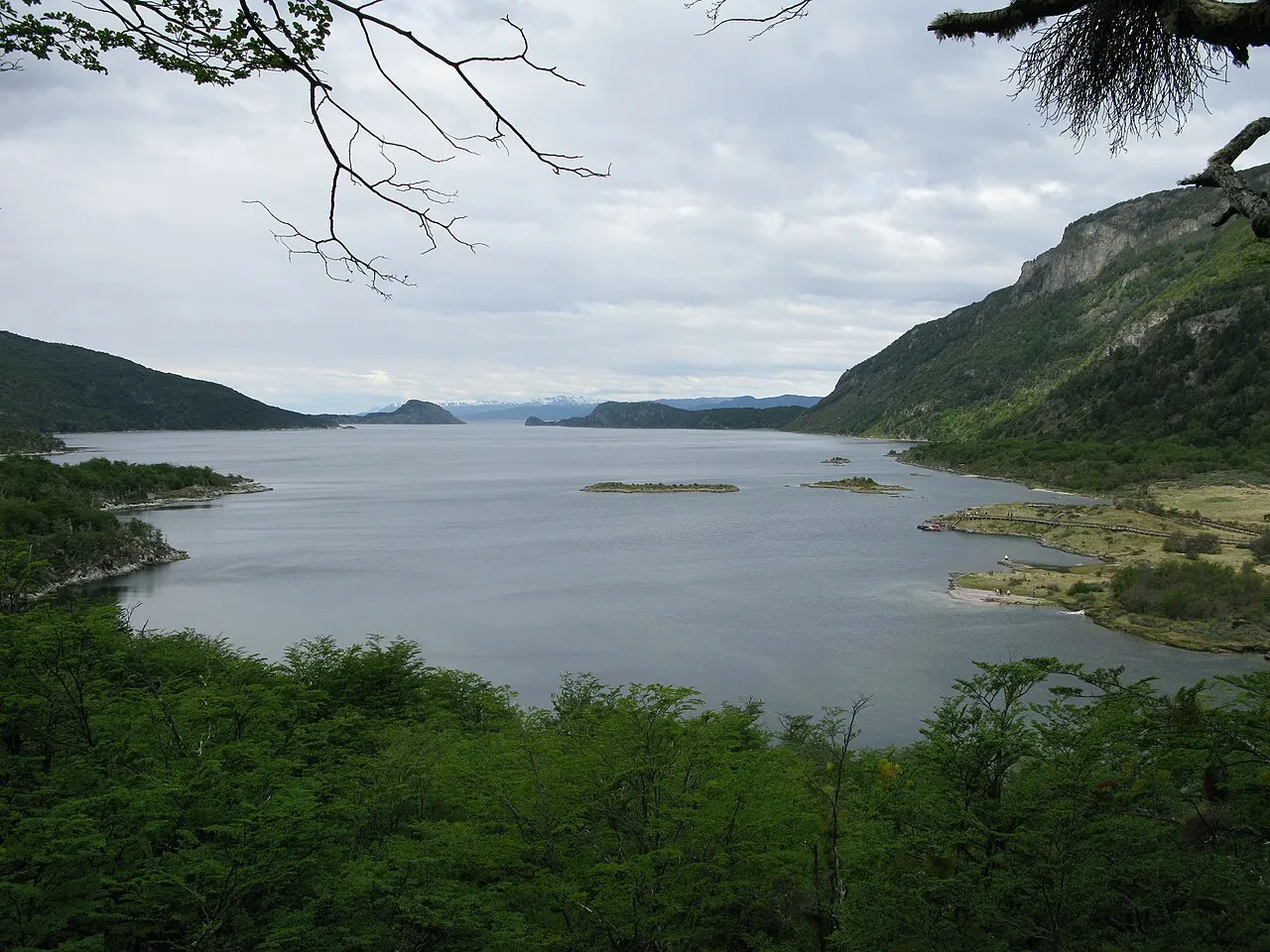
The point where the national highway ends, with the sign stating 3,079 km to Buenos Aires. Wooden boardwalks over the peat bog lead to the cove; the final walk is under 1 km and is accessible.
The national highway ends here, a sign marks 3,079 km to Buenos Aires, and wooden boardwalks over the peat bog lead to the cove in a final walk of under 1 km, which is accessible.
Check access
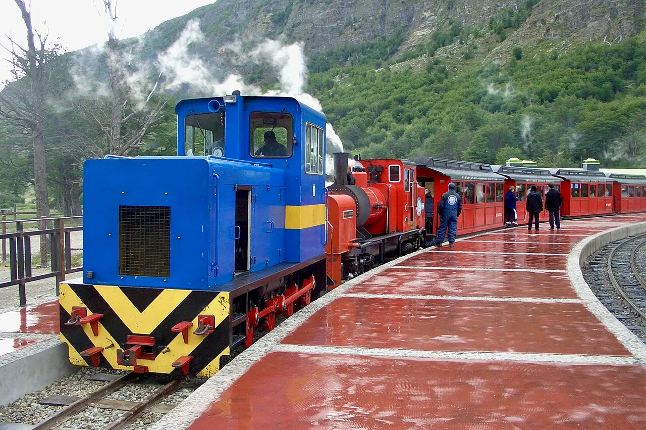
Tren del Fin del Mundo
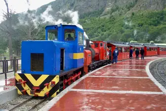
A 60 cm-gauge railway that retraces the route inmates once used to haul firewood, starting at Estación del Fin del Mundo, at km 8 of RN3. The ride lasts about 1 hour each way and enters the National Park, stopping at the Macarena waterfall.
A 60 cm-gauge railway that retraces the route inmates once used to haul firewood, leaving from Estación del Fin del Mundo, at km 8 of RN3; the ride lasts about 1 hour each way, with a stop at Macarena waterfall, already inside the protected area.
Check access

Avenida San Martín
The twelve-block commercial spine where you buy tax-free electronics, chocolate, wool and lenga-wood crafts. Watching who walks it in January versus May is the fastest way to grasp the city's seasonality.
Across twelve blocks you can buy tax-free electronics, chocolate, wool, and lenga wood, and the rush of January and May explains the year; Avenida San Martín, the commercial spine.
Check access

Casa Beban
A prefabricated catalogue house, imported from Sweden and assembled by the Beban family between 1911 and 1913, later dismantled and rebuilt on the waterfront. Today it works as a cultural center and exhibition hall, generally free to enter.
It came ready-made from a catalog, was assembled, disassembled, and re-erected on the waterfront, and today serves as a showroom, generally with free admission; imported from Sweden between 1911 and 1913.
Check access

Cerro Castor
A ski resort 26 km east along RN3, opened in 1999, with runs between about 200 and 1,000 m of altitude and a season from mid-June to early October. Because of the latitude, it hosts European teams training out of season.
26 km to the east, on RN3, the ski resort opened in 1999 keeps runs between about 200 and 1,000 m of altitude, from mid-June to early October; thanks to its latitude, it hosts European teams training out of season.
Check access

Martial Glacier and lookout
A glacial cirque 7 km from downtown, up Luis Fernando Martial street. The chairlift stopped running around 2018 and the ice has retreated a lot; what still justifies the stop is a head-on view over the channel and the start of the high-altitude trails. Wear sturdy shoes and a windbreaker.
It's worth it for the scenery: from the glacial cirque, 7 km from downtown, you see the Beagle head-on, and that's where the mountain hikes start. Of the glacier itself, little is left.
Check access
Nilo’s itinerary
Start with the basic programme and choose extensions for the time you have.
Plan my days in the app ↗Day 1 · The city, the prison and the channel
Start at the Museo Marítimo y del Presidio, on the corner of Yaganes and Gobernador Paz, and set aside 2 to 3 hours for the old cellblock pavilions.
Have merluza negra or a centolla empanada for lunch at a place on Avenida San Martín, between 25 de Mayo and Rivadavia.
Board at 3pm at the Muelle Turístico for the roughly 3-hour sail: Isla de los Lobos, Isla de los Pájaros and the 1920 Les Éclaireurs lighthouse.
On the way back, walk the waterfront to the “Ushuaia, fin del mundo” sign and then on to the 1913 Casa Beban.
Finish with a submarino at one of the San Martín chocolate shops, before they close.
Day 2 · National Park and the end of Ruta 3
Take the regular transfer on Avenida Maipú or drive 12 km along RN3 to the Tierra del Fuego National Park gate and pay the entrance fee.
Walk the Senda Costera: about 8 km between Bahía Ensenada and Lago Roca, 3 to 4 hours, with the channel always on your left.
Bring lunch from town: inside the park, food options are minimal and expensive.
Head to Bahía Lapataia and the sign marking the end of RN3, 3,079 km from Buenos Aires, along the boardwalks over the peat bog.
On the way back, ride the Tren del Fin del Mundo from the Estación del Fin del Mundo, at km 8 of RN3, about 1 hour each way.
Day 3 · East: a ranch, penguins and mountain
Leave at 8am along RN3 eastward and then the gravel Ruta J to Estancia Harberton: 85 km, about 2 hours.
Take the 15-minute boat ride to Isla Martillo to walk alongside colonies of Magellanic and gentoo penguins.
Visit the Museo Acatushún, on the ranch itself, with skeletons of South Atlantic marine mammals and seabirds.
On the way back, stop at Paso Garibaldi, at 430 m, for the lookout over Lago Escondido and Lago Fagnano.
In winter, swap the day for Cerro Castor (26 km, skiing from June to October) or the Laguna Esmeralda trail.
Food
 AI illustration
Centolla
The Beagle's king crab (Lithodes santolla), caught in traps under a regulated season. Served plain with light mayonnaise, in a gratin cazuela, or in an empanada; it's the priciest and most-ordered dish on the menu.
 AI illustration
Merluza negra
Merluza negra (Dissostichus eleginoides), which some menus call Patagonian toothfish, has white, fatty flesh and is almost always grilled with butter or crusted. It is cheaper than centolla and more reliable out of season.
 AI illustration
Spit-roasted Fuegian lamb
Lamb splayed in a cross over embers for 4 to 6 hours, a legacy of the sheep ranches to the north of the island. It appears at downtown barbecue houses and at ranch lunches; comes with a simple salad and bread.
 AI illustration
Calafate
The dark-blue berry of Berberis microphylla, growing across the steppe and the woodland. It becomes jam, ice cream, liqueur and meat sauce, sold in jars along San Martín.
 AI illustration
Chocolate and submarino
Avenida San Martín has a run of artisanal chocolate shops, a legacy of immigrants who replicated the Bariloche model. The submarino is hot milk with a chocolate bar that dissolves in the cup: the standard late-afternoon order.
 AI illustration
Fuegian craft beer
Local production since the 2000s, with brands like Beagle and Cape Horn, almost always dark, malty styles. Served on tap in the bars of San Martín and the waterfront.
 AI illustration
Empanadas and mate
Empanadas of knife-cut beef, lamb or centolla, baked and sold from morning to night. The centolla one is the local version, filled with the king crab of the Beagle.
Day trips

Estancia Harberton and Isla Martillo
85 km east along RN3 and Ruta J, about 2 hours each way, much of it on gravel road. Tierra del Fuego's first ranch, founded by Thomas Bridges in 1886, with the Museo Acatushún of marine mammals and seabirds; the neighboring island hosts penguin colonies from October to March, with a daily visitor cap and mandatory booking.

Tolhuin, Lago Fagnano and Paso Garibaldi
110 km north on RN3, about 1 hour 40 minutes. Paso Garibaldi, at 430 m, is the classic lookout over lakes Escondido and Fagnano; Fagnano covers 645 km², shared with Chile, and in Tolhuin, at the eastern end of the lake, the traditional stop is the La Unión bakery.

Laguna Esmeralda and Valle de Tierra Mayor
20 km northeast along RN3, about 30 minutes by car. The trail runs about 9 km round trip, 4 hours, nearly flat but waterlogged with peat bog, passing beaver dams. In winter the same valley works as a Nordic ski center, dog sledding site and home to the August races.
Where to begin
The city, the prison and the channel
Start at the Museo Marítimo y del Presidio, on the corner of Yaganes and Gobernador Paz, and set aside 2 to 3 hours for the old cellblock pavilions.
National Park and the end of Ruta 3
Take the regular transfer on Avenida Maipú or drive 12 km along RN3 to the Tierra del Fuego National Park gate and pay the entrance fee.
East: a ranch, penguins and mountain
Leave at 8am along RN3 eastward and then the gravel Ruta J to Estancia Harberton: 85 km, about 2 hours.
Money
The currency is the Argentine peso (ARS) and it devalues fast, so it's worth thinking in dollars and treating any peso figure as a short-term reference. Since the 2025 currency normalization it no longer pays to look for a parallel exchange rate: international credit and debit cards are accepted at practically every restaurant, hotel and agency, and go through at the official rate. ATMs exist downtown, but they have low withdrawal limits and high fees for foreign cards; carry some cash as a backup. The approximate 2026 ranges: coffee or submarino US$3–6; a simple lunch or empanadas US$10–18; dinner with merluza negra US$25–40; a centolla dish US$35–60; a hostel bed US$35–55; a mid-range hotel in January US$130–220 for a double room; a 3-hour sail on the Beagle US$55–90. Ushuaia is 20% to 40% pricier than Buenos Aires, and freight costs and seasonality are to blame. A 10% tip is customary, preferably in cash, though many restaurants now let you add it to the card. Non-residents paying for lodging with a card issued abroad or by international transfer are entitled to a refund of the 21% VAT, usually applied directly on the hotel bill: ask at check-in.
Getting there and around
Airport: 4 km from downtown, on the peninsula itself
Malvinas Argentinas International Airport (USH) is on the Ushuaia Peninsula, about 4 km from downtown, and opened in 1995: it's 10 to 15 minutes by taxi or remise, and there's no regular city bus line to the terminal. Taxis run on the meter and remises at a fixed fare booked by phone or app; count on the equivalent of a few dollars from the airport to downtown. The city network has four lines, A, B, C and D, run by the municipal company, linking downtown to the upper neighborhoods and the peninsula. Payment is electronic only (SUBE card, SUBE QR, debit or credit), and no coins are accepted on board. The fare was about $1,280 in mid-2026, with a proposed increase to the $1,500–1,600 range. The actual operating cost is over $3,100, and the city subsidizes the difference. For the National Park and the Estación del Fin del Mundo there are private shuttles leaving from Avenida Maipú, usually every hour in high season, with round trips sold together.
No road leaves without passing through Chile
There's no intercity train, nor any road linking Ushuaia to the rest of Argentina without crossing Chile. By land, RN3 climbs to Río Grande (212 km, about 3 hours 30 minutes) and then crosses the border at San Sebastián, with a ferry at Primera Angostura, in the Strait of Magellan. Punta Arenas is 10–12 hours by bus, with passport and two customs checks. Puerto Williams, in Chile, is just a few kilometers across the channel and is reached by boat in about 1 hour, on a seasonal service with full immigration procedure. Within the city, downtown is walkable on the flat and tiring on the vertical: San Martín and Maipú are easy on foot, but climbing to the hillside neighborhoods means slopes of 10% or more. There's a short bike lane on the waterfront and bike rental, though the constant westerly wind and the slopes make cycling a sport choice, not a commuting one. A rental car only pays off for Harberton, Tolhuin and Cerro Castor.
Safety
Ushuaia is a small city with low violent crime, even by Argentine standards. The typical urban problem is opportunistic theft downtown and at the port on cruise-ship days, plus bikes and backpacks left unwatched. The real risk is environmental. The weather turns within a few hours (rain, hail and a 10°C drop in the same afternoon are normal) and hypothermia is the most common emergency among visitors on trails like Laguna Esmeralda, Ojo del Albino and the Martial ridge crossings. Bring layers, food, water and a flashlight, let someone know or register in the municipality's trekking log. In winter, black ice on the sloped streets causes more accidents than anything else: grippy shoes when walking, snow tires or chains if driving. On the channel, the wind cancels sailings without warning, and the Drake Passage, toward Antarctica, is notoriously rough. Emergencies: 911 for police, 100 for the fire department and 107 for ambulance. Hospital Regional Ushuaia handles emergencies, and travel insurance with mountain rescue coverage is advisable.
Etiquette tips
Mate has fixed rules
Whoever pours is the cebador, and the gourd always goes back to them. Don't touch the bombilla, drink it all down to the gurgle and hand it back; saying “gracias” means you don't want more, not that you're thanking them for the round.
Malvinas isn't a joking matter
The province is officially named Tierra del Fuego, Antártida e Islas del Atlántico Sur, there are veterans of 1982 living in the city and monuments in nearly every square. Say Malvinas, not Falklands, and treat the subject with the same seriousness it's treated with there.
Don't argue over which city is the southernmost
Puerto Williams, in Chile, on the other side of the channel, is farther south, but it's a village. That's why Ushuaia presents itself as the southernmost city in the world, and Puerto Williams as the southernmost town. The debate is old, technical and dull for the people who live on both shores.
Social greeting: one kiss on the right cheek
Greet with a single kiss, on the right cheek, even between men in a social setting. Handshakes are for the bank, government offices and a first business meeting.
Boat and train times are literal
Social life is elastic and dinner starts at 9:30pm, but the catamaran, the train, and the park transfer leave on time. Whoever arrives late misses boarding.
In the park: don't pick or feed
Picking calafate, cutting a branch, or feeding foxes and caracaras is prohibited in the National Park and carries a fine. All trash goes back out with you, including fruit peel, which doesn't decompose in the peat bog.
Mistakes to avoid
Summer clothes in January, with highs of 9 to 15°C
Arriving in January with summer clothes is a common mistake: Fuegian summer has highs of 9 to 15°C and constant wind, and without layers, a waterproof windbreaker, and a beanie, you give up on half the outings on day one.
Climbing Martial expecting a glacier
Going up to Martial Glacier expecting a great tongue of ice. Today only a small patch is left high in the glacial cirque, and the reason to go up is the view over the Beagle and the start of the mountain hikes.
Antarctic cruises: the season runs from late October to March
Leaving the Antarctic cruise for the last minute. Discounted last-minute berths have practically disappeared: the season runs from late October to March and most ships sell out 6 to 12 months ahead.
Harberton is 85 km, two hours each way
Underestimating the distances and the ripio. Harberton, Tolhuin and Río Grande each take a full day by car, and overland there's no way to reach mainland Argentina without crossing a stretch of Chile, with two border crossings, at San Sebastián and at Monte Aymond.
Waterlogged bog and beaver dams
Tackling Laguna Esmeralda in sneakers. The ground is wetter than it looks, and without waterproof boots your foot sinks into the mud. Register the hike in the municipal trekking log before setting out.
Useful phrases
¿Cómo andás?
How's it going? The everyday greeting, with the River Plate voseo in place of “cómo estás.”
Dale
Sure, sounds good: used to accept, agree, and close out a conversation.
¿Me cobrás, por favor?
The check, please: nobody brings the bill unasked.
Un submarino
A hot-milk drink with a chocolate bar that melts in the cup, ordered in the late afternoon.
Nacido y criado / venido y quedado
Born and raised / came and stayed: how Fuegians classify who is from the island and who arrived later.
Está soplando
It's blowing: explains a delayed boat, a canceled flight and generalized bad mood.
Districts
Centro (San Martín and 25 de Mayo)
Twelve blocks packed with tax-free electronics stores, chocolate shops, tour agencies, banks and most of the restaurants; everything here is within walking distance, and it's the only part of the city laid out on a regular grid.
Costanera and Puerto
The strip between Avenida Maipú and the water, with the Muelle Turístico Comandante Luis Piedrabuena, the cruise terminal, the “Ushuaia, fin del mundo” sign and the prison museum inside the Naval Base. It runs on two rhythms: packed when a ship is in, empty when it isn't.
Ushuaia Peninsula
A flat arm east of downtown, home to Malvinas Argentinas Airport, the yacht club and higher-end houses facing the bay. No street-level shops: living there means depending on a car.
Valle de Andorra
A rural valley behind the first ridge of hills, about 6 km from downtown, with smallholdings, sled-dog kennels, cross-country ski trails and wooden houses on large lots. It's where the city turns into countryside without warning.
Barrio Ecológico and Las Raíces
Residential neighborhoods on the north slope, formed from the 1990s onward through subdivisions and settlements. Full views of the channel, severely sloped streets, and the city's biggest headache with snow, ice and transport.
Kaupén and the eastern hillside neighborhoods
Public housing and financed developments, linked to downtown by urban bus lines. This is where much of the factory and tourism workforce lives, and where the city's housing cost becomes visible.
Bahía Golondrina and Playa Larga
The western exit along RN3, with pebble beaches, cabins, lodgings outside downtown and the Estación del Fin del Mundo, where the train departs. Good for those who want to be on the way to the National Park.
Río Pipo and the industrial zone
Electronics assembly warehouses, depots and services on the western exit, in the Pipo river valley. Not a tourist area, but the part of the city that explains the economy and population growth since 1972.
History
c. 6000 BC · The Yámana in the channel
Yámana (Yaghan) canoe-dwelling groups occupy the banks of the Beagle, living off shellfish, sea lions and fires kept burning inside their own canoes. The shell middens they left still turn up on the city's coastline.
1520 · Magellan names the island
Ferdinand Magellan's expedition spots fires while crossing the strait and calls the land to the south “Tierra de los Fuegos.” No European settles there for the next three centuries.
1826–1836 · The Beagle and Jemmy Button
The two voyages of HMS Beagle, under Robert FitzRoy, map the channel that inherits the ship's name; Charles Darwin passes through the region in 1833. FitzRoy takes four Yámana to England, among them Orundellico, renamed Jemmy Button.
1869–1871 · The Anglican mission
Waite Stirling sets up a South American Missionary Society mission on the bay in 1869; Thomas Bridges arrives in 1871 and compiles a Yámana-English dictionary of about 32,000 entries. Measles and tuberculosis reduce the indigenous population to a fraction within a few decades.
Oct 12, 1884 · The Argentine flag
The South Atlantic Expeditionary Division, commanded by Augusto Lasserre, raises the flag and creates the maritime sub-prefecture of Ushuaia. The date is the city's official founding anniversary.

1902–1947 · The prison at the end of the world
The State transfers the reoffenders' prison to Ushuaia, merged in 1911 with the military prison; inmates build their own cellblock, the sawmill and the narrow-gauge railway that fetched firewood from the forest. The prison is closed by decree in 1947 and the building passes to the Navy.
1960 · Tierra del Fuego National Park
Created by law to protect the subantarctic lenga and guindo forest, the peat bogs and the Beagle coastline, covering about 69,000 hectares. National Route 3 ends inside it, at Bahía Lapataia, 3,079 km from Buenos Aires.
1972 · Law 19,640 and the factories
The tax-promotion regime and the special customs zone attract electronics, textile and plastics assembly plants. Population jumps from a few thousand in the 1970s to about 29,000 in 1991 and 45,000 in 2001.
1978–1984 · The Beagle crisis
The dispute with Chile over the Picton, Nueva and Lennox islands brings the two countries to the brink of war in December 1978, contained by Vatican mediation through Cardinal Antonio Samoré. The 1984 Treaty of Peace and Friendship ends the dispute and fixes the border in the channel.
1990 · Tierra del Fuego becomes a province
Law 23,775 converts the former National Territory into a province and confirms Ushuaia as its capital, under the official name Tierra del Fuego, Antártida e Islas del Atlántico Sur. The Malvinas (Falklands), occupied by the United Kingdom, are listed as a department of the province.

1995–present · The gateway to Antarctica
Malvinas Argentinas International Airport opens in 1995 and the port becomes the base for over 90% of Antarctic cruises, with a season running from late October to March. The 2022 census records 82,615 residents, the largest relative growth among Argentine cities over twelve years.

Complete history
Yámana territory before any name
Before any European name, the Beagle Channel was Yámana territory. They were canoe people: they lived for months inside bark canoes, with a fire kept burning on a bed of sand at the bottom of the boat, eating mussels, crabs and sea lions. Those were the fires Magellan's expedition spotted in 1520 and that gave the island its name. The word Ushuaia comes from the Yámana language and is usually translated as “bay that penetrates westward.” The shock came late and fast: between 1870 and 1910 measles, tuberculosis and the occupation of the land reduced a population estimated at three thousand to a few dozen.
Argentina arrived after the English
The Anglican mission of 1869 and Thomas Bridges's house, set up in 1871, created the first permanent settlement; in 1886 Bridges moved to Estancia Harberton, 85 km east, the first on the island. The Argentine founding act came on October 12, 1884, when Augusto Lasserre established the maritime subprefecture to occupy the far south before another country did. For the same geopolitical reason, in 1902 the government sent repeat offenders there. The prison is the key to understanding the built city: the inmates put up the cellblocks, the sawmill, the power plant, the pier and the 60-cm-gauge railway that survives today as the Tren del Fin del Mundo.
Closing the prison nearly emptied the city
Closing the prison, in 1947, nearly emptied Ushuaia. The Navy took over the buildings and the city spent two decades as a naval base of a few thousand people, supplied by ship. The turning point was fiscal: Law 19,640, of 1972, exempted production on the island from taxes and created a special customs zone. Within a decade, warehouses sprang up assembling televisions, radios and, later, cell phones and air conditioners, with labor coming from Buenos Aires, Argentina's Northwest, Chile and Bolivia. That's why Ushuaia doesn't look like an old town: most of the urban fabric is less than fifty years old, and the hillside neighborhoods are the result of subdivisions and settlements that climbed the slope at the speed of hiring.
Borders: two twentieth-century traumas
The 20th century ended with two border traumas. In December 1978, the dispute with Chile over the channel islands led Argentina to launch Operation Sovereignty; the war was called off at the last minute and papal mediation ended in the 1984 Treaty of Peace and Friendship. In 1982, the Falklands War turned the region into a logistical rear base, and the memory of 1982 remains present in monuments, street names and the province's very name. In 1990 the territory became a province and Ushuaia gained its own legislature, university and bureaucracy.
Three economies sharing the same space
The city today lives off three economies occupying the same space: the industry protected by the 1972 regime, the provincial government, and tourism. The port receives cruise ships flying international flags and is the departure point for almost all tourist voyages to Antarctica, in a short window between late October and March. The result is heavy urban pressure (housing shortage, high rents, occupied hillsides) and brutal seasonality, with streets packed in January and half the shops closed in May. The industrial regime is periodically debated in Buenos Aires, and every review of it makes local front-page news.
The Tren del Fin del Mundo runs on the 60 cm railway built by the prisoners.
Geography and shape of the city
The strip between the channel and the range
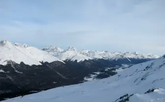
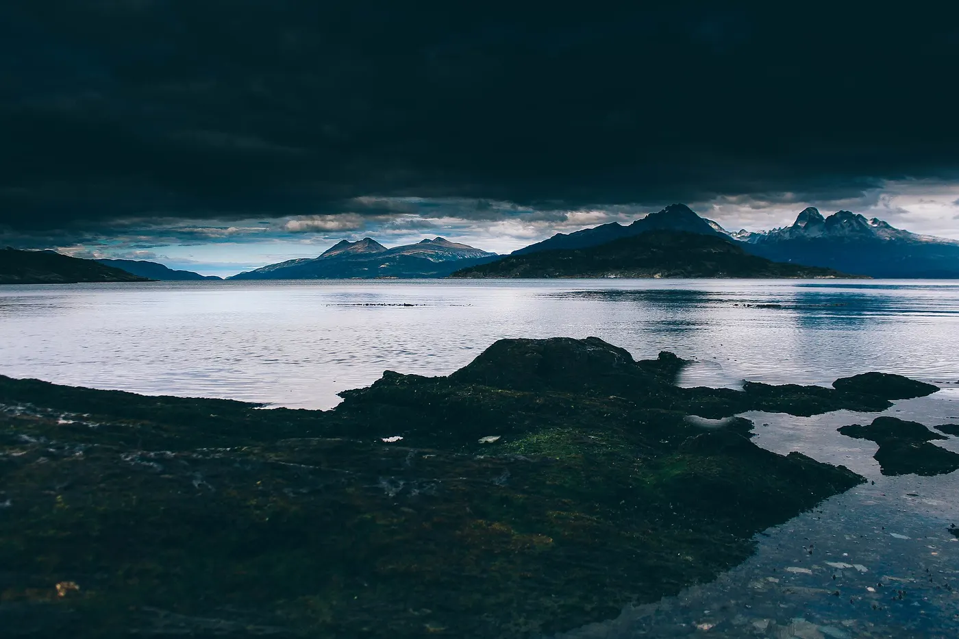
Ushuaia occupies a narrow strip between the Beagle Channel and the Martial range, at the southern tip of Isla Grande de Tierra del Fuego, where the Andes bend at the end of the continent and begin running west to east, the only stretch of the range in that direction. Behind the city rise Monte Olivia (1,318 m), Cinco Hermanos and the Martial ridge, snowcapped much of the year; in front, the channel is about 5 km wide, and the other side is already Chile, Isla Navarino, home to Puerto Williams.
Geography: the city on slopes and Ruta 3 toward the park
The urban grid is linear and follows the terrain: Avenida Maipú hugs the coast, Avenida San Martín runs one block up as the commercial spine, and from there the streets climb in short, steep slopes up to the hillside neighborhoods, where ice on the streets is a real problem from June to September. To the east, the Ushuaia Peninsula holds the airport on flat land reclaimed from the bay; to the west, National Route 3 runs along Bahía Golondrina, passes the Pipo River and enters the National Park 12 km further on.
Subpolar climate and westerly wind
The climate is oceanic subpolar (Cfc): no hot summer, no extreme winter, about 530 mm of precipitation well spread across the year, prevailing westerly wind, and the possibility of snow in any month.
Culture
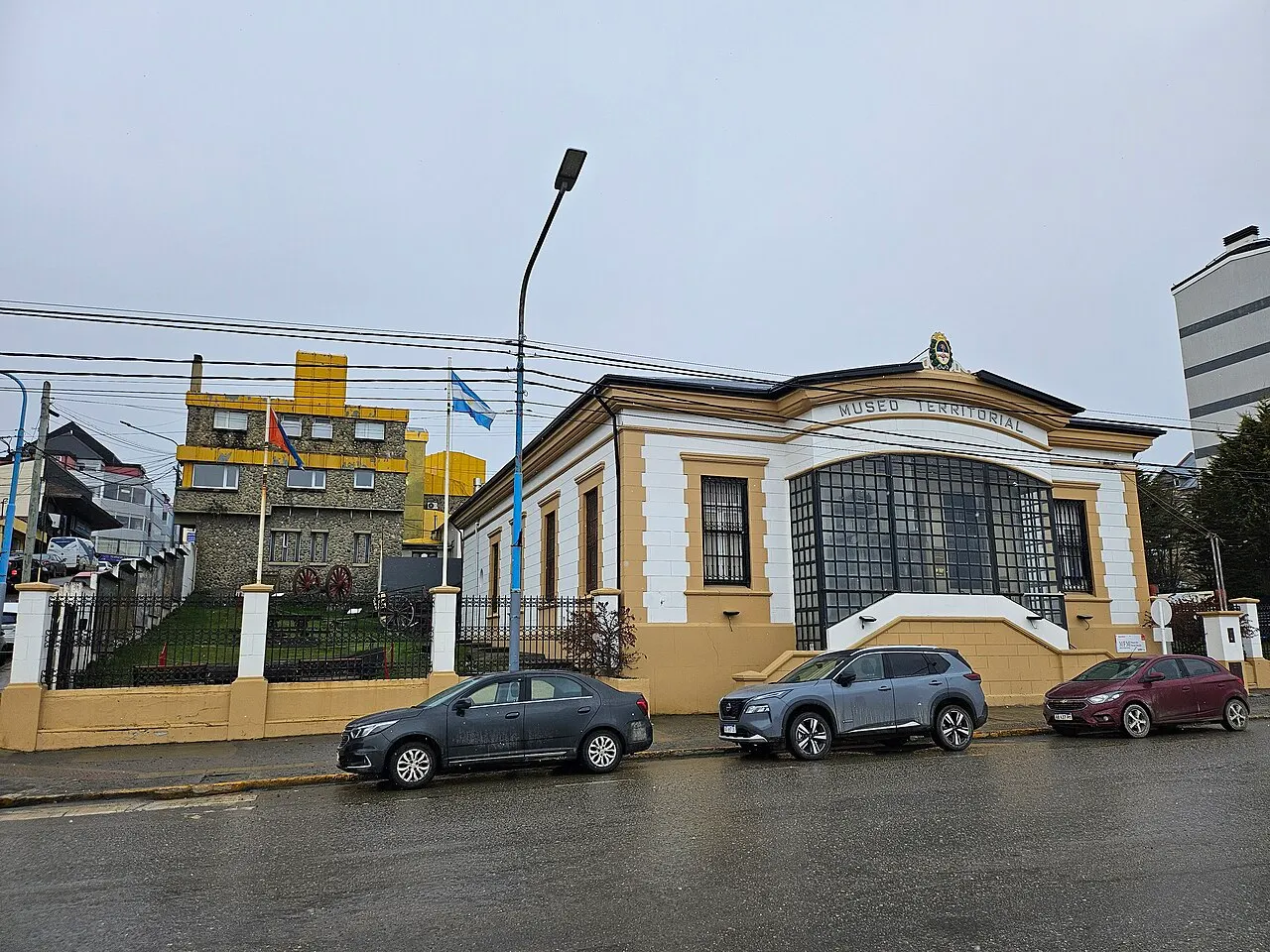
Yámana and Selk'nam survive in place names
The oldest layer of local culture is indigenous, and it survives mostly in museums and place names. The channel's Yámana and the island's northern Selk'nam were decimated between the late 19th and early 20th centuries; the last fully fluent native Yagán speaker, Cristina Calderón, died in 2022 on the Chilean side of the channel. Thomas Bridges's dictionary and the collections at the Museo del Fin del Mundo and the Museo Yámana are what remains for public access. In parallel, Ushuaia is a city of science: CADIC, a CONICET research center based there since 1969, studies glaciology, marine biology and peat bogs, and the city hosts the logistical support for Argentina's Antarctic bases.
The living culture is one of recent migrants
The living culture is one of recent migrants. Almost everyone, or their family, arrived after 1972 from Buenos Aires, Salta, Jujuy, Chile, Bolivia and Paraguay: to the point that there's a common distinction between “nacido y criado” (born and raised) and “venido y quedado” (came and stayed). Out of this came a peculiar mix: folk peña and cumbia in the same warehouse, strong industrial unionism, local-league soccer played in crosswind, and a mountain-sports scene disproportionate to the city's size, with Nordic skiing, trail running and dog sledding in the Valle de Tierra Mayor.
The “end of the world” brand: train, museum, beer, stamp
The “end of the world” is both geography and trademark: it shows up in the name of the train, the museum, the beer, the passport stamp sold at the port, and half the shops. The literature the city claims comes from both outside and in: Jules Verne's “The Lighthouse at the End of the World” (1905), set on the nearby Isla de los Estados; the memoirs of Lucas Bridges; “Archipiélago,” written by Ricardo Rojas after he was imprisoned there in 1934. The Bienal de Arte Contemporáneo del Fin del Mundo, started in 2007, is the most visible attempt to lift local production out of the souvenir register.
Festivals and events

Fiesta Nacional de la Noche Más Larga (June 20–21)
The winter solstice, with about 7 hours of daylight, is celebrated as a national festival: shows, fireworks over the bay, torchlit descents on the ski slopes, and the official opening of the winter season.
 AI illustration
Marchablanca and Ushuaia Loppet (August)
The Marchablanca is a cross-country ski crossing in the Valle de Tierra Mayor commemorating San Martín's crossing of the Andes; the Loppet is the competitive race on the same circuit. Together they drive the winter sports calendar.
 AI illustration
City anniversary (October 12)
The anniversary of the 1884 founding, marked with a civic parade, ceremonies at Plaza 25 de Mayo and municipal events. It falls a few weeks before the Antarctic season begins at the port in late October.
 AI illustration
Festival Internacional de Música Clásica (April)
A concert season with guest musicians in the city's auditoriums, held in autumn since the mid-2000s. Dates change each edition; confirm before planning a trip around it.
Books and films
“Uttermost Part of the Earth,” Lucas Bridges (1948)
Memoir by the son of Thomas Bridges, born in Ushuaia in 1874 and raised among the Yámana and Selk'nam. The closest first-hand account of the encounter that founded the city.
“In Patagonia,” Bruce Chatwin (1977)
The book that defined the region's literary image in the 20th century; the final section crosses Tierra del Fuego and dismantles part of the end-of-the-world myth while feeding it.
“The Lighthouse at the End of the World,” Jules Verne (1905)
A novel set at the San Juan de Salvamento lighthouse, on Isla de los Estados, east of Ushuaia. It's the literary origin of the nickname the city turned into a brand.
Frequently asked questions
Ushuaia: How do you get from the airport to downtown?
Taxis run on the meter and remises at a fixed fare booked by phone or app; count on the equivalent of a few dollars from the airport to downtown.
Ushuaia: How do you get to Estancia Harberton and Isla Martillo?
Estancia Harberton is 85 km east, along RN3 and Ruta J: about 2 hours each way, much of it on gravel road. From the ranch, it's 15 minutes by boat to Isla Martillo, which has a daily visitor quota and only takes people who booked a spot in advance, so book as soon as your dates are set.
Ushuaia: What's the currency, and how should you think about prices?
The currency is the Argentine peso (ARS) and it devalues fast, so it's worth thinking in dollars and treating any peso figure as a short-term reference.
Ushuaia: When is high season?
Ushuaia has two high seasons. The main one is the austral summer, from December to March, with highs of 9 to 15°C and up to 17 hours of daylight near the December 21 solstice, when it only gets dark after 10pm; the second is the snow season, in July and August, with highs of 0 to 4°C and Cerro Castor in operation.
Ushuaia: Is the city safe?
Yes: Ushuaia is a small city with low violent crime, even by Argentine standards.
Other cities in the country
Argentina ↗- Days
- 3–4
- When
- Mar–May · Sep–Nov
- Per person/day
- Average 90–140 USDMid-range · per person/day
Cost scope
Per person per day: accommodation, meals, urban transport, visits and a small allowance for extras. Flights excluded; larger purchases vary. Editorial estimate, not a quote.
- Days
- 4
- When
- Mar–Apr · Nov
- Per person/day
- Average 70–100 USDMid-range · per person/day
Cost scope
Per person per day: accommodation, meals, urban transport, visits and a small allowance for extras. Flights excluded; larger purchases vary. Editorial estimate, not a quote.
- Days
- 4–5
- When
- Mar–May · Oct–Nov
- Per person/day
- Average 83,200 ARSMid-range · per person/day
Cost scope
Per person per day: accommodation, meals, urban transport, visits and a small allowance for extras. Flights excluded; larger purchases vary. Editorial estimate, not a quote.
- Days
- 4–5
- When
- Jan–Apr · Oct–Dec
- Per person/day
- Average 86,300 ARSMid-range · per person/day
Cost scope
Per person per day: accommodation, meals, urban transport, visits and a small allowance for extras. Flights excluded; larger purchases vary. Editorial estimate, not a quote.
- Days
- 6–7
- When
- Apr–Nov
- Per person/day
- Average 66,100 ARSMid-range · per person/day
Cost scope
Per person per day: accommodation, meals, urban transport, visits and a small allowance for extras. Flights excluded; larger purchases vary. Editorial estimate, not a quote.
- Days
- 3
- When
- Jan–Apr · Oct–Dec
- Per person/day
- Average 95,400 ARSMid-range · per person/day
Cost scope
Per person per day: accommodation, meals, urban transport, visits and a small allowance for extras. Flights excluded; larger purchases vary. Editorial estimate, not a quote.


Itineraries through here
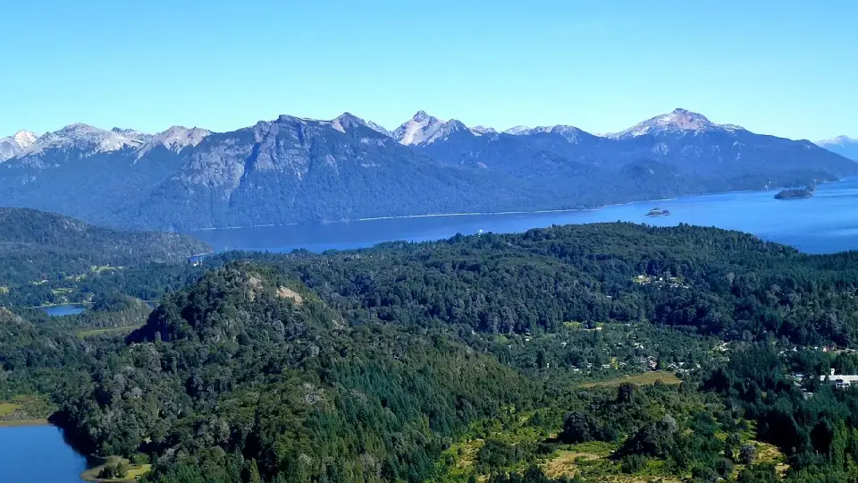
 Argentine Patagonia in 7 daysAndean lakes and the end of the worldBariloche · Ushuaia7 days2 cities
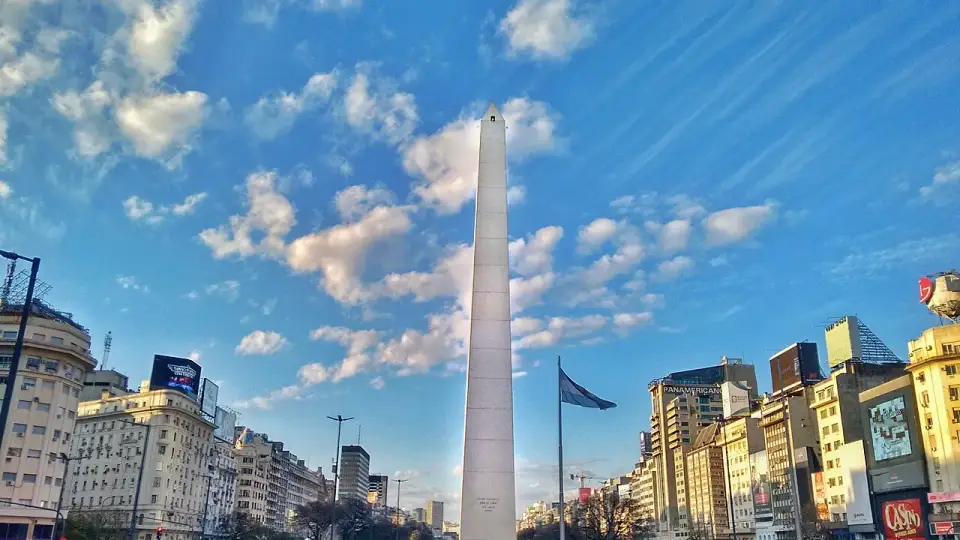
 Argentina in 10 daysFrom tango to the end of the worldBuenos Aires · Bariloche · Ushuaia10–11 days3 cities
 Argentine and Chilean Patagonia in 15 daysFrom the Beagle Channel to Torres del PaineUshuaia · El Calafate · Torres del Paine13–15 days3 cities