Brazil
Chapada dos Veadeiros
Waterfalls, canyons and cerrado savanna in Chapada dos Veadeiros National Park, with São Jorge at the park gate and Alto Paraíso de Goiás as the support town
See the 3-day itineraryOpen Chapada dos Veadeiros on the map
Days Start with the basic programme and choose extensions for the time you have.
How the guide reaches this number
I'd spend the first three in São Jorge: the Vale da Lua on arrival, the Yellow Trail to the Rio Preto falls on the second day and the Red Trail to Cânion II on the third, always entering the park at 8 a.m. On the fourth I'd move to Alto Paraíso for the Almécegas and Loquinhas, and on the fifth I'd go to Engenho II, in Cavalcante, for Santa Bárbara, which is far and on a dirt road, but is the waterfall I wouldn't leave out given the time. With three days, I'd stay only in São Jorge and do the Vale da Lua and the two park trails, which are the reason for the trip. The Catarata dos Couros I'd save for those with an extra day and a car ready for dirt roads.
3–5
When May to September; this is the dry season, with an average of under 6 mm of rain in June, July and August, firm trails and the Sete Quedas crossing open from June.
How the guide reaches this number
From November to April it rains more, the waterfalls run full and rivers can rise suddenly
May to September; this is the dry season, with an average of under 6 mm of rain in June, July and August, firm trails and the Sete Quedas crossing open from June. From November to April it rains more, the waterfalls run full and rivers can rise suddenly
Per person/day Add up lodging per night, meals per person, Alto Paraíso's municipal fee, the park ticket and internal shuttle, and the entrance fees of the farm waterfalls; holidays and July change the total a lot.
How the guide reaches this number
Per person per day: accommodation, meals, urban transport, visits and a small allowance for extras. Flights excluded; larger purchases vary. Editorial estimate, not a quote.
 What Nilo thinks
I'd stay five days in Chapada dos Veadeiros. I'd spend the first three in São Jorge: the Vale da Lua on arrival, the Yellow Trail to the Rio Preto falls on the second day and the Red Trail to Cânion II on the third, always entering the park at 8 a.m. On the fourth I'd move to Alto Paraíso for the Almécegas and Loquinhas, and on the fifth I'd go to Engenho II, in Cavalcante, for Santa Bárbara, which is far and on a dirt road, but is the waterfall I wouldn't leave out given the time. With three days, I'd stay only in São Jorge and do the Vale da Lua and the two park trails, which are the reason for the trip. The Catarata dos Couros I'd save for those with an extra day and a car ready for dirt roads.What organizes Chapada dos Veadeiros is water. The rivers run over a quartzite plateau in the middle of the Goiás cerrado and, when the rock ends, they fall: the Rio Preto in two falls of 120 and 80 meters, the São Miguel in rounded potholes at the Vale da Lua, the Rio dos Couros in successive falls. Between one waterfall and the next there are rocky fields, veredas of buriti palms and long stretches of dirt road. The two bases tell the story of the region. São Jorge was born of crystal mining and became the village of the guides, at the gate of the national park; Alto Paraíso was a farm that supplied the gold mines of Cavalcante and today mixes ecotourism, alternative therapies and small-town life. Farther north, the Kalunga communities receive visitors at their own waterfalls.
Quick facts
- Population
- 11,421 inhabitants in the municipality of Alto Paraíso de Goiás (IBGE, 2026 estimate); 10,306 in the 2022 Census. The village of São Jorge is a district of the municipality
- Founding
- The municipality was created as Veadeiros by a state law of October 12, 1953, split off from Cavalcante and installed on January 1, 1954; it was renamed Alto Paraíso de Goiás in 1963. The national park was created on January 11, 1961
- Country and region
- Brazil, Center-West; northeastern Goiás, about 230 km from Brasília. Town seat at 1,232 m above sea level
- Language
- Portuguese
- Currency
- Real (BRL, R$)
- Time zone
- UTC−3
- Best time to go
- May to September; this is the dry season, with an average of under 6 mm of rain in June, July and August, firm trails and the Sete Quedas crossing open from June. From November to April it rains more, the waterfalls run full and rivers can rise suddenly
- Average daily cost
- Add up lodging per night, meals per person, Alto Paraíso's municipal fee, the park ticket and internal shuttle, and the entrance fees of the farm waterfalls; holidays and July change the total a lot.
When to go
May to September; this is the dry season, with an average of under 6 mm of rain in June, July and August, firm trails and the Sete Quedas crossing open from June. From November to April it rains more, the waterfalls run full and rivers can rise suddenly
How the year changes
The plateau has two clearly marked seasons. The dry season runs from May to October, according to the park's concessionaire, and the rain concentrates from November to April: in the 1976 to 2001 averages of the Goiás government, it rains 4.8 mm in June, 2.3 mm in July and 5.6 mm in August, against 258.6 mm in December and 246.6 mm in January. From May to September the trails are firm, the sky is usually clear and the Sete Quedas crossing opens in June; May and June still keep good water in the waterfalls. At the end of the dry season the humidity drops sharply, the heat rises and the cerrado is subject to fires, like that of October 2017. In the rains the waterfalls run full and the green returns, the Seriema Trail and some seasonal falls open, but the water can rise suddenly and the dirt roads get worse. The park operates all year, including on rainy days.
Nilo's tips
Without a car, I'd sleep in São Jorge
There is no direct bus from Brasília to the village, and the park gate is inside it. If you arrive by bus in Alto Paraíso and arrange the 36 km leg to São Jorge once, you can do the park trails on foot, without depending on transport every day.
The Segredo leaves from São Jorge
The Cachoeira do Segredo is about 17 km beyond the village and accepts entry only until 1 p.m. Leaving São Jorge early, it fits into a morning; leaving from Alto Paraíso, it is 53 km.
Exemptions worth registering
Those under 12 and over 60 do not pay the municipal fee, but must fill in their details on the site to generate the exemption. At the park, anyone aged 60 or over pays half price, of any nationality.
Night trail
The park opens the Yellow Trail and the Blue Trail at night, Wednesday through Sunday, in groups of up to six people with an authorized guide required. The ticket office is closed at that hour, so the ticket is bought beforehand, and each person brings their own flashlight, because a phone flashlight is not accepted; swimming in the river is not recommended at night. In May 2026, the Night Trail to the Saltos cost R$ 49 full price.
Explore the map
Explore the map, read about the other places and plan your travel days in the app.
Open the appWhat to see
Chapada dos Veadeiros: The plateau
The chapada is a high plateau in northeastern Goiás. A district of Alto Paraíso, with dirt streets, low houses, guesthouses, campgrounds, restaurants and bars, next to the national park gate. It is the base for the park trails and the Vale da Lua, and the place where the evening happens after the hike. Facilities are more rustic than in town.

Saltos do Rio Preto
The two Rio Preto falls, of 120 and 80 meters, are the reason for almost every first trip to the park. The Yellow Trail, marked with yellow arrows, leaves the Visitor Center in São Jorge and passes old crystal mining areas on the way to the lookout over the 120-meter fall; the 80-meter one, the Cachoeira do Garimpão, has a pool for swimming. The same route includes the Carrossel, a set of falls and canyons, and the Corredeiras, small falls and natural pools. It is about 11 km round trip, six to seven hours, over steep, stony ground, rated by the concessionaire as upper-moderate difficulty. On foot, entry runs until noon; with the internal shuttle, paid separately, you can shorten the walk to the Corredeiras.
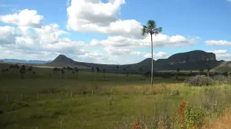
The Rio Preto crosses the park and plunges in two falls, of 120 and 80 meters, before entering Canyon II. Outside the park, the Rio São Miguel carved the rocks of the Vale da Lua, and the Rio dos Couros forms the cataract of the same name. The vegetation is cerrado in several forms: gallery forest along the banks, open cerrado, clean grassland, rocky fields on the stone slopes and veredas with buriti palms in the wet areas.
Check access

Cânion II
Cânion II is a large pool on the Rio Preto, between rock walls, at the end of the Red Trail. The same trail leads to the Cachoeira das Cariocas, with falls and pools, about half an hour's walk from the canyon. It is about 11 km round trip, four to five hours, on a stony path with little incline, of moderate difficulty. It is the pick for a second day in the park, but it demands attention to rain: firefighters have rescued a group of 16 visitors stranded in Cânion II after the water rose in about two minutes.
The main risk on the plateau is the flash flood (cabeça d'água): rain falls at the river's headwaters, sometimes far away and with the sky still clear at the pool, and within minutes the volume rises sharply, with no audible warning, as the Goiás Fire Department command explained.
Check access

Vale da Lua
Outside the park, on private property beside the GO-239, the Rio São Miguel carved the quartzite into potholes, grooves and rounded pools that give the place its name. The trail is short and easy, about 1.5 km round trip, and access is 4 km of dirt from the pavement. It is open from 8 a.m. to 5 p.m., with entry paid only in cash or Pix, Brazil's instant payment system. On rainy days part of the valley becomes inaccessible, and the potholes turn dangerous when the river rises.
The park records 1,476 plant species, and the animals include the maned wolf, the giant anteater, the pampas deer and the Brazilian merganser, a threatened bird.
Check access
Cachoeiras Almécegas
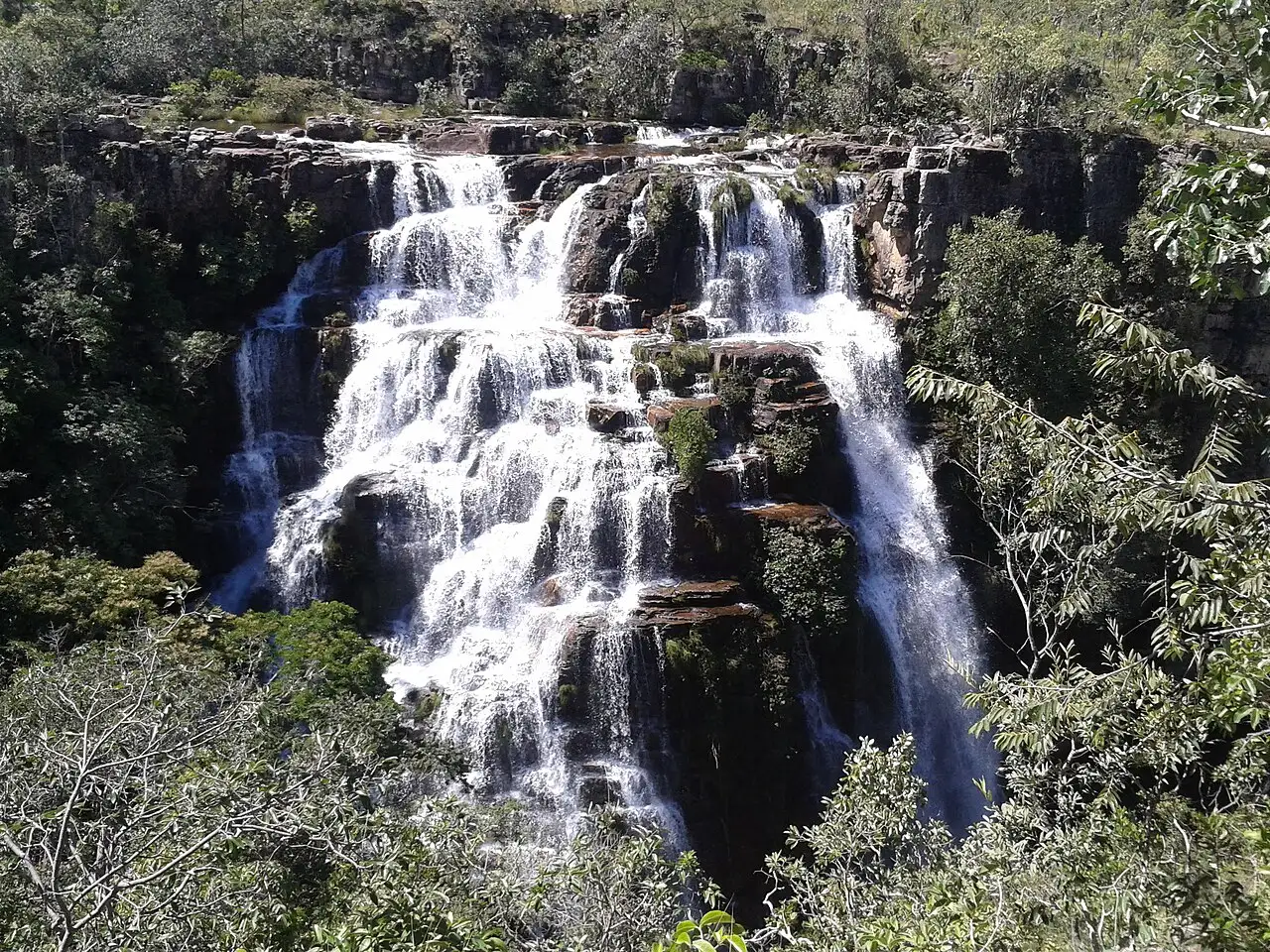
On Fazenda São Bento, with an entrance 8 km from Alto Paraíso on the GO-239, are Almécegas I, 45 meters high, seen from a lookout and with swimming below the series of falls, Almécegas II and the Cachoeira São Bento. All three are on the same property and have different characters, which makes the farm a good morning for those staying in town. The entrance fee is charged at the gate.
Everything depends on the GO-239, the paved road that leaves Alto Paraíso heading west and reaches the village of São Jorge, about 36 km away, where the park gate is. Along the way are the entrances to Fazenda São Bento, with the Almécegas falls, the Jardim de Maytrea and the Vale da Lua. To the north, the GO-118 leads to Teresina de Goiás and the road to Cavalcante and the Kalunga territory; to the south, it continues to Brasília.
Check access
Cachoeira Loquinhas
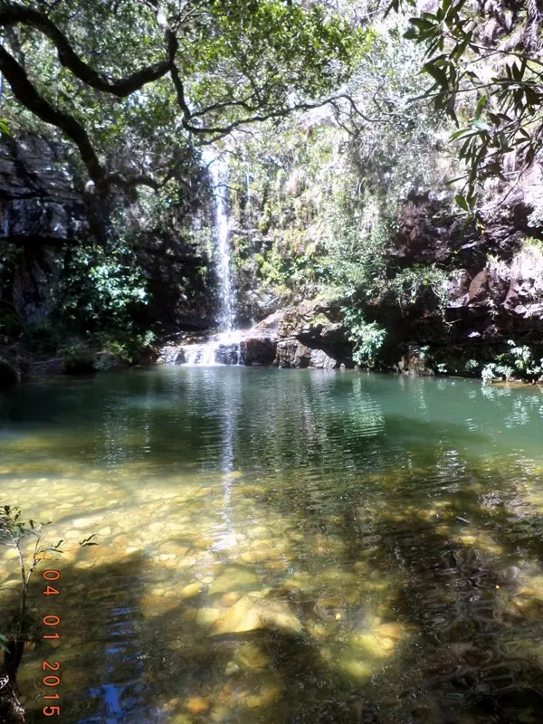
A complex of eighteen emerald-green pools and small falls on a farm 4.4 km from the center of Alto Paraíso, along Rua do Segredo. The circuit totals about 2.2 km on three well-kept trails with easy access, which is why it is one of the best-suited options for families with children. Free-roaming monkeys often accompany the walk.
The municipality's town, 36 km from the park, with banks and ATMs, supermarkets, pharmacies, bakeries and the bus station where the buses from Brasília arrive.
Check access
Cachoeira do Segredo
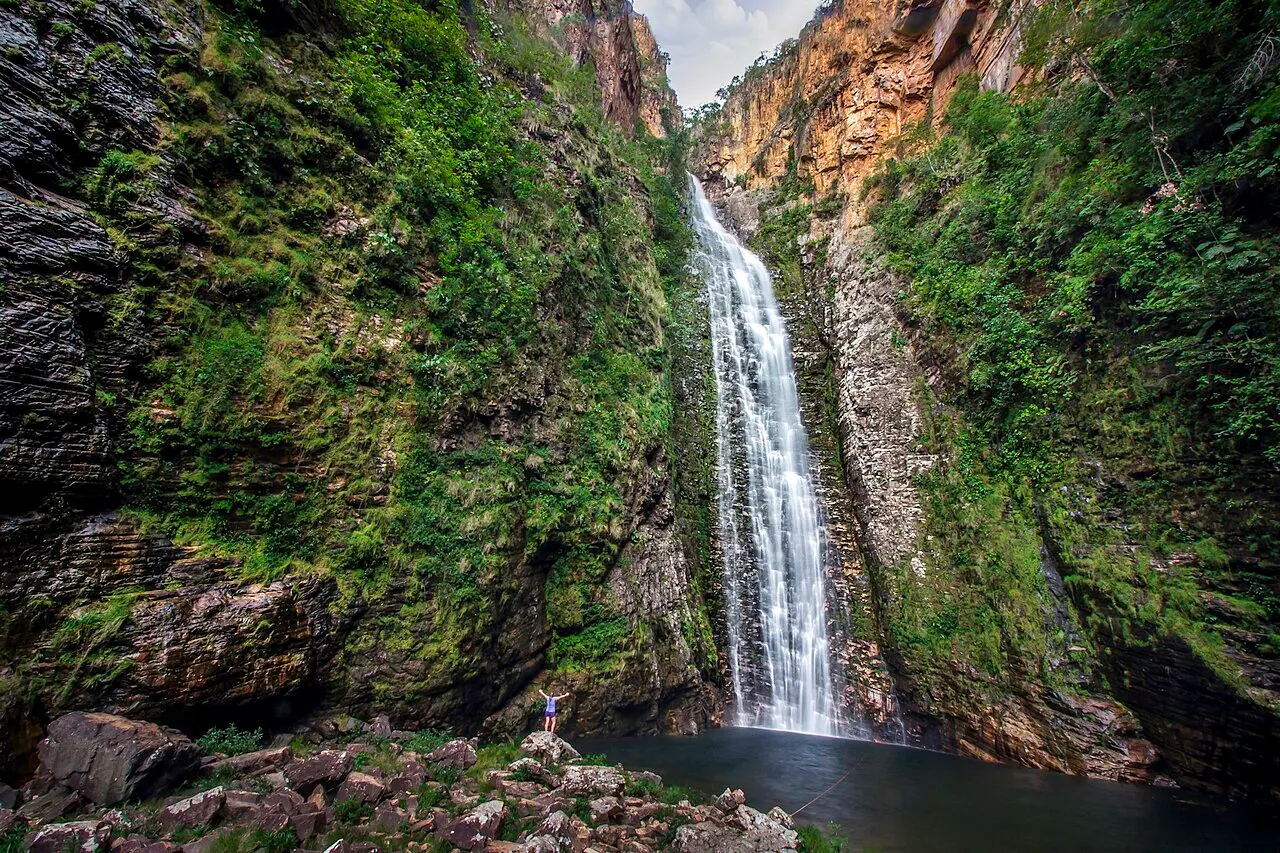
A 130-meter cascading waterfall 53 km from Alto Paraíso, passing through São Jorge: it is about 17 km beyond the village, with the last 8 km on dirt, which makes São Jorge the right base. The trail is about 7 km round trip and follows the river through the forest, with two swimming pools along the way. Entry is from 8 a.m. to 1 p.m., and the sun hits the fall from October to April.
Santa Bárbara, the Catarata dos Couros and the Cachoeira do Segredo have long dirt stretches, with little signage in the case of the Couros.
Check access
Jardim de Maytrea
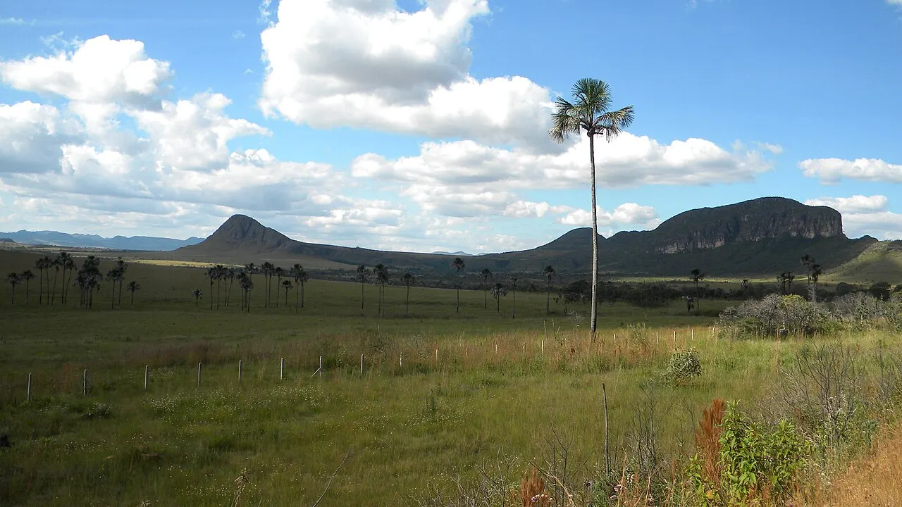
A lookout beside the GO-239, between Alto Paraíso and São Jorge, over a vereda of buriti palms and cerrado fields, with the Morro da Baleia in the background. The area is inside the national park and is not open to entry: the view is from the fence, free of charge. The crowd concentrates in the late afternoon, when cars pull over on the shoulder for the sunset.
The waterfalls are generally dozens of kilometers apart, and the last stretch is usually dirt.
Check access
Cachoeira dos Cristais
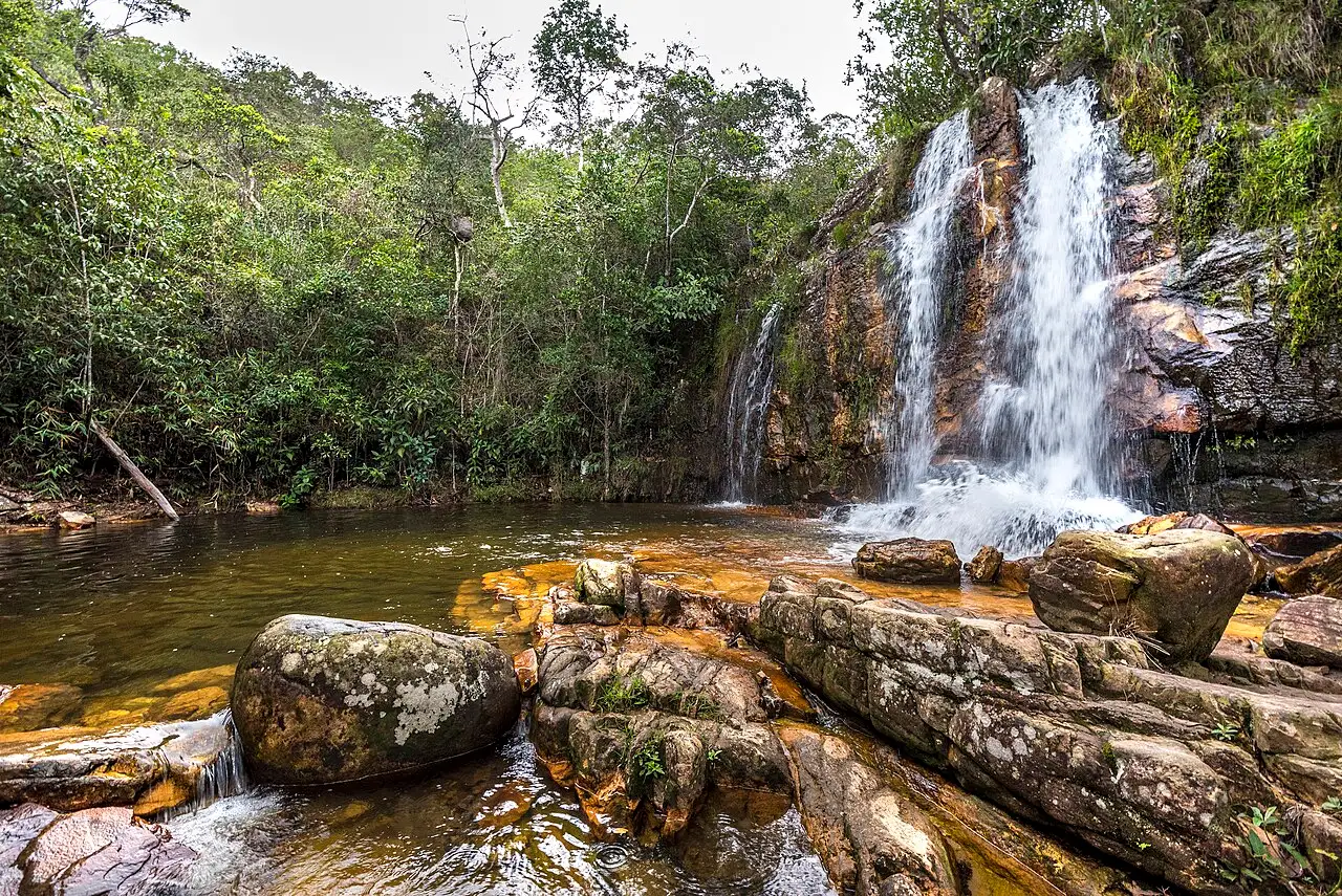
A farm 11 km from Alto Paraíso, toward Cavalcante, with 3 km of dirt road to the parking lot. The trail of about 3 km round trip passes nine falls on the way to the main waterfall, and there is a restaurant and campground on site. It is open from 8 a.m. to 5 p.m. It suits those with few hours in town or traveling with children.
It serves as a base for the waterfalls near town, such as the Loquinhas, and those on the way out toward Cavalcante, such as the Cristais, and for the roads toward Cavalcante and the Catarata dos Couros.
Check access
Nilo’s itinerary
Start with the basic programme and choose extensions for the time you have.
Plan my days in the app ↗Day 1 · From Brasília to São Jorge, with the Vale da Lua on the way
Before leaving, pay Alto Paraíso's Environmental Conservation Fee online and save the QR code; also buy the park tickets for days 2 and 3.
Leave Brasília early: it is about 230 km to Alto Paraíso along the BR-020 and the BR-010/GO-118, nearly four hours by car.
Have lunch and withdraw cash in Alto Paraíso; it is the last town with banks before São Jorge.
Take the GO-239 toward São Jorge to the entrance of the Vale da Lua and drive the 4 km of dirt to the parking lot. The visit is open until 5 p.m., and the trail is about 1.5 km round trip; if it rains upstream, stay out of the water.
Continue to the village of São Jorge, check in and have dinner in the village.
Day 2 · Yellow Trail: the Rio Preto falls
Be at the Visitor Center at 8 a.m. with the ticket for the date, water, a snack, sunscreen and a rain jacket; entry on foot runs until noon.
Follow the yellow arrows to the lookout over the 120-meter fall and go down to the pool at the 80-meter Cachoeira do Garimpão for a swim.
On the way back, pass the Carrossel and finish at the Corredeiras. It is about 11 km and six to seven hours in total. If you want to spare yourself the walk back, the internal shuttle sells the return separately, for R$ 45; confirm at the ticket office in the morning where it leaves from.
Leave the park by 6 p.m. and spend the night in São Jorge.
Day 3 · Red Trail: Cânion II and Cariocas, and the late afternoon at Jardim de Maytrea
Return to the gate at 8 a.m. with that day's ticket and follow the red arrows to Cânion II, a large pool between rock walls on the Rio Preto.
Walk about half an hour to the Cachoeira das Cariocas. The trail totals about 11 km and four to five hours.
After lunch in the village, rest; in the late afternoon, take the GO-239 toward Alto Paraíso to the Jardim de Maytrea to see the vereda of buriti palms by the roadside.
Return to São Jorge for the last night in the village.

If you stay longer
Day 4 · Almécegas and Loquinhas, now based in Alto Paraíso
Leave São Jorge in the morning and take the GO-239 to the entrance of Fazenda São Bento, 8 km from Alto Paraíso.
See Almécegas I, 45 meters high, from the lookout and then from below, and add Almécegas II and the Cachoeira São Bento.
Have lunch and check in in Alto Paraíso.
In the afternoon, go to the Loquinhas, 4.4 km from the center, and walk the roughly 2.2 km pool circuit. Confirm the entry hours with the farm.
Sleep in Alto Paraíso, which is where the roads to Cavalcante and the Catarata dos Couros start.
Day 5 · Cachoeira Santa Bárbara and Engenho II (Cavalcante)
Day trip
About 117 km from Alto Paraíso, at Engenho II, a community of the Kalunga Territory in Cavalcante. The last 27 km, from Cavalcante, are dirt, and the final stretch to the waterfall is made on the community's transport, paid separately, and then on foot, for about 1.5 km; on rainy days the road may require a 4x4. Santa Bárbara is known for its turquoise water, and the Capivara and Candaru waterfalls are on the same route. The visit requires a guide, who can be hired at the community's Tourist Service Center; on busy days, each group's time at the waterfall may be limited to one hour. Confirm rules and prices with the community before going, leave Alto Paraíso very early and sleep in town again.
Food
Arroz com pequi
The traditional dish of Goiás: rice cooked with pequi, a thick-skinned cerrado fruit with yellow flesh and a strong smell. Pequi is gnawed carefully, never bitten, because it has fine spines inside the pit.
Galinhada
Chicken stewed with rice, usually with corn, turmeric and, depending on the house, pequi or guariroba. It is the pot lunch of the small towns of interior Goiás.
Empadão goiano
A tall pie with a pastry crust, most commonly filled with chicken, boiled potato and queijo minas cheese, sometimes with pork or beef.
Frango com guariroba
Guariroba is the heart of a cerrado palm, more bitter than ordinary palm heart, cooked with free-range chicken.
Pamonha
Fresh corn paste cooked in the husk. It appears among the snacks at the park's Visitor Center, alongside tapiocas, empadas and savory pastries.
Cerrado juices
Cajuzinho-do-cerrado, mangaba, cupuaçu and soursop are among the fruit juices sold at the Visitor Center snack bar. Baru, a cerrado nut, goes into sweets and paçocas.
Where to eat
- Park Visitor Center, in São Jorge
Snacks before and after the trail: the snack bar is open from 8 a.m. to 6 p.m., with a break from noon to 1:15 p.m. on weekdays, and sells savory pastries, tapiocas, empadas, pamonhas and juices from cerrado fruits, such as cajuzinho and mangaba. At the Corredeiras there is a snack trailer on weekends and holidays.
- Centro de Alto Paraíso
Lunch of Goiás food, such as arroz com pequi, galinhada and empadão, and shopping for trail snacks at the town's supermarkets and bakeries before heading to São Jorge.
$: a snack and juice at the park snack bar or a bakery in Alto Paraíso · $$: à la carte lunch or dinner in Alto Paraíso or São Jorge · $$$: dinner at a guesthouse restaurant · 2026-10-16
Day trips
Cachoeira Santa Bárbara and Engenho II (Cavalcante)
About 117 km from Alto Paraíso, at Engenho II, a community of the Kalunga Territory in Cavalcante. The last 27 km, from Cavalcante, are dirt, and the final stretch to the waterfall is made on the community's transport, paid separately, and then on foot, for about 1.5 km; on rainy days the road may require a 4x4. Santa Bárbara is known for its turquoise water, and the Capivara and Candaru waterfalls are on the same route. The visit requires a guide, who can be hired at the community's Tourist Service Center; on busy days, each group's time at the waterfall may be limited to one hour. Confirm rules and prices with the community before going, leave Alto Paraíso very early and sleep in town again.
Catarata dos Couros (Águas do Paraíso State Park)
South of Alto Paraíso: according to the Goiás government, it is about 18 km on the GO-118, toward São João d'Aliança, and then about 20 km on the GO-575, dirt, to the entrance of the state park created in 2020. The Rio dos Couros forms a series of falls there: the Cachoeira da Muralha, the São Vicente, the Parafuso, with a pool for swimming, and the Catarata dos Couros itself, three falls totaling about 70 meters, seen from a lookout and closed to swimming because of the height. The visit is free, from 8 a.m. to 5 p.m. with entry until 3 p.m., in groups of up to six people accompanied by a local guide. One of the trails covers about 3 km of flat ground to the start of the descent to the lookout.
Where to begin
From Brasília to São Jorge, with the Vale da Lua on the way
Before leaving, pay Alto Paraíso's Environmental Conservation Fee online and save the QR code; also buy the park tickets for days 2 and 3.
Yellow Trail: the Rio Preto falls
Be at the Visitor Center at 8 a.m. with the ticket for the date, water, a snack, sunscreen and a rain jacket; entry on foot runs until noon.
Red Trail: Cânion II and Cariocas, and the late afternoon at Jardim de Maytrea
Return to the gate at 8 a.m. with that day's ticket and follow the red arrows to Cânion II, a large pool between rock walls on the Rio Preto.
Almécegas and Loquinhas, now based in Alto Paraíso
Leave São Jorge in the morning and take the GO-239 to the entrance of Fazenda São Bento, 8 km from Alto Paraíso.
Money
The currency is the real (R$). Banks and ATMs are in Alto Paraíso; São Jorge has more rustic facilities. Some farm waterfalls, such as the Vale da Lua, accept only cash or Pix, Brazil's instant payment system, which generally requires an account at a Brazilian bank. If you do not have Pix, withdraw cash in Alto Paraíso before heading to the village. The Alto Paraíso city government charges the Environmental Conservation Fee of R$ 20 per visitor, valid for stays of up to seven days; beyond seven days, it is charged again. It is paid online or through an app, generates a QR code checked at the entrance to the village of São Jorge and at the attractions, and exempts, among others, people over 60 and under 12, who fill in their details on the site, people with disabilities and local residents. At the national park, according to the concessionaire's website consulted on October 16, 2026, the ticket costs R$ 49 full price and R$ 5 for residents of the six surrounding municipalities with proof of residence. The half-price ticket, R$ 24.50, is valid for students with a student card, people with disabilities and a companion when needed, low-income young people aged 15 to 29 registered in CadÚnico, and people aged 60 or over; children up to 6 do not pay. The ticket is valid only for the date purchased and does not include the internal shuttle (R$ 35 one way and R$ 45 for the return) or camping (R$ 25). Parking is outside the park and privately run. Farm waterfalls charge their own entrance fees; the city government's tourism portal, with no update date, lists R$ 40 at the Vale da Lua, R$ 50 at the Loquinhas, R$ 60 at the Cachoeira do Segredo and R$ 70 for the Almécegas with the São Bento together, and it is best to confirm the amounts with each attraction before going.
Getting there and around
Getting there via Brasília
There is no airport with regular flights in the region. The nearest is Brasília International Airport, 235 km from Alto Paraíso along the BR-020 and the BR-010, which becomes the GO-118 on entering Goiás; the city government estimates about 3 hours 50 minutes by car, all on paved road. From town to São Jorge it is another 36 km on the GO-239, also paved. Brasília is the natural stopover for the trip.
Buses and getting there without a car
Direct lines run from Brasília's Rodoviária Interestadual to the Alto Paraíso bus station, operated by Real Expresso and Real Maia; in October 2026 the Buson aggregator listed from one to seven departures a day, with trips of 2 hours 55 minutes to 5 hours 15 minutes. Schedules and fares change: check at the bus station or on the company's website. The city government says there is no direct bus to São Jorge and, for those leaving Brasília without a car, points to organized ride-shares in groups such as Conexão Chapada and Carona Solidária Chapada dos Veadeiros. From the Alto Paraíso terminal to the village it is 36 km of pavement on the GO-239; arrange that leg with your guesthouse or an agency before arriving. Without a car, sleeping in São Jorge is what lets you walk to the park gate.
Between attractions
The city government says there is no public transport to the waterfalls and that the access roads are almost always dirt and in poor condition. With a car, the trip is much simpler; without one, the alternative is agencies and guides who take you to the attractions. For Cavalcante, Santa Bárbara and the Catarata dos Couros, the dirt stretches may require a 4x4 on rainy days. Inside the park there is a paid internal shuttle, with an accessible vehicle, that takes you from the gate to the trails.
Safety
The main risk on the plateau is the flash flood (cabeça d'água): rain falls at the river's headwaters, sometimes far away and with the sky still clear at the pool, and within minutes the volume rises sharply, with no audible warning, as the Goiás Fire Department command explained. Firefighters have rescued a group of 16 visitors stranded in Cânion II, where the area flooded in about two minutes, and in 2023 a tourist died at the Cachoeira Raizama, swept away by a sudden rise of the water. On rainy days, the guidance is not to enter the rivers and to respect closed areas. The park trails have long stretches exposed to the sun, loose gravel and rocks, and in the dry season the humidity drops sharply: water, a hat, sunscreen and sturdy footwear make a difference. On the crossings, a guide is not mandatory, but the concessionaire strongly recommends hiring one. On the night visits, groups have at most six people, with an authorized guide required, and each person brings their own flashlight; a phone flashlight is not accepted, and swimming in the river is not recommended. Outside the park, the dirt roads call for care and daylight, and the signage at some access points is poor.
Etiquette tips
Pay the fee before you arrive
Alto Paraíso's Environmental Conservation Fee is checked by QR code at the entrance to the village of São Jorge and at the attractions. Paying it online before the trip avoids a line at the gate.
Nothing leaves the park
It is forbidden to remove plants, animals and minerals from the national park, including quartz crystals lying loose on the trail, and it is forbidden to leave the official paths or use shortcuts.
No alcohol, cigarettes or pets
The park prohibits smoking and drinking during the visit and does not accept pets. Trash goes back out with the visitor, in a bag brought for that purpose.
In the Kalunga territory
The Engenho II waterfalls are in a quilombola community that organizes visits, with a Tourist Service Center, its own transport to the trail and community guides. The visit is made with a guide, and the community's rules apply as in any protected area.
Mistakes to avoid
Reaching the gate after noon
On foot, entry to the park trails runs from 8 a.m. to noon. After that, you can only enter with the internal shuttle, until 3 p.m., and from noon it depends on availability and must be bought round trip. If you sleep in Alto Paraíso, count the 36 km to the gate, and the full Yellow Trail takes six to seven hours.
Thinking one ticket is good for two days
The park ticket is valid only for the date purchased. Two trails on two days means two tickets, and buying them on the website before the trip avoids depending on the ticket office.
Getting in the water with rain upstream
A river can rise in minutes because of rain that fell far away, upstream, with the sky still clear at the pool, and there is no audible warning. On rainy days in the region, the firefighters' guidance is not to enter the rivers and to respect closed areas.
Counting on an ATM in São Jorge
Banking is in Alto Paraíso, 36 km away. Several farms charge only cash or Pix, and those without a Brazilian bank account depend on cash withdrawn in town.
Planning the Blue Trail (Seriema) in the dry season
The Blue Trail, or Seriema Trail, is the gentlest in the park: about 850 m round trip, around 1.5 hours, on flat ground, recommended by the concessionaire for older people, children, pregnant women and people with mobility difficulties, with entry on foot until 4 p.m. It is closed from June to October, when the Córrego Preguiça dries up.
Underestimating the dirt roads
Santa Bárbara, the Catarata dos Couros and the Cachoeira do Segredo have long dirt stretches, with little signage in the case of the Couros. Leave early and, in the rainy season, check whether the road is passable for an ordinary car.
Useful phrases
Cabeça d'água
A sudden rise of a river caused by rain at its headwaters; the most important warning in the region
Condutor
An accredited local guide who accompanies the trail; on the crossings and in the Kalunga territory, this is the person to hire
Poço
A natural pool in the river, where people swim
Vereda
A wet area of the cerrado, with buriti palms and marsh
Porteira
The gate of a farm; at private waterfalls, it is where the entrance fee is paid
Where to stay
- Vila de São Jorge · Those spending two or more days on the park trails and the Vale da Lua, those traveling without a car who want to walk from the guesthouse to the gate at 8 a.m., and those going to the Cachoeira do Segredo.: The park gate is in the village itself, the Vale da Lua is a few kilometers away on the GO-239 and the Segredo is about 17 km beyond. There are guesthouses, campgrounds, restaurants and bars. The drawback is the rustic setup, with dirt streets and without the network of banks and services in town, and the 36 km distance from Alto Paraíso, from the waterfalls near town and from the road to Cavalcante.
- Centro de Alto Paraíso · Those traveling by car with children or older people who prefer services nearby, and those visiting the Loquinhas, Cristais, Almécegas, Santa Bárbara or the Catarata dos Couros.: The town has banks, supermarkets, pharmacies, bakeries and the bus station, and it is the starting point of the roads to Cavalcante and to the south. The drawback is the trip to the park: it is 36 km of road to the gate, which must be driven early to enter on foot before noon, and without a car that stretch depends on arranged transport.
$: camping or a simple guesthouse in São Jorge or Alto Paraíso · $$: a guesthouse with breakfast · $$$: a chalet-style guesthouse outside the villages · 2026-10-16
Districts
Vila de São Jorge
A district of Alto Paraíso, with dirt streets, low houses, guesthouses, campgrounds, restaurants and bars, next to the national park gate. It is the base for the park trails and the Vale da Lua, and the place where the evening happens after the hike. Facilities are more rustic than in town.
Centro de Alto Paraíso
The municipality's town, 36 km from the park, with banks and ATMs, supermarkets, pharmacies, bakeries and the bus station where the buses from Brasília arrive. It serves as a base for the waterfalls near town, such as the Loquinhas, and those on the way out toward Cavalcante, such as the Cristais, and for the roads toward Cavalcante and the Catarata dos Couros.
GO-239
The road between Alto Paraíso and São Jorge works as a corridor of attractions: Fazenda São Bento with the Almécegas, the Jardim de Maytrea and the entrance to the Vale da Lua lie along it, and a few guesthouses and country plots are scattered along the way.
Povoado do Moinho
A quilombola community a few kilometers from Alto Paraíso, by dirt road, known for its traditional knowledge and handmade crafts. It is also the way to some waterfalls on properties in the area.
History
1740 · Gold in Cavalcante
Bandeirantes in search of gold and of escaped enslaved people open the mining cycle in the north of the plateau and found Cavalcante. Veadeiros, the farm that would give rise to Alto Paraíso, begins producing food and cattle for the mines.
1940s · The crystal boom
Mining of quartz and rock crystal reaches its peak. The crystal was exported for components of sonar, radios, telegraphs and telephones, and the miners' settlement grows, first called Garimpão and later Baixa dos Veadeiros.
1952 · The village is named São Jorge
In the early 1950s, Baixa dos Veadeiros is renamed Vila de São Jorge, in honor of the saint chosen as protector of the miners; the first feast for the saint takes place on April 23, 1952.
1953 · Veadeiros becomes a municipality
A state law of October 12 splits Veadeiros off from Cavalcante. The municipality is installed on January 1, 1954 and, in 1963, changes its name to Alto Paraíso de Goiás.
1961 · The park is born
On January 11, Juscelino Kubitschek creates Tocantins National Park, with 625,000 hectares. Mining inside it begins to be restricted; in 1972, already smaller, the park is renamed Chapada dos Veadeiros.
1980s · From mining to tourism
Ecotourism inside the park is authorized and many former miners become visitor guides. In the same period, philosophical and esoteric groups arrive in São Jorge and Alto Paraíso.
2001 · World Heritage and an expansion that did not last
In December, UNESCO inscribes the Cerrado Protected Areas, the Chapada dos Veadeiros and Emas national parks, on the World Natural Heritage list. That same year, a decree expands the park to 235,000 hectares, but the Supreme Federal Court suspends it in 2003, and the park returns to the roughly 65,000 hectares set in 1981.
2017 · Expansion and fire
On June 5, a federal decree expands the park from about 65,000 to about 240,000 hectares. In October, a fire with at least five outbreaks, according to an ICMBio report, burns about 65,000 hectares, nearly a quarter of the park, over more than two weeks.
2018–2019 · Concession
In December 2018, ICMBio signs a 20-year concession contract for visitor services; since 2019, Parquetur has operated the ticket office, Visitor Center and internal shuttle, while ICMBio remains in charge of managing the park.
2024 · Municipal fee
Alto Paraíso regulates the Environmental Conservation Fee, created by a complementary law of December 2023 and charged to each visitor, checked by QR code at the entrance to the village of São Jorge and at the attractions.
Complete history
Gold, cattle and the name of the deer
Colonial settlement of the plateau began with gold. Bandeirantes arrived chasing mines and escaped enslaved people, and Cavalcante was born in 1740. Farther south, on a farm founded by Francisco de Almeida, the settlement of Veadeiros took shape, selling food and cattle to the mines. The name, according to the municipal records, comes from the number of deer in the region. When the gold ran out, cattle ranching and small farms remained, and Veadeiros continued as a district of Cavalcante until it became independent in 1953. Ten years later, the municipality changed its name to Alto Paraíso de Goiás.
Crystal and the village of São Jorge
The village of São Jorge has a different origin: the mining of quartz and rock crystal, which peaked in the early 1940s, when the crystal was exported to the radio, sonar and telephone industries. The settlement was called Garimpão, then Baixa dos Veadeiros, and in the early 1950s it took the name of the miners' saint. The prosperity did not last: after World War II, synthetic crystal began to be made in laboratories and exports fell, and the cycle ended in the late 1960s. In the lean years, residents lived on small plots and on gathering dried cerrado flowers. The pits dug in that period still appear along the Yellow Trail.
The park and the turn to tourism
In 1961, the federal government created a 625,000-hectare national park on the plateau. It shrank twice: in 1972, when it received its current name, and in 1981, when it was left with about 65,000 hectares. An expansion to 235,000 hectares, decreed in 2001, was suspended by the Supreme Federal Court in 2003; only the 2017 decree brought the park to today's roughly 240,000 hectares. The creation of the park restricted mining and, from the 1980s, with ecotourism authorized, the miners began guiding visitors along the same trails they had used to reach the diggings. The spiritual quest in the region is older: the Fazenda Bona Espero, linked to Esperanto, arrived in the 1950s, and the Cidade da Fraternidade, of Spiritist orientation, in the 1960s; in the 1980s came other esoteric groups and alternative communities, drawn by quartz and by the idea of the 14th parallel, and they give Alto Paraíso part of the reputation it has today. Later came the UNESCO inscription, in 2001, and the visitation concession, in 2019, which organized the ticket office, Visitor Center and internal shuttle at the São Jorge gate.
Geography and shape of the city
The plateau
The chapada is a high plateau in northeastern Goiás. The seat of Alto Paraíso lies at 1,232 m, and the Morro do Pouso Alto, in the same municipality, named as the highest point in Goiás and the Central Plateau, exceeds 1,670 m: the city government cites 1,676 m, the measurement of the Cruls Commission in the late 19th century, and other sources give 1,691 m. The high points of the park sit near 1,600 m, with rock outcrops and rocky fields; in the valleys, the terrain drops to 400 to 500 m. Most of the park lies on metamorphic rocks derived from ancient marine sediments, and the hard quartzite is what forms the waterfall walls.
Rivers and cerrado
The Rio Preto crosses the park and plunges in two falls, of 120 and 80 meters, before entering Canyon II. Outside the park, the Rio São Miguel carved the rocks of the Vale da Lua, and the Rio dos Couros forms the cataract of the same name. The vegetation is cerrado in several forms: gallery forest along the banks, open cerrado, clean grassland, rocky fields on the stone slopes and veredas with buriti palms in the wet areas. The park records 1,476 plant species, and the animals include the maned wolf, the giant anteater, the pampas deer and the Brazilian merganser, a threatened bird.
How the bases fit together
Everything depends on the GO-239, the paved road that leaves Alto Paraíso heading west and reaches the village of São Jorge, about 36 km away, where the park gate is. Along the way are the entrances to Fazenda São Bento, with the Almécegas falls, the Jardim de Maytrea and the Vale da Lua. To the north, the GO-118 leads to Teresina de Goiás and the road to Cavalcante and the Kalunga territory; to the south, it continues to Brasília. The waterfalls are generally dozens of kilometers apart, and the last stretch is usually dirt.
São Jorge for the park days, Alto Paraíso for the farm days and the Cavalcante days. Changing base midway through the trip saves driving.
The park trails are self-guided and color-coded: yellow for the Saltos, red for the Canyons, blue for the Seriema, orange for the Sete Quedas crossing.
Culture
Miners who became guides
The culture of the village of São Jorge comes from mining. The village's name and the first feast for São Jorge, in 1952, come from the miners, who chose the saint as their protector. When the park restricted extraction and tourism was authorized, in the 1980s, many of them began working as visitor guides, on the trails that once led to the crystal diggings.
Esoteric Alto Paraíso
The region has attracted spiritual movements since the 1950s. According to the city government, the pioneer was Esperantism, with the Fazenda Bona Espero, founded in 1957 by a mission from Recife and set near the national park, on the GO-239; in the 1960s came the Cidade da Fraternidade, of Kardecist Spiritist orientation. From the 1980s more philosophical and esoteric groups arrived, drawn by quartz and by the 14th parallel south, which crosses the plateau. Today the city government also promotes the town for wellness tourism, and the offer of alternative therapies and experiences coexists with ecotourism.
Quilombolas and traditional cultures
The plateau has old quilombola communities. Near Alto Paraíso, the village of Moinho is known for its traditional knowledge and crafts. To the north, the Kalunga Territory, with more than 260,000 hectares and more than 39 communities in Cavalcante, Monte Alegre de Goiás and Teresina de Goiás, is the largest quilombola territory in Brazil by area, and receives visitors through community-based tourism. In São Jorge, the Casa de Cultura Cavaleiro de Jorge organizes the Encontro de Culturas Tradicionais, which brings together masters and folk-culture groups from several regions of the country.
Festivals and events
Encontro de Culturas Tradicionais da Chapada dos Veadeiros
A festival in the village of São Jorge with performances, workshops, conversation circles and processions by traditional groups from several regions of Brazil, organized by the Casa de Cultura Cavaleiro de Jorge. The date changes from year to year and is announced by the organizers: the 2025 edition ran September 13 to 20, and the 2026 one, the 26th, October 6 to 17. The village fills up on those days.
Books and films
Grande Sertão: Veredas, by João Guimarães Rosa
The novel is not set on the plateau, but it is the work that fixed in Brazilian literature the landscape of veredas, buriti palms and broad plateaus of the cerrado of central Brazil, the same one seen from the edge of the GO-239.
Vila de São Jorge e Parque Nacional da Chapada dos Veadeiros: os caminhos da geografia passam por lá (revista Ateliê Geográfico, UFG, 2007)
A field note by geography students and a professor at UFG that sums up the village's passage from crystal mining to tourism, with the settlement's old names and the effect of the park's creation on residents. It describes the village as it was in 2007.
Frequently asked questions
Chapada dos Veadeiros: how do I get there?
The nearest airport is Brasília's, 235 km from Alto Paraíso, about 3 hours 50 minutes by car on paved road, and São Jorge is 36 km further. Buses run from Brasília to Alto Paraíso, but not to São Jorge: arrange that leg with your guesthouse or an agency.
Chapada dos Veadeiros: how many days should I stay?
Five days is ideal: three in São Jorge, for the Vale da Lua and the park's Yellow and Red Trails, one in Alto Paraíso, for the Almécegas and Loquinhas, and one for Santa Bárbara, in Cavalcante. With three days, stay only in São Jorge.
Chapada dos Veadeiros: is one park ticket good for two days?
No. The ticket is valid only for the date purchased, so two trails on two days means two tickets; full price is R$ 49, without the internal shuttle. Buying them on the website before the trip avoids depending on the ticket office.
Chapada dos Veadeiros: until what time can I enter the park?
On foot, entry to the trails runs from 8 a.m. to noon; after that, only with the internal shuttle, until 3 p.m., subject to availability and bought round trip. The exception is the Blue Trail, with entry on foot until 4 p.m., closed from June to October.
Chapada dos Veadeiros: is it better to sleep in São Jorge or in Alto Paraíso?
São Jorge is at the park gate and suits those doing the trails or traveling without a car, but it is rustic and has no banks. Alto Paraíso, 36 km away, has services and is the base for the Loquinhas, Almécegas, Santa Bárbara and the Catarata dos Couros.
Chapada dos Veadeiros: how do I visit the Cachoeira Santa Bárbara?
It is at Engenho II, a Kalunga community in Cavalcante, about 117 km from Alto Paraíso; the last 27 km are dirt and may require a 4x4 in rain. Then come the community's transport, paid separately, and 1.5 km on foot, with a required guide; on busy days, each group may get only one hour at the falls.
Chapada dos Veadeiros: when is the best time to go?
From May to September, in the dry season, the trails are firm, the sky is usually clear and the Sete Quedas crossing opens in June. From November to April the waterfalls run full, but the water can rise suddenly and the dirt roads get worse.
Other cities in the country
Brazil ↗- Days
- 4
- When
- Apr–Jun
- Per person/day
- Average 615 BRLMid-range · per person/day
Cost scope
Per person per day: accommodation, meals, urban transport, visits and a small allowance for extras. Flights excluded; larger purchases vary. Editorial estimate, not a quote.
- Days
- 2–3
- When
- Apr–May · Sep
- Per person/day
- Average 400–700 BRLMid-range · per person/day
Cost scope
Per person per day: accommodation, meals, urban transport, visits and a small allowance for extras. Flights excluded; larger purchases vary. Editorial estimate, not a quote.
- Days
- 2–3
- When
- Jan–Mar · Sep–Dec
- Per person/day
- Average 350–550 BRLMid-range · per person/day
Cost scope
Per person per day: accommodation, meals, urban transport, visits and a small allowance for extras. Flights excluded; larger purchases vary. Editorial estimate, not a quote.
- Days
- 1–2
- When
- May–Sep
- Per person/day
- Average 260–520 BRLMid-range · per person/day
Cost scope
Per person per day: accommodation, meals, urban transport, visits and a small allowance for extras. Flights excluded; larger purchases vary. Editorial estimate, not a quote.
- Days
- 3–4
- When
- Jun–Sep
- Per person/day
- Average 400–700 BRLMid-range · per person/day
Cost scope
Per person per day: accommodation, meals, urban transport, visits and a small allowance for extras. Flights excluded; larger purchases vary. Editorial estimate, not a quote.
- Days
- 2–3
- When
- Apr–Jun
- Per person/day
- Average 350–550 BRLMid-range · per person/day
Cost scope
Per person per day: accommodation, meals, urban transport, visits and a small allowance for extras. Flights excluded; larger purchases vary. Editorial estimate, not a quote.
- Days
- 3–5
- When
- Mar–Apr · Nov
- Per person/day
- Average 397 BRLMid-range · per person/day
Cost scope
Per person per day: accommodation, meals, urban transport, visits and a small allowance for extras. Flights excluded; larger purchases vary. Editorial estimate, not a quote.
- Days
- 2–4
- When
- Mar–May · Sep
- Per person/day
- Explore costsGuide estimate
Cost scope
Per person per day: accommodation, meals, urban transport, visits and a small allowance for extras. Flights excluded; larger purchases vary. Editorial estimate, not a quote.
- Days
- 4–5
- When
- Aug–Nov
- Per person/day
- Explore costsGuide estimate
Cost scope
Per person per day: accommodation, meals, urban transport, visits and a small allowance for extras. Flights excluded; larger purchases vary. Editorial estimate, not a quote.
- Days
- 3–4
- When
- Jul–Sep
- Per person/day
- Explore costsGuide estimate
Cost scope
Per person per day: accommodation, meals, urban transport, visits and a small allowance for extras. Flights excluded; larger purchases vary. Editorial estimate, not a quote.
- Days
- 3–4
- When
- Sep–Nov
- Per person/day
- Explore costsGuide estimate
Cost scope
Per person per day: accommodation, meals, urban transport, visits and a small allowance for extras. Flights excluded; larger purchases vary. Editorial estimate, not a quote.
- Days
- 2–4
- When
- May–Sep
- Per person/day
- Explore costsGuide estimate
Cost scope
Per person per day: accommodation, meals, urban transport, visits and a small allowance for extras. Flights excluded; larger purchases vary. Editorial estimate, not a quote.
- Days
- 3–5
- When
- Jun–Sep
- Per person/day
- Explore costsGuide estimate
Cost scope
Per person per day: accommodation, meals, urban transport, visits and a small allowance for extras. Flights excluded; larger purchases vary. Editorial estimate, not a quote.
- Days
- 3–4
- When
- Jun–Aug
- Per person/day
- Explore costsGuide estimate
Cost scope
Per person per day: accommodation, meals, urban transport, visits and a small allowance for extras. Flights excluded; larger purchases vary. Editorial estimate, not a quote.
- Days
- 4–5
- When
- Jan–Mar · Sep–Dec
- Per person/day
- Explore costsGuide estimate
Cost scope
Per person per day: accommodation, meals, urban transport, visits and a small allowance for extras. Flights excluded; larger purchases vary. Editorial estimate, not a quote.
- Days
- 3–4
- When
- Oct–Dec
- Per person/day
- Average 1,110 BRLMid-range · per person/day
Cost scope
Per person per day: accommodation, meals, urban transport, visits and a small allowance for extras. Flights excluded; larger purchases vary. Editorial estimate, not a quote.
- Days
- 3–4
- When
- Aug–Sep
- Per person/day
- Explore costsGuide estimate
Cost scope
Per person per day: accommodation, meals, urban transport, visits and a small allowance for extras. Flights excluded; larger purchases vary. Editorial estimate, not a quote.
- Days
- 4–7
- When
- Apr–Sep
- Per person/day
- Explore costsGuide estimate
Cost scope
Per person per day: accommodation, meals, urban transport, visits and a small allowance for extras. Flights excluded; larger purchases vary. Editorial estimate, not a quote.
- Days
- 3–4
- When
- Jan · Sep–Dec
- Per person/day
- Explore costsGuide estimate
Cost scope
Per person per day: accommodation, meals, urban transport, visits and a small allowance for extras. Flights excluded; larger purchases vary. Editorial estimate, not a quote.
- Days
- 2
- When
- Aug–Dec
- Per person/day
- Average 442 BRLMid-range · per person/day
Cost scope
Per person per day: accommodation, meals, urban transport, visits and a small allowance for extras. Flights excluded; larger purchases vary. Editorial estimate, not a quote.
- Days
- 3–5
- When
- Jan–Feb · Sep–Dec
- Per person/day
- Explore costsGuide estimate
Cost scope
Per person per day: accommodation, meals, urban transport, visits and a small allowance for extras. Flights excluded; larger purchases vary. Editorial estimate, not a quote.
- Days
- 2–3
- When
- Apr–Sep
- Per person/day
- Average 484 BRLMid-range · per person/day
Cost scope
Per person per day: accommodation, meals, urban transport, visits and a small allowance for extras. Flights excluded; larger purchases vary. Editorial estimate, not a quote.
- Days
- 3
- When
- Apr–May · Aug
- Per person/day
- Average 478 BRLMid-range · per person/day
Cost scope
Per person per day: accommodation, meals, urban transport, visits and a small allowance for extras. Flights excluded; larger purchases vary. Editorial estimate, not a quote.
- Days
- 3–4
- When
- Aug–Dec
- Per person/day
- Explore costsGuide estimate
Cost scope
Per person per day: accommodation, meals, urban transport, visits and a small allowance for extras. Flights excluded; larger purchases vary. Editorial estimate, not a quote.
- Days
- 2
- When
- Apr–May · Sep
- Per person/day
- Explore costsGuide estimate
Cost scope
Per person per day: accommodation, meals, urban transport, visits and a small allowance for extras. Flights excluded; larger purchases vary. Editorial estimate, not a quote.
- Days
- 3
- When
- Sep–Dec
- Per person/day
- Explore costsGuide estimate
Cost scope
Per person per day: accommodation, meals, urban transport, visits and a small allowance for extras. Flights excluded; larger purchases vary. Editorial estimate, not a quote.
- Days
- 3–5
- When
- Apr–Nov
- Per person/day
- Average 427 BRLMid-range · per person/day
Cost scope
Per person per day: accommodation, meals, urban transport, visits and a small allowance for extras. Flights excluded; larger purchases vary. Editorial estimate, not a quote.
- Days
- 4
- When
- Jul–Sep
- Per person/day
- Explore costsGuide estimate
Cost scope
Per person per day: accommodation, meals, urban transport, visits and a small allowance for extras. Flights excluded; larger purchases vary. Editorial estimate, not a quote.
- Days
- 4–5
- When
- May–Sep
- Per person/day
- Explore costsGuide estimate
Cost scope
Per person per day: accommodation, meals, urban transport, visits and a small allowance for extras. Flights excluded; larger purchases vary. Editorial estimate, not a quote.
- Days
- 3
- When
- May–Sep
- Per person/day
- Explore costsGuide estimate
Cost scope
Per person per day: accommodation, meals, urban transport, visits and a small allowance for extras. Flights excluded; larger purchases vary. Editorial estimate, not a quote.